We found 109198 price guide item(s) matching your search
There are 109198 lots that match your search criteria. Subscribe now to get instant access to the full price guide service.
Click here to subscribe- List
- Grid
-
109198 item(s)/page


Lot 112
Ireland.- Smith (Charles) The Ancient and Present State of the County of Kerry, engraved portrait frontispiece, double-page folding map (1 or 2 small tears), 4 folding or double-page plates, 1 with tears and small areas of loss, 1 full-page plate, scattered pencil notes, contemporary calf, rebacked, a little rubbed, 8vo, Dublin, for the Author, [?1774].

Lot 113
Kent.- Dearn (T. D. W.) An Historical Topographical and Descriptive Account of the Weald of Kent, engraved map, 8 aquatint plates, list of subscribers, occasional spotting, occasional pencil notes, bookplates, contemporary calf, rebacked, a little rubbed and worn, Cranbrook, 1814 § Cruden (Robert Peirce) The History of the Town of Gravesend in the County of Kent and of the Port of London, 9 plates, 3 folding or double-page, illustrations, occasional damp-staining, presentation inscription, ex-library with usual stamps and labels, contemporary half calf, a little rubbed, 1843 § Leeds (C. S.) Chats about Gillingham, frontispiece, illustrations, ink inscription to front free endpaper, original cloth, faint spotting, slight bumping to corners and extremities, Gillingham, [1906]; and another, Kent, 8vo (4)


Lot 9
Elzevier.- Republics.- Regni Chinensis descriptio, ex variis authoribus, engraved pictorial incorporating a map of China, 2 full-page woodcut illustrations of costumes, [Willems 486], Leiden, Bonaventure & Abraham Elzevier, 1639 bound after De Imperio Magni Mogolis, sive India vera commentarius, engraved pictorial title, full-page woodcut botanical illustration, [Willems 354], Leiden, Bonaventure & Abraham Elzevier, 1631, together 2 works in 1 vol., woodcut head-and tail-pieces and decorative initials § Turcici imperii status, engraved pictorial title, [Willems 416], Leiden, Bonaventure & Abraham Elzevier, 1634 bound after Persia, seu Regni Persici Status, engraved pictorial title, full-page woodcut illustrations of costumes, [Willems 623], Leiden, Bonaventure & Abraham, 1634, together 2 works in 1 vol., woodcut head-and tail-pieces and decorative initials; and 12 other works from the 'Republics' series or similar in 8 vol. (see list below), uniformly bound in attractive 19th century panelled calf, gilt, spines in compartments and richly so and with dark orange morocco labels, v.s. (10)⁂ A handsome set. The other titles are: Græcorum Respublicæ (Willems 364); Respublica et Status regni Hungariæ (Willems 409); Sabaudiæ Respublica et Historia (Willems 411); Respublica Romana (Willems 321); De Princi Patibus Italiæ (Willems 356); Republica Hebræorum (Willems 362); De Republica Ebræorum (not in Willems) Respublica Hollandiæ et Urbes (not in Willems); Scotiæ et Hiberniæ (Willems 287); Anglorum (Willems 529); Helvetiorum Respublica (Willems 278) and Vallesiæ et Alpium (Willems 390).


Lot 1546
AFTER EG RAVENSTEIN; 'The Oarsmans and Anglers Map of the River Thames', with notes on relevant elevations and history, the river later coloured and on canvas backing, length approx 250cm. CONDITION REPORT: Heavily worn with some holes particularly to lower end but with tears, rips and losses throughout, areas of staining and discolouration, in entirety somewhat stained and tired, the left margin frequently with losses, creasing and cracking throughout.


Lot 697
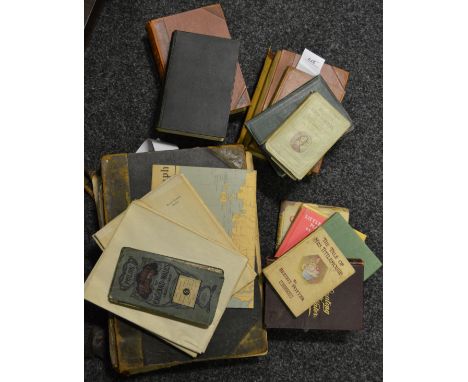
A group of Cheshire historical and topographical books includingSir. P. Leycester 'Historical Antiquities, in Two Books. The First Treating in General of Great-Brettain and Ireland. The Second Containing Particular Remarks Concerning Cheshire [...] Where Unto is Annexed a Transcript of Doomsday-Book [...]', printed by W.L. for Robert Clavell, London 1673, in worn leather boards (lacking map), J. Hall 'A History of the Town and Parish of Nantwich' with illustrations, Ilkley 1976, W.J. Reader 'Imperial Chemical Industries A History' volume I, London 1970, G. Barraclough (editor) 'The Charters of the Anglo-Norman Earls of Chester, c. 1071 - 1237', W. Thompson Watkin 'Roman Cheshire', Liverpool 1886, W. Andrews (editor) 'Bygone Cheshire', Chester, Hull and London 1895 etc. CONDITION REPORT: Leycester; Extensive and heavy wear to the boards, some loss to the corners and upper surface of the leather throughout, the spine binding coming loose from boards at the top and bottom, heavy staining and some creases and tears to the interior lining of the boards, foxing and staining/spotting as expected to pages throughout, ownership name inscribed to title page going through to the dedication page, waviness to the pages throughout, some old creases and folds, staining or foxing and wear particularly to the page edges. Varied states and conditions, please submit further requests in relation to specific items within the lot. We cannot guarantee that all illustrations/engravings/plates are present. Provenance: The collection of Colin Lynch.

Lot 698
A group of Cheshire historical and topographical books including J.H. Hanshall 'The History of the County Palatine of Chester' will illustrations, Chester 1817, Lady Newton 'House of Lyme Illustrated', London 1917, A. Ingham 'Cheshire its Traditions & History', Edinburgh 1920, F. Moss 'The Fourth Book of Pilgrimages to Old Homes', Didsbury 1908, J. Cumming Walters 'Romantic Cheshire', London 1930 (first edition), F. Ross 'The Ruined Abbeys of Britain' with illustrations, 'Kelly's Directory of Cheshire' (x2), London 1892 and 1910 (the former lacking map), T. Worthington Barlow 'The Cheshire and Lancashire Historical Collector', Manchester and London 1855, A. Hume 'Antiquities Found on the Sea-Coast of Cheshire' with map and illustrations, London 1863, H.E. Young 'A Perambulation on the Hundred of Wirral' with illustrations, Liverpool 1909 etc. CONDITION REPORT: Varied states and conditions, please submit further requests in relation to specific items within the lot. We cannot guarantee that all illustrations/engravings/plates are present. Provenance: The collection of Colin Lynch.

Lot 701
A group of Cheshire historical and topographical books with salt works interest including Sir P. Leycester 'Historical Antiquities, in Two Books. The First Treating in General of Great-Brettain and Ireland. The Second Containing Particular Remarks Concerning Cheshire [...] Where Unto is Annexed a Transcript of Doomsday-Book [...]', printed by W.L. for Robert Clavell, London 1673, in worn leather boards (lacking map), 'The Duttons of Dutton' with plates and fold-out diagrams, London and Chester 1901, A.F. Calvert 'Salt in Cheshire' with illustrations, London 1915 (x2, one ex library), 'A History of the Salt Union' (af), 'Salt and the Salt Industry' (second edition) and 'Salt Union Ltd Cheshire District Plans of Works' containing fifteen plans mounted on linen (some very faded) and an oil on board by B. Booth titled 'British Salts Co' (44.5 x 91cm, framed), S. Bagshaw 'History, Gazetteer and Directory of the County Palatine of Chester', Sheffield 1850, T.A. Coward 'Cheshire Traditions and History', London 1932, W.V. Burgess 'Cheshire Village Stories', Manchester 1906, T. Baines and W. Fairbairn 'Lancashire and Cheshire, Past and Present' volumes I and II etc. CONDITION REPORT: Varied states and conditions, please submit further requests in relation to specific items within the lot. We cannot guarantee that all illustrations/engravings/plates are present. Provenance: The collection of Colin Lynch.

Lot 705
A group of Cheshire related ephemera including Brunner, Mond & Co and later ICI pamphlets and magazines, documents relating to the saltworks and River Weaver including Salt Union lease, 18th century and later land deeds, indentures and auction catalogues on vellum and parchment, linen backed folding map of Cheshire after James Williams dated 1888 etc., 'Shipbrooke Court Book', 'Webbs Practical Farmers Account Book', C. S. Davies 'The Agricultural History of Cheshire, 1750-1850', late 19th and early 20th century bill heads relating to the Northwich area, etc. Please note that these items may contain manorial documents subject to the Manorial Documents Rules 1959, 1963 and 1967; the purchaser is under obligation to notify the Secretary of the Historical Manuscripts Commission at The National Archives of their acquisition and to provide details of where they will be kept; they may in no circumstances be removed from England and Wales without the prior consent of the Master of the Rolls; please see condition report for further detail. CONDITION REPORT: Provenance: The collection of Colin Lynch.These items may contain manorial documents which are subject to the Manorial Documents Rules 1959, 1963 and 1967, administered by The Historical Manuscripts Commission at The National Archives on behalf of the Master of the Rolls. Accordingly the purchasers of the documents lie under an obligation to notify the Secretary of the Commission of their acquisition and to provide details of where they will be kept. They may in no circumstances be removed from England and Wales without the prior consent of the Master of the Rolls. Further information can be found via the link below:http://www.nationalarchives.gov.uk/information-management/legislation/other-archival-legislation/manorial-documents/The Secretary of the Commission can be contacted by e-mail at mdr@nationalarchives.gov.uk

Lot 710
AFTER A BRYANT; 'Map of the County Palatine of Chester from Actual Survey, in the Years 1829, 1830 & 1831. London, published by A. Bryant, 27, Great Ormond Street, May 3rd 1831', with explanation and classical divisions charts lower left and image of Chester cathedral lower right, in two horizontal sections on linen back, each approx 75 x 109cm or 150 x 218cm together, in contemporary gilt tooled brown leather case of book form and titled to spine. CONDITION REPORT: Areas of staining, foxing, discolouration, stains particularly prevalent to the upper section of the map, these should be considered as present throughout to greater and lesser degrees, some areas where the map has come away from the linen backing, particularly to the edges, some unevenness to the cut on the page and the edges of the map, some small tears, creases and folds, wear, discolouration to the backs of the maps as well, regarding the case he has written his name to the interior, some discolouration and some tears to the inner lining, also distress to the outer leather surface with some deep scratches, gouges, losses to the extremities, wear to the gilt, general heavy wear and tear, mottling to the corners, losses to the leather finish on the corners and other areas etc. Provenance: The collection of Colin Lynch.


Lot 3036
A collection of various hand tinted maps, comprising: a map of the county of Darbye, eighteenth Century; a map of Lincolnshire; Monmouthshire; a modern map of Monmouthshire, drawn from the surveys corrected and improved by the best authorities and another of Monmouthshire, various dates and sizes


Lot 273
The Harmsworth Universal Atlas and Gazetteer or the World; The Kellys Post Office maps of London; The Royal Automobile Club official touring map of England and Wales; Great Western Railway map (sheet London to Reading, Oxford) ; Books including Chaffers handbook of Marks and Monograms on pottery and porcelain; Alison Utterley; Beatrix Potter etc


Lot 1224
John Sellers & Francis Grosse, circa 1787, Pembrokeshire, hand coloured engraved map, 11.5cm x 14.5cm, and six other engraved maps of Pembrokshire by John Luffman, circa 1803, Phillips, circa 1803, John Roper, circa 1810, John Roper, circa 1809, Samuel Lewis, circa 1835 and Archibald Fullerton, circa 1845, of Milford Haven (7).


Lot 192
Various early 20thC and later world used stamps, to include Cyprus, Cayman Islands, Brunei, Bermuda, Belgium etc., many used examples, Gold Coast, red backs, Hungary, various, Vatican, India, various GB used etc., mid 20thC and later and a Bacon's motoring and cycling road map of Lincoln district, with folding cloth map. (2) (AF)


-
109198 item(s)/page