We found 109182 price guide item(s) matching your search
There are 109182 lots that match your search criteria. Subscribe now to get instant access to the full price guide service.
Click here to subscribe- List
- Grid
-
109182 item(s)/page


Lot 505
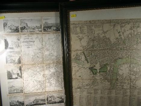
A NEW MAP OF WORCESTERSHIRE divided into the hundreds by JOHN CARY, Engraver, the borders of the County with green within a pink measuring rim, dated 1824, 52cm x 60cm in an oak glazed frame and FOUR OTHER MAPS, later, one being entitled "Overland Ro ute to India", Published by John Tallis & Company, London and New York, in Hogarth glazed frames


Lot 34
`REAR ADMIRAL SIR JAMES CLARK ROSS, D.C.L. F.R.S.`, published by Alexander Scott (late 18th Century) after Stephen Pearce, mezzotint on wove paper, marginal staining, slight scuffing, [early 19th century]. 550 x 420mm.; together with three further mezzotint portraits of The Right Honourable Robert Viscount Melville K.T., First Lord Commissioner of the Admiralty by C. Turner after Sir Thomas Lawrence; Admiral Sir Charles Napier after John Simpson; Admiral Sir George Francis Seymour by John Lucas; with 7 bookplate portraits of naval figures, various conditions, (11) An attractive seated portrait of the Arctic and Antarctic explorer James Clark Ross (1800-1862) in uniform. His arm rests upon a map of the Arctic, and a map of the south pole hangs on the wall behind. His achievements include the discovery of the Ross sea, Victoria Land and the volcanoes Mount Erebus and Mount Terror, named after the expedition`s vessels. Ross`s expedition mapped much of the Antarctic coastline and the Ross ice-shelf was named in his honour.

Lot 249
A MONUMENTAL 1:48 SCALE DOCKYARD MODEL OF THE 1ST CLASS ARMOURED CRUISER, H.M.S. LEVIATHAN, BUILT BY JOHN BROWN & CO. LTD, CLYDEBANK FOR THE ROYAL NAVY, 1901, the laminated and carved hull with ram bow, bilge keels, twin propeller shafts on `A`-brackets with carved and gilt wood propellers, rudder, portholes, kedge and main anchors on studded cable, sponson booms with Jacobs ladders, sponson guns in casemates; the lined and lacquered deck and superstructure with a multitude of fittings finished in gilt and silvering and including deck rails, bitts, bollards, covered hatches, ventilators, glazed bridge with wood and brass binnacles, telegraphs, search lights, masts with yards, standing and running rigging, signal lanyards, four stayed funnels with mesh tops, safety valve extension pipes, main and secondary armament with ammunition supply tracks with buckets, seven assorted and fully-fitted boats rigged in davits with a further five on deck including three steam pinnaces, aft bridge and mast with telegraphic signal arms, and much other fine detailing, contained within original carved mahogany glazed case and stand, with ivorine builder`s plates and bow/stern name plates on green plush display board. Measurements overall Ñ 95 x 159 x 45 1/2in. (241.5 x 404 x 115.5cm.) This model may be viewed courtesy of Pizza Express, Olympia Way throughout March and April 2010. Please refer to the map inside back cover. Charles Miller Ltd is grateful for their kind assistance. Despite the common practice of using certain ships` names repeatedly over the centuries, only three vessels have borne the name Leviathan during the long history of the Royal Navy; the first was a `74` of 1790 and the last a modest aircraft carrier of 1945 which was never, in fact, completed for sea. Only the second vessel in this trio remotely lived up to the derivation of her name Leviathan - meaning gigantic, impressive, formidable or `anything of huge size` [from the Hebrew livyathan] - and she was the splendid four-funnelled armoured cruiser which joined the fleet at the dawn of the twentieth century. One of the four `Drake` class cruisers approved in the 1898 Programme, the order for Leviathan went to John Brown`s yards at Clydebank where she was laid down on 30th November 1899. Launched on 3rd July 1901 and completed on 16th June 1903, her design was an enlarged version of the `Cressy` class of 1897 although this increased size was mostly utilised to accommodate the significantly more powerful machinery needed to provide their top speed of 23 knots. Displacing 14,150 tons (fully loaded), the `Drakes` measured 533 feet in length (overall) with a 71 foot beam, and were impressively armoured up to a maximum of 6ins. on the most vulnerable areas of their hulls. Coal-fired from 43 Belleville boilers, their twin-shaft 4-cylinder triple-expansion engines could generate 31,500ihp. and, when travelling at full steam, Leviathan and her sisters provided a memorable spectacle. Armed with 2-9.2in. guns, 16-6in., 14-12pdrs. and 3-3pdrs., they also sported 2-18in. submerged torpedo tubes and, with their relatively uncluttered decks, were destined for employment as cruiser squadron flagships as befitted their size and prestige. Crucially, the `Drakes` were among the first British warships to incorporate wood that had been treated to make it less flammable and also to have their coal bunkers subdivided to minimize the effects of a torpedo rather than simply shellfire. Amongst the fastest ships in the world when completed, Lord Goschen, the First Lord [of the Admiralty], hailed the new quartet as "mighty cruisers" and, once in service, all four frequently exceeded their trial speed of 30 knots and proved both good seaboats as well as "exceptional steamers". All in all a triumph of design and construction, it was therefore a pity that, by the time the Great War began in 1914, more modern cruisers had already outclassed them. Leviathan was commissioned immediately after completion and sent to join the Cruiser Squadron in the [English] Channel for two years (1903-04). Transferred to the 3rd Cruiser Squadron in the Mediterranean (1905-06), she came home for a refit at Chatham during 1907 after which she remained in Home Waters and joined the 5th Cruiser Squadron in 1908. The next year (1909) she was sent to join the 4th Cruiser Squadron in North American Waters where she remained until 1912. After a brief tenure as flagship to the Training Squadron in 1912, she was then transferred to the 6th Cruiser Squadron (3rd Fleet) from 1913 where she stayed until that squadron was broken up in the weeks leading up to the outbreak of War in August 1914 and its vessels attached to the Grand Fleet based at Scapa Flow. Leviathan`s earliest wartime employment involved northerly patrols off the Shetland and Faroe Isles, on scouting and blockading duties, in which she showed her mettle to the extent that she was soon made flagship to the newly-constituted 1st Cruiser Squadron (Rear-Admiral Sir Gordon Moore) on 2nd December. Despite the lack of fleet activity, the winter of 1914-15 was extremely busy for the cruiser squadrons which found themselves at sea for long periods in appalling weather protecting inbound shipping and enforcing the blockade against Germany. In March 1915, after almost eight months of unremitting patrol work in adverse conditions, Leviathan was ordered to the West Indies as flagship to Vice-Admiral Patey and, in the latter part of the War, was employed on North Atlantic convoy escort duties. Surviving hostilities, this elegant four-funnelled relic of the Edwardian Royal Navy was finally sold out of the service in 1920 and scrapped at Blyth.

Lot 978
A presentation silver salver, by F. Crump, Sheffield 1926, shaped circular form, the border with medallions, on three gnarl feet, the centre engraved with a map of Africa, a pelican and following inscription `PRESENTED TO LADY BEATRICE ORMSBY GORE BY THE DIRECTORS OF THE NORTH SEA AERIAL & GENERAL TRANSPORT CO LTD, IN COMMEMORATION OF HER LAUNCHING THE SEAPLANE "PELICAN" TO BE USED ON THE FIRST COMMERCIAL AIR LINE BETWEEN KHARTOUM & KISUMA, KENYA COLONY, nOV 15TH 1926.` diameter 32.4cm, approx. weight 32oz. Lady Beatrice Ormsby-Gore, wife of the Under-Secretary of the State for the Colonies, Rt. Hon. Ormsby-Gore, was presented with the salver following the naming ceremony of the `Pelican`, by Mrs T H Gladstone. The route was used weekly to transport goods and mails in each direction following the White Nile from Khartoum to Malakal, via Mongalla, Jinja, to Kisumu, on Lake Victoria, a total distance of 1,400 miles in 23 hours. The route was opened in conjunction with the governments of Kenya, Uganda and Sudan, and described as the first link in what would ultimately be one of the most important routes in the Empire, saving at least 10 days to the previous scheme.

Lot 1261
A collection of books, comprising Pratts Road Map, Motorists Pocket Boom 1928, Motor Racing (1st Edition 1935), Book of the Motor Car 1952, Hobby Annual 1933, showing old cars, Speed on Salt 1936 Practical Automobile Engineering, 1935 Achievements, Motorbikes, Cars, Jubilee Number 1953 The Motor, The Modern Motor Car 1930?, and the Motor Cycle Book for Boys 1933 (good illustrations)


Lot 388
An African black rhinoceros (Diceros bicornis) horn, mounted on its original colonial shield, Large horn: 36.5cm (outside curve), 30cm (tip to shield), Small horn: 18cm (tip to shield) Shot by the vendor`s uncle. He was Edward Stallibrass, a British telegraph engineer, who worked in Africa in the late 19th century. He produced a map of the Congo Canyon while on the cable ship Buccaneer, which was illustrated in his book "Deep-Sea Sounding in Connection with Submarine Telegraphy," published in 1887. This specimen is legal to sell under Cites legislation as it is regarded as `worked`. It is mounted on its original shield


Lot 472
A group of assorted prints and engravings, including views of Queens College, Cambridge; Richmond in Surrey; Pigeon Island, St Lucia; Somerset House; Richmond Hill; Chatham, Rochester Castle; Aylesford Church, Chatham Dockyard and a map of Les Indes Orientales et Leur Archipel by M. Bonne,(qty).


Lot 502
A set of four early George III embossed paper and gouache bird pictures in the manner of Samuel Dixon depicting a parrot, water and other birds with flowers, butterflies, shells and grapes, 30 x 39cm. (3) and 29 x 38cm. (1) in giltwood and gesso frames (one backboard with trade label for ‘’Spilsbury, Engraver map and print seller, Russel Court, Covent Garden, London’’) Samuel Dixon of Dublin was famous for his embossed bird pictures which incorporated a technique which Dixon referred to as ‘basso relievo’, whereby parts of the design were raised by means of a copper plate. Dixon along with his contemporary Isaac Spackman, based many of his designs on illustrations from George Edwards’ ‘Natural History of Uncommon Birds’ (1743-51).


-
109182 item(s)/page