We found 109182 price guide item(s) matching your search

Refine your search

Year

Filter by Price Range
  • List
  • Grid
  • 109182 item(s)
    /page

Lot 123

Kenneth Stevens MacIntire (American, 1891-1979),a three-fold screen design, decorated with a nautical map of the Atlantic showing America and Europe, centred with a three-masted ship 'Montezuma',21 x 22cm 37 x 37cm overallCondition report: Verso with signed authentication stamp issued by the estate. Additional images uploaded.

Lot 177

Tobias Conrad Lotter: 18th century engraved map of the world, circa 1775, titled Mappa Totius Mundi, with hand colouring, plate 45 x 63.5cm, glazed frame

Lot 178

18th century folding map of Colchester and environs, by John Chapman and Peter Andre, comprising the northern portion of their 1777 map of Essex, including vignette plan of Colchester, divided into 24 folding panels with linen backing, total size 93 x 118cm, housed within marbled card sleeve

Lot 315

Small group of 17th and 18th century hand coloured maps, including 1779 map of Africa Propria and Numidia by Basire, 20 x 27cm, 1745 Basire map of Sicilia, Basire map of Armenia, Pontu, Capadocia, Media etc., Delisle map of Gallia Cisalpina, Liguria and the Neighbouring countries, Delisle map of Great Greece, Delisle map of 'The Extent of Alexander's Conquests' and a map of Asia Minor.Condition report: 7 in total

Lot 222

World War II double-sided silk escape map, one side entitled Sheet F and illustrating Croatia, Montenegro, Hungary, Slovakia, Germany, Italy and Switzerland, the reverse Sheet E depicting Germany Protectorate, Slovakia, Poland and Hungary

Lot 429

Miss Middleton  ( of Southgate St. Gloucester)Two watercolours "The Siege of Gloucester, August 10th to September 5th 1643", "A City Assailed by Man but saved by God" and a map of Gloucestershire with illustrations (2) 

Lot 184

BOX OF MIXED MAPS INCLUDING AA MAP OF FRANCE AND ROAD ATLAS OF WESTERN EUROPE

Lot 479

A pine framed horse map of the world, a garden herbs chart and another Tree's of Britain

Lot 629

After C Smith, The Strand London "A New Map of the County of Suffolk" divided into hundreds

Lot 725

After Melton Prior, cartoon of HRH Edward VII with inscription verso and letter from National Portrait Gallery; also a copy of a page from the Nuremberg Chronical with British Museum letter verso;' a map of Suffolk; a coloured fashion prion; a marine print and a map of the North Sea

Lot 795

A poster print Tournee du Chat Noir; a print after Hilary Whyard "Tawny Owl"; and an Ordnance Survey map of Ipswich

Lot 1310

Cased Nautical map magnifier. P&P Group 1 (£14+VAT for the first lot and £1+VAT for subsequent lots)

Lot 239

A 19th century engraved map, of Great Dunmow, Essex, 35 x 54cm

Lot 349

A 20th century hand coloured map of Polo Artico, together with another of Russia, 33 x 41cmCondition report: These look to be early to mid 20th century reproductions. One has no glass and both have scruffy frames. Some discolouration to the paper, most visible to the margins.

Lot 89

P. Schenk (1728 - 1784). Landkarte. Neue Sächsische Post-Charte mit denen Post - Wegen und Stra ... Kupferstich-Karte mit altkoloriertem Grenz- und Flächenkolorit. Neuer Sächsischer Atlas, enthaltend die sieben Kreise . (Amsterdam und 59,5 cm x 50,5 cm. Leipzig, Peter Schenk und Sohn, 1757). Betitelt oben links: Neue Sächsische Post-Charte mit denen Post-Wegen und Strassen wie viel Meilen die Stationes von ein ander liegen. Gestochen von P. Schenk Jun. in Amsterdam mit Königl. und Churfürstl. Sachss. Privilegio. Versand dieses Objektes durch Drittanbieter möglich. Liste ausgewählter vertrauenswürdiger Versandpartner liegt jeder Rechnung bei. Das Auktionshaus versendet nicht. P. Schenk (1728 - 1784). Map. Neue Sächsische Post-Charte mit denen Post - Wegen und Strassen. 1757. Engraved map with old colored border and area coloring. Neuer Sächsischer Atlas, enthaltend die sieben Kreise . (Amsterdam und 59,5 cm x 50,5 cm. Leipzig, Peter Schenk und Sohn, 1757). Betitelt oben links: Neue Sächsische Post-Charte mit denen Post-Wegen und Strassen wie viel Meilen die Stationes von ein ander liegen. Gestochen von P. Schenk Jun. in Amsterdam mit Königl. und Churfürstl. Sachss. Privilegio. Versand dieses Objektes durch Drittanbieter möglich. Liste ausgewählter vertrauenswürdiger Versandpartner liegt jeder Rechnung bei. Das Auktionshaus versendet nicht.

Lot 1090A

A Royal geographical society silvered map of the world. John Pinches Hallmark to bottom right hand corner.

Lot 2324

Two framed and glazed old maps. (1 map is marked John Speed) ****Condition report**** Frames are glazed both sides & appear to be pages from a large book, they also appear to be antique maps.

Lot 1239

XIV: Seals by Simon, Second Great Seal of the Commonwealth, 1651, a cast copper Seal and Counterseal (obverse and reverse), map of England and Ireland, the great seale of england 1651, rev. in the third yeare of freedome by gods blessing restored 1651, view of the House of Commons in session, 140mm, 662.05g (Nathanson pp.20-1; Vertue pl. vii; Birch 599). Cast from a wax original, possibly in two pieces and joined together, very fine, patchy green patina £150-£200 --- Provenance: DNW Auction 50, 20 June 2001, lot 1063

Lot 1240

XIV: Seals by Simon, Second Great Seal of the Commonwealth, 1651, an epoxy resin replica cast Seal and Counterseal (obverse and reverse), two sizes, map of England and Ireland, the great seale of england 1651, revs. in the third yeare of freedome by gods blessing restored 1651, view of the House of Commons in session, 138mm, 263.63g, 32mm, 2.55g (Nathanson pp.20-1; Vertue pl. vii; Birch 599); Third Great Seal of Charles II, 1663, an epoxy resin replica cast Counterseal (reverse), King on horseback galloping right, view of London below, carolvs ii dei gratia mag britanniæ franciæ hiberniæ rex fidei defensor, 132mm, 258.00g (Vertue pl. xl) [3]. Large 1651 Seal very fine, others extremely fine; both large Seals with with cords for attachment £80-£100 --- Provenance: Second bt D. Fearon May 2006. These are exact replicas from a document wax original, produced commercially by the British Museum. Charles II’s Third Great Seal was used from 1663 to 1672

Lot 1617

18TH CENTURY MAP OF HUNTINGTONSHIRE, hand coloured, 41cm x 50cm, mounted, framed and under glass

Lot 1740

KIGU ‘WORLD MAP’ CIRCULAR COMPACT,7cm diameter and twenty-three other Kigu compacts (24)

Lot 1741

THIRTEEN AMERICAN STATE MAP COMPACTS,along with a Canada map compact (14)

Lot 570

Wainwright Bells map, "Bothams Ashes" limited edition cricket print and signed Langdale Pikes print

Lot 473

* Darton (W. & T., publisher). Walker's Tour through England and Wales, A New Pastime, Published for the Author, W. & T. Darton, January 2nd 1809, hand-coloured engraved map, sectionalised on linen, with columns of letterpress rules and directions to either side, generally in very good condition, overall size 550 x 650 mm (21.6 x 25.6 ins), contained in original publisher's card slip-case with printed title label, rubbed and some wear, restrengthened to left hand edge with later calf (and titled in gilt), and to right hand edge with marbled paper, 8vo, together with Optical Toy. A Peepshow of the Thames Tunnel from the Wapping Entrance, published by Bondy Azulay, circa 1846, four hand-coloured engraved sections, and green card top section with engraved vignette view of the Thames Tunnel and two peepholes, each section attached by folding paper bellows, 12 x 15 cm (4.75 x 6 ins) extending to a depth of approximately 53cm (21 ins) when fully open, laid down inside a contemporary empty cloth binding, lettered Works of Pope to spine, and with printed description titled A Brief Account of the Thames Tunnel also mounted inside, with publisher's name: Azulay, Printer, Thames TunnelQty: (2)NOTESWhitehouse, Table Games of Georgian and Victorian Days (1951), page 13, for the first work.

Lot 789

Childers (Erskine). The Riddle of the Sands. A Record of Secret Service Recently Received, edited by Erskine Childers, 1st Colonial edition, London & Bombay: George Bell & Sons, 1903, folding map frontispiece, 3 other maps and charts, 4 pp. Bell's Colonial Editions & 16 pp. Bell's Indian & Colonial Library (dated October 1902) advertisements at rear, small inscription erased from title, grey stub from where advertisement previously attached inserted before half title, endpapers a little toned, original red cloth, spine slightly darkened, one or two small light stains, 8voQty: (1)NOTESThe first Colonial edition of the classic spy thriller, published in the same year as the first English edition (published by Smith, Elder & Company).

Lot 804

Fermor (Patrick Leigh). A Time of Gifts, 1st edition, London: John Murray, 1977, portrait frontispiece, double-page map, inscription erased at head of front endpaper, original blue cloth gilt, price-clipped dust jacket, spine a little faded and rubbed at ends with small tears, 8vo, signed by the author to title, together with Psychoundakis (George). The Cretan Runner. His Story of the German Occupation, translation and introduction by Patrick Leigh Fermor, 1st edition, London: John Murray, 1955, map and half-tone illustrations, a little light spotting, original cloth, price-clipped dust jacket, small repairs to verso, signed to title by Patrick Leigh Fermor, plus Thesiger (Wilfred). Arabian Sands, 1st edition, London: Longmans, 1959, folding map contained in rear pocket, maps and illustrations, original cloth, price-clipped dust jacket, edges slightly rubbed, 8vo, signed by the author to the folding map in rear pocket, 8vo, plus In Tearing Haste. Letters between Deborah Devonshire and Patrick Leigh Fermor, edited by Charlotte Mosely, 1st edition, 2008, signed by Patrick Leigh Fermor, Deborah Devonshire, Charlotte Mosely and Tom StoppardQty: (4)

Lot 877

Pratchett (Terry). Pyramids, 1st edition, London: Victor Gollancz, 1989, original cloth, dust jacket, 8vo, signed by the author to title, together with Ishiguro (Kazuo). The Remains of the Day, 1st edition, London: Faber and Faber, 1989, previous owner inscription to front endpaper, original cloth, dust jacket, one or two small marks, 8vo, plus Chatwin (Bruce). In Patagonia, 1st edition, London: Jonathan Cape, 1977, illustrations, slight marginal toning, small previous owner signature to half title, map endpapers, original cloth (slight edge wear), dust jacket, some fading to spine and spotting to flaps, 8vo, with 12 others Brian Jacques' Redwall, 1986 including Nick Hornby's Fever Pitch, 1992, Paul Auster's The New York Trilogy, 1st UK edition, 1987, Lee Child's Killing Floor, 1997 and Die Trying, 1998 (both 1st UK editions), E.L. James's Fifty Shades of Grey, 1st UK edition, 2012 (with autopen signature to title), and The Strand Magazine, volumes IV & VIII only, 1892-94Qty: (15)

Lot 884

Saville (Malcolm). Lone Pine adventure series, complete in 20 volumes, mixed editions, 1943-2005, comprising Mystery at Witchend, 1st edition. 1943; Seven White Gates, 2nd edition, 1945; The Gay Dolphin Adventure, 1st edition, 1945; The Secret of Grey Walls, 4th impression, 1954; Lone Pine Five, 1st edition, 1949; The Elusive Grasshopper, 1st edition, 1951; The Neglected Mountain, Children's Book Club edition, circa 1953; Saucers Over the Moor, 1st edition, 1955; Wings Over Witchend, 1st edition, 1956; Lone Pine London, revised edition, 1970; The Secret of the Gorge, 1st edition, 1958; Mystery Mine, 1st edition, 1959; Sea Witch Comes Home, 1st edition, 1960; Not Scarlet But Gold, 1st edition, 1962; Treasure at Amorys, 1964; Man With Three Fingers, 1966; Rye Royal, 1st edition, 1969; Strangers at Witchend, 1st edition, 1970; Where's My Girl, 1972, and Home to Witchend, 4th edition, Richard Griffiths, 2005, illustrations by G.E. Breary, Bertram Prance, Terence Freeman and Michael Whittlesea, map endpapers, occasional minor spotting, one or two previous ownerr inscriptions, original cloth, some light spotting and fading to a few spines, dust jackets (except for Mystery at Witchend, Lone Pine Five, The Secret of the Gorge and Not Scarlet But Gold), a few tears, losses and creases to early titles, Strangers at Witchend jacket adhered to covers with clear tape, Sea Witch Comes Home price-clipped, 8vo, together with 15 others by Malcolm Saville plus a George Newnes collotype publicity portrait card of the author, signedQty: (36)

Lot 891

Tolkien (J.R.R.) The Hobbit, 2nd edition (5th impression), London: George Allen & Unwin, 1951, colour frontispiece, illustrations, map endpapers, top edge green, original green pictorial cloth, dust jacket, spine a little toned, a few small chips and tears, 8voQty: (1)NOTESA good copy of the 2nd edition, the 5th printing overall, and notable for the revisions by Tolkien to chapter 5, 'Riddles in the Dark'. As Tolkien was writing The Lord of the Rings he became aware of the inconsistencies in the character of Gollum, who originally was less demented and corrupted by his association with the Ring, and therefore at odds with his desperate obsession with the Ring in Lord of the Rings, hence the substantial revisions to chapter 5 in this present edition.

Lot 892

Tolkien (J.R.R.) The Hobbit, 9th impression, London: George Allen & Unwin, 1957, colour frontispiece, illustrations, previous owner inscription, small marginal water stain, map endpapers, original green cloth, spine a little faded, dust jacket, lacking spine, some tears, losses and repairs, 8vo, together with Farmer Giles of Ham, 1st edition, London: George Allen and Unwin, 1949, colour frontispiece and illustrations by Pauline Baynes, light partial offsetting to endpapers, original cloth, dust jacket, repaired at head to verso, 8vo, with others related including The Lord of the Rings, 1st one volume India paper edition, 1969, The Letters of J.R.R. Tolkien, 1981 and The Children of Húrin, de luxe edition, 2007 (in original shrinkwrap)Qty: (10)

Lot 893

Tolkien (J.R.R.) The Lord of the Rings: The Fellowship of the Ring, 2nd edition, 2nd impression, 1967; The Two Towers, 4th impression, 1956; The Return of the King, 2nd impression, November 1955, folding map to each (both maps detached in Fellowship and Return of the King, Return of the King map with one blank corner torn away, Two Towers map tipped-in at rear pastedown), occasional light spotting, previous owner signatures, top edge red, original red cloth, some fading to Two Towers and Return of the King spines, edges a little rubbed, 8voQty: (3)

Lot 894

Tolkien (J.R.R.) The Lord of the Rings: The Fellowship of the Ring, 2nd edition, 2nd impression, 1967; The Two Towers, 2nd edition, 1966; The Return of the King, 2nd edition, 1966, folding map at end of each, previous owner inscription to front endpapers, original red cloth, dust jackets, faint ring mark to Two Towers front panel, a little rubbed with tiny tears at spine ends, 8voQty: (3)

Lot 895

Tolkien (J.R.R.) The Return of the King, 1st edition, London: George Allen & Unwin, 1955, folding map at end, light spotting to endpapers, top edge red, original red cloth, 2nd state dust jacket (with reviews to rear flap), spine a little rubbed and toned, a couple of closed tears to panels, 8voQty: (1)NOTESFirst edition, one of 7000 printed, 3rd state text with signature '4' at foot of page 49 and sagging text, previously identified by Wayne Hammond as a first issue point now redesignated by Hammond as a third state printing.

Lot 901

Waugh (Evelyn). Black Mischief, 1st edition, London: Chapman & Hall, 1932, map frontispiece, a little light spotting, original patterned cloth, dust jacket, spine ends and folds professionally repaired, 8voQty: (1)

Lot 375

A Victorian mahogany picture gallery viewing glass, length 50cm, and a modern magnifying glass, length 26cm (2).Additional InformationThere is a large chip to the glass plate on the map reader, also splits to the joints, generalwear throughout. 

Lot 425

JODOCUS HONDIUS; 'Abissino Run Sive Pretiosi Ioannis Imperiu', an early 17th century hand tinted map of Central Africa from the Hondius edition of the Mercator Atlas, c1628, 34 x 48.5cm, framed and glazed.Additional InformationCentral fold with some surface ruffling and creasing, ripples to the paper, general wear throughout.

Lot 426

JOHN BOOTH AND T. EGERTON; 'An Historical Map & Plan of the Campaign in Belgium, A.D.1815 [...] The Battle of Waterloo [...]', pub. March 18th 1816, approx 69 x 57cm, framed and glazed.Additional InformationFolded, visible browning, some fading in colour also, framed scuffed and worn.

Lot 430

G F CRUCHLEY OF FLEET STREET; 'Railway and Station Map of Yorkshire Showing all the Railways & Names of Stations, also the Turnpike Roads, Gentleman's Seats &C Improved from the Ordinance [sic] Surveys', approx 48 x 53cm, and an early 19th century aquatint engraving, 'View of the Manchester & Liverpool Railway, Taken at Newton 1825' after Calvert, both framed and glazed (2).Additional InformationMap discoloured, gapping and loss to the folds of the map, small stamps, browing etc. The engraving similarly displaying foxing, some light creasing, in general browned including the mount, both frames worn.

Lot 102

Antiquarian map of Worcestershire engraved by Robert Morden with later hand coloured decoration, 36cm x 43cm

Lot 156

Antiquarian map of Glocestershire (sic) by Eman Bowen, with later hand coloured decoration, 18cm x 20.5cm

Lot 157

Antiquarian map of Warwickshire engraved by Robert Morden with later hand coloured decoration, 38cm x 45cm

Lot 173

Antiquarian map of Saint Helena based upon the work of John Seller 'The Geographical Plan of The Island & Forts of Saint Helena is Dedicated by permission to Field Marshal His R. Highness The Duke of Kent and Strathearn By Lieut. R. Read - London, published for the proprietor June 4th 1817 by J & M Rippin, No 21, Theobalds Road' 45cm x 59cm

Lot 1130

Lloyd (W.W.). P & O PENCILLINGS, 24 chromolithographed plates, map, publisher's cloth, oblong folio, n.d., [1891].

Lot 1159

General books, to include an English Greek Lexicon by Edwards (G.M.), published 1930, a book relating to Xenophontis, quarter edition published in London by Hutchinson (Thomas A.M.), 1747 with map to front, leather bound, Cambridge University Press editions mainly relating to Sophocles, etc. Provenance: The library of the late Colonel D. Walton, CBE MCTD, 230 Battery, 58th Suffolk Medium Regiment, Royal Artillery in North Africa, Italy and Austria 1941-45. Accepted the surrender of ten thousand German POW, and surrender of General Dieter Von Arnim.

Lot 536

coloured lithographs: The Gift of Tongues; Unholy Alliance; The Last of his Race; The Sign of the Red Lion; A Scene from "John Jones"; and A Will O'the Wisp; also a map of Suffolk by Lewis, a French map and a pen and ink cartoon (9)

Lot 583

Cary, A Map of East Riding, Yorkshire 1805, Another Map of Middlesex 1787 (2)

Lot 47

A map of Bristol and Somerset from early 20th century. Four separate maps combined. Printed and published by the Ordnance Office, Southampton. Printed 1920

Lot 480

A WOODBLOCK PRINT POCKET MAP OF KYOTO Japan, 19th century A woodblock print map detailing Kyoto area, including illustrated streets, rivers, temples, other public sites and mountains in the background. The names of individual streets, etc. are listed. Framed. SIZE 37 x 49.5 cm Condition: Good age-related condition, modest staining and worm holes, creases and damages to fold intersections. Provenance: Austrian private estate.

Lot 170

A William & Mary olive-wood oyster-veneered, fruitwood and walnut cabinet-on-stand, circa 1690 and laterHaving a moulded cornice and a full-width cushion-moulded 'map' drawer, atop two cupboard doors, each with four glass-panes, and enclosing a single shelf, the stand with two frieze drawers, on five spiral-turned and elongated-ball centred legs, joined by pointed-ogee platform stretchers, on bun feet, 114cm wide x 47.5cm deep x 178.5cm high, (44 1/2in wide x 18 1/2in deep x 70in high)For further information on this lot please visit Bonhams.com

Lot 286

A George III needlework map of England and wales, circa 1800Worked mainly in black silk thread, and using coloured silk for the various county borders, on a linen ground, Hogarth-style frame, glazed, 42.5cm x 39cmFor further information on this lot please visit Bonhams.com

Lot 622

A Regency needlework map of England and Wales, circa 1820Of oval form, worked in coloured silks on a linen ground, designed with the counties of England and Wales, within a naturalistic trailing floral border, verre eglomise glass and gilt-wood frame, 62.5cm x 54cmFor further information on this lot please visit Bonhams.com

Lot 652

A Regency needlework: 'A Map of the World', dated 1810Worked in silk on a partly-printed silk ground, with longitude and latitude coordinates in black and the Continents and regional boundaries in shades of blue, brown, green and red threads, entitled 'A Map of the World with its latest discoveries, worked by Mary Thompson, at York School, 1810', within a laurel wreath, a compass below, verre eglomise glazed and ebonized frame, 52.5cm x 87cmFor further information on this lot please visit Bonhams.com

Lot 36

After Sir Thomas Lawrence, 'the Countess of Wilton', and a later copy of Saxtons map of Kent, Sussex, Surrey and Middlesex, 18" x 24".

Lot 1482

A LARGE FRAMED IMAGE OF A HISTORIC MAP OF STAFFORDSHIRE

Lot 2158

A RETRO COFFEE TABLE WITH ANCIENT MAP DESIGN AND BRASS SURROUNDS

Lot 101

Davis (Thomas). General View of the Agriculture of the County of Wilts. With observations on the means of its improvement. Drawn up for the consideration of the Board of Agriculture and Internal Improvement, by Thomas Davis, of Longleat, Wilts, Steward to the most noble the Marquess of Bath, London: Printed in the Year 1794, folding hand-coloured engraved county map by John Cary, bound with Billingsley (John), General View of the Agriculture in the County of Somerset; with observations on the means of its improvement ... drawn up for the consideration of the Board of Agriculture and Internal Improvement, London: Printed by W. Smith, 1794, folding hand-coloured engraved county map, occasional spotting and offsetting, contemporary half calf, upper joint and spine split, without title label, spine worn, 4to, together with: Billingsley (John), General View of the Agriculture of the County of Somerset, with observations on the means of its improvement. Drawn up in the year 1795, for the consideration of the Board of Agriculture and Internal Improvement, reprinted with considerable additions and amendments, Bath: Printed by R. Cruttwell, for the Author, 1797, half-title with ownership inscription at head, folding engraved county map, folding plan and one plate, edges untrimmed, 20th half calf, contrasting roan labels to spine, 8vo, Vancouver (Charles), General View of the Agriculture of the County of Devon ... Drawn up for the consideration of the Board of Agriculture, and Internal Improvement, London: Richard Phillips, 1808, folding hand-coloured engraved county map, signature to title, seven folding tables, 27 engraved plates (2 hand-coloured and 6 folding), contemporary half calf, gilt decorated spine, lower joint split, upper joint split at head, 8vo, and five others similar relating to agriculture in Cornwall, Dorset & HampshireQty: (8)

Lot 11

Conway (William Martin). Climbing and Exploration in the Karakoram-Himalayas, 1st edition, London: T. Fisher Unwin, 1894, half-title (newspaper cutting tipped to verso), monochrome frontispiece, first leaf of preface with signature W. Phillips to upper blank margin, monochrome folding map and plates, armorial bookplate of William Phillips to upper pastedown, top edge gilt remainder untrimmed, original pictorial cloth, 8voQty: (1)

Lot 13

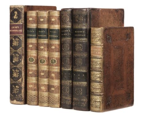
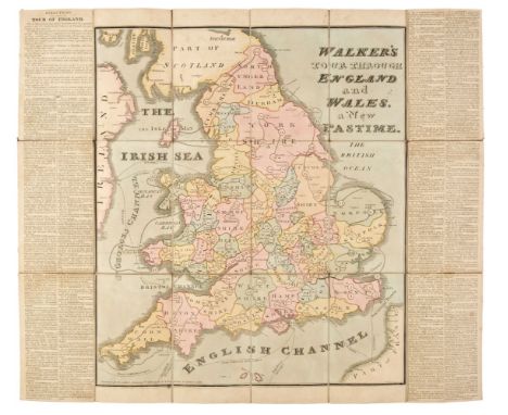
Coxe (William). Sketches of the Natural, Civil, and Political State of Swisserland; in a Series of Letters to WIlliam Melmoth, 1st edition, London: J. Dodsley, 1779, light spotting and browning, closed tear in N7, bookplate of the Honourable Lionel Damer (1748-1807), British politician, contemporary speckled calf, rebacked retaining original spine, label renewed, Damer's arms gilt to top compartment, 8vo (22.4 x 13.5 cm), together with: ibid. Travels in Switzerland. In a Series of Letters to William Melmoth, 3 volumes, 3rd edition, London: T. Cadell, 1789, vi [4] iv 428, [6] iv 422 [1], viii iv 456 pp., 2 engraved folding maps (including general map and 'Mont Blanc and the Adjacent Alps', 5 plates (some folding), errata leaf to rear of volume 2, first folding map with extensive closed tear, bookplates of Sir Richard Bempde Johnstone, 1st Baronet (1732-1807), British politician, edges sprinkled blue, contemporary marbled calf, 8vo (21.1 x 12.6 cm), Burnet (Gilbert). Some Letters, containing an Account of what seemed most Remarkable in Travelling through Switzerland, Italy, some Parts of Germany, etc. In the Years 1684 and 1686, 2nd edition ('corrected'), Rotterdam: Abraham Acher, 1687, bound with: ibid. Three Letters concerning the Present State of Italy ... Being a Supplement to Dr. Burnet's Letters, [London: no printer], 1688, 2 works in 1 volume, first work retainining initial blank, burn-hole in A2, contemporary panelled calf, rebacked to style, 8vo (17.2 x 10.5 cm), Moore (John). A Journal during a Residence in France, from the beginning of August, to the Middle of December, 1792 ... A new edition, corrected, 2 volumes, London: G. G. and J. Robinson, 1794, [2] 502, [2] 617 [3], engraved folding map hand-coloured in outline, 'Explanation of the Map' leaf to rear, light browning, spotting to title-pages and elsewhere, without half-titles (unknown if issued), engraved rococo-style bookplates of Harry Calvert (possibly Lieutenant-General Sir Harry Calvert, 1763-1826), contemporary sprinkled calf, rebacked with original spines laid down, extremities refurbished, 8vo (21 x 12 cm)Qty: (7)NOTESESTC T86683 (Coxe, 1779 edition), T134278 (Coxe, 1789 edition), R25315 (Burnet, Some Letters), R20842 (Burnet, Three Letters), T121419 (Moore: seven copies in UK libraries). The third edition of Coxe's work was the first to be illustrated, with the exception of a 1781 French translation which contained a map, and of which ESTC traces one copy only.

Lot 131

Atkyns (Robert). The Ancient and Present State of Glocestershire, 2nd edition, London: Reprinted by T. Spilsbury for W. Herbert, 1768, eight single-page engraved armorial plates, 65 folding engraved plates including county map, birds-eye plan of Gloucester, view of the West Prospect of Gloucester, Gloucester Cathedral and 60 birds-eye views of country seats by Kip (complete), later endpapers, contemporary speckled calf, morocco reback with gilt decorated spine, board corners repaired, board edges lightly rubbed, folioQty: (1)NOTESUpcott p.246-249.

Loading...Loading...
  • 109182 item(s)
    /page

Recently Viewed Lots