17th Century, John Speed, map of Connaught Attractive map of Connaught with inset town plan of Galway. “Performet by John Speede and are to be solde in Popes Head Alley against The Exchang by John Sudbury and George Humble, Anno Dominis 1610”. contemporary hand colouring, framed. 15¼ x 20¼in. (38.74 x 51.44cm)
We found 109198 price guide item(s) matching your search
There are 109198 lots that match your search criteria. Subscribe now to get instant access to the full price guide service.
Click here to subscribe- List
- Grid
-
109198 item(s)/page
Military Medal group - MM GV (11278 Pte T Mullen 12/W.York R.), 1915 Star Trio (11278 Pte T Mullen W.York.R.). Comes with much original paperwork and newspaper cuttings (these have been laminated). At one point he was believed Killed In Action and the family received official notification of his death (this included) however he was recuperating in German Hospitals after laying Wounded within a few yards of the German Trenches for three days. Mullen of Newcastle finally Escaped to the Dutch Frontier after three days of travelling by night with an Australian companion Hughie West (MM) who had hid a compass and map in his clothing. The newspaper cuttings give a vivid account of Mullens escape form the Prison Camp. MM L/G 30/1/1920 POW/Escapers Gazette. A super group.
An unusual George III Needlework SAMPLERfinely embroidered in coloured threads on silk with a map of the World depicting Western and Eastern Hemispheres within floral borders 45cms by 68cms - mounted and in original glazed gilt frameConditionGood overall condition, some tears to silk, some discolouration and fading
Tolkein, Lord of the Rings Trilogy. revised edition, Alan & Unwin, London, c1967 CONDITION REPORT: 1 Dust covers damaged, split slightly at top and bottom of spines, rough at lead edges. Pencil booksellers mark inside front cover. Ink date and name (3 lines)Unclipped dustcovers and pencil text on second inside blank padge, otherwise very slight discolouration / foxed on page edges and foxing to edges of final page, map presentBook 2 Similar to one but no long pencil text, map presentBox 3 Similiar to book 2 - no long pencil text, map present
Wales. Mercator (Gerard, Jansson Jan & Lhuyd Humphrey), Cambriae Typus Auctore, Humfredo Lhuydo Denbigiense Cambrobritanno, c.1630, hand coloured engraved map, decorative cartouche and mileage scale, compass rose and numerous rhumb lines, French text on verso, 37 x 50.5cm.; 14.5 x 19.75in. Reference: John Booth. Antique Maps of Wales, No.3.
Kent. Speed (John), Kent with her Cities and Earles Described and Observed, performed by John Speede and sold by Thomas Bassett in Fleet Street and Richard Chiswell in St. Paul's Churchyard, 1676, hand coloured engraved map, inset town plans of Canterbury and Rochester, decorative strapwork cartouche, with seven armorials and Royal coat of arms with supporters to top edge, English text on verso, 39.5 x 52cm.; 15.5 x 20.5in.Condition Report: The map is in fair, original condition. There are just a few minor spots of foxing but one larger spot of browning in the top right corner. There appears to be blue and red paint on the reverse of the page in the top left corner as can be seen. There is a dark mark with a small central pinhole in the margin at the top right corner as can be seen. There is some smudging to the black ink possibly occurring during the printing process but again shown in the mid left index box. There is a repaired tear and corresponding patch which is visible looking at the reverse on the right hand edge and shown in a detail image. There is the usual overall creasing to the page as expected and as shown in the images but the border colours are still strong in colour and sensitively done. The map is framed and glazed to both front and back as can be seen. The frame has knocks and losses commensurate with age.
Radnorshire. Speed (John), The Countie of Radnor Described and the Shyretownes sittuatione, described by Christopher Saxton, augmented and published by John Speed, sold by Thomas Bassett in Fleet Street and Richard Chiswell in St. Paul's Churchyard, 1618, hand coloured engraved map, strapwork cartouche, mileage scale and compass rose, inset town plan of Radnor, English text on verso, 42 x 53.5cm.; 16.5 x 21in, together with Christopher Saxton and William Kip, Warwici comitatus a cornauiis olim inhabitatus [Warwickshire], engraved county map, hand-coloured in outline, 29 x 35cm.; 11.5 x 13.75in (2).
An early 19th century working estate chart, Map of the Parish of Awre in the County of Gloucester, Made partly from Old Surveys and partly from Actual Survey by Charles Baker, Land Surveyor, Civil Engineer, Architect & c., Painswick 1828, printed and laid onto canvas, the parish with plots of land numbered and annotated in ink ms., a red titled line cuts through the parish and is inscribed Forest of Dean Central Railway, including elaborate Chippendale style cartouche drawn and titled in pen and ink, printed compass to margin, the lower portion flanking the River Severn, Forest of Dean to the West, etc., 103cm x 160cm, mahogany turned baton
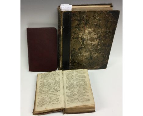
Miscellaneous Reference and Topography - The Treble Almanack for the Year 1820, Containing I. John Watfon Stewarts Almanack, II. The Englifh Court Regiftry, III. Wilfons Dublin Directory with a New correct Plan of the City (sic), Forming The most Complete Lists published of the Present Civil, Military and Naval Establishments of Great Britain and Ireland, Printed by Authority [John Watson], Dublin 1820, 215 + 223 + 216pp + Historical Annals of The City of Dublin [xii], full period red morocco, 12mo; Paterson (Daniel), A New and Accurate Description of All The Direct and Principal Cross Road in England and Wales, eleventh edition, T.N. Longman, London 1796, xxxv + 406pp, the front with engraved two-page map of England and Wales, inserted clippings, 20th century buckram binding, 12mo; Jones' Views of the Seats, Mansions, Castles, &c., of Noblemen and Gentlemen in England, Wales, Scotland and Ireland, And Other Picturesque Scenery [...], Jones & Co., London 1829, bound as one, period half-leather and marbled boards, 4to (3)
HAVILAND, Alfred - Scarborough as a Health Resort: its physical geography, geology, climate & vital statistics with health map guide, 1883, ex-library, together with five books of photo-lithographic views covering Nottingham; Edinburgh together with another of the city; London and Berlin (6)
NEWCOME, Rev. Peter - The History of the Ancient and Royal Foundation, called the Abbey of St. Alban, in the County of Hertford, from the foundation thereof in 793, to its dissolution, in 1539. Exhibiting the Life of Each Abbot and the principal events relating to the Monastery, during the rule and Government, 1795, with plates and fold out map, lacking front and rear boards
-
109198 item(s)/page