We found 109182 price guide item(s) matching your search
There are 109182 lots that match your search criteria. Subscribe now to get instant access to the full price guide service.
Click here to subscribe- List
- Grid
-
109182 item(s)/page


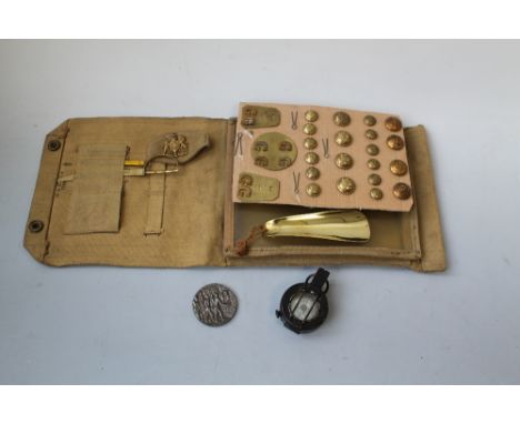
Lot 603
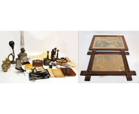
A small group of vertu and other items comprising a Neva gold filled antique pocket watch,a vintage map measuring wheel,a miniature brass bed warmer of railway interest depicting a steam train of the Severn Valley Railway,a wooden loving spoon,an attractive framed miniature print of barges on the canals of Bruges and an early 20th century police whistle and a miniature brown stone figure of a pig


Lot 692
A large County Map of Huntingdonshire by Robert Morden - size 44 cm x 38 cm - sold by Abel Swale Awnsham and John Churchill - some staining and folds - together with a Thomas Kitchin map of Huntingdonshire published 1748 and a map of Norfolk published by Laurie and Whittle - size 24 cm x 18 cm - some staining and folds and a large reproduction map of the North & East Ridings of Yorkshire after John Speed - size 54 cm x 41 cm - all framed

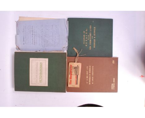
Lot 96
GNR tenancy agreement and maps for land at Hadley Wood station. 6 inch Ordnance map re GC and mid Joint Line Rotherham to Shereoaks railway, bound linen map 58 Survey of "Liverpool Street", Large linen bound map Post War Development Peterborough. Linen map diagram of MGN and GE Rly with New committees Lines Norfolk/Suffolk January 1904, etc

Lot 295
'The Silver Map of Great Britain', a limited edition of 3000 hallmarked silver maps, authorised by the council for the protection of rural England on the occasion of it's Golden Jubilee, with certificate, glazed in a wooden frame, together with a commemorative Prince Charles and Lady Diana commemorative map of Great Britain, in hallmarked silver in wooden frame.


Lot 309
REV. STEBBING SHAW - 'THE HISTORY AND ANTIQUITIES OF STAFFORDSHIRE', two volumes 1798 & 1801, Vol I with Yates's reduced map of Staffordshire and Vol II with Taylor's map of Wolverhampton A/F together with an incomplete section of Shaw's Vol I (3) Buyers - for shipping pricing on this lot, visit www.cuttlestones.co.uk/shipping

Lot 370
'PER RAIL Transportation is the Life Blood of Commerce', printed by Knapp, Drewett & Sons, 1913, includes three coloured folding maps - 'The Bird's eye View of Immingham', 'The Colliery and Industrial Map' and 'The Map of the Great Central Railway and its Connections' - some tears Buyers - for shipping pricing on this lot, visit www.cuttlestones.co.uk/shipping


Lot 97
AN AIR MINISTRY BLACK AND WHITE SILK MAP OF BULGARIA - ROMANIA AND GREECE, 51 x 59 cm, along with a silk map of France, coloured, 57 x 62 cm and a printed silk souvenir of the 'State Performance of Romeo and Juliet' July 4th 1893, 54 x 35 cm (3) Buyers - for shipping pricing on this lot, visit www.cuttlestones.co.uk/shipping
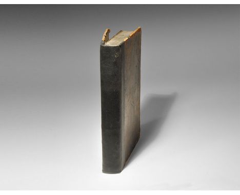
Lot 161
Published 1777 AD. First edition, by John Gibson (Merchant in Glasgow), published 'for the author' [title; preface, vii pp.; text, 391 pp.], original full calf boards, later spine reinforcement, text block solid. 550 grams, 21.5 x 14cm (8 1/2 x 5 1/2"). [No Reserve] Good condition; some browning, boards rubbed and corners bumped; no map.
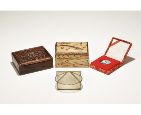
Lot 342
20th century AD. A mixed group comprising: an unvarnished wooden 'treasure chest' with pokerwork detailing, 'Cuba', compass rose and stylised map to the lid; a box with hinged lid made from transparent shell panels; a varnished wooden box with hinged lid; a silk-covered and lined box with inset for a gold-coloured metal enamelled badge with Thai text. 249 grams total, 60 - 95mm (2 1/2 - 3 3/4"). Ex Steinberg collection; acquired London art market, 1960s-1970s. Walter Steinberg has been a well-known figure at fairs, sales and events for many years. Born in 1922 in Philadelphia, Walter has had a life-long passion for collecting. A long-time resident in London, he has now retired to New York and decided that the time has come to pass on the antiquities and coins he has collected over his lifetime. Walter acquired coins and artefacts that interested him, so his collection, although containing many lovely examples, also contains many affordable specimens. Much of the material has been unavailable to the market for 30 to 50 years. Walter hopes that the items he collected will now find new homes with the next generation of collectors. [4, No Reserve] Fine condition.


Lot 1125
Fifteen Western National Bus Company reverse glass advertising signs and an 'Associated Motorway Express Coach Routes' map of the British Isles:. *Note- The Western National Omnibus Company was formed in 1929 as a joint venture between Great Western Railway (GWR) and the National Omnibus & Transport Company, operating in the South West until the 1990s.


Lot 267
Baedeker (Karl). Handbook for Travellers, Central Italy (1893), Northern Italy (1899), Belgium and Holland (1885), Rhine (1886), an Antiquarian Travellers map of Spain and Portugal, and Harriet Martineau's Complete Guide to the English Lakes, red cloth binding, spine in poor condition, (6). Provenance: Ex Duddington Manor


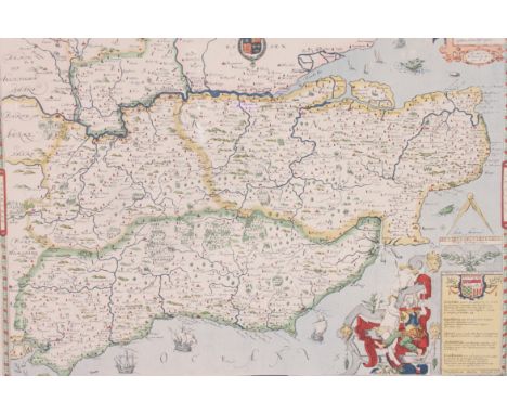
![John Bill, original hand-coloured map of 'Lincolneshire' [sic]. Framed.](https://cdn.globalauctionplatform.com/6a6ecd11-a9dd-40cc-ab46-a4ec0097ecc3/d336e2c3-1e35-44e4-9e0c-d3d884ea7614/468x382.jpg)

-
109182 item(s)/page