We found 109198 price guide item(s) matching your search
There are 109198 lots that match your search criteria. Subscribe now to get instant access to the full price guide service.
Click here to subscribe- List
- Grid
-
109198 item(s)/page


Lot 383
1- LINGARD, John: The Antiquities of the Anglo-Saxon Church; in 2 Volumes. Keating, Brown and Keating, 1806, 1st. edn. With Folding frontis map and each title page has a woodcut engraving, PP:360; 382. Cont. full calf, rebacked with later spine, hinges reinforced internally. Ex- library: the Monastery of St Mary the Virgin, Worth; label to pastedown; 2- THORPE, B: Analecta Anglo-Saxonica a Selection, in Prose and Verse, from Anglo-Saxon Authors of Various Ages. John and Arthur Arch, 1834, 1st. edn. 285pp. Full calf, which has been professionally restored incorporating a modern back strip (3)

Lot 347
LYON, Captain G F: The Private Journal of Captain G F Lyon of HMS Hecla; Being recent voyage of discovery under captain Parry L, J Murray, 1824, 1st. edn. With folding Map, Frontis, and 6 plates. PP: xiii, (i), 468. Original boards with later plain spine and label; boards chipped; foredges little frayed; occasional foxing; map with small repair
Lot 353
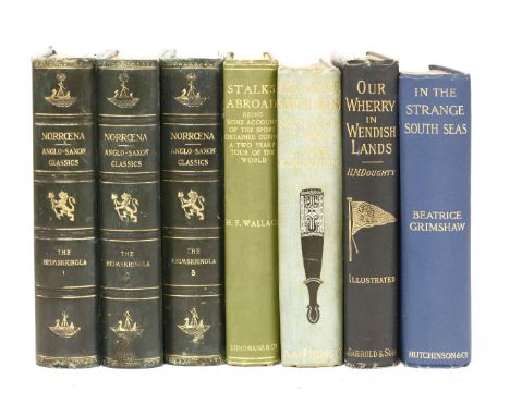
1- Sturlason, Snorre: The Heimskringlas. A History of The Norse King; in 3 vols. L, Norroena Society, 1906, Numbered Limited Imperial edition, # 25/350. Original highly gilt decorated full leather; slightly rubbed; 2- Wallace, H F: Stalks Abroad. Longmans, Green, 1908, 1st. edn. Original gilt pictorial cloth; 3- Elkington, E: The Savage South Seas. A&C Black, 1907, 1st. edn. Original gilt pictorial cloth; 4- Doughty H M: Our Wherry in Wendish Lands : From Friesland Through the Mecklenburg Lakes to Bohemia. nd, c1890. Original pictorial cloth; rubbed; one map torn; 5- Grimshaw, B: In the strange South Seas. 1908. Original cloth (7)

Lot 381
GIBSON, Edmund: Chronicon Saxonicum Ex MSS Codicibus. Oxford, Theatro Sheldoniano, 1692, 1st. edn. With Engraved vignette title & folding frontis map. PP: Title page, second title page; (viii) preface, 244, (xviii) Index Rerum Chronologicus, (ii), 3-64(Regulae Generales). Old calf, rebacked; rubbed; inner joints reinforced; foredges damp stained/nibbled

Lot 338
INDIA: McClelland, John: Some inquiries in the province of Kemaon, relative to geology, and other branches of natural science. Calcutta, Baptist mission press,1835. Illustrated with a large folding coloured map, colour frontis Plus 8 Plates with colouring. PP: xv, (i) blank, (ii) Subscribers list, (i) Errata, (i) blank, 384. Bound in plain green cloth; rubbed and faded; completely unopened copy. (Scarce title; ONLY 83 NAMES IN THE SUBSCRIBERS' LIST, WITH A TOTAL OF 96 COPIES)
Lot 460
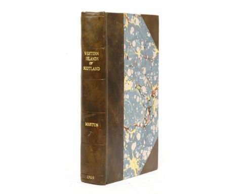
Martin, M: A Description of the Western Islands of Scotland. For Andrew Bell, 1703, 1st. edn. With a folding Map and folding Plate. PP: (xxxii)including Errata, 392. Rebound in half leather over marbled boards and new endpapers; tear and repair to map; plate torn (without loss); small hole to bottom margin of one contents page.

Lot 403
1- Malcolm, F P: First Impressions or Sketches from Art, and Nature Animate & Inanimate. J Nichols, 1807, 1st. edn. with 20 steel engraved plates, 285pp + publisher's list. Full calf with marbled endpapers, book plate of Bryan Hall - further armorial bookplate. Foot of spine has small chip; 2- Gardiner, F: History of Wisbech & Neighbourhood During the Last Fifty Years - 1848-1898. Wisbech, Gardiner & Co, 1898, 1st. edn. Numerous black and white illustrations; But lacking the Map, 503pp inc list of subscribers. Later half leather gilt, aeg; 3- John Murray: Handbook for Essex, Suffolk, Norfolk and Cambridgeshire. 1875, 2nd. edn. Original publisher's cloth which has been relaid on matching modern cloth. Part of the original backstrip is missing. Publisher's lists on endpapers, two folding plans and folding map in pocket at end, 472pp inc index + 72 pp handbook advertiser for 1875; 4- Buckler, G: Twenty-Two of The Churches of Essex, Architecturally Described and Illustrated. Bell & Daldy, 1856, 1st. edn. Half calf; rubbed; 5- Inglis, H: The 'Contour' Road Book Of England. 1906. full leather; 6- The Lives of Eminent & Remarkable Characters, Born or Long Resident in the Counties of Essex, Suffolk & Norfolk. 1820. With 68 portraits from engravings. Contemporary half calf (6)
Lot 408
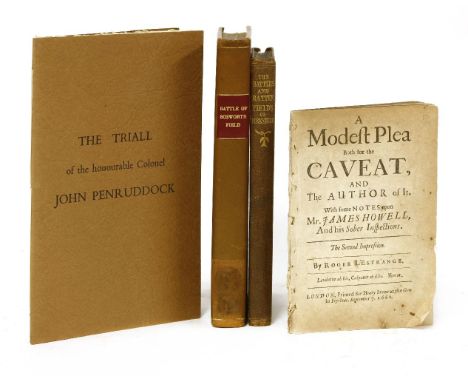
CIVIL WAR/MILITARY: 1- Hutton, W: The Battle of Bosworth-Field Between Richard the Third, and Henry earl of Richmond August 22, 1485. Birmingham, Pearson and Rollason, 1788, 1st. edn. with a folding battle field map. Full modern calf; A label has been removed from the foot of the spine leaving a mark on the leather; 2- L’Estrange, R: A Modest Plea Both for the Caveat, and the Author of it with Some Notes Upon Mr James Howell, and His Sober Inspections. Printed for Henry Brome, 1661, 2nd. edn. 40 pp. Disbound, Contents browned; 3- Grainge, W: The Battles and Battle Fields of Yorkshire; from the Earliest Times to the End of the Great Civil War. 1854, 1st. Blindstamped cloth covers, hand coloured frontis map, 204pp. Covers unevenly faded; 4- The Triall of the Honourable Colonel John Penruddock of Compton in Wiltshire and His Speech. No. 29 of an edition limited to 100 copies. Card covers with flaps (4)
Lot 343
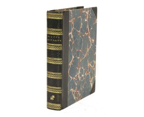
SHIPWRECK: Riley, James: Loss of the American Brig Commerce, wrecked on the western Coast of Africa, in the month of August 1815, With an account of Tombuctoo, and of the hitherto undiscovered great city of Wassanah. J. Murray, 1817, first edition. With a folding map frontis. PP: xvi, 618. Later half leather over marbled boards; title page slightly trimmed at the top and with two small scribbles; inscription to rear blank endpaper

Lot 350
FALKLAND ISLANDS: Dom Pernetty: Histoire d'un voyage aux isles Malouines, fait en 1763 & 1764; Avec des observations sur le détroit de Magellan, et sur les Patagons; in 2 vols. Paris, Saillant & Nyon & Delalain, 1770, new edn. Illustrated with folding Map and 18 folding plates. PP: iv, 385; 334, (ii) Approbation. Full leather; rubbed and with cut to side of spine (2)

Lot 330
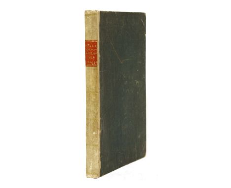
CARY, John: A NEW UNIVERSAL ATLAS; Containing Distinct Maps of All the Principal States and Kingdoms Throughout the World. London, J. Cary, 1808 (some of the maps dated 1799). Folio, Engraved title, 56 hand-coloured double-page maps on 60 numbered sheets (complete); plus an extra, loosely inserted one sheet map. Influential and popular atlas, presenting the world at the beginning of the 19th century in a series of finely-engraved maps with bright original colouring. Contents loose in worn and torn covers; title page torn and a small tear to a couple of the maps (away from the image). Damp stain to folds of the last few maps. SOLD A/F NOT SUBJECT TO RETURN

Lot 363
Meinertzhagen, Colonel R: Birds of Arabia. Deluxe edition limited to # 26/250 copies. Folio; Cased in half green morocco with raised bands, gilt decoration and titles, TEG, marbled endpapers. With 9 tipped-in colour plates with tissue guards, 9 photographic plates, numerous text figures and a large folding map at the back. 624pp inc index. VG+
Lot 402
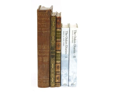
NORFOLK AND SUFFOLK: 1- Grose, F: The Antiquities of England and Wales: 'Norfolk and Suffolk' volume only. Hooper & Wickstead, 1783. With 29 plates engraved on copper and two hand-coloured maps. 4to. Cont. half calf; rubbed; 2- Pike, W T(edit): Norfolk and Suffolk in East Anglia. Brighton, 1911, 1st. edn. From the Pike New Century Series. Full morocco with gilt decoration and inner dentelles. Numerous photographs of country houses and churches; The inner hinges have been neatly reinforced with bookbinders tape; 3- Britton, John: The History and Antiquities of the See and Cathedral Church of Norwich. Longman, Hurst,.. 1816, 1st. edn. With 25 engravings, 89pp. Full leather; light foxing; 4- Fiske, J(edit): The Oakes Diaries Business Politics and the Family in Bury St Edmunds. 2 VOLS. Woodbridge, Boydell Press, 1990-91. Suffolk Records Society Vols. XXXII and XXXIII. Map endpapers and bw illustrations. (5)

Lot 449
TOTTENHAM: 1- Robinson, W: The History and Antiquities of the Parish of Tottenham. 2 vols. Nicholls & Son, 1840. With plates and 2 large folding colour maps (now linen backed). Bound in later ¾ leather, with extra tipped-in copy of newspaper cutting, etc.; 2- Robinson, W: The History and Antiquities of the Parish of Tottenham High Cross.. Middlesex, printed for the author, 1818, 1st. edn. With plates and large folding colour map (relaid). Later full leather signed binding by Anthony Gardner, 1950; with the binder's notes on a page tipped-in at the end; 3- Fisk, F: History of Tottenham. Tottenham, for the author, 1913. Original cloth; 4- Roe, W J: Tottenham, Edmonton & Enfield Historical note book. Percy press, Tottenham, 1952, 1st. edn. dw. (5)

Lot 329
MAPS: Malta: 1- SEUTTER MATTHEUS: Melite vulgo Malta cum vicinis Goza quae olim Gaulos, et Comino insulis uti exhibetur a Nic. De Fer. Augsburg, c.1730. Hand coloured and measuring 500 x 580mm. large and decorative map of Malta, orientated with north to the bottom right, with an inset map of Valletta, the arms of 64 Grand Masters of the Knights of Malta, and an allegorical scene representing the sea power of the Knights. 2- Insula Melitae vulgo malte nova et accurata descriptio. Amsterdam, Gerardum Valka et Petrum Schenk, no date, c18. Partially hand coloured. 3- View of the Grand Port of Malta. A hand drawn map with some colouring and with a list of the cities and populations; PLUS: Piano dell assedio della cittadella di Messina (Map of the siege of the Citadel of Messina). No date, c18. All four maps are mounted, framed and glazed (4)

Lot 474
MILITARY: 1- A System of Camp Discipline, Military Honours, Garrison-Duty, and other Regulations for the Land Forces. Printed for J Millan, 1757, 2nd. edn. PP:vi, 146(ie 138), 83(ie 100), plus a folding hand coloured map, 20 plates (some hand coloured), & a folding table. Cont. full calf, rebacked with later spine; 2- [Fawcett, William]: An elucidation of several parts of his majesty's regulations for the formations and movements of cavalry. Printed for the War office by T. Egerton, 1798, 1st. edn. Two parts in one volume, PP: iv, 54(continuous pagination), Plus 31 folding colour plates. Contemporary marbled boards, covers detached and lacking spine; dust soiling to foredges of some pages. (2)
Lot 397
NORFOLK & SUFFOLK: 1- Cromwell, T K: Excursions in the County of Suffolk 2 Volumes; LARGE PAPER COPY. Longman, Hurst,.. 1818-1819. With a map of the county, plan of Ipswich, 2 engraved title pages , Plus 96 engraved plates (as called for). Covers rubbed; One gathering loose in Vol. II; occasional light foxing; 2- Gillingwater, E: An Historical and Descriptive Account of St Edmund's Bury, in the County of Suffolk. J Rackham, 1804, 1st. edn. 4 engraved plates, Original plain paper boards; Frontis plate stained; 3- Chubb & Stephens: A Descriptive List of the Printed Maps of Norfolk 1574-1916 with biographical notes.. Norwich, Jarrold, 1928, 1st. edn. Covers faded with some damage to foot of spine; 4- Brayley, E W: Views in Norfolk, Suffolk and Northamptonshire Illustrative of the Works of Robert Bloomfield. Vernor, Hood,.. 1818. With 15 plates including engraved title page. Cont. half leather, rebacked; lacking front endpaper; occasional foxing and one plate with a tear; 5- Stephen: Norfolk Bibliography; PLUS one other (7)

Lot 339
Parry, William Edward: (Two works): 1- Journal of a Voyage for the Discovery of a North-West Passage from the Atlantic to the Pacific; Performed in the Years 1819-20, in His Majesty's Ships Hecla and Griper... With an Appendix, Containing the Scientific and Other Observations. J Murray, 1821, 2nd. edn. Complete with 20 Plates Plus a map (some folding). PP: xxix, 310, clxxix; 2- Journal of a second voyage for the discovery of a North-West Passage from the Atlantic to the Pacific; performed in the years 1821-22-23. J Murray, 1824, first edn. Complete with 39 plates, maps & charts (many folding). PP: xxx, 571, (i)errata, (iv) Publishers Ads dated 1824. Both volumes bound in matching C20 half calf over marbled boards, with to labels to each, new endpapers and without the ½ title. Occasional foxing and some offsetting (2)
Lot 396
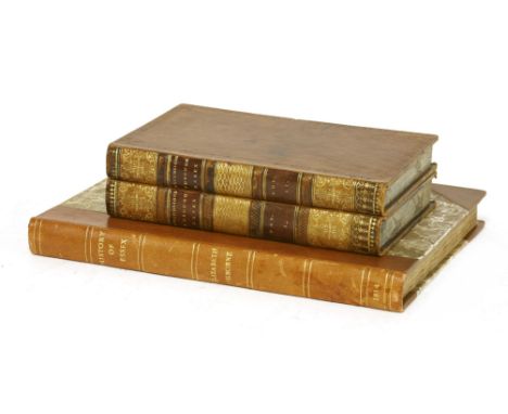
ESSEX: 1- Ogborne, E: The History of Essex from the Earliest Period to the Present Time. 1814, 1st. edn. with a double page plan, plates and illustrations. 4to. 280pp. Later half leather and new endpapers. 2- Cromwell, T K: Excursions in the County of Essex 2 Volumes; LARGE PAPER COPY. Longman, Hurst,.. 1818-1819. With a map of the county, plan of Colchester, Plus 96 engraved plates (as called for). Full diced calf (3)
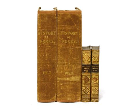
Lot 395
ESSEX: 1- Wright, Thomas: The History and Topography of the County of Essex Illustrated By a Series of Views; in 2 Volumes. George Virtue, 1836, 1st. edn. with an extra engraved title to each volume, folding map, frontis plate, Plus 99 plates (as called for). pp 695; 834 with an index to each vol. Original publisher's cloth, rebacked with original spines; endpapers loose; occasional foxing; 2- Cromwell, T K: Excursions in the County of Essex 2 Volumes. Longman, Hurst,.. 1819. With a map of the county, plan of Colchester, Plus 96 engraved plates (as called for). Near cont. calf; rubbed; occasional foxing (4)

Lot 351
Sandys, George: Sandys Travels, containing an History of the Original and present State of the Turkish Empire…The Mahometan religion and ceremonies; description of Constantinople; Greece; Egypt; Holy-Land; Italy; Cyprus, Crete, Malta, etc…illustrated with fifty graven Maps and figures. L, Printed for John Williams Junior, 1673, 7th. edn. Also with an engraved general title-page: A relation of a Journey begun An Dom 1610.. printed for Philip Chetnin, 1670, 6th. edn. PP: extra engraved title-page for 6th. edn., title-page, (ii) Dedication, 240, Plus a folding map and a folding plate, torn. Illustrated with 47 engravings in the text, extra engraved title, folding map and folding plate. Cont. full leather, recased with later spine with embossed decoration and a label. Boards rubbed; occasional browning and staining; two small holes affecting a couple of letters in two pages; the folding plate with three tears, but no loss

Lot 477
1- Wyndham, H P: The Diary of the late George Bubb Dodington.. Salisbury, E. Easton, 1784, 1st. edn. PP:xv, 502, (i)adv. Cont. full calf; rubbed; 2- Moore, John: A journal of a residence in France, from the beginning of August, to the middle of December, 1792. in 2 vols. L, Robinson, 1793, vol.1 1st. edn. vol.2 2nd. edn corrected. PP:(iv)tp & adv. for late printing, 502; 617, + large folding colour map. Cont. half leather; rubbed. 3- Barrow, J: the life of George Lord Anson. Murray,1839, 1st. edn. Later cloth backed marbled boards; frontis repaired; 4- Restif de la Bretonne: Monsieur Nicolas Or The Human Heart Unveiled; in 6 vols. John Rodker, 1930-31, 1st. edn. with dust jackets. Limited edn. #176/825. Spines of DWs faded. (10

Lot 476
MILITARY: 1- Raikes, Captain G A: The History Of The Honourable Artillery Company; In 2 volumes. L, Richard Bentley, 1878-79, 1st. edns. All plates present. Both volumes with a presentation inscription from the Artillery Company to Major General Sir R. Gipps, K.C.B. Original gilt decorated cloth; rubbed and spines frayed; tear to map (without loss); paper brittle; A/F; 2- General Regulations and Standing Orders for the Garrison of Dublin, 24th October, 1822. Published by authority; Dublin, printed & sold by George & John Grierson and Martin Keene. PP:Full page ink inscription: “by Day” & “by Night” to front blank endpaper, vii, (i)blank, 39, (ii)blank. Bound in the original paper backed boards; The Armorial bookplate of Lt. Colonel Henry Madox to front pastedown, & Upper cover inscribed: Major Madow, December 1822. Spine little chipped. 3- Mahan, A T: The Major Operations of the Navies in the War of American Independence. 1913, 1st. edn. with maps, plans & portraits. Full calf; VG. (4)

Lot 346
Keating, William Hypolitus: Narrative of an Expedition to the Source of St. Peter's River, Lake Winnepeek, Lake of the Woods, &c. Performed in the Year 1823; in 2 volumes. L, Printed for Geo. B Whittaker, 1825. Illustrated with a large folding coloured Map, 6 plates (as called for), Plus an extra 2 colour plates and 3 folding tables in the Appendix. Later half leather with aeg; boards rubbed; bound without the ½ titles (2)


Lot 253
BISHOPS BIBLE - ENGLISH - 16TH CENTURY, possibly a 1572 Bishops bible, lacking main title, engraved title to the new testament present, text illustrations and maps, full suede calf, London, c1572 (1) (at fault) CONDITION REPORT: The bible is defective, the first page present is 'The sum of the whole scripture', the first five pages which are present are in poor condition, ink names and writing from old family members in blank areas, the last page does appear to be present 'Finis - Imprinted at London in Povvles', the last four pages which are present are in poor condition, the fifth from last with a few holes. Generally the internal pages are ok, evenly browned with some grubby marks and there. Binding poor. AT FAULT - NOT SUBJECT TO RETURNThe bible begins with 'Christ Lyfe' (sic), followed by 'lessons to be read', calendar, Preface, Prologue, order of the books of old and new testaments. End of the old testament: Machebees end and there is a page with the description of the holy land with printed map and then the title of the new testament. The bible is 40.5cm long, 28cm wide and 11.5cm thick


Lot 29
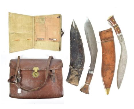
HMS Philantes Interest, a leather map satchel, with brass lock and buckles, stamped PHILANTES, R.Y.S. (Royal Yacht Squadron)**HMS Philantes was an armoured motor yacht, launched in 1937, it acted as a submarine escort throughout the Second World War; a Second World War Map Case, A3 size, in khaki canvas with leather V hanging strap; a Nepalese Kukri, the ricasso of the steel blade stamped 10471, the wood grip with steel bolster and butt plate, the leather scabbard with sharpening knife; a British Kukri, the blade stamped P8, the wood grip with steel bolster, brass bands and butt plate, with leather scabbard (4)
-
109198 item(s)/page