We found 109198 price guide item(s) matching your search
There are 109198 lots that match your search criteria. Subscribe now to get instant access to the full price guide service.
Click here to subscribe- List
- Grid
-
109198 item(s)/page


![John Speede, 'Pembrokshyre Described', [sic], an original framed and coloured map of Pembrokeshire with vignettes and armoria](https://cdn.globalauctionplatform.com/0dbc74aa-f173-4d1e-ac8c-a72f010de7a9/dfc1179b-8e7e-4b70-dea8-3d39091ad265/468x382.jpg)


Lot 101
THE VISIT OF THE FRENCH FLEET 1905', official programme with silk end board embossed with gilt and printed silk map in slip at back, blue morocco with embossed decoration and titles -10 x 6¼in; together with a large quantity of printed naval ephemera including a comprehensive book of cuttings and images pertaining to the Dardanelles campaign bound in blue cloth; a 19th century album of press cuttings and engravings pertaining to Admiral Henry Keppel bound in quarter calf red morocco; naval publications including victualling yard accounts 1905, naval rationing and yard hours 1901 and a confidential report into naval rationing; a catalogue of government stores disposed at Malta 1922; copy of the Wavy Navy signed by Admiral Cunningham no. 250/250; a copy of 'Deutschland Sur Zee'; a commemorative album pertaining to the death of an Osborne cadet 1917; several 'Crossing the Line' certificates (two framed) and a large assortment of related naval ephemera, (A lot),

Lot 125
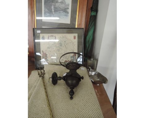
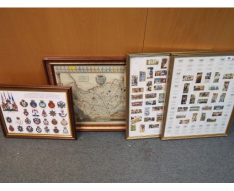
A collection of Dad's Army Primrose confectionary cards depicting characters from the show, framed under glass also a framed collection of Wills cigarette cards, a framed map of Cheshire and a framed commemorative picture of the 90th birthday of Her Majesty Queen Elizabeth II and the Queen Mother and Her Majesty's service appointment with the Commonwealth armed forces
Lot 376
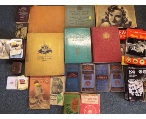
A good lot to include a quantity of road maps for Bartholomew's Revised half inch contoured maps, one of Merseyside, one of Surrey, one of Wharfedale and one of the Lake District, a book of routes via the road entitled The Open Road, Guide to Blackpool Transport, the Ford V8 handbook, a canvas backed map of London, Ordnance and Survey road map of Great Britain, Coronation Souvenir book 1937, The Silver Jubilee book, Guinness Book of Records 1955, a quantity of cigarette cards by Wills, Players, and a collection of Kensitas cigarette silks depicting National Flags and other


Lot 208
DAMBUSTERS THE: An extremely rare and interesting selection of five vintage 8½ x 11 aerial reconnaissance photographs, the images depicting the dams of the Möhne and Edersee, as taken by the German Luftgaubildstelle VI Munster i. W., at heights of between 4,500 and 8,000 metres, during the period of 10th March - 18th May 1943, comprising the Möhne Dam intact, 10th March 1943, a second of the Möhne Dam breached, with a large flooded area beneath, 18th May 1943, a third image depicting a portion of the Möhne reservoir, drained of water, and the Stockumer Dam intact, 18th May 1943, a fourth of the Edersee Dam intact, 21st April 1943, and a fifth image depicting the Edersee Dam breached, with water flooding onto the land below, 17th May 1943. Each with German Geheime Kommandofache (Secret Command Document) identification stamps to the verso, completed in blue fountain pen ink, recording the day, date, map reference, photographer I.D., etc, a further notification states it is a secret document under §88 of the laws of 24th April 1934, and that duplication is forbidden. One image with a small, neat tear to the left edge, and each with two file holes to the left edge, otherwise VG, 5 Operation Chastise was an attack on German dams carried out on 16th-17th May 1943 by Royal Air Force No. 617 Squadron, subsequently publicised as the 'Dam Busters'. The Möhne and Edersee Dams were breached, causing catastrophic flooding of the Ruhr valley, whilst the Sorpe Dam sustained only minor damage.


![Saxton (Christopher) and Hole (William) [Map of Cheshire] Cestriae Comitatus Romanis Legionibus et Coloniis olim insignis ve](https://cdn.globalauctionplatform.com/135cbed6-2ea5-4f55-bfb2-a73d00f710c4/471c5d6c-bb70-4a03-b92b-f3d7a9e49132/468x382.jpg)
Lot 69
Saxton (Christopher) and Hole (William) [Map of Cheshire] Cestriae Comitatus Romanis Legionibus et Coloniis olim insignis vera et absoluta descriptio [London,1610], hand coloured engraved map, printed area 250 x 300mm, centrefold, some light spotting, unexamined out of modern gilt frame [together with:] [Senex (John)] two hand coloured engraved strip road maps, in Yorkshire, printed to both sides of one sheet [1759], visible 165 x 215mm; unexamined out of modern gilt frame, glazed both sides (2)
![Stanford (Edward, Publishers) Ordnance Survey [Map] of Yorkshire, 1865, London, E. Stanford, complete in seven parts with ou](https://cdn.globalauctionplatform.com/135cbed6-2ea5-4f55-bfb2-a73d00f710c4/e1a5778d-abf3-4fd2-ab5d-6a13f687d7ce/468x382.jpg)
Lot 73
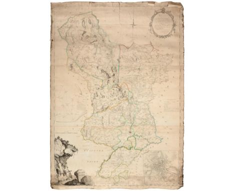
Stanford (Edward, Publishers) Ordnance Survey [Map] of Yorkshire, 1865, London, E. Stanford, complete in seven parts with outline colour by hand, each sectionalized and on linen, varying open dimensions but all folding to 8vo size, and each with marbled e.p.s, and bookplate label for C.J. Peacock; (bumped and rubbed) red cloth box with publisher's label preserved (lacking lid). Scale one inch to one mile. Scattered soiling and staining, the maps generally well preserved, without significant loss. The first OS map of the whole ceremonial county (8)

Lot 64
Nightingale (Joseph) English Topography: or a series of Historical and Statistical Descriptions of the Several Counties of England and Wales, 1816, London, Baldwin, Cradock and Joy, folio of 58 engraved maps in original colour BY J. ROPER AND G. COLE, including two general maps of England and Wales (frontis. map disbound). Both original frayed boards detached, internally a good copy, with Sidney Stanley armorial bookplate (1)
Lot 107
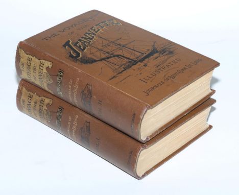
De Long (George W.) (De Long, Emma, Editor) The Voyage of the Jeannette. The Ship and Ice Journals of George W. De Long…, 1883, Boston [USA], Houghton, Mifflin and Co., two vols., 8vo, frontispiece to each, 14 additional plates, illustrations, diagrams, maps and charts (some folding or double-page), incl. folding map of the voyage (good) in pocket at rear of Vol. I, all complete as list. Only minor marginal browning; publisher's pictorial black and gilt cloth bindings a little rubbed and bumped, a good sound copy (2)
![Ortelius (Abraham) and Lhuyd [Llwyd] (Humphrey) [Map of England and Wales] Angliae Regni Florentissimi Nova Descriptio, Aucto](https://cdn.globalauctionplatform.com/135cbed6-2ea5-4f55-bfb2-a73d00f710c4/935d5399-75dc-491d-96b0-9aa529acc2f2/468x382.jpg)
Lot 75
Ortelius (Abraham) and Lhuyd [Llwyd] (Humphrey) [Map of England and Wales] Angliae Regni Florentissimi Nova Descriptio, Auctore Humfredo Lhuyd Denbygiense, [1574 or later, Antwerp], engraved map with fine early colour by hand, elaborate strapwork cartouche and mileage scale, plate 380 x 470mm; Latin text with hand-coloured historiated initial to verso Centrefold, margins visible outside platemark, some very minor blemishes and stains; unexamined out of modern frame
Lot 59
Bower (A., Surveyor) The Two Acts of Parliament for the Holderness Drainage with an Index and Plan. 1781, York, A. Ward, folio, 480 x 375mm, title, Index, xvi, pp. 20, the letterpress in two columns followed by several tables, two blank leaves preserved at rear (detached); the block loosely bound by original stitching (title almost detached), the laid paper rather browned, soiled and stained, with tatty extremities, and pp. 15-20 with hole to centre; with Bower's (disbound) folded map 'A Plan of the Holderness Drainage', engraved by Consitt at York, separately dated 1781, the floral cartouche surmounted by an eagle, sheet approx. 825 x 650mm. Scale of Chains lower right. Rather tatty extremities, some soiling and light foxing with some folds splitting at margins. The whole offered with remains of original leather-covered portfolio boards. No sale records nor institutional copy of this very scarce work traced (1)

![Baker (Robert, Surveyor) [Map of Antigua] Antigue, Levee par Robert Baker, Arpenteur General de l'Isle. 1779, Paris, hand-col](https://cdn.globalauctionplatform.com/135cbed6-2ea5-4f55-bfb2-a73d00f710c4/c4212b1a-673e-4e11-ff3e-3b2082ffd41c/468x382.jpg)
Lot 67
Baker (Robert, Surveyor) [Map of Antigua] Antigue, Levee par Robert Baker, Arpenteur General de l'Isle. 1779, Paris, hand-coloured engraved double-page map, plate 485 x 625 mm. Centrefold, as issued, some very light soiling, with margins visible beyond the platemark. Unexamined out of modern frame. Scarce map of the Caribbean island of Antigua, a French edition of Thomas Jefferys' map of 1775. Inset plan of English Harbour near Falmouth upper right

Lot 77
Bacon, G.W. & Co. (Publishers) Bacon's Excelsior Map of Yorkshire and parts of Adjoining Counties, 1901 colour printed map with inset geological map of Yorkshire, sectionalized and laid on linen, folding into publisher's moroon morocco boards stamped in gilt with title (a little rubbed), map 920 x 1200mm, with circular cup stain close to title, only minor toning/soiling, a good copy overall

Lot 109
Leigh (Samuel, Publisher) The Post-Roads in France; or, Etat General Des Postes…for 1818. Published by Authority, 1818, Paris and London, 16mo, folding map frontispiece (a couple of nicks and fold splits), title with engraved royal arms, pp. i-vi (lacking iii-iv), 7-202 including folding table plus pp. 13 publisher's adverts to rear, original dark blue calf gilt, joints and extremities a little frayed, tender upper hinge. A handbook full of practical information for the traveler in France, which more British people were visiting after the Bourbon restoration. [with:] Marchant (Francois) Le Constitution en Vaudevilles, Suivie des Droits de l'Homme, de la Femme, et de plusieurs autres vaudevilles constitutionnels, Paris, 1792, 32mo, lacking frontispiece, pp. 160, contemporary red morocco gilt, a.e.g.; the royalist Marchant savagely attacks the constitution of 1791 (2)

Lot 161
John Berry (British, 1920-2009) Four original Ladybird gouache and watercolour on board illustrations from The Public Services- Gas, Series 606E, Book No. 2 comprising 'North Sea Map'; 'Floating Platform'; 'Infogram Gas Works' and 'Earth Layers'; all 26.9cm x 17.7cm; published by Wills & Hepworth, 1967. together with: The Public Services- Electricity, Series 606E, Book No. 1 comprising 'Reservoir', 26.9cm x 17.7cm, published by Wills & Hepworth, 1966 (5) Artists' Resale Rights/Droit de Suite may apply to this lot, please refer to our Terms of Business
![Speed (John) Cornwall, 1610 [but c.1614?], John Sudbury and George Humble, engraved map by Hondius (signature in plate), attr](https://cdn.globalauctionplatform.com/135cbed6-2ea5-4f55-bfb2-a73d00f710c4/55d0d5d8-e538-47df-9a7c-1d4fe0b8bcf2/468x382.jpg)
Lot 74
Speed (John) Cornwall, 1610 [but c.1614?], John Sudbury and George Humble, engraved map by Hondius (signature in plate), attractive early colour by hand, an early issue with inset town plan of Launceston, plate 380 x 510mm; margin visible on all sides, some crinkling but paper looks in good condition, verso not visible, unexamined out of modern frame
![Senex (John) Africa Corrected from the Observations of the Royal Society of London and Paris, [c.1720, London], large engrave](https://cdn.globalauctionplatform.com/135cbed6-2ea5-4f55-bfb2-a73d00f710c4/7a2a0222-e0f9-4cc8-9101-9ac2d692b4ab/468x382.jpg)
Lot 78
Senex (John) Africa Corrected from the Observations of the Royal Society of London and Paris, [c.1720, London], large engraved map on two sheets joined with early green colouring, 680 x 970mm, the title set into elaborate allegorical vignette, dedication to Isaac Newton in figurative cartouche lower right, four Scales upper right. Crinkling and some soiling, printed border visible on all sides, unexamined out of thick modern frame

Lot 111
Edwards (Bryan) The History, Civil and Commercial, of the British Colonies in the West Indies, 1794-1801, London, John Stockdale, second edition, the complete set of 3 volumes, 4to (280 x 220mm), including the posthumously-published third: Vol I pp. 494, frontispiece, two further plates, nine maps incl. two folding; Vol II pp. 520 plus errata leaf, frontis., three plates; Vol III pp. 443, with half title (not present to I & II), but lacking frontis., three plates and two maps, incl. two folding; in total ten engraved plates, and eleven engraved maps (some spotting and browning, a few tears/splits to map folds). Contemporary rubbed and scuffed marbled boards skillfully rebacked in modern brown calf, replicating [Lancaster] 'Amicable Society' spine letterpieces, new endpapers, scattered internal foxing and soiling, especially to uncut block extremities, with Society labels preserved to two front pastedowns (3)
Lot 43
Evelyn (John) Memoirs, Illustrative of the Life and Writings of John Evelyn…1819, London, H. Colburn, 2 vols., second edition, engraved portrait frontispiece to each, a further seven engraved plates (one double-page) and a double-page map of Deptford, folding pedigree; half morocco over marbled boards, rubbed and bumped, edges stained red, spotting to titles and frontispieces, and last few ff. both vols., map stained, two bookplates (2)

Lot 30
A COLLECTION OF 20th CENTURY POETRY Twenty-one slim (large) 8vo volumes and booklets, publisher's cloth, some with dust jackets, all reading copies with varying degrees of ware, most with previous owner inscription(s): Yeats (William Butler) The Winding Stair and Other Poems, 1933, London, Macmillan and Co, first edition, xi, pp. 101, original bumped and rubbed green cloth, (sunfaded) spine with gilt, lacking jacket, errata slip p. 85 with fore and top edges uncut, foxing to e.p.s only, ownership inscription to f.f.e.p; Betjeman (John) Summoned by Bells, 1960, John Murray, d.j., inscribed 'J.B gave me this as a present, unfortunately (?) forgot to sign it'; signed presentation copies of works by Lucy Masterman, John Barron Mays, Thomas Blackburn and John H.F. McEwen; Clark (Leonard) The Mirror, 1948, d.j., with 'Poem for Christmas 1955' private insert; Reed (Henry) A Map of Verona, 1946, first, d.j.; Lewis (Cecil Day) Word Over All, 1946, Cape, d.j. [&] Collected Poems, Vol. 1, 1946, Hogarth press, d.j. [with:] Housman (A.E.) More Poems, 1936, Cape, a first, with two reprints of his poems by The Richards Press, London; Shelley by Francis Thompson, 1914, Burns & Oates; The Faber Book of Modern American Verse, plus six others (21)

Lot 65
Letts, Son & Co. (Publishers) Letts's Popular County Atlas being a Complete Series of Maps Delineating the whole Surface of England and Wales...1884, folio, colour printed key map of England and Wales with 46 double-page colour county maps (complete as Contents) SHOWING RAILWAY LINES, disbound from contemporary rubbed boards, spine missing (1)

Lot 127
Tuke (John) General View of the Agriculture of the North Riding of Yorkshire, 1800, London, G. Nicol and the Board of Agriculture, 8vo, folding hand-coloured engraved map, 14 engraved plates (some folding), folding table; contemporary full calf, upper board bowed and splitting at joint (hinges reinforced), extremities bumped and rubbed with spine ends a little frayed; lacking half-title, otherwise internally a sound copy
![GEOLOGICAL MAPS No.XLIV [44, Worcestershire/Gloucestershire]; No.LV [55, Herefordshire/Worcestershire]; No.LXXIV [74, Llangol](https://cdn.globalauctionplatform.com/135cbed6-2ea5-4f55-bfb2-a73d00f710c4/df7a2353-7203-450e-f2ee-9748eedc2c80/468x382.jpg)
Lot 76
GEOLOGICAL MAPS No.XLIV [44, Worcestershire/Gloucestershire]; No.LV [55, Herefordshire/Worcestershire]; No.LXXIV [74, Llangollen/North Wales]; No.LXXXII [82, Nottinghamshire/Derbyshire/South Yorkshire], 1860s, Geological Survey of Great Britain; four hand-coloured engraved geological maps, sectionalized and mounted on linen (folding); nos. 44 and 82 printed borders 630 x 730mm, nos. 55 and 74 in frames 730 x 1030mm. Early issues in original colour of these informative and decorative maps, fault lines highlighted in white, based on the Ordnance Survey one inch to one mile map. Sheet 82 with (part of) official blindstamp for January 1863, three sheets with 'Price 2s' upper right, keys in the margins. Generally minor and marginal soiling and staining; no tears or loss, generally bright original condition (4)

Lot 53
POPULATION CENSUS FOR YORKSHIRE Abstract of the Answers and Returns Made pursuant to an Act, passed in the Eleventh Year of His Majesty King George IV Intituled [sic], ''An Act for taking an Account of the Population of Great Britain, and the Increase or Diminuation thereof''. London, 1833, folio, pp.377-410 of letterpress tables, double-page hand-coloured map, the complete population survey of the county compiled from Parish Registers. Modern half calf, marbled boards (1)
![Tombleson (William) Tombleson's Panoramic Map of the Thames and Medway, [London, c.1846], hand-coloured steel engraving on tw](https://cdn.globalauctionplatform.com/135cbed6-2ea5-4f55-bfb2-a73d00f710c4/56f90991-89f3-460e-f08e-ec36a92b6671/468x382.jpg)
Lot 70
Tombleson (William) Tombleson's Panoramic Map of the Thames and Medway, [London, c.1846], hand-coloured steel engraving on two joined sheets of fine paper, showing the Thames from its source in Gloucestershire to Southend. This popular bird's eye view including the towns and topography close to the river was originally issued with the plate book 'Tombleson's Thames'. 1265 x 270mm visible sheet. Fold creases and some crinkling to the paper, a fine copy. Unexamined out of modern hogarth frame. Reprinted lithographically throughout the 19th century and into the 20th, an early issue in good condition such as the present example is hard to find
Lot 68
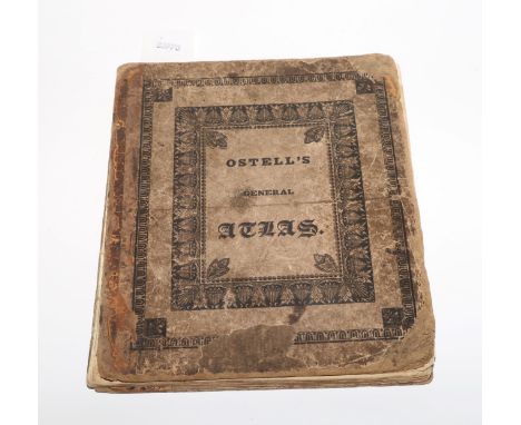
WORLD ATLAS Ostell's New General Atlas; containing Distinct Maps of all the Principal States and Kingdoms throughout the World...A New Edition, 1826, London, Baldwin, Craddock and Joy, 4to, publisher's printed pasteboards, detached; titlepage, Contents with publisher's advert to verso, 30 engraved maps by J.C. Russell (complete), hand-coloured in outline. The two world maps are double-page. Boards very rubbed, scuffed and soiled, with frayed extremities, lacking spine, first gathering detached from block; the plates with marginal foxing and finger-soiling, the first map (The World) with hole outside image, ink stains and splitting fold; ink inscription to front pastedown. A scarce atlas in this edition, printed from 'a set of entirely new plates, on an enlarged scale'

Lot 54
YORK GUIDES The Stranger's Guide through the City of York and its Cathedral, 1835, York, published and sold at Bellerby's Public Library, 12mo, fifth enlarged edition, plates, text illustrations, pp.168, with Specimens of the Yorkshire Dialect (pp. 36) bound towards rear, folding engraved city plan (with tear) at end of volume. Early rubbed and bumped calf gilt, previous owner inscriptions by the editior of 'The Yorkshireman' [with:] Stevens (George, Publisher) Directory for 1881-1882 of the City of York, 8vo, part of map frontis. missing, publisher's cloth worn, rebacked preserving original spine, new e.p.s (2)
Lot 79
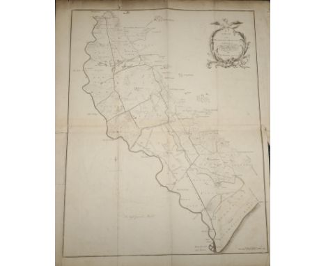
IMPORTANT MAP OF DERBYSHIRE Burdett (P.P.) To The Right Honourable The President, Vice-Presdient…of the Society for the Encouragement of Arts, &c, This Survey of Derbyshire, Began in the Year 1762, and finished in the Year 1767… [c.1767], London, Kitchin and Derby, Burdett. Large engraved map on six sheets laid on linen, partly hand-coloured in outline; rococo cartouche, inset plan of Derby and trigonometry diagram, vignette of rocks lower left. The paper c.1550 x 1040mm, scale one inch to one mile. The expected age-toning and cockling/crinkling to the paper, the extremities tatty and chipped, with a few mostly small tears into the plate (one c.20cm from the top); spots of mould and associated soiling to right margin, getting more pronounced into lower right corner. No loss within printed border. Peter Perez Burdett's map of Derbyshire won him the £100 premium (prize) offered by the Society of Arts to encourage accurate county mapping. He later published the first aquatint in England, and sold his new process to Paul Sandby. A fine draughtsman and noted expert in perspective, he was the first President of the Liverpool Society of Arts and exhibited in London at the Society of Artists. His Derbyshire acquaintances included Joseph Wright, who painted a fine portrait of Burdett and his first wife, Hannah (in the Národní Galerie, Prague). Burdett left for Germany to escape his debts in 1774, working for the Margrave of Baden as surveyor, never to return to England. A scarce example of the first edition of this map, which very rarely appears on the market


Lot 132
TWO BOXES OF STAFFORDSHIRE INTEREST BOOKS, BOOKLETS AND EPHEMERA including Cox, Hall & Morden - 'Magna Britannia Antiqua Nova: Staffordshire' c. 1720, rebound section A/F lacking map, Harrison, Harrod & Co. Directory and Gazeteer Staffordshire' c. 1861 A/F, 'The Stafford Knot', bound copy of magazines 1967 - 1969, 'Collections For A History of Staffordshire', William Salt Archaeological Society' Vol. X Part II 1907 and Vol. XI 1908 etc.

Lot 140
WILLIAM PITT - 'A TOPOGRAPHICAL HISTORY OF STAFFORDSHIRE; including its Agriculture, Mines, and Manufactures. Memoirs of Eminent Natives; statistical tables; and every species of information connected with the local history of the county.', Printed by and for J. Smith, 1817, includes folding map, bookplate of James E. Moxon, rebound

Lot 141
A SMALL COLLECTION OF ANTIQUARIAN STAFFORDSHIRE INTEREST BOOKS including Sampson Erdeswick - 'A Survey of Staffordshire...' 1844, Robert Garner - 'The Natural History of the County of Stafford...' 1844 original cloth, Robert Garner - 'The Natural History of the County of Stafford...' 1844 rebound half leather but dedication on title page 'Mr Crockett from his friend the Author', George Aexander Cooke - 'Topographical and Statistical Description of the County of Stafford', incuding map, rebound and Rupert Simms (compiled by) - 'Bibliotheca Staffordiensis' 1894, rebound half leather (5)

-
109198 item(s)/page