

Americas.- Mercator (Michael) America Sive India Nova, map of the Western hemisphere centred on the Americas, including New Guinea and both poles, surrounded by roundels in the four corners, three containing inset maps of the Gulf of Mexico, Cuba, and Hispaniola, the fourth containing the title, arabesque decoration filling the remaining border, the map based on Rumold Mercator's world map of 1587, engraving with hand-colouring, platemark 380 x 465 mm (15 x 18 1/4 in), sheet 480 x 535 mm (18 7/8 x 21 in), Latin text verso, central vertical fold with some repairs, parallel creasing, some spotting and browning, the margins with exposure lines and toning, handling creases, unframed, [circa 1595 or slightly later]⁂ "A few of the most famous theories are still present: a large inland lake in Canada, two of the four islands of the North Pole, a bulge to the west coast of South America and the large southern continent. It does not show any knowledge of the English in Virginia, which is possibly a reflection of their failure by then" (Burden 87)
We found 109182 price guide item(s) matching your search
There are 109182 lots that match your search criteria. Subscribe now to get instant access to the full price guide service.
Click here to subscribe- List
- Grid
-
109182 item(s)/page

Americas.- Savage-Landor (A. Henry) Across Unknown South America, 2 vol., first American edition, plates, folding maps at end, ink gift inscription to half-titles, light rubbing to spine tips and corners, otherwise excellent, Boston, 1913 § Enock (C. Reginald) The Great Pacific Coast, first edition, plates, folding map in pocket at rear, ink ownership inscription to half-title, bookplate to pastedown, light bumping to spine tips and corners, 1909 § Huxley (Aldous) Beyond the Mexique Bay, first edition, plates, dust-jacket, spine ends and corners a little chipped, light surface soiling, extremities rubbed, 1934; and 13 others, Americas, 8vo (17)

Asia.- Arundell (Rev. Francis Vyvyan Jago) A Visit to the Seven Churches of Asia; with an Excursion into Pisidia..., first edition, folding engraved map, 21 lithographed sheets of inscriptions, 4 folding, title foxed, one or two small stains to text, contemporary ink inscription and bookplate of Meyrick J.L.Beebee of St.John's College Cambridge, contemporary half roan, spine gilt, rubbed, spine lightly faded, joints cracked, corners worn, [Atabey 36; Blackmer 48], 8vo, 1828.⁂ Arundell was chaplain to the English factory at Smyrna (now Izmir) from 1822 to 1836. The number of plates of inscriptions appears to vary, those in Atabey and Blackmer only amounting to 14 sheets.


Asia.- Hamilton (William John) Researches in Asia Minor, Pontus, and Armenia, 2 vol., first edition, half-titles, 12 lithographed plates, 2 folding engraved maps, 4 folding sheets of inscriptions, illustrations, errata leaf at end of each vol., 8pp. advertisements at end of vol.2, one folding map torn at inner edge, occasional foxing to edge of plates, original grey-blue cloth with border in blind, a little rubbed and marked, spines faded, [Atabey 552; Blackmer 779], 8vo, 1842.⁂ Hamilton was a geologist who travelled in the Levant from 1835 to 1837. He served as president of both the Geological Society and the Royal Geographical Society.

Asia.- Homann Heirs & Johann Matthias Hase. Asia Secundum Legitimas Projectionis Stereographicae Regulas et Juxta Recentissimas Observationes..., detailed map of Asia, showing from the Arabian peninsula across India and China, with Indonesia and the Philippines, and Japan in the upper right corner, decorative title cartouche in the lower left corner, further cartouche with scale in the upper right, engraving with hand-colouring, on laid paper platemark 500 x 560 mm (19 3/4 x 22 in), under glass, minor surface dirt, framed, M. Aug. Gottlob Boehmio, 1744

Asia.- Laurie (Robert) and James Whittle. Asia and Its Islands According to D'Anville; Divided Into Empires, Kingdoms, States, Regions &ca., large detailed map extending to include all of South East Asia and numerous islands of the Pacific, with emphasis on English exploration, including the discoveries of Capt. Cook, large decorative title cartouche in the upper left corner, engraving with outline hand-colouring, four sheets in two horizontal section, each section approx. 535 x 1220 mm (21 x 48 in), if joined approx. 1070 x 1220 mm (42 x 48 in), old folds and handling creases, offsetting, surface dirt and some browning, all unframed, Robert Sayer, 1787

Baltics.- Homann (Johann Baptist) Ducatuum Livoniae et Curlandiae cum Vicinis Insulis, map of Estonia and Latvia including the islands of Saaremaa and Hiiumaa, and part of Russia, engraved map with original hand-colouring, on laid paper without watermark, platemark 490 x 584 mm (19 1/4 x 23 in), sheet 500 x 620 mm (19 3/4 x 24 1/4 in), central vertical fold with minor repairs to splitting, some repaired tears to edges, minor spotting and surface dirt, unframed, [circa 1715-1720]; together with Tobias Conrad Lotter's Tabula Hungaria et Regionum, engraving with original hand-colouring, platemark 470 x 650 mm (18 1/2 x 25 1/2 in), small margins, repair to perforation within the Black Sea, surface dirt and handling creases, unframed, [circa 1760] (2)

Central Asia.- Atkinson (Thomas Witlam) Oriental and Western Siberia, first edition, chromolithographed frontispiece, 19 chromolithographed or tinted lithographed plates, folding map at rear with a few tape repairs to verso, some light spotting, mostly marginal, original green pictorial cloth, gilt, recased with new endpapers, Mudie's Library label to upper cover, spine ends repaired, corners bumped and a little worn, a little rubbed and darkened, 8vo, 1858.

Central Asia.- Bonvalot (Gabriel) Through the Heart of Asia, Over the Pamir to India, 2 vol., first English edition, plates and illustrations, folding map, prize bookplate to pastedown, original pictorial cloth, spines darkened, spine ends and corners a little bumped light rubbing, 1889 § Dobson (George) Russia's Railway Advance Into Central Asia, first edition, presentation inscription "With the author's compliments" to endpaper, plates, 3 folding maps, Carlingford bookplate to pastedown, original pictorial cloth, light rubbing and mottling, otherwise excellent, 1890 § Roosevelt (Theodore and Kermit) East of the Sun and West of the Moon, first English edition, plates and maps, browning to endpapers, original cloth, dust-jacket, very light toning to spine, internal tear to lower panel, a few small nicks to head and foot, otherwise excellent, 1928; and 19 others, mostly Central Asia, 8vo (22)

Central Asia.- Stein (Sir Marc Aurel) On Ancient Central-Asian Tracks, first edition, frontispiece, folding map, plates, some scattered spotting, light tape-marking to endpapers, original cloth, gilt, t.e.g., others uncut, light bumping to spine ends and corners, a little rubbed, light marking to upper cover, 4to, 1933.

Central Asia.- Sykes (Sir Mark Masterman) Dar-Ul-Islam. A Record of a Journey through Ten of the Asiatic Provinces of Turkey, first edition, half-title, 22 maps, 1 large folding colour, 75 plates (as called for, this copy with 2 additional plates), light spotting, ink ownership inscription and stamp to front free endpaper, original cloth, decorated and lettered in gilt with map onlay to upper cover, very light fading and slight mottling to spine, spine ends and corners with light bumping and fraying but a good copy overall, 8vo, 1904.
Africa.- Campbell (Rev. John) Travels in South Africa..., third edition, 4pp. advertisements at beginning, engraved portrait, folding map and 9 plates on 8 sheets, one folding, contemporary ink signature to head of title, plates lightly foxed and offset, 1815; Travels in South Africa...being a Narrative of a Second Journey in the Interior..., 2 vol., first edition, half-titles, folding hand-coloured map, 12 hand-coloured aquatint plates, vol.1 with binder's leaf, 3pp. advertisements and final blank at end, light offsetting from plates, Sir James G.Frazer's copy with his ink inscription to half-title of vol.1, [Abbey, Travel 328], 1822, uniformly bound in modern half tan calf, red and green morocco labels, uncut; and a 1857 Glasgow Bible edited by Campbell, 8vo (4)⁂ Sir James G.Frazer (1854-1941), social anthropologist and folklorist who studied mythology and comparative religion, author of The Golden Bough, first published in 1890.
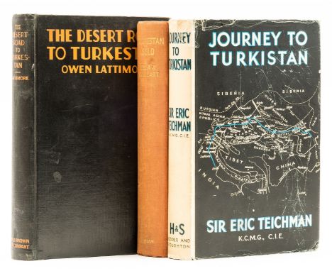
Central Asia.- Turkistan.- Teichman (Sir Eric) Journey to Turkistan, first edition, plates, folding map at rear, original cloth, dust-jacket, light toning to spine, spine ends and corners a little chipped, a few short tears with creasing to head, tape repair to verso, rubbed, 1937 § Maillart (Ella K.) Turkestan Solo. One Woman's Expedition from the Tien Shan to the Kizil Kum, first English edition, maps and plates, light toning to half-title, original cloth, light sunning to spine, 1934; and another, Turkestan, 8vo (3)⁂ The first scarce in the dust-jacket.

Central Asia.- Vambery (Arminius) Travels in Central Asia, being the Account of a Journey from Teheran across the Turkoman Desert on the Eastern Shore of the Caspian to Khiva, Bokhara, and Samarcand, first edition, plates, folding map at rear, ink name erased from front free endpaper, original cloth, spine gilt, light bumping to spine tips and corners, but a sharp and excellent example overall, 8vo, 1864.
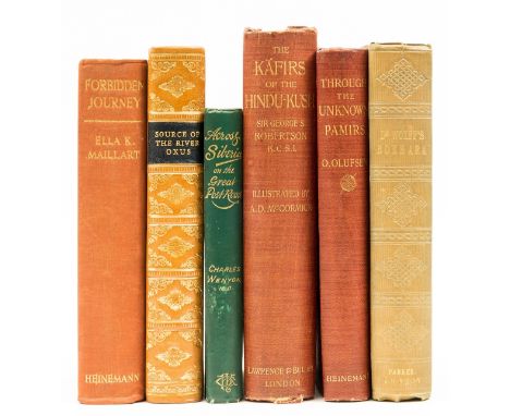
Central Asia.- Wolff (Rev. Joseph) Narrative of a Mission to Bokhara, in the years 1843-1845, to ascertain the fate of Colonel Stoddart and Captain Conolly, third edition, half-title, frontispiece portrait, light sunning to spine and cover, otherwise excellent, 1846 § Robertson (Sir George Scott) The Kaffirs of the Hindu-Kush, new edition, title tipped in with ink ownership stamp of O. Olufsen, folding map at rear, plates, light sunning to spine, joints rubbed, 1900 § Olufsen (O.) Through the Unknown Pamirs. The Second Danish Expedition 1898-99, first edition, plates, folding map at rear, bookplate of the Cavalry Club to pastedown, 1904, original cloth; and 3 others, Central Asia, 8vo & 4to (6)


China.- Gueulette (Thomas Simon) & Caylus (Comte de) Chinese Tales; or the Marvellous Adventures of the Mandarin Fum-Hoam, Oriental Tales, engraved frontispiece, additional engraved title, advertisements at end, scattered spotting, original printed boards, rebacked, rubbed and worn, 1817 § Medhurst (W. H.) China: its State and Prospects, colour frontispiece, vignette title, 5 plates, 1 folding map, scattered spotting, contemporary half-calf, a little rubbed, 1838; 12mo & 8vo (2).

Africa.- Campbell (W. W.) East Africa by Motor Lorry, first edition, signed and dated by author, portrait frontispiece, plates, map, ex-library with occasional discreet blind-stamp, abrasion mark where label removed to front pastedown, original cloth, gilt, blind-stamp to upper cover, remnants of label to spine foot, slight bumping to corners and extremities, 1928 § Kearton (Cherry) In the Land of the lion, first edition, frontispiece, plates, scattered faint spotting, original cloth, gilt, 1929; and 3 others, Africa, 8vo (5).
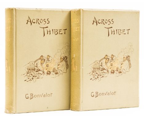
China.- Tibet.- Bonvalot (Gabriel) Across Thibet, translated by C.B.Pitman, 2 vol., first edition in English, half-titles, folding colour map, wood-engraved plates and illustrations, 16pp. publisher's catalogue at end of each vol., ink ownership inscription and faint ink stamp to endpapers, original pictorial cloth, slight shelf lean, light toning to spines, a little bumped, light rubbing, but a very good, bright set overall, 8vo, 1891.⁂ Scarce in the original cloth. Bonvalot's account of his third expedition, during which he became the first European to traverse the heard of Asia from north to east.

China.- Tibet.- Chandra (Sarat) Journey to Lhasa and Central Tibet, new edition, plates, 3 colour folding plans, folding map at rear (with tear running from inner margin), bookplate to pastedown, new endpapers, New York, 1904 § David-Neel (Alexandra) My Journey to Lhasa, first edition, photographic plates, Signet Library bookplate and ink inscription to pastedown, light mottling to upper cover, spine ends and corners a little bumped and frayed, 1927 § Chapman (F. Spencer) Lhasa: The Holy City, first edition, photographic plates, dust-jacket, neat tape repairs and some light creasing to head and foot, light surface soiling, 1938, original cloth, excellent copies; and 5 others, Tibet, 8vo & 4to (8)

China.- Tibet.- Huc (Abbé E.R.) Travels in Tartary, Thibet, and China, 2 vol., first English edition, wood-engraved frontispieces and illustrations, folding map, scattered foxing, bookplate of John F. Kingsford to front pastedown, light sunning to spine, light surface soiling, [c.1852] § McGovern (William Montgomery) To Lhasa in Disguise. A Secret Expedition Through Mysterious Tibet, first edition, plates, ink ownership inscription, light sunning to spine, upper cover a little rubbed, 1924 § Pallis (Marco) Peaks and Lamas, first edition, maps and plates, light foxing, 1939, original cloth; and 7 others, China and Tibet, 8vo (11)


China.- Tibet.- Landor (A. Henry Savage) In The Forbidden Land. An account of a journey in Tibet, capture by the Tibetan Authorities, imprisonment, torture, and ultimate release, 2 vol., folding map, plates and illustrations, 1899; Across Coveted Lands, 2 vol., folding maps, plates, very light fading to spines, light rubbing, 1902, first editions, original pictorial cloth, excellent copies; and 2 others, Landor, 8vo (6)
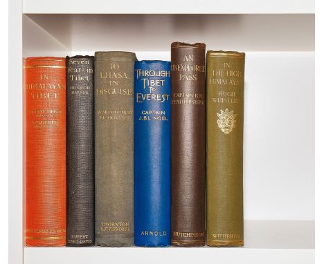
China.- Tibet.- Montgomery McGovern (William) To Lhasa in Disguise, first edition, portrait frontispiece, plates and maps, scattered spotting, original cloth, lightly sunned spine, slight bumping to corners and extremities, 1924 § Noel (Captain J. B. L.) Through Tibet to Everest, first edition, frontispiece, advertisements at end, original cloth, small stain to upper cover, a little rubbed, slight bumping to corners and extremities, 1927 § Whistler (Hugh) In the High Himalayas, first edition, frontispiece detached and loosely inserted, plates and map, scattered spotting, original cloth, slight bumping to corners and extremities, 1924; and 3 others, similar, 8vo (6).
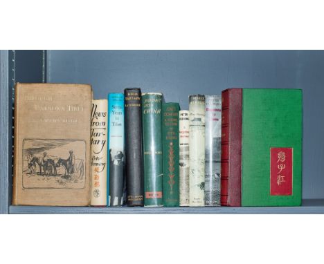
China.- Tibet.- Wellby (Capt. M. S.) Through Unknown Tibet, first edition, frontispiece portrait, plates and illustrations, 4 folding maps in pocket at rear, original pictorial cloth, light toning to spine, spine ends and corners a little bumped, light rubbing and surface soiling, 1898 § [Bird (Isabella L.)] "Mrs. J. F. Bishop". The Yangtze Valley and Beyond, first edition, plates and illustrations, folding map at end, original cloth, rebacked in modern morocco, spine gilt, new endpapers, light surface soiling, 1899; and 8 others, China and Tibet, 8vo (10)
![NO RESERVE Europe.- Commemorative handkerchief.- Anonymous (circa 1914) [Europe at the outbreak of World War I], corners deco](https://cdn.globalauctionplatform.com/e2557cbd-211b-4fc1-8806-ae7500f8cf0e/2c0f1f29-f938-48eb-8573-ae750101d2bd/468x382.jpg)
NO RESERVE Europe.- Commemorative handkerchief.- Anonymous (circa 1914) [Europe at the outbreak of World War I], corners decorated with Union flags paired with the flags of the principal allies at the beginning of WWI, including France, Russia and Belgium, map printed in colours on linen, sheet 465 x 640 mm (18 1/4 x 25 1/4 in), old folds, minor surface dirt, unframed, [circa 1914].

Europe.- Dalrymple (Major William) Travels through Spain and Portugal, in 1774; with a short account of the Spanish Expedition against Algiers, in 1774, first edition, engraved frontispiece, engraved folding map, faint off-setting, scattered faint spotting, contemporary calf, a little rubbed, small loss to spine head, upper joint cracked but holding firm, 4to, for J. Almon, 1777.

Europe.- Moll (Herman) A New Map of Germany, Hungary, Transilvania & the Suisse Cantons, showing from the North Sea east to Danzig, Belgrade and Trieste incorporating all of Germany, Switzerland, Austria and Hungary, with cartouche celebrating the victories of the Duke of Marlborough in the upper left, and vignette of the Diet of the Holy Roman Empire in the upper right, engraving with hand-colouring, sheet 650 x 1040 mm (25 1/2 x 40 1/4 in), horizontal and vertical folds, a few small perforations to corners of folds, handling creases some reinforced verso, minor surface dirt, some nicks and tears, unframed, 1712.

![John Ogilby 'Bristoll [Bristol] to Worcester', 18th Century engraved hand-coloured ribbon map, 31cm x 45cm, unframed](https://cdn.globalauctionplatform.com/1248ffa5-9120-4b82-b785-ae6f009ed63b/0d0fbb9f-ac70-4747-96a9-ae7600b411d1/468x382.jpg)

![John Ogilby (1600-1676), 'London to King's Lyn' [sic], hand-coloured engraved ribbon map, 33.5cm x 44.5cm, framed and glazed](https://cdn.globalauctionplatform.com/1248ffa5-9120-4b82-b785-ae6f009ed63b/82155f5e-9b1a-4bab-93fc-ae7600b6b47c/468x382.jpg)


Pictures, to include: two nineteenth-century prints in colours, 'The New Steam Carriage' and 'The Enterprise Steam Omnibus', framed and glazed, image size 29 x 44cm and 32 x 42cm; original 1990s pen newspaper cartoon, framed and glazed, image size 29 x 60cm; Sundat Express 1969 cartoon print, framed and glazed, image size 25 x 35cm; reproduction 'Teviot' map, framed and glazed, map size 40 x 51cm. (5)

Military General Service 1793-1814, 4 clasps, Busaco, Albuhera, Badajoz, St. Sebastian (J. Ferrier, Serjt. R. Arty. Drivers.) medal removed from a mount and with reconstituted suspension with copy clasps, much pitting and some weakness to name, therefore fair £200-£300 --- John Ferrier was born in the Parish of Liberton, Edinburgh, and enlisted at Musselburgh for unlimited service in the Royal Artillery, aged 17 years 133 days. He was promoted to Corporal and Bombardier in September 1805, to Sergeant in August 1820, and to Quarter Maser Sergeant in August 1823. He was discharged at Woolwich on 31 October 1826, in consequence of ‘having obtained the situation of Clerk in the Ordnance Map Office at the Tower.’ Sold with copied discharge papers.


British Rail Eastern Region carriage line map showing routes from Liverpool Street and Fenchurch Street. The blue line shows the route to Hertford East and Bishops Stortford, the red line to Clacton and the green line to Shoeburyness. Melamine on aluminium (melaminium) measuring 29.5in x 7.5in. Extremely good condition.

-
109182 item(s)/page