We found 109182 price guide item(s) matching your search
There are 109182 lots that match your search criteria. Subscribe now to get instant access to the full price guide service.
Click here to subscribe- List
- Grid
-
109182 item(s)/page


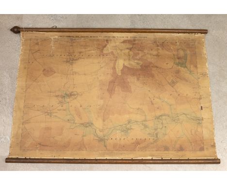
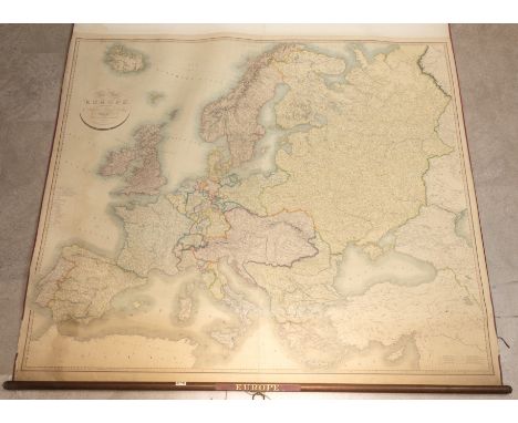
Lot 283
John Cary, A New Map of Europe c1834, 5ft Schoolroom Roller Map. Titled 'A new map of Europe, exhibiting its natural and political divisions delineated from the most recent authorities'. Paper map mounted on linen with hardwood top and bottom and silk lined outer edge. W 160cm, H fully unrolled 235cm. Map: W 154cm, H 132cm. (C)
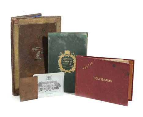
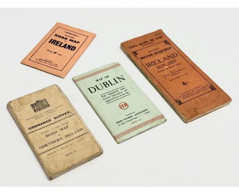
Lot 721
AN ORDNANCE SURVEY MAP OF YESTERC.1855paper on canvas, the green leather cover tooled with a crown and thistles and stamped 'W. & A.K. Johnstone, Edinburgh', together with an Edwardian gilt tooled leather stationery folder, the front applied with the Marquess of Tweeddale's crest and the motto 'Spare Nought', the back dated '1905', a Yester House Telegram folder, a Yester House glass ashtray and a copper bookplate engraved with the Marquess of Tweeddale's coat of arms (5)30cm (max)ProvenanceParker & Morris: The Art of Decorating.The Marquess of Tweeddale, Yester House, Gifford, East Lothian.PLEASE NOTE THAT THIS LOT IS TO BE OFFERED WITHOUT RESERVE.


Lot 233
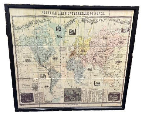
Framed Ceramic Tiled French Map of the World. French translation is "New Universal Map of the World", drawn according to naval charts and documents. With illustrations and descriptions to various parts of the map. 15 tiles make up this piece. Dimensions of frame Height 96cm x Width 107cm. BUYER TO COLLECT OR ARRANGE COURIER.
Lot 407
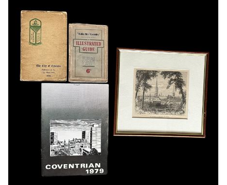
Coventry interest; Walks thro’ Coventry an Illustrated Guide: And a Historical and Descriptive Account of All The Chief Points of Interest in the City (Eighth Edition Revised). Published by F. Caldicott, Printer and Publisher [Coventry, 1910]. With internal folded map, excellent overall condition. Plus, The City of Coventry Extension of the City Boundary 1932 pamphlet [1st April 1932], Coventrian 1979 [Plaistow Press Magazines Ltd, 1979] and a William Henry James Boot [1848-1918] framed print of St. Michael’s Church, Coventry.
![KEMP, THOMAS. A History of Warwick and its People by Thomas Kemp. Henry T. Cooke & Son Publishers [Warwick, 1905]. With f](https://cdn.globalauctionplatform.com/475a4e8b-c3b5-41b7-8b3b-b1290097f727/3a3a8c4b-dfaa-4ebe-8d33-b149011c95e3/468x382.jpg)

Lot 302
DE WIT, FREDERICK, 17th Century Map of Malta by Frederick de Wit, Insula Malta Accuratissime Delineata, Urbibus, et Fortalitiis, map centred of Malta and Gozo, with Sicily and the northern coast of Africa shown, the fortified cities of Tunis and Tripoli identified, with inset map in the lower right that shows the extensive fortifications of Valleta that were built by the famous Knights of Malta after the Siege of Malta, engraving with hand-colouring. Fold to middle with further off-centre crease (see photo). Framed and glazed. 52cm x 61cm.


Lot 298
Map of the Nile from the Equatorial Lakes to the Mediterranean, embracing the Egyptian Sudan, (Kordofan, Darfur, & c.) and Abyssinia. Published by Edward Stanford [55 Charing Cross, London, 1884]. Watercolour-tinted engraved map, dissected and laid of cotton, cloth covered boards with printed label.
![CISPIN, EDMUND. The Moving Toyshop by Edmund Crispin. Victor Gollancz Ltd [London, 1946]. The Moving Toyshop. A New Detective](https://cdn.globalauctionplatform.com/475a4e8b-c3b5-41b7-8b3b-b1290097f727/38f2a5c6-b577-47a9-b4b3-b149011d4250/468x382.jpg)
Lot 438
CISPIN, EDMUND. The Moving Toyshop by Edmund Crispin. Victor Gollancz Ltd [London, 1946]. The Moving Toyshop. A New Detective Story by Edmund Crispin author of The Case of the Gilded Fly, Holy Disorders. First Edition, map illustration, original cloth dust jacket, some areas of deterioration to spine of jacket (as often expected). An attractive copy of this classic work of detective fiction, dedicated to Philip Larkin.
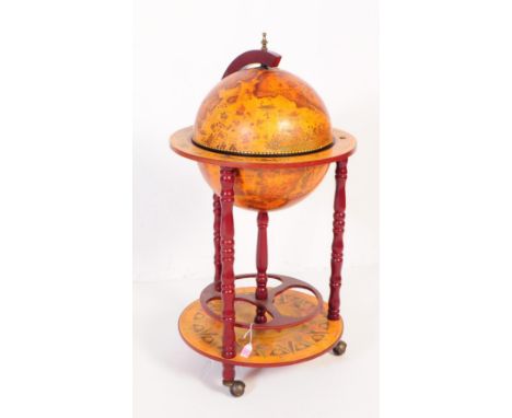
Lot 810
A 20th Century vintage mahogany veneer zodiac globe cocktail drinks cabinet / trolley. Having a hinged lid to globe top, opening to reveal cocktail cabinet interior. The globe decorated with transfer printed map, encompassed by a rounded shelf showing zodiac motif depictions. Raised on turned columns with rotating bottle rack to base, terminating in castors to base. Measures approx. 90x47x47cm


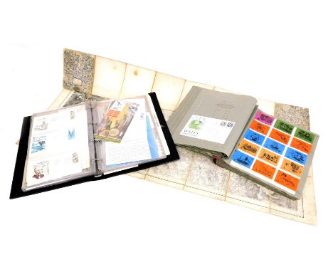
Lot 1478
Five maps of interest to the United States and Canada to include, an untitled map depicting New York, 7cm x 12cm, 'Canada', with an inset map titled, 'Part of New Brunswick and Nova Scotia', published by Virtue, 20cm x 25cm, 'Map of New York', published and engraved by Fenner Seara and Co, 26cm x 40cm, 'United States', published by J. Arrowsmith, 15cm x 14cm, all four maps framed and glazed, and together with a unframed but mounted map of 'West Canada' engraved by J. Rapkin, 25cm x 34cm (5)


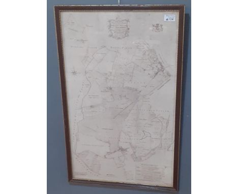
Lot 1476
W. H. TOMS (1700-1765), 'A Map of Northamptonshire, North from London', Sept. 29, 1742, 17cm x 18cm, together with five double sided maps, each 19cm x 14cm, by, EMMANUEL BOWEN & JOHN OWEN titled, 'The Road from Oxford to Salisbury', numbered 221, and 'The Road from Ferrybridg to Borobridge', numbered 256, all three coloured, and 'The Road from Oxford to Chichester', numbered 215, 'The Road from Cambridge to Coventry', numbered 157, and 'The Road from Prestain to Carmarthen', each uncoloured (6)


-
109182 item(s)/page