We found 109182 price guide item(s) matching your search

Refine your search

Year

Filter by Price Range
  • List
  • Grid
  • 109182 item(s)
    /page

Lot 107

Old map ‘The West Riding of Yorkshire’ by Jan Jannsen 1646, image 21.5” x 18”, frame 23” x 19.5”

Lot 108

Old map ‘North Riding of Yorkshire’ by William Corden, 1607, image 14” x 9”, frame 15” x 10”

Lot 188

A tray of assorted lady's wrist watches, foreign coins, Egyptian bank note, map measuring gauge leather purse etc

Lot 1104

" Berkshire......." disbound, folding map printed T Cadell and Davies 1806 , other plates and maps, boards detached, with " Herefordshire" 3 vols, published by the Royal Commission of Historical Monuments in England, 1931, numerous photographic ills and plans, vols and I and II backstrips separating (4)
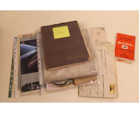
Lot 1130

"The Oarsman's and Angler's Map of the River Thames - from the Source to London Bridge...with notes on Punting" George Philip and Son, the map folds out, text loose, all within a small repaired slipcase, "Philip's Tape Indicator Map of London " George Philip and Son folding map with the original tape, text, green boards and folding map of Berner Oberland (3)

Lot 260a

Reproduction C & J Greenwood 'Map of London', modern print 96 x 151 cm 

Lot 284

JAN JANSSON (1588-1664). A hand-coloured engraved map of the British Isle “Britannia prout divisa suit temporibus Anglo-Saxonum…. Heptaichia”, decorated ot margins with fourteen scenes of Saxon figures & events; 17” x 21”, framed & glazed (23” x 27¼” over-all.

Lot 285

ROBERT MORDEN (1605-1703). A hand-coloured engraved map of Wiltshire; published by Swale, Awnshaw, & Churchill, 14½” x 17”, framed & glazed. (17” x 20” over-all).

Lot 286

JOHN SPEED (2552-1629). A hand-coloured engraved map “Devonshire with Excester described and the Armes of Such Nobles as have borne the titles of them”; published by Thomas Bassett & Richard Chiswell: 15½” x 20½”, framed & glazed. (21¾” x 26½” over-all).

Lot 287

JOAN BLAEU (1596-1673). A hand-coloured map of Cambridgeshire “Cantabrigiensis Comitatus, Cambridge Shire”, 1½” x 20½”, framed & glazed. (22½” x 26½” over-all).

Lot 288

P. SCHENK & G. VALK (17th century). An engraved hand coloured map of Devonshire “Devoniae Descriptio. The Description of Devon-Shire”; 15¼” x 19½”, framed & glazed. (21¾” x 25¾” over-all).

Lot 289

JAN JANSSON (1588-1664). An engraved hand coloured map of Cambridgeshire “Comitatis Cantabrigiensis vernacule Cambridgeshire”; 16½” x 20½”, framed & glazed. (22” x 26” over-all).

Lot 31

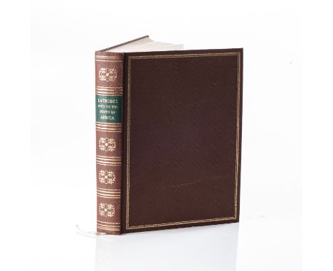
Cape Town: C Struik (Pty) Ltd, 19694to, 44 pp. + vii + 406 pp. Original hardcover binding, with gilt lettering and inlays to spine, and gilt inlays to the boards. With frontispiece of author, fold-out map, and 16 plates. Collated and complete.LIMITED EDITION FACSIMILIE REPRINT OF 1000 COPIES, OF WHICH THIS IS NO. 401.Light scuff marks to boards. Previous owner's name stamp to the front pastedown. Text, map and plates are clean and clear. A well bound copy.
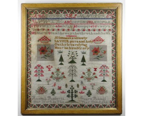
Lot 571

1941 Dated German Officers Map Case. In super condition.

Lot 253

MIXED LOT: TWO REPRODUCTION FRAMED MAPS OF NORFOLK TOGETHER WITH A FURTHER FRAMED MAP OF CEYLON (3) AND A FRAMED PRINT OF A YOUNG LADY

Lot 171

A framed map of London to Flamborough Head along with a framed map of Lincolnshire.

Lot 201

A framed print of a European Map in Latin. H: 84cm, W: 37cm. A reproduction originally by Blaeu, Willem Janszoon, 1571-1638. Colour illustrations.

Lot 549

A box of miscellaneous. Including framed map, ceramic figures, jugs, enamelled brass, etc.

Lot 610

A framed and glazed vintage map of Essex

Lot 709

A map of the Thames and two pictures 

Lot 924

An MAP Concept 15' match rod

Lot 78

A small coloured map of Essex in gilt frame

Lot 1559

William Kip after Johannes Norden, Map of 'Sussexia', 23 x 40cm

Lot 137

Christophorus Saxton (1540-1610) - Map of Essex ' Essexiae Comitat Nova 1576', 20th century facsimile, 41.5cm x 53cm Condition report: We now believe this to be a 20th century facsimile, probably lithographic process. The condition is good

Lot 74

Mike Read, contemporary, signed limited edition artists proof print - Choc-Art, Smarties Tube Map, 1/25, 52cm x 81cm, in glazed frame

Lot 80

17th century hand coloured Robert Morden engraved map of Essex, 36cm x 42cm, in glazed gilt frame

Lot 777

DOOMSDAY BOOK PUBLISHED BY ALECTO HISTORICAL EDITIONS LONDON 1987 WITH VOLS FOR INTRODUCTION AND TRANSLATION AND FOLIO AND MAP

Lot 731

A vintage garage sign for Michelin tyres with road map

Lot 744

A garage advertising map sign for Raleigh Motor Cycle

Lot 745

A vintage garage advertising map for Environs of Leeds

Lot 45

ANTIQUE LARGE LINEN BACK FLOOR MAP OF PART OF SCIENCE MUSEUM 97cm x 62cm OWNED BY MICHAEL RICHARD PRESTON - FORMER HEAD OF EXHIBITION (DESIGN) AT THE SCIENCE MUSEUM - SOUTH KENSINGTON ACCEPTABLE CONDITION

Lot 46

ANTIQUE LARGE LINEN BACK FLOOR MAP OF PART OF SCIENCE MUSEUM 108cm x 70cm OWNED BY MICHAEL RICHARD PRESTON - FORMER HEAD OF EXHIBITION (DESIGN) AT THE SCIENCE MUSEUM - SOUTH KENSINGTON ACCEPTABLE CONDITION

Lot 47

ANTIQUE LARGE LINEN BACK FLOOR MAP OF PART OF SCIENCE MUSEUM 110cm x 71cm OWNED BY MICHAEL RICHARD PRESTON - FORMER HEAD OF EXHIBITION (DESIGN) AT THE SCIENCE MUSEUM - SOUTH KENSINGTON ACCEPTABLE CONDITION

Lot 86

A full set of USA gold plated state quarters in 10 box's, first state quarters of the United states collectors map complete. Plus loose quarters

Lot 118

Vintage beveled edge mirror with tiled frame 84cm x 53cm: together with a modern map of Staffordshire and a framed acrylic Continental street scene painting (3).

Lot 27

An early 20thC map of Western Australia, dated '1904', 21.5" x 14.4" and a smaller 1914 map of WA by H. Johnston, Surveyor General, 13" x 9". (2)

Lot 1119

Henricus Hondius II (Dutch 1597-1651): 'Northumbria Cumberlandia et Dunelmensis Episcopatus' - Bishoprics of Northumbria, Cumberland, and Durham, 17th/18th century engraved map with later hand-colouring 35cm x 47cm

Lot 623

A collection of miscellaneous items, to include a George III indenture dated 8th November 1819; Nailing Up the Old Barn (Chapel Door) and what came of it by Rev R S Blair, an Ordnance Survey map of Cambridge and Ely etc

Lot 27

Framed map of Leicestershire

Lot 1026

Robert Morden - Engraved and later hand-coloured county map of Essex, 35 x 42cm

Lot 1108

H G Webb - Five various topographical etchings, each being pencil signed; together with a French map

Lot 1

1866 CONWY VALLEY WELSH WOOL SAMPLER with alphabetical and religious content, by thirteen year old Hannah Roberts of 'Gwern Rhisgl', Llanrwst, Conwy Valley, 71 x 65cms (including frame)Provenance: private collection Hampshire, purchased by vendor in Llanrwst, north Wales in 1970sAuctioneer's Note: Gwern-y-Rhisgl appears as a group of houses in the circa 1900 OS Map of the Llanrwst area but not in modern map. In the 1881 census the Roberts family were recorded as living at 1 Gwern Rhisgl - with father Lewis Roberts, a general labourer and wife Elizabeth Roberts, both 49 years old, together with sons Rowland, Williams and James Roberts who was a 62 year old widower. The 1861 census records Hannah Roberts as being daughter of James and Margaret Roberts, when the house was listed as Gwern Rhisk. It is believed therefore that the dwelling was split into smaller houses between 1866 and 1881.Condition Report: discolouration especially to left of sampler, old frame
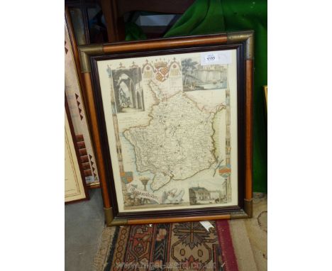
Lot 344

Assorted prints and a map

Lot 353

A 17th Century hand coloured engraved William Kip map, Staffordiae, framed

Lot 1117

A small map of Worcestershire by John Cowley, 1744, 7'' x 5 1/4'' and a Print of Thomas Moule map of Worcestershire.

Lot 1147

A framed Page from book of Herefordshire with map, 15'' x 11'' (glass cracked)

Lot 1155

A framed map print of Monmouthshire with three insets of Tintern Abbey, Chepstow Castle etc.

Lot 1205

A set of large scale Ordnance Survey map sheets, circa 1904-05, believed to cover the whole of Radnorshire, with many duplicates.

Lot 1206

A set of large scale Ordnance Survey map sheets for Breconshire.

Lot 1310

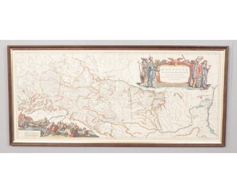
Robert Morden, a rare hand coloured 17th Century map of Shropshire, being the 1695 edition before the 1722 corrections (Acton Round is shown as Roundatton); laid down and with a little staining to the edge, framed and galzed (the old inscription to the rear dating this map to 1722 is incorrect), 17 1/2" x 15".

Lot 1400

A large map of Suffolk (water damage), 33 1/2" x 26 1/2" and small map of Glamorganshire.

Lot 1404

John Speed, a framed Map of Denbighshire (Basset and Chiswell edition), On laid paper with early hand colouring, unexamined outside the a/f frame, 21'' x 16''

Lot 199

PIGOT & SON OF MANCHESTER, MAP OF LANCASHIRE, hand coloured steel engraving, published Pit & Co, 37.5cm x 24.5cm mounted in glazed Hogarth frame, companions similar, Map of Cumberland, Map of Durham, Map of Westmoreland & Map of Yorkshire, 34cm x 37. 5cm (5)

Lot 836

London Transport NORTHERN LINE melamine map, circa pre 1972, as used in the Underground stock. Manufactured by Leonard Ripley, in very good condition, measures 55in x 6.5in.

Lot 1092

Various boxed games and jigsaw puzzles including c.1930 map of Leicester

Lot 1154

An antique map of Suffolk 1838 published by Colonel Colby, linen backed and printed in sections, 44" x 38" (some areas of damage)

Lot 1174

A painted cast iron Michelin Man on a motor cycle, a painted cast iron car doorstop plus a tin Michelin map of Britain

Lot 448

A 17th Century map of Huntingdonshire by John Blaeu with Latin text, unframed, text verso, 39cm x 50cm

Lot 312

A 17th Century map of Cheshire by Robert Morden, framed and glazed. 35cm x 42cm.

Lot 162

Great Western Railway MAP OF THE SYSTEM mounted on linen and folds into a book cover gilt embossed with company name. Signed James C. Inglis General Manager Paddington Station 1909. The map is in excellent condition and measures 38in x 38in when opened out.

Loading...Loading...
  • 109182 item(s)
    /page

Recently Viewed Lots