FALLE, Philip - Caesarea : or, an Account of Jersey, The greatest of the islands remaining to the Crown of England of the ancient Duchy of Normandy. With an appendix of records, &c an accurate map of the island and a Prospect of Elizabeth-Castle ... (etc). Cont. full calf snagged at the extremities of the spine. Loosely inserted is a very used folding map of Jersey dated 1694 after Philip Dumaresq. fold plate. 1734.
We found 109198 price guide item(s) matching your search
There are 109198 lots that match your search criteria. Subscribe now to get instant access to the full price guide service.
Click here to subscribe- List
- Grid
-
109198 item(s)/page
FORSTER, George - A Voyage Round the World in His Britannic Majesty's Sloop, Resolution, commanded by Capt. James Cook, during the years 1772, 3, 4, and 5. 2 volumes. Large folding map. Cont. tree calf, sometime skilfully rebacked retaining the original extra gilt spine, with contrasting morocco labels. Large 4to. Printed for B. White, et al. 1777.
OLIPHANT, Laurence - Narrative of the Earl of Elgin's Mission to China and Japan in the years 1857, '58,'59. 2 vols. Org. cloth wear to one hinge. Illustrated inc. a large folding map of China, fold map of Japan, 3 fold. plans and coloured lithographs.8vo. William Blackwood. 1860 & 1859 (second edition).
PLEES, W - An Account of the Island of Jersey; containing a compendium of its ecclesiastical, civil, and military, history ... (etc) : folding hand coloured map, 3 steel engraved plates. Paper covered boards, rebacked with part of the original label retained. 4to. Southampton printed by T. Baker. 1817.
SIDMOUTH : A Hand-Book and History of Sidmouth from the Triassic Period up to " Now". Folding map, 8 plates, local adverts. 8vo. org. printed wrappers. 8vo. Griffith, Farran, et al. No date c1880s.* scarce. With - Macvean, Neil & Williams, Leonard. The English Riviera; A Guide to Sidmouth, etc. org. cloth backed printed boards. 8vo. 1904. With three other literary works relating to Sidmouth.(5)
BAKEWELL, Robert - An Introduction to Mineralogy : comprising the natural history and characters of minerals; and a description of rocks ... and the elements of Crystallography. 5 folding plates. Half calf boards detached. 8vo. London, 1819. With - Humble, William. Dictionary of Geology and Mineralogy, org. cloth, 8vo, 1840. With - Murchinson, Sir Roderick and Geikie, Archibald, First Sketch of a New Geological Map of Scotland with explanatory Notes. Colour printed folding map (360 x 280 mm.) printed in colour by A. Keith, Johnston, in cloth covers. Map dated 1865. explanatory notes 1862. With two others.(5)
MANUSCRIPT ESTATE PLAN : " A Plan of that Part of Crackpot Farm, commonly called or known by the name of High Pasture, situate and being within the Manor of Healaugh in Swaledale in the County of York 1768. 550 x 405 mm. * hand painted on parchment with the title within a decorative cartouche and an explanation within a cartouche in the opposite corner, and distance scale, and fantasy compass. * a most decorative map which is rolled.
CARY, John - A New Map of Africa, from the latest authorities. Engraved map with typical Cary outline hand colouring and wash borders. From the New Universal Atlas. Size : 530 x 470mm. 1811. With 13 maps from the same series, including Russian Empire, Ireland, China, North America, America, British Isles, etc, etc. Thirteen loose maps, in lovely condition.
GUTHRIE, William - A New Geographical, Historical, and Commercial Grammar; and Present State of the Several Kingdoms of the World. ...Illustrated with a New and Correct Set of Large maps, Engraved by Mr. Kitchen, Geographer. Two Volumes. Large folding map of the World with outline hand colouring, 10 folding maps, plate. folding table. full calf gilt spines with contrasting morocco labels
MORDEN Robert. A map of Hertfordshire, hand coloured map, 445 x 365mm, framed and glazed KEERE, Van Den, P - Hartforde Shire : hand coloured map, 120 X 85 mm, with the number 19 engraved in the plate, c1617. With - BOWEN, Emanuel & OWEN, John - Hertfordshire : hand col. map, 180 x 110mm, c1720. With - BADESLADE, Thomas & TOMS, W.H - A Map of Hertfordshire : hand coloured map, 145 x 150 mm, c1742,MOULE, Thomas - Hertfordshire : hand coloured decorative map with vignette views, 255 x 190mm, c1830s. F&G. With - OGILBY, John - London to Oakeham. Hand coloured strip road map. 420 x 314mm. F & G c1675. With - JANSSON, Jan : Middlesex & Hertfordshire. Hand coloured map. F & G. c1644.
SPEED, John - Salisbury : hand coloured 17th century plan, Size : 130 x 105mm. Taken from Speed's map of the county of Wiltshire these small town plans are usually attributed to John Speed. F & G. With - Morden, Robert . Wiltshire, engraved map with minimal hand colouring. size : 410 x 335mm. In attractive gilt frame. With - Blaeu, Jan. Wiltonia sive Comitatus Wiltoniensis : [ Wiltshire ] hand coloured 17th century map. Size : 495 x 410 mm. Attractive frame and double glazed with German text on verso. Nice hand colouring. c1645. (3)
NOVELTY TABLE LIGHTERS. Five novelty table lighters: three knights in armour (one with post-WWII map of British Zone, Germany); a large horse lighter (height 23cm) & a globe shaped lighter with matching cigarette dispenser. Note: all lighters are used & cannot be guaranteed as working. They are offered in the condition received by us & may need restoration or repair. Please note that all items in this auction are previously owned & are offered on behalf of private vendors. If detail on condition is required on any lot(s) PLEASE ASK FOR A CONDITION REPORT BEFORE BIDDING. The absence of a condition report does not imply the lot is perfect. WE CAN SHIP THIS LOT, but NOT if part of a large, multiple lots purchase and only to the UK mainland. WE CANNOT SEND THIS ITEM TO A NON-UK ADDRESS.Please note that all items in this auction are previously owned & are offered on behalf of private vendors. If detail on condition is required on any lot(s) PLEASE ASK FOR A CONDITION REPORT BEFORE BIDDING. The absence of a condition report does not imply the lot is perfect.WE CANNOT SHIP THIS LOT due to fragility, size or weight. Our recommended carrier is MBE Plymouth on +44 (0) 1752 257224 or info@mbeplymouth.co.uk.
Quantity of Royal and Military items and ephemera including The Strand Coronation King George VI and Queen Elizabeth May 12th 1937 souvenir book, Kings & Queens of Great Britain A genealogical chart showing descent, relationships and coat of arms, Royalty of England poster, Silver Jubilee procession route, Silver Jubilee Royal Tournament and Musical Pageant posters and souvenir programme, Silver Jubilee Programme, Silver Jubilee Royal Map of Succession, Silver Jubilee Thanksgiving order of service, Queens Birthday Parade 1977 orders for rehearsals and parade tickets, vintage Birds Custard advertising poster dated September 1 1945, reproduction Olympic posters (years 1912, 1920, 1924, 1928, 1932, 1936, 1952, 1956, 1960, 1964, 1968, 1972), framed pictures including sketch of Hitler caricature, Lawrence of Arabia sketch with newspaper article, large Union Jack flag, photo of German Airforce pilot Richard Amthor, and others, all generally Fair to Good. (qty)
'Peacock Super Dissected Maps Jigsaw Europe' in wooden box, a Chad Valley GWR jigsaw puzzle 'Glorious Devon', a Waddingtons jigsaw of three horses watering, a Coronation jigsaw puzzle 'Queen Elizabeth II Coronation Coach', a Chad Valley jigsaw puzzle no.2194, and a Chichester jigsaw map puzzle no.3 The Mews (6).
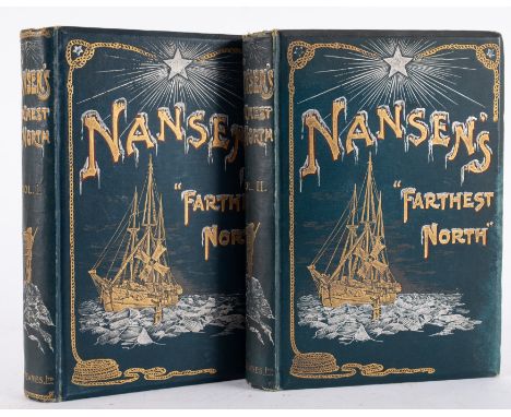
Hayley William "The Poetical Works of John Milton with a Life of the Author...." printed by W. Bulmer & Co. for John and John Boydell and George Nicol 1794, engraved frontis after G. Romney, creased, numerous engraved plates, 3 vols, full leather, blind tooled with gilt rules and decorations, gilt titles, vol 1 the end papers are torn and creased, back board detached, vol II front board detached, loss of back strip as on vol III, elephant folioKennedy, Matthew "A Chronological, Genealogical and Historical Dissertation of the Royal Family of the Stuarts ...", printed in Paris by Lewis Coignard, printer and bookseller in St. James Street at The Eagle d'Or 1705, contemporary binding, half leather, marbled boards, all edges stained redStewart, Duncan"A Short Historical and Genealogical Account of the Royal Family of Scotland from Kenneth II who conquered the Picts and of the Surname Stuart from the Founder of that Name ...", Edinburgh, printed by W. Sands, A. Brymer, etc., 1734, tp has serious offsetting from a folded genealogical map which has been repaired but is interesting, pages creased, ink stains to the edges, bkpl from Hunstanton Hall, ep offset and chipped, rebacked, contemporary leather laid down on boards with raised bands and pastedown title
Gregory Davies, oil on board, titled ' Appletree in Sunlight ', signed and dated 1980, bearing label verso, with purchase receipt, 33cms x 29cms, together with an antique map, ' The Road to Truro ', by E. Bowen, pen and ink drawing, titled ' She pulled the boat towards her ', framed, 16cms x 28cms, bearing label verso
1948 London Olympics two Victoria & Albert Museum press passescomprising Press and Press Photographer's Messenger, London Transport map, Information Sheet containing Programme of Events and prices of admission and white-metal souvenir caddy spoon featuring Big Ben, modern paperweight, inscribed 1908, (qty)
England v Scotland handbook for the game at Wembley on 6th April 1957, along with an FA Letter, an Invitation to the post inner for the game, an England rosette and a ticket for the England v Scotland U23 game at Hillsborough on February 8th 1956 and a directional map issued to players for Holland, (qty) The condition of the items is generally good with some slight rusting to the staples of the itinerary and some small marks to the invitation in pen. Provenance: The Grainger family
° ° BUCKS: (Storer, James) The Rural Walks of Cowper; displayed in a series of views near Olney, Buckinghamshire ... with Descriptive Sketches, and a Memoir of the Poet's Life ... 16 plates, half title; old marbled boards with printed label, later red morocco spine. (1822); Cowper, Illustrated by a Series of Views, in, or near, the Park of Weston-Underwood ... pictorial engraved and printed titles, 12 plates; late 19th cent. gilt-ruled and blind decorated morocco (rebacked, with maroon label), 4to. 1803; Cooke, George Alexander - Topographical and Statistical Description of the County of Buckingham ... a Copious Travelling Guide ... folded map; old half calf and marbled boards, 12mo. (ca.1830); bound with (The Same) for Bedfordshire; WILTS: Moffat, Rev.J.M. (editor) - The History of the Town of Malmesbury, and of its Ancient Abbey ... 3 plates, a plan and folded table, subscribers list; contemp. gilt calf and panelled spine. Tetbury, 1805: 'An Observer' - Kaleidoscopiana Wiltoniensia; or, a Literary, Political, and Moral View of the County of Wilts, during the Contested Election in June 1818 ... the advertisements, letters, speeches, squibs, and songs ... rebound paper boards with printed label, uncut, 1818 and CAMBS: Malden, Henry - An Account of King's College Chapel, in Cambridge ... portrait frontis, & plate; old grey wrappers. Cambridge: printed for the Author ... 1769
TWO BOXES AND LOOSE PICTURES AND PRINTS ETC, to include an oil on board depicting Aros Bridge in Mull, signed and dated F.W. Dale 1927, approximate size 27cm x 34cm, three mid 1950's watercolour pictures depicting scenes from Malaysia signed B. Rabemananjara, two pencil signed Maud Earl prints depicting sporting dogs, reproduction Samuel Howitt fishing prints, early 20th century watercolours, portrait engravings of noted public and medical figures including Lord Byron, Captain Cook, Sir Benjamin Brodie, Sir Charles Clarke, Thomas Linacre, Sir Henry Halford etc, together with assorted other prints and a three dimensional map of the lake district etc (some frames are in poor condition)
A SMALL QUANTITY OF PAINTINGS AND PRINTS ETC, to include two watercolour landscapes signed and dated A.S. Mayes 1964, a river landscape depicting Beddgelert signed H. Williams 1995, a watercolour coastal landscape signed P.A. Lay-Greaves, a Winter landscape signed Thomas W. Paintain, an unsigned pen, ink and colour wash sketch depicting animals before thatched cottages, Michael Smith oil on canvas coastal landscape together with assorted prints and an Emanuel Bowen map of Northamptonshire published 1754, largest size approximately 63cm x 71cm including frame
A SMALL QUANTITY OF MAPS, PICTURES AND PRINTS ETC, to include a map of Staffordshire 'Staffordiensis comitatus vulgo Stafford shire' by J Blau circa 1646, framed with glass front and back, approximate size 44cm x 53cm, a John Ogilby London to Holyhead strip road map - Lichfield to Chester section, circa 1676 - some discolouration to the paper, together with four watercolour landscape miniatures by Marion Thornton, four 19th century silhouette portrait miniatures, two reproduction miniature portraits of Maria Mancini and Sofia Trubetzkoy, assorted prints etc (1 box + loose)
OIL PAINTINGS, PRINT AND MAP, comprising W. Petch water landscape with grazing cattle and birds, signed and dated (19)04 bottom right, oil on canvas, approximate size 49cm x 68cm, two early 20th century water landscapes signed G Collins, unframed, approximate sizes 31cm x 46cm, a distressed oil on canvas winter landscape signed T.S. Cooper, a limited edition print montage regarding the rules of rugby, approximate size including frame 62cm x 87cm and a hand coloured map of Radnorshire (6)
Travel. Bates, Henry Walter - The Naturalist on the River Amazons. London: John Murray, 1864. Second edition. Illustrated, including folding map. Original green cloth, rubbed. With; Hadfield, William - Brazil and The River Plate in 1868. London: Bates, Hendy and Co. 1869. Four plates. Original cloth, some soiling. (2)
Travel. Cumming, C. F. Gordon - At Home in Fiji. Edinburgh: William Blackwood, 1881. Two volumes. With plates and a map (volume I lacks a plate). Original cloth, re-cased. Ex-library with stamp to reverse of title pages. Presentation copy - 'with the author's compts.' written at the head of the half-title in volume I. (2)
Antiquarian. A Code of Gentoo Laws, or Ordinations of the Pundits. From a Persian Translation made from the Original Written in the Shanskrit Language. London: 1777. With; The Travels of Anacharsis The Younger in Greece, During the Middle of the Fourth Century before the Christian Era. Abridged from the Original Work of the Abbe Barthelemi. Illustrated with Plates Designed and Engraved by H Richter. London: 1797. Three plates and a map. (2)
Antiquarian. Travel. Captain Mundy - Pen and Pencil Sketches, Being the Journal of a Tour in India. London: John Murray, 1832. Two volumes. With 19 plates/woodcuts (including frontispieces) and a small folding map, as per 'directions to binder'. Uniform in calf (rubbed), sometime re-backed, spines in gilt. Foxing to plates. (2)
Travel/Sporting. Peel, C. V. A. - Somaliland. London: Robinson, 1900. With plates, text illustrations and a map. Ex-library, with bookplate and blind-stamps. With; Stebbing, E. P. - The Diary of a Sportsman Naturalist in India. London: 1920. With plates and text illustrations. Both in original cloth. (2)
Travel. Africa. Sutton Smith, H. - 'Yakusu' The Very Heart of Africa. London: Marshall Brothers, Ltd. [1911]. With plates and a folding map. Original cloth, repairs to spine. With; Fisher, Ruth B. - On The Borders of Pigmy Land. London: Marshall Brothers, Ltd. Fifth edition. With plates. Original cloth. (2)
Military. Bollaert, William - The Wars of Succession of Portugal and Spain, from 1826 to 1840: &c. London: Edward Stanford. 1870. Two volumes. Volume I lacking two plates and one page of text. With; A History of Gibraltar and Its Sieges. London: Provost & Co. 1873, 2nd edition. With real photo-frontispiece and a map. (3)
-
109198 item(s)/page