We found 109182 price guide item(s) matching your search
There are 109182 lots that match your search criteria. Subscribe now to get instant access to the full price guide service.
Click here to subscribe- List
- Grid
-
109182 item(s)/page


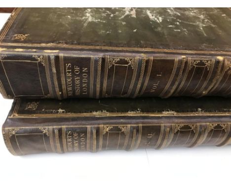
Lot 107
NEWCOURT (Richard) Repertorium Ecclesiasticum Parochiale Londinense; an Ecclesiastical Parochial History... London. 1708-10, 2 vols. folio, portrait frontispiece, 4 plates and a folding map with outline hand colour, some foxing and browning, binding tight in later straight grain morocco, library shelf number painted to foot of spines

Lot 117
SANDYS (George) Travels containing an history of the … Turkish Empire…, of Aegypt… Holy-Land… Italy…, 7th edition London 1673, folio, added engraved title from the 6th edition, lacks folding map, partial tear to one crease line of folding plate, illustrations in text, some light age staining and dust soiling, rebound in spotted calf in 1787 in Portugal (according to an old ink inscription at the rear)


Lot 208
China Missions, late 19th century, a small box of various China Missionary items and ephemera, including a tissue paper map, passport to Rev. A W Nightingale expiring 1880, signed 'Bullock', printed sheet depicting Liu driving out the French troops, with pencil annotations in English, 1879 almanac, Tibethan gospel of Matthew, and other mainly ephemeral items; also a small opium smoker's box with fittings.
![[CROMWELL (T K)] Excursions in the County of Suffolk, 2 vols., 1818, large 8vo, folding map and plan, mounted india paper pla](https://cdn.globalauctionplatform.com/a227e4d1-7fe6-47cc-8ad5-a9b900a5bba9/6b7c7f94-d722-4efa-b301-a9bd0121688a/468x382.jpg)
Lot 247
[CROMWELL (T K)] Excursions in the County of Suffolk, 2 vols., 1818, large 8vo, folding map and plan, mounted india paper plates, uncut, boards (worn); KIRBY (John) The Suffolk Traveller, 2nd edition 1764, 8vo, 4 folding strip road maps, morocco gilt, lacking spine label; another copy, with upper board detached, worn; [HOME (Henry, Lord Kames)] The Gentleman Farmer. Being an Attempt to Improve Agriculture by Subjecting it to the Test of Rational Principles, first edition, Edinburgh: W. Creech 1776, 3 engraved plates, uncut, modern half binding; BIGLAND (J) Yorkshire, or Original Delineations, 1815, 8vo, 4 maps and plates, some foxing, worn binding; one other - Suffolk Agriculture (7)


Lot 13
Hearne (Samuel) A Journey from Prince of Wales's Fort in Hudson's Bay, to the Northern Ocean. Undertaken by Order of the Hudson's Bay Company, for the Discovery of Copper Mines, A North West Passage, &c. in the Years 1769, 1770, 1771, & 1772, Strahan and Cadell, 1795, quarto, large folding frontis map, eight plates (seven folding), all edges gilt, contemporary calf gilt (re-backed retaining original backstrip)


Lot 62
Seemann (Berthold) Narrative of the Voyage of H.M.S. Herald During the Years 1845-51, under the Command of Captain Henry Kellett .... in Search of Sir John Franklin, Reeve, 1853, two volumes bound as one, colour frontis to each volume, folding map, all edges gilt, modern half morocco by Aquarius


Lot 203
Wright (C.S.) & Priestley (R.E.) British (Terra Nova) Antarctic Expedition, 1910-1913, Glaciology, Harrison, 1922, quarto, plates as called for (a few with closed tears), fifteen folding maps in rear pocket (several torn without loss), ex-university with stamps to each map and deaccession stamp to rear endpaper, later cloth with part of original back-strip laid down
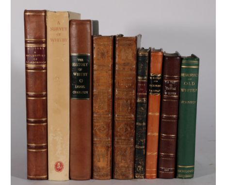
Lot 332
Hinderwell (Thomas) The History and Antiquities of Scarborough and the Vicinity, York: Bayley, 1798, first edition, quarto, frontis, town plan, two maps (one folding, torn without loss), extra illustrated with engravings throughout, the plates called for by Boyne (p.197) are all present but one of the folding plans called for may be either single page or an incorrect replacement, half calf; Charlton (Lionel), The History of Whitby and of Whitby Abbey .., York: Ward .., 1779, quarto, folding frontis plan, three plates as called for, modern quarter calf; Hutton (W.), A Tour to Scarborough in 1803; Including a Particular Survey of the City of York, Nichols, Son & Bentley, 1817, second edition, half calf (edges worn, spine head a little pulled); idem, A Trip to Coatham, A Watering Place in the North Extremity of Yorkshire, Nichols, 1810, portrait frontis, folding colour map, three plates as called for, modern half morocco; Belcher (Henry), Illustrations of the Scenery on the Line of the Whitby and Pickering Railway .., Longman, Rees ..., 1836, engraved title, eleven (of twelve) engraved plates, modern half calf; with four others (9)
![Nares ([George], Captain) The Official Report of the Recent Arctic Expedition, John Murray, 1876, frontis map, original blue](https://cdn.globalauctionplatform.com/b7768c5d-2849-4ed4-9331-a9b900933df5/754575c6-584c-4a58-b40f-a9b900a84602/468x382.jpg)
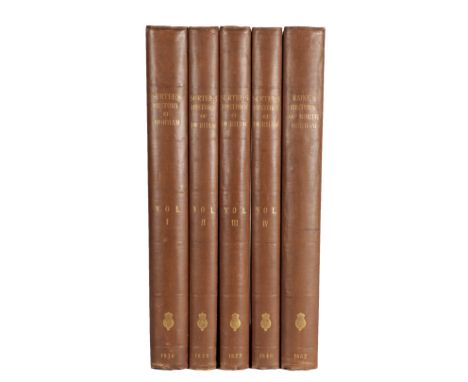
Lot 321
Surtees (Robert) The History and Antiquities of the County Palatine of Durham … Volumes I - IV, Nichols and Andrews, 1816-1840, four volumes, folio, eighty-two plates (the eighty-one called for with extra plate of Raby Castle, one plate with cropped margins), cloth; Raine (James), The History and Antiquities of North Durham, as subdivided into the Shires of Norham, Island and Bedlington …, Nichols and Andrew, 1852, folio, ten plates including portrait frontis and map, two pedigrees, cloth (uniform with Surtees) (5)

Lot 210
Dixon (George, Capt.) A Voyage Round the World; But More Particularly to the North-West Coast of America: Performed in 1785, 1786, 1787, and 1788, in The King George and Queen Charlotte, Captains Portlock and Dixon, Goulding, 1789, quarto, large folding map (torn without loss), twenty one charts and plates ( twelve folding, one plate with repaired tear), original boards, preserved in modern solander box
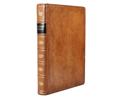
Lot 212
Willyams (Cooper) A Voyage up The Mediterranean in His Majesty's Ship the Swiftsure, one of the Squadron under the Command of Rear-Admiral Sir Horatio Nelson ..., with a Description of the Battle of the Nile ...., White, 1802, quarto, engraved dedication, double-page aquatint map, forty-one aquatint plates as called for, additional plate and mounted portrait, manuscript leaf loosely inserted, contemporary diced calf (re-backed)
Lot 9
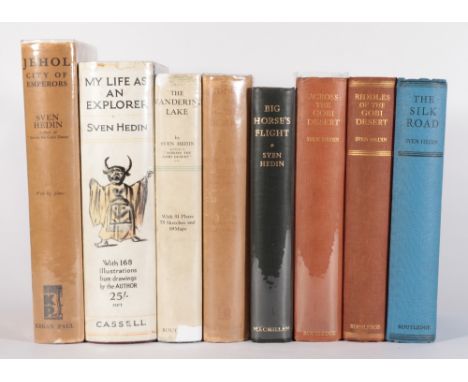
Sparrman (Andrew) A Voyage to the Cape of Good Hope, towards the Antarctic Polar Circle, and Round the World, but chiefly into the Country of the Hottentots and Caffres, from the Year 1772, to 1776, Robinson, 1785, first English edition, two quarto volumes, frontis, nine plates, folding map, errata leaf, half morocco

Lot 123
Manby (George William) Journal of a Voyage to Greenland, in the Year 1821 .., Whittaker, 1823, folding frontis map (facsimile), twenty litho plates (four folding), circulation list to front pastedown, original boards (edges worn, re-backed with new spine label); Markham (Albert Hastings), A Whaling Cruise to Baffin's Bay and the Gulf of Boothia ..., Sampson Low, .., 1874, eight plates, colour folding map (torn without loss), half morocco (school stamp to front endpaper); Bullen (Frank T.), The Cruise of the 'Cachelot', Round the World after Sperm Whales, Smith, Elder, 1898, folding map, eight plates, original cloth gilt (3)

Lot 23
Richardson (Sir John) Arctic Searching Expedition: A Journal of a Boat-Voyage through Rupert's Land and the Arctic Sea, in search of the Discovery Ships under Command of Sir John Franklin ..., Longman, Brown .., 1851, two volumes, hand-coloured folding map, ten chromolitho plates, ex-college library with stamps on reverse of titles, original cloth (re-backed retaining original endpapers and spine labels), modern slipcase


Lot 234
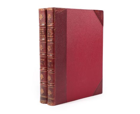
Hedin (Sven) Jehol, City of Emperors, Kegan Paul ..., 1932, first English edition, plates as called for, dust wrapper (priced 18s.); idem, Riddles of the Gobi Desert, Routledge, 1933, first English edition, folding map, plates as called for, dust wrappper (priced 18s.); idem, The Wandering Lake, Routledge, 1940, first English edition, folding map, plates as called for, dust wrapper (with 10/8 label over 18s.); with five others, all English first editions by Hedin (8)
Lot 328
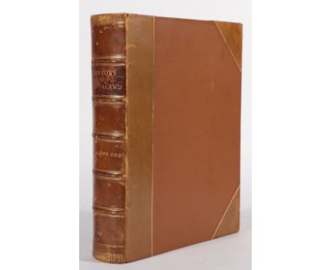
Ord (John Walker) The History and Antiquities of Cleveland ..., Simpkin and Marshall, 1846, additional title, fourteen plates and maps as called for, including large folding map, with six added plates, at least two after Frith, of Hutton Hall, Nunthorpe Hall and Pinchingthorpe House, half calf (rubbed)


Lot 326
Graves (John) The History of Cleveland, in the North Riding of the County of York ..., Carlisle: Jollie, 1808, quarto, engraved title, folding hand-coloured map, nine engraved plates including frontis, folding pedigree, some foxing, particularly the frontis and engraved title, 16 page paper on Mount Grace (1900) bound in at rear, top edge gilt, other edges uncut, full morocco gilt with armorial to upper board [Boyne p.189]

Lot 199
National Antarctic Expedition 1901-1904 Album of Photographs and Sketches with a Portfolio of Panoramic Views, The Royal Society, 1908, quarto volume with portfolio, 167 plates as called for, including the twenty-four folding panoramic views and two folding maps in portfolio, institution stamps on reverse of title and final page of album and on reverse of one folding map, both volumes in original quarter style full cloth (wear to head and tail of album, portfolio joints split)
Lot 331
Graves (John) The History of Cleveland, in the North Riding of the County of York ..., Carlisle: Jollie, 1808, quarto, engraved title, folding hand-coloured map, nine engraved plates including frontis, folding pedigree, some foxing, particularly the frontis and engraved title, contemporary tree calf (worn, re-backed) [Boyne p.189]; Atkinson (J.C.), History of Cleveland, Ancient and Modern, Volumes I and II (parts I & 2), Leeds: Rigg, 1988-93, numbered limited editions of 300 and 500, quarto, first two volumes in quarter leather, the third in cloth (4)

Lot 267
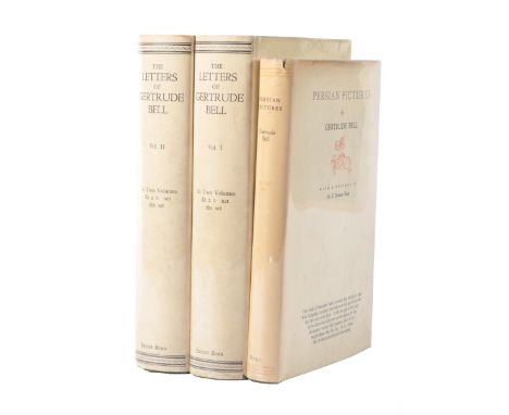
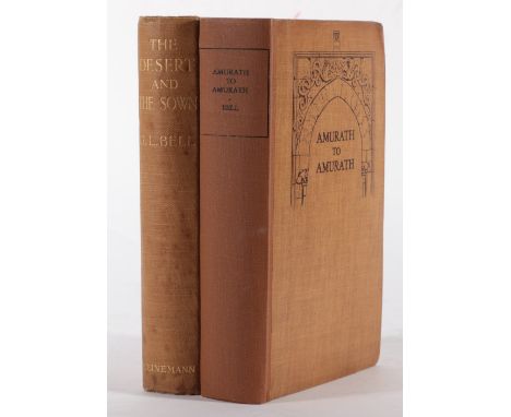
Bell (Gertrude Lowthian) The Desert and the Sown, Heinemann, 1907, first edition, colour frontis, text illustrations, folding map, original cloth idem, Amurath to Amurath, Heinemann, 1911, first edition, frontis, plates as called for (one torn with unsightly tape repair), folding map, original cloth (re-backed, new endpapers) (2)

Lot 42
M'Clure (Robert, Capt.) & Osborn (Sherard) edit. The Discovery of the North-West Passage by H.M.S. 'Investigator', Capt. R. M'Clure, 1850, 1851, 1852, 1853, 1854, Longman, Brown ..., 1856, folding map and four plates as called for, original cloth (neat restoration to spine, closed tear to lower edge of title and A2), modern slipcase

Lot 124
Greely (Adolphus W.) Three Years of Arctic Service, An Account of the Lady Franklin Bay Expedition of 1881-84 and the Attainment of the Farthest North, New York; Scribner's Sons, 1886, two volumes, signed by the author, frontis to each, forty-two other plates, nine maps including large folding map in rear pocket (torn at folds), original cloth; U.S. Senate, Proceedings of the 'Proteus' Court of Inquiry on the Greely Relief Expedition of 1883, Washington; Govt. Printing Office, 1884, six folding maps (several torn without loss), seven illustrations on four plates, modern cloth; with four others (7)
Lot 89
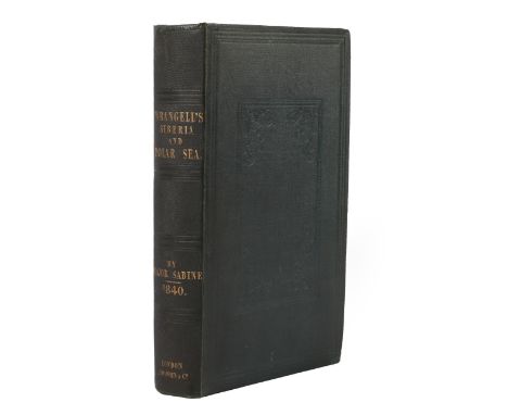
von Wrangell (Ferdinand) Narrative of an Expedition to the Polar Sea in the Years 1820, 1821, 1822, & 1823, James Madden, 1840, edited by Edward Sabine, library blindstamps, large folding map in front pocket, original cloth [note; the 1844 edition was issued with a portrait frontis, this edition does not appear to call for one]
Lot 223
Younghusband (Francis) Peking to Lhasa, The Narrative of Journeys in the Chinese Empire made by the late Brigadier-General George Pereira ..., Constable, 1925, first edition, thirty-three plates, two folding maps, original cloth; Dainella (Giotto), Buddhists and Glaciers of Western Tibet, Kegan Paul ..., 1933, thirty-two plates, map, original cloth; Bishop (Isabella Bird), Among the Tibetans, New York; Revell, n.d. [1894], first US edition, frontis, text illustrations (including full page, original cloth gilt; with eleven others (14)

![Danenhower [John W.] Lieutenant Danenhower's Narrative of the Jeannette, Boston; Osgood, 1882, portrait frontis, plate, doubl](https://cdn.globalauctionplatform.com/b7768c5d-2849-4ed4-9331-a9b900933df5/4a649db6-ead1-4bf2-9736-a9b900a8509d/468x382.jpg)
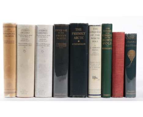
Lot 134
Stefansson (Vilhjalmur) The Adventure of Wrangel Island, Cape, 1926, folding map, plates as called for, dust wrapper (priced 18s.); Andree (S.A.), Strindberg (Nils) & Fraenkel (Knut), The Andree Diaries, being ... written during their Balloon Expedition to the North Pole in 1897 ...., John Lane, 1931, first English edition, frontis, three folding maps, plates as called for, dust wrapper (priced 21s.); with seven others (9)
![Clarkson (Christopher) The History [and Antiquities] of Richmond, in the County of York, Richmond: for the author, 1821, quar](https://cdn.globalauctionplatform.com/b7768c5d-2849-4ed4-9331-a9b900933df5/a1dc3542-d582-40f7-8190-a9b900a91e0c/468x382.jpg)
Lot 324
Clarkson (Christopher) The History [and Antiquities] of Richmond, in the County of York, Richmond: for the author, 1821, quarto, eighteen plates as called for including folding plan [Boyne p.181], calf gilt (re-backed retaining original back-strip); Anon. [Clarkson (Christopher), The History of Richmond, in the County of York .., Richmond: Bowman, 1814, three plates as called for, modern half sprinkled calf ; Longstaffe (W. Hylton), Richmondshire, Its Ancient Lords and Edifices, A Concise Guide ..., Bell, 1852, folding frontis map, ten plates as called for (Boyne p.184), top edge gilt, half morocco gilt with original wraps bound in; Robinson (W.R.), Robinson's Guide to Richmond, Richmond: Robinson, 1833, six plates, original cloth; with six others (10)

Lot 111
Koldewey (Captain) The German Arctic Expedition of 1869-70, and Narrative of the Wreck of the 'Hansa' in the Ice, Sampson Low ..., 1874, four chromolitho plates, two coloured folding charts, thirty one other plates, top edge gilt, half morocco; Payer (Julius), New Lands Within The Arctic Circle, Narrative of the Discoveries of the Austrian Ship 'Tegetthoff' in the Years 1872-1874, Macmillan, 1876, two volumes, chromolitho frontis, map, plates as called for, top edge gilt, original cloth gilt (3)
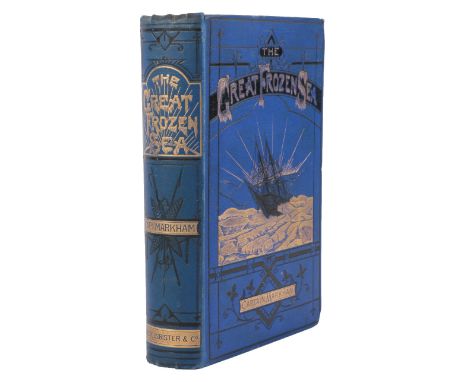
Lot 180
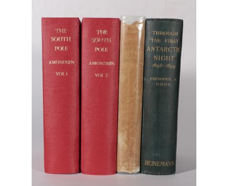
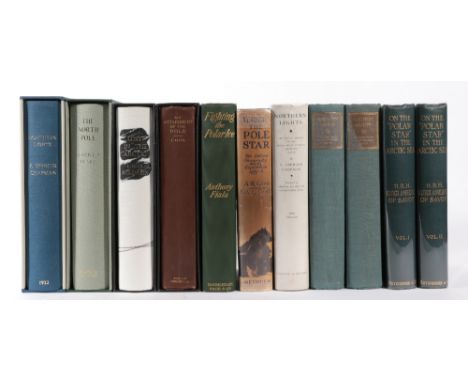
Cook (Frederick A.) Through the First Antarctic Night, 1898-1899, A Narrative of the Voyage of the 'Belgica' …, Heinemann, 1900, colour and monochrome plates as called for, original pictorial cloth (re-backed retaining original backstrip, library stamp to final page); Amundsen (Roald), My Life as an Explorer, Heinemann, 1927, frontis, dust wrapper (priced 10s.6d., worn and faded); idem, The South Pole, An Account of the Norwegian Antarctic Expedition in the 'Fram', 1910-1912, John Murray, 1912, first English edition, two volumes, plates and maps as called for (one folding map torn without loss), top edge gilt, modern red cloth (4)
Lot 339
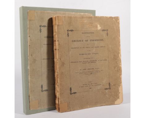
Phillips (John) Illustrations of the Geology of Yorkshire; or a Description of the Strata and Organic Remains of the Yorkshire Coast ..., York: the Author, 1829, quarto, hand-coloured geological map, nine strata plates (eight with hand-colouring), fourteen fossil plates, original printed wraps (worn), preserved in solander box

Lot 30
Back (Captain) Narrative of the Arctic Land Expedition to the Mouth of The Great Fish River and Along the Shores of the Arctic Ocean in the Years 1833, 1834 and 1835. John Murray, 1836, quarto large paper copy, limited to 250, folding map, sixteen plates on India paper, top edge gilt, half morocco binding by Farrell [provenance - Franklin Brooke-Hitching #54]
Lot 129
Amedeo (Luigi, of Savoy) On the 'Polar Star' in the Arctic Sea, Hutchinson, 1903, two volumes, sixteen plates, two panoramas, five maps including two folding maps in rear pocket, text illustrations, original; cloth gilt; Glen (A.R.) & Croft (N.A.C.), Under the Pole Star, The Oxford University Arctic Expedition, 1935-6, Methuen, 1937, plates and maps as called for, dust wrapper; Mikkelsen (Ejnar), Lost in the Arctic, Being the Story of the 'Alabama' Expedition, 1909-1912, Heinemann, 1913, folding map, plates as called for, modern cloth binding with mounted figures on skis towing a sled, slipcase; with seven others (11)
![MacGahan (J.A.) Under the Northern Lights, [The Cruise of the Pandora], Edward Stanford, 1876, folding map, eight plates, tex](https://cdn.globalauctionplatform.com/b7768c5d-2849-4ed4-9331-a9b900933df5/0274813c-54ab-44c8-9043-a9b900a84eb5/468x382.jpg)

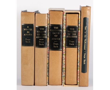
Lot 273
Stark (Freya) The Valleys of the Assassins ..., John Murray, 1934, first edition, plates and maps as called for, map endpapers, modern quarter morocco, slipcase; idem, The Southern Gates of Arabia .., John Murray, 1936, first edition, plates as called for, two folding maps (one torn and taped), modern quarter morocco, slipcase; idem, Seen in the Hadhramaut, John Murray, 1938, map, illustrated throughout, modern quarter morocco; with two others (5).
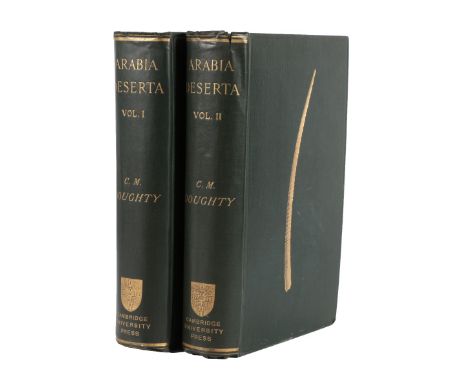
Lot 257
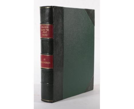
Doughty (Charles M.) Travels in Arabia Deserta, Cambridge; University Press, 1888, first edition, two volumes, partly unopened, folding map in rear pocket, original cloth gilt (endpapers split at hinge, 13mm tear to spine head of volume II), preserved in two quarter morocco book-form slipcases [provenance - H. Bradley Martin]


Lot 211
Portlock (Nathaniel, Capt.) A Voyage Round the World; But More Particularly to the North-West Coast of America: Performed in 1785, 1786, 1787, and 1788, in The King George and Queen Charlotte, Captains Portlock and Dixon, Stockdale & Goulding, 1789, quarto, large folding map, nineteen other charts and plates (five folding), calf boards (re-backed with calf gilt)
-
109182 item(s)/page