We found 109182 price guide item(s) matching your search
There are 109182 lots that match your search criteria. Subscribe now to get instant access to the full price guide service.
Click here to subscribe- List
- Grid
-
109182 item(s)/page
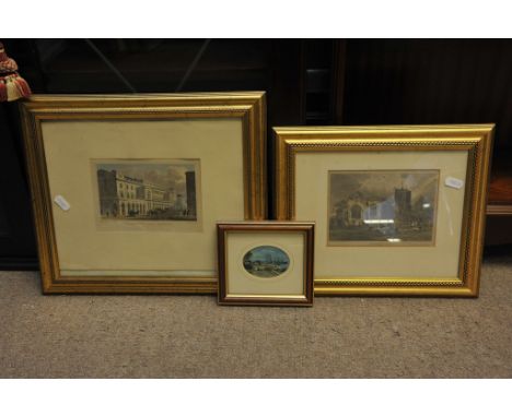


Lot 543
Wainwright A. : Pictorial Guide to the Lakeland Fells. Small 8vo. Seven volume set in a common textured green rexine binding, gilt. The Outlying Fells of Lakeland. All titles comprehensively illustrated with Wainwright's detailed sketches. Together with : Jenkinson H. Practical Guide to the English Lake District, 1881. 8vo. hb. Folding coloured plates, map. Jenkinson lacks maps in front pocket.

Lot 552
Johns W. : Biggles Follows On, 1952; Biggles Works it Out, 1951; Biggles and the Black Raider, 1953; Another Job for Biggles, 1951. These titles all 1st.Eds. with Djs. Together with 14 further 'Biggles' titles, all with Djs., all early editions from the 1940/50s. Gimlet Lends a Hand, 1949; Gimlet Off the Map, 1951. 1st.Eds. with Djs. With five unrelated titles. Djs. in variable condition, some with a little wear and very minor loss.

Lot 572
Heming T. : Complete Survey of Scripture Geography, 1818. Qto. Recent professional qtr. binding. Text and large folding, h/c world map indicating religions of each region. Very scarce. Vg. The volume contains two maps, one as frontis - the Middle East. The second, a folding world map. The tp refers to a 'set' of maps. References located so far give no definitive collation, neither does the book.

Lot 573
Palmer S. : St. Pancras, Middlesex - Antiquarian, Topographical and Biographical Memoranda, 1870. Qto. Hb. Map frontis & plate. Featherstone T. Legends of Leicester, 1838. 8vo. Hb. plates. Both titles uncommon. Together with : The Works of Robert Burns, 1846 and three further bindings. The bindings of both titles require some restoration.
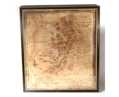
Lot 595
Territories and Surveys : Joint Palestine Survey Commission, 1928; Migration and Settlement, 1971; Goodman P. : The Jewish National Home, 1943. Together with a large Palestine Map Wall Chart, linen backed, coloured, indicating Jewish Settlements, Arab Villages,International Boundaries,Historical and Physical features. Nd. C. 1940. Also a similar wall-poster map. Books vg. Map with minor wear at margins, parts of glazed surface cracking but generally sound.
Lot 629
Beattie W. : Scotland Illustrated in a Series of Views, 1838. 1st. Ed. Two vols. Qto. qtr. binding, gilt, aeg. Engraved tp. and plates, fldg. map. Manuscript dedication from author. Wilson D. : Memorials of Edinburgh in Olden Time, nd. c. 1860. Two vols., qto. green cloth blind stamped & gilt. Fldg. plan frontis, engraved plates.

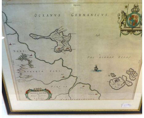
Lot 661
Speed J. : Hartford Shire described, The sittuations of Hartford and the most ancient towne S.Albons with such memorable actions as have happened, pub. Thomas Bassett & Richard Chiswell, c.1676, hand coloured engraved map with inset town plans of Hertford and Verolanium ( St.Albans ). Text to verso. Mounted, framed and glazed. Vg.


Lot 664
Bedford : Comitatus olim pars Cathifuclanorum, Nd. C.1610. Kip after Saxton. Hand coloured, framed and glazed. Together with : Bowen E. : An Accurate Map of the County of Bedford, C.1767. Engraved titular cartouche, marginal notes & tables. Hand coloured in outline.Moule T. : Bedfordshire. All mounted, framed and glazed. Saxton generally clean and bright. Others vg.


Lot 688
Railwayana : Railway Map of England & Wales,1926 and another, Scotland, 1920, both 8vo, linen-backed in original Railway Clearing House Binders; Rules and Regulations, London & North Western Railway Company, 1904 and another booklet for Instructions relating to Transmission of Telegrams, 1916. Together with : Fuel Efficiency on the Footplate, GWR 1945 and Railwayman's Handbook, 1947. Maps and Telegrams generally vg. Other items clearly having been used but complete.

Lot 695
Bradshaw G. : New Railway Map of Great Britain, 1849. Hand-tinted, folding, linen-backed sectioned map of 'Railways Completed and in Progress and for which Acts of Parliament have been Obtained'. Chart showing 40 Railway Lines and another with charges for Messages by Electric Telegraph. Engraved border. Original maroon blind-stamped & gilt cloth covers. Cover lacks original spine o/w a vg+ copy


Lot 139
Carte des Indes et de la Chine Dressée sur plusieurs Relations particulieres Rectifiées par quelques Observations par Guillaume de L`Isle de L`Academie Royal des Sciences, an early 18th century French coloured map of the far east showing trade routes, Delisle Covens and Mortier, circa 1730, 60cm by 63cm


Lot 10
Challenger Expedition. Report on the Scientific Results of the Voyage of H.M.S. Challenger during the Years 1873-76..., Zoology, Parts VII, IX, XVII, XXXII, XXXVIII & LXXVI, pub. 1880-82, 1884, 1886, 1888, part VII comprising Corals by Henry Nottidge Moseley, lacking general title, containing thirty-two litho plates, early 20th c. cloth, part IX comprising Echinoidea by Alexander Agassiz, containing forty-five litho plates, ink stamps to half-title and title, contemporary cloth, spine reinforced and corners repaired, parts XVII, XXXVIII & LXXVI (complete in 5 vols.), comprising Tunicata by William Abbott Herdman, containing ninety-seven litho plates and one map, ink stamps to titles, presentation bookplates recording their donation by Alexander Agassiz to the Museum of Comparative Zoology at Harvard, near contemporary half calf, some joints cracked and slight wear, part XXXII comprising Crinoidea by Philip Herbert Carpenter, containing sixty-nine litho plates (one coloured, & repaired to margins), ink stamps to title, 20th c. cloth, stained to upper board, together with Narrative of the Cruise, by T.H. Tizard, H.N. Moseley, J.Y. Buchanan & John Murray, part 1 only, pub. 1885,five chromo plates, twenty b & w plates from photographs (including folding frontispiece), two plans, thirty charts & twelve sections (mostly folding), some repaired, lacks map in rear pocket, ink stamps to title, 20th c. cloth, all large 4to. The Challenger was the first steam-powered ship to cross the Antarctic Circle. The illustrations from photographs in this work include the earliest known photographic illustrations of Antarctic icebergs and peri-Antarctic islands. The expedition`s major scientific findings were published over the next two decades. (9)


Lot 103
* England & Wales. Hole (William), Englalond Anglia Anglo Saxonum Heptarchia, c.1637, hand coloured engraved map, 275 x 315mm, mounted, framed and glazed, together with, Saxton (Christopher & Kip William),Lincolniae Comitatus ubi olim insederunt Coritani, c.1637, hand coloured engraved map, slight creasing, 300 x 350mm, mounted, framed and glazed. Not examined out of frames. (2)

Lot 105
England & Wales. Walker (J. & C.), A Geological Map of England Wales and Part of Scotland, Showing also the Inland Navigation by Means of Rivers & Canals, with their Elevation in feet above the Sea, together with the Rail Roads & Principal Roads, [1835 - 37], engraved map, sectionalised and laid on linen, with contemp. watercolour illustrating the geological structure of England & Wales, table of explanation and two geological cross sections, later railways added in contemp manuscript, 1400 x 990mm (1)

Lot 106
* England & Wales. Jansson (Jan), Anglia Regnum, c.1647, engraved map with contemp. hand colouring, strapwork cartouche and mileage scale, 395 x 500mm, mounted, framed and glazed, together with, Buck (S & N),The East View of Hurst Castle in Hampshire, 1733 [but later impression], hand coloured engraving, 200 x 370mm, mounted, framed and glazed, with, Debaines (Burnet),Shipping on the Mersey, c.1880, uncoloured etching after W.Wyllie, 130 x 280mm, mounted, framed and glazed (3)
Lot 108
Folding maps. Lynam (George), Map of the Parish of Stoke upon Trent in the County of Stafford from an Actual Survey, 1848, litho. map sectionalised and laid on linen, sparse contemp. hand colouring, some staining, some worming to image, 645 x 930mm, cloth endpapers, contained in contemp. slip case, worn and stained, with, Greenwood (C. & J.),Map of the County of Hereford from an Actual Survey, 1834,engraved map sectionalised and laid on linen, contemp. hand colouring, calligraphic cartouche, compass rose and table of explanation, b & w vignette of Hereford cathedral, slight offsetting, marbled endpapers, 590 x 700mm, with another ten folding maps, including examples by Ordnance Survey, Pratt and Bartholomew, plus an early 20th century jigsaw puzzle of central London, various sizes and condition (12)

Lot 109
Folding maps. Wyld (James), The Islands of New Zealand from the Admiralty Surveys of the English and French Marine from the Observations of the Officers of the New Zealand Company and from Private Surveys & Sketches....., c.1850, engraved map with contemp. outline colouring, sectionalised and laid on linen, inset maps of Port Jackson and the Chatham group of Islands, some near contemp. ink and pencil annotaions to image, the map has been cut into smaller sections but with no loss, overall size 1170 x 840mm, contained in contemp. slipcase with publishers label to upper board, together with, Rennel (James),A Map of the Moguls Empire or a Geographical Survey of the Provinces of Bengal, Bahar, Awd, Ellahabad, Agra and Delhi, pub. R.Sayer & J.Bennett, 1778, engraved map with contemp. outline colouring, old folds, some staining to maps, closed tears and small holes to folds, 695 x 1050mm, contained in slipcase with publishers printed label to upper board, worn and frayed, with, Society for the Diffusion of Christian Knowledge (pubs.),Edinburgh, Antwerp, Turin, Genoa, Athens, Lisbon, Florence, Bordeaux [and] Dresden, pub. Baldwin & Cradock, c.1835, nine engraved town plans with contemp. outline colouring, sectionalised and laid on linen, each with cloth gilt endpapers, each approx. 320 x 390mm, contained in contemp. `envelope style` slipcase with morocco gilt label to upper board, a little worn at extrems., plus, Poirson (J.B.),Carte Routiere de la France, pub. Paris, 1816, engraved map with contemp. outline colouring, sectionalised and laid on linen, inset map of Holland and list of `Departements`, a little dust soiled, slight staining, 545 x 555mm, contained in contemp. chemise and card slipcase, rubbed, frayed and worn (4)

Lot 110
Four Continents. De Fer (Nicolas), L`Amerique Meridionale et Septentrionale..., L`Asie Suivant les Nouvelles Decouvertes..., L`Afrique Dressee selon les dernieres Relat et Suivant les Nouvelles Decouvertes...., [and] L`Europe Suivant les Nouvelles Observations....., pub. Paris, 1717, together four hand coloured engraved maps, each with a decorative strapwork cartouche and mileage scale, map of the Americas with insular California, old folds, each map with repaired closed tears affecting image, each approx. 230 x 340mm (4)
Lot 114
Germany. Visscher (Nicholas), Archiepiscopatus ac Electoratus Trevirensis Ditio...., c.1690, engraved map with contemp. hand colouring, 490 x 580mm, together with, Homann (Johann Baptist),Bavariae pars Inferior tam in sua Regimina Generalia...., pub. Nuremberg, c.1720, engraved map with contemp. hand colouring, 485 x 575mm, with,De L`Isle (Guillaume),Partie Meridionale de la Souabe, pub. J.Covens & C.Mortier, Amsterdam, c.1705, engraved map with contemp. outline colouring, 485 x 635mm, plus, Schenk (Pieter),S.Imperium Roman-Germanicum oder Teutschland mit Seinwn Angrant Zenden Konigreichen und Provinces, pub. Amsterdam, c.1700, engraved map with contemp. hand colouring, slight overall toning and dust soiling, central fold split and repaired on verso, slight spotting, 475 x 585mm (4)

Lot 115
Germany. Homann (Johann Baptist), Geographische Vorstellung der j?merlichen Wasser-Flutt in Nieder-Teutschland, welche den 25. Dec. Ao. 1717, in der heiligen Christ-Nacht, mit unz?hlichen Schaden, und Verlust vieler tausend Menschen, einen grossen theil derer Hertzogth. Holstein und Bremen, die Grafsch. Oldenburg, Frislandt, Gršningen und Nort-Holland, pub. Nuremberg, c.1720, engraved map with contemp. hand colouring, inset map of North Holland, inset vignettes of water control, the breaching of dykes and depictions of flooding, extensive panels of explanatory text, 490 x 585mm. A fascinating map showing the flood which engulfed East Friesland on Christmas Day in 1717 and which drowned thousands of people. The map is dominated by a large allegorical vignette and small engravings of flood control barriers, water wheels, flooded towns and breached dykes. (1)

Lot 116
Gibraltar. Lotter (Tobias Conrad), Castellum Gibraltar in Andalusia situm... pub. Augsburg, c.1770, two engraved maps of Gibraltar on one sheet (as published) with contemp. hand colouring, slight creasing to margins, old folds, 490 x 590mm, together with, Seutter (George Matthaus),Accurata Designatio Celebris Freti prope Andalusiae Castellum Gibralter inter in Europam et Africam...., pub. Augsburg, c.1730, engraved map with contemp. hand colouring, two inset maps of Minorca and Ceuta, three engraved views of Cadiz, Gibralter and Malaga, trimmed to plate mark, 500 x 575mm (2)

Lot 118
Gloucestershire. Bowen (Emanuel), An Accurate Map of the County of Gloucester Divided into Hundreds. Drawn from the best Authorities and Illustrated with Historical Extracts...., c.1762, hand coloured engraved map, orante cartouche and engraved vignette of Gloucester Cathedral, old folds, trimmed to neat line with margins extended, 495 x 405mm, together with, Bickham (George),A Map of Glocestershire, N.West from London...., 1751, hand coloured engraved decorative panoramic map, 255 x 150mm, with Seller (John),Glocestershire, c.1700, uncoloured engraved map, old folds, 130 x 150mm, with four leaves of descriptive text, plus another nineteen county and road maps, all relating to Gloucestershire, mostly hand coloured, including examples by Badeslade & Toms, Cary, Kitchin, Seller/Grose, Leigh, Owen & Bowen, Gardner, Senex, Fullarton and Valesco, occ. duplicates, various sizes and condition (22)

Lot 123
Italy. Homann (Johann Baptist), Ducatus Mediolani una cum Confinys Accurata Tabula exhibitus auctus et emedatus, pub. Nuremberg, c.1720, engraved map with contemp. hand colouring, decorative uncoloured cartouche, 480 x 590mm, together with, Lotter (Tobias Conrad),Novissima et Accuratissima Delineatio Status Ecclesiae et Magni Ducatus Hetruriae publici juris facta...., pub. Augsburg, c.1760, engraved map with contemp. hand colouring, large uncoloured cartouche, 500 x 580mm (2)

Lot 124
Lancashire. Hennet (George), A Map of the County Palatine of Lancashire, Divided into Hundreds and Parishes from an accurate Survey made in the Years 1828 and 1829, pub. Henry Teesdale & Co., 1830, engraved map by James Bingley, contemp. hand colouring, sectionalised and laid on linen, calligraphic title, table of explanation, compass rose and engraved vignette of the New Custom House Liverpol, slight dust soiling, the whole edged in green silk, 1600 x 1110mm, marbled endpapers, contained in contemp. calf book box, rubbed and worn at extrems. Brian Kentish. A Catalogue of County Atlases of England and Wales...., and large scale maps, 2012. No.68. (1)
Lot 125
Map reference. Shirley (Rodney W.), The Mapping of the World, Early Printed World Maps, 1472 - 1700, pub. The Holand Press, 1983, numerous col. and b & w illusts. throughout, pubs. cloth gilt, a little damp spotted, d.j. a little frayed with faded spine, folio, together with, Karrow (Robert W.),Mapmakers of the Sixteenth Century amd their Maps, pub. for The Newberry Library by Speculum Orbis Press, Illonois, 1993, addn. half title, pubs. cloth, d.j., 4to, with, Binding (Paul),Imagined Corners, Exploring the World`s first Atlas, 2003 numerous col. and b & w illusts. throughout, pubs. cloth gilt, d.j. price clipped, 4to, plus, Beresiner (Yasha),British County Maps, Reference and Price Guide, pub. Antique Collectors Club, 1983, numerous col and b & w illusts. throughout, pubs. cloth gilt, d.j., 4to, with another ten volumes similar, various sizes and condition (14)
Lot 129
Maps. A mixed collection of approx. 135 maps, mostly 19th century, engraved and lithographic overseas maps, including maps of Australasia, South America, East Indies, Malta, Europe, Asia and China, with examples by S.D.U.K., Johnston, Dower, Philip, Cowperthwait, Perthes, Weller and Bacon, together with a C & J Greenwood map of Surrey, mostly mounted, various sizes and condition (approx.135)

Lot 130
Middle East. Waldseemuller (Martin), Quarta Asiae Tabula, c.1513, uncoloured woodblock map of Cyprus, the Holy Land, Mesopotamia and the Middle east, trimmed to neat line, one margin strengthened on verso, old folds, 390 x 540mm. An historically important Ptolemaic map. Laor. Maps of the Holy Land, no.608. (1)
Lot 131
Middlesex. Blaeu (Johannes), Middlesexia, c.1645, engraved map with contemp. hand colouring, ornate cartouche and mileage scale, 395 x 410mm, French text on verso, together with, Van den Keere (Pieter),Midle-sex, c.1630, uncoloured engraved map, 90 x 120mm, English text on verso with a second page of descriptive text, with another hand coloured example, plus, Bowen (Emanuel & Owen William),A Map of Middlesex, [1720 or later], hand coloured engraved map, 180 x 120mm, with an uncoloured strip road map to verso, paper mount (4)
Lot 132
Monmouthshire. Blaeu (Johannes), Monumethensis Comitatus Vernacule Monmouth Shire, pub. Amsterdam, c.1645, engraved map with contemp. hand colouring, decorative cartouche and mileage scale, 385 x 500mm, French text on verso, together with, Ogilby (John),The Road from Bristol Com. Somst.to Exeter Com. Devon., c.1676, uncoloured engraved strip road map, slight staining, 350 x 450mm, with, Blome (Richard),A Mapp of the County of Cornwal with its Hundreds, c.1673, uncoloured engraved map, 245 x 310mm, plus, Morden (Robert), Darbyshire [and] South Wales, c.1695, together two uncoloured engraved maps, each approx. 360 x 425mm and Mercator (Gerard & Hondius J.),Cornub. Devonia, Somerset etc., c.1636, hand coloured engraved map, 185 x 130mm, English text on verso (6)
Lot 133
Montenegro. Camocio (Giovanni Francesco), Antivari cita in confine della Dalmatia et Albania....., pub. Venice, c.1575, uncoloured engraved map of the city of Bar and its environs, 155 x 210mm, together with, Munster (Sebastian), Aphricae Tabula II, pub. Basel, c.1550, uncoloured woodcut map on a trapezoidal projection, 270 x 340mm, letter press description in Latin to verso. In the first described item, the town is shownflying a flag decorated with the Venetian Lion and was published in Camocio`s `Isole famose, porti fortezze e terre marittime sottoposte alla Ser.ma Sig.ria di Venezia`, a description of the places claimed as subject to the Republic of Venice. Ironically the town was captured by the Ottomans in 1571 - the date of the engraving - and held until 1878. The second item, Munster`s map of North Africa and the Mediterranean, is based upon an earlier Ptolemaic map and is illustrated with a vivid depiction of the shipwreck of St. Paul the Apostle on the coast of Malta. (2)
Lot 137
Murchison (Roderick Impey). Geological Map of England and Wales (with all the Railways) 5th ed., 1864, folding engraved map by J. & C. Walker, with original hand-colouring, sectionalised on linen, light dust-soiling & toning, slight spotting, contained within original green cloth covers (155 x 100mm), map dimensions approx. 385 x 320mm (1)
Lot 138
Netherlands. Van der Aa (Pieter), A collection of twelve maps, c.1710, twelve hand coloured engraved maps of regions in the Netherlands, some maps trimmed to neat line, old folds, slight browning to old folds, each approx. 170 x 215mm, together with, Brockhaus (F.A.),Niederlande und Belgien, c.1863, engraved map with contemp. hand colouring, the map surrounded by ten uncoloured engraved vignettes, 445 x 335mm (13)
-
109182 item(s)/page