We found 109198 price guide item(s) matching your search
There are 109198 lots that match your search criteria. Subscribe now to get instant access to the full price guide service.
Click here to subscribe- List
- Grid
-
109198 item(s)/page


Lot 1045
Three assorted volumes on Yorkshire/South Yorkshire, comprising M.H. Habershon: "Chapeltown Researches, Archaeological and Historical; including Memories of Thorncliffe, its Ironworks and Collieries and their Antecedents", Sheffield, 1893, 1st edition, plates/ folding pedigree as called for, original cloth, plus Sam Wood: "Random Rhymes", Barnsley, W.R. Massie, provincial imprint, 60pp; plus Raistrick: "Yorkshire Maps and Map Makers" (3)


Lot 1188
Blaeu (Johannes) 'Ducatus Eboracensis', handcoloured map; together with after George Walker 'The Collier' and two engraved panoramic views of Leeds, framed as one. A group of Yorkshire Regimental prints, descriptions verso framed and glazed; together with other framed works and two mirrors (one oval and one round) (14)

Lot 1215
Various maps and pictures including a Robert Mordon map of Cumbria, a further map of West Moorland also by Robert Mordon, numerous prints and photographs, an early 20th century portrait bust of a young girl with a blue ribbon in her hair, pastel, dated 1911, indistinctly signed and a late 19th century printed certificate for the institute of architects and surveyors dated 1896 etc (qty)

Lot 864
Full title: Hendrik Hondius (1597-1651): 'Pars Flandriae orientalis', copper engraving, 17th C.Description: Work: 49,5 x 39,5 cmÊ Frame: 75 x 65 cmÊ Ê Map of the eastern part of West Flanders.Condition:Please contact us to let us know which lots are of interest, so we can make the requested report for you.Once complete, it will be published on our website.High resolution pictures are already available on our website at www.coronariauctions.com. Further questions are always welcome at info@coronariauctions.com
![[TOPOGRAPHY]. KENT New Margate, Ramsgate, and Broadstairs Guide; or, An Historical Epitome of the Antient and Present State](https://cdn.globalauctionplatform.com/b2b260d2-de2b-44da-b5bb-acec00de81d7/5bd2f9d6-9de5-4a37-8c00-ad1900dac604/468x382.jpg)
Lot 680
[TOPOGRAPHY]. KENT New Margate, Ramsgate, and Broadstairs Guide; or, An Historical Epitome of the Antient and Present State of the Isle of Thanet; with An Account of the Public Assemblies, Libraries, Theatre, and other Accommodations of those improved Watering-Places, fourth edition, Warren and Witherden et al., Margate, 1807, half dark green leather, engraved portrait frontispiece of Charles Le Bas, three further engraved plate illustrations, folding map, one page of publisher's advertisements, small octavo. Provenance: Rachel Ann Le Bas, N.E.A.C., R.E. (1923-2020). Condition Report : Generally good condition; spine slightly faded and rubbed; clipping from The Times, 1905, relating to Mr Le Bas, pasted to frontispiece verso; ink gift inscription ('H.V. Le Bas / from G.G.P. Glossop') to front free endpaper. Condition reports are offered as a guide only and we highly recommend inspecting (where possible) any lot to satisfy yourself as to its condition.
![[TRAVEL]. CANADA Hanbury, David. Sport and Travel in the Northland of Canada, first edition, Arnold, London, 1904, dark blue](https://cdn.globalauctionplatform.com/b2b260d2-de2b-44da-b5bb-acec00de81d7/34fe6f32-2f45-4c60-8cb1-ad1900dac6ce/468x382.jpg)
Lot 681
[TRAVEL]. CANADA Hanbury, David. Sport and Travel in the Northland of Canada, first edition, Arnold, London, 1904, dark blue cloth gilt, five tissue-guarded colour plate illustrations (including frontispiece) and a further fifty-six monochrome plate and text illustrations (as called for), two folding maps at end, sixteen-page publisher's list dated December 1903, large octavo. Condition Report : Generally good; one map chipped and torn along fore edge margin, without loss. Condition reports are offered as a guide only and we highly recommend inspecting (where possible) any lot to satisfy yourself as to its condition.
![[TRAVEL] M'Clintock, Captain F.L. The Voyage of the 'Fox' in the Arctic Seas. A Narrative of the Discovery of the Fate of Si](https://cdn.globalauctionplatform.com/b2b260d2-de2b-44da-b5bb-acec00de81d7/60550783-8697-4d14-aded-ad1900daca4c/468x382.jpg)
Lot 685
[TRAVEL] M'Clintock, Captain F.L. The Voyage of the 'Fox' in the Arctic Seas. A Narrative of the Discovery of the Fate of Sir John Franklin and his Companions, first edition, Murray, London, 1859, half leather, retailer's label for Sampson, York to front pastedown, sixteen plate and text illustrations (including frontispiece and folding facsimile document, as called for), three (of four) maps, one page publisher's list, octavo. Condition Report : Edges, corners and lower board scuffed; lacking 'Map of the Arctic Regions, Showing the Discoveries of Captain M'Clintock' at end. Condition reports are offered as a guide only and we highly recommend inspecting (where possible) any lot to satisfy yourself as to its condition.
![[MAP]. SOMERSET Speed, John (English, 1552-1629), 'Somerset-shire Described: a[n]d into Hundreds devided, with the plott of](https://cdn.globalauctionplatform.com/b2b260d2-de2b-44da-b5bb-acec00de81d7/c8e7c56a-bc86-45c9-9336-ad1900dae766/468x382.jpg)
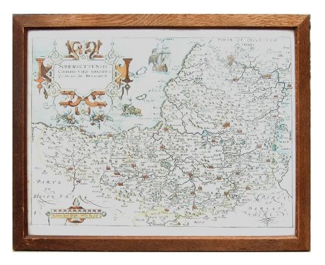
Lot 713
[MAP]. SOMERSET Speed, John (English, 1552-1629), 'Somerset-shire Described: a[n]d into Hundreds devided, with the plott of the famous and most wholsom waters and citie of the Bathe', engraved map, sold by Roger Rea the Elder and Younger, uncoloured, English text verso, 40cm x 53cm, framed and glazed in a double-sided oak frame. Condition Report : Generally good condition. Lightly foxed to the front; slightly heavier foxing to the reverse, mainly marginal. No obvious tears, repairs, holes or annotations. Condition reports are offered as a guide only and we highly recommend inspecting (where possible) any lot to satisfy yourself as to its condition.
![[MAP]. SOMERSET Cary, John (English, c.1754-1835), 'A New Map of Somersetshire, Divided into Hundreds, Exhibiting its Roads,](https://cdn.globalauctionplatform.com/b2b260d2-de2b-44da-b5bb-acec00de81d7/abc60843-4bb7-4cda-b946-ad1900dae8f0/468x382.jpg)
Lot 714
[MAP]. SOMERSET Cary, John (English, c.1754-1835), 'A New Map of Somersetshire, Divided into Hundreds, Exhibiting its Roads, Rivers, Parks, &c', engraved map, published 1805, hand-coloured, 49cm x 54cm, framed and glazed. Condition Report : Generally good condition. Closely cropped margins, particularly left and right. No obvious tears, repairs, holes or annotations. Condition reports are offered as a guide only and we highly recommend inspecting (where possible) any lot to satisfy yourself as to its condition.
![[MAP]. DEVON Morden, Robert (English, c.1650-1703), 'Devonshire', engraved map, sold by 'Abel Swale Awnsham & John Churc](https://cdn.globalauctionplatform.com/b2b260d2-de2b-44da-b5bb-acec00de81d7/04ad267b-c3d3-4402-9d7c-ad1900daea39/468x382.jpg)
Lot 715
[MAP]. DEVON Morden, Robert (English, c.1650-1703), 'Devonshire', engraved map, sold by 'Abel Swale Awnsham & John Churchil', hand-coloured in outline, 36.5cm x 42.5cm, framed and glazed. Condition Report : Some foxing, mainly marginal. Vertical centre line slightly browned. Some creasing, particularly to upper and lower right corners. No obvious tears, repairs, holes or annotations. Condition reports are offered as a guide only and we highly recommend inspecting (where possible) any lot to satisfy yourself as to its condition.
![[MAPS]. WEST COUNTRY Cary, John (English, c.1754-1835), 'Somersetshire', engraved map, published 1793, hand-coloured in outl](https://cdn.globalauctionplatform.com/b2b260d2-de2b-44da-b5bb-acec00de81d7/63579a4d-3653-44bd-954e-ad1900daeb0c/468x382.jpg)
Lot 716
[MAPS]. WEST COUNTRY Cary, John (English, c.1754-1835), 'Somersetshire', engraved map, published 1793, hand-coloured in outline, 22cm x 27cm, mounted but unframed; together with Hall, Sidney (English, 1788-1831), 'Somersetshire', 'Glocestershire', 'Cornwall', 'Devonshire', and 'Dorsetshire', engraved maps, published 1833, hand-coloured, each approximately 20cm x 25cm, each mounted but unframed, (6). Condition Report : Generally good condition. Somerset with 2cm surface indented line south-west of Wiveliscombe. None with obvious tears, repairs, holes or annotations. Condition reports are offered as a guide only and we highly recommend inspecting (where possible) any lot to satisfy yourself as to its condition.
![[MAP]. SOMERSET Blome, Richard (English, 1635-1705), 'A Mapp of the County of Somerset with the Hundreds', engraved map, han](https://cdn.globalauctionplatform.com/b2b260d2-de2b-44da-b5bb-acec00de81d7/0a672fcf-a803-4feb-aeda-ad1900daec5a/468x382.jpg)
Lot 717
[MAP]. SOMERSET Blome, Richard (English, 1635-1705), 'A Mapp of the County of Somerset with the Hundreds', engraved map, hand-coloured in outline, 25.5cm x 34cm, framed and glazed. Condition Report : Generally good condition. Lightly and evenly toned. Closely cropped to lower left margin. No obvious tears, repairs, holes or annotations. Condition reports are offered as a guide only and we highly recommend inspecting (where possible) any lot to satisfy yourself as to its condition.
![[MAP]. CRYSTAL PALACE, LONDON Plan of the Crystal Palace, Sydenham, for Sale by Auction by Howard Frank, of Messrs Knight, F](https://cdn.globalauctionplatform.com/b2b260d2-de2b-44da-b5bb-acec00de81d7/d4f2556b-91d7-462f-909c-ad1900daed60/468x382.jpg)
Lot 718
[MAP]. CRYSTAL PALACE, LONDON Plan of the Crystal Palace, Sydenham, for Sale by Auction by Howard Frank, of Messrs Knight, Frank & Rutley and J. Roy Lancaster, of Messrs Horne & Co., no date [1911], colour printed, 101cm x 126cm. Condition Report : Some tears to ends of fold lines and at some fold line inter-sections, without significant loss. Condition reports are offered as a guide only and we highly recommend inspecting (where possible) any lot to satisfy yourself as to its condition.
![[MAPS]. Ogilby, John (Scottish, 1600-1676). 'The Continuation of the Road from London to Bristol' [Marlborough to Bristol an](https://cdn.globalauctionplatform.com/b2b260d2-de2b-44da-b5bb-acec00de81d7/9085d618-6234-4688-9f9d-ad1900daee97/468x382.jpg)
Lot 719
[MAPS]. Ogilby, John (Scottish, 1600-1676). 'The Continuation of the Road from London to Bristol' [Marlborough to Bristol and Bristol to Huntspil section], engraved ribbon map, hand-coloured, 37cm x 46cm, framed and glazed; together with early 19th century maps of Frome (Somerset), Calne (Wiltshire) and St. Ives (Cornwall), various sizes, the largest 11.5cm x 18cm, each mounted but unframed; and a reduced map of Somerset after Christopher Saxton, probably late 19th or early 20th century, hand-coloured, 10cm x 14.5cm, framed and glazed, (5). Condition Report : Ogilby: Generally good condition; uniformly browned; probably laid-down; four small punched holes to lower centre margin. Condition reports are offered as a guide only and we highly recommend inspecting (where possible) any lot to satisfy yourself as to its condition.
![[MAP]. DURHAM Saxton, Christopher (English, c.1540-c.1610), & Kip, William (English, fl. 1585-1618). 'Dunelmensis Episco](https://cdn.globalauctionplatform.com/b2b260d2-de2b-44da-b5bb-acec00de81d7/4d05ba35-a95d-4bb2-8dfc-ad1900daeff5/468x382.jpg)
Lot 720
[MAP]. DURHAM Saxton, Christopher (English, c.1540-c.1610), & Kip, William (English, fl. 1585-1618). 'Dunelmensis Episcopatus qui comitatus est Palatinus olim pars Brigantum', engraved county map, hand-coloured, 30.75cm x 36cm, framed and glazed. Condition Report : Generally good condition. Minor marginal staining. No obvious tears, repairs, holes or annotations. Condition reports are offered as a guide only and we highly recommend inspecting (where possible) any lot to satisfy yourself as to its condition.
![[MAP]. HOLSTEIN Mercator, Gerardus (Flemish, 1512-1594), 'Holsatia ducatus', engraved map, hand-coloured, 37.5cm x 49cm, mou](https://cdn.globalauctionplatform.com/b2b260d2-de2b-44da-b5bb-acec00de81d7/37366160-e030-469c-9cdd-ad1900daf115/468x382.jpg)
Lot 721
[MAP]. HOLSTEIN Mercator, Gerardus (Flemish, 1512-1594), 'Holsatia ducatus', engraved map, hand-coloured, 37.5cm x 49cm, mounted but unframed. Condition Report : Generally good condition. Slightly compressed along centre fold line, with some rubbed patches. Condition reports are offered as a guide only and we highly recommend inspecting (where possible) any lot to satisfy yourself as to its condition.
![[MODERN FIRST EDITIONS] Waugh, Evelyn. Black Mischief, first edition, Chapman & Hall, London, 1932, decorative cloth, ma](https://cdn.globalauctionplatform.com/b2b260d2-de2b-44da-b5bb-acec00de81d7/36de226a-56b1-49c9-8908-ad1900daa1fb/468x382.jpg)
Lot 646
[MODERN FIRST EDITIONS] Waugh, Evelyn. Black Mischief, first edition, Chapman & Hall, London, 1932, decorative cloth, map frontispiece, octavo; and Waugh, Evelyn. Scoop, first edition, Chapman & Hall, London, 1933, decorative cloth, octavo, (2). Condition Report : Mischief: joints rubbed, lightly foxed; Scoop: joints rubbed, ink ownership inscription to front pastedown, vertical crease to front free endpaper. Condition reports are offered as a guide only and we highly recommend inspecting (where possible) any lot to satisfy yourself as to its condition.
![[SCIENCE & TECHNOLOGY]. EVOLUTION Wallace, Alfred Russel. Darwinism. An Exposition of the Theory of Natural Selection wit](https://cdn.globalauctionplatform.com/b2b260d2-de2b-44da-b5bb-acec00de81d7/591b09bb-9a93-4085-9213-ad1900dab357/468x382.jpg)
Lot 662
[SCIENCE & TECHNOLOGY]. EVOLUTION Wallace, Alfred Russel. Darwinism. An Exposition of the Theory of Natural Selection with Some of its Applications, second edition, Macmillan, London, 1889, modern quarter leather, thirty-eight illustrations (including portrait frontispiece, as called for), folding map, octavo; together with Wallace, Alfred Russel. Island Life or The Phenomena and Causes of Insular Faunas and Floras including a Revision and Attempted Solution of the Problem of Geological Climates, second (revised) edition, Macmillan, London, 1892, original green cloth, twenty-six maps and illustrations (including frontispiece, as called for), two-page list of works by the author, octavo, (2). Condition Report : Darwinism: Generally good condition; Island Life: Good condition. Condition reports are offered as a guide only and we highly recommend inspecting (where possible) any lot to satisfy yourself as to its condition.
![[SPORTING]. HUNTING Evered, Philip. Stag-Hunting with the 'Devon and Somerset' 1887-1901. An Account of the Chase of the Wil](https://cdn.globalauctionplatform.com/b2b260d2-de2b-44da-b5bb-acec00de81d7/ed9fe0eb-4e38-4101-9e60-ad1900dabcad/468x382.jpg)
Lot 671
[SPORTING]. HUNTING Evered, Philip. Stag-Hunting with the 'Devon and Somerset' 1887-1901. An Account of the Chase of the Wild Red Deer on Exmoor, first edition, Chatto & Windus / Commin, London / Exeter, 1902, original crimson cloth with gilt stag's head motif, top edges gilt, black and white plate and text illustrations from photographs, quarto; Fortescue, John. Records of Stag-Hunting on Exmoor, first edition, Chapman & Hall, London, 1887, pictorial green cloth gilt, fourteen plate illustrations (including frontispiece, as called for), folding map, octavo; Grimble, Augustus. Deer-Stalking, first edition, Chapman & Hall, London, 1886, scarlet cloth gilt, six plate illustrations (including frontispiece, as called for), period advertisements, octavo; and seven other works of related interest, (10). Condition Report : Evered: spine fadeed and corners bumped; Fortescue: generally good condition; spine ends slightly rubbed; Grimble: spine faded and with hole in cloth; one plate detached, but present. Condition reports are offered as a guide only and we highly recommend inspecting (where possible) any lot to satisfy yourself as to its condition.
![[TOPOGRAPHY]. SOMERSET Savage, James. History of the Hundred of Carhampton, first edition, Strong / Longman et al., Bristol](https://cdn.globalauctionplatform.com/b2b260d2-de2b-44da-b5bb-acec00de81d7/309d2824-4457-4a85-a57a-ad1900dac541/468x382.jpg)
Lot 679
[TOPOGRAPHY]. SOMERSET Savage, James. History of the Hundred of Carhampton, first edition, Strong / Longman et al., Bristol / London, 1830, half dark green leather by Bayntun, Bath, top edges gilt, frontispiece, vignette title page, hand-coloured map, list of subscribers, octavo; together with Lyte, Sir. H.C. Maxwell. A History of Dunster and of the Families of Mohun & Luttrell, two volumes, St. Catherine Press, London, 1909, black cloth gilt, top edges gilt, tissue-guarded frontispiece and a further fifty-two plate illustrations (as called for), octavo, (3). Condition Report : Carhampton: map torn with significant loss, ink ownership inscription with front free endpaper; Dunster: spine ends rubbed and nicked, ink ownership inscriptions to front free endpaper. Condition reports are offered as a guide only and we highly recommend inspecting (where possible) any lot to satisfy yourself as to its condition.

Lot 353A
English School (19th century): Portraits of Husband and Wife, pair oval miniatures unsigned 9cm x 7cm in ornate gilt frames; 'Frederick Cornewall MP' (1752-1783), watercolour miniature unsigned 4cm x 3cm; and an Owen & Bowen map of Norfolk 18cm x 12cm (4)Click here to view further images, condition reports, sale times & delivery costs for this lot.


Lot 399
Estra Clark (British 1904-1993): 'A Map of Yorkshire', map pub. Leak & Thorp, York 1949, 46cm x 58cm (unframed) Notes: this is a reduction of the larger colour map by Clark published for British RailwaysClick here to view further images, condition reports, sale times & delivery costs for this lot.
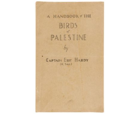
Lot 177
NO RESERVE Birds.- Middle East.- Hardy (Capt. Eric) A Handlist of the Birds of Palestine, first and only edition, typescript, line map of North and Central Palestine, original drab printed wrappers, lacking staples, so loose, folio, G. H. Q., Middle East Forces, [1946].⁂ A rare survival of the sole edition of British Army officer Eric Hardy's comprehensive list of the 364 bird species and 64 sub-species native to Palestine. He was secretary to the Jerusalem Naturalists Club, an organisation founded for the troops of Middle East Command to encourage interest in natural history. The work is summarised by Hardy as a 'privately printed list which, it is hoped, will be the forerunner of an authoritative and comprehensive handbook of Palestinian ornithology'; a project which seemingly did not come to fruition.
Lot 201
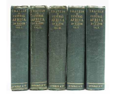
Africa.- Barth (Heinrich) Travels and Discoveries in North and Central Africa, 5 vol., first edition, half-titles in vol.1, 4 & 5 (not called for in vol.2 & 3), 60 tinted lithographed plates by Bernatz after Barth, 14 folding hand-coloured maps only (of 15, lacking map XV in vol.5), folding plan, numerous illustrations, with advertisement leaf and 24pp. publisher's catalogue at end of vol.1 & 4 and errata leaf at end of vol.5, small Arabic ownership stamp to half-title of vol.5, maps with some offsetting and a few short tears and repairs, tissue guards to plates browned, some spotting or light browning to text, hinges repaired, original blind-stamped green cloth, printed terracotta endpapers, rubbed and slightly stained, [Abbey, Travel 274], 8vo, 1857-58.⁂ Barth's five-year expedition with the British explorer James Richardson covered large parts of North and sub-Saharan Africa. He also produced an account of his travels in German but this work is not a direct translation.
Lot 204
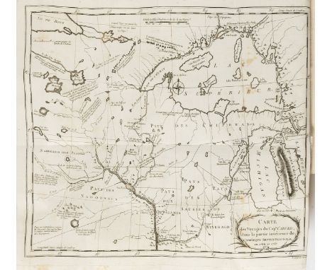
America.- Carver (Jonathan) Voyage dans les Parties Intérieures de l'Amérique Septentrionale, Pendant les annees 1766, 1767 & 1768, first edition in French, half-title, engraved folding map of the region around Lakes Michigan and Superior, a few small areas of foxing to map, some water-staining to lower margins towards end, occasional spotting, 19th century mottled boards, orange paper label to spine, 8vo, Paris, Pissot, 1784.
Lot 211
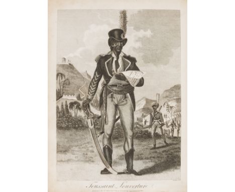
Caribbean.- Slave Revolt.- Rainsford (Marcus) An Historical Account of the Black Empire of Hayti, comprehending a view of the principal transactions in the Revolution of Saint Domingo, first edition, half-title, engraved frontispiece, folding map and plan, 8 engraved plates and 3pp. engraved facsimile letter, 3pp. advertisements at end, a few small stains, modern morocco-backed cloth, rubbing to upper joint, 4to, Albion Press, 1805.⁂ Account of the Haitian Revolution of 1791-1804, led by the ex-slave Toussaint Louverture, which created the first independent nation of Latin America and the Caribbean, the only one in history established by a successful slave revolt. It also became the first country to abolish slavery.

Lot 212
NO RESERVE Caucasus.- Wagner (Dr. Friedrich) Schamyl als Feldherr, Sultan und Prophet und der Kaukasus, second edition, wood-engraved frontispiece, engraved map, hand-coloured in outline, original wood-engraved pictorial wrappers, upper wrapper trimmed at head, spine worn, text block split in 2, 8vo, Leipzig, Remmelmann, 1854. sold not subject to return.

Lot 213
China & Mongolia.- Despatch from His Majesty's Minister at Peking, inclosing a Report by Mr. George J. Kidston on a Journey in Mongolia [with] Map to accompany..., nos. 3 & 4 only, folding lithographed map of Eastern Mongolia at end, ex-library copy with ink stamp on title, modern wrappers, folio, HMSO, 1904.
Lot 217
Greece.- Dodwell (Edward) A Classical and Topographical Tour Through Greece, 2 vol., first edition, folding engraved map, 2 errata leaves, 66 engraved plates, 2 hand-coloured, 6 folding, wood-engraved illustrations, some foxing and offsetting, contemporary half morocco, t.e.g., rubbed, [Atabey 356; Blackmer 492], 4to, 1819. ⁂ Dodwell was one of the most energetic of his generation of travellers. A great collector and archaeologist, he opened numerous tombs and kept much of their content. When he died he had 115 bronzes and over 140 vases.
Lot 220
NO RESERVE Italy.- Anville (Jean Baptiste Bourguignon d') Analyse Géographique de l'Italie..., first edition, 2 folding maps, engraved head- and tail-pieces, some 19th century hand-colouring and heightening with gum arabic, M², M³ and final map are detached, some light spotting and soiling, first map torn and repaired with tape, modern boards, g.e., 4to, Paris, by Estienne and sons, 1744.

Lot 230
Middle East.- 2 Photograph Albums, comprising tours of the Middle East, Egypt, India etc., numerous snapshots c.60 x 90mm. or vice versa, mounted on card leaves and captioned in white ink, tissue guards, one album with map drawn on front pastedown and including a few stamps and banknotes of local currency, original green velvet fastened with cord, the other mottled padded leather fastened with leather tie, upper cover embossed with scenes of Egypt highlighted in white, both rubbed, the first a little faded, oblong 4to, [1940s].⁂ The first is a record of a tour through Persia, Palestine, North Africa & Egypt, India (including snake charmers, a fakir sitting on a bed of nails, street-vendors etc.), Burma and Singapore. The second appears to be a serviceman's album including a few photographs of uniformed personnel and covers Palestine, Transjordan, North Africa, the Sudan, Egypt, and India. The last few photographs (captioned Tripoli) show Churchill reviewing troops.
![Middle East.- [Bell (Gertrude)] The Arab of Mesopotamia, first edition, frontispiece map, lightly browned throughout, occasio](https://cdn.globalauctionplatform.com/2589b8da-535e-41cd-8af6-ad1300ea03be/5e08600e-0a36-4973-8a00-ad1301149e12/468x382.jpg)
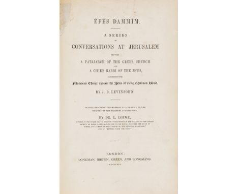
Lot 232
NO RESERVE Middle East.- Levinsohn (Isaac Baer) Efes Dammim. A Series of Conversations at Jerusalem...concerning the Malicious Charge against the Jews of using Christian Blood, translated by Dr.L.Loewe, first English edition, with offprint from the 'Daily Telegraph' of letter from the translator of 1883 tipped in at beginning, lightly foxed and browned, original cloth, spine and joints worn, 1841 § Viator. A Knapsack Guide to Palestine, with folding map in original wrappers loose in pocket at end (torn at folds, some repairs), original cloth, 1917 § Shaw (S.) Southern Palestine. Geological Map..., folding colour map in pocket, original cloth-backed printed boards, ex-M.O.D. library copy with red ink stamps to title, map and upper cover ("cancelled" on map), Jerusalem, 1947 § Aubin (E.) La Perse d'aujourd'hui: Iran. Mésopotamie, folding colour map, ink manuscript note to title, contemporary half cloth, Paris, 1908, a little rubbed, 8vo et infra (4)

Lot 233
Middle East.- War Office (Geographical Section), and others. Collection of six detailed maps of the Arabian Peninsula, third and fourth editions of maps of Riyadh, Medina, Mukalla, Aden, Muscat, and with a large 'Road Map of Iran, lithographs printed in colours, various sizes largest 840 x 870 mm (33 x 34 1/4 in), minor nicks and handling creases, some browning and surface dirt, unframed, rolled, [1940s or slightly later]; together with 5 further 20th century maps of the wider region, including Palestine, Egypt, and Israel, various sizes, all laid onto linen, 20th century (11)
Lot 239
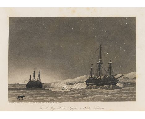
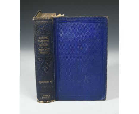
Polar.- Parry (William Edward) Journal of a Voyage for the Discovery of a North-West Passage. From the Atlantic to the Pacific; Performed in the Years 1819-1820, first edition, 14 plates, some aquatint, some steel-engraved, and 6 maps (4 folding), bookplate to pastedown, one map with lateral tear, some spotting to plates,contemporary half calf, lightly rubbed, rebacked preserving whole spine, 4to, John Murray, 1821.
Lot 241
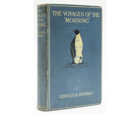
Polar.- Antarctic.- Doorly (Capt. Gerald S. ) The Voyages of the 'Morning', first edition, half-title, 16 plates, 6pp. music, folding map at end, large library stamp label to rear pastedown, occasional spotting, original pictorial cloth, light traces of labels, some staining and spotting, 8vo, Smith, Elder & Co., 1916.⁂ One of the great primary accounts from the 'heroic period' of Antarctic exploration. The 'Morning', commanded by William Colbeck, made two voyages to the relief of Scott's first expedition, 1901-04, with E.R.G.R. Evans as Second Officer and Doorly as Third.
Lot 248
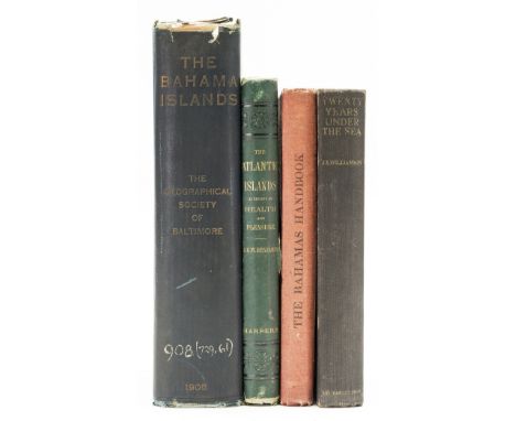
NO RESERVE West Indies.- Bahamas.- Shattuck (George Burbank) The Bahama Islands, half-title, plates, folding map (short tear), folding table, cracked hinges, ex-Ministry of Defence library with bookplate and ink-stamps to title, original cloth, rubbed, bumping to corners and spine extremities, shelf-mark to spine foot, New York, 1905 § Moseley (Mary) The Bahamas Handbook, first edition, frontispiece, plates, 4 maps (3 folding, 1 with short tear), bookplate, original cloth, small mark to upper cover, slight bumping to corners and extremities, Nassau, 1926 § Benjamin (S. G. W.) The Atlantic Islands as resorts of Health and Pleasure, first edition, wood-engraved frontispiece and illustrations, scattered spotting, cracked hinges, advertisements at end, occasional pencil underlining, original pictorial cloth, gilt, spine covering beginning to split at upper joint (but holding firm), bumping to corners and spine extremities, New York, 1878 § Williamson (J. E.) Twenty Years under the Sea, first English edition, portrait frontispiece, plates, occasional spotting, original cloth, slight bumping to corners and spine extremities, 1935, 8vo (4)
Lot 250
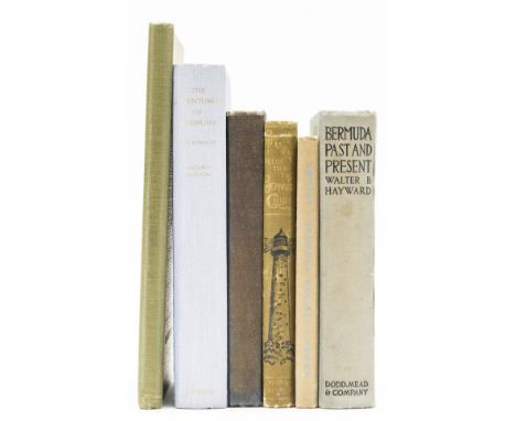
NO RESERVE West Indies.- Bermuda.- March (Bertha) Bermuda Days: Intimate Glimpses of the Happy Island, first edition, frontispiece, plates, folding map, scattered spotting, original cloth, browned spine, slight bumping to corners and extremities, New York, 1929 § Stark (James H.) Illustrated Bermuda Guide, frontispiece, illustrations (some full-page), maps, cracked hinges, advertisements at end, original pictorial cloth, slight bumping to corners and extremities, Boston, 1890 § Hayward (Walter Brownell) Bermuda Past and Present, frontispiece, plates, folding map, bookplate, original cloth, slight bumping to corners and extremities, New York, 1923; and others Bermuda, 8vo (6)
Lot 251
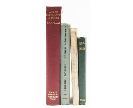
NO RESERVE West Indies.- Bermuda.- McCallan (E. A.) Life in Old St. David's Bermuda, first edition, frontispiece, plates, original cloth, slight bumping to corners, Bermuda, Bermuda Historical Monuments Trust, 1948 § Bushell (John J.) Picturesque Bermuda, plates, illustrations, folding map, previous owner's biro inscription to front pastedown, original pictorial cloth, slight bumping to corners and extremities, 1933 § Rider (Fremont) Bermuda. A Guide Book for Travelers, maps (1 folding), illustrations, original cloth, chipping to spine extremities, New York, 1922 § Bell (Euphemia Young) Beautiful Bermuda, illustrations and maps, original pictorial wrappers, tape repair to spine, date to upper cover, a little rubbed, New York and Bermuda, 1911, 8vo (4)
Lot 256
NO RESERVE World.- Vigne (G. T.) Travels in Kashmir, Ladak, Iskado, the Countries Adjoining the Mountain Course of the Indus and the Himalaya, North of the Panjab, 2 vol., first edition, 12 maps and plates, lacking folding map in pocket, contemporary half calf, covers rubbed and working loose, spines worn with loss, 1842 § Burnaby (Capt. Fred) On Horseback Through Asia Minor, third edition, portrait frontispiece and maps, original pictorial cloth, gilt, spines work, joints splitting but holding firm, 1877; and 36 others, travel and topography, v.s. (40)
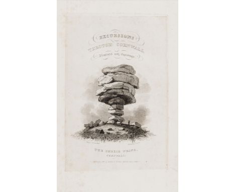
Lot 258
NO RESERVE Cornwall.- Stockdale (F.W.L.) Excursions in the County of Cornwall, folding engraved map, additional vignette title and 48 plates, all on india paper and mounted, light foxing, old boards, uncut, 1824; and 2 others, 8vo (3)⁂ With section entitled 'Description of the Mines in Cornwall, with an Excursion to the Scilly Islands' at end.
![NO RESERVE England.- Gillray (James), After. [Britannia], caricature map of England, pen and brown ink, with some coloured pe](https://cdn.globalauctionplatform.com/2589b8da-535e-41cd-8af6-ad1300ea03be/75724bb1-0e41-4023-becc-ad130114b386/468x382.jpg)
Lot 60
NO RESERVE England.- Gillray (James), After. [Britannia], caricature map of England, pen and brown ink, with some coloured pencil, on laid paper without watermark, sheet 185 x 155 mm (7 1/4 x 6 1/8 in), old folds and handling creases, minor spotting and surface dirt, unframed, [19th century]; together with six loose cuttings from a scrap album, unframed [19th century]


Lot 286
DU CHAILLU (P)Exploration and Adventures in Equitorial Africa, 1861, 8vo, folding map (a little torn and frayed), illustrations, publisher's cloth, spine ends chipped; SPEKE (John Hanning) Journal of the Discovery of the Source of the Nile, 2nd edition, 1864, 8vo, map and illustrations, publisher's cloth; WATERTON (Charles) Wanderings in South America, The North-West of the United States.., 1828, 2nd edition, 8vo, rebacked calf; PASHA (Rudolf C Slatin) Fire and Sword in the Sudan, London: Edward Arnold, 1896, 8vo, original cloth (4)
Lot 288
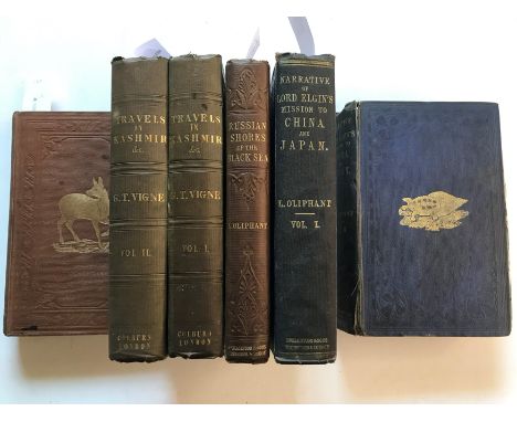
OLIPHANT (Laurence)Narrative of the Earl of Elgin’s mission to China and Japan in the Years 1857, '58, '59. London 1859, first edition, 2 vols., coloured plates, lacking map of China, publisher's cloth, a little shaken; The Russian Shores of the Black Sea, 3rd edition 1854, 8vo, folding map, illustrations, publisher's cloth; VIGNE (G T) Travels in Kashmir, 2nd edition, in 2 vols., London: Henry Colburn 1844, 8vo, lithographic portraits and views, sketch map, lacking folding map to pocket, some light foxing, original blind stamped cloth; [WILSON (W)] A Summer Ramble in the Himalayas, 1860, 8vo, title foxed, original cloth; (6)
-
109198 item(s)/page