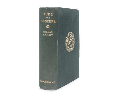
HARDY, Thomas (1840-1928). Jude the Obscure. London: James R. Osgood, McIlvaine and Co.,1896. 8vo. Half-title; etched frontispiece, engraved map. Original publisher's green cloth gilt, top edge gilt, others uncut (small L-shaped tear to head of spine, corners bumped, spine slightly leaned). FIRST EDITION IN BOOK FORM, published as Volume VIII of The Wessex Novels. Purdy, pp. 86-91.For condition inquiries please contact Gretchen Hause at gretchenhause@hindmanauctions.com
We found 109182 price guide item(s) matching your search
There are 109182 lots that match your search criteria. Subscribe now to get instant access to the full price guide service.
Click here to subscribe- List
- Grid
-
109182 item(s)/page
HARDY, Thomas (1840-1928). Jude the Obscure. London: James R. Osgood, McIlvaine and Co.,1896. 8vo (192 x 124 mm). Half-title; etched frontispiece, engraved map. 20th century green crushed levant gilt, edges gilt, STAMP SIGNED BY BAYNTUN-RIVIERE. FIRST EDITION IN BOOK FORM, published as Volume VIII of The Wessex Novels. Purdy, pp. 86-91.For condition inquiries please contact Gretchen Hause at gretchenhause@hindmanauctions.com
MELVILLE, Herman (1819-1891). Narrative of a Four Months' Residence among the Natives of a Valley of the Marquesas Islands; or, A Peep at Polynesian Life. London: John Murray, 1846.8vo. Map of the Marquesas Islands bound before pg. [1]. (Lacking half-title and 16 pp. publisher's advertisements.) 19th-century half calf gilt, edges marbled (some rubbing and wear). FIRST EDITION OF MELVILLE'S FIRST BOOK, FIRST STATE of page 19 ('Pomarea'), published just prior to the first American edition of the same year entitled Typee. BAL 13652.For condition inquiries please contact Gretchen Hause at gretchenhause@hindmanauctions.com
MELVILLE, Herman (1819-1891). Omoo: A Narrative of Adventures in the South Seas. London: John Murray, 1847.8vo. Frontispiece map. (Lacking 16pp. publisher's advertisements at end, a few leaves with light spotting). 19th-century half calf, marbled boards, smooth spine gilt, edges marbled (some light rubbing or wear). Provenance: Joan Emlyn (armorial bookplate).FIRST EDITION, published in the same year as the first American edition (see next lot). BAL 13655 (State A of signature 'P' [no priority]).For condition inquiries please contact Gretchen Hause at gretchenhause@hindmanauctions.com
MELVILLE, Herman (1819-1891). Omoo: A Narrative of Adventures in the South Seas. New York: Harper & Brothers, 1847.8vo. Half-title printed in red, title-page printed in black and red; frontispiece map. (Some spotting throughout.) Later marbled boards with modern rebacking; slipcase.FIRST AMERICAN EDITION, preceded by a London edition of the same year (see previous lot). BAL 13656.For condition inquiries please contact Gretchen Hause at gretchenhause@hindmanauctions.com
Amerika. America septentrionalis Novissima. - America Meridionalis accuratissima, Nord- und Südamerika, mit Kalifornien als Insel und figürlichen Kartuschen.Kolorierte Kupferstichkarte bei P. Schenck, 1696. Blattgröße ca. 48 x 56,5 cm, (Montageblatt 55,5 x 64 cm). Burden 722. Altersspuren; komplett aufgezogen, mit kleineren Defekten am unteren Mittelfalz sowie einigen Quetschfalten, dieser Bereich zusätzlich hinterlegt, insgesamt etwas gebräunt, stellenweise stockfleckig. "The most notable feature of this map is the two separate titles for North and South America. These, it is believed are etched by the noted artist Romeyn de Hooghe. The cartography reflects that typical of the period for Amsterdam ... California is depicted in a Foxe style insular format. The map is uncommon as clearly there were legal disputes over its issue" (Burden 722, S. 429).
ANON: FIRST ELEMENTS OF ASTRONOMY AND NATURAL PHILOSOPHY WHEREIN THE KNOWLEDGE OF THOSE SCIENCES ARE RENDERED MORE SIMPLE AND THE SOLAR SYSTEM DESCRIBED IN A FAMILIAR MANNER... TO WHICH IS ADDED A CONCISE SYSTEM OF GEOGRAPHY... THE WHOLE SELECTED FROM THE BEST AUTHORS FOR THE IMPROVEMENT OF YOUTH, London, for G Sael, 1796, 2nd edition, greatly improved, engraved folding frontis map and one plate as called for, 2pp adverts at end, 12mo, later cloth, one copy only on COPAC held at The British Library, no copy 1st edition traced
J C WALKER: A GEOLOGICAL MAP OF ENGLAND AND WALES SHOWING ALSO THE INLAND NAVIGATION BY MEANS OF RIVERS AND CANALS WITH THEIR ELEVATION IN FEET ABOVE THE SEA TOGETHER WITH THE RAIL ROADS AND PRINCIPAL ROADS, engraved hand coloured map, pub December 1835, dissected into 32 sections and backed onto linen, approx 1200 x 980mm
JOHN OGILBY: THE ROAD FROM MONMOUTH TO LLANBEDR..., engraved hand coloured road map circa 1698, plate 79, approx 325 x 420mm framed and glazed + RICHARD BLOME: A MAPP OF YE COUNTY OF MONMOUTH..., engraved hand coloured map circa 1715, approx 235 x 185mm, framed and glazed + THOMAS KITCHIN: A NEW MAP OF MONMOUTHSHIRE, engraved hand coloured map, circa 1764, approx 250 x 190mm, framed and glazed + THOMAS MOULE: MONMOUTHSHIRE, engraved hand coloured map circa 1845, approx 260 x 195mm, framed and glazed, (4)
SIR PAUL DUKES - 'THE STORY OF "ST 25" Adventure and Romance in the Secret Intelligence Service in Red Russia', published by Cassell and Company Ltd. 1938, a very rare book albeit in poor conditionCondition Report:Spine cocked, faded, titles faded. Remains of a Boots sticker on front board, ex-owners name on endpaper. Map, title page and initial pages up to No. 14 partially detached, pages 15,16,17,18 completely detached but present. Photograph detached and then taped in. Various other pages detached but none are missing.
GEORGE ANSON - 'A VOYAGE ROUND THE WORLD IN THE YEARS 1740, 1741, 1742, 1743, 1744', a new edition revised, printed for C & J Rivington 1828, (no map or illustrations) together with 'An Abridgment of Mr. Locke's Essay concerning Human Understanding, The eleventh edition, corrected, printed for S. Hooper 1724 (2)Condition Report:Anson - Missing initial pages but has title page. Leather very worn on spine with loss at top, boards worn and scratchedLocke - Missing top of title page, scratches to leather on spine and boards
Three assorted volumes on Yorkshire/South Yorkshire, comprising M.H. Habershon: "Chapeltown Researches, Archaeological and Historical; including Memories of Thorncliffe, its Ironworks and Collieries and their Antecedents", Sheffield, 1893, 1st edition, plates/ folding pedigree as called for, original cloth, plus Sam Wood: "Random Rhymes", Barnsley, W.R. Massie, provincial imprint, 60pp; plus Raistrick: "Yorkshire Maps and Map Makers" (3)
British Isles.- Ortelius (Abraham) Angliae, Scotiae, et Hiberniae, sive Britannicar Insularum Descriptio, Ortelius' earliest map of Britain, oriented with north to the right, and embellished with two ornate strapwork cartouches, a royal coat of arms, a compass and scale and five sailing ships, engraving with hand-colouring on laid paper with indistinct watermark, platemark 345 x 500 mm (13 1/2 x 19 3/4 in), sheet 440 x 550 mm (17 1/4 x 21 3/4 in), Latin text verso, central vertical fold with minor splitting, some marginal damp-stains, minor surface dirt and handling creases, unframed, [circa 1595]
British Isles.- Collection of over 45 maps of counties and regions of England & Wales, including maps by Robert Morden of Cambridge, Oxford, and Hertfordshire, two maps showing distribution of the Volunteer Force in 1883, two maps by Col. Colby from the Ordnance Map Office showing the River Thames, 38 maps of counties by J. Archer, and others, engravings, lithographs, some with hand-colouring, various sizes, from approx. 225 x 270 mm (8 3/4 x 10 5/8 in) to 370 x 510 mm (14 1/2 x 20 in), some minor surface dirt and browning throughout, handling creases, minor nicks and tears, all unframed, 17th to 19th century (45)
British Isles.- Brion de la Tour (Louis) Carte des Places Fortes et des Principaux Ports des Isles Britanniques et des Etats d'Hanovre..., large double-page map of the British Isles, with impressive title cartouche in the upper right corner, engraving with hand-colouring, on thick laid paper with rosary watermark, platemark 495 x 620 mm (19 1/2 x 24 1/4 in), sheet 550 x 650 mm (21 3/4 x 25 1/2 in), extensive expert restoration to old splitting and associated tears to platemark, some touches of restoration in manuscript facsimile, marginal nicks and tears, minor browning and surface dirt, unframed, [1756].
World.- Anonymous. Coronation King Edward VIII souvenir flag map, with a portrait of the King and a double-hemisphere world map with the British Empire coloured red, and the Royal Arms illustrated over a Union Jack background, colour-printed wood engraving on linen, 230 x 320 mm (9 x 12 1/2 in), small holes and rough edges, minor surface dirt, framed, [1936].⁂ The flag was printed in 1936 ready for the Coronation which was to take place the following year. However, Edward VIII chose love and marriage to Mrs Wallis Simpson rather than the throne and crown. Edward abdicated on 11th December 1936 and George VI was crowned instead.
NO RESERVE Britain.- Camden (William) Britannia siue Florentissimorum regnorum, Angliae, Scotiae, Hiberniae, et insularum adiacentium ex intima antiquitate chorographica descriptio...., engraved title by William Rogers, letterpress title with woodcut Royal arms bound after dedication, one folding engraved map only (Britannia Provincia Romanorum) by William Rogers, ten full-page engraved illustrations including map of Ireland and view of Stonehenge, several woodcut illustrations and decorative initials, small loss to lower right corner of engraved title, the folding map with some nicks and minor losses to extremities, occasional spotting and browning, modern calf reback with red label, gilt, boards very worn, 4to, George Bishop, 1600.Provenance:G. Harold Culshaw (bookplate to front pastedown)
Britain.- Hermannides (Rutgerus) Britannia magna, sive Angliae, Scotiae, Hiberniae et adjacentium insularum geographico-historica descriptio, engraved pictorial title, with 32 engraved folding plans, including the general folding map and map of London, the maps of Hull, Exeter and Oxford probably from another copy and tipped in, otherwise scattered nicks and tears, old folds, some spotting and browning, bookplate of Charles Edward Fewster, Hull, contemporary vellum, spine with ink title inscribed, yapp edges, soiled, 12mo, Amsterdam, Gillis Jansz Valckenier, 1661.Literature:cf. Howgego 13
NO RESERVE Britain.- Hermannides (Rutgerus) Britannia magna, sive Angliae, Scotiae, Hiberniae et adjacentium insularum geographico-historica descriptio, engraved pictorial title, with 31 engraved folding plans only, lacking the general folding map, but the map of London present, the first 170 pp. heavily cleaned, the pages thereafter with minor damp-staining and some browning throughout, rebacked, vellum restored at edges, worn, 12mo, Amsterdam, Gillis Jansz Valckenier, 1661.Literature:cf. Howgego 13
NO RESERVE Britain.- Senex (John) The Roads through England delineated or, Ogilby's Survey, Revised, Improved and Reduced to a size portable for the Pocket..., engraved title, engraved map of England & Wales and 101 uncoloured strip road maps printed back-to-back, title page frayed and torn with slight loss, water stained throughout with some discolouration to first part, final two leaves with closed tears crudely repaired with tape, new end papers, modern limp calf gilt, oblong 8vo, 1759.
NO RESERVE Britain.- Cary (John) Cary's Traveller's Companion, or a Delineation of the Turnpike Roads of England and Wales..., calligraphic title, advertisement and contents, general map of England & Wales and forty-one engraved maps only with contemporary outline colouring, lacking folding map of Yorkshire, maps printed back-to-back, minor off-setting, some spotting and surface dirt, contemporary tree calf, upper cover detached, rubbed and scuffed, 8vo, 1st Jan., 1790.
Britain.- Paterson (Daniel) Paterson's British Itinerary. Being a New and Accurate Delineation and Description of the Direct and Principal Cross Roads of Great Britain, 2 vol. in 1, frontispiece of a double-page engraved map of England & Wales with contemporary hand-colouring, calligraphic title, dedication, contents list and preface, index, 360 engraved strip road maps, printed in pairs and back to back, list of cross roads, errata and publisher's advertisement at rear, occasional browning and spotting, contemporary tree calf, gilt, red morocco label to spine, spine splitting, hinges cracked with loss to ends, other wear to extremities, 8vo, Carrington Bowles, 1785.
Britain.- Cary (John) Cary's New Map of England and Wales with Part of Scotland, engraved title, hand-coloured general map and 76 sheets (numbered 1-81), mostly engraved maps hand-coloured in outline but including dedication, key and scale as part of sheets, no sheets numbered 62, 71 or 80, [?] as issued, bound with index and list of places, occasional spotting and browning, minor off-setting, modern half calf, 4to, 1794.
NO RESERVE Britain.- Paterson (Daniel) Paterson's Roads, 18th edition, folding engraved general map frontispiece and 8 folding maps, the maps mounted on linen, the general map with some splitting and and repairs to minor loss, spotting and browning, the title on paper support, otherwise occasional light toning, rebacked modern half calf, original boards rubbed and worn, 8vo, Edward Mogg, Longman, Rees, Orme, et al., 1826; together with two copies of vol. 1 only of Paterson's 1785 British Itinerary, both with double-page general map and 188 strip road maps, and vol. 1 only of Carrington Bowles's Bowles's Post-Chaise Companion; or a Travellers Directory through England and Wales..., with 98 road strip maps, boards loose, worn 8vo, 1782-1785 (4)
NO RESERVE Map Curiosity.- Basire (James) A Map of Time, three circular engraved diagrams invented by F. King, with 4 pp. letterpress booklet of accompanying descriptive text, largest images each approx. 370 x 360 mm (14 1/2 x 14 1/8 in), handling creases and folds within margins, several nicks and tears, some into plates, surface dirt and browning, unframed, 1785 (3)
England & Wales.- Speed (John) The Kingdome of England, First edition, 'carte-a-figure' map with eight costumed figures to vertical margins, the seas decorated with ships and monsters, engraving with hand-colouring, sheet 395 x 530 mm (15 1/2 x 20 7/8 in), trimmed with border at left and right, margins restored with further associated loss restored in manuscript facsimile, central vertical fold reinforced verso with careful repairs to splitting and minor loss, unframed, John Sudbury & George Humble, [circa 1611]
Cornwall.- Saxton (Christopher) & Philip Lea. Cornwall... Corrected & Many Additions in the Roads, county map with inset view of Launceston surmounted by Royal coat-of-arms, and decorated with ships, sea-monsters and ducal arms, engraving with hand-colouring, 370 x 490 mm (14 1/2 x 19 1/4 in), under glass, laid on support with repairs to old splits and small loss, some areas restored in manuscript facsimile, spotting and browning, some damp-stains to lower edges, framed, [circa 1694].
Durham.- Speed (John) The Bishoprick and Citie of Durham, First edition, county map with inset town plan of Durham, engraving with some hand-colouring, sheet 420 x 510 mm (16 1/2 x 20 in), English text verso with first edition woodcut initial, central vertical fold with careful repair verso to minor splitting at foot, some even toning and light spotting, with minor surface dirt, unframed, [1611].
Hampshire.- Saxton (Christopher) & Philip Lea. Hampshire, county map with inset map of Winchester in the upper left corner, engraving with hand-colouring, platemark 400 x 430 mm (15 3/4 x 17 in), central vertical fold with careful repairs to old splitting, restoration to edges with some marginal loss and repaired tears, unframed, [circa 1695].
London.- Overton (Henry) A New & Correct Map of Thirty Miles Round London Shewing all the Towns, Villages Roads &c..., scarce circular map of the enirons of London, showing from Great Marlow in the West, clockwise to Baldock, Chelmsford, Canvey Island, Maidstone, Horsham and Godalming, with extensive key of place names to left and right edges, engraving with outline hand-colouring, on laid paper without watermark, 620 x 970 mm (24 1/4 x 38 1/4 in), central vertical fold with some splitting, other folds and handling creases with restoration to sheet loss and splits visible verso, numerous small tears at edges, notable loss just to the right edge of the title, trimmed with rough edges, minor surface dirt, unframed, [circa 1720]Literature:Howgego 67 (1)
NO RESERVE London.- Anonymous. An Accurate Map of the Country Sixteen Miles round London Drawn and Engrav'd from an Actual Survey, originally published in four parts with The Gentleman's Magazine, engravings, four sheets conjoined, total sheet approx. 430 x 410 mm (17 x 16 1/8 in), mounted on paper support, careful repairs to old splitting, nicks and small losses, unframed, [circa 1764]; together with John Harrison's A Map of Middlesex, engraving, 360 x 470 mm (14 1/8 x 18 1/2 in), unframed, 1787 (2)
-
109182 item(s)/page