We found 109198 price guide item(s) matching your search

Refine your search

Year

Filter by Price Range
  • List
  • Grid
  • 109198 item(s)
    /page

Lot 20

Knight (E.F.). Madagascar in War Time, the 'Times' Special Correspondent's Experiences among the Hovas during the French Invasion of 1895, Longmans, Green, & Co., 1896, black and white frontispiece, folding map at rear, three further black and white plates, scattered minor spotting, bookplate of Andrew Jameson to upper pastedown, original publisher's gold-coloured cloth, a little dust-soiled to spine, minor wear to extremities, 8vo (1)

Lot 200

Lincolnshire. Jansson (Jan), Lincolnia Comitatus Anglis Lincolne Shire, published Amsterdam, circa 1655, engraved map with contemporary hand colouring, slight overall toning, 400 x 500 mm, Latin text on verso, with another five maps and town plans of Lincolnshire including examples by Morden, Teesdale, Duncan, Stukeley and Cary, various sizes and condition (6)

Lot 201

*London. Flyn (J.), A New and Correct Plan of London, Westminster and Southwark with the New Building to the Year 1770, uncoloured engraved map, old folds, 300 x 510 mm, mounted, framed and glazed, together with, Vue D'optique, The South West Prospect of London, circa 1770, engraved view of London with contemporary hand colouring, title repeated in French, trimmed to image, 235 x 400 mm, mounted, framed and glazed (2)

Lot 207

Middlesex. Speed (John), Midle-Sex described with the most Famous Cities of London and Westminster, published George Humble, circa 1627, uncoloured engraved map, inset town plans of Westminster and London, inset vignettes of St. Peters and St. Pauls, some dust soiling, central fold split and frayed, 390 x 515 mm, English text on verso, later paper wrappers (1)

Lot 208

Northamptonshire. Blaeu (Johannes), Comitatus Northantonensis vernacule Northamton Shire, published Amsterdam, circa 1648, hand coloured engraved map, large ornate cartouche and mileage scale, slight spotting, largely confined to margins, 420 x 505 mm, French text on verso, together with, Saxton (Christopher & Kip William), Northamtoniae Comitatus Descriptio in quo Coritani olim Insederunt, [1637], uncoloured engraved map, slight spotting, central fold partially strengthened on verso, 290 x 360 mm, together with another fifty-eight engraved maps of Northamtonshire, including examples by Lewis, Archer, Morden, Kitchin, J & C Walker, Cary, Pigot, Harrison, Duncan, Teesdale, Seller/Grose, Fullarton, Collins, Greenwood and Moule, some duplicates, various sizes and condition (60)

Lot 21

La Mottraye (Aubrey de). Travels through Europe, Asia, and into Part of Africa; with Proper Cutts and Maps. Containing a great variety of geographical, topographical, and political obversations on those parts of the world; especially on Italy, Turky, Greece, Crim and Noghaian Tartaries, Circassia, Sweden, and Lapland, 3 volumes, 1st English edition, printed for the author [3rd volume printed for E. Symon & others], 1723-32, first volume with printed licence leaf facing title, third volume with engraved frontispiece, 56 copper engraved maps and plates, including many folding or double-page, first volume with short wormtrack towards centre of inner margins at rear, slightly affecting some plates, one folding map to second volume torn without loss, third volume with wormtrack to extreme lower outer corners at centre of volume, contents generally in very good, clean condition, contemporary full calf blindstamped calf, gilt decorated spines, rubbed and some wear to edges with joints to first and second volumes, partly cracked, folio (358 x 220 mm) Ex libris Thomas Johnes (1748-1816) of Hafod, with his bookplate to front pastedown of each volume. Atabey 661. Navari 946: 'This important work describes La Mottraye's travels over a 26-year period which took him through Northern Europe to Tartary and the Levant. The plates are of particular interest and include many signed by Hogarth which form part of his early work. They illustrate antiquities, objets d'art, and scenes of the eastern life.' (3)

Lot 210

Ogilby (John). The Continuation of the Road from London to Holy Head, circa 1675, uncoloured engraved strip road map, together with another copy with sparse early hand colouring, each 315 x 440 mm The road runs through Towcester, Daventry, Coventry, Coleshill and Lichfield. (2)

Lot 212

Pembrokeshire. Speed (John), Penbrokshyre described and the Sittuations both of Penbroke and St. Davids shewed in due form as they were taken..., 1st. edition, published John Sudbury & George Humble, [1611], hand coloured engraved map, inset town plans of Pembroke and St. Davids, 385 x 510 mm, English text on verso A good dark impression. (1)

Lot 213

Pigot & Co (Publishers). Pigot and Co.'s Maps of the Counties of Derby, Hereford, Lincoln, Leicester and Rutland, Monmouth, Nottingham, Salop, Stafford, Warwick and Worcester; with a General Map of Wales, [1828], large folding map of Wales and ten engraved county maps, all with contemporary outline colouring, each map approxmately 375 x 250 mm, publisher's paper wrappers with printed title, contained in later marbled slip case (1)

Lot 214

Portugal. Mercator (Gerard & Hondius Jodocus), Portugalliae Que Olim Lusitania, Novissima et Exactissima Descrtiption Auctore Vernando Alvaro Secco..., circa 1610, engraved map by Baptista van Doetecum, with contemporary hand colouring, three ornate strapwork cartouches, compass rose and rhumb lines, slight oxidisation to old watercolour causing slight cracking, repaired on verso, 335 x 495 mm, German text on verso One of the most attractive maps of Portugal and one of the few maps engraved for Hondius by Baptista van Doetecum. The map is a based upon Alvares Secco's map of 1561. (1)

Lot 215

Reference. Baynton-Williams (Ashley & Miles), New Worlds, Maps from the Age of Discovery, published Quercus, 2006, additional half title, numerous colour illustrations throughout, publisher's cloth gilt, d.j., folio, together with, Shirley (Rodney), Printed Maps of the British Isles, 1650 - 1750, published 1988, numerous uncoloured illustrations throughout, publisher's cloth gilt, d.j., 4to, with, Goss (John), The Map Maker's Art, published Studio Editions, 1993, numerous colour and black & white illustrations throughout, publisher's cloth gilt, d.j., folio, with another approximately seventy-two volumes on maps, cartographers and map collecting, various sizes and condition (approx.75)

Lot 216

Shropshire. Saxton (Christopher and Lea Philip), Shropshire accuratly drawen and sett forth by C S, corrected with some Additions by P Lea, circa 1693, hand coloured engraved map, inset town plan of Shrewsbury, one marginal closed tear, slight overall toning, 395 x 505 mm (1)

Lot 217

Shropshire. Speed (John), Shropshyre described, The Sittuation of Shrowesbury Shewed with the Armes of thos Earles and other Memorable things observed, published George Humble, circa 1627, hand coloured engraved map, large strapwork cartouche and mileage scale, inset town plan of Shrewsbury, central fold partially strengthened on verso, slight overall toning, 390 x 510 mm, English text on verso (1)

Lot 218

Staffordshire. Blaeu (Johannes), Staffordiensis Comitatus vulgo Stafford Shire, published Amsterdam, circa 1645, engraved map with contemporary hand colouring, ornate cartouche and mileage scale, 415 x 505 mm, Latin text on verso, together with another seven maps of Staffordshire, including examples by Walpoole, Archer, Morden and Saxton/Kip, some duplicates, various sizes and condition (8)

Lot 219

Suffolk. Saxton (Christopher), Suffolciae Comitatus continens in se Oppida Mercatoria 25 Pagos et Villas 464 una cum Singulis Hundredis & Fluminibus in eodem Vera Descriptio, circa 1579, engraved map with early hand colouring, ornate strapwork cartouche and mileage scale, central fold partially strengthened at base, slight creasing in mrgins, 340 x 480 mm With the bunch of grapes watermark. (1)

Lot 22

Martin (R. Montgomery). The Illustrated Atlas and Modern History of the World, published J.F.Tallis, circa 1857, uncoloured double page map of Liverpool, decorative title page, two comparison plates, seventy-eight (of 80), engraved maps with contemporary outline colouring (lacking Venezuela and Peru & Bolivia), a few maps with short marginal closed tears, some marginal spotting and finger soiling, a few maps trimmed with slight loss, descriptive text for Ireland with long closed tear, text for Jamaica frayed and creased, hinges and joints weak, contemporary half calf gilt, worn and frayed, folio Sold as a collection of maps, not subject to return. (1)

Lot 220

Surrey. Lindley (Joseph & Crosley, William). To the Kings most Excellent Majesty this Map of the County of Surrey from a Survey made in the Years 1789 and 1790, is with His Majesty's gracious Permission most humbly dedicated, published 1793, large engraved map with contemporary hand colouring, sectionalised and laid on linen, decorative uncoloured cartouche and table of explanation, one closed tear along old fold, 860 x 1120 mm, contained in contemporary card slip case, worn at extremities (1)

Lot 223

Warwickshire. Greenwood (C. & J.), Map of the County of Warwick from actual Survey made in the years 1820 & 1821 by C. & J. Greenwood, Dedicated to the Nobility, Clergy & Gentry of the County by the Proprietors and Published for them by George Pringle Junr. 1822, engraved map with contemporary hand colouring, sectionalised and laid on linen, on four sheets, calligraphic title, table of explanation, compass rose and uncoloured vignette of Warwick castle, very slight offsetting, edged in blue linen, 1320 x 1050 mm, contained in modern blue cloth slip case with morocco gilt label to spine (1)

Lot 224

Warwickshire. Saxton (Christopher & Kip William), Warwici comitatus a Cornauiis olim inhabitus, [1637], uncoloured engraved map, strapwork cartouche and mileage scale, 295 x 350 mm, bound with eleven pages of descriptive text, 20th century cloth boards, slim 4to, together with, Kitchin (Thomas), A New and Accurate Map of Warwickshire drawn from the best Surveys and Intelligence..., published R.Sayer, T. & J. Bowles, circa 1760, engraved map with contemporary outline colouring, sectionalised and laid on linen, slight staining, 670 x 530 mm, contained in contemporary card slipcase with printed label to upper cover, with, Richmond (George, publisher), New Map round Birminham from the Ordnance Survey, circa 1870, large engraved map with contemporary outline colouring, sectionalised and laid on linen, 1040 x 1270 mm, publisher's cloth boards, upper board detached, with another seven maps and part volumes similar, various sizes and condition (10)

Lot 225

Worcestershire & Warwickshire. Schenk (Pieter & Valk Gerald), Wigorniensis Comitatus cum Warwicensi nec non Conventriae Libertas, circa 1702, engraved map with bright contemporary hand colouring, 430 x 525 mm, together with, Blaeu (Johannes),Wigorniensis Comitatus et Comitatus Warwicensis nec non Coventrae Libertas. Worcester Warwik Shire and the Liberty of Coventre, published Amsterdam, circa 1648, engraved map with contemporary outline colouring, slight spotting, 415 x 510 mm, Dutch text on verso (2)

Lot 226

World. Bowen (Thomas), A New and Complete Chart of the World Displaying the Tracks of Captn. Cook and other Modern Navigators, circa 1780, uncoloured engraved world map on a Mercator projection, old folds, laid on modern paper, 340 x 465 mm, together with, Neele (S.), A General Chart of the World on Mercator's Projection exhibiting all the New Discoveries and the Tracks of the different Circum Navigators, 1795, uncoloured engraved map, old folds, one small closed tear affecting image, laid on modern paper, 345 x 445 mm, with, Bowen (Thomas), A New and Accurate Map of Asia, drawn from the most approved Modern Maps and Charts, circa 1780, uncoloured engraved map, old folds, laid on modern paper, 330 x 410 mm (3)

Lot 287

*Glover (George, 1778-1862, Archdeacon of Sudbury, Commissary of Norfolk, Vicar of Gayton and Rector of Southrepps). A good and continuous archive of letters to George Glover, circa 1802-43, including papers and letters concerning ecclesiastical preferments of George Glover, 1802-31, (45 letters and documents including Sudbury map); a group of 66 letters to Glover from George Nugent-Grenville, 2nd Baron Nugent (1788-1850), 1802-40; a group of approximately 50 letters from Augustus Frederick, Duke of Sussex (1773-1843, 6th son of King George III (1821-43); approximately 35 letters to Thomas William Coke, 1st Earl of Leicester (1756-1842), 1816-36; and a group of approximately 50 items of miscellaneous correspondence of George Glover, various lengths and sizes An unusually long and unbroken bundle of correspondence covering a wide variety of subjects both theological including Catholic Emancipation, but also political and personal. Provenance: Lots 287-291 by family descent. (a small carton)

Lot 33

Wyld (James). An Atlas of the World, Comprehending Separate Maps of its various Countries, Constructed & Drawn from the latest Astronomical & Geographical Observations, published James Wyld (Successor to Mr Faden), 1844, calligraphic title page, contents list, four comparison tables (including one double page), forty-four engraved maps with contemporary hand colouring, map of the Confederated States of Germany detached (possibly a copy from another volume), map of India stained, occasional dust and marginal finger soiling, later pencil ownership signature to front pastedown, contemporary half morocco gilt, rubbed and worn at extremities, 4to (1)

Lot 34

Yule (Henry). A Narrative of the Mission sent by the Governor-General of India to the Court of Ava in 1855m with notices of the Country, Government, and People..., Smith, Elder & Co., 1858, twenty-six lithographed plates (most tinted or colour), three chromolithograph maps, lacking folding black and red dissected map from front pocket, frontispiece creased and repaired to verso, scattered spotting, ownership inscription in ink to title, all edges gilt, original publisher's gilt decorated red cloth, repaired, 4to Abbey Travel 408. (1)

Lot 35

Armstrong (Mostyn John). An Actual Survey of the Great Post-Roads between London and Edinburgh, published 1776, title page with engraved oval vignette of a coach and horses, dedication (to Thomas Pennant) with old ink library stamp to verso, general map of the Post Roads, table and index and forty-four (complete) engraved road maps with sparse contemporary outline colouring and some later crude outlining of the main roads, a few more library stamps on the verso of some leaves, page 8 with repaired closed tear, later ownership signatures to preliminaries, later endpapers, modern panelled calf with gilt decorated spine, 8vo (1)

Lot 36

Armstrong (Walter). The Thames from its Rise to the Nore, 2 volumes, J.S. Virtue [1886-87], additional engraved titles, etched plates, illustrations, volume II front hinge broken, all edges gilt, original pictorial cloth, a few small stains, light edge wear, 4to, together with The Book of the Thames, from its Rise to its Fall, by Mr. and Mrs. S.C. Hall, 1867, mounted photographic prints, wood-engraved illustrations, a few leaves detached, front hinge reinforced, all edges gilt, original cloth gilt, rebacked with original spine relaid, a little rubbed, 8vo, plus Loftie (W.J.), Windsor. A Description of the Castle, Park, Town and Neighbourhood, 1886, etched plates and illustrations, a few spots, top edge gilt, original morocco-backed boards, rubbed with stains, limited large paper copy, 46/100, with others, mainly topographical, including John Fisher Murray's A Picturesque Tour of the River Thames, 1845, Our River, by George D. Leslie, 1881 and Henry Taunt's A new Map of the River Thames, 6th edition, circa 1890 (with new endpapers) (2 cartons)

Lot 37

Atkyns (Sir Robert). The Ancient and Present State of Glocestershire, 1st edition, 1712, engraved portrait frontispiece, eight untitled engraved plates of coats of arms of Gloucestershire families, double-page engraved county map, plan of the Gloucester City, plate of the West Prospect of Gloucester and North West prospect of Gloucester Cathedral, plus sixty-one double-page 'bird's eye' views of the seats of the nobility and gentry by Johannes Kip (complete), few marginal annotations, occasional light spotting, 19th century presentation inscription pasted to upper pastedown "Presented to the Rev. Heathfield Weston Hickes by the Members of the Painswick Book Club in grateful memory of the invaluable services of his late Brother Weston Hickes Esq. as Secretary of their Club for more than 40 years, Painswick, June 28, 1864", hinges repaired, early 19th century marbled calf, rebacked preserving original gilt decorated spine, joints splitting, minor wear to extremities, folio Upcott p.246-249. The rare first edition: many copies were lost in a fire at the printer's house in Whitefriars on January 30th 1712. Upcott notes that a similar fate befell copies of the second edition. Sir Robert Atkyns, MP and topographer was somewhat overshadowed by his father, who as chief baron of the exchequer was speaker of the House of Lords between 1689 and 1693. Atkyns refused to take the oath of allegiance to William III and retired to Pinbury Park in Gloucestershire. The first of the three major Gloucestershire antiquaries, the other two being Ralph Bigland (1712-1784) and Samuel Rudder (1726-1801), Atkyns collected material for parish histories in an attempt to record the population of each parish, based on the number of houses therein and the yearly birth and burial numbers. (1)

Lot 38

Atkyns (Sir Robert). The Ancient and Present State of Glocestershire, 2nd edition, 1768, eight single-page engraved armorial plates, sixty-five double-page engraved plates (complete) including county map, birds-eye plan of Gloucester, view of the West Prospect of Gloucester, Gloucester Cathedral and sixty-one birds-eye views of country seats by Kip, additional etched plate tipped onto verso of front blank of the ancient chesnut tree at Tortworth, by De La Motte, dated 1771, endpapers renewed, contemporary calf gilt, rebacked preserving original morocco title label, corners repaired, extremities rubbed and scuffed, folio (1)

Lot 382

Bible [English]. The Holy Bible, Containing the Old Testament and the New. Newly Translated out of the Originall Tongues..., Imprinted at London by Bonham Norton and John Bill, 1628, general and New Testament titles present, each within decorative woodcut borders, Apocrypha present, double-column black letter text, some close trimming with occasional slight loss to printed marginal notes, some early annotations and inscriptions to verso of New Testament title and final leaf of Revelation, complete with Genealogies by John Speed, containing double-page woodcut map (torn to lower border with loss), contemporary inscription 'Joseph Harison 166-' to lower margin of page 13 of Genealogies (cropped at foot with consequent loss to inscription), bound with an incomplete Book of Common Prayer at front and Psalms at rear, some dust & finger soiling, occasional dampstains & few marks etc. throughout, lacking free endpapers, later sheep over earlier boards, crude reback, boards rubbed and scuffed, 4to Herbert 411. (1)

Lot 388

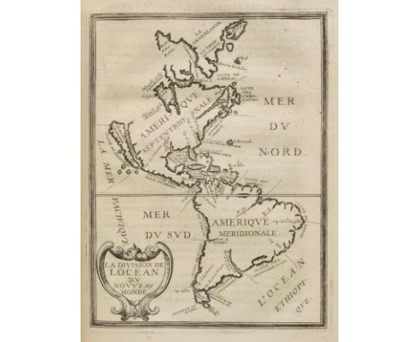
Blackmore (Richard). King Arthur. An Heroick Poem. In Twelve Books, 1st edition, printed for Awnsham and John Churchil and Jacob Tonson, 1697, a few minor marks, early ownership inscription in ink to front endpaper of William Hughes, and old bookplate of John Hughes of Glann Rafon to front pastedown, contemporary blind-panelled calf, rubbed and some wear, with joints partly cracked, folio, together with Philips (Katherine), Poems by the Most Deservedly Admired Mrs. Katherine Philips, the matchless Orinda. To which is added Monsieur Corneille's Pompey & Horace, Tragedies. With several other translations out of French, printed by J.M. for H. Herringman, 1667, without engraved portrait frontispiece, some soiling and wormtracks to margins, near-contemporary calf, rubbed and joints partly cracked, folio, plus Lyttelton (George Lord), Poetical Works, Glasgow, Andrew Foulis, 1787, some marks and minor soiling, presentation inscription to half-title 'Presented to Miss Spiers by Her Most Humble Sert R Graham', marbled endpapers, 18th century bookplate of Graham of Gartmore to front pastedown, contemporary full tree calf, gilt decorated spine, with red morocco title label, rubbed and with some marks and minor wear, folio, and Rowe (Nicholas), Lucan's Pharsalia, 1st edition, printed for Jacob Tonson, 1718, copper engraved frontispiece, folding map, engraved vignettes by Kirkall after Cheron, bookplate of Henry Edward Bunbury to front pastedown, contemporary panelled full calf, gilt decorated spine with morocco title label, rubbed and joints cracked, large folio, plus The Works of Michael Drayton... now first collected into one volume, 1748, contemporary full calf, joints cracked and some wear, folio Wing B3077 for the first work. (5)

Lot 40

Badeslade (Thomas & Toms, William Henry). Chorographia Britanniae, or a New Set of Maps of all the Counties in England and Wales, published C.Hitch & W.H.Toms, [1742], engraved double page title and dedication, four general maps of England & Wales, seven double page engraved letterpress tables and forty-three uncoloured double page engraved maps (only forty-two are called for but a duplicate map of Rutland is bound in with this copy ), occasional splits to central folds, slight staining and spotting throughout, later ink ownership signature to front pastedown, hinges and joints weak, contemporary calf rubbed and worn, 8vo Chubb CLXXIV. (1)

Lot 417

Le Noble (Eustache). Carta topografica dell' Isola del Maritaggio di Monsieur le Noble..., "Cosmopoli", 1765, 45pp., folding engraved allegorical map (short closed handling tear), scattered spotting, later limp wrappers (1)

Lot 424

Priolo (Benjamin). The History of France Under the Ministry of Cardinal Mazarine... Done into English by Christopher Wase, 1671, errata leaf and publisher's catalogue at end, some light soiling front endpaper detached, contemporary calf, manuscript label to spine, some wear, 8vo, together with The Whole Proceedings upon an Information Exhibited ex Officio by the King's Attorney-General against the Right Hon. Sackville Earl of Thanet, Robert Fergusson Esquire and Others, for a Riot and other Misdemeanours... To which are added, some Observations by Robert Fergusson on his own case..., 1799, folding plan at end, a few spots, inscribed by the author to title, original boards, spine defective, some soiling, 8vo, plus Observations on the Expedition of General Bounaparte to the East; and the Probability of its Success Considered... [by William Tooke}, 1798, folding engraved map (spotted with closed tear), publisher's list at end, some spotting, disbound, 8vo, with others including Copies of Original Letters from the Army of General Bonaparte in Egypt, Intercepted by the Fleet under the Command of Admiral Lord Nelson, 2 volumes, 6th & 3rd editions, 1798-99 (disbound), W. Wood's Zoography, or the Beauties of Nature Displayed..., 3 volumes, 1807 (with 60 uncoloured aquatints by William Daniell) and Charles Napier's Tales, Guensey, 1846 (24)

Lot 48

Camden (William). Guili. Camdeni Viri Clarrissimi Britannia sive florentiss. Regnorum Angliae, Scotiae, Hiberniae, Insulaumq Adiacentium ex Intima Antiquitate Descriptio, published G.Blaeu, Amsterdam, 1639, title page, sixteen (complete) uncoloured engraved folding maps, attributed to Pieter Van den Keere, one map (Warwicum, Northapton, Hunting etc.) split along old fold with crude sellotape repair, index bound at rear, text block split into two pieces, contemporary calf, worn and frayed, 8vo Chubb LV. (1)

Lot 51

Cary (John). Cary's New and Correct Engliah Atlas: Being a New Set of County Maps from Actual Surveys..., 1st edition, 1787, title, contents and dedication, general map of England & Wales and forty-five (complete as list) engraved maps with contemporary outline colouring, each with tissue guard and page of descriptive text, occasional tears with loss to tissue guards, map of Hertfordshire trimmed with slight loss to margin, Derbyshire with slight staining, index and tables bound at rear, near contemporary ownership signature to title page and front blank, book plate of John Cheesment of Christ Church Oxford to front pastedown, contemporary sheep gilt, upper board detached, rubbed and worn, 4to Chubb CCLX. (1)

Lot 52

Cary (John). Cary's Traveller's Companion, or a Delineation of the Turnpike Roads of England and Wales; Shewing the immediate Route to every Market Borough Town throughout the Kingdom, laid down from the best authorities on a New Set of County Maps..., 1819, calligraphic title with near contemporary ownership signature, advertisement and contents list, forty-three engraved maps with contemporary outline colouring, including one folding (Yorkshire), occasional slight offsetting, index bound at rear, bound with, Cary's New Itinerary or an Accurate Delineation of the Great Roads, both Direct and Cross throughout England ans Wales..., 8th edition, 1819, title and folding engraved map of England Wales with contemporary hand colouring, occasional splits along old folds, list of tables and six engraved folding maps with contemporary outline colouring, modern endpapers, modern calf retaining remains of original decorative gilt spine, 8vo (1)

Lot 522

Rackham (Arthur, illustrator). Alice's Adventures in Wonderland, by Lewis Carroll, with a Proem by Austin Dobson, William Heinemann, [1907], thirteen colour plates, letterpress illustrations, some full-page, contemporary pencil note at head of half-title, pictorial endpapers faintly spotted, original green cloth gilt, spine and returns faded, upper cover with stain to lower inner corner, small 4to in 8s, together with Peter Pan in Kensington Gardens, by J.M. Barrie, Hodder and Stoughton, circa 1920, twenty-four colour plates (a couple detached), map endpapers, original gilt decorated green cloth, one or two minor marks, spine lightly faded and a trifle frayed at ends, small 4to, plus a worn copy of Konig Nussknacker, by Heinrich Hoffmann (3)

Lot 538

Tallis (John). Tallis's History and Description of the Crystal Palace, and the Exhibition of the World's Industry in 1851, 2 volumes, circa 1851, numerous engraved plates, occasional light spotting, contemporary green half calf, heavily rubbed, 4to, together with Tombleson (William), Tombleson's Views of the Rhine, edited by W.G. Fearnside, 1832, numerous steel engraved views on india paper, tissue-guard to each, all edges gilt, contemporary dark green full morocco, marked and some wear, with a little loss to head of spine, 8vo, plus Artaria (Ferdinand, publisher), Nouveau Guide du voyageur en Italie, 4th edition, Milan, 1836, folding hand-coloured map frontispiece, numerous folding maps and plans, contemporary vellum gilt, rubbed, 8vo, and other miscellaneous 19th century antiquarian interest, including Charles M'Cormick, Memoirs of the Right Honourable Edmund Burke, 2nd edition, 1798, International Exhibition of 1862 Illustrated Catalogue, British Division, 2 volumes, circa 1862, Sergeant Major Cotton, A Voice from Waterloo, Brussels, 1847, etc., leather and cloth bound, many with some wear, mainly 8vo (but including some 4to) (3 cartons)

Lot 54

Clark (John). General View of the Agriculture of the County of Brecknock with observations on the means of its improvement, printed by J. Smeeton, 1794, bound without half-title, bound with Hassall (Charles), General View of the Agriculture of the county of Pembroke..., half-title, bound with General View of the Agriculture of the county of Carmarthen..., half-title, bound with General View of the Agriculture of the county of Cardigan..., printed by W. Smith, half-title, bound with Quayle (Basil), General View of the Agriculture of the Isle of Man..., printed by C. Macrae, half-title, engraved map frontispiece, occasional minor spotting, contemporary half calf, contrasting spine labels, a little rubbed and scuffed, 4to (1)

Lot 541

Yonge (J. E. ). Horace, Longmans, Green, & Co., 1868, folding map frontispiece, original green cloth, small 4to, together with Homer, Opera, 4 volumes (bound in 2), Paris: Lefevre, 1824, Greek text, minor scattered spotting, half morocco, rebacked with original spines relaid, small 8vo, plus Pearson (A. C., editor), Sophocles Fabulae, Oxford: Clarendon Press, 1924, Greek text, occasional manuscript annotation, modern cloth, 8vo, plus other Classical texts including LOEB publications (a carton)

Lot 55

Collinson (Rev. John). The History and Antiquities of the County of Somerset, Collected from Authentick Records and an Actual Survey made by the Late Mr. Edmund Rack, 3 vols., 1st ed., Bath, 1791, half titles, folding engraved map frontispiece to volume one, subscribers list, numerous engraved plates and plans, 19th century calf, elaborate gilt decorated spines with contrasting morocco labels, 4to, (Upcott 1146-47), together with Phelps (Rev. W.), The History and Antiquities of Somersetshire..., 3 vols. in two, printed for the author, 1839, lithograph and engraved plates and plans, dampstaining and spotting, armorial bookplate of J. Douglas Clephane Wickham, 19th century half morocco gilt with Wickham family crest to upper panel of each spine, 4to (5)

Lot 553

Maclise (D., illustrator). Moore's Irish Melodies, 1st edition, 1846, numerous black and white illustrations, ex-libris bookplate to front pastedown, contemporary inscription to front endpaper, some minor spotting, contemporary gilt-decorated green morocco bound by Hayday, boards and spine slightly rubbed with minor loss, large 8vo, together with Cox (Thomas), A Topographical, Ecclesiastical, and Natural History of Somersetshire, printed by Eliz. Nutt, 1700, pp. 720-911, black and white folding map to the front, some light spotting, later half morocco, boards rubbed with some loss to head, 4to, plus Caldecot (R., illustrator), Old Christmas, From the Sketch Book of Irving Washington, 1892, numerous black and white illustrations, ex-libris bookplates to front endpapers, contemporary inscription to half-title, some light spotting, contemporary gilt-decorated monogrammed red calf, bound by Murray's Nottingham Book Co. Ltd., spine slightly rubbed with minor loss, 8vo, (limited large paper edition, 57/25), plus other 18th to early 20th-century antiquarian literature and historical reference, all leather bindings, some decorative, condition is generally good/very good, 8vo/folio (3 shelves)

Lot 61

Depping (G.B.). L'Angleterre ou Description Historique et Topographique du Royaume-Uni de la Grande Bretagne..., published Paris, 1824, title page, folding engraved map of the British Isles with contemporary outline colouring, folding list of counties in French and English, decorative plate of mileage scales, fifty-eight (complete) engraved miniature maps with contemporary outline colouring, slight damp staining throughout, later endpapers, modern half cloth on marbled boards, 12mo (1)

Lot 66

Ellis (John). Ellis's English Atlas: or A Compleat Chorography of England and Wales in Fifty-four Maps, Containing more Particulars than any other Collection of the same kind..., published Carington Bowles, 1768, printed title with index printed on verso, title page frayed and worn with slight loss but not affecting text, fifty-four (complete) uncoloured engraved maps including six folding, all maps printed back-to-back, the first folding map has a long closed tear affecting image, crudely repaired, the map of Guernsey is split into two pieces along an old fold, all maps with near contemporary ink marginalia and with the principal roads crudely heightened with watercolour, blank leaves between maps with copious ink notes in a near contemporary hand, lacking preliminaries, disbound, retaining remnants of leather wrappers, oblong 8vo Chubb CCXXVIII. Sold as a collection of maps, not subject to return. (1)

Lot 69

Fenton (Richard). A Historical Tour Through Pembrokeshire, 1811, engraved portrait frontispiece & engraved title (strengthened at gutter and reattached), folding map and extra-illustrated containing a total of 56 engraved plates, few worm holes to fore-edge blank margins of initial leaves, some spotting, offsetting and browning, front free marbled endpaper partially adhered to paste-down at hinge with consequent skinning), top edge gilt, 19th century dark green half morocco, gilt decorated spine, upper joint split at head, joints and extremities rubbed and worn, 4to, together with Lewis (Samuel), A Topographical Dictionary of Wales..., 2 vols. in one, 1833, eleven engraved maps (including one folding), signature to vol. 1 title, fore-edge margin of one leaf of text repaired, occasional spotting and light dust-soiling, near contemporary half calf, joints splitting, wear to extremities, 4to (2)

Lot 7

Briet (Philippe). Parallela Geographiae Veteris et Novae, volume I only (of 3), Paris, 1648, title with engraved vignette, additional engraved title, 47 engraved maps, a few folding, numerous diagrams and illustrations, small waterstain to additional title, some spotting to first map, manuscript note at head of title, contemporary mottled calf, rebacked, some edge wear, 4to (1)

Lot 79

Hughson (David). Walks Through London, including Westminster and the Borough of Southwark, with the Surrounding Suburbs: Describing every thing worthy of Observation ... forming a Complete Guide to the British Metropolis, 2 volumes, 1817, lacking folding map, 96 engraved maps and plates on india paper, black and white illustrations to text, occasional scattered spotting, marbled endpapers, bookplate of William George Smith to pastedowns, green half morocco gilt (by Tout), slightly rubbed to joints and corners, 8vo (2)

Lot 82

Jefferys (Thomas). [Jefferys's Itinerary; or Travellers Companion through England, Wales and Part of Scotland, Containing all the Direct and Principal Cross Roads...., published R.Sayer and J.Bennett, 1775], title page torn with loss, preface and index, general map of England and Wales, 104 uncoloured engraved strip road maps, printed back to back, lacking map sheet 101/102 but with an additional duplicate map sheet 103/104 bound in upside down, map sheet 47 with tear to margin but with no loss to image, very occasional spotting, later endpapers, modern cloth, oblong 8vo Chubb CXLIV. (1)

Lot 84

Laurie (R.H., publisher). Laurie's New Traveller's Companion and Guide through the Roads of England and Wales including Great part of Scotland with a general Map and an Index Villaris &c. An Improved edition corrected to the present time, 1836, calligraphic title, advertisement, explanation and index, folding engraved map of England and Wales with contemporary outline colouring, and twenty-five (complete) double page engraved linear road maps with contemporary hand colouring, very slight spotting and offsetting, contemporary limp red burgundy morocco with envelope style cover, slightly stained, 4to (1)

Lot 85

Leigh (Samuel). Leigh's New Pocket Road-Book of England, Wales and Part of Scotland..., 2nd edition, 1826, frontispiece of a 'Table of the Price of Postage', additional decorative title, fifty-five (complete) uncoloured engraved county maps, folding engraved map of England & Wales with contemporary hand colouring bound at rear, later endpapers, contemporary green sheep with gilt title to upper board and spine, re-backed but retaining old spine, repaired at extremities, slight staining to boards, 12mo Chubb CCCLXXV. (1)

Lot 87

Lewis (Samuel, & Co., publishers). Atlas to the Topographical Dictionaries of England and Wales..., 1845, title page, folding engraved map of England & Wales with contemporary outline colouring, folding uncoloured engraved map of London and fifty-five engraved maps with contemporary outline colouring (including twelve folding), contemporary blindstamped calf with gilt decorated spine, slim 4to (1)

Lot 88

Lewis (Samuel, & Co., publishers). Lewis's Atlas Comprising the Counties of Ireland and a General Map of the Kingdom, 1837, calligraphic title with an engraved allegorical vignette, contents list, folding map of Ireland (some spotting) and thirty-two (complete as list) uncoloured engraved county maps, very occasional spotting, contemporary cloth glit, bumped at extremities, 4to (1)

Lot 89

Lewis (William, publisher). Lewis's New Traveller's Guide, or a Pocket Edition of the English Counties Containing all the Direct & Cross Roads in England & Wales..., circa 1819, frontispiece of an uncoloured engraved map of England & Wales, calligraphic title page with a black & white engraved vignette of a coach and postillions, preface (undated), contents list, list of mail coaches and cost of postage, forty-two (complete as list) uncoloured engraved maps, including one folding (Yorkshire), map of Middlesex with repaired corner, each map with a page of descriptive text, later endpapers, later quarter morocco gilt with vellum corners by Maltbys of Oxford, spine a little faded, 12mo Chubb CCCLXIV. The title page is undated but the preface usually has the date Oct. 16 1819. This copy has an undated preface. (1)

Lot 9

Buckingham (James Silk). Travels in Mesopotamia. Including a Journey from Aleppo to Bagdad, by the route of Beer, Orfah, Diarbekr, Mardin & Mosul; with researches on the Ruins of Nineveh, Babylon, and other ancient cities, 2 volumes, 1st octavo edition, 1827, folding engraved map, 2 folding lithographed plates to second volume, 26 (of 27) wood engraved illustrations (lacking plate 11 to volume 2, Tower of Babel to face page 359), some light spotting to folding map, otherwise generally in clean condition, contemporary diced full calf, gilt decorated spines, rubbed and some marks, 8vo, together with Chateaubrand (F. A. de), Travels in Greece, Palestine, Egypt, and Barbary, during the years 1806 and 1807, translated from the French by Frederic Shoberl, 2nd edition, printed for Henry Colburn, 1812, some some minor spotting to fore-margins, marbled endpapers, contemporary half calf gilt, rubbed and some wear to spines, with upper joints cracked, 8vo (4)

Lot 91

Malkin (Benjamin Heath). The Scenery, Antiquities, and Biography, of South Wales, from Materials Collected During Two Excursions in the Year 1803, 1st ed., 1804, twelve hand-coloured soft ground etched plates (including frontispiece), folding engraved map, armorial bookplate of Baron Northwick, all edges gilt, contemporary dark green straight grain morocco, elaborate gilt and blind decoration, 4cm horizontal scratch to upper board, 4to (1)

Lot 94

Oulton (Walley Chamberlain). Picture of Margate and Vicinity, London: Balwin, Cradock, and Joy, 1820, hand-coloured engraved map, twenty hand-coloured engraved plates including additional vignette title, bound without plate list, upper hinge strengthened, all edges gilt, early 20th century marbled calf, gilt decorated spine with red morocco labels, joints strengthened with tissue, 8vo (1)

Lot 95

Owen (Thomas). Owen's New Book of Roads; or a Description of the Roads of Great Britain..., 8th edition, 1799, frontispiece of an engraved folding map of England & Wales, 210 pages of tables and lists, bound with Ownen's New Book of Fairs published by the King's Authority..., a new edition, 1799, title page, publisher's advertisement and 122 pages of lists of fairs, index of towns bound at rear, later endpapers, modern cloth gilt, 8vo, together with, Mogg (Edward), Mogg's Pocket Itinerary; or an Entirely New and Accurate Description of the Direct and Cross Roads of England and Wales, with part of the Roads of Scotland..., 1826, additional decorative title, tables and list of roads, publisher's advertisement bound at rear, manuscript ownership signature to front endpaper, hinges cracked, contemporary half calf gilt, rubbed and worn at extremities, 12mo, with, Brookes (R.), The General Gazetteer; or Compendious Geographical Dictionary in miniature, 3rd. edition, 1806, six uncoloured engraved folding maps, slight spotting, contemporary calf with gilt decorated spine, rubbed and worn, 12mo, plus, Peacock (W., publisher), A Compendious Geographical Dictionary, Containing a Concise Description of the Most Remarkable Places, Ancient and Modern..., 1793, title page and advertisement, six folding engraved maps with contemporary outline colouring, marbled endpapers, modern calf, 12mo, with another twenty-nine atlases, road books and gazetteers, various sizes and condition (33)

Lot 97

Owen (John and Bowen, Emmanuel). Britannia Depicta or Ogilby Improv'd; Being a Correct Coppy of Mr Ogilby's Actual Survey of all ye Direct & Principal Cross Roads in England and Wales..., 1st edition, published Thomas Bowles & Emanuel Bowen, 1720, title page and four page of tables, 273 (complete) uncoloured engraved county maps and strip road maps, printed back to back, the last map appears to have either been cleaned or taken from another copy, book plate of Alexander Hamilton, contemporary blind stamped reverse calf, a little worn at head and foot of spine and extremities, 8vo Chubb CXLVII. The title page corresponds to the imprint required for the first edition, but the popularity of the book resulted in three editions being published in 1720 with no alteratioon to the title. (1)

Lot 98

Paterson (Captain Daniel). Paterson's British Itinerary Being a New and Accurate Delineation and Description of the Direct and Principal Cross Roads of Great Britain, 2 volumes (bound in one), 2nd. edition, published Bowles & Carver, 1796, frontispiece of a double page engraved map of England & Wales, calligraphic title to each volume, dedication and 388 uncoloured engraved strip road maps printed back to back on ninety-seven leaves, modern half calf gilt with contrasting morocco label to spine, 8vo (1)

Lot 9

Framed and glazed Map of Britain print

Loading...Loading...
  • 109198 item(s)
    /page

Recently Viewed Lots