

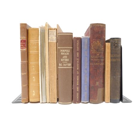
Arthur Henry Patterson: 'Rough Notes on the Fish & Fisheries of East Suffolk.', Great Yarmouth, John Buckle, 1910, for private circulation, copy 70 of a limited edition of 111 copies only, 3 photo plates, map & 12 plates after sketches, original roan backed printed paper covered boards; 'Catalogue of the Birds of Great Yarmouth. Giving a few descriptive notes, and dates when most of the rarer species were obtained', Great Yarmouth Printing Co Ltd, 1901, reprinted from The "Zoologist", for private circulation, limited edition (100), 12 illustrations as called for, original roan backed printed paper covered boards; J.H. Gurney Jnr: 'A Catalogue of the Birds of Norfolk', 1884, A.H. Patterson's copy, with his m/s note at foot of title page "with addenda 1885 (see end)" and blank leaf before addenda stating so in his m/s hand, very scarce offprint, Norfolk Library have only 1 copy and that without 1885 addenda, old calf gilt, interleaved with many blank leaves; 'The Naturalists' Journal Incorporated with which is the Naturalists' Guide', Huddersfield, 1901, pages 131-133 & 149-153 A.H. Patterson "From the log of the Moorhen" content, old cloth gilt; 'The Field Club: A Magazine of General Natural History', [1890-93], 4 volumes bound in 2 (all published), vol.4 pages 92-93 A.H. Patterson "A Rare Fish", uniform contemporary cloth gilt (6)
We found 109182 price guide item(s) matching your search
There are 109182 lots that match your search criteria. Subscribe now to get instant access to the full price guide service.
Click here to subscribe- List
- Grid
-
109182 item(s)/page
![[Charles Coleman Laing] : A Week on The Bure, Ant, and Thurne', 1895 “privately printed”, limited edition (this copy numbered](https://cdn.globalauctionplatform.com/c3d676e1-dbfc-4a6c-b513-ada600b1a8bd/b21a5bcc-bde4-470d-ad28-ada6010d246a/468x382.jpg)
[Charles Coleman Laing] : A Week on The Bure, Ant, and Thurne', 1895 “privately printed”, limited edition (this copy numbered 26), signed and inscribed by author on FFEP and dated 1895, also with ownership signature of Herbert Woods (1891-1954), founder of the Herbert Woods boatyard of Potter Heigham in 1929 and designer of the revolutionary Broads light Cruiser 'Speed of Light', 4 plates plus map as called for, 58pp + epilogue, original cloth gilt. An account of a Broads boating trip aboard the "May Fly". One copy only on Copac, signed association copy of a scarce title


W.A. Copinger, 2 titles: 'History of the Parish of Buxhall in the County of Suffolk', London, H. Sotheran, 1902, 1st edition, 24 plates and folding map as called for, large 4to, original cloth gilt, top edge gilt, 'County of Suffolk, Its History as Disclosed by Existing Records and Other Documents, being Materials for... The History of Suffolk, London, Henry Sotheran, 1904-05, 5 volumes, plus index volume compiled H.B. Copinger, Manchester, 1907, uniform original cloth gilt, top edges gilt (7)
![[Arthur Young]: 'General View of the Agriculture of the County of Suffolk', London, 1797, 2nd and fullest edition, engraved f](https://cdn.globalauctionplatform.com/c3d676e1-dbfc-4a6c-b513-ada600b1a8bd/1c75e8e4-7d61-4672-a523-ada6010d43e4/468x382.jpg)
[Arthur Young]: 'General View of the Agriculture of the County of Suffolk', London, 1797, 2nd and fullest edition, engraved folding hand coloured map and two engraved folding plates as called for, contemporary calf, rebacked retaining backstrip, later Morocco gilt labels, plus William & Hugh Raynbird: 'On the Agriculture of Suffolk', London, 1849, folding map and illustrations in text as called for, original cloth gilt, plus Robert Bloomfield: 'The Farmer's Boy; A Rural Poem', 1803, 7th edition, contemporary calf, plus Rider Haggard: 'A Farmer's Year', 1899, new impression, original cloth gilt (4)

Walter Rye, twenty three East Anglia history titles, including 'The Murder of Amy Robsart. A Brief for the Prosecution', London & Norwich, 1885, 1st edition, 91pp, paper wraps with m/s title to top wrap, original lower wrap present at end. Scarce book on Amy Dudley (nee Robsart) (1532-1560), heiress of Sir John Robsart of Syderstone, Norfolk. Her death by falling down a flight of stairs has often been regarded as suspicious, and caused a scandal at the time, despite the inquest's outcome, her husband Robert Dudley was widely suspected to have orchestrated his wife's demise, a view not shared by most modern historians; 'Some Early English Inscriptions in Norfolk', [nd], limited edition (61/375), numbered and signed by the author, original cloth, dust wrapper; 'Norwich Castle', Holt, 1921, 100 copies printed for subscribers only, folding map, 57pp, original printed wraps; 'A Month on the Norfolk Broads on board the Wherry, "Zoe", and its Tender, the Tub, "Lotus", [1887], 1st edition, 3 folding maps, original pictorial boards (worn); 'Songs, Stories and Sayings of Norfolk', 1897; 'Pedes Finium: Or Fines, Relating to the County of Norfolk', 1881, half calf gilt, plus 17 others (23)
![S.W.H. Aldwell, Vicar of Wingfield: 'Wingfield: Its Church, Castle & College', Ipswich, Harrison, [1925], 1st edition, si](https://cdn.globalauctionplatform.com/c3d676e1-dbfc-4a6c-b513-ada600b1a8bd/dd26267b-ca88-4d54-8d2b-ada6010dc0ee/468x382.jpg)

John Betts: 'New Itinerant & Commercial Map of England & Wales on which the various Lines of Railroad, the Turnpike & Principal Cross Roads, with the Courses of the Rivers & Canals are Carefully Laid Down', engraved map, 1841, folding backed onto linen, hand coloured in outline, approx 96 x 79cm, in original cloth gilt slipcase

Eleven Broadland related titles, comprising Ernest Suffling 3 titles: 'The Land of the Broads', London, L. Upcott Gill, [1885], 1st edition, folding map, original pictorial card wraps (scarce in wraps), 'The History and Legends of the Broad District', circa 1890, original pictorial card wraps, 'How to Organize a Cruise on the Broads', [1897], 1st edition, folding map, original pictorial cloth gilt (VGC); H.M. Leathes, 2 titles: 'Unnatural Natural History Notes', [1884], 1st edition, original card wraps, rebacked (scarce), 'Rough Notes on Natural History in Norfolk & The Eastern Counties', [1890], 1st edition, original pictorial card wraps; rev. G.N. Godwin: 'Marshland, Bure, & Thurne', circa 1895, folding map, 22pp + [2]pp ads at end, original printed wraps; Warner: 'Holiday Tramps Through Picturesque England and Wales', [nd], scarce, includes an extensive account of a cruise on the Broads (pp259-313, with folding map), original cloth; 'The Way About Norfolk & Suffolk', [1893], folding map, frontis, scarce, ex Ron Fiske with his bookplate, original cloth gilt, plus 3 others (11)
Thirteen Norfolk interest titles, including 'A Compleat History of Norfolk', T. Cox, 1730, excerpt from 'Magna Britannia', folding map backed onto linen, pp.251-457, ownership signature "F.H. Barclay [Northrepps] Oct. 1894" to first blank, contemporary calf, rebacked (not recent), bookplate Warren R. Dawson F.S.A. and typed letter signed addressed to him from Norwich City Librarian George Hayward dated 1936 tipped in; plus Rye: 'Recreations of a Norfolk Antiquary', 1920; 'Hunt & Co's East Norfolk &c. Directory', 1850; ''J.G. Harrod & Co's Posta;l & Commercial Directory of Norfolk', 1863; Arthur Young: 'A Six Weeks Tour Through the Southern Counties of England & Wales', 1769, 2nd edition, lacks map, rebound half calf gilt, new EP's, plus others George Christopher Davies, King's Lynn, Wymondham Church etc (13)
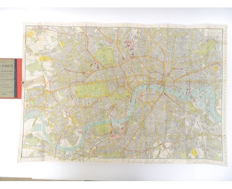
C. Smith & Sons 'Tape Indicator Map of London', circa 1910, divided into quarter mile squares for measuring distances, lithograph printed in colours with indicator tape affixed to left margin, approximately 61cm x 90cm, folding into original cloth gilt boards, 54, [2] pp alphabetical lists of streets affixed to upper cover; plus another similar 'Extended Tape Indicator Map of London', published C. Smith and dated 1896 - 1897, slightly worn, plus a 'W.H. Smith & Sons Map of Environs of London', circa late 19th Century, engraved hand coloured folding map, backed onto linen, covering Central London and out to Chesham, Epping, Knockholt and Woking, approximate size 74cm x 86cm, folding into original cloth boards, printed label to upper cover (3)

John Kirby of Wickham Market: 'The Suffolk Traveller', 1764, 2nd edition, large folding map + 4 folding road maps as called for, contemporary calf gilt, rebacked, plus Augustus Page: 'A Supplement to the Suffolk Traveller', Ipswich, 1844, subscriber's copy, bookplate of J.D. Hustler of Euston, contemporary half calf gilt, inner joints reinforced, plus 'John Kirby's Suffolk: His Maps and Roadbooks', Suffolk Records Society, 2004, 256pp, orig. cloth gilt, plus corresponding 12 maps (10 folding) housed in original printed envelope, all housed together in original card box, printed label to upper cover (3)


A small collection of scarce/early Norfolk Geology and Natural History related titles, comprising J.W. Robberds Jnr: 'Geological and Historical Observations on the Eastern Vallies of Norfolk', Norwich, Bacon & Kinnebrook, 1826, 1st edition, folding plan frontis, 76pp + errata leaf, contemporary calf backed boards; F.W. Harmer: 'The Testimony of the Rocks in Norfolk. A Popular Description of the Geology of the County', London & Norwich, [1877], hand coloured folding geological section map from Hunstanton to Yarmouth, 38pp, original printed card covers; Lubbock: 'Observations on the fauna of Norfolk : and more particularly on the district of the Broads', Norwich, HW Stacy, 1848, engraved folding map, contemporary half calf gilt; plus 1879 new edition of same work, large folding map, original cloth gilt; F.W. Harmer: 'The Glacial Geology of Norfolk & Suffolk, with a contour map showing the distribution of the glacial deposits of East Anglia', Jarrold & Sons, 1910, contour map + 7 ills. of which 3 full page plates as called for, orig. pictorial boards; Browne: 'Notes and Letters on the Natural History of Norfolk', 1902, original cloth gilt; Meldola & White: 'Report on the East Anglian Earthquake of April 22nd, 1884', Essex Field Club, 1885, 4 maps (2 folding), + ills. in text as called for, original cloth gilt (7)

A collection of twenty one view albums, tourist guides etc, South Coast of England and environs, circa late 19th/early 20th Century, including 'Stride's Album of Portsmouth & Southsea Views', 24 views on 16 folding concertina leaves (20 x 15cm), '150 Views of the Isle of Wight', London, Rock Brothers, (28 x 22cm), 'The Album of Brighton Views', London, Wm. Z, 14 views on 10 leaves, (19 x 14cm), 'Rock's Royal Chichester Cabinet Album', (19 x 14cm), 'The Album of Hastings and St. Leonards Views', 15 views on 16 leaves, (22 x 17cm), plus others Jersey, Bournemouth, Folkestone, Southampton, Ramsgate, Sherborne, Salisbury, Beaulieu Abbey etc, plus 'Nelson's Handbook for Tourists - The Isle of Wight', 1859, folding coloured map, coloured plates etc (21)


Tomas Lopez: 'Mapa de España y Portugal Al Ex. S. Marques de la Romana Vincente Beneyto Valencia del Cid. 1809', engraved hand coloured folding map of Spain, published Valencia, 1809 [1810], during the period of French Occupation of Madrid. This is one of only a few maps published in Valencia during the occupation, during a period where loyalty to the Spanish crown was in crisis. A Tribute to Spain's ongoing resistance against Napoleon in 1809. Dissected and laid on linen (possible later professionally laid onto linen). Generally VGC, very clean condition, housed in contemporary battered marbled paper covered slipcase, printed label bearing armorial crest to front. A rare separately published map from the Peninsular War/Spanish War of Independence period


Ten titles on fishing, many relating to fishing in Norfolk, including A.J. Rudd: 'The Illustrated Guide to Fishing in Norfolk Waters', 1896, inscribed by author to half title, folding map, original cloth gilt (VGC), plus later edition of same work, red cloth with mounted illustration to top wrap; Robert Moll: 'The Illustrated Guide to FIshing in Norfolk Waters', 1889, 1st edition, folding map etc, orig. printed wraps (worn), plus an 1893 4th edition of same work, rebound cloth, orig paper wraps covers laid down; Captain St. John Dick: 'Flies and Fly Fishing', London, 1873, 1st edition, original pictorial cloth gilt; Bazley: 'Great Northern Railway - Guide to Angling Resorts', 1909, orig. cloth backed pictorial boards (worn); John Greville Fennell: 'The Rail and the Rod; or Tourist-Angler's Guide', 1867, three parts in 1 volume, orig. blindstamped cloth gilt; Bazley 'Fishing Stunts', 1919; J.H. Keene: 'Fishing Tackle', Ward Lock, [1886], orig. pictorial cloth gilt, etc (10)

Edward Mogg: 'Paterson's Roads', London, 1826, 18th edition, large folding map of England & Wales (later laid down on coarse paper) + map of the Wye (trimmed/part loss at foot just affecting map) + 8 folding maps as called for, rebound half calf, new EP's, plus Robert Thoroton: 'The Antiquities of Nottinghamshire', 1677, a/f, 8 full page illustrations of coats of arms on 4 leaves + 48 engraved ills. of which 15 full page, including portraits, country seats, prospects of Newark etc (lacks map & many plates), folio, contemporary calf worn (2)
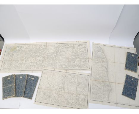
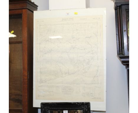
Ordnance Survey map of Norfolk, circa 1836-1838, eight separate engraved folding map sheets, each dissected and backed onto linen, each scale one inch to a mile, Ordnance Map Office, Colonel Colby, sheet numbers 50 (Diss, Eye & environs); 54 (Thetford, Bury St Edmunds, Ely & environs); 65 (Kings Lynn, Downham, Brandon, Wisbech, Littleport & environs); 66 (Norwich, Dereham, Watton, New Buckenham & environs); 67 (Yarmouth & environs); 68 (Wells, Fakenham, Cromer, Aylsham, Sea Palling & environs), 68 East Part (North Sea & Waxham); 69 (Burnhams, Hunstanton, The Wash, Lincolnshire & environs), all housed in battered original slipcase, Ordnance Survey printed title label

*** Please note, the description of this lot has changed ***Cyprus, Palestine & Singapore.- Kitchener (Horatio Herbert, Earl Kitchener of Khartoum, army officer, 1850-1916).- Sutherland (Angus, Royal Engineers, Senior Survey Officer of Singapore and Penang, 1848-1925) Presentation travel desk from Kitchener to Major Sutherland, presentation inscription on lid: "Sergeant Major A Sutherland R.E. from Lieut Colonel Kitchener R.E. Palestine - Cyprus", diced leather travelling desk, worn with loss, lid partially repaired using old cloth, brass handle, leather lids internally, [1886], containing letters, documents, photographs etc. relating to Sutherland and family, including: 2 ALs.s. from Kitchener to Sutherland, together 8pp., 8vo, Nicosia etc., inviting Sutherland to do the survey of Cyprus & a survey of the Holy Land, 1880 & 1883; Coordinates map of Perak [Malaysia], n.d.; Sutherland's Forms, Tables and Coefficients for Use in the Astronomical Observatory Singapore..., 1893 (2 copies); Sutherland's printed report, "Longitude of Penang", 1894 etc., folds, browned, v.s., v.d., 1880-1917 (qty).⁂ Sutherland worked with Kitchener on the surveys of Palestine, Cyprus (twice), as well as working later in The Straits Settlements and Penang. The travel desk was probably awarded by Kitchener to Sutherland in 1886, after six years working on the survey of Cyprus.

Voyages.- Chardin (Sir John) Journal du voiage en Perse & aux Indes Orientales, par la Mer Noire & par la Colchide, engraved additional pictorial title, portrait, folding map, 15 plates (some folding) and vignettes, additional title with a few holes to inner margin, just touching image in 1 instance, occasional spotting, contemporary calf, rebacked, corner little worn, rubbed, [Chadenat 2580], rare at auction, 12mo, Amsterdam, Jean Wolters & Ysbrand Haring, 1686.
World.- Maps.- Botero (Giovanni) Mundus imperiorum sive Relationes de praecipuis mundi imperijs, regnis et dynastiis, 5 folding engraved maps, some spotting and light staining, lightly browned, 19th century calf-backed limp marbled boards with vellum corners, spine gilt and with double leather labels, upper joint splitting, but holding firm, rubbed, small 4to, Oberursel, Cornelius Sutor, 1603.⁂ With a world map and Asia, Africa, Europe, and the Ottoman Empire.

Bible, English. The Holy Bible, Conteyning the Old Testament, and the New: Newly Translated out of the Originall Tongues, Second Folio edition, the "Great She Bible", black letter, text in double columns, 59 lines, printed within ruled border with enclosed inner and outer margins for sidenotes, roman type for chapter summaries, roman and italic for side-notes, general and New Testament title within ornate woodcut border (McKerrow & Ferguson 231), calendar in red and black, woodcut historiated and decorated initials, headbands and tailpieces, engraved More-Speed 1611 double-page map of Canaan and Speed's Genealogies inserted before Genesis, general title inner margin strengthened, slightly browned throughout, later endpapers, contemporary calf with ornate gilt corner and centre pieces, slightly rubbed, upper and lower cover panels inset into 19th century red morocco with double gilt borders, gilt spine, rubbed and faded, g.e., [Herbert 319; STC 2224], folio, Robert Barker, 1613-11.⁂ A very fine copy of one of the early King James folio bibles.Second folio edition of the King James Bible, also known as the "Great She Bible" for the more correct reading "she went into the citie" in Ruth 3:15. Also in Matthew 26:36 a corrected overslip of "Jesus" has been laid down over the error of "Judas" to lead the Apostles into the Garden of Gethsemane.

Roman Empire.- Panciroli (Guido) Notitia dignitatum, utriusque Imperii Orientis scilicet et Occidentis ultra Arcadij Honoriique tempora, 3 parts in 1, double column, woodcut fountain device to first title and printer's device to third title, double-page engraved map, numerous woodcut illustrations in text, woodcut head- and tail-pieces and decorative initials, occasional spotting and staining, lightly browned, new endpapers, contemporary vellum, yapp edges, spine with later gilt, black stamped star motifs and an olive morocco label, a solid copy, small folio, Geneva, Étienne Gamonet, 1623.
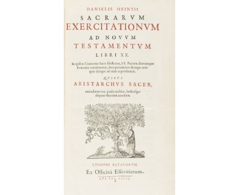
Bible commentaries.- Heinsius (Daniel) Sacrarum exercitationum ad Novum Testamentum libri XX, first edition, half-title, title in red and black and with woodcut printer's device, woodcut head- and tail-pieces and decorative initials, final f. blank, occasional spotting or light staining, lightly browned, contemporary calf, spine in compartments and with later gilt and red leather label, head of spine little worn, rubbed, especially at joints, [Willems 481], Leiden, House of Elzevier, 1639 § Le Clerc (Jean) Pentateuchus, sive Mosis prophetae libri quinque, 2 parts in 1, general and sectional titles in red and black and with woodcut ornament, 3 folding engraved maps, short neat tear to first map, occasional spotting and light staining, contemporary panelled calf, richly gilt spine in compartments and with later black leather label, spine ends and corners worn, joints splitting, but holding firm, rubbed, Amsterdam, Henrick Wetsten, 1696; and 5 others, including 3 Grotius NT commentaries, folio (7)
![Ireland.- [Stafford (Sir Thomas)] Pacata Hibernia. Ireland Appeased and Reduced or, An Historie of the Late Warres of Ireland](https://cdn.globalauctionplatform.com/a0988b56-ce15-46f3-a774-ad9e00bb6358/72659674-82d0-4dd4-a629-ad9e00db1583/468x382.jpg)
Ireland.- [Stafford (Sir Thomas)] Pacata Hibernia. Ireland Appeased and Reduced or, An Historie of the Late Warres of Ireland ..., 18 engraved plates only (of 19, lacking Speed's map of Munster, engraved portraits of Queen Elizabeth and the Earl of Totnes trimmed and pasted to front free endpaper verso and frontispiece recto, short tears to title expertly repaired, tear with neat repair (O4), short tear just touching text (Z3, 2M3 & 2N4), small marginal loss not affecting text (3B4), holes to margin at gutter affecting text (3C1-3C4), scattered marginal pencil notes, occasional marginal spotting and staining, bookplate, contemporary calf, rebacked and recornered, a little rubbed, [STC 23132], folio, Aug. Matthews for Robert Milbourne, 1633.
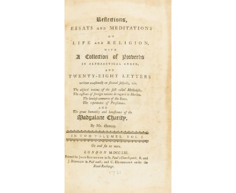
Hanway (Jonas) Reflections, essays and meditations on life and religion... The customs of foreign nations in regard to Harlots. The lawless commerce of the Sexes. The repentance of Prostitutes. And The great humanity and beneficence of the Madgalane Charity, 2 vol., first edition, engraved frontispieces, plate to vol. 2, occasional light spotting or soiling, pagination and collation somewhat erratic but seemingly complete, modern calf, for John Rivington, 1761 § Pugh (John) Remarkable Occurrences in the life of Jonas Hanway, first edition, engraved folding map, offsetting onto title, modern calf, J. Davies, 1787; and 5 others, naval, 8vo & folio (8)
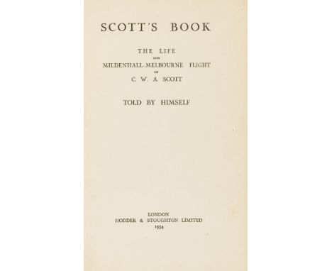
Scott (Charles William Anderson) Scott's Book: The Life and Mildenhall-Melbourne Flight, presentation inscription from the author "With thanks for returning that which was lost & now found" to front free endpaper, signed photograph of Scott loosely inserted, inscription offset to half-title, frontispiece detached and frayed, folding map detached, occasional light foxing, original cloth, lightly stained and faded, 8vo, 1935.⁂ Charles W. A. Scott was an aviation pioneer who, together with pilot Tom Campbell Black, won the 1934 London to Melbourne Air Race or the MacRobertson Trophy Air Race in just 71 hours, winning £15,000 (about £750,000 today) and making him world-famous.
![Greece & Turkey.- [Guillet de Saint-George (Georges)] Lettres écrites sur une dissertation d'un Voyage en Grèce, publié p](https://cdn.globalauctionplatform.com/a0988b56-ce15-46f3-a774-ad9e00bb6358/c6b54ab7-e00c-4049-8007-ad9e00daab57/468x382.jpg)
Greece & Turkey.- [Guillet de Saint-George (Georges)] Lettres écrites sur une dissertation d'un Voyage en Grèce, publié par Mr. Spon, médecin antiquaire. Avec des remarques sur les médailles, les inscriptions, l'histoire ancienne & la moderne, la géographie, la chronologie, & une carte des détroits de Constantinople, first and only edition, title with small woodcut ornament, engraved map, woodcut head-pieces and decorative initials, à6 blank, later pencil underlining, occasional spotting and light staining, lightly browned, new endpapers, covers of contemporary calf binding laid on to 20th century tan morocco, [Blackmer 768], 12mo, Paris, Estienne Michallet, 1679.⁂ Rare. A rebuttal to Spon's ruthless attack on his Athènes ancienne et nouvelle, 1675.
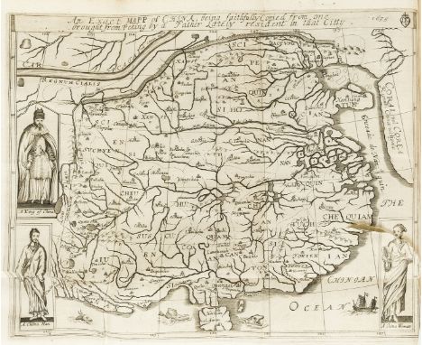
China.- Semedo (Alvaro) The History of that Great and Renowned Monarchy of China, 2 parts in 1 vol., first edition in English, 2 engraved plates, folding map (with short tear running from inner margin), 2 engraved full-page illustrations, woodcut initials and headpieces, some light soiling to title but very clean generally, contemporary calf, rebacked and recornered, new endpapers, [Wing S2490], folio, by E. Tyler for John Crook, 1655.⁂ A good copy of this important account of China. Alvaro Semedo served as Portuguese Procurado General for China.
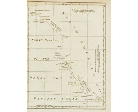
America & The North Pole.- Barrington (Hon. Daines) Miscellanies, first edition, 2 engraved maps (1 folding), 2 engraved portraits (one of the young Mozart, see below), 5 genealogical tables (1 folding), with a preface paginated *471-*477 and signed *0004-7 inserted between pp.470-471, water-staining to inner gutters of first few ff., spotting or light foxing, lightly browned, contemporary mottled calf, gilt, rebacked, preserving original backstrip in compartments and with black leather label, corners and lower edges worn, rubbed, [Hill 56; Sabin 3628], 4to, Printed by J. Nichols, 1781.⁂ Includes 'Tracts on the Possibility of reaching the North Pole'; 'Whether the Turkey was known before the Discovery of America', 'Account of Mozart, a very remarkable young Musician' with portrait of the young composer (the first published portrait, reprinted from Philosophical Transactions of 1770); 'Journal of a Spanish Voyage in 1775, to explore the Western Coast of N. America' (with map). The latter is the first and only contemporary account in English of the first Spanish voyage into Alaskan waters. There is also much relating to Thomas Pennant.Provenance: Lord Lloyd Kenyon (bookplate).

Low Countries.- Meteren (Emanuel van ) Historia Belgica nostri potissimum temporis Belgii sub quatuor Burgundis et todidem Austriacis principibus conjunctionem et gubernationem breviter, collation: (?)4 A-Z Aa-Zz6 Aaa-Eee6 Fff4 Ggg Hhh6, title within engraved historiated border, engraved folding map and circular portraits within text, small marginal worm trace at head at start, some spotting and water-staining, 19th century dark green morocco-backed limp marbled boards, vellum corners, gilt spine in compartments, rubbed, [Adams M1366], scarce, [?Antwerp], no printer, [1598, preface dated 1597] § Grotius (Hugo) Annales et historiæ de rebus Belgicis, first edition, title with woodcut printer's device, fine engraved full-page portrait of the artist, woodcut decorative initials and tail-pieces, pencil underlining and marginal markings, tear to final f. within text, but with minor loss, occasional spotting, contemporary speckled calf, sympathetically rebacked, corners repaired, Amsterdam, Johann Blaeu, 1657; and a defective copy (with the majority of portraits and plates) of Grotius' Jaerboeken, 1681, folio (3)

Geology.- Dechen (Ernst Heinrich Karl von) Geognostische Übersichts-Karte von Deutschland, Frankreich, England und den angrenzenden Laendern, folding hand-coloured engraved map, 650 x 900mm., small hole to blank part of English Channel, lightly browned, the odd small stain, linen-backed and dissected, folding into contemporary shagreen, brass clasp, rebacked, corners worn, rubbed, Berlin, Simon Schropp & Co., 1839.⁂ Rare. Dechen 'prepared numerous geological maps, which Humboldt described as models in this field and which for long were standard' (DSB). This map is one of Dechen's earliest. It extends from the east coast of Ireland to the Pyrenees, and westwards as far as Vilnius and the eastern edge of the Carpathians. Dechen (1800-1889) was a German geologist, who became director of the Prussian mining department. The mineral Dechenite was named after him by Carl Wilhelm Sigismund Bergemann in 1850.
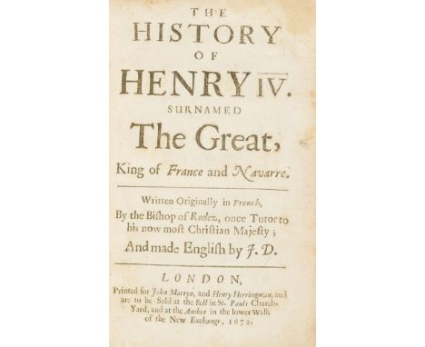
Péréfixe de Beaumont (Hardouin de) The history of Henry IV. surnamed the Great, King of France and Navarre, title lightly browned, very light damp-staining, endpapers renewed, contemporary calf, rebacked and recornered, [Wing P1465eA], for John Martyn, 1672 § Savage (John) The Antient and Present State of the Empire of German [& A Compleat History of Germany], 2 vol., folding engraved map of Germany to vol.1, engraved portrait frontispiece and plates to vol.2, bookplates of James Hamilton, contemporary panelled calf, gilt coat-of-arms to covers, spines rubbed, joints cracked but holding firm, for A. Robert et al., 1702; and 12 others, European histories etc., v.s. (15)⁂ Provenance: bookplates and coat-of-arms of James Hamilton, 4th Duke of Hamilton. In 1712 Hamilton fought a celebrated duel with Charles, Lord Mohun in Hyde Park, following the death of Fitton Gerard, third Earl of Macclesfield, who died without an heir.
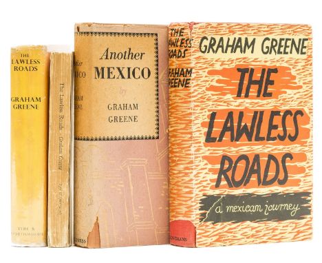
Greene (Graham) The Lawless Roads, first edition, second issue with plain map endpapers and photographic illustrations, the spine lettered in black and top edge un-stained, occasional light foxing or spotting, light browning to endpapers, original cloth, light fading to foot of spine, some bumping to extremities, dust-jacket, price-clipped, spine a little dulled, spine ends and corners chipped with loss to 1" of spine at foot, closed tear with creasing to upper panel, 1939; and three others, the first American with the third edition of the same with proof, 8vo (4)

Middle East.- Pelly (Lewis) A Visit to the Wahabee Capital, Central Arabia, in The Journal of the Royal Geographical Society, vol. 35, pp. 169-191, folding map, 10 other folding maps, photographic plate, general title mounted on stub, modern library cloth, 8vo, 1865.⁂ Also included are Richard Burton's On Lake Tanganyika, and other articles on Cambodia, Kurdistan, Greenland, the North Pole, and north-west Australia.
![Denmark.- M[anley] (Sir R[oger]) The History of the Late Warres in Denmark, first edition, folding engraved map and 3 folding](https://cdn.globalauctionplatform.com/a0988b56-ce15-46f3-a774-ad9e00bb6358/7d959e8e-0ae0-46e0-bc15-ad9e00dbb3d2/468x382.jpg)
Denmark.- M[anley] (Sir R[oger]) The History of the Late Warres in Denmark, first edition, folding engraved map and 3 folding plates, advertisement f. at end, woodcut initials and headpieces, occasional light marginal staining, N1 with chip to margin, contemporary calf, spine repaired at foot, cracking to upper cover, some rubbing to extremities, [Wing M439], folio, for Thomas Basset, 1670.
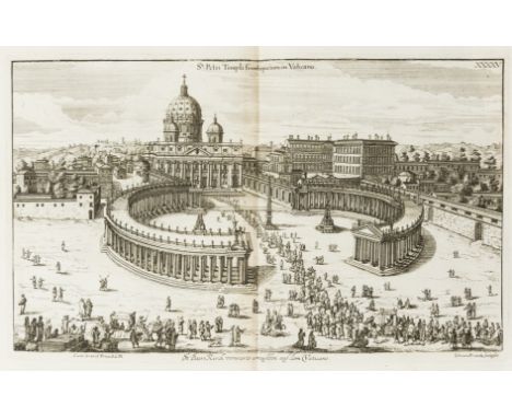
Rome.- Sandrart (Joachim von) Romæ antiquæ et novæ theatrum, engraved double-page additional pictorial title, double-page map of ancient Rome, large folding map of modern Rome and 61 plates and plans (of 69), some folding or double-page, modern Rome map with hole (c.30 x 20mm.) at fold, plate XXXXX* with split at fold, some spotting and (water-)staining and light browning at folds, 19th century red straight-grain morocco, gilt, spine in compartments, spine faded, rubbed, Nuremberg, Christian Sigismund Froberg for the author, 1684; and a volume of 24 double-page engravings, attributed to Giovanni Battista Fontana, illustrating events of the Dacian Wars as depicted on Trajan's Column in Rome, small folio (2)
Greene (Graham) Journey Without Maps, first edition, photographic plates, map endpapers, original cloth, light toning to spine, spine ends and corners bumped, short split to head of spine, light toning and surface soiling to covers, 8vo, 1936.⁂ Greene's first travel book and one of his rarest titles in first edition.

Kircher (Athanasius) Mundus subterraneus, in XII libros digestus, 2 vol. in 1, first edition, double-column, 2 engraved pictorial titles, printed title to vol.1 with engraved vignette, engraved portrait of Pope Alexander VII (but without the portrait of the author), 22 plates and maps (including 1 smaller woodcut plate at p.30 in vol.2), most double-page or folding, numerous engraved or woodcut illustrations in text, 7 letterpress tables, all but 1 double-page, 1 double-page table in vol.2 trimmed at foot with loss of text, sig. Nn misbound, single-page map 'Hydrophilacium' and smaller woodcut plate loose, water-stained, causing some purple damp-spotting in a few instances, occasional spotting, contemporary calf, rebacked, upper corners repaired, covers rubbed and scuffed, [Caillet 5783 'Le plus curieux des nombreux ouvrages de ce savant. - Ce monde souterrain est plutôt un monde kabbalistique'; Ferguson I, p. 467; Sabin 37967; cf. Duveen p.322 (1678 edition)], folio, Amsterdam, J. Jansson & E. Weyerstraten, 1665.⁂ First edition of Kircher's survey of the subterranean world, which is based on his visit to Sicily in 1637-38, during which he witnessed the eruptions of Etna and Stromboli. Includes geology, metallurgy, mining, mineralogy and meteorolgy, coupled with speculation on more esoteric subjects, such as the possibility of underworld inhabitants. The world map (Shirley 436) is one of the earliest to depict the movement of ocean currents with any degree of accuracy.
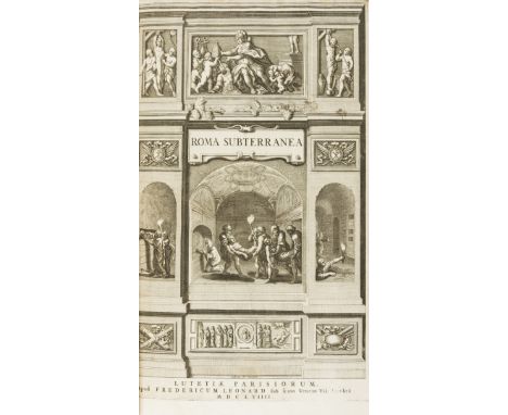
Rome.- Subterranean Rome.- Aringhi (Paolo) Roma subterranea novissima, 2 vol. in 1, fine engraved additional historiated title, half-title to vol.2, titles with woodcut printer's device, engraved folding map, numerous engraved and woodcut illustrations and plans in text, some full-page, map lightly browned in places, vol.2 D1 tear within text without loss, occasional spotting or light staining, contemporary mottled calf, gilt spine in compartments and with new double leather labels, head of spine worn, upper joint splitting, but holding firm, rubbed and scuffed, folio, Paris & Cologne, no printer, 1659.⁂ Aringhi's Latin translation expands on Antonio Bosio's Roma sotteranea, which was unfinished at the time of his death in 1629. Bosio was the first person to extensively explore the catacombs.
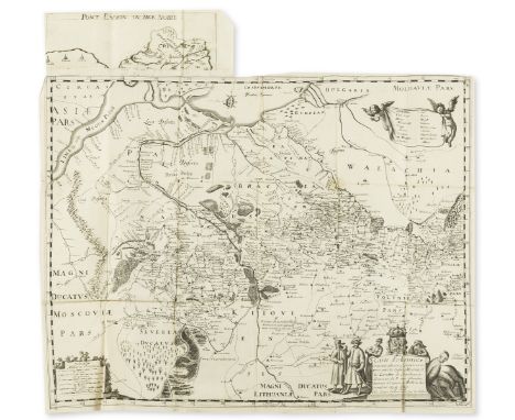
Ukraine.- Beauplan (Guillaume Levasseur, Sieur de) Description d'Ukranie, qui sont plusieurs provinces du Royaume de Pologne. Contenuës depuis les confins de la Moscovie, jusques aux limites de la Transilvanie, small woodcut ornament to title, large folding engraved map with extension piece at head, 2 woodcut plates, woodcut illustrations in text, woodcut head-pieces and decorative initials, some pencil underlining and passage marking, map with a few small splits at folds, and some light staining and creasing, occasional spotting, contemporary limp vellum, spine with later gilt, stamped black foliage decoration and a black morocco label, nick to spine near head, lightly soiled, edges stained red, small 4to, Rouen, Jacques Cailloüé, 1660.⁂ Rare. Beauplan was a French-Polish cartographer, engineer and architect. In 1639 he created the first descriptive map of Ukraine. The present work, first published under the title Description des contrés du Royaume de Pologne in 1651, gives a geographical, economic, and demographic description of Ukraine.
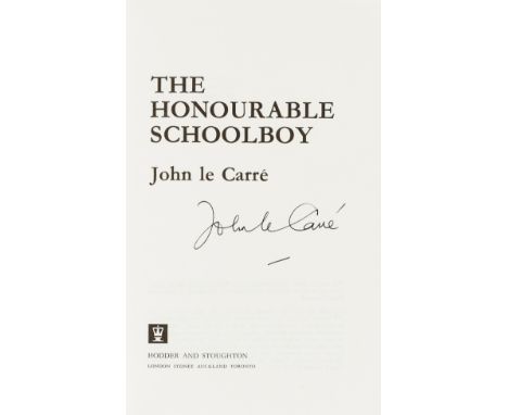
Le Carré (John) The Honourable Schoolboy, first edition, signed by the author on title, plain endpapers, original boards, light bumping to spine ends, dust-jacket, price-clipped, some rubbing and light creasing to head and foot, near-fine otherwise, 8vo, 1977.⁂ The second title in the Karla trilogy. There are two issues with either map or plain endpapers, seemingly without any established primacy.

Bible, Dutch.- Biblia, Dat is De gantsche H. Schrifture vervattende alle de Canonijcke Boecken des Ouden en des Nieuwen Testaments, 4 parts in 1, engraved pictorial title, double-page world map by N. Visscher and 5 double-page maps and plans of the Holy Land, woodcut historiated and decorative initials, engraved title trimmed to border and laid down, maps and plans lightly browned and with a little staining, marginal water-staining at head, occasional spotting and staining, lightly browned, late 18th / early 19th century green morocco-backed burgundy morocco, ?later metal centre- and corner-pieces, rubbed, a solid copy, folio, Dordrecht, [Printed by Jacob Braat] for Ian Barentsen Smient & Helmich van Cappel, 1662.
![[Hanway (Jonas)] A Journal of Eight Days Journey from Portsmouth to Kingston upon Thames; through Southampton, Wiltshire, &am](https://cdn.globalauctionplatform.com/a0988b56-ce15-46f3-a774-ad9e00bb6358/158f162e-84ca-4d7a-a1cd-ad9e00dbdf47/468x382.jpg)
[Hanway (Jonas)] A Journal of Eight Days Journey from Portsmouth to Kingston upon Thames; through Southampton, Wiltshire, &c...To which is added, An Essay on Tea, 2 vol., second edition, engraved folding frontispieces, occasional foxing or light soiling, modern crushed morocco, H. Woodfall & C. Henderson, 1757 § Pugh (John) Remarkable Occurrences in the Life of Jonas Hanway, first edition, folding engraved map, occasional spotting, modern calf, for the Author, 1787; and 4 others, 8vo (7)
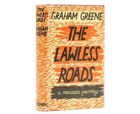
Greene (Graham) The Lawless Roads, first edition, first issue with yellow map endpapers, photographic illustrations tinted blue, the spine lettered in gilt and top edge stained yellow, photographic plates, neat contemporary ink ownership inscription to endpaper, original cloth, spine a little darkened, light surface soiling to covers, spine ends a little bumped, dust-jacket, price-clipped, light toning to spine, 2 small puncture marks, spine ends and corners a little chipped, some splitting to upper fore-edge, a few small surface abrasions, but a very good example overall, preserved in custom slip-case, 8vo, 1939.⁂ The rare first issue with a number of differences in the production between this and the second issue (see next lot). The Lawless Roads is Greene's account of his 1938 trip to Mexico, a visit that would also provide the basis for The Power and the Glory.
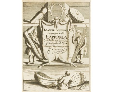
Lapland.- Schefferus (Joannes) Lapponia id est regionis Lapponum et gentis nova et verissima descriptio, first edition, engraved additional pictorial title (dated 1674), printed title in red and black and with woodcut vignette, folding engraved map, woodcut illustrations in text, some full-page, errata f. at end, some underlining and passage marking in brown or ordinary pencil, single small wormhole to inner gutter of around first half of the work, little offsetting to map, foxing, occasional staining, lightly browned, later vellum, flat gilt spine in compartments and with black stamped floral motifs and a black leather label, yapp edges, little marked and stained, small 4to, Frankfurt, Johann Andreae for Christian Wolff, 1673.⁂ First edition of the first comprehensive study of the Sami people, and for long the most important source of information on Lapland and its inhabitants.
![Classics.- Caesar (Gaius Julius) [Opera] quae exstant, engraved pictorial title, folding map and full-page illustrations, som](https://cdn.globalauctionplatform.com/a0988b56-ce15-46f3-a774-ad9e00bb6358/66c2ae77-9e09-4875-b374-ad9e00dada2f/468x382.jpg)
Classics.- Caesar (Gaius Julius) [Opera] quae exstant, engraved pictorial title, folding map and full-page illustrations, some ink staining, occasional spotting, Amsterdam, House of Elzevier, 1670 § Plinius Secundus (Gaius) Epistolæ et Panegyricus, engraved vignette to title, lacking initial and final blanks, occasional spotting and light staining, [Wing P2578], Oxford, Sheldonian, 1687, contemporary calf, the first mentioned armorial, rebacked in later red morocco, gilt, spines in compartments, some with floral motif, some fading, rubbed; and 15 others, Classics, similarly bound, 8vo (17)
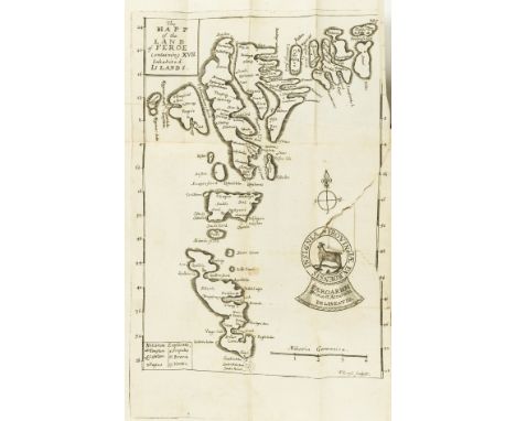
Faroe Islands.- Debes (Lucas Jacobsen) Faeroae, & Foeroareserata: that is A Description of the Islands & Inhabitants of Foeroe, translated by John Sterpin, first edition in English, folding map (torn), lacks folding plate of whirlpool, contemporary gilt panelled morocco, rebacked in later calf, gilt, g.e., [Wing D511], 12mo, printed by F.L. for William Iles, at the Flower-de-Luce in Little-Brittain, over against St. Bartholomews Gate, 1676; sold not subject to return.


18th Century Tokens, LONDON, Cheapside, John Ching, Halfpenny, 9.11g/6h (DH 282), Chiswell Street, Robert Heslop, Halfpenny, 7.65g/5h (DH 336b), Finsbury Square, Lackington, Allen & Co, Halfpenny, 8.94g/6h (DH 356), Newgate Street, Daniel Eaton, Halfpenny, 1795, 9.46g/6h (DH 301), Russell Court, Sim, Halfpenny, 9.66g/6h (DH 478a); SURREY, Croydon, Daniel Garraway, Halfpenny, 1797, 7.19g/12h (DH 8); Mainwaring’s ‘Map of France’ Halfpenny, 1794, 10.97g/6h (DH 1017f); Uncertain manufacturers, Tom Tackle Halfpenny, 7.49g/12h (DH 1048) [8]. DH 301 extremely fine, others very fine and better £120-£150


-
109182 item(s)/page