We found 109182 price guide item(s) matching your search
There are 109182 lots that match your search criteria. Subscribe now to get instant access to the full price guide service.
Click here to subscribe- List
- Grid
-
109182 item(s)/page
![Nicol, James Geological Map of Scotland Edinburgh & London: W. Blackwood, [1857300], hand-coloured engraved map, divided](https://cdn.globalauctionplatform.com/4cf549bc-a8e0-40fd-a1b5-acbb00b39752/214d75a0-5c3d-430c-8bc8-acc200c16c30/468x382.jpg)


Lot 38
Scotland and Cornwall 6 maps, including A New Map of the County of Cornwall. London: C. Smith, 1804, 50 x 55cm, hand coloured, laid onto board with small repair to centre; Collins, Greenvile Prospect of Leith...[London, n.d.], 50.5 x 61.5cm, roughly hand coloured; Morden, Robert Scotland [n.p., n.d.], 33 x 39cm, chipped; Blaeu, Jan 3 hand coloured maps to include: Carricta, Evia et Eskia (loosely laid into mount) & Lothian and Linlithquo (browned, mounted at edges) (6)
Lot 381
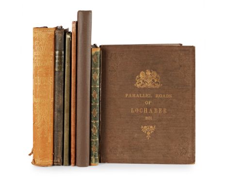
7 Quarto works on Scotland, including Morison, D. Sketches of Scenes in Scotland. Perth: R. Morison, 1834. 4to, etched plates, green half morocco, rubbed; James, Henry Notes on the Parallel Roads of Lochaber. Southampton, 1874. 4to, 9 plates, large folding map on linen, original cloth gilt, spine worn; Loch, James. Memoir of George Granville, late Duke of Sutherland. 1835. 4to, Privately Printed, engraved and lithographed plates, original green cloth gilt; Pennant, Thomas The Literary Life of the late Thomas Pennant, by Himself. London, 1793. Large 4to, large paper copy, library and cancellation stamp to title, engraved plates, one hand-coloured, modern black morocco-backed marbled boards, uncut; [Tiree Sale Prospectus] For Sale the Island of Tiree. 1902, folding plan, original wrappers bound in, cloth; Bovet, Anne de l'Ecosse. Paris, 1898, 4to, plates, illustrations, pictorial half morocco, rubbed; White, Captain T.P. Archaeological Sketches in Scotland Knapdale and Gigha. Edinburgh, 1875. Folio, map and 49 plates, original brown pictorial cloth gilt, neatly rebacked

Lot 382
A Collection of Art Reference and Travel Books 12 volumes Baedeker, Karl Egypt and the Sudan. Leipzig, 1908. 12mo, folding map, original red cloth gilt; [Idem] Baedeker’s Egypt 1929. Newton Abbot: David & Charles, [1974]. 12mo, original yellow cloth gilt, dust-jacket price-clipped; Murray, John A Handbook for Travellers in India, Ceylon and Burma. London, 1894. 12mo, original red cloth gilt, contemporary annotations, folding map in rear pocket; Chambers, Robert Walks in Edinburgh. Edinburgh: William Hunter…, 1839. Second edition, 12mo, folding map, original cloth with rubbed paper label to spine; and 3 ‘Blue Guides’ (Denmark, Greece & Egypt); Crombie, Benjamin W., artist Modern Athenians… Edinburgh: Adam & Charles Black, 1882. Small 4to, hand-coloured plates, contemporary quarter morocco, rubbed; McDowall, William History of the Burgh of Dumfries. Edinburgh: Adam and Charles Black, 1897. 8vo, green cloth gilt, foxing; Smith, George Adam Jerusalem. London: Hodder and Stoughton, 1907. 2 volumes, 8vo, original red cloth gilt; Munro, Alexander Macdonald Records of Old Aberdeen. Aberdeen: the New Spalding Club, 1899. 2 volumes, original green cloth gilt; Cramond, William The Records of Elgin. Aberdeen: the New Spalding Club, 1903. 2 volumes, original green cloth gilt; AND 5 works on atlases and illuminated manuscripts by other publishers (20)

Lot 390
Brooke, Arthur de Capell A Winter in Lapland and Sweden with various Observations relating to Finmark and its Inhabitants. London: J. Murray, 1827. 4to, frontispiece, folding map and 21 plates, original quarter cloth, occasional spotting, mostly to title and frontispiece, 8 vignettes in text, some on india paper, binding a little marked, corners slightly rubbed
Lot 392
Caithness - Henderson, John General View of the Agriculture of the County of Caithness ... with an Appendix including an Account of the Improvements carried on, by Sir John Sinclair, Bart.. on his Estates in Scotland. London: McMillan, 1812. First edition, 8vo, hand-coloured folding map, 12 folding plates, plans and charts, 6 printed folding tables, contemporary half calf, red morocco label, short splits to folding map, slight spotting to platesFootnote: Note: Purchased Phillips Edinburgh, 24 August 2001, lot 292, for £230.
Lot 395
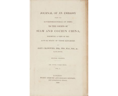
Crawfurd, John Journal of an Embassy from the Govenor-General of India to the Courts of Siam and Cochin China. London: H. Colburn & R. Bentley, 1830. Second edition, 2 volumes, 8vo, 14 (of 15) lithographed plates and maps, lacking Map of Siam and Cochin China, very small marginal stain to a few plates, a few small spots, original maroon cloth, spines faded, bindings detached

Lot 396
Crawfurd, John Journal of an Embassy from the Governor General of India to the Court of Ava. London: H. Colburn, 1834. Second edition, 2 volumes, 8vo, large folding map torn in two without loss, folding plan and 6 plates, vignettes, half-title in volume 1, original grey embossed cloth, slightly markedFootnote: Note: No copy appears to have the "five lithographic plates descriptive of Fossil Remains to be inserted at the end of the Appendix" referred to in the list of Illustrations.
![Senex, John, after Gordon of Straloch A New Map of Scotland [N.p., 1721] 49.5 x 58.5cm, hand-coloured, framed and glazed](https://cdn.globalauctionplatform.com/4cf549bc-a8e0-40fd-a1b5-acbb00b39752/e4a3e954-915a-4c84-b9a9-acc200c174bc/468x382.jpg)

Lot 405
Goujon, Jacques Histoire et Voyage de la Terre-Sainte Lyon: P. Compagnon & P. Taillandier, 1671. Second edition, 4to, woodcut device on title-page, woodcut initials, head- and tail-pieces, additional privilege leaf in preliminaries, folding engraved map of the Holy Land (slightly torn at fold), 16 folding engraved plates, contemporary calf, occasional light foxing, spotting or staining, binding lacking backstripFootnote:

Lot 408
Grose, Francis The Antiquities of Scotland London: Hooper & Wigstead, 1797. 2 volumes, folio (325 x 224mm), large paper copy, engraved titles, folding map, and 190 plates, contemporary calf gilt, gilt edges, neatly rebacked retaining original spines, bookplates of J. Douglass Kennedy and Dudgeon, g.e.; a clean copy
![Moore, Joseph Birman Empire. Eighteen Views Taken at or Near Rangoon London: Thomas Clay, [1825]. First series only, Folio, t](https://cdn.globalauctionplatform.com/4cf549bc-a8e0-40fd-a1b5-acbb00b39752/588b22c7-cda5-473a-b33f-acc200c4ef7e/468x382.jpg)
Lot 420
Moore, Joseph Birman Empire. Eighteen Views Taken at or Near Rangoon London: Thomas Clay, [1825]. First series only, Folio, title page/upper wrapper on grey-green paper, map mounted on guard, engraved subscribers' leaf (foxed), engraved dedication (a little foxing), 18 hand-coloured lithographs in fine condition, contemporary green half morocco, some creasing to tissue guards and descriptions; [AND] a cloth bound folio volume containing a list of subscribers to the work in India (2)Footnote: Provenance: The Late Dr Helen E C Cargill Thompson Note: Dr Helen Cargill Thompson has been recognised for her contribution to both librarianship and the art world. Born in Burma in 1933, she returned to live in Glasgow aged 6, along with her parents and two brothers, and her love of art developed in the city’s Kelvingrove Galleries. Dr Cargill Thompson lived frugally, collected art passionately and never viewed her purchases as a monetary investment, donating over 1000 pieces to Strathclyde University. A graduate in physiology and pharmacology, Dr Cargill Thompson initially worked as a research scientist, before making the decision to pursue a career in librarianship, being awarded the Princess Royal Medal for services to the discipline. This work, from the Cargill Thompson library, can be traced to the family’s routes in The East India Company and Burma. The Cargills were merchants in Glasgow, with interests in the East India Trading Co., and proceeded to found The Burmah Oil Company.

Lot 427
Schefferus, Joannes Histoire de La Laponie Paris: Olivier de Varennes, 1678. First edition in French, small 4to, additional engraved title-page, folding map, 21 plates, with additional cancel leaf A1, contemporary calf with gilt tooled spine and red morocco gilt labelFootnote: Provenance: The Late Dr Helen E C Cargill Thompson

Lot 429
Scotland, 12 Guide books, including Stirling & Kenney, publishers The Scottish Tourist, and Itinerary. Edinburgh, 1825, 8vo, plates and folding maps, 1 repaired, modern quarter calf gilt; another copy. Edinburgh, 1827. 8vo, plates, folding maps, contemporary maroon half roan, title loose, slightly rubbed; Lumsden, James, publishers Lumsden & Son's Steam-Boat Companion or Stranger's Guide to the Western Isles & Highlands. Glasgow, 1831, Tall 8vo, 4 engraved plates, 3 folding maps, original maroon morocco lettered in gilt, slightly rubbed; Stillie, J., publisher Tracts illustrative of the Traditionary & Historical Antiquities of Scotland. Edinburgh, 1836. 8vo, engraved title, contemporary calf, rebacked; Kohl, J.G. Travels in Scotland. 1844. 8vo, original cloth, rebacked, new endpapers, cloth lightly soiled; Morison, J., publisher The New Picture of Scotland. Perth, 1807, 2 volumes, 12mo, engraved titles, folding map, & 8 plates, contemporary half calf; Landsborough, David Arran, a Poem, in six cantos. Edinburgh, 1847. 8vo, additional title, engraved plates, original cloth, rebacked; Black, A. & C. Black's Economical Tourist of Scotland. Edinburhg, 1849. Fifth edition, 8vo, original cloth, map loose; Colquhoun, John. Rocks and Rivers or Highland Wanderings. 1849. 8vo, original green embossed cloth; M'Phun, W.R. The Scottish Land Tourist's Pocket Guide. Glasgow, 1850. 12mo, folding map, original cloth; Muir, J.S. Descriptive Notices of some of the Ancient Parochial and Collegiate Churches of Scotland. 1848, 8vo, original cloth-backed wrappers (12)

Lot 43
Taylor, George and Andrew Skinner Taylor & Skinner's Survey and Maps of the Road of North Britain London: for the Authors, 1776. Folding title, folding general map (tear repaired), folding index, 61 engraved folding maps of roads on 31 leaves, 19th century half calf, title splitting at one fold, occasional light spotting, one or two tiny tears (without loss), rubbed, upper joint split

Lot 430
Scotland: Interesting Travel, History & Literature Including Burns, Robert Poems Chiefly in the Scottish Dialect London: A. Strachan..., 1787. Third [first London] edition, 8vo, half-title, portrait frontispiece, contemporary calf, binding rubbed and split along spine, text-block also split, some light dampstaining to upper margins, a few other internal marks [T91546]; Horne, James Fifteen One Day Cycle Tours from Edinburgh. Edinburgh: W. & A.K. Johnston, [n.d.] Tall 12mo, folding map, original cloth covers; The Edinburgh Almanac...for 1835 Edinburgh: Oliver & Boyd. 12mo, contemporary calf, some leaves missing; The Edinburgh Almanac...for 1841 Edinburgh: Oliver & Boyd. 12mo, contemporary red calf gilt; New Edinburgh Almanac...for 1847 Edinburgh: Oliver & Boyd. 12mo, contemporary red calf gilt; New Edinburgh Almanac...for 1860 Edinburgh: Oliver & Boyd. 12mo, contemporary red calf gilt; Sinclair, Catherine Shetland and the Shetlanders, Northern Circuit. Edinburgh: William Whyte and Co., 1840. 8vo, original blue cloth gilt; [Idem] Scotland and the Scotch, the Western Circuit. Edinburgh: William Whyte and Co., 1840. 8vo, original blue cloth gilt; and 3 others (11)
Lot 432
Scottish Guide Books, 15 volumes, comprising Cumming, Gershom Views at Dunkeld. Dundee: G. Cumming, 1839. 12mo, additional engraved title and 12 plates, original cloth, slightly spotted, slight marginal dampstain to plates; [Dunkeld] A Description of the Ancient City of Dunkeld, and its environs. Dunkeld: D. M'Donald, 1826. 12mo, later wrappers; Chambers, Robert The Picture of Scotland. Edinburgh, 1828. Second edition, 2 volumes, 8vo, several engraved plates, contemporary half calf, pp. 146-147 vol. 1 soiled; Stirling, Kenney & Co., publishers The Scottish Tourist and Itinerary. Edinburgh, 1836. 6th edition, engraved plates and maps, original maroon roan, frontispiece rather clumsily reattached, some margins slightly rubbed; Firmin Didot, publishers Guide Pittoresque du Voyageur en Ecosse. Paris, 1838. 8vo, additional engraved title and 117 plates (3 plates called for not bound in, but 1 not called for bound in), original printed boards, slightly spotted, rubbed; Buist, James National Record of the Visit of Queen Victoria to Scotland. Perth, 1842. 8vo, later cloth; [Macculloch, John] A Description of the Scenery of Dunkeld and of Blair in Atholl. London: for the Author, 1823. 12mo, half-title, contemporary calf, rubbed; Graham, Patrick Sketches descriptive of the Picturesque Scenery of Perthshire. Edinburgh, 1810. 12mo, half-title, original boards, uncut, spine worn; Lumsden, James & Son, publishers Lumsden & Son's Steam Boat Companion, or Stranger's Guide to the Western Isles & Highlands of Scotland. Glasgow, 1829. Tall 8vo, 3 folding maps, 4 engraved plates, original cloth, rebacked, somewhat spotted; Wakefield, Priscilla A Family Tour through the British Empire. 8vo, hand-coloured folding map, modern quarter calf, marbled sides; Brown, John Notes on an Excursion into the Highlands of Scotland in autumn 1818. Edinburgh, 1819. 12mo, contemporary half calf, rather dust-soiled; Stewart, Christina B. The Loiterer in Argyllshire. Edinburgh, 1848. 12mo, original cloth, binding somewhat soiled; Wilson, John Wilson's Guide to Rothesay. Rothesay, 1848. 8vo, additional pictorial title, map, plates, original red cloth, rubbed; and a defective copy of Leigh's Road-Book of Scotland (13)
Lot 434
Scottish History, Culture, Topography & Antiquities a large collection, including Penny, George Traditions of Perth. Perth, 1836. 8vo, brown half morocco gilt, t.e.g.; Aikman, James The History of Scotland. Glasgow, 1827. 4 volumes, 8vo, original boards, uncut, early reback using original paper labels; Brown, James Harris Scenes in Scotland. Glasgow, 1833. 8vo, engraved plates, quarter morocco, worn; Rhind, William Sketches of the Past and Present State of Moray. Edinburgh, 1839. 8vo, plates, original cloth, rubbed; Campbell, D. The Raid of Albyn. 1854. 8vo, original cloth gilt; Taylor, Elizabeth The Braemar Highlands. 1869, 8vo, original cloth, worn; Gorrie, W. Notes of a Botanical and Arboricultural Tour to Atholl, Orkney, Caithness and the Lewis. Edinburgh: Printed for Private Circulation, 1876, 8vo, modern boards; Macfadzean, James The Parallel Roads of Glenroy. [c. 1880], 8vo, presentation copy from the author, original cloth; Nelson, T., publisher Souvenir of Scotland. 1889. 8vo, 120 chromolithographed views, original cloth gilt, slightly rubbed; Walker, John Essays on Natural History and Rural Economy. 1812. 8vo, contemporary half calf, rebacked; Chamberlayne, John Magnae Britanniae Notitia, or the Present State of Great Britain. 1726, 8vo, frontispiece, contemporary panelled calf, rubbed; Chambers, Robert The Gazetteer of Scotland. [c.1830], 2 volumes, 8vo, contemporary half calf gilt; d'Arville, Nicholas The Navigation of King James V. round Scotland. Glasgow, 1819. extract from "Miscellanea Scotica", modern quarter calf; [Matheson] The Cruise of the "Clan Matheson" in Northern Waters, June 1895. 4to, Printed for Private Circulation, plates, original pictorial cloth; Gibson, John C. Lands and Lairds of Larbert and Dunipace Parishes. Glasgow, 1908. 4to, limited to 150 copies, plates, original buckram gilt, t.e.g.; McConnochie, Alexander Ben Muich Dhui and his Neighbours. Aberdeen, 1885. 8vo, original cloth, a little shaken; Journal of a Voyage through the Western Isles of Scotland and along the Coast of Norway n the Yacht Cymba. 1857. 8vo, lithographed frontispiece, folding map, original blue cloth gilt, slightly spotted, rubbed; Macpherson, James The Poetical Works. Edinburgh, 1802. 12mo, modern cloth-backed boards; Harvey, George Ossian's Fingal, an Ancient Epic Poem. 1814, 8vo, contemporary red half calf gilt, several library stamps, somewhat spotted; Playfair, James A Geographical and Statistical Account of Scotland. Edinburgh, 1819. 2 volumes, 8vo, hand-coloured folding map, modern quarter calf gilt; The Thistle or Anglo-Caledonian Journal. 1836. 8vo, contemporary half calf, some spotting and staining; Borthwick, William An Inquiry into the Origin and Limitations of the Feudal Dignities of Scotland. Edinburgh, 1775. 8vo, early 19th century cloth; Robertson, J.A. Comitatus de Atholia, the Earldom of Atholl. Printed for Private Circulation, 1860. 8vo, folding map only, original cloth; Carus, C.G. The King of Saxony's Journey through England and Scotland. 1846, later cloth; Buchan, Earl of Discourse delivered ...at a meeting for the purpose of Promoting the Institution of a Society. 1778, 8vo, drop-head title, modern calf-backed boards; Reliquiae Santiquae Scoticae, illustrative of Civil and Ecclesiastical Affairs. 1848. 8vo, contemporay brown half morocco, rubbed; Lumsden, James, publisher Lumsden & Son's Guide to the Romantic Scenery of Loch Lomond, Loch Ketturin, The Trossachs &c., Glagow, 1837. 12mo, folding map, modern calf-backed cloth; Brown, John A Picture of Strathearn in Perthshire. Crieff: for the Authort, 1823, 12mo, original boards, uncut, slightly rubbed; Black, A. & C., publishers Black's Picturesque Guide to the Trossachs. 1853. 12mo, illustrations, contemporary calf, lacks the map; [Maynwaring, Arthur] Four Letters to a Friend in North Britain. London, 1710. 4to, modern boards; McDiarmid, Angus Striking and Picturesque Delineations ... around Loch-Earn. Lochearnhead, 1877, 8vo, plates, contemporary calf, upper joint splitting; Saussure, L.A.N. de Travels in Scotland. London, 1821. 8vo, modern buckram; Fraser, Tytler Case for the County of Invernes in regard to the Repair of Military and Parliamentary Roads. 1827, quarter calf, rubbed (quantity)


Lot 383
ANNE FRASER “New English Rose - Graham Thomas”, a botanical study watercolour, signed and dated September 1990 lower right, 41cm x 29cm, together with a framed and glazed map of Wiltshire by Edward Weller, a set of four 19th Century studies of birds, including painted Pheasant, pencilled Chinese Pheasant, Alexandrine Parrakeet and Touraco and four various black and white engravings, three botanical print studies and four other prints various (17 total)

Lot 426
AFTER SIMON PATTERSON (b1967) "The Great Bear", a take on the London underground map, signed and inscribed lower right "For Sue, Simon Patterson 2002", size including frame 58.5 cm x 70.5 cm CONDITION REPORTS General ware and tear conducive to age and use. The glass in need of a clean. See images for more details. This does appear to be an original poster and is personally signed "For Sue from Simon Patterson 2002". Certainly we would like to think that the artist would personally sign a real one, not a fake one. This said, it is of course a poster therefore printed. See inscription bottom left with name of artist and title within the print.
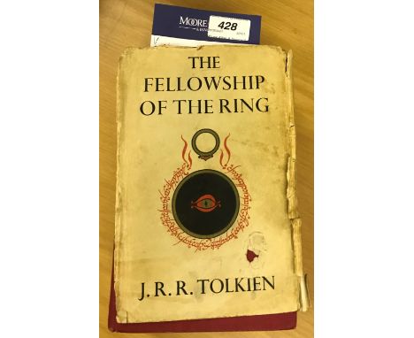
Lot 428
JRR TOLKIEN "The Fellowship of the Ring", 1st edition, 13th impression, published 1963, cloth board bound with dust jacket (poor condition), "The Two Towers", 1st edition, 10th impression 1963, cloth board bound with dust jacket and "The Return of the King", 1st edition, 10th impression 1963, cloth board bound with dust jacket (all dust jackets with wear) CONDITION REPORTS All three books are present from the trilogy. "The Fellowship of the Ring" dust jacket is worn and in pieces. Spine part is missing completely. Has been inscribed in the front. Map present and stuck in at back. Back - a dozen pages have been mis-cut. Foxing, wear and discolouration to the outside edges of the pages. "The Two Towers" - paper dust jacket is worn and discoloured but intact. Map is present at the back. "The Return of the King" is in a similar condition. Wear and tear conducive with age and use. See images for more details.

Lot 221
Explorations Of The Highlands Of The Brazil, by Richard Burton, 1869 First Edition published in 2 volumes by Tinsley Brothers of London Annotations and a few pages absent. Annotations and a few pages absent. Volume 1, There is some writing in the margins and some water staining to pages. Volume 2, has a map before chapter one. There is some staining to the paper and there are no other plates or maps in the volume.


Lot 316
BLUE & WHITE TABLEWARE, various patterns, ceramic bread bin and two chamber pots ETC, COLOURFUL VINYL CRESTED HERALDIC EMBLEM OF WALES, 70 x 56cms, oil on board, numerous boats on beach, 59 x 90cms and Berkshire Map and other rural bridge scene, and GILT, OAK, MAHOGANY and other framed wall mirrors, two W S & S Austrian type scene wall chargers ETC

Lot 237
3rd-2nd millennium BC. A large clay tablet with cuneiform script to both sides, one side with tight lines of script, the other side with an empty central column and three further empty columns to the sides, cuneiform script in between, possibly representing a map. 627 grams, 16cm (6 1/4"). Ex central London gallery; acquired on the UK art market in 1999; formerly with Maggs Bros, London, WC1; previously in a UK collection formed before 1992; this lot has been checked against the Interpol Database of stolen works of art and is accompanied by AIAD certificate number no. 10321-166474.[No Reserve] Fair condition, repaired.


![John Tallis JuniorLondon & New York: John Tallis & Co, (1850) [c1851]Steelplate engraving, outline colour, centerfold as issu](https://cdn.globalauctionplatform.com/2d84ed6c-8111-4c7c-ae3d-acbf00899800/5aba039e-1507-42b3-9e71-acc30112cc6c/468x382.jpg)
Lot 100
John Tallis JuniorLondon & New York: John Tallis & Co, (1850) [c1851]Steelplate engraving, outline colour, centerfold as issued, light tanning along centerfold, bottom left: The Illustrations by H. Warren & engraved by H. Bond; bottom right: The Map Drawn & Engraved by J. Rapkin; verso: pencil notefrom Illustrated Atlas and Modern History of the World24 by 32cmLITERATUREScott, V., Tooley's Dictionary of Mapmakers (Q-Z), Riverside: Early World Press, 2003, p.244
-
109182 item(s)/page