We found 109182 price guide item(s) matching your search

Refine your search

Year

Filter by Price Range
  • List
  • Grid
  • 109182 item(s)
    /page

Lot 77

Johnson (William and Son). A Map of Several Canals situated in the Counties of Lancaster, Derby, York & Chester; Shewing the Heights of their pools above the Level of the Sea at Low Water...., 1825, map with contemporary outline colouring, engraved by J. & G. J. Pickett, sectionalised and laid on linen, calligraphic title, compass rose, mileage scale and table of reference, slight ink staining, 865 x 1240 mm, marbled endpapers, contained in a contemporary marbled card slipcase, case worn and rubbedQTY: (1)

Lot 254

Moore (J. E. S.) To the Mountains of the Moon. Being an account of the modern aspect of Central Africa, and of some little known regions traversed by the Tanganyika Expedition in 1899 and 1900, 1st edition, London: Hurst and Blackett, 1901, 3 maps (2 folding), folding panoramas and half-tone illustrations, advertisements at rear, occasional light spotting, mainly to endpapers, top edge gilt, original green cloth gilt, small mottled stains to upper cover, 8vo, together with Evans (Ivor H. N.) Papers on the Ethnology & Archaeology of the Malay Peninsula, 1st edition, Cambridge: CUP, 1927, folding plate, half-tone illustrations, small ink stamp and owner signature at front, original cloth, dust jacket, a few tears and losses, 8vo, plus Dainelli (Giotto). Buddhists and Glaciers of Western Tibet, 1st UK edition, London: Keegan Paul, Trench, Trubner & Co., 1933, double-page map, illustrations, abrasion to rear pastedown, a few minor spots, previous owner inscription, original cloth gilt, spine a little faded and rubbed at ends, 8vo, with others related including China in Transformation, by Archibald R. Colquhoun, 2nd edition, 1898, The Soul of Malaya, by Henri Fauconnier, 1st UK edition, 1931, The Malayan Civil List 1939, Noone of the Ulu, by Dennis Holman, 1958, and Eastern Windows, by F. D. Ommannay, 1960QTY: (approximately 50)

Lot 507

Bates (Henry Walter). The Naturalist on the River Amazons, a record of adventures, habits of animals, sketches of Brazilian and Indian life, and aspects of nature under the equator, during eleven years of travel, 2 volumes, 1st edition, London: John Murray, 1863, 9 wood-engraved plates (including frontispieces), folding map, wood-engraved illustrations to text, a few small tape repairs to verso of folding map, crudely trimmed with round edges, 20th-century green quarter calf gilt, faintly marked, 8voQTY: (2)

Lot 71

Ireland. Speed (John), The Kingdome of Ireland Devided into Severall Provinces and the Againe Divided into Counties Newly Described [in set with] The Province of Connaugh with the City of Galwaye Described [and] The Countie of Leinster with the Citie Dublin Described [and] The Province of Mounster [and] The Province of Ulster described, John Sudbury and George Humble [1616], the set of five engraved maps, all with contemporary hand-colouring, each map with some degree of oxidisation to the old watercolour causing some cracking and splitting, The Province of Connaugh and The Province of Mounster with small areas of strengthening and repair to the verso, each approximately 390 x 510 mm, Latin text on verso QTY: (5)NOTE:Andrew Bonar Law. The Printed Maps of Ireland to 1612. p. 250, p. 253, p. 252, p. 251 [and] p. 254.It is rare to find the full set of John Speed's Irish maps with contemporary colouring and from the scarce 1616 'Latin' edition.

Lot 263

Slade (Adolphus). Records of Travels in Turkey, Greece, &c. And of a cruise in the Black Sea, with the Capitan Pasha, in the years 1829, 1830, and 1831, 2 volumes, 1st edition, London: Saunders and Otley, 1832, half-titles, chromolithograph frontispieces, folding double-page map, errata slip and publisher's advertisement leaf in volume one, 4 pp., publisher's advertisements mounted to front free endpaper of volume one, original purple cloth gilt, spine with some professional restoration, stain to lower cover of volume two, 8voQTY: (2)

Lot 330

Reposati (Rinaldo). Della Zecca di Gubbio e delle gest de conti, e Duchi di Urbino, 2 volumes, Bologna: per lelio dalla volpe impressore dell' Instutio dell Scienze, 1772-73, engraved title page vignettes, folding map with a repaired tear to the front of volume 2, 2 folding plates plus further numismatic plates & illustrations, later endpapers, circa 19th century ex-libris ink stamps to the foot of both title pages, period annotation pasted onto the left margin of p.486, some minor spotting, uniform 19th century gilt decorated half with red and green spine labels, lightly rubbed to head and foot, 8voQTY: (2)

Lot 53

Estate Plan. Sparrow (Joseph), A Map of an Estate belonging to Mr. J. Dunk, also Stock Farm situated in the Parishes of Smeeth, Brabourn & Aldington in the County of Kent, 1803, pen, ink and watercolour plan on vellum, floriate cartouche, compass rose, contents list and scale of rods and chains, two inset maps of adjacent fields, two watercolour vignettes, one of a pastoral scene with cattle and sheep, the other of a running hare, old folds, some dust soiling, faint later pencil annotations, 910 x 630 mmQTY: (1)

Lot 1

Africa. Homann (Johann Baptist), Totius Africae nova repraesentatio qua praeter diversos in ea status et regiones etiam origo Nili ..., published Nuremberg, circa 1715, engraved map with contemporary wash colouring, decorative cartouche with later colouring, 490 x 570 mmQTY: (1)NOTE:Although an accurate map in outline, the interior is full of geographical errors, including the source of the River Nile being depicted as twin lakes. Strangely, there are two St Helena Islands, one real and one imaginary.

Lot 602

Plot (Robert). The Natural History of Stafford-shire, 1st edition, Oxford: Printed at the Theater, 1686, title with large engraved vignette of the Sheldonian and Bodleian, engraved royal arms at head of dedication, 37 engraved plates, most folding, lacking folding map and 'Armes omitted' plate, a few plates repaired (one or two crudely), occasional light water stains and soiling, blank leaf before title upper corner torn away, contemporary calf, joints cracked, rubbed, folioQTY: (1)NOTE:Wing P2588. Sold with all faults not subject to return.

Lot 108

* Screen. A large wooden room divider, late 18th century, a large 4-part hinged wooden room divider, the panels joined with leather (partially perished) and re-inforced with later metal hinges, the front panels decorated with a large mid-17th century etched and engraved hand-coloured map by N. Cochin of the Siege of Arras, the map on sixteen conjoined sheets consisting of a panorama and a siege map, the margins decorated with separately printed floriate strips, with the title excised and pasted along the base, the title reads "Le Siege D'Arras Leve par la Deffaite des Ennemis, 1654", varnished overall, slight surface abrasion and staining, the reverse of the panels with a plain paper design with separately printed borders, each panel 1920 x 530 mm, overall size approximately 1920 x 2125 mmQTY: (1)NOTE:RCIN 723105. An aerial view and prospect of the siege of Arras. The city was besieged by the Spanish, commanded by Louis de Bourbon, the Prince de Condé (1621-86) from 3 July to 25 August 1654, during the Franco-Spanish War (1635 - 59). The Spanish were defeated in battle on 25 August 1654 by a French relief army under the command of Henri de la Tour d'Auvergne (1611-75). This example retains the separately printed title which is pasted along the base of the image. The word 'Defaite' in this title panel is spelt with two 'F's whereas the title in the Museum of the Bibliothèque Nationale de France copy contains only one 'F'. The Museum's copy also retains the columns of letterpress text, (in French and Latin) which were pasted to the vertical margins, with a further eight columns (two blank) of text pasted along the lower border.

Lot 66

India. Map of Mysore. Govt. Photozinco Office, Poona, 1921, large folding lithographic map, sectionalised and laid on linen, slight near-contemporary crayon annotations, some dust soiling and creasing, edged in green silk, 675 x 1000 mm, marbled endpapers, bound in a contemporary 'envelope style' cloth boards, QTY: (1)

Lot 130

West Indies. Visscher (Nicholas), Insulae Americanae in Oceano Septentrionali ac Regiones Adiacentes, a. C. de May usque ad Lineam AEquinoctialem, Amsterdam, circa 1680, engraved map with contemporary outline colouring, slight oxidisation to old watercolour, central fold strengthened on verso, occasional marginal closed tears, slight browning but largely confined to the margins, 470 x 570 mm, no text on versoQTY: (1)NOTE:This is the second state of the map with the addition of the privilege in the cartouche. The map is noteworthy for the inclusion of several cartographic anomalies. These include two large nonexistent lakes in the region of western Georgia and a non-existent mountain range extending from the Piedmonts across the North American continent. In South America, the archetypal cartographic myth, Manoa o' El Dorado (the golden city), is located on the north-western shores of the Lacus Parime vel Roponowini in Guyana.

Lot 226

* Williams (Charles). Boney Bothered or an Unexpected Meeting, July 9th, Thos. Tegg, 1808, etched caricature with bright contemporary hand-colouring, slight marginal soiling, 345 x 245 mm, together with Cruikshank (Isaac). Billy a Cock-Horse or the Modern Colossus amusing himself, S. W. Fores March 8th 1797, etched caricature with bright contemporary hand-colouring (after James Gillray), slight marginal soiling, 280 x 225 mm, with Nixon (John). Madame Very Restaurateur, Palais Royal Paris [and] La Belle Liminaudiere au Caffee de Mille Collone, Palais Royale Paris. circa 1814, two etched caricatures after Thomas Rowlandson on one sheet (as published) both with bright contemporary hand-colouring, slight marginal soiling, overall size 350 x 250 mm, plus Cruikshank (Isaac). The Kentish Hop merchant and the Lecturer on Optics!!, Thomas Tegg [1809], an etched caricature (after George Woodward) bright contemporary hand-colouring, slight marginal soiling, 245 x 350 mm, and Frey (George). La Politique du Marais..., circa 1828, lithograph with contemporary hand colouring showing an old maid reading a newspaper whilst leaning on a map of Spain & Portugal (The Map Collector Spring 1991 issue 59, page 52), some staining and dust soiling, slight marginal fraying, 330 x 250 mm, with Heath (Henry). Nothing Extenuate nor aught set down in Malice, H. Fores, 28th August 1827, etched caricature with contemporary hand colouring (the title being Othello's dying words) a satire on the excesses of female fashion, trimmed to the plate mark, 370 x 250 mm, with another five caricatures by or after William Heath, Charles Williams and H. Bunbury, various sizes, good conditionQTY: (11)

Lot 87

London. Faden (William), The Country Twenty-Five Miles Round London Planned from a Scale of One Mile to an Inch..., 3rd. edition, 1815, engraved map with contemporary outline colouring, sectionalised and laid on linen, 1015 x 1270 mm, contained in a contemporary half sheep book box, heavily worn and frayed, small area of loss to the foredge of the book boxQTY: (1)NOTE:James Howgego. The Printed Maps of London, number 188, state 7.

Lot 629

Wallace (Alfred Russel). Studies Scientific & Social, 2 volumes, 1st edition, London: Macmillan and Co., 1900, folding map with outline colour of a glacier, half-tone and wood-engraved illustrations, advertisement leaf at end of volume 2, errata slips at front of each volume, occasional light spotting, original green cloth gilt, spines a little darkened, a few small bumps and indentations, 8voQTY: (2)

Lot 100

New York. Hammond's Complete Map of New York City, C. S. Hammond and Co. 1917, uncoloured lithographic map, laid on linen, some slightly later ink, pencil and watercolour annotations and key, 1480 x 525 mmQTY: (1)

Lot 109

Sea Chart. Van Keulen (Johannes), Nieuwe Paskaart van Ierland en de West Kust van Engeland ..., The New Sea Map of Ireland and the West Coast of England, containing St. George and the Channel of Bristol..., Amsterdam, circa 1735, large hand-coloured engraved sea chart of the west coast of England & Wales, The Irish Sea and Ireland, on two conjoined sheets, oval cartouche, compass rose and numerous rhumb lines, old folds, slight creasing, 600 x 960 mmQTY: (1)NOTE:Originally published in the Zee-Faakel.

Lot 91

London. Mogg (Edward), An Entire New Plan of the Cities of London & Westminster with the Borough of Southwark, Comprehending the New Buildings and other Alterations to the present time....., Jan. 1st. 1813, engraved map with contemporary hand colouring, sectionalised and laid on linen, 455 x 870 mm, contained in a contemporary blue card slipcase with orange and black printed label to the upper cover, worn at extremitiesQTY: (1)NOTE:James Howgego, Printed Maps of London, number 227, state 10.

Lot 94

London. Weller (Edward), London, published in 'The Weekly Dispatch Atlas', circa 1863, uncoloured lithographic map on nine double-page sheets, each sheet laid on later cotton, very slight spotting, each sheet approximately 475 x 640 mm, together with Davies (B. R.). London, published for the Diffusion of Useful Knowledge, 1843, double-page engraved map with contemporary wash colouring, 395 x 640 mm, with Bowen (Emanuel). A Plan of the City and Liberties of London after the Dreadful Conflagration in the Year 1666..., circa 1730, uncoloured engraved plan, slight spotting, old manuscript number in the upper right corner, 225 x 340 mm, with another 10 maps, ward plans and views of London, various sizes and conditionQTY: (21)

Lot 119

The Dispatch Atlas. Volumes 2 & 3 (only), circa 1860, both volumes lacking titles, 173 lithographic map sheets and city plans, by or after Edward Weller, John Dower and others, lacking the 2 double-page plans of London panorama, after Agas, and the 12 double-page plans of London, but retaining the map of The Canton River, occasional creasing and very slight staining, contemporary half morocco gilt, rubbed and worn, folio QTY: (2)NOTE:Sold as a collection of maps, not subject to return.

Lot 118

The Caribbean. Mount (Richard & Page Thomas), A Correct Chart of the Caribbee Islands [1715 - 50], hand-coloured engraved map, orientated to the east, large strapwork cartouche, compass rose and numerous rhumb lines, 435 x 545 mmQTY: (1)NOTE:A chart of the Lesser Antilles extending from Puerto Rico to Venezuela. The chart was published in Mount & Page's The English Pilot. The Fourth Book Describing The West India Navigation, the first sea atlas of America containing charts only from English sources.

Lot 36

* Cornwall. Blaeu (Johannes), Cornubia sive Conwallia, Amsterdam, circa 1645, engraved map with contemporary outline colouring, decorative cartouche and mileage scale, slight dust soiling and faint text showthrough, 390 x 500 mm, mounted, framed and glazed QTY: (1)

Lot 9

Asia. Homann (Johann Baptist), Asiae Recentissima Delineatio qua Status et Imperia Totius Orientis Unacum Orientalibus Indiis Exhibentur, Nuremberg, circa 1720, engraved map with contemporary hand colouring and some later enhancement to the cartouche, slight staining and dust soiling, very faint browning to the central fold, 490 x 585 mmQTY: (1)

Lot 93

London. Philip (George & Son, publisher), Philips New Library Map of London and its Environs, circa 1895, large colour lithographic map, sectionalised and laid on linen, marbled endpapers, 1150 x 1520 mm, contemporary gilt cloth boards (the remains of a slipcase), worn and frayedQTY: (1)

Lot 120

* The Stock Exchange. Whistler (Reginald John, 'Rex'), The Stock Exchange London 1933, London: The Financial News, 1933, colour photolithograph, additional cartouche with the title 'The Financial News map of the Stock Exchange' with a table of explanation below, numerous allegorical symbols and figures surrounding the map, slight marginal staining, laid on later card, 390 x 535 mm, framed and glazedQTY: (1)NOTE:A scarce map crammed with allegorical symbolism. The cartouche is supported by a bear and a bull, the classic representations of a sellers and buyers market, and both are shown in morning dress. The secondary cartouche is flanked by King Midas who has coins spilling from his waist and Dame Fortune who is blindfolded and holding a pair of scissors and whose arm rests on the 'rota fortunae' or wheel of fortune, a symbol of the capricious nature of fate. In the upper corners of the map are representations of Mercury carrying an elaborate compass and the goddess Demeter spilling her cornucopia into the market. The stock exchange itself is shown as a castellated courtyard within whose walls commodities, gilts and bonds are depicted being traded by a variety of humorous vignettes.

Lot 86

London. Cary (John), Cary's New and Accurate Plan of London and Westminster, the Borough of Southwark and parts adjacent: viz. Kensington, Chelsea, Islington, Hackney, Walworth, Newington &c with an Alphabetical list of upwards of 500 of the most principal streets with references to their situation, and Plans of the New London & East & West India Docks, 1816, engraved map with contemporary wash colouring, sectionalised and laid on linen, with a list of over 500 of the principal streets printed below the map, three inset tables of reference to churches, parishes and public buildings, a printed list of streets and their altitude above sea level pasted to the right-hand margin, bookplate of Alexander Boetefeur pasted to the upper right corner, two faint manuscript circles in upper right corner, slight staining, marbled endpapers, 800 x 1485 mm, contained in a contemporary marbled card slipcase with printed label to upper board, slipcase heavily worn and frayedQTY: (1)NOTE:James Howego. The Printed Maps of London, no.184, state 14 (of 20).

Lot 76

Jamaica. Bordone (Benedetto). Jamaiqua..., Venice [1528], uncoloured woodblock map with Italian text below and on the verso, map size 85 x 150 mm, mountedQTY: (1)NOTE:The first separately printed map of Jamaica, taken from the Isolario, and first published in 1528.

Lot 101

Norfolk. Bryant (Andrew), Map of the County of Norfolk from Actual Survey by A. Bryant in the Years 1824, 1825 and 1826, Respectfully dedicated to the Nobility, Clergy & Gentry of the County, published A. Bryant, Dec. 1st. 1826, large-scale engraved folding map on two sheets, bright contemporary hand colouring, sectionalised and laid on linen, calligraphic cartouche, list of the ecclesiastical divisions, compass rose, table of explanation and uncoloured engraved vignette of Norwich Cathedral, slight offsetting, bordered with green silk, each sheet approximately 750 x 2275 mm, contained in a contemporary sheep book box, box heavily worn and frayed with one section near detachedQTY: (1)NOTE:T. Chubb. A Descriptive List of the Printed Maps of Norfolk 1574 - 1916, page 106.

Lot 601

Plot (Robert). The Natural History of Oxford-Shire, being an essay toward the natural history of England, 1st edition, Oxford: printed at the Theater, 1677, imprimatur leaf, title with large engraved vignette of the Sheldonian and Bodleian, folding engraved map (with small splits along folds and reinforced to verso), 16 engraved plates, errata leaf, lower corner of final preface leaf torn away, occasional light spotting, endpapers renewed, 19th-century bookplate of Rev. Robert Clarke, AM, contemporary calf, Clarke's swan device in gilt-stamped to covers, rebacked and repaired, a little rubbed, folioQTY: (1)NOTE:ESTC R231542; Gibson 536; Madan 3130; Wing P2585.

Lot 46

England & Wales. Speed (John), The Kingdome of England, George Humble, 1632, hand-coloured 'carte-a-figure' map engraved by Abraham Goos, eight costumed vignettes to the vertical margins, strapwork cartouche and an inset list of shires, cities, bishopricks and market towns, good margins, faint ownership stamp to verso (Rodney Shirley) with very slight show through, 390 x 515 mm, English text on versoQTY: (1)

Lot 234

Bruce (C. G.). Twenty Years in the Himalayas, 1st edition, London: Edward Arnold, 1910, monochrome portrait frontispiece, folding panorama & map plus 58 further illustrations, modern endpapers, some spotting & toning throughout, modern gilt decorated green half morocco, 8vo, together with:Shepherd (C. W.), The North-West Peninsula of Iceland, being the journal of a tour in Iceland in the Spring and Summer of 1862, 1st edition, London: Longmans, Green, and Co., 1867, inscription by the author tipped-in to the front endpaper, colour frontispiece, folding map & 1 further colour plate, some light spotting & toning, original green cloth, boards & spine slightly rubbed, 8vo, plusSwayne (H. G. C.), Through the Highlands of Siberia, 1st edition, London: Rowland Ward, 1904, 60 monochrome illustrations plus a folding map to the rear, original front pastedown marked with the remains of a bookplate, original endpapers with further modern endpapers, some light marginal toning & spotting, modern gilt decorated brown half morcocco, 8vo, and Haughton (H. L.), Sport & Folklore in the Himalaya, 1st edition, London: Edward Arnold, 1913, 24 monochrome illustration, bookplate to the front pastedown, some spotting & light toning throughout, original gilt decorated red cloth, boards & spine very lightly rubbed, 8voQTY: (4)

Lot 2

Africa. Covens (J. & Mortier P.), Carte D'Afrique Dressée pour l'Usage du Roy, par Guillaume DeLisle..., Amsterdam, circa 1730, engraved map with contemporary outline colouring, strap work cartouche and advertisement, title repeated in Latin in the upper margin, 510 x 635 mm, together with DeLisle (Guillaume). Carte D'Afrique Dressée pour l'usgae du Roy, par Guillaume DeLisle.., published by Phillipe Buache, Paris, circa 1745, engraved map with contemporary outline colouring, strap work cartouche and advertisement (a slightly later impression of the Covens & Mortier map), 505 x 650 mm, with Blaeu (Willem Janszoon), Aethiopia Inferior vel Exterior..., circa 1645, engraved map of South Africa with contemporary outline colouring, large decorative cartouche and mileage scale, large margins, 385 x 505 mm, no text on verso, plus Ortelius (Abraham). Barbariae et Biledulgerid Nova Descriptio, [1580], uncoloured engraved map, 330 x 500 mm, German text on verso, with another copy similar (1572 edition) with French text on the verso, with another four maps of Africa and South Africa including examples by or after Rapin/Tallis, le Rouge, Tardieu and Fullarton, and De Bruyn (Cornelius). Tyrus [1698 - 1714], uncoloured engraved panorama, taken from the sea, old folds, small near-contemporary manuscript notation in the upper margin, 250 x 640 mm and Scherer (Heinrich). Aethiopum Abassinorum Mores et Consuetudines, Munich [1702 - 10], uncoloured engraved decorative title page, 245 x 195 mmQTY: (11)

Lot 133

* Worcestershire. Speed (John), Worcestershire Described, Thomas Bassett & Richard Chiswell [1676], hand-coloured engraved map, inset city plan of Worcester, large strapwork cartouche and compass rose, small areas of strengthening to the verso, 385 x 505 mm, mounted, framed and double-glazed, English text on verso, together with Morden (Robert). Worcestershire [1695 or later], hand-coloured engraved map, 365 x 425 mm, mounted, framed and glazedQTY: (2)

Lot 67

Ireland. Blaeu (Willem Janszoon), Hibernia Regnum vulgo Ireland, Amsterdam, circa 1640, engraved map with contemporary outline colouring, slight dust soiling and staining, 385 x 500 mm, French text on versoQTY: (1)NOTE:Andrew Bonar Law. The Printed Maps of Ireland 1612 - 1850, page 36.

Lot 40

Devon. Greenwood (C. & J.), Map of the County of Devon from an Actual Survey, made in the Years 1825 & 1826 by C. & J. Greenwood, most Respectfully dedicated to the Nobility, Clergy and Gentry of the County, by the Proprietors Greenwood, Pringle and Co., February 20th, 1827, large scale engraved map on three sheets, sectionalised and laid on linen with bright contemporary wash colouring, inset map of Lundy Island, calligraphic cartouche, compass rose, table of explanation, uncoloured engraved vignette of the 'North West View of Exeter Cathedral', slight offsetting and spotting, each sheet edged in green silk, each sheet approximately 645 x 1905 mm, contained in a contemporary tree calf book box with a contrasting red morocco gilt label to spineQTY: (1)NOTE:Batten & Bennett. The Printed Maps of Devon, number 96.

Lot 58

Geological Maps. Wyld (James), Map of the United Kingdom of Great Britain and Ireland, circa 1850, engraved map with contemporary wash colouring, sectionalised and laid on linen, inset map of the Shetland Islands, slight dust soiling and staining, a statistical table and a table of references, 485 x 375 mm, contained in a contemporary cloth slipcase with publisher's printed label to the upper cover, slipcase a little worn and faded, together with Walker (J & C). Geological Map of England and Wales, published for the Society for the Diffusion of Useful Knowledge, arranged by Roderick Impey Murchison, 1843, engraved map with contemporary wash colouring, 390 x 320 mm, with Geological Map of England & Wales, circa 1900, unattributed colour lithographic map on two sheets with inset table of references and cross-sections, each sheet approximately 315 x 495 mm, plus Geological Survey of England and Wales (publishers). Isle of Wight, 1947, colour photolithographic map, slight creasing, 510 x 690 mmQTY: (4)

Lot 482

Jackman (William). The Australian Captive; or, An Authentic Narrative of Fifteen Years in the Life of William Jackman. 1st edition, Auburn: Derby and Miller, 1853, pencil inscription to rear endpaper, various illustrations, ink stamp to front flyleaf ‘M.G.G.’ repaired to the reverse, occasional spotting throughout, re-backed to retain original boards, spine laid down to cloth, covers and spine rubbed with occasional marks, 8vo, together with;Hood (John), Australia and The East: being a journal narrative of a voyage to new south wales …, 1st edition, London: John Murray, 1843, occasional minor spotting throughout, half Morocco, covers and spine rubbed, 8vo, plusBurnaby (Fred), A Ride to Khiva Travels and Adventures in Central Asia, 14th edition, London: Cassell Petter & Galpin, 1878, folding map at rear, slightly torn, front hinge cracked, some occasional light spotting, publishers original gilt decorated green cloth, covers and spine rubbed to head and foot, 8vo, and other 19th and 20th century travel including Life on the Mississippi by Mark Twain, 1883, Mission Life in the Islands of the pacific by A. Buzacott, 1866, Farthest North by Fridtjof Nansen, 2 volumes, 1897, some original cloth some original cloth in dust jackets, 8vo/Large 8vo, GQTY: (6 shelves )

Lot 231

Beechey (Frederick William). A Voyage of Discovery Towards The North Pole, performed in His Majesty's Ships Dorothea and Trent, under the command of Captain David Buchan, 1st edition, London: Richard Bentley, 1843, 6 engraved plates (including 2 folding panoramas), folding map in front pocket, ownership ink stamp to head of title, a few leaves with loss to outer blank margin, original blue blindstamped cloth gilt, spine and upper cover faded, 8vo, together with:Back (George). Narrative of the Arctic Land Expedition to the mouth of the Great Fish River, and along the shores of the Arctic Ocean, in the years 1833, 1834, and 1835, 1st edition, London: John Murray, 1836, folding map, 16 engraved plates, smaller illustrations and tables in-text, publisher's advertisements at rear, endpapers stained, a few spots, gutter of preliminaries wormed with stitching perishing, original blindstamped grey cloth gilt, head of lower joint split, lightly rubbed and faded, 8vo, withHuxley (Leonard). Life and Letters of Sir Joseph Dalton Hooker, based on materials collected and arranged by Lady Hooker, 2 volumes, 1st edition, London: John Murray, 1918, 9 black and white illustrations (including frontispieces), folding map at rear of volume one, small ownership inscription in blue ink to head of front free endpaper, original blue cloth gilt, marked and rubbed, 8voQTY: (4)NOTE:Hill 97; Sabin 4329 (for first work).

Lot 41

Devon. Jansson (Jan), Devoniae Descriptio. The Description of Devon-Shire, Amsterdam, circa 1646, engraved map with bright contemporary outline colouring, large decorative cartouche and mileage scale, large margins, slight spotting, 385 x 495 mm, French text on versoQTY: (1)NOTE:Batten & Bennett, The Printed Maps of Devon, number 11.

Lot 309

Bible [English]. The Bible: Translated according to the Ebrew and Greeke, and conferred with the best Translations in divers Languages..., Imprinted at London by Robert Barker, 1614/13, general title and New Testament title within woodcut border (imprint to general title dated 1614 and imprint to New Testament title dated 1613), text in double-column black letter, Apocrypha present, lacking blank before New Testament title and first leaf of 'Certaine questions and answers...' (following NT title), few leaves with early ownership inscriptions including several of William and Thomas Speechly(?), some light worming to lower blank margins with occasional discreet repairs, light cropping to few running titles, bound with at rear Concordance. Two right profitable and fruitful Concordances, or large and ample Table Alphabeticall..., Collected by R. F. H., Imprinted at London by Robert Barker, 1613, early manuscript ownership inscriptions to verso of title and final leaf, dust-soiling throughout volume, some damp-staining mostly to margins, spotting and few other marks, modern blind panelled calf, 4to (21.4 x 15.5 cm)QTY: (1)NOTE:Darlow and Moule 256; Herbert 330; STC 2232.This volume is bound without Speed's Genealogies and map which is sometimes present.

Lot 33

Central Asia. Wyld (James), Wyld's Military Staff Map of Central Asia and Afghanistan, circa 1880, lithographic map with contemporary outline colouring, sectionalised and laid on later linen, map with colour code indices outside the map's borders, 900 x 1200 mm, marbled endpapers with publisher's advertisements to the verso, bound in contemporary boards with printed label to the upper cover, some staining to the upper siding, size when bound 245 x 175 mmQTY: (1)NOTE:The colour-coded indices identify and illustrate the vast domains acquired by the Russian Empire in Central Asia (present-day Turkmenistan, Tajikistan, Kyrgyzstan, and Uzbekistan) in the late 19th century, as well as Afghanistan, eastern Persia, and parts of Baluchistan (present-day Pakistan), India, and China. The political boundaries shown on the map delineate the khanates of Bukhara, Khiva, and Afghanistan, as well as the borders of the Russian Empire, Persia, and Baluchistan. The map was published during the Second Anglo-Afghan War (1878 - 80) for use by army officers

Lot 47

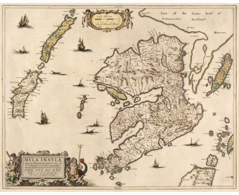
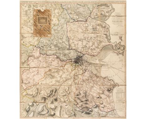
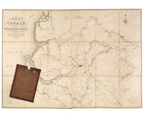
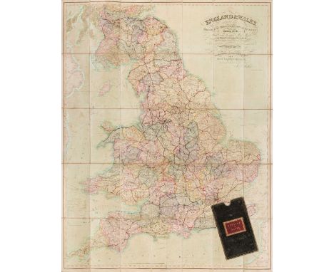
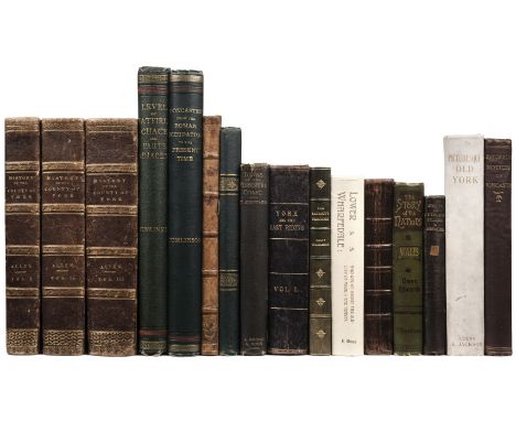
England & Wales. Walker (J & C), England & Wales founded upon the Grand Trigonometrical Survey, Shewing all the Mail Coach, Turnpike & Rail Roads, the Rivers & Navigable Canals, also the Boundaries & Divisions of Counties..., circa 1850, engraved map with contemporary wash colouring, sectionalised and laid on linen, slight staining and spotting, calligraphic title and table of explanation, 1300 x 1030 mm, contained in a contemporary green morocco gilt slipcase with red morocco gilt label to the upper cover, some wear to extremities, together with another copy similar (dated 1845) with some offsetting from the calligraphic title, contained in a contemporary cloth slipcase, with Wyld (James. successor to Mr Faden). A New Map of England & Wales Projected upon the Trigonometrical Operations made for the General Survey of the Kingdom, January 1st 1836, engraved map with contemporary wash colouring, sectionalised and laid on linen, table of the 'Altitudes of the Principal Mountains', and table of explanation, slight offsetting, edged in green silk, advertisement endpapers, 1250 x 950 mm, contained in a contemporary cloth slipcase with publisher's printed label to the upper cover, slipcase worn and frayed, plus Mogg (Edward). Map of the United Kingdom of Great Britain & Ireland with the adjacent parts of the Continent from Amsterdam to Paris and Brest..., January 1st 1834, engraved map with contemporary wash colouring, sectionalised and laid on linen, with an additional title above the map 'Mogg's Map of Steam Navigation', inset map of the Shetland and Orkney Islands, table of reference and compass rose, very slight staining, 770 x 610 mm, advertisement endpapers, contained in a contemporary blue card slipcase with publisher's printed label to the upper cover, slipcase worn and frayed at extremities, and Sayer (Robert). An Accurate Modern Map of England and Wales, drawn from the latest Surveys, Corrected & Improved by the Best Authorities, circa 1775, an engraved map with contemporary outline colouring, sectionalised and laid on linen, some staining and dust soiling, slight wear where old folds cross, 480 x 405 mm, contained in a contemporary marbled card slipcase with a near-contemporary manuscript ownership signature to the upper cover, slipcase worn and frayed, with Wyld (James). Wyld's Road Director through England and Wales being a New and Comprehensive Display of the Roads and Distances from Town to Town and of each Remarkable Place from London, 1851, lithographic folding map with contemporary outline colouring, laid on linen, slight offsetting, bound in contemporary cloth boards with publisher's label to the upper cover, some wear to extremitiesQTY: (6)

Lot 5

* Africa. Visscher (Nicolas), Africae Accurata Tabula ex officina, circa 1680, engraved map with contemporary wash colouring, slight oxidization to the old watercolour, 440 x 545 mm, mounted, framed and glazedQTY: (1)

Lot 277

Allen (Thomas). A New and Complete History of the County of York, 3 volumes, 1st edition, London: I. T. Hinton, 1828-31, 143 engraved plates, spotting (heavily in a few places), contemporary brown half morocco gilt, spines faded, boards marked, extremities with some wear, 4to, together with:[Peck, William]. A Topographical History and Description of Bawtry and Thorne, with the Villages Adjacent, Doncaster: Thomas and Hunsley, 1813, folding map frontispiece, full-page engraved plates throughout (original watercolour mounted to verso of two), occasional contemporary marginal annotations, occasional light spotting and toning, contemporary half calf, extremities worn, 4to, plusTomlinson (John). Doncaster from the Roman Occupation to the Present Time, Doncaster: John Tomlinson, 1887, full-page plates throughout, original green cloth gilt, lightly rubbed, folio, with 11 other topographical volumes QTY: (16)

Lot 456

Serres (John de). A General Inventorie of the History of France, from the beginning of the Monarchie, unto the Treatie of Vervins, in the yeare 1598,...translated by Edward Grimeston, London: George Eld., 1607, engraved title page plus further in-text illustrations & vignettes, later inscription to the head of the title page, bookplate to the front pastedown, gutters cracked, some marginal toning, lacking final page of 'The Table' to the rear, later embossed full calf, boards & spine rubbed with some loss, folio, together with:Mill (James), The History of British India, 3 volumes, London: printed for Baldwin, Cradock, and Joy, 1817, some repaired slight damage to the foot of the title page to volume 1, lacking a map in volume 2, some light spotting & toning throughout, contemporary uniform gilt decorated plum half morocco, boards & spines slightly rubbed, large 4to, plusCampbell (J.), Lives of the British Admirals: containing a new and accurate Naval History, from the earliest periods, 4 volumes, London: printed for Alexander Donaldson, 1779, period inscriptions to the front endpapers of volumes 1 & 2, 4 engraved frontispieces, 4 folding maps, bookplates to the front pastedowns, gutters cracked, some marks & light marginal toning, contemporary uniform full calf, hinges cracked, boards & spines slightly rubbed with some minor loss, 8vo, and other 18th & 19th century literature, mostly contemporary leather bindings, some odd volumes, overall condition is generally fair/good, 8vo/folioQTY: (6 shelves)

Lot 115

Sussex. Greenwood (C. & J.), Map of the County of Sussex from an actual Survey made in the Years 1823 & 1824..., Greenwood Pringle & Co., March 24th, 1825, large scale uncoloured engraved map, sectionalised and laid on linen, in three sections, calligraphic title, engraved vignette of Chichester Cathedral and table of reference to the hundreds, slight staining, 1250 x 2020 mm, marbled endpapers, contained in contemporary cloth slipcaseQTY: (1)

Lot 92

London. Mogg (Edward), Mogg's Strangers Guide to London, exhibiting all the various alterations & improvements complete to the present time, January 1st. 1837, engraved map with contemporary outline colouring, sectionalised and laid on linen, with 'A List of 500 of the Principal Places with References to their Situation on the Above Plan' below the map, very slight dust soiling, 500 x 570 mm, card endpapers with a contemporary manuscript ownership inscription, contained in a later card slipcase with a contemporary label to the upper cover, together with Cruchley (George Frederick). Cruchley's New Plan of London Shewing All the New and Intended Improvements to the Present Time, 1830, engraved map with contemporary outline colouring, sectionalised and laid on linen, table of references to both vertical margins and the lower horizontal margin, marbled endpapers, one with a publisher's advertisement, 425 x 595 mm, contained in a contemporary marbled card slipcase with a publisher's yellow printed label to the upper cover, slipcase wornQTY: (2)NOTE:The first described item. J. Howgego. The Printed Maps of London, number 238, state 9. The second item, number 307, state 4.

Lot 81

* Leicestershire. Speed (John), Leicester both County and Cities described, The Honorable Famylies that have had the titles of Earls thereof. With other accidents therein observed, Thomas Bassett & Richard Chiswell [1676], hand-coloured engraved map, inset town plan of Leicester, large margins, 380 x 510 mm, mounted, framed and double-glazedQTY: (1)

Lot 233

Bermuda. Narrative of the Voyage of H.M. Floating Dock "Bermuda," from England to Bermuda. Written in the Form of a Diary, by One of Those On Board, 1st edition, London: John B. Day, circa 1870, 4 tinted lithographed plates, one folding lithographed map, errata slip, light spotting and offsetting, original publisher's blue blindstamped cloth gilt, covers stained, extremities rubbed, 8voQTY: (1)NOTE:A scarce eye-witness account of a great naval engineering feat.

Lot 88

London. Homann (Johann Baptist, Heirs of), Regionis quae est circa Londinum specialis repraesentatio Geographica..., Ausfuhrliche Geographische Vorstellung der Gegend um London...., published Nuremberg, 1742, engraved map of the environs of London with contemporary hand-colouring, below the map is an uncoloured engraved panorama of the city, 510 x 575 mm,QTY: (1)NOTE:James Howgego. The Printed Maps of London, number 88.

Lot 576

Hooker (William Jackson). Journal of a Tour in Iceland, in the summer of 1809, 2 volumes, 2nd edition, London: Longman, Hurst, Rees, Orme, and Brown, 1813, half-titles, 8 engraved plates (3 folding), spotting, a few gatherings damp-stained, modern brown morocco-backed boards, 8vo, together with:Belt (Thomas). The Naturalist in Nicaragua: A Narrative of a Residence at the gold mines of Chontales; journeys in the savannahs and forests, 1st edition, London: John Murray, 1874, frontispiece, folding colour map, full-page engraved plates, smaller illustrations in-text, 32 pp. publisher's advertisements at end, lightly spotted, original blue pictorial cloth gilt, rubbed and marked, 8vo, plusGrant (George). Ocean To Ocean, Sandford Fleming's Expedition through Canada in 1872, 1st edition, London: Sampson Low, Marston, Low & Searle, 1873, 61 plates, lower hinge cracked, spotting, original burgundy pictorial cloth gilt, worn and marked, 8vo, with approximately 35 other travel books, both 19th & 20th-century QTY: (approx. 40)

Lot 89

London. Laurie & Whittle (publishers), A New Map of London, November 8th. 1800, engraved map with contemporary outline colouring, sectionalised and laid on linen, title cartouche of a ruined pyramid, a beehive, a ship, flag and anchor, table of explanation, 585 x 780 mm, contained in a contemporary marbled card slipcase with circular engraved label to upper cover, slipcase worn QTY: (1)NOTE:J. Howgego. Printed Maps of London, number 231. Unrecorded state published before Howgegos's first entry of 1804. This example may be the first edition as the 1804 edition is recorded as the '3rd. edition'.

Lot 31

British Isles. Speed (John), The Kingdome of Great Britaine and Ireland, published Thomas Bassett & Richard Chiswell, [1676], hand coloured engraved map, inset map of the Orkney Islands, inset views of London and Edinburgh, good margins, central fold repaired on verso, slight mount staining, 385 x 515 mm, English text on versoQTY: (1)NOTE:R. W. Shirley. Early Printed Maps of the British Isles 1477 - 1650, number 316.

Lot 80

Kent. Speed (John), Kent with her Cities and Earles described and observed, 1st edition, [1611], hand coloured engraved map, inset town plans of Canterbury and Rochester, central fold strengthened on verso, occasional marginal repaired closed tears, slight mount staining, 380 x 505 mm, English text on verso, together with Morden (Robert). Kent, circa 1695, hand-coloured engraved map, old folds, central fold partially strengthened on verso, 350 x 635 mmQTY: (2)

Lot 270

Stein (Marc Aurel). Sand-Buried Ruins of Khotan, Personal Narrative of a Journey of Archæological & Geographical Exploration in Chinese Turkestan, Cheaper Edition, London: Hurst & Blackett, 1904, photogravure plates and illustrations to text, folding colour map at rear, original pictorial rust-coloured cloth, very lightly rubbed, together withPrejevalsky (Colonel Nikolai). From Kulja across the Tian Shan to Lob-Nor, translated by E. Delmar Morgan, 1st English edition, London: Sampson Low, Marston, Searle, & Rivington, 1879, two folding colour maps (first map with long closed tear), 32-page publisher's catalogue at end, circular blindstamp of the Athenaeum Library to title (with red council stamp), and one or two further circular blindstamps elsewhere to text, hinges loose, original dark grey-green cloth, rubbed and some fraying and marks, 8vo, plusBeal (Samuel, translator). Travels of Fah-Hian and Sung-Yun, Buddhist PIlgrims, from China to India (400 A. D. and 518 A. D.), translated from the Chinese by Samuel Beal, 1st edition, London: Trubler & Co., 1869, folding colour map frontispiece, inner hinges partly broken, original gilt-decorated yellow cloth, rubbed and soiled with spine discoloured, and fraying to head and foot of spine and extremities, and others related: Through Deserts and Oases of Central Asia by Miss Ella Sykes and Brigadere-General Sir Percy Sykes, 1st edition, London: Macmillan & Co., 1920, and Among the Tibetans by Isabelle L. Bishop (The Leisure Hour Library), London: Religious Tract Society, 1794, all 8vo QTY: (5)NOTE:Yakushi (1994) P295a. Prejevalsky's second expedition, which travelled through East Turkestan and the Tian Shian but failed to reach the goal of Lhasa. He collected many plant and animal specimens during the course of his various expeditions, discovering a wild horse and gazelle, both named for him, as well as the Wild Bactrian camel.

Lot 68

Ireland. Braun (Georg & Hogenberg Franz), Galwaye, Dubline, Lymericke [and] Corke, published Cologne [1617], four engraved city plans on one sheet (as published), contemporary hand colouring, six costumed figures to the vertical margins with a view of 'Ennis Kelling Fort' and the Irish crest, large margins, 310 x 440 mm, Latin text on versoQTY: (1)NOTE:Andrew Bonar Law. The Printed Maps of Ireland to 1612. P 330.Published in volume 6 of the monumental work Civitates Orbis Terrarum. This is the only Irish plate to appear in the six volumes. The city plans are taken from John Speed's maps of the four provinces, which had been published six years earlier. Lest there is any doubt, the city plans are flanked by the same figures that Speed had used on his map of Ireland.

Lot 75

* Isle of Mull. Blaeu (W. J & Pont T.), Mula Insula quae es Aebudarum numero una est et Lochabriae ad occasum praetenditur. The Yle of Mull which is one of the Western Yles and lyeth ovir against Lochabÿr, Amsterdam, circa 1654, engraved map with contemporary outline colouring heightened in gilt, decorative title cartouche and mileage scale, 425 x 540 mm, mounted, framed and double-glazed, Latin text on verso QTY: (1)

Lot 248

Howard-Bury (Charles Kenneth). Mount Everest, The Reconnaissance, 1921, 1st edition, London: Edward Arnold, 1922, photogravure frontispiece, 32 black and white illustrations after photographs (one loose), 3 folding maps at rear, 'Presentation copy' stamp to title, ownership inscriptions to front free endpaper, occasional light spotting, original blue cloth gilt, 8vo, with loose publisher's advertisement slip, together with:Bruce (Charles Granville). The Assault on Mount Everest, 1922, 1st edition, London: Edward Arnold, 1923, photogravure frontispiece, 35 black and white illustrations after photographs, 2 folding maps at rear, occasional light spotting, original red cloth gilt, spine faded, 8vo, plusNorton (Edward Felix). The Fight for Everest: 1924, 1st edition, London: Edward Arnold, 1925, colour frontispiece, 31 illustrations (7 colour), 1 large folding map at rear, 1 folding panorama, occasional spotting, a few small adhesive tape reinforcements to closed tear on folding map, original green cloth gilt, lightly marked and rubbed, 8voQTY: (3)

Lot 73

Ireland. Taylor (John), Taylor's Map of the Environs of Dublin, extending 10 to 14 Miles from the Castle, by Actual Survey on a Scale of 2 Inches to 1 Mile, Dublin, 1816, engraved map with contemporary wash colouring, sectionalised and laid on linen, table of explanation, dedication and a note of the banks in Dublin Bay, 900 x 805 mm, contained in a contemporary marbled card slipcase, case worn and frayedQTY: (1)

Lot 575

Hooker (Joseph Dalton & Ball, John). Journal of a Tour in Marocco and the Great Atlas..., with an Appendix including a sketch of the Geology of Marocco, by George Maw, 1st edition, London: Macmillan and Co., 1878, folding panoramic view wood engraved frontispiece and six wood engraved plates, folding lithograph cross-section geological plate, folding lithograph map at rear, few wood engraved vignette illustrations, frontispiece strengthened to folds at verso and folding map strengthened to one fold at verso, original publisher's pictorial khaki brown cloth gilt in bright condition, 8voQTY: (1)NOTE:Neate H109; Playfair 1275. 'This journey was undertaken in 1871, and the account of its botany and geology is one of the most important works that has been written on the country' (Playfair).

Loading...Loading...
  • 109182 item(s)
    /page

Recently Viewed Lots