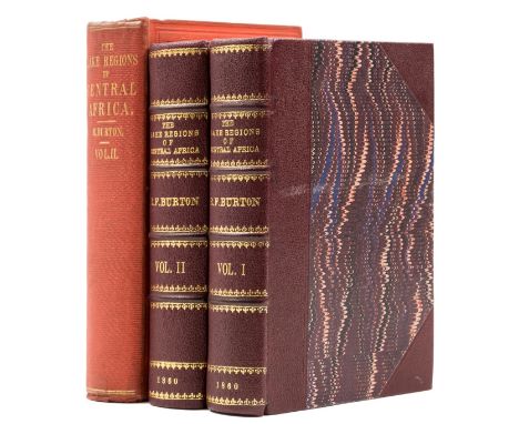

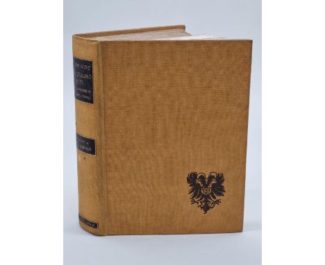
Africa.- Burton (Sir Richard Francis) The Lake Regions of Central Africa, 2 vol., first edition, half-titles, tinted lithograph frontispieces and 10 tinted lithographs, woodcut illustrations, lacking original folding map, vol. 1 with modern facsimile of folding map in pocket at end, scattered faint spotting, ex-Bournemouth Public Library with occasional faint ink-stamps, modern half-morocco, gilt, 1860; The Lakes Regions of Central Africa, vol. 2 only (of 2), second issue, tinted lithograph frontispiece, 5 tinted lithographs, woodcut illustrations, folding map, publisher's advertisements at end, scattered very faint spotting, original red cloth, fractional bumping to corners and spine extremities, 1860, [Penzer pp.65-66], 8vo (3)⁂ Penzer notes that unlike the first issue of this work, vol. 2 of the second issue generally contains the map.
We found 109198 price guide item(s) matching your search
There are 109198 lots that match your search criteria. Subscribe now to get instant access to the full price guide service.
Click here to subscribe- List
- Grid
-
109198 item(s)/page
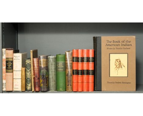
America.- Catlin (George) Letters and Notes on the Manners, Customs, and Condition of the North American Indians, 2 vol. bound as 4, second edition, frontispiece, plates, one folding map, split in half at foldline, one or two short marginal tears and loss to corners, neat tissue repairs, scattered faint spotting, modern calf-backed boards, 1841 § Dodge (Colonel Richard Irving) Our Wild Indians: Thirty-Three Years' Personal Experience ..., portrait frontispiece, plates, occasional marginal water-staining, ex-library with usual ink-stamps, modern crushed morocco-backed boards, Hartford, Conn., 1882 § Garland (Hamlin) The Book of the American Indian, first edition, frontispiece, plates, scattered spotting, original cloth-backed boards, slight bumping to corners and extremities, New York & London, 1923; and others similar, v.s. (16)
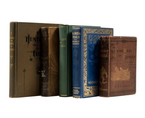
America.- Florida.- Cory (Charles B.) Hunting and Fishing in Florida, including a Key to the Water Birds, frontispiece, plates and illustrations, 2 pp. advertisements at end, bookplate, original pictorial cloth, a little rubbed, slight bumping to corners and extremities, Boston, Mass., 1896 § Deland (Margaret) Florida Days, colour frontispiece, plates and illustrations, ex-library with label, ink- and blind-stamps, light soiling to title and frontispiece, cracked hinges, old tape marks to endpapers, original pictorial cloth, gilt, rubbed, bumping to corners and extremities, 1889 § Townshend (F. Trench) Wild Life in Florida, frontispiece, title in red and black, one map, all linen-backed, ex-library with occasional blind- and ink-stamps, occasional marginal soiling, modern cloth, 1875; and others on Florida, 8vo (5).

America.- Inman (Colonel Henry) & Colonel William F. Cody. The Great Salt Lake Trail, frontispiece, 7 plates, folding map, faint spotting to title, bookplate, blind-stamp of Sir Thomas McIlwraith to title, original cloth, gilt, fractional bumping to corners and extremities, New York, 1898 § Cody (Louisa Frederici) and Courtney Ryley Cooper. Memories of Buffalo Bill, signed by Mrs. Cody on half-title, lacking front free endpaper, vintage silver albumen print of Buffalo Bill and Mrs. Cody loosely inserted, scattered faint spotting, original cloth, remnants of dust-jacket flap pasted to front pastedown, New York & London, 1919 § Buel (J. W.) Heroes of the Plains or Live and Wonderful Adventures of Wild Bill, Buffalo Bill, Kit Carson ..., colour frontispiece, wood engraved illustrations, some full-page, scattered faint spotting, previous owner's ink inscription, original pictorial cloth, gilt, bumping to corners and extremities, New York & St. Louis, 1882; and others on or by Buffalo Bill, 8vo & 4to (13)
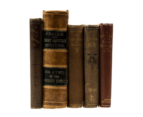
America.- Rocky Mountains.- van Tramp (John C.) Prairie and Rocky Mountain Adventures, or, Life in the West, Columbus, frontispiece, plates, occasional light marginal finger-soiling, contemporary calf, cracked upper joint becoming loose, a little rubbed, 1869 § Bowles (Samuel) Across the Continent: a Summer's Journey to the Rocky Mountains ..., folding colour map frontispiece, short tear with old tape repair, scattered spotting, cracked hinges, original cloth, light spotting, bumping to corners and extremities, Springfield, Mass, 1866 § Bird (Isabella L.) A Lady's Life in the Rocky Mountains, half-title, frontispiece, plates and illustrations, ex-library with ink-stamp to half-title, cracked hinges, original cloth, a little rubbed, slight bumping to corners and extremities, 1885; and others similar, 8vo (5).
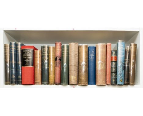
America.- Stansbury (Howard) Exploration and Survey of the Valley of the Great Salt Lake of Utah, lithograph frontispiece, 55 plates, 3 folding, 1 detached and loosely inserted, 1 folding map, spotting, original cloth, bumping to corners and extremities, Washington, 1853 § Kolb (E. L.) Through the Grand Canyon from Wyoming to Mexico, signed by author, colour frontispiece, plates, original pictorial cloth, a little rubbed, slight bumping to corners and extremities, New York, 1920 § McCabe, Jr. (James D.) Lights and Shadows of New York Life; or, the Sights and Sensations of the Great City, frontispieces, illustrations, several full-page, previous owner's ink inscription to front pastedown, cracked hinges, original cloth, gilt, rubbed and worn, bumping to corners and extremities, Philadelphia, n.d.; and others, America, 8vo (28)
America.- Wild West.- Harris (A. C.) Alaska and the Klondike Gold Fields, frontispiece, short marginal tear and old tape repair, plates and illustrations, 2 folding maps, one with tears laid down and expertly repaired, occasional spotting, small marginal worming not affecting text, modern half-calf, [Washington D.C.], 1897 § Campion (J. S.) On the Frontier, frontispiece, plates, advertisements at end, bookplate, original cloth, slight rubbing to corners and extremities, 1878 § Bowles (Samuel) Our New West, frontispiece, plates, scattered spotting and staining, later calf, rebacked retaining original backstrip, Hartford, Ct., 1869 § Beadle (J. H.) Western Wilds, and the Men who Redeem Them, folding colour map frontispiece, illustrations, previous owner's ink inscription, scattered faint spotting, contemporary half-morocco, gilt, rubbed, bumping to corners and extremities, Cincinnati, 1880; and others, frontier or wild west, 8vo (32)
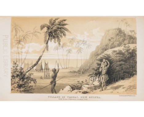
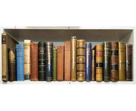
Australia.- Macgillivray (John) Narrative of the voyage of H.M.S. Rattlesnake... during the years 1846-1850. Including discoveries and surveys in New Guinea, the Louisiade archipelago...to which is added...the exploration of the Cape of York peninsula, 2 vol., first edition, engraved folding map and 13 plates after T. Huxley & others (2 engraved, the remainder lithographed, including 7 tinted), wood-engraved illustrations, advertisement slip for Napier's War in the Peninsular tipped-in to vol.2, remains of advertisement slip for Rae's Franklin loosely inserted in vol.1, ex-Brooklyn Public library copy with ink and perforated stamps to titles, perforated stamp within image of most plates, map with perforated stamp, short tears or splits, and laid down, occasional perforated stamp within text, preliminaries of vol.1 all but detached, some chipping, including preliminaries of vol.1., occasional spotting or light staining, lightly browned, brown water-staining to final 2 plates of vol.2, mostly marginal, but touching caption and small part of image on the second, modern dark brown half morocco, spines with double leather labels, [Bagnall 3260; Ferguson 11972; Hill (2004) 1060; Wantrup 145], 8vo, T. & W. Boone, 1852.⁂ 'A very important voyage of exploration and scientific research' (Ferguson). John MacGillivray served as the chief naturalist on the Rattlesnake. The voyage was part of a series of hydrographical expeditions undertaken by the Admiralty, and aimed to chart the Great Barrier Reef, and the northern and southern coastlines of New Guinea. Ports visited included Rio de Janeiro; Simon Bay, South Africa; Port Louis, Mauritius; Hobart Town, Tasmania; Sydney, New South Wales; Bay of Islands, New Zealand; and Stanley, The Falkland Islands.
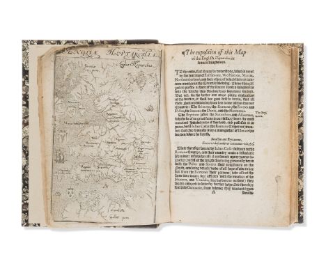
Kent.- Lambarde (William) A Perambulation of Kent, first edition, engraved map after Richard Lyne, additional f. signed H2 'The names of Kentish writers', occasional contemporary ink marginalia and notes to final verso, lacking title, map with small chip to lower corner (with minor loss to image), trimmed just within border at head and foot and all but loose, water-stained, occasional spotting or staining, lightly browned, modern calf-backed marbled boards, spine in compartments and with black leather label, [STC 15175], small 4to, [[By Henrie Middleton] for Ralphe Nevvberie, dwelling in Fleetestreete a litle aboue the Conduit], 1576.
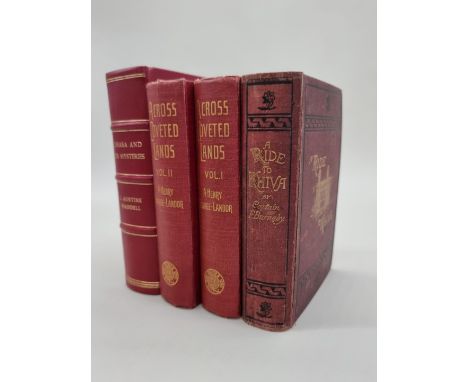
WADDELL (L Austine): 'Lhasa and its Mysteries..a record of the expedition of 1903-1904', New York, E P Dutton, 1905: FIRST EDITION, maps and plans throughout, some colour, folding tinted map at end, recent red leather, gilt ruled and lettered, teg: SAVAGE-LANDOR (A Henry): 'Across Coveted Lands or a Journey from Flushing (Holland) to Calcutta, Overland..', London, Macmillan, 1902: 2 vols, publishers red cloth gilt, VG with minor wear: with one other, travel. (4)
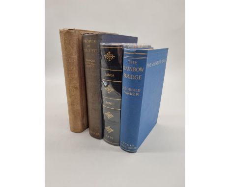
FORESTER (Thomas): 'Rambles in the Islands of Corsica and Sardinia...', London, Longman, Brown et al, 1858: FIRST EDITION. With map & 8 litho plates (one folding): publishers salmon cloth gilt, rubbed and dampmarked, free endpapers and flyleaves removed, endpaper joints strained, large 8vo: with 3 others, travel, including Francis Rennell Rodd's 'People of the Vale', 1926. (4)
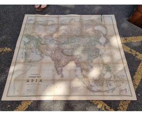
ASIA, FOLDING MAP: 'Stanford's Library Map of Asia..Constructed by A. Keith Johnston, FRSE..': London, Edward Stanford, pub. July 31st 1862. Large folding map, hand coloured in outline, dissected into 48 sections and laid onto linen, approx 158 x 173.5cm, some light toning and offsetting, else VG, lacking one board. (1)
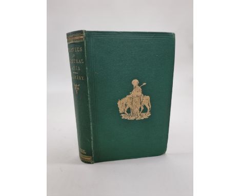
VAMBERY (Arminius): 'Travels in Central Asia, being the Account of a Journey from Teheran across the Turkoman Desert on the Eastern Shore of the Caspian Khiva, Bokhara, and Samarcand...', London, John Murray, 1864: FIRST EDITION, wood engraved plates, folding map in pocket at rear, publishers green cloth gilt, expertly recased with endpaper joints renewed, light wear to extrems but a very good copy, 8vo. (1)

FISHER (Alexander): 'Journal of a Voyage of Discovery, to the Arctic Regions..', London, printed for Richard Phillips, n.d (1819): VIII 104pp: folding map & 3 plates: issued as Vol.1 No.1 of 'Modern Voyages and Travels'. Bound with: PRIOR (James) 'Narrative of a Voyage in the Indian Seas, in the Nisus Frigate..', London, same publisher, n.d: with folding map frontispiece and plates: recent dark calf gilt, 8vo. (1)
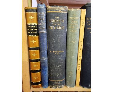
ISLE OF WIGHT: COOKE (William): 'A New Picture of the Isle of Wight, illustrated with thirty-six plates, of the most beautiful and interesting views throughout the island...': London, printed by W Wilson, 1808: FIRST EDITION, hand-coloured map and 36 engraved plates, some foxing and browning, contemporary diced calf boards, recently rebacked: LONG (W H) 'A Dictionary of the Isle of Wight dialect, and of provincialisms used in the island...', London, Reeves & Turner, 1886: publishers blind stamped blue cloth, rubbed and bumped, 8vo: with 3 other books on the Isle of Wight. (5)
AGRICULTURE: MURRAY (Adam): 'General View of the Agriculture of the County of Warwick..', London, printed by B McMillan, 1813: folding map frontispiece, period paper covered boards, recently rebacked, edges rough trimmed, 8vo: LOWE (Robert) 'General View of the Agriculture of the County of Nottingham..', London, W Smith, 1798: hand-coloured folding map, bound with: KENT (Nathaniel) 'General View of the Agriculture of Norfolk..': Norfolk Press, 1796, folding frontispiece and plate, later tree calf gilt with red morocco label, light wear else VG: with 9 other volumes similar, varying bindings and condition, all 8vo. (11)
INDIA: HODGES (William): 'Travels in India during the years 1780, 1781, 1782 & 1783...', London, printed for the author, 1793: FIRST EDITION. Large folding engraved map and 14 engraved plates, without leaf bearing table of plates and advertisements at rear, contemporary marbled boards, 20thc Indian calf gilt reback with endpaper joints renewed and outer corners refurbished, scattered foxing and handling marks internally but a good clean copy overall, 4to. (1)


AMERICA: WHYMPER (Frederick): 'Travel and Adventure in the Territory of Alaska..', London, John Murray, 1868: frontispiece, folding map at rear and numerous illustrations: publishers brown cloth gilt, rubbed and worn: MESSITER (Charles) 'Sport and Adventures Among the North-American Indians..', London, R H Porter, 1890: publishers green decorated cloth, spine cocked, rubbed and scuffed, 8vo: with a quantity of other books over 2 shelves, chiefly American travel and memoirs. (2 shelves)

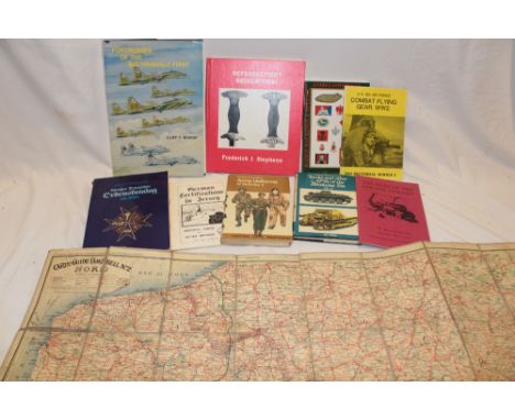
PRESTON (R M P): 'The Desert Mounted Corps..an account of the cavalry operations in Palestine and Syria 1917-1918': London, Constable, 1921: publishers red cloth, a little rubbed, 8vo: MASSEY (W T) 'How Jerusalem was won..being a record of Allenby's campaign in Palestine': London, Constable, 1919: publishers blue cloth gilt, 8vo: KENDALL (Henry) 'Village Development in Palestine during the British Mandate..': Waterlow & Sons, 1949, folding map in pocket at rear, library marking, publishers cream cloth, 4to: with 6 others, military. (9)


BAKER (Samuel): 'A New and Exact Map of the Island of St. Christopher in America, according to an actual and accurate survey made in the year 1753. Describing the parishes with their respective limits, contents & churches, also the highways, the situation of every gentleman's plantation..': copper engraved map with contemporary hand-colouring, 2 sheets only (of 4), torn creased and frayed, for sale with all faults and not subject to return. (1)

BRITISH ATLAS: WALLIS (J, publisher): 'Map of England & Wales from the Latest Surveys': 20 double-page maps (circa 1815): bound with 12 Scottish maps, all with contemporary hand-colouring, some staining and repair, recent half roan, large folio. For sale as a collection of maps and not subject to return. (1)


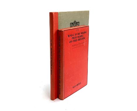
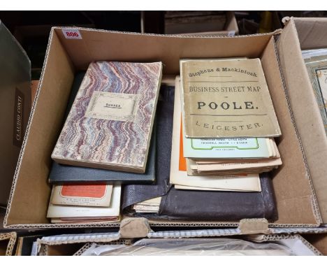
MILITARY: two volumes. Firstly, Becke, Major A.F. (ed.) 'History of the Great War Based on Official Documents...Order of Battle Divisions Part 3A. New Army Divisions (9-26)', HMSO, 1938. In grey boards with red spine. Comes with: 'Manual of Map reading, Photo Reading, and Field Sketching'. The War Office, 1929 (Reprinted with Amendments (Nos. 1 to 4) 1939). In red boards. Pencil inscr. to front cover of H.B.A. de Bruyne and date (1939). De Bruyne was code-named 'Bruno' a key figure under Norman Crockatt at MI9, we understand. In excellent condition internally with various fold-out map/illus.


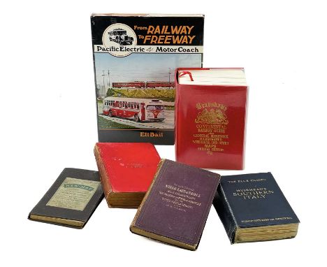
Railway Maps & Books: West London Map, USA ref. book, Bradshaws & guide books with tram/railway maps Comprising:"Environs of West London" by Ordnance Map Depot being Gall and Ingliss 60 miles west of London featuring roads and railways. 2":1 mile scale. Mounted on cloth. Size 75cm x 64cm.Mint sealed copy of "From Railway to Freeway Pacific Electric and the Motor Coach" by Eli Bail.Bradshaws Continental Railway Guide of May 1913 with all maps, timetables, bookmark etc. 1106 pages. Reprinted in 2012, clean example.Muirhead's Southern Italy published 1925. Numerous town plans depicting tram and rail routes e.g. Palermo, ideal for tracing routes past and present.Murray's handbook of Japan published 1903 with numerous maps and plans.CB Black guide to North East of France, Belgium and Holland published 1873 with numerous maps and plans of towns and cities.Interesting and useful research material.

Early Railway Maps - Cheffins's Railway Map Comprising a dated 1848 Cheffins's map of the English and Scotch Railways. Scale approx. 13 miles to 1 inch. Hand coloured and dissected mounted on cloth. Cloth is somewhat marked by brown foxing, map much less so. Shows completed and proposed railways. Size 58cm x 72cm.

Early Railway Maps - Black's Road and Railway Travelling Map of England circa 1855 Comprising a circa 1855 Black's Road and Railway Travelling Map of England 15 miles to 1 inch dissected map mounted on cloth and subsequently partly rebound but retaining its attractive gilt cover. Size 62cm x 90cm.


Early Railway Maps, Cassell's Railway Map of Great Britain circa 1864 Comprising a 81/2 miles to 1 inch dissected map remounted on new cloth at a later date. A very detailed map covering the four areas: North East, North West, South West and South East In very good condition. Each map 51cm x 70cm.

Early Railway Maps - E Stanford 1":5 miles N.E. and N.W. England 1855 maps "A map of England and Wales showing the principal roads, railways, rivers and canals". Dissected and mounted on cloth: All details hand coloured. N.B. Lincoln Sheet has been mounted upside down! Only two of the areas to make up England and Wales are present. Size 90cm x 107cm per map. Vendor has supplied a sketch of the Lincoln sheet.

Cornwall Interest: Cornish Mineral Railways Map, GWR wooden jigsaw and early engravings Comprising:An 1873 Cornwall Mineral Railways Map (f&g) 75cm x 50cm showing Cornwall Mineral Railways, Delabole proposed railway and Devon and Cornwall Railway Western extensions in red and blue - a rare item.An early Great Western No. 4073 Caerphilly Castle complete 150 piece wooden jigsaw together with original blue box. Size 24" x 81/2" (f&g)A framed and glazed hand coloured mounted early set of four engravings of the Liverpool and Manchester railways - scenes as follows: "Moorish Arch", "Sankey Viaduct", "Entrance to Manchester", "Entrance of the Tunnels".

Miniature dolls, GWR railway map & GB mint decimal stamps A mixed lot comprising:2 x small dolls - length 15cm porcelain headed late 19th century articulated German doll lacking one arm. The second doll is Japanese origin length 13cm with ceramic head, arms and legs.A GWR paper map (66cm x 50cm) in good condition. Circa 1930Approx. £27 face value of usable GB decimal stamps in Royal Mint presentation packs.

Historic Newspapers and other ephemera including silk map An interesting lot of mostly newspapers including many 1926 General Strike issues. Some WWII related papers and publications. Amongst the more unusual papers is an 1805 Times reproduced in 1924 for the British Empire Exhibition and an 1815 Times reproduced and sent by post 50 years later. Lot also includes a wartime Silk Map of Burma.
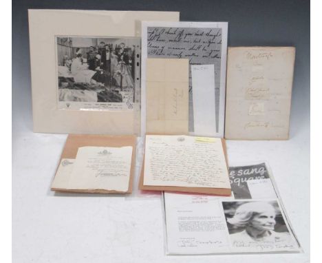
A collection of fifty-three autographs, 1815-1985, spanning the influential early 19th century Wendell Holmes and Lowell families from Massachusetts, 19th-century British aristocrats and other notable contemporaries, film stars, and the original singer of "A Nightingale Sang in Berkeley Square": Two-page letter, with remains of seal, signed by Mary Jackson Holmes (1802-25), the sister of Oliver Wendell Holmes, headed "Cambridge [Massachusetts] February 11th 1815". The letter was sent by one teenaged member of a leading Massachusetts family to another, Susan Cabot Lowell of Boston (1801-27), whose family gave its name to the town of Lowell, Massachusetts. Mary Jackson Holmes mentions her hobby of map-making, referring to Massachusetts, New Orleans and the Mississippi River; and mentions, apparently tongue-in-cheek, a letter from "his Excellency Sancho Panza". She died aged only 23 in 1825, a year after the birth of her son, Charles William Parsons. The Massachusetts Historical Society curates the Lowell Family Papers. with: (b) 51 clipped autographs, most of British aristocrats, laid on to 10 loose pages from an album (double-sided), each page inscribed "1878" or "c. 1878". All clipped from letters or other documents except for a one-page letter signed by the Marquis of Sligo, 1885. Signatures include Duke of Grafton, Marquis of Hertford, Earl Camperdown, General Lord Lucan, Viscount Hardinge, Duke of Buccleugh, Duke of Norfolk, W. G. Armstrong (gun-maker), Hugh Childers M.P., William Cope R.A., Sir Moses Montefiori (philanthropist), Joseph Prestwick (Professor of Geology).with:(c) The actress Anna Neagle, inscription and signature on mounted photographic still from the film "Sixty Glorious Years" ("An R.K.O. Radio World Release"), 24 x 19 cm., inscribed "Mabel Hope/It is nice to have you with us again in the Florence Nightingale picture/Anna Neagle" (some ink loss/flaking). Mabel Hope's name and Mill Hill, London NW7 address are inscribed on the back of the photo. Anna Neagle starred as Queen Victoria in the film 'Sixty Glorious Years" (1938). She also starred as Florence Nightingale in the historical drama film "The Lady with a Lamp" (1951), so the reference to this film suggests that the inscription was written in about 1951. with:(d) Three autographs of Judy Campbell (1916-2004), the original singer of the famous song "A Nightingale Sang on Berkeley Square", introduced in a Second World War revue in 1940: a signed photograph; a signed typed letter to "Jon Clarke" with the letterhead of her home, 21 Old Church Street, Chelsea, London SW3; and a photocopy of the title page of the sheet music for "A Nightingale Sang on Berkeley Square" (but with her original signature: the letter apologises for the fact that she had no original copy of the sheet music to send). In addition, a copy of the original sheet music is included in this lot. The letter is not dated, but must be post-1974, the date she moved to the Chelsea house (she was at that address until her death in 2004). Judy Campbell was the mother of Jane Birkin, the grandmother of Charlotte Gainsbourg, and the muse of Noel Coward. with: (e) Autograph of Tyrone Power (1914-58), the American film and theatre actor, in typed letter signed, dated 5 April 1956: "Dear Mrs Kirkpatrick, Thank you very much for your kind letter. I am delighted to hear that you enjoyed the production/ I had a pleasant time while in Scotland and as I have my own car, was able to see much of the beautiful countryside/ Thank you for writing to me, With best wishes, TYRONE POWER" (and signed above his typed name). On Grand Hotel, Birmingham headed notepaper, in the original envelope with the Grand Hotel's printed crest. Addressed to Mrs Jeanne Kirkpatrick of Giffnock, Renfrewshire. Power's reference to "the production" and to his time in Scotland must refer to his stage performance, in March 1956, in The Devil's Disciple by George Bernard Shaw at the King's Theatre, Glasgow and also in Edinburgh. Power's stay in Birmingham in April that year is probably explained by his starring roles in some of Associated Television's earliest programmes (he had been present at the inaugural ceremony for Midlands Independent Television in February 1956 in Birmingham). with: (f) Interesting full-page First World War-period manuscript letter written and signed by Andrew Bonar Law (1858-1923), dated 5 February 1917, when he was Chancellor of the Exchequer in Lloyd George's Coalition Government. With the Chancellor's printed letterhead and in the original envelope stamped "Treasury". Bonar Law writes to Mr H. O. Hope of Banwell Castle, stating that "The war has ... reached a position in which it is evident that the issue must largely depend upon the staying power of the combatants, and in my belief there is nothing which would do more to hasten a satisfactory peace than the evidence of the financial stability of the United Kingdom which would be shown by the complete success of the War Loan ..." Bonar Law goes on to invite Mr Hope to "make a liberal subscription to the Loan". A revealing sidelight on the vital importance of the mammoth 1917 War Loan, which raised the astonishing sum of £2 billion and which allowed the UK to keep fighting in the First World War. Bonar Law became Conservative Prime Minister after the General Election of 1922.
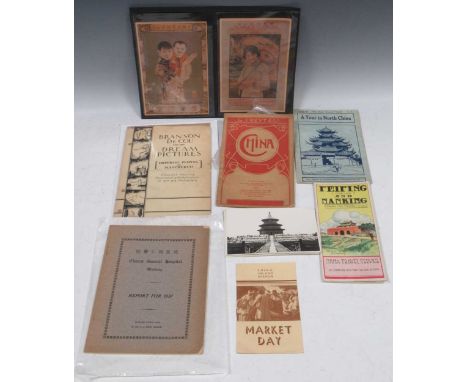
Eight items of travel and other ephemera concerning China, 1900 to 1930s, comprising:Rare folding colour map of China, decorative thick paper wrappers, published in 1900 by G. Freytag & Berndt, Vienna and Leipzig. The map includes the European concession territories, besieged during the Boxer Rebellion in 1900, which broke out in the year of the map's publication."Peiping (Peking) and Nanking. China's Old Capital and New". Illustrated folding pamphlet with decorative colour cover and colour map, published by China Travel Service, c. 1930s (post-1928, when Peking was first called Peiping)."Branson de Cou and his Dream Pictures (Imperial Peiping and Manchukuo). A Musical Travelogue with Masterpieces of Art and Photography", 4 pages leaflet, 1934, New York. In 1935 Branson de Cou gave eight lectures in American cities on Peiping and Manchukuo.Frank L. Norris, Bishop in North China. A Tour in North China. [1920s]. Stapled pamphlet, 16 pages.Warren, Market Day. [1930s]. Published by China Inland Mission. Stapled pamphlet, 8 pagesChurch General Hospital, American Church Mission, including many real photographic cards, Wuchang, China. Report for 1937. 1938, published by R.T.S. Press, Hankow, China. 37 pages, with photographs and Chairman's Report in Chinese as well as English. Thick paper wrappers, lettered in black. Scarce.photographs of Peiping, c. 1930s. Two colour photographs, advertisements in Chinese and English, showing fashionably dressed women, 1930s.


A group of ephemera including an original hand-drawn rotoscope lightsaber illustration on paper, three Lucasfilm Ltd. letterhead documents, a location map copy, two glossy press photos, and a biscuit foam section of a miniature Death Star model from the production of Star Wars: Episode IV - A New Hope (Lucasfilm Ltd., 1977).8.5 x 11 inches


Early 1800s A.D. With King William IV (1830-1837) modelled in the half-round beside a draped table with a crown, holding a scroll or map; horizontal base with abraded legend 'WILLIAM THE FOURTH'. 64 grams, 81 mm (3 1/4 in.). Acquired 1960s-1990s. Late Alison Barker collection, a retired London barrister. [No Reserve]

Football collectables, Chelsea FC, the complete package!, two large boxes containing everything the Chelsea fan desires including table lamps, door mat, mini guitar, mechanical ashtray, sunglasses, clocks, yoyos, jigsaw, merchandise catalogues, two umbrellas, OS map showing Stamford Bridge, Jose Mourrinho wall hanging, Champions League Winners rosette 2021, money box, lunchbox, coasters & more! BUYER TO ARRANGE COLLECTION.
-
109198 item(s)/page