We found 109198 price guide item(s) matching your search
There are 109198 lots that match your search criteria. Subscribe now to get instant access to the full price guide service.
Click here to subscribe- List
- Grid
-
109198 item(s)/page


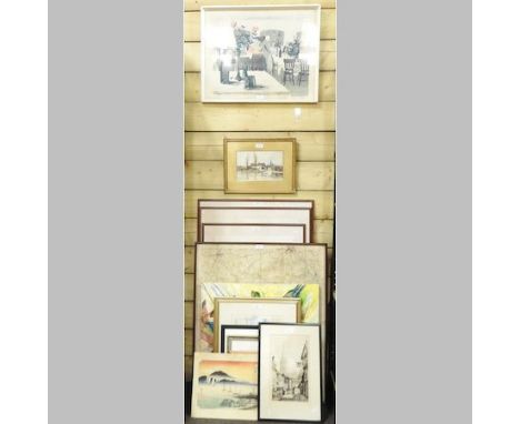
Lot 576
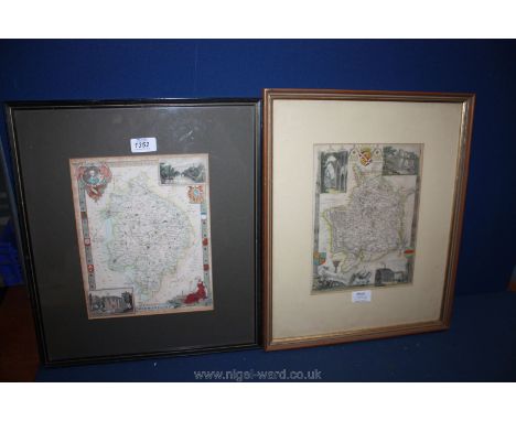
“The Royal Scots Tercentenary 1633-1933”, 12 large postcard size coloured prints of uniform, covering the period, mounted and framed together, 17½” x 28½”; 2 Smitherman coloured prints of Norfolk Rangers uniform, 1783 and 1795, mounted and framed together 19” x 25”; “A Cartographic History of Sussex” being a map of the county with vignettes and details, c 1960, mounted and framed, 27” x 33”; 6 others. GC to VGC (9)

Lot 21
World coins x 8, Falklands 1s x 4, 50p x 3; 1995 VE day, 2001 75th birthday, 2002 Coach, 1999-200 Island Map bi-metal; Marshall Islands 1s x3, 1990 Battle of Britain $5 cu-ni plus $10 x 2; 1991 Mosquito, 1994 B-day both brass all prooflike; Uganda 2000 shillings, 2001 silver proof all encapsulated


Lot 1122
Attributed to William Russell Flint (1880 - 1969), watercolour on fabric - A pirate treasure map, 46cm x 50cm.Provenance: By descent from the vendor's grandfather, artist and close friend of Russell Flint. As a frequent house guest at Dryderdale House, Russell Flint was often involved in amateur dramatic productions and by family tradition this was painted by the artist as a prop for a production of Treasure Island - offered together with two books by Russell Flint (3)


Lot 16
Adam Johann von Krusenstern (1770-1846), Voyage Round the World in the Years 1803, 1804, 1805, & 1806, by order of His Imperial Majesty Alexander the First, on board the Ships Nadeshda and Neva, Volume 1, London: Printed by C. Roworth and T. Davison for John Murray and the Board of Longitude, 1813, with hand-coloured aquatint frontispiece and folding engraved map, in original half leather binding with marbled paper


Lot 2106
Four 19th Century and Later Souvenir and Advertising Fans of Historical Interest, including a commemorative fan for the Paris Exposition Universelle 1889, of cockade form, with a drawing of the Eiffel Tower to the central support, 38cm; folding fan for the International Exhibition of 1937 in Paris, depicting a map of Paris and shops and services to the verso, 26cm; paper fan for the Louvre Paris, featuring two Japanese figures in kimonos, 28cm; a late 19th century fan painted with flowers, 38cm Paris Exposition fan - fabric mount is torn to the edges. Paper rubbed to the handle and wear. International Exhibition fan - scuffing and rubbing to the card. Louvre fan - several holes to the mount and slight wear Painted fan - paper mount ripped in several places, fading and scuffing.


Lot 261
Robertson - William 'An Historical disquisition concerning the knowledge which the ancients had to India' Third edition with fold out map, published by A Strahan, London 1799, bound in tan dark calf with gilt decoration, further books by Robertson's 'The History of America' in four volumes, with two fold out maps, printed for A Strahan, London 1800, bound in tan calf with gilt decoration. (5)


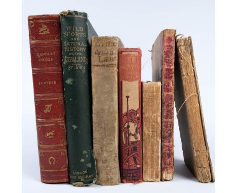
Lot 179
A collection of books To include The Scotch Itinerary by James Duncan, with folding map, Glasgow, 1805, Handley Cross by R. S. Surtees with illustrations by John Leech, London, 1854 and Wild Sports of the Highlands by Charles St. John, London 1893, together with four other similar publications (7)


Lot 541
Comprehensive WW2 Air Gunner's Uniform, Medal and Paperwork Collection all relating to 'Fl/Lt Colin McDermott'. Consisting blue grey service dress tunic. The cuffs with Fl/Lt rank. Left breast with embroidery 'AG'. Half wing over 1939/45 Star, F & G Star, Defence medal ribbons. KC brass RAF buttons ... Blue grey Officer service dress cap. KC bullion and gilt Officer's cap badge. Chinstrap absent. Some service wear and minor moth ... Blue grey field service cap. KC gilt two piece cap badge. KC RAF front buttons. Some service wear and minor moth .. WW2 medals consisting 1939/45 Star, France & Germany Star, Defence medal and War medal, all in box of issue named to 'F/Lt Colin McDermott' ... Unopened Air Crew first aid outfit ... Osnabruck 1943 dated issue map ... Good selection of photographs of 104 Course Air Gunnery, some signed by crews ... Bombing photographs. Good collection.

Lot 548
Good Selection of Target and Aerial Photographs consisting various target photos including Hassel ... Mailly-Le-Camp ... Kiel ... Berchtestagen ... Hannover ... Essen. Together with a large printed map of Hamburg showing the damaged areas from raids 24/7/43 - 24/8/43 ... Unused bomb aimer's form ... Instruction booklet covering bombing. Quantity.


Lot 107
Miscellaneous Lot comprising: 14 x crowns: 1935(x3) AEF to EF, 1937 AEF, 1951(x2) with certs, in BofI & 1953(x8) in plastic cases; a set of 7 x CuNi crowns commemorating the Queen Mother's 80th Birthday 1980 issued by UK, Guernsey, Gibraltar, St Helena, Tristan da Cunha, Falkland Islands & Tuvalu, card mounted in a red leatherette wallet UNC, Falkland Islands a set of 3 x crowns 1977, 1980 & 1981 together with a 'Liberation Medal' (issued by Spink) depicting obv. map of Falkland Islands, rev. British Soldiers raising Union Flag, card mounted in a red leatherette wallet UNC, 220 x foreign coins including 36 x silver (weight 168g), approximately 230 x pre-decimal sixpences & 4 x 'plastic' sets 1953, together with 6 x commemorative medals comprising: 3 x Silver Jubilee 1935 official small (32mm) silver by Metcalfe (two in BofI), 'Sinking of the Lusitania 1915' British-made cast copy in original box & 2 x Selby Abbey commemorative medals 1969 'Queen's Visit' & various other coins, imitation guineas etc


Lot 131
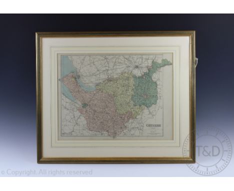
Books and Maps - a Philips ten - sheet road map of England and Wales, cloth edition; Bartholomew's General Map of Ireland; Motorways (Overseas) Touring map of Europe c.1950's; Ward Lock and Co. The Isle of Wight; Observer's book of Aircraft, Pond Life; The Science Fiction illustrations of Peter Elson and Chris Moore; Motoring through Punch 1900- 1970 ; The Flights of Icarus; etc
-
109198 item(s)/page