We found 109182 price guide item(s) matching your search
There are 109182 lots that match your search criteria. Subscribe now to get instant access to the full price guide service.
Click here to subscribe- List
- Grid
-
109182 item(s)/page


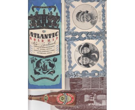
Lot 1308
ENGLAND 1937 Collection of items from the FA Tour to Australia and New Zealand 1937. These items are from the New Zealand leg and were previously owned by H.S.Robbins of Dulwich Hamlet who was a full back on the tour. Comprises a rare fixture list issued by Dunedin Speights XXXX Ale which also includes the fixtures for the Springboks Rugby Tour and the English Cricket team.. Other items include a map, Auckland Guide Book, picture cuttings and a good luck and safe return card. generally good


![[MAPS] Moll, Herman (1654?-1732), 'Northumberland', engraved county map, hand-coloured, 32.5cm x 20cm; together with a furth](https://cdn.globalauctionplatform.com/60c39ec2-4c8f-47ba-9153-a77900b24a93/8a6fe9f2-0d8e-4c78-ccb4-ae0a46c02137/468x382.jpg)
![[MAPS] Speed, John (1552-1629), 'Anglesey antiently called Mona', engraved county map, uncoloured, sold by 'John Sudbury and](https://cdn.globalauctionplatform.com/60c39ec2-4c8f-47ba-9153-a77900b24a93/b6ef7c84-b519-44ac-9d63-c67341d54ada/468x382.jpg)
![[MAPS] Speed, John (1552-1629), 'Northumberland', engraved county map, uncoloured, sold by 'John Sudbury and George Humble',](https://cdn.globalauctionplatform.com/60c39ec2-4c8f-47ba-9153-a77900b24a93/1e970d62-c9c1-4541-821f-8d71eeee3c6c/468x382.jpg)


Lot 66
SUMMERS J. W. The History & Antiquities of Sunderland. Vol. 1. Fldg. map & text illus. Rebound morocco. Sunderland, 1858; also vol. 2, part 1 of the same, in cloth with orig. wrappers, 1860 & morocco rebound copies of W. S. Gibson, Northumbrian Castles, Churches & Antiquities, 1848 & John Sykes, Local Records, 1824. (4).


Lot 151
JOHANNES JANSON, (Dutch, 1588-1664), 'Insulae Minores', the small Islands of Britain, a map with three plates to the page, showing: Anglesey; the Isle of Man and the Isle of Wight, later coloured. Latin text verso. 45 x 55.5cm approx.(B.P. 24% incl. VAT) CONDITION REPORT: Double sided frame, small hole in the Isle of Man plate, small minor tears around margin, mounted over visible plate mark.
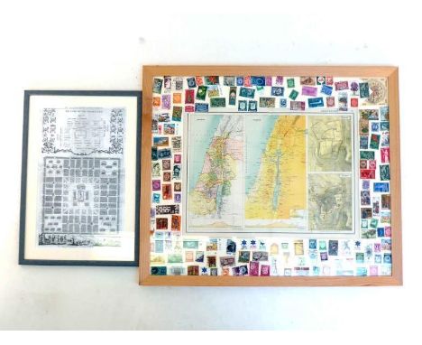
Lot 435
A large display map of ancient and modern Israel with larger scale corresponding maps of Jerusalem, all within a mount covered with Israeli postage stamps including the early issues. 59 x 49cm. together with a print of a 19th. century layouts of "The Camp of the Israelites according to Reyherus and Lamy", 21x35cm. Both in good condition, the print copying losses from the original off the left hand margin.


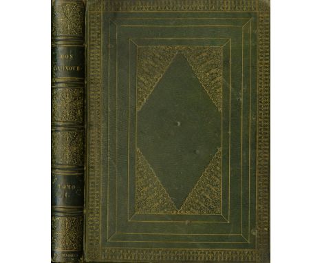
Lot 197
In Fine Bindingde Cervantes Saavedra (M.) El Ingenioso Hidalgo don Quixote de la Mancha, Nueva Edicion Corregida Por La Real Academia Espanolo. 4 vols. lg. 4to Madrid 1780. First Royal Spanish Academy Edition, engd. port. frontis Vol. I, 4 engd. add. titles, fold. engd. map, engd. head & tails etc., & 28 full page plts., a.e.g. in cont. full straight grained green mor. lg. gilt tooled borders, line decorated panels, including lg. central panel with attractive corner decorations, and profusely gilt spines, some small wear, otherwise a very fine set. (4)* Presentation copy, inscribed 'From W. Ronan ... to James Roche [Cork Banker]Esq. Cork 10th May 1843.'

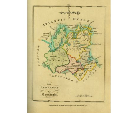
Lot 37
With Hand-Coloured MapsScale (Bernard) An Hibernian Atlas: or General Description of the Kingdom of Ireland. 4to L. 1776. First Edn., engd. title, dedit & index, hd. cold. map of Ireland & 36 full page maps of Provinces & Counties (37 maps in all), cont. hf. calf, worn (needs rebinding), mor. label. A very clean copy. (1)

![[Hyde (Dr. Douglas) An Craoibhín] A short ALs., dated 20.12.[19]39, on verso of a Brian O'Higgins Card, to An Craoibhín from](https://cdn.globalauctionplatform.com/a1235de0-ae2f-4b31-9734-a76000fab544/b798e77d-a208-4e58-b648-e14bcb9986b8/468x382.jpg)
Lot 401
[Hyde (Dr. Douglas) An Craoibhín] A short ALs., dated 20.12.[19]39, on verso of a Brian O'Higgins Card, to An Craoibhín from Múirgheal Ní Bhroin, explaining why she has not written earlier and sending him a booklet by O'Higgins, etc. The paragraphs crossed off in pencil, probably by Hyde; also a small bundle of various Notes, including an English translation of the Gaelic Lament for Pádraig Sairséal, in Hyde's hand, written on an invitation from Castlerea Lawn Tennis Club; a note about a poem of his which has been translated without attribution; a sketch map with directions; and a few other items, one of them possibly not in Hyde's hand. As a lot of m/ss, w.a.f. (1)
![P.S. O'Hegarty's Copy[Yeats (Jack B.)] Marriott (Ernest) Jack B. Yeats Being A True Impartial View of his Pictorial & Dramati](https://cdn.globalauctionplatform.com/a1235de0-ae2f-4b31-9734-a76000fab544/81a01754-4cf6-4721-c94c-82929119d839/468x382.jpg)

![[Irish Map] Ortelius (Abraham) Hibernia Eryn Hiberniae Britannicae Insula Nova descriptio - Irlandt, hd. cold. engd. map, [is](https://cdn.globalauctionplatform.com/a1235de0-ae2f-4b31-9734-a76000fab544/c77a9977-6825-4fff-bfe2-8a64bd18d942/468x382.jpg)
Lot 508
[Irish Map] Ortelius (Abraham) Hibernia Eryn Hiberniae Britannicae Insula Nova descriptio - Irlandt, hd. cold. engd. map, [issued in Ortelius Theatrum Ordis Terrarum] * dated 1572, approx. 44cms x 55cms (17" x 21 1/2") overall, contemp. hd. colouring, unframed. Clean Copy. (1)* Ireland first appeared in Ortelius Theatrum in 1573 as an additamentum.

Lot 534
Coloured Cartoon Prints: O'Nuallain (Michael) A large Cartoon Print - Flann O'Brien, Map of Ireland - Hung, Drawn & Quartered, by Michael O'Nuallain; approx. 71cms x 60cms (28" x 24") framed; together with a Cartoon Print of Brendan Behan - Dublin Millenium, approx. 40cms x 32cms (16" x 12 1/2"), framed. (2)

Lot 567
Signed Presentation CopyKavanagh (Peter) Inniskeen Circa 1939, A Map (Peter Kavanagh Hand Press, New York 1978), First Edition, tall narrow wrappers with folded map tipped in, No. 205 of 470 numbered Copies. Inscribed by Peter Kavanagh for Grattan Freyer, 'corrected N.Y. 22 Ap. 78'. Essential for Kavanagh lovers, identifying various fields, roads and homesteads relevant to the poet and his work. A very fine Copy. Very scarce. (1)

Lot 7
Extremely Rare Report - The Belfast Pogrom, 1920 - 1922Only a Handful of which were for Private DistributionNorthern Ireland: Kenna (G.B.) [Fr. John Hassan] Facts and Figures of the Belfast Pogrom 1920 - 1922, 8vo D. (O'Connell Published Co.) 1922. Sole Edn., fold. map, hf. title, title, 213pp. orig. green cloth, lettered within black border. A very fine copy of this Scarce Work.* This work was reportedly commissioned by the Free State Government, at the instigation of Michael Collins to document the notorious Belfast Pogroms in which hundred of Catholics (together with some Protestants) were driven from their homes and work places, and when hundreds were killed. The work which was set in type, but publication had to be cancelled for fear of furthering more serious sectarian tensions. It is believed only about eighteen copies were ever bound. An excessively rare item. (1)
-
109182 item(s)/page