We found 109182 price guide item(s) matching your search
There are 109182 lots that match your search criteria. Subscribe now to get instant access to the full price guide service.
Click here to subscribe- List
- Grid
-
109182 item(s)/page


Lot 309
Hamilton (Rev. Wm.) Letters Concerning the Northern Coast of the County of Antrim, roy 8vo D. 1786. First Edn., hf. title, fold. map frontis, uncut; Reeves (Rev. Wm.) Ecclesiastical Antiquities of Down, Connor, and Dromore, 4to D. 1847. First Edn., both recent hf. calf, tooled gilt spines. Very good copies. (2)


Lot 699
Co. Clare: Dwyer (Rev. P.) The Diocese of Killaloe, D. 1878. First Edn., frontis, fold. map, ports. illus.; Frost (James) The History and Topography of The County of Clare, D. 1893. First, cold. map frontis, plts.; White (Rev. P.) History of Clare and The Dalcassian Clans, D. 1893. First, fold. map frontis & 1 other fold. map, all orig. cloth. (3)


Lot 459
With Contemporary Hand ColouringLarge Map of Ireland: Price (Charles) A Correct Map of Ireland, Divided into its Provinces, Counties, and Baronies, Showing the Roads and the Distances of Places in Computed miles by Inspection, where Barraques are Erected etc. London (Senex & Maxwell) 1711. Fine lg. engd. map, approx. 93cms x 69cms (39" x 27"), with fine cartouches, and cont. hand-colouring, in fine condition. Framed. As a map, w.a.f. (1)


Lot 627
Spectacular Early Coloured View of The North West PassageCresswell (Samuel Gurney) A Series of Eight Sketches in Colour; together with a Coloured Map of the Route; by Lieut. S.G. Cresswell, of the Voyages of the H.M.S. Investigator, Capt. M'Clure, during the Discovery of the North West Passage. Lg. atlas folio London (Day & Son) July 25, 1854. Sole Edition, title incorporating Dedit, 4pp, 8 full page chromo plts. and one full page chart, all leaves & plts. re-mounted on linen, orig. red cloth, gilt professionally rebacked, a few stains. An extremely fine copy with v. clean plates. (1)Reference: Abbey Travel 644; Sabin 17490.


Lot 196
Hand-coloured Plates: The Tour of Dr. Syntax in Search of the Picturesque, roy 8vo L. 1812, hd. cold. frontis title, & 29 hd. cold. plts. hf. calf, upr. cover loose; Souvenir de Nogent-le-Rotrou, orig. photo illus; Theatre de la Guerre en Italie, lg. fold. map Paris 1859, hd. cold.; Conversations on Harmony, roy 8vo L. 1855, signed Pres. Copy. a lot. (4)


Lot 237
Archdall (Mervy) Monasticon Hibernicum or An History of the Abbbies, Priories, and other Religious Houses in Ireland, 4to L. 1786. First Edn., fold. map frontis, L.S.s., 18 engd. plts., errata leaf at end, recent crushed hf. brown mor., raised bands, mor. labels, v. good by Sidney Aiken. (1)

Lot 219
Wright (Thomas) Louthiana, Or An Introduction to the Antiquities of Ireland. 4to L. 1758. Second Edn., red & bl. title (top of title repaired), engd. head on dedit & preface, sm. vignette map & other vignette illus, also 66 full page plts., some letters cut-out, some finger marks, recent boards, a working copy. S.N.S.R. (1)

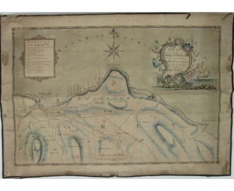
Lot 460
Extremely Rare Early Map of Dublin, 1717Map: A Map of ye Strand of ye North Side of ye Channel of ye River Anna Liffe as it was granted and set out in Easter Assembly 1717 by ye Rt. Honourable Thomas Bolton Esqr. Lord Mayor of the City of Dublin William Empson and David King Esqrs. Sherriffs of the said City and the Deeds and this Map perfected in the Mayoralty of ye Rt. Honoble Anthony Barkey Esqr. Lord Mayor John Reyson & Vincent Kidder Esq. Sherriffs, A linen backed engraved map, approx. 66cms x 515cms (26" x 20 1/4"), with large engd. cartouche, some dam. Framed. As a map, w.a.f. Extremely Rare. Bonar Law G5 (1). (1)

Lot 626
From Sir Shane Leslie's LibraryRuggieri (Ferdinando) Scelta di Architetture Antiche e Moderne della Cittag di Firenze, 5 vols. in 2, lg. atlas folio Florence 1755. Second Edn., ed. by Joseph Bouchard, fold. map 3 engd. ports. 4 add. engd. titles, 5 red & bl titles with engd. vignettes, & 268 engd. single & dble page plts. (ex. 279) uncut, orig. mor. backed boards. Ex. Libris Sir Shane Leslie, with bookplates. (2)
Lot 615
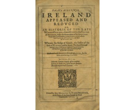
Very Fine Copy of First EditionStafford (Thomas) Pacata Hibernia Ireland Appeased and Reduced, Folio L. 1633. First Edn., 2 engd. ports. lg. fold. Map of Munster, & 17 other maps (mostly lg. fold. or dbl. page), recent full blue mor. tooled gilt fillets & panel, raised bands, spine gilt in panels, mor. label. V. good copy. (1)


Lot 37
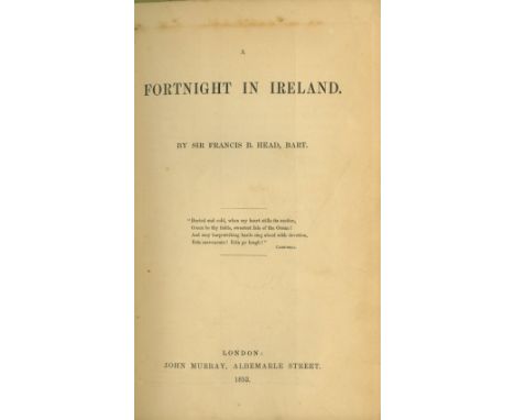
Irish Travel: Head (Sir F.B.) A Fortnight in Ireland, 8vo L. 1852. First Edn., fold. map frontis, 16pp cat. at end, fine in orig. cloth; [Thackeray (W.M.)] The Irish Sketch Book, by Mr. M.A. Titmarsh. 2 vols. 8vo L. 1845. Second Edn., hf. titles, 2 frontis, text illus., fine in orig. cloth. (3)


Lot 55
Co. Donegal: Harkin (Wm.) Scenery & Antiquities of North West Donegal, 8vo Derry (David Irvine) 1893, fold. map, adverts & illus., buckram; Allingham (Hugh) Ballyshannon its History and Antiquities, 8vo, Ballyshannon (Donegal Democrat) 1937, cloth backed wrappers; Percival Swan (H.) The Book of Inishowen, 8vo Buncrana (Wm. Doherty & Co.) 1938, illus., ptd. wrappers., clean copies. (3)

Lot 453
Rare Map of Ballycastle Colliery, 1790 Co. Antrim: Williamson (J.) Surveyor, A Map of Part of the County of Antrim Showing the particular situation of the Ballycastle Colliery, The Property of Hugh Boyd Esq., Surveyed & drawn by J. Williamson, 1790, approx. 52cms x 72cms (20 1/2" x 28 1/2") with magnificent cartouche in watercolour, & with 'Reference to the several Coal Pits,' linen backed. As a map, w.a.f. (1) * A Rare Survivor.


Lot 730
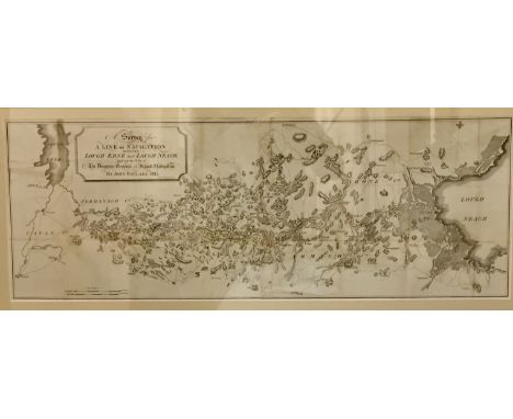
With the Folding MapsIrish Inland Navigation: Bligh (Wm.), Corneille (D.) & others Accounts, etc. Presented to the House of Commons, Relative to The Inland Navigations of Ireland, and to the Port of Dublin, Folio 1806. 7 fold. maps (some hd. cold. in outline), a few tears or repairs, an extra map The Grand and Royal Canals, by Rev. J. Whitelaw, 1812, 98pp (lacks 2 leaves), recent cloth. As an Atlas, w.a.f. Scarce. (1)
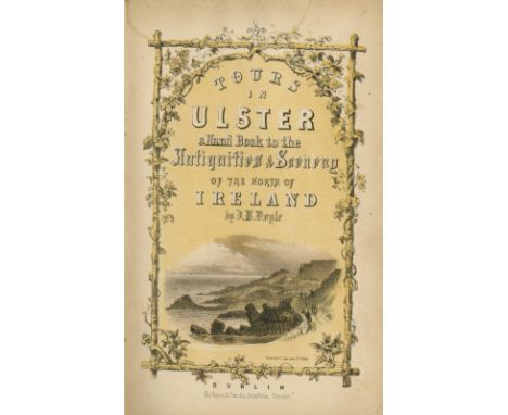
Lot 6
Northern Ireland: Doyle (J.B.) Tours in Ulster: A Handbook of The Antiquities and Scenery... sm. 8vo D. 1854. First Edn, fold. map, decor. title, fold. plan, litho frontis & 16 litho plts., text illus. etc.; A Picturesque Handbook to Carlingford Bay, 12mo 1846, First Edn., 2 fold. & other maps, illus. cloth; Ward Lock - Guide to the Giant's Causeway and Co. Antrim, L. n.d. fold. maps, illus., new cloth; Guide to Belfast and the Adjacent Counties, Belfast 1874, maps & illus. Good lot. (4)

Lot 706
Excessively Rare 16th Century Plate BookEyzinger (Michael) Ad Leonis Belgici Topographicam atque Historicam Descriptionem, ... appendix. 2 vols.in one, 4to [Cologne] 1586. 162 dlb. page engd. illustrations (only) and 1 single page ditto, lg. fold. engd. map of Holland & Belgium in the shape of a lion, with cont. hd. colouring, some pps. lacking, the text & illustrations in extremely fine condition, in a 17th Century full sprinkled calf, with each gathering and each plate separately bound in, raised bands, spine gilt in panels. As a coll. of plts., w.a.f. (1)

Lot 616
Olearius (Adam) Voyes tres curieux & tres renommez, fait en Moscovie Tartarie, et Perse... 2 vols. in one, folio Leiden 1719. New Edn. Ed. by Sr. de Wicquefort. 2 hf. titles, 1 add engd. title & 2 red & bl. titles with engd. vignettes, dedit with engd. vignette, 10 dble. page maps & 1 single page map, 3 fold. plans, 23 dble page & 1 single page plts., & 58 engd. vignette type text illus., cont. full sprinkled calf, raised bands, spine gilt in panels, top of spine broken. A very good copy of this important work. 'Ex. Libris Jac. Butler.' (1)
Lot 51
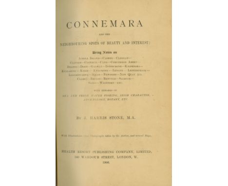
Stone (J. Harris) Connemara and the Neighbouring Spots of Beauty and Interest, L. 1906. First Edn., illus. map etc.; O'Sullivan (M.D.) Old Galway - The History of a Norman Colony in Ireland, Cambridge 1942, First, illus.; The Present State of Great Britain and Ireland, In Three Parts L. 1738. Port frontis all recent hf. mor. (3)
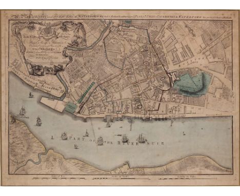
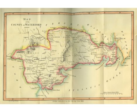
Lot 455
Very Rare Map of Waterford City Co. Waterford: Richards (Wm.) & Scale (Bernard) A Map of the City and Suburbs - Plan de la Ville et Fauxbourgs de Waterford, a fine engraved map, approx. 47cms x 64cms (18 1/2" x 25"), London 1764, with fine engraved cartouche and cont. hand-colouring, wooden frame. V. Rare. (1)

Lot 454
Chart of Waterford Harbour Co. Waterford: Sayer (Robert) An Actual Survey of the Harbour and River of Waterford, and of The Bay of Tramore, with the Adjacent Coast, from Great Newtown Head to Bagenbon Head. Fine engd. & hand coloured map, London 1787, approx. 53cms x 73cms (21" x 28 1/2") in gilt & bl. frame. (1)

Lot 456
Rare Early Map of Waterford HarbourCo. Waterford: Doyle (Wm.) Hidrographer. A New Chart Being an Actual Survey of the Harbour of Rineshark and Waterford to the Confluence of the Rivers Sure & Barrow, and Sea Coast to them Adjacent, Waterford Dec. 10th 1737. Approx. 57cms x 74cms (22 1/2" x 29"). With fine large cartouche, engd. coats of arms, & engd. models of the important houses in the area framed. In extremely fine condition. (1)


Lot 302
1798: Musgrave (Sir R.) Memoirs of the Different Rebellions in Ireland, 2 vols. D. (Robert Marchbank) 1802, Third Edn, fold map frontis, 2 fold. plates, & 10 maps charts, cloth (restored), orig. labels on spine laid down. Fine Copy; Maxwell (W.H.) History of the Irish Rebellion in 1798,... 8vo L. (G. Bell) 1903, illus, cloth. (3)
![[Stevens (Capt.)] Monasticon Hibernicum, Or, The Monastical History of Ireland. 8vo L. 1722. First Edn. fold. Map of Ireland,](https://cdn.globalauctionplatform.com/e91816df-556e-4bc6-906a-a6c700f8fac3/28c556e6-72eb-4791-877e-b2480b95e868/468x382.jpg)

Lot 573
Americana: de Smet (Fr. P.J.) Voyages dans L'Amerique Septentrionale - Oregon, 8vo Brussels 1874. Third, port. frontis, fold. map, partly unopened, cont. mor. backed boards; Wise (Lt.) Los Gringos; or, An Inside View of Mexico and California, with Wanderings in Peru, Chili and Polynesia. Roy 8vo Paris 1850. Hf. title, boards. (2)

Lot 586
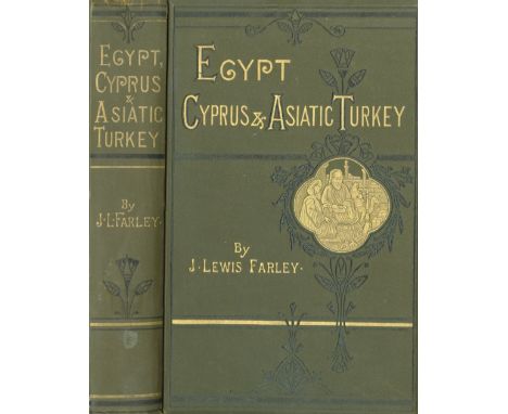
Barker (W. Burckhardt) Lares and Penates: or, Cilicia and its Governors, ... ed. by W.F. Ainsworth. 8vo L. 1853. Frontis, fold. map & 4 plts., text illus. thro.-out, cont. calf, tooled gilt spine; St. John (J.A.) Egypt and Nubia, their Scenery and their People. 8vo L. n.d., hf. title, vign. title, text illus., cont. full calf, tooled gilt spine, mor. labels. V. good. (2)
Lot 583
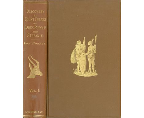
Von Hohnel (Lt. Ludwig) Discovery of Lakes Rudolf and Stefanie, A Narrative of Count Samuel Telekis Exploring & Hunting Expedition in Eastern Equatorial Africa in 1887 & 1888. 2 vols. roy 8vo L. 1894. First English Edn. 2 hf. titles, port. & map frontis, & 2 fold. maps numerous text illus., unopened thro-out, L.S.s, orig. cloth gilt decor. Good. (2)
![A Magnificent Complete CopyCo. Kilkenny: [Tighe (Wm.)] Statistical Observations... relative to the County of Kilkenny made in](https://cdn.globalauctionplatform.com/e91816df-556e-4bc6-906a-a6c700f8fac3/6d697e8a-d9fd-49a4-e3d5-8a55ee2490c9/468x382.jpg)
Lot 593
A Magnificent Complete CopyCo. Kilkenny: [Tighe (Wm.)] Statistical Observations... relative to the County of Kilkenny made in the Years 1800 & 1801 [Dublin Society]. Thick 8vo D. 1802. First Edn. v. lg. hand cold. Map of County & 10 plts. (some fold. & some sepia) plus fold. tables, complete. In sprinkled calf, raised bands, mor. labels. A magnificent Copy. (1)
Lot 68
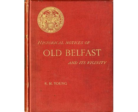
Young (R.M.) Historical Notices of Old Belfast and its Vicinity, 4to Belfast (Marcus Ward) 1896. First Edn., cold. frontis dbl. page map, plts. illus. etc., Orig. cloth, gilt; Stuart (J.) Historical Memoirs of the City of Armagh, 4to D. 1900. New Edn., port. frontis maps & illus. cloth. Both V. good. (2)
Lot 10
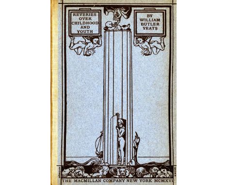
Yeats (W.B.) Reveries over Childhood and Youth, N.Y. 1916. First American Edn., illus., cloth backed pict. boards; Bickerdyke (J.) Wild Sports in Ireland, L. 1897. First, illus.; Laurie & Whittle A New Map of Ireland, L. 1808, fold. map, linen backed hd. cold. map; & another fold. 3rd Cavalry Brigade Training Map Ireland, As a lot. (4)


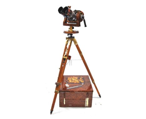
Lot 937
A pair of Soviet TZK 10880 anti aircraft binoculars circa 1953 on later tripod, heavily enhanced with painted snakeskin effect and brass-plated metalwork, in original steel case, painted with wood-effect and pirate-map design Condition Report Optical condition good and clear. We do not, however, guarantee that the lenses, calibrations and adjustments are all in full working order. the later tripod stand may imply that the binoculars are not totally in their original, functional state
-
109182 item(s)/page