We found 109198 price guide item(s) matching your search

Refine your search

Year

Filter by Price Range
  • List
  • Grid
  • 109198 item(s)
    /page

Lot 695

BR(S) Suburban Services Mirror British Railways Southern Region Suburban Services Route Map mirror showing all the routes from London Bridge, Victoria, Waterloo, Charing Cross & Cannon Street, and Holborn Viaduct Stations in a coloured diagrammatic map. Measures 24in x 16in and is in very good condition.

Lot 117

An embroidery backed onto linen depicting a map of Scotland with landmarks and figures, framed and glazed, 60cm x 45cm

Lot 200

A quantity of assorted maps and engravings etc including 1828 world map, hand coloured in outline; John Speed miniature map of Huntingdonshire, 1627; some hand coloured 19th century marine engravings including The Discovery at Deptford; sea charts, etc

Lot 371

MIXED LOT OF COLLECTABLESincluding a sarcophagus walnut and inlaid tea caddy with two divisions, a quaich, carved soapstone rhino, three powder compacts, brass matchbox cover, table top match striker, oval embossed jewellery box, map measurer, cigarette case, wooden page turner, two daggers and other items

Lot 561

A pair of reproduction mahogany bedside tables, together with a stained pine bookcase and a firescreen with map decoration (4)bookcase 90w x 28d x 101h cmBedside tables measure 45w x 60d x 58h cm

Lot 1059

A group of decorative furnishing pictures and prints, including: a still life of flowers in an urn, a similarly framed needlework depicting pine cones and ivy, another modern still life of flowers, an early 19th century sampler, a modern oil on canvas of a young girl, a landscape, and a map (7)

Lot 6316

19th century folding map of Middlesex by J & C Walker, another of Dorsetshire, Bacon's new cycling road map of Brighton, Bacon,s large scale plan of Leeds, other maps etc (10)

Lot 154

CAPT G A PRIDEAUX, MC: A SOLDIER'S DIARY OF THE GREAT WAR 1914-1917, London, The Chiswick Press, 1980, 1st edition, printed for private circulation, portfrontis folding map at end as called for, original cloth backed boards, spine dulled + FRANK PERCY CROZIER: A BRASS HAT IN NO MANS LAND, London, Jonathan Cape, 1930, 1st edition, original cloth, d/w (small part losses) + REV GEORGE THOMPSON: WAR MEMORIES AND SKETCHES, Paisley, Alexander Gardner, 1916, 1st edition, original cloth + RICHARD ALLEYN LLOYD: A TROOPER IN THE 'TINS', AUTOBIOGRAPHY OF A LIFEGUARDSMAN, London, Hurst & Blackett, [1938], 1st edition, original cloth + SIR ARTHUR BINNY SCOTT & PERCY MIDDLETON BRUMWELL (EDS): HISTORY OF THE 12TH (EASTERN) DIVISION IN THE GREAT WAR 1914-1918, London, Nisbet, 1923, 1st edition, plates and maps collated complete, original cloth worn and v soiled (5)

Lot 169

HUGH CLARENDON: A NEW AND AUTHENTIC HISTORY OF ENGLAND, London for J Cooke, circa 1770, 2 vols, engraved folding map (long closed tear), 72 plates as list, plate of the Buckingham defeating three French men of war misbound at page 446 in vol 2, 4to, contemporary reverse calf v worn, vol 2 top board detached (2)

Lot 199

NOTES FOR COMMANDING OFFICERS ISSUED TO STUDENTS AT THE SENIOR OFFICERS SCHOOL, ALDERSHOT, 1918, Aldershot, 1918, 1st edition, original cloth worn and soiled + GENERAL STAFF WAR OFFICE: FIELD SERVICE POCKET BOOK, HMSO, [1915], folding plate 18 with part loss, original limp cloth worn, folding trench map of Hollebeke corrected to 26.1.17 in pocket at front + SIR JAMES LEWIS SLEEMAN: FIRST PRINCIPLES OF TACTICS AND ORGANISATION (WAR EDITION 1915)..., London, Gale & Polden, 1915, original cloth + BRIG-GENERAL R A K MONTGOMERY: LECTURE DELIVERED BY ... AT THE CAMP OF THE 8TH DIVISION NEAR WINCHESTER ON 30TH OCTOBER 1914, original wraps browned + FIELD SERVICE REGULATIONS PART ONE OPERATIONS 1909 (REPRINTED WITH AMENDMENTS 1912), HMSO, [1912], original cloth + INFANTRY TRAINING (4-COMPANY ORGANISATION), 1914, HSMO, 1914, original cloth + E JOHN SOLANO (ED): FIELD ENTRENCHMENTS, SPADE WORK FOR RIFLEMEN..., London, John Murray, 1914, original cloth + SOLDIERS PAY BOOK FOR USE ON ACTIVE SERVICE, [1914], unissued, original cloth + WHAT EVERY SOLDIER OUGHT TO KNOW, Oxford University Press, 1915, 2nd impression, small format, original limp cloth (9)

Lot 224

ALFRED RUSSEL WALLACE: DARWINISM AN EXPOSITION OF THE THEORY OF NATURAL SELECTION WITH SOME OF ITS APPLICATIONS, London, MacMillan, 1890 reprint, portfrontis, folding map, contemporary calf gilt worn, spine gilt in compartments, morocco gilt spine label

Lot 242

LOUIS HARALD DAHL: THE ROMAN CAMP AND THE IRISH SAINT AT BURGH CASTLE WITH LOCAL HISTORY, London, Jarrold & Sons, 1913, 1st edition, plates and maps collated complete, folding map of the coast-line with old clear adhesive tape repair, original cloth bright gilt + A J MORRIS: THE SAXON SHORE FOUGHT AT BURGH CASTLE, Ipswich, W E Harrison & Sons, 1947, 1st edition reprint from the proceedings of the Suffolk Institute of Archaeology and Natural History, modern cloth (2)

Lot 258

EDWARD WALFORD: GREATER LONDON, A NARRATIVE OF ITS HISTORY, ITS PEOPLE AND ITS PLACES, London, Paris and New York, Cassell & Co, circa 1885, 4 vols, folding map (splits at folds) in pocket at front of vol 4, plates collated complete, 4to, original decorative cloth gilt, aeg, ex-libris label of Gavin Stamp (1948-2007) on front paste downs (4)

Lot 270

KELLYS DIRECTORY OF CAMBRIDGESHIRE, NORFOLK AND SUFFOLK, 1933, lacks Norfolk map, original cloth worn and soiled

Lot 273

KELLY'S DIRECTORY OF CAMBRIDGESHIRE, NORFOLK AND SUFFOLK 1922, lacks Norfolk map, original cloth, v worn + THE EASTERN COUNTIES PICTORIAL GUIDE..., Bournemouth, Bright's [1889], lacks title page, oblong, 4to, original limp cloth, mixed condition (2)

Lot 281

KELLY'S DIRECTORY OF NORFOLK 1896, 1904, 1912, 1904 vol lacks map, all modern cloth (3)

Lot 282

KELLY'S DIRECTORY OF NORFOLK 1922, 1925, 1937, 1922 vol lacking map, all vols modern cloth (3)

Lot 283

KELLY'S DIRECTORY OF NORFOLK 1916 with map, original cloth + KELLY'S DIRECTORY OF SUFFOLK 1937 with map + KELLY'S DIRECTORY OF HUNTINGDONSHIRE 1914 with map, original cloth (3)

Lot 284

KELLY'S DIRECTORY OF NORFOLK AND SUFFOLK 1929 with maps, original cloth worn + KELLY'S DIRECTORY OF NORFOLK 1933, lacks map, original cloth worn (2)

Lot 285

KELLY'S DIRECTORY OF SUFFOLK 1904, 1912, 1912 vol lacking map, both vols modern cloth (2)

Lot 290

SIDNEY HALL: BLACK'S ROAD AND RAILWAY TRAVELLING MAP OF SCOTLAND, [Edinburgh], A & C Black, circa 1845, engraved hand coloured map, folding backed onto linen, approx 820 x 570mm, original blind stamped cloth gilt, ribbon ties

Lot 301

CLIVE HOLLAND: WARWICKSHIRE, ill Frederick Whitehead, London, Adam & Charles Black, 1906, 75 coloured plates as list, folding map at end, original decorative cloth recased, new end papers

Lot 371

ROBERT MORDEN: THE EAST RIDING OF YORKSHIRE, engraved hand coloured map [1695], browned, approx 355 x 420mm, framed and glazed

Lot 372

H G COLLINS (PUB): HAMPSHIRE, engraved hand coloured map circa 1852, approx 420 x 330mm, f/g

Lot 373

SAMUEL JOHN NEELE: CORNWALL, engraved hand coloured map pub Cadell & Davies, 1814, inset Scilly Isles, approx 370 x 410mm, framed and glazed

Lot 375

THOMAS MOULE: MIDDLESEX, engraved hand coloured map circa 1850, approx 200 x 250mm, f/g

Lot 376

EMANUEL BOWEN: AN ACCURATE MAP OF THE COUNTY OF MONMOUTH DIVIDED INTO HUNDREDS..., engraved part hand coloured map circa 1764, approx 500 x 410mm, f/g

Lot 377

EMANUEL BOWEN: AN ACCURATE MAP OF THE COUNTY PALATINE OF DURHAM DIVIDED INTO ITS WARDS..., engraved part hand coloured map circa 1749, approx 410 x 500mm, f/g

Lot 378

EMANUEL BOWEN: AN ACCURATE MAP OF DORSETSHIRE DIVIDED INTO HUNDREDS..., engraved part hand coloured map circa 1749, approx 410 x 500mm, f/g

Lot 379

EMANUEL BOWEL: AN ACCURATE MAP OF THE COUNTY OF NORTHAMPTON DIVIDED INTO ITS HUNDREDS..., engraved part hand coloured map circa 1749, approx 495 x 410mm, framed

Lot 380

ORDNANCE SURVEY: NORWICH, engraved hand coloured map 1910, folding, backed onto linen, approx 410 x 110mm, f/g

Lot 75

COSMO MONKHOUSE: NONSENSE RHYMES, ill Gilbert Chesterton, London, R Brimley Johnson [1902], original cloth backed pictorial boards worn, scarce + GILBERT K CHESTERTON: THE NAPOLEON OF NOTTING HILL, ill William Graham Robertson, London and New York, John Lane, 1914, 1st edition, 7 plates, map, as list, original pictorial cloth worn + WILLIAM SOMERSET MAUGHAM: 5 titles: ON A CHINESE SCREEN, London, William Heinemann, 1922, 1st edition, original cloth gilt; THE CASUARINA TREE, London, William Heinemann, 1926, 1st edition, original cloth gilt worn; AH KING, London, William Heinemann, 1933, inscription on ffep, original cloth gilt worn; A WRITERS NOTEBOOK, London, William Heinemann, 1949, 1st edition, inscription on ffep, original cloth; THE COMPLETE SHORT STORIES, London, William Heinemann, 1952 reprint, 3 vols, original cloth, d/ws. slip-case (9)
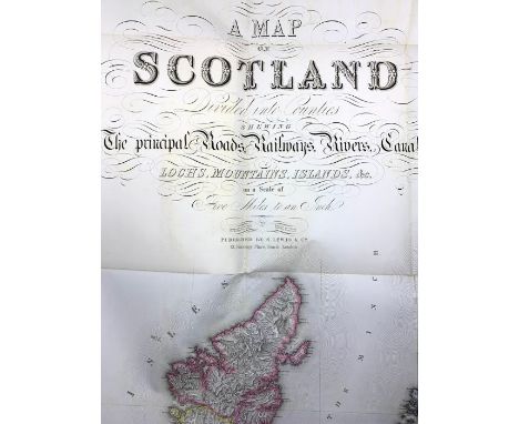
Lot 413

AN ACTION MAN BATH PATROL MAP CASE comprising two 'depth charge' bath cubes, one 'dynamite' soap', one compass, and one walkie-talkie design sponge, boxed as one.

Lot 440

Assorted folding maps, including Bacon's Survey Map of Derby, Nottingham and Leicester, (approximately 60; box).

Lot 442

[MAPS] Map of the Bristol Coal Fields and Country Adjacent, Geologically Surveyed by William Saunders, 1862, quarter cloth, comprising eleven (of nineteen) hand-coloured double-spread maps (lacking upper cover).

Lot 342

Framed and mounted 19th century map "The Conquest of Demetrius" (surnamed Poliorcetes) and coloured map of Cumberland

Lot 159

Harting (J.E.). Our Summer Migrants, An Account of The Migratory Birds, etc. Woodcut illustrations, original cloth, Published by Bickers & Son, 8vo 1875 & Livingstone (David): A Popular Account of Missionary Travels and Researches in South Africa. New edition, folding map and woodcut plates, full presentation calf, “Lancastrian Prize”, City of Manchester School Board” crest on top board, 8vo, 1875; and other books in embossed cloth and calf. (20)

Lot 16

Miscellaneous collection of 18th- & 19th-century books, to include The New and Complete Newgate Calendar, Vol.VII only, London: Alexander Hogg, n.d., illustrated with 13 engraved plates depicting criminals and murders taking place, no boards, disbound; A Midsummer Drive through the Pyrenees, by Edwin Asa Dix, New York & London: Putnam's, 1890, publisher's gilt cloth; Poems on Several Occasions, by Matthew Prior, in two volumes, London: Knaplock, Round, Tonson, 1733, eng. frontis. portrait, full calf; History of the Borough of Liskeard, by John Allen, London: Cash, 1856, map frontis., worn contemp. cloth; Nothing to Wear: An Episode of Fashionable Life, London: Sampson Low, 1857, illustrated cloth; The Book of Orders of Knighthood and Decorations of Honour of All Nations, ed. by Sir Bernard Burke, London: Hurst & Blackett, 1858, attractive coloured plates, worn half-calf; Souvenir: Acis and Galatea, Masque of Love, illustrated by Gordon Craig, [1902], and others. Condition varied, some part-sets, some detached/lacking boards, sold as found with all faults (29)

Lot 194

Wallace (Alfred Russel). The Malay Archipelago, 6th edition, maps, woodcut plates and illustrations, original cloth worn at edges, front hinge broken, small octavo, 1877; and Darwinism: An Exposition of the Theory of Natural Selection With Some of Its Applications. Woodbury-type photo frontis, map and illustrations, rubber stamp used on title and 1 other leaf - “Victoria University”, original cloth, octavo 1890; with another copy, 1st edition 1889, original cloth; and 2 others by Wallace. All octavo. (5)

Lot 217

Cary, John. Cary's Traveller's Companion, or, A Delineation of the Turnpike Roads of England and Wales, London: Printed for John Cary, 1 January 1791. Calligraphic engraved title, advertisement, list of contents, 43 engraved maps (as called for) with outline colour, the Yorkshire map sectional & linen-backed, 6pp. list of markets. Contents well-preserved, clean and bright, with a few pale marks in places; Worcestershire with small repair and slight loss at upper margin; Yorkshire linen-backed with slight loss at fold-lines. Octavo, full contemporary calf, rebacked, owner inscription dated 1800 on verso of ffep, later armorial bookplate with offsetting where tipped-in

Lot 218

Lewis, Samuel. Mixed collection comprising: View of the Representative History of England, London: S. Lewis, 1840, with 116 plates showing electoral divisions & boundaries with outline colour, quarto, publisher's embossed cloth lettered in gilt, internally good with some spotting at beginning & end; Map of Scotland, being the Supplementary Volume to A Topographical Dictionary of Scotland, London: S. Lewis, 1846, comprising title, contents, and engraved map with outline colour on six folding sheets, quarto, publisher's cloth, internally well-preserved & bright, very pale spots in a few places, a couple of short splits at fold-lines and one short tear, the cloth with discolouration and light wear; A Topographical Dictionary of England, Vol. I, fourth edition, London: S. Lewis, 1840, Vol.II, third edition, 1835, Vol.III, fourth edition, 1840, Vol.IV, fourth edition, 1840, in worn cloth, condition varied, sold as found with all faults (6)

Lot 227

Barrie, J. M. The Little White Bird, presentation copy signed & inscribed by the author, March 1924, London: Hodder & Stoughton, n.d., octavo, blue cloth with paper title labels, frontispiece map of Kensington Gardens, contents good & bright, some light spotting to half-title, spotting to fore-edge coming into margins of a few leaves, corners slightly bumped, paper labels with discolouration

Lot 258

Gray, Hugh. Letters from Canada, Written During a Residence There in the Years 1806, 1807, and 1808, first edition, London: Longman, 1809, complete with folding map and three tables. Octavo, restored half-calf with morocco title label lettered in gilt, armorial bookplate for George Crompton. Contents good & bright, the map with some offsetting and a reinforced tear at edge, binding tight & square with light surface wear

Lot 260

Grattan, Thomas Colley. Civilized America, second edition, in two volumes, London: Bradbury & Evans, 1859, complete with two maps (one folding). Octavo, full polished calf with raised bands and contrasting morocco title labels lettered in gilt, marbled endpapers & page edges, contemporary gift inscription relating to Eton. Contents good, clean, bright; spotting to endleaves; very pale spotting to titles; the folding map with short tears & slight loss at margins; bindings tight & square with some discolouration and scuffs (2)

Lot 261

Domenech, Abbé Emmanuel. Seven Years' Residence in the Great Deserts of North America, first edition, in two volumes, London: Longman, 1860. Complete with 58 plates and a folding map, as called for. Octavo, full polished calf with raised bands and morocco title labels lettered in gilt, marbled endpapers & page edges, contemporary gift inscription relating to Eton. Contents good & bright; well-preserved & vibrant plates; spotting to endleaves; occasional pale spots and folded corners; bindings tight & square with some discolouration and light surface wear (2)

Lot 264

Russell, William. The History of America, from its Discovery by Columbus to the Conclusion of the Late War, first edition, in two volumes, London: Fielding & Walker, 1778, illustrated with 50 [of 51] plates and maps. Vol.I: frontis., red & black title, 2pp. advertisement, 596pp.; Vol.II: title, 629pp., 3pp. errata & directions for placing maps/cuts. Contents generally well-preserved and good with pale spotting & faint staining in places; the plates are mostly very good & bright, though the folding map of North America is torn/creased; lacking only one plate [the map of the world]; there is an owner inscription on blank leaf prior to title of each volume, 'Josh Scott Senior, 1802'; the rear of the first volume is inscribed, 'Ann Holdsworth, Westgate, 1778'; the rear of the second volume is inscribed, 'John Keegan, Contractor, Wakefield', accompanied by a manuscript 'Composition', signed, 'Kate Keegan, age - 9 year old, Wakefield'. Quarto, quite crudely rebacked and incorporating the worn contemporary calf boards (2)

Lot 267

Livingstone, David. Missionary Travels and Researches in South Africa, first edition, London: John Murray, 1857. Complete with all plates & maps as called for [not tinted]. Octavo, embossed cloth. Contents very good, clean, bright; very light spotting & folded corners in a few places; pale spotting to the folded map in rear wallet; cloth expertly restored with recent endpapers

Lot 268

Harris, Captain William Cornwallis. The Wild Sports of Southern Africa, first edition, London: John Murray, 1839. Complete with all plates & folding map as called for (Hunting at Meritsane is positioned as a frontispiece). Contents good, clean, bright; a few pale spots & light creasing in places; a few pages loose but present & complete; cloth good with slight wear to extremities, slight shelf-lean; bookseller's ticket on pastedown (J. Bain, 1, Haymarket)

Lot 269

Nansen, Fridtjof. Farthest North, in two volumes, London: George Newnes, 1898. Octavo, publisher's gilt pictorial cloth. Contents very good, clean, bright; complete with the folding map at rear; cloth well-preserved with light wear to extremities (2)

Lot 291

Black's Road & Railway Travelling Map of England, [Edinburgh: A. & C. Black], n.d., sectional, linen-backed, steel-engraving with hand-coloured outline for the railways that are 'already opened', generally good with some toning/discolouration & pale spotting verso, publisher's cloth boards lettered in gilt with some marks and a tear to cloth verso. Together with Our Iron Roads, by Frederick S. Williams, fourth edition, London: Bemrose, 1883, rebacked, and Locomotive Engine Driving, by A. Oliver, n.d. (3)

Lot 310

Moore, John. A Journal During a Residence in France, in two volumes, London: Robinson, 1793, folding map with short tear; A View of the Causes and Progress of the French Revolution, in two volumes, London: Robinson, 1795, worn contemporary calf, contents generally good & bright, bindings worn, sold as found with all faults (4)

Lot 316

Ball, John (Ed.). Peaks, Passes, and Glaciers: A Series of Excursions by Members of the Alpine Club, first edition, London: Longmans, 1859. Complete with all chromolithographic plates, maps and woodcuts, as called for. Errata slip present. 516pp. Association copy bearing signature of Sir Leslie Stephen (1832-1904), English writer, mountaineer and father of Virginia Woolf & Vanessa Bell, dated 1888 & pasted verso of frontis. Octavo, publisher's gilt cloth, rebacked with original spine laid down. Contents good, chromo plates vibrant, maps bright, some general toning & slight wear to untrimmed edges, very pale spots in places, the larger folding map of Snowdon (which is printed on a more delicate paper) has some closed tears & light spotting, an additional C20 illustration pasted to blank section of one map, cloth worn to edges, the gilt rubbed from illustration on upper board

Lot 318

Freshfield, Douglas W. The Exploration of the Caucasus, second edition in two volumes, London: Edward Arnold, 1902. Complete with four folding maps, as called for, frontispieces (one folding), and illustrations within the text. Quarto, publisher's blue cloth lettered in gilt. Contents good & bright, the maps with vibrant colours, some very pale staining at some margins (not affecting text), pale spots in places, the larger folding map at rear with one short tear, cloth discoloured/mottled with slight wear & bumping to corners/extremities (2)

Lot 319

Whymper, Edward. A Guide to Zermatt and the Matterhorn, 12th edition, signed by the author, 'Edward Whymper, Zermatt, Sept. 8, 1908', London: John Murray, 1908. Octavo, publisher's printed paper covers, 224pp., plus 44pp. advertisements, introduction and contents, and three folding maps at rear. Contents good & bright, a few light spots in places, one tear to largest folding map at rear, paper covers worn with loss to spine, binding intact but shaken

Lot 320

Workman, Fanny Bullock; William Hunter Workman. Ice-Bound Heights of the Mustagh, first edition, London: Constable, 1908. Illustrated with numerous plates from photographs taken by the author, including a photogravure portrait of each author, a colour frontispiece, and a folding map of Kashmir. Octavo, publisher's gilt green cloth with illustrated panel, top edge gilt, rebacked with the original spine laid down. Contents good & bright, a few very light spots & marks in places, the photogravure of Peak above Basin Glacier with some staining, some incredibly pale staining to title & opening leaves, some surface wear and a couple of tears to list of illustrations, the final page of list with loss to corner (not affecting text), the cloth with discolouration & wear

Lot 321

Abraham, Ashley P. Rock-Climbing in Skye, first edition, London: Longmans, 1908. Octavo, publisher's blue cloth lettered in gilt, top edge gilt. Complete with all collotype plates, as called for, plus line diagrams in the text, and folding map in rear pocket. Contents good & bright, the folding map well-preserved, some light spotting to page edges, heavier throughout endpapers & introduction, some pale staining to some margins (not affecting text), cloth with some marks and wear to corners/extremities. Together with On Alpine Heights, first edition, London: Methuen, 1919, and The Complete Mountaineer, third edition, London: Methuen, 1923, by George Abraham (3)

Lot 342

Miscellaneous collection of books to include Robson's Commercial Directory of the Seven Counties of Middlesex, Essex, Herts, Kent, Surrey, Sussex, and Hants, 20th edition, London: William Robson & Co., 1839, with six folding maps, half-calf; The South American Gentleman's Companion, by Charles H. Baker, New York: Crown Publishers, 1951, two volumes in blue cloth, worn slipcase; four cookery books, including The Lady's Every-Day Book, London: Bemrose & Sons, 1875; India, Burma and Ceylon, London: Thomas Cook & Son, 1910, folding map, gilt cloth; Be Vivid, Be Vital, by Barbara Cartland, first edition, London: Herbert Jenkins, 1956, red cloth, price-clipped dust-jacket; Breakheart Pass, by Alistair Maclean, London: Book Club Associates, 1974, and Almanack of Sport 1966, London: Sampson Low, 1965. Condition varied, collection sold as found with all faults (10)

Lot 395

Tolkien, Christopher. The Silmarillion, first edition, London: George Allen & Unwin, 1977. Octavo, publisher's blue cloth, folding map at rear, price-clipped dust-jacket with protective plastic sleeve. Contents very good, clean, bright; one tiny mark on front-free endpaper, a few light marks on edges of text-block; binding tight and square, slight fading to spine of jacket. Together with The Adventures of Tom Bombadil, by J. R. R. Tolkien, third impression, 1968, and The Letters of J. R. R. Tolkien, first edition, 1981 (3)

Lot 466

Cary, John. Collection of 25 hand-coloured, copper-engraved, folding maps, comprising: A New Chart of the World, 1801; A New Map of Europe, 1804; Netherlands, 1804; France, 1799; France, 1806; Turkey in Asia, 1801; Turkey in Europe, 1804; Prussia, 1799; Hungary, 1799; Tyrol & Venice, 1799; Austria, 1801; Bavaria, 1799; Swabia, 1799; Upper & Lower Rhine, 1799; United Provinces, 1799; Piedmont, 1799; Italy, 1799; Spain & Portugal, 1801; Germany, 1799; Bohemia & Moravia, 1801; Westphalia, 1799; Upper Saxony, 1799; Lower Saxony, 1799; Franconia, 1799; Hindoostan, 1806. Together with four folding maps from John Thomson's New General Atlas: Italy, Naples & Sicily, Europe, and Switzerland. Condition varied, some are well-preserved & bright; some with pale spotting and/or pale staining to margins; some with heavier spotting/staining; a few with slight damage. Housed in a half crushed morocco portfolio folder. (29)

Lot 471

Miscellaneous collection of maps to include Essex, hand-coloured copper engraving by John Gibson & Emanuel Bowen, London: John Bowles, 1778; Cambridgeshire, by Emanuel Bowen, London: J. Tinney, n.d.; Essex, London: C. Smith, 1804; a selection of 31 maps from a disbound copy of A Topographical Dictionary of England, by Samuel Lewis, 1831, including a folding map of England & Wales; 20 loose maps by B. R. Davies, Jehoshaphat Aspin, Keith Johnston, G. W. & C. B. Colton, and others, including Central and South America, a few English counties; a John Ogilby road map of Chelmsford to Billericay, mounted in printseller's wrappers; one sheet only (title) of A Map of the County Sixty Five Miles Round London, by Andrews & Dury, 1807. Condition generally good, but varied, sold as found with all faults, the whole housed in a portfolio folder

Loading...Loading...
  • 109198 item(s)
    /page

Recently Viewed Lots