We found 109198 price guide item(s) matching your search
There are 109198 lots that match your search criteria. Subscribe now to get instant access to the full price guide service.
Click here to subscribe- List
- Grid
-
109198 item(s)/page


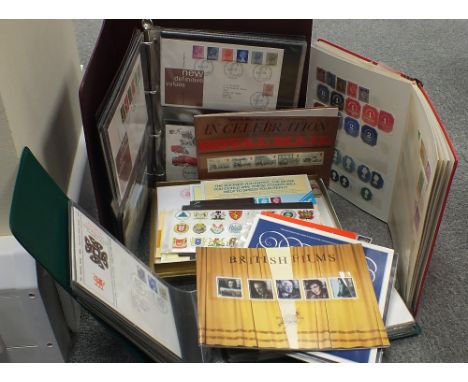
Lot 142
TWO VOLUMES ON THE PENINSULAR WAR BY FRANZ XAVER RIGEL FROM THE PAVLOVSK PALACE LIBRARYRIGEL, Franz Xaver (German, 1783-1852) Der siebenjahrige Kampf auf der Pyrenaischen Halbinsel vom Jahre 1807 bis 1814; besonders meine eigenen Erfahrungen in diesem Kriege nebst Bemerkungen uber das Spanische Volk und Land [A seven-years battle on the Iberian Peninsula from the year 1807 to 1814; particularly my own experiences in this war including my remarks about the Spanish people and the country] Rastatt, 1819. Published at author`s expense by the author himself. 12mo (206 x 133 mm) each volume. 532 pages (volume I); 454 pages (volume II). Both volumes contain a label from the Pavlovsk Palace Library indicating item`s location and inventory number. Contemporary red Morocco binding with gilt tooling along the borders and on the spines. All edges gilt. Silk endpapers. Volume I containing a full-page copperplate etching depicting a Spanish insurgent, and a foldout map of a battle plan. Volume II containing six full-page copperplate etchings featuring a Spanish national dance Bolero, and various landmarks of the territories where the battles took place.PLEASE NOTEIf you will be bidding live on auction day, please note that Session I of the Auction (Asian and Russian Fine & Decorative Art), starts at 10:00 AM New York Time and goes from Lot 1 through Lot 254. Session II of the Auction (European, American and International Fine & Decorative Art) starts at 3:00 PM New York Time and goes from Lot 500 through Lot 676. We sell approximately 70 lots per hour.
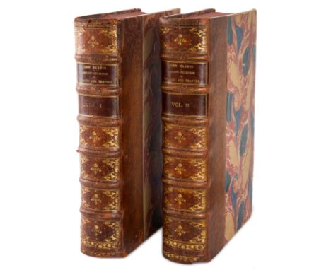
Lot 500
TWO VOLUMES OF NAVIGANTIUM ATQUE ITINERANTIUM BIBLIOTHECA HARRIS, John (English c. 1666-1719) Navigantium Atque Itinerantium Bibliotheca, Or A Complete Collection of Voyages and Travels., London: T. Woodard, A. Ward, S. Birt, D. Brown (et al.), 1744-1748. Large folio (417 x 267 mm) each volume. 984 pages (volume I); 1056 pages (volume II). Second edition. Contemporary quarter mottled calf binding with marbled paper. Spine with six raised bands and intricate gilt tooling. All edges stained. Marbled endpapers matching the cover. Royal privilege as frontispiece in volume one, engraved frontispiece in volume two. Containing 61 full-plate engravings, 39 of which featuring panoramas and landscape views, scenes from the life of locals depicting their customs and traditions; and 22 maps, most of them folding.LOT NOTESThis highly regarded work contains the first separate map of Australia, and one of the first maps of Georgia and the southeast United States-, along with valuable cartography on the Northwest Passage, North and South America, the Arctic regions, and more. It is the second edition, regarded as the best, notably by Hill who commented "This revised edition is the one collectors should seek. It is so expanded compared with the first edition that it is almost a new work." Particularly valuable is the inclusion of a printing of Tasman`s original map and two short articles printed on the map. One discusses Quiro`s voyage, while the other speculates about the possibility of the Australian continent being colonized. To the original extensive collection are added accounts of voyages completed since the first publication: Christopher Middleton to Hudson`s Bay in 1741-42; Bering to the Northeast in 1725-26; Woodes Rogers`s circumnavigation in 1708-11; Clipperton and Shelvocke`s circumnavigation, 1719-22; Roggeveen to the Pacific, 1721-33; and the various travels of Lord Anson, 1740-44. Rearranged to reflect the new English interest in the Pacific.PLEASE NOTEIf you will be bidding live on auction day, please note that Session I of the Auction (Asian and Russian Fine & Decorative Art), starts at 10:00 AM New York Time and goes from Lot 1 through Lot 254. Session II of the Auction (European, American and International Fine & Decorative Art) starts at 3:00 PM New York Time and goes from Lot 500 through Lot 676. We sell approximately 70 lots per hour.
Lot 348
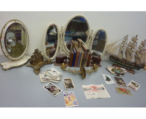
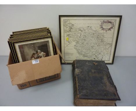
Vintage Ordnance Survey map of Scarborough, pair carved wood elephant bookends H17cm, 'The Story of the Life of George Stephenson Railway Engineer' by Samuel Smiles pub. 1862 and other books, pair brass wall sconces and a letter rack, model of a galleon, two dressing table mirrors and a collection of vintage cards


Lot 216
Jacques Nicolas Bellin (1703-1772) 'Carte Reduite des Isles Britanniques dressee aux Depost des Cartes, Plans, et Jounaux de la Marine', pub. c.1757, copper engraved map with hand colouring, decorative title cartouche, meridians of the Lizard, London and Paris, scale borders, 35 x 21in. (89 x 54.5cm.), unframed.
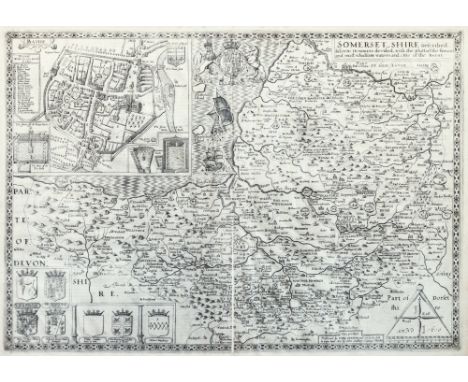
Lot 218
John Speede (1552-1629) 'Somerset-Shire Described: ad into Hundreds Devided, with the Plott of the Famous and most Wholsom Waters and Citie of the Bathe', engraved map with inset town plan of Bath with key, compass rose with callipers and Royal Arms, uncoloured, pub. Sudbury and Humble, c.1615, 15 x 20in. (38 x 51cm.).
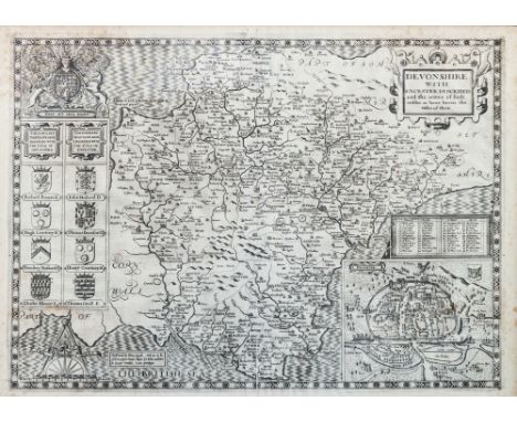
Lot 219
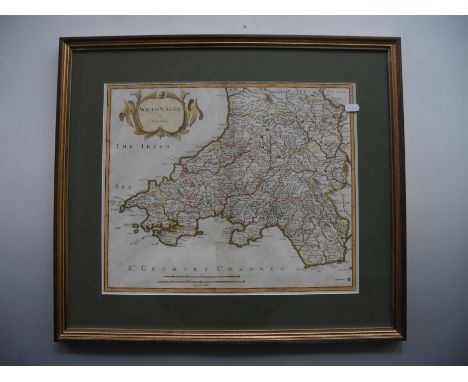
John Speede (1552-1629) 'Devonshire with Excester Described and the Armes of Such Nobles as have Borne the Titles of them', engraved map with inset town plan of Exeter with key, compass rose with callipers and Royal Arms, uncoloured, pub. Sudbury and Humble, c.1615, 14.5 x 19.75in. (37 x 50cm.). * Condition: Some noticeable foxing to the corners on both sides. Top left verso very heavily foxed - almost uniformly browned. Wrinkling to the paper across the surface due to damp. The two sheets joined verso with laid paper strip which is well matched. No rips, tears or holes to paper.


Lot 814
Theodore Danckerts (1663-1729) 'Nova et Accurata Normandiae Ducatus Tabula Portubus, Littoribus, Viisque, Praecipuis, A Regio Geographo Dimensis Exornata Aeri Incisa et in Lucem Edita per Theodorum Danckers', hand coloured engraved map, showing the Channel Islands, 19.25 x 22.5in. (49 x 57cm.), unframed.

Lot 818
Alexis-Hubert Jaillot (1632-1712) 'Le Duche et Gouvernement de Normandie divisee en Haute et Basse Normandie', also showing the Channel Islands, engraved map with hand colouring, pub. Covens et Mortier, Amsterdam c.1705, large decorative title cartouche, 18.75 x 23.5in. (47.5 x 59.5cm.), unframed.


Lot 413
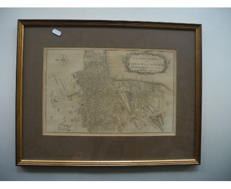
The British Atlas comprising Complete set of County maps of England and Wales with a general map of navigable rivers, canals and plans of cities and principal towns, London 1810, collated with fifty eight coloured maps of counties and twenty one town plans, C.Cole and J.Roper Folio, red leather and marbled boards, front cover detached


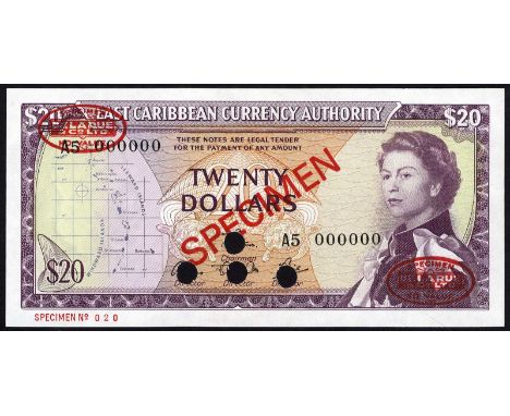
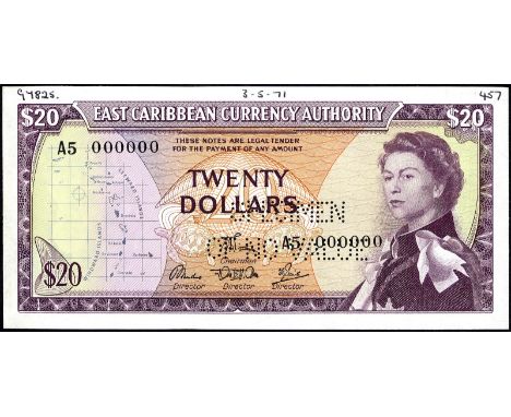
Lot 336
East Caribbean States, P 15e, Linzmayer ECCA B3b5s, East Caribbean Currency Authority, 20 Dollars, (1968), SPECIMEN. Map at left, turtles at center, portrait of Queen Elizabeth II at right on front. Signatures Theophilus - unknown - unknown - Smith. Coastline with palm trees on back. Diagonal red overprint SPECIMEN as well as red oval DE LA RUE NO VALUE on front and back. Red SPECIMEN NO 020 in lower left margin on front. Punched cancelled., # A5 000000, UNC- Start Price: €360
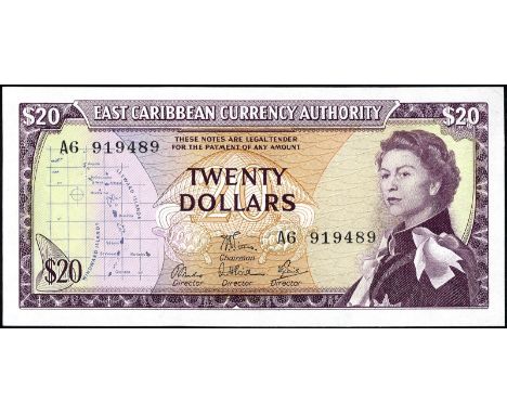
Lot 337
East Caribbean States, P 15e, Linzmayer ECCA B3b6, East Caribbean Currency Authority, 20 Dollars, (1965). Map of the islands at left, portrait of Queen Elizabeth II at right on front. Signatures George Theophilus - unknown - unknown - N.L. Smith. Harbor with ships, buildings and trees on back., # A6 919489, UNC Start Price: €240
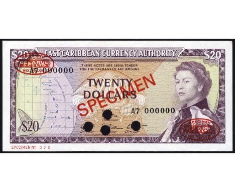
Lot 338
East Caribbean States, P 15e, Linzmayer ECCA B3b6s, East Caribbean Currency Authority, 20 Dollars, (1968), SPECIMEN. Map at left, turtles at center, portrait of Queen Elizabeth II at right on front. Signatures Theophilus - unknown - unknown - Jacobs. Coastline with palm trees on back. Diagonal red overprint SPECIMEN as well as red oval DE LA RUE NO VALUE on front and back. Red SPECIMEN NO 020 in lower left margin on front. Punched cancelled., # A7 000000, UNC- Start Price: €340
Lot 339
East Caribbean States, P 15e, Linzmayer ECCA B3b6s, East Caribbean Currency Authority, 20 Dollars, (1968), SPECIMEN. Map at left, turtles at center, portrait of Queen Elizabeth II at right on front. Signatures Theophilus - unknown - unknown - Smith. Coastline with palm trees on back. Diagonal red overprint SPECIMEN as well as red oval DE LA RUE NO VALUE on front and back. Red SPECIMEN NO 025 in lower left margin on front. Punched cancelled., # A6 000000, UNC Start Price: €360
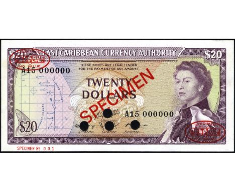
Lot 340
East Caribbean States, P 15s, Linzmayer ECCA B3, East Caribbean Currency Authority, 20 Dollars, (1965), SPECIMEN. Map of the islands at left, portrait of Queen Elizabeth II at right on front. Signatures Vans T. LeBlanc - Norris R. Cummings - Cecil Jacobs . Harbor with ships, buildings and trees on back. Diagonal red overprint SPECIMEN as well as red oval DE LA RUE NO VALUE on front and back. Red SPECIMEN No 001 in lower left margin on front. Punched cancelled., # A15 000000, UNC- Start Price: €380
Lot 341
East Caribbean States, P 15s, Linzmayer ECCA B3b5s, East Caribbean Currency Authority, 20 Dollars, (1965), SPECIMEN. Map of the islands at left, portrait of Queen Elizabeth II at right on front. Signatures George Theophilus - unknown - unknown - N.L. Smith. Harbor with ships, buildings and trees on back. Printers annotations in upper margin on front. Perforated SPECIMEN OF NO VALUE., # A5 000000, UNC Start Price: €360
-
109198 item(s)/page