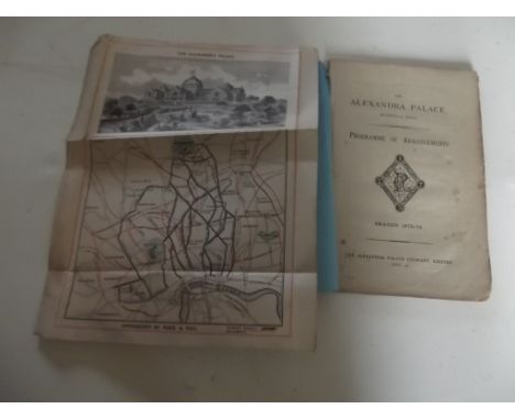
We found 109198 price guide item(s) matching your search

Refine your search

Year

Filter by Price Range
  • List
  • Grid
  • 109198 item(s)
    /page

Lot 13

A group of signed, limited edition and open edition prints to include a London Police artwork official concert poster for Blink-182, signed and numbered 75/88 right corner, 24 x 18, a signed Alex Cherry print, a New York 2017 bike map spray painted with a New York bridge scene and another signed, limited edition print, all unframed

Lot 210

Miscellaneous ephemera, to include pieces relating to India such as a map of the Indian Railways, a copy of Adam and Eve and Pinch Me by A E Coppard, published by Golden Cockerel Press, the Unexpurgated Case Against Woman Suffrage, by Sir Almroth Wright, some poems of Roger Casement etc.

Lot 283

An 18thC hand coloured map of Huntingdonshire, plate size 12cm x 15cm within a book page.

Lot 297

After Scttaghia. Histoire naturelle, coloured print depicting butterflies and moths, later additions, sets of three, 34cm x 26cm, and a coloured map of Lincoln

Lot 47

A charm bracelet, the curb link bracelet, yellow metal, marked 14K to first link, with eleven charms, including Australia map, daisy, boat, sea horse, tankard etc., yellow metal, some marked 9ct, others unmarked, mixed grades, 35.2g all in.

Lot 757

After Pigot. County map of Yorkshire, later coloured and four small hand coloured maps of Yorkshire Ridings (5)

Lot 864

A framed map of Hampshire by Robert Morden

Lot 330

A VINTAGE MAP OF WEST BROMWICH, TOGETHER WITH A SELECTION OF OS MAPS AND FAMILY TREES

Lot 74

Two vintage childrens books and a cloth backed map of Cheshire

Lot 485

1989 Betts Map. Canvassed. England & Wales with layout of Railroads

Lot 441

LEWIS (SAMUEL PUB.) A MAP OF ENGLAND & WALES Divided into Counties, Parliamentary Divisions & Dioceses shewing the Principal Roads, Railways, Rivers & Canals.., four orig. divisions, folding map, sectionalised onto linen on four separate sheets, engraved by J. Dower after R. Creighton.

Lot 1628

A Georgian mahogany and inlaid longcase clock, the painted dial with broken arch and painted floral spandrels including a map of the two hemispheres and a rolling lunar phase with marine landscape panels, indistinctly signed, with subsidiary calendar and secondary dial and eight day striking movement.

Lot 821

Gloucester County Maps, etc - Thomas Kitchen, circa 1770, 18th road map Gloucester & Montgomery and Bristol to West Chester, Archibald Fulverton, The Bristol Channel Circa 1845, together with Bakers Map of the Environs of Bristol circa 1900, another by Roberts (5)

Lot 906A

A very large map of the Railways in England and Wales (compiled from the ordinance surveys and other sources) by Charles R Cheffins, published 1865 scale 6 miles to 1 inch, overall size 180 x 145 cm

Lot 286

Johan (Joan) Blaeu A hand coloured map of Carnarvonshire in double glazed Hogarth frame, 44 x 55cm

Lot 287

John Speede Hand coloured map of Denbighshire, dated 1610 in a Hogarth double glazed frame, 40 x 55cm

Lot 290

John Speede Hand coloured map of Anglesey in double glazed Hogarth frame, 40 x 51cm

Lot 436

A Framed Hand Coloured Ribbon Road Map, The Road from London to Carlisle. By John Ogilby

Lot 437

A Framed Hand Coloured Ribbon Road map by John Ogilby, The Continuation of the Road from Bristol to Chester.

Lot 1289

ALEXANDRA PALACE. "Programme of Arrangements, Season 1875-76." first proof from slips, manu additions, folding map, orig wps, April 1875.

Lot 1295

ARABIA. "Phillips Map of Egypt, The Soudan, The Valley of the Nile ... Arabia." col folding linen-backed map, approximately 24x25 inches, orig cl c1870s vg.

Lot 1305

ETON COLLEGE. Children's Book being "Geographical Questions and Answers ... Instruction of Young Minds." (no map) 56 pp comp, cont sheep, 16 mo, Eton, Pote & Williams 1797 g.

Lot 1515

COLLINS (J.H.). "Observations on the West of England Mining Region." folding map & 18 plts incl col comp, orig cl recased, 1912.

Lot 1543

VAN KEULAN "De River van Falmouth en Helfort Found..." engraved map, 13x19 inches, c1740s, vg. Condition report: Very good condition

Lot 1561

WRIGHT (THOMAS). "The History & Topography of the County of Essex." Vol only, hand col folidng map, & engr plts comp therein, cont cf, taped 4to, 1836

Lot 1562

FALCONER (WILLIAM). "The Shipwreck, A Poem." 18 aquatint plts by Dodd comp, folding map, vignettes, cont cf, 1811 marked.

Lot 1571

STOCKDALE (F.W.L.) "Excursions in the County of Cornwall..." folding engr map & views comp, cf det, 8vo 1833; GILBERT (C.S.) "An Historical Survey of the County of Cornwall ..." Vol 1 only, 1/2 cf, 4to 1817.

Lot 1572

BORLASE (WILLIAM). "The Natural History of Cornwall." 1st edn, 29 engr plts incl map comp, later 1/2 cf, worn, fl, Oxford, 1758

Lot 1603

WORGAN (G.B.). "General View of the Agriculture of the County of Cornwall." folding map, table & 15 plts comp, orig bds, cl spine, uncut, 1811 good copy. Condition report: Sections strengthened and re-set in binding.

Lot 1604

WILLIAM BORLASE. "Observations on the Antiquities Historical & Monumental of the County of Cornwall...." 1st edn, 32 engr plts incl map comp, old cf recased, folio, Oxford, 1754 good copy.

Lot 1605

TUNNICLIFFE. "Cornwall." 1791, hand col folding map, other plts, later 1/4 cf, 8vo vg. Condition report: Map and 4 plates arms.

Lot 1614

KELLY'S Directory of Cornwall. 1902 comp with map, orig cl; plus 8 other Kellys of Cornwall or Devonshire & Cornwall.

Lot 1622

CHINESE EXPLORATION. "The Yangtze valley & Beyond." by Mrs J.F. Bishop, folding col map & 116 illus comp, orig cl, THICK 8VO, 1899

Lot 1627

IPSWICH. "Borough of Ipswich."manu map, 40 x 26 inches, Oct 1928; plus town maps of Southend, Chelmsford, Hendon; plus rolled Ordnance Survey maps etc. BAG

Lot 231

A 1914 Queen Mary gift tin, a T.A. lapel badge and silk map of Siam, Malaya and Sumatra.

Lot 204

A vintage AA badge 11 x 9.5cm, together with a Bentley map bound in tan leather, 14 x 9.5cm.

Lot 383

A framed and glazed text relating to Suffolk; and a map of Suffolk

Lot 7

A coloured map of Suffolk

Lot 74

Two vintage maps depicting John Nordens Map Of The Penwithe Hundred

Lot 81

A vintage print depicting map of Lancaster

Lot 1552

A pair of framed maps, the largest being of Radnorshire whilst the other smaller example is of Essex. The Radnorshire map is two sided, measuring approximately 50cm by 38cm. The smaller example being dated 1645 by Joanne’s Blaeu, measuring approximately 29cm by 23cm.

Lot 1559

An antique framed map of Britain written in Latin and English bearing name W.Stukeley and date 1723.Approx 45x49cm

Lot 183

Collection of Military issued books c.WW2. To include New Testament bible, M.P notebook, Official copy of the Regulations for Army Fire services in War 1942, Not to be Published - The German Army in Pictures pamphlet, Air Raid Precautions handbook no1, Official copy of Notes on Map Reading with pullouts.

Lot 1773

A Boy Scouts pin badge attached to a letter bearing signature of Baden Powell, plus another autograph, stamps and map

Lot 291

Blaeu, coloured engraving, map of Suthsexia Vernaculae Sussex, 38 x 52cm

Lot 300

J. Cary, a map of Sussex, 35 x 50.5cm and a similar smaller map by Cary

Lot 323

Nicholas Sanson, coloured copper plate Map of Ancient Africa, dated 1667, label verso for The Map House 40 x 55cm

Lot 176

Double sided map The Road from Kings Lyn to Norwich by J. Owen and E. Bowen c 1720-1764 hand coloured to both sides framed and double glazed 18.5 X 11 cms good condition

Lot 177

Hand coloured map of Nottinghamshire by T. Kitchen Geographer 22 x 17 cms framed and glazed

Lot 179

Two World Maps and a Telegraph War Map

Lot 182

1720 map of Coleman St and Bashishaw ward pub by J Stype after J Stow

Lot 186

Small 19th Century Map of Scarborough and a Strip Road Map of York to Whitby and Malton to Scarborough.

Lot 188

A county Map of Cornwall and the Scilly Isles by Osborne/Hutchinson Circa 1780 15 X 17 cm

Lot 469

AN EARLY 20TH CENTURY MAHOGANY MAP CHEST, c.1920, of rectangular form fitted with a series of fourteen graduated drawers, on outset plinth base. 91cm wide, 107cm high

Lot 158

Two framed maps to include a map of East Lothian and another plan of Dunbar, (2)

Lot 308

Robert Morden map of Suffolk, circa 1695, 45cm x 41cm

Lot 310

William Faden, A map of the inhabited part of Canada from the French survey's with the frontiers of New York and New England from the large survey by Claude Joseph Sauthier, Engraved by Wm Faden, 1777, 85cm x 56cm

Lot 20

A 1748 T. Osborne map, A Correct Map of Nottinghamshire and assorted prints

Lot 149

A National Railway Network Map, published November 1966, & a portfolio containing 3 large scale 'London & North Western Railway Company' railway plans

Loading...Loading...
  • 109198 item(s)
    /page

Recently Viewed Lots