We found 109198 price guide item(s) matching your search
There are 109198 lots that match your search criteria. Subscribe now to get instant access to the full price guide service.
Click here to subscribe- List
- Grid
-
109198 item(s)/page

![MICHAEL DRAYTON: DORSETSHERE - HAMPSHERE, [DORSET & HAMPSHIRE] engraved hand coloured map [1622], approx 250 x 327mm](https://cdn.globalauctionplatform.com/2937087f-76ba-41fb-bbf7-a69500d581c6/1476a8a1-12aa-4922-8fcc-04cec0d66f72/468x382.jpg)
![MICHAEL DRAYTON: THE PARTE OF SHROPSHYRE ONE THE WEST OF SEVERNE, [SHROPSHIRE] engraved hand coloured map [1622], approx 120](https://cdn.globalauctionplatform.com/2937087f-76ba-41fb-bbf7-a69500d581c6/3917774c-7e57-4019-f4eb-18f67f7b8636/468x382.jpg)
![MICHAEL DRAYTON: CARNARVANSHYRE - MERIONETHSHYRE, [CARNARVONSHIRE, MERIONETHSHIRE] engraved hand coloured map [1622], approx](https://cdn.globalauctionplatform.com/2937087f-76ba-41fb-bbf7-a69500d581c6/ddafd82d-e166-4cef-9518-7e349a3749a0/468x382.jpg)
![MICHAEL DRAYTON: FLINTSHYRE - DENBIGHSHYRE, [FLINTSHIRE - DENBIGHSHIRE] engraved hand coloured map [1622], approx 120 x 327mm](https://cdn.globalauctionplatform.com/2937087f-76ba-41fb-bbf7-a69500d581c6/8b9297e3-f113-441f-c13a-62f93873f11b/468x382.jpg)
![MICHAEL DRAYTON: GLOCESTERSHYRE - PARTE OF WORCESTER, [Gloucestershire - Worcester] engraved hand coloured map [1622], approx](https://cdn.globalauctionplatform.com/2937087f-76ba-41fb-bbf7-a69500d581c6/0bd2da04-2247-4dff-ff7b-76a861d0f452/468x382.jpg)


Lot 1238
SCARBOROUGH COMPANY, BOSTON, USA (PUBLISHED): SCARBOROUGH'S MAP OF ENGLAND AND WALES SHEWING GEOGRAPHICAL COUNTIES AND BOROUGHS, ALL RAILWAYS AND STEAMSHIP LINES WITH DISTANCES BETWEEN STATIONS AND LANDINGS, coloured litho folding linen map, circa 1901, 1250 x 840mm, VGC, original calf gilt slip case
Lot 1255
W FADEN (PUBLISHED): 3 maps: SPAIN AND PORTUGAL DIVIDED INTO THEIR RESPECTIVE KINGDOMS AND PROVINCES FROM THE SPANISH AND PORTUGUESE PROVINCIAL MAPS, engraved outline coloured map, 1796, folding backed onto linen, 505 x 735mm - A CORRECT MAP OF FRANCE ACCORDING TO THE NEW DIVISIONS INTO METROPOLITAN CIRCLES ... FROM A REDUCED COPY OF MONSR CASSINI'S LARGE MAP, engraved hand coloured map, 1806, 2 sheets, folding backed onto linen, each sheet 620 x xx60mm; A NEW MAP OF SPAIN AND PORTUGAL EXHIBITING THE CHAINS OF MOUNTAINS WITH THEIR PASSES ... REQUISITE FOR THE INTELLIGENCE OF MILITARY OPERATIONS COMPILED BY JASPER C NANTIAT, engraved hand coloured map 1810, 4 sheets, folding backed onto linen, each sheet approx 560 x 785mm (3)

Lot 160
SIR ARTHUR CONAN-DOYLE: RODNEY STONE, 1896, 1st edition, 10pp adverts at end, original cloth gilt recased, new end papers, + JOHN MEADE FALKNER: MOONFLEET, London, Edward Arnold, circa 1917, "Popular" edition, 4pp adverts at end, original red cloth, "File copy" label on top board, + SIR HENRY RIDER-HAGGARD: KING SOLOMON'S MINES, Cassell, 1887, 43rd thou, folding frontis map, 16pp adverts at end, original pictorial cloth (3)

Lot 314
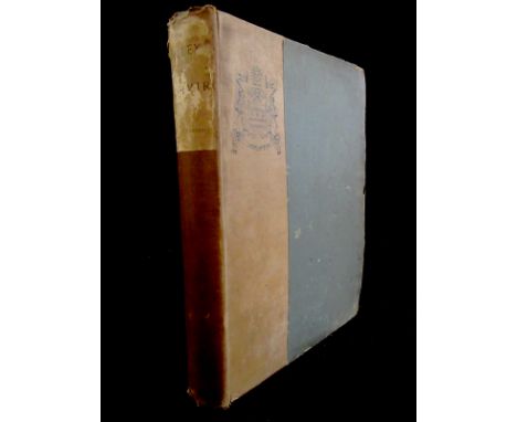
PRISCILLA WAKEFIELD: A FAMILY TOUR THROUGH THE BRITISH EMPIRE..., London, Harvey & Darton, 1820, 10th edition, hand coloured folding frontis map (close tears), 6pp adverts at end, old calf worn, top board near detached, + "A LADY": CHRONOLOGY OF THE KINGS AND QUEENS OF ENGLAND, RENDERED INTO RHYME, Bath, Benj Higman, 1843, 2nd edition, original printed paper boards worn, no copy of any edition on COPAC, (2)
Lot 480
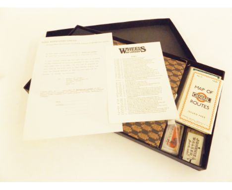
GEORGE PERRY (EDITED): WHEELS OF LONDON - THE STORY OF LONDON STREET TRANSPORT, London, The Sunday Times Magazine, 1972, limited edition (3000) numbered, oblong, original two tone cloth gilt, housed in original case with facsimile reproductions of London Transport circa 1930s London Transport tickets, 5 facsimile reproduction folding maps including Omnibus No 11 1930, Greenline Coach Map No 1 1937, Trolley Bus and Tram Map No 1 1940 etc, and set of 30 London Transport Cigarette Cards as issued, publisher's original printed order form and printed description of tickets loosely inserted, original box
Lot 481
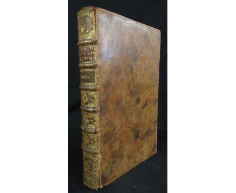
LODOVICO ANTONIO MURATORI: RERUM ITALICARUM SCRIPTORES: AB ANNO AERAE CHRISTIANAE QUINGENTESIMO ..., Mediolani (Milan), 1727, volume 10 (of 25) only, engraved frontis by Girolamo Frezza after Masucci; title in red and black with engraved vignette plus engraved portrait plate by F M Francia after Ferroni plus engraved head piece plus multi folding engraved map of Italy by Angela Baroni, TABULA ITALIAE MEDII AEVI GRAECO LANGOBARDICO FRANCICI ..., 1123pp, folio, old full calf, spine gilt in compartments
Lot 582
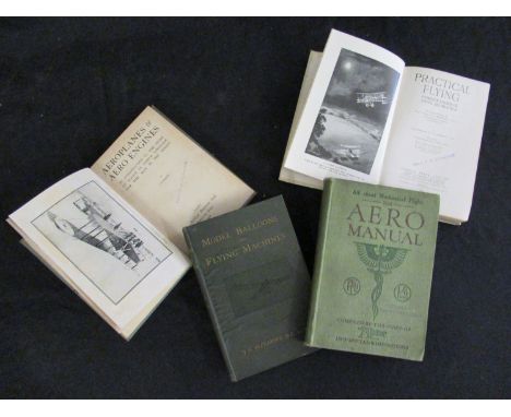
FLIGHT COMMANDER W G MCMINNIES: PRACTICAL FLYING, COMPLETE COURSE OF FLYING INSTRUCTION, illustrated E L Ford, London, Temple Press, 1918 1st edition, frontis + 2 full page plates + folding map + illustrations in text as called for, original cloth, ownership ink stamp of Cecil F W Cudworth to title page, verso map etc + JOHN HENRY ALEXANDER: MODEL BALLOONS AND FLYING MACHINES WITH A SHORT ACCOUNT OF THE PROGRESS OF AVIATION, London, Crosby, Lockwood & Son, 1910, 1st edition, black and white frontis, 5 folding sheets of "working drawings", + black and white illustrations in text as called for, 127pp + 32pp publishers adverts at end, original cloth gilt + THE AERO MANUAL, A MANUAL OF MECHANICALLY PROPELLED HUMAN FLIGHT, COVERING THE HISTORY OF THE WORK OF EARLY INVESTIGATORS, AND OF THE PIONEER WORK OF THE LAST CENTURY..., London, Temple Press Ltd, 1910, 2nd edition, original cloth, "Sheffield Model Aero Club" ink stamps to half title, title etc + "AVION": AEROPLANES AND AERO ENGINES, AN INTRODUCTION TO THE STUDY OF FLIGHT IN SIMPLE LANGUAGE FOR THE MAN IN THE STREET, London, 1918, 1st edition, black and white frontis + 43 black and white illustrations in text as called for, original cloth, ownership ink stamps of Cecil F W Cudworth to top board, title etc (4)
Lot 63
CHRISTOPHER TOLKIEN: PICTURES BY J R R TOLKIEN, London, 1979, 1st edition, original cloth gilt worn, dust-wrapper + BRIAN SIBLEY & JOHN HOWE: THE MAP OF TOLKIEN'S BELERIAND AND THE LANDS TO THE NORTH, London, HarperCollins, 1999 1st impression, folding coloured map, original pictorial wraps + KAREN WYNN FONSTAD: THE ATLAS OF MIDDLE-EARTH, London, Grafton, 1992, 1st UK edition, original pictorial laminated wraps + DAVID DAY: 2 titles: TOLKIEN THE ILLUSTRATED ENCYCLOPAEDIA, London, 1991 1st edition, original cloth gilt, dust-wrapper, A TOLKIEN BESTIARY, New York, Ballantine Books 1979, original cloth, dust-wrapper (5)

Lot 686A
R T MCMULLEN: DOWN CHANNEL FROM LONDON TO THE LANDS END IN THE "LEO"..., London, 1869, 1st edition, frontis + 4 maps (of which 2 folding), original blind stamped cloth gilt worn, + SUMMER TOURS IN SCOTLAND, GLASGOW TO THE HIGHLANDS, THE ROYAL ROUTE WITH TIMETABLES AND LIST OF FARES, WITH DAVID MACBRAYNE'S ROYAL MAIL STEAMERS "COLUMBA", "IONA" ETC, 1896, "Official Guide - new edition", original pictorial cloth gilt worn + LT COL F M BAILEY: CHINA - TIBET - ASSAM, A JOURNEY, 1911, 1945 1st edition, original cloth gilt + S M BURROWS: THE BURIED CITIES OF CEYLON; A GUIDEBOOK TO ANURADHAPURA AND POLLONARUA; WITH CHAPTERS ON DAMBULLA, KALAWEWA..., Columbo, A M & J Ferguson, 1885, folding map + folding railway timetable, original half cloth worn and soiled, + R P MURRAY: THE FLORA OF SOMERSET, Taunton, 1896, rebound half calf gilt, top edge gilt + FISHERS DRAWING ROOM SCRAPBOOK WITH POETICAL ILLUSTRATIONS, London, 1833, grey frontis, engraved vignette title + 34 engraved plates as called for, original calf backed blind stamped cloth gilt, all edges gilt, inner joints split (6)
Lot 689
R NISBET BAIN: THE DAUGHTER OF PETER THE GREAT ..., Westminster 1899 1st edition, frontis plus 6 plates as called for, inscribed presentation copy, original cloth gilt worn plus W K KOROSTOWETZ: THE RE-BIRTH OF POLAND, 1928 1st edition, frontis plus 4 maps as called for, original cloth gilt ex German Consulate Glasgow Institutional markings plus THE DOWAGER MARCHIONESS OF DUFFERIN AND AVA: MY RUSSIAN AND TURKISH JOURNALS, London, John Murray 1916 1st edition, frontis plus 11 plates as called for, original cloth gilt worn, ffep, frontis and half title loose plus A F FOORD: SPRINGS, STREAMS AND SPAS OF LONDON HISTORY AND ASSOCIATIONS, 1910 1st edition, original cloth gilt plus JOHN FINNEMORE: PEEPS AT MANY LANDS INDIA, Illustrated Mortimer Menpes, London, A & C Black 1907 1st edition, 12 coloured plates plus map as called for, original cloth worn plus 1 other similar (6)
Lot 695
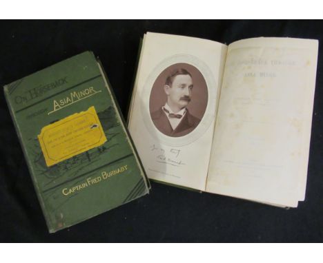
CAPT FRED BURNABY: ON HORSEBACK THROUGH ASIA-MINOR, London, Samson Lowe, 1877, 1st edition, 2 volumes, 1st edition, mounted Woodbury type portrait photograph frontis + 3 folding maps as called for (of which 2 coloured), map of "routes which traverse Asia-Minor and Mesopotamia" with closed tear, volume 1 - 24pp publishers adverts at end dated September 1877 and errata slip tipped in at end, original pictorial cloth gilt worn, "Mudie's Select Library" labels to top boards (2)
Lot 697
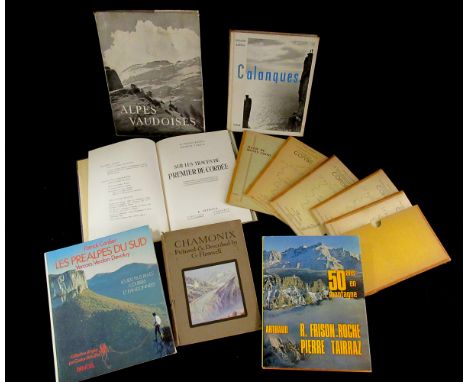
R FRISON-ROCHE AND G TAIRRAZ: SUR LES TRACES DE PREMIER DE CORDEE, Paris and Grenoble, 1952, black and white and colour illustrations from photographs as called for, rebound, half calf gilt + MICHEL FABRIKANT: LES TOPO-GUIDES DE L'ALPINIST ET DU RONDONNEUR EN CORSE II LE MASSIF DU SINTO, Club Alpin Francais et de la Federation Francaise de la Montagne, circa 1960, parts 1-4 in 3 volumes + supplement + folding map (5 volumes), each original printed wraps, original slip-case + G FLEMWELL: CHAMONIX, Blackie, 1913, 1st edition, 12 coloured plates as called for, original boards, pictorial label to top board + ROGER FRISON-ROCHE: 50 ANS EN MONTAGNE, 1974, original cloth, dust-wrapper + EMILE GOS AND LOUIS SEYLAZ: ALPES VAUDOISES, Lausanne, 1948, 1st edition, original cloth, dust-wrapper + G REBUFFAT AND G M OLLIVE: CALANQUES, 1957 reprint, original cloth pictorial label to top board + PATRICK CORDIER: LES PREALPES DU SUD, 1981, original pictorial laminated boards + MASSIF DES ECRINS, folding map circa 1922, (7)
Lot 73
G A HENTY: 2 titles: WITH FREDERICK THE GREAT, A STORY OF THE SEVEN YEARS WAR, London, Blackie & Son, 1898, [1897], 1st edition, 12 black and white plates + 8 black and white maps as called for, 32pp adverts at end, headed "Books for Young People", original pictorial red cloth gilt, bevelled edges, THROUGH THE SIKH WAR; A TALE OF THE CONQUEST OF THE PUNJAUB, London, Blackie & Son, 1894, variant issue, 12 black and white plates + map as called for, original pictorial grey cloth gilt, bevelled edges, all edges olive green + S R CROCKETT: SWEETHEART TRAVELLERS, A CHILD'S BOOK FOR CHILDREN, FOR WOMEN AND FOR MEN, London, Wells, Gardner, Darton & Co, 1895, 2nd edition, black and white frontis, illustrated title page + 12 plates as called for, original pictorial cloth + HAMPDEN GORDON: OUR GIRLS IN WARTIME, illustrated Joyce Dennys, London, John Lane [1917] 1st edition, original cloth backed pictorial boards (4)
Lot 730
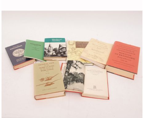
W PITT: GENERAL VIEW OF THE AGRICULTURE OF THE COUNTY OF WORCESTER..., 1969, facsimile of the 1st edition published 1813, folding map frontis, original cloth dust-wrapper + MAXWELL FRASER: COMPANION INTO WORCESTERSHIRE, 1949, 4th edition, original cloth + R M HAINES: A CALENDAR OF THE REGISTER OF WOLSAN DE BRANSFORD, BISHOP OF WORCESTER 1339-49, 1966 1st edition, original cloth dust-wrapper + CALENDAR OF WILLS AND ADMINISTRATIONS IN THE CONSISTORY COURT OF THE BISHOP OF WORCESTER 1601-1652, 1968, Kraus reprint, original printed wraps + M PATERSON & ERNIE WARD: ASHTON KEYNES, A VILLAGE WITH NO HISTORY, 1986 1st edition, original cloth dust-wrapper + VICTOR SKIPP: MEDIEVAL YARDLEY, THE ORIGIN AND GROWTH OF A WEST MIDLAND COMMUNITY, 1970, original cloth dust-wrapper + R HUNT & R JACKSON: INKBERROW WAYS, 1982, original printed wraps + ARTHUR MEE: WORCESTERSHIRE, THE GARDEN IN THE HILLS, 1947 reprint, original cloth dust-wrapper (8)


![[TOPOGRAPHY]. ISLE OF WIGHT Barber's Picturesque Illustrations of the Isle of Wight, Simpkin & Marshall, London, no date, ha](https://cdn.globalauctionplatform.com/7aca822e-d80e-43a9-8b4b-a6b40116c67f/7817b319-4ad2-47b2-f959-d51ad9f8d3a2/468x382.jpg)
![[TOPOGRAPHY]. BIRMINGHAM A Pictorial Guide to Birmingham: Being a Concise Historical, and Descriptive Account of the Great M](https://cdn.globalauctionplatform.com/7aca822e-d80e-43a9-8b4b-a6b40116c67f/c9502004-472f-438c-c84f-dc4fae5bc52c/468x382.jpg)
Lot 241
[TOPOGRAPHY]. BIRMINGHAM A Pictorial Guide to Birmingham: Being a Concise Historical, and Descriptive Account of the Great Midland Metropolis, Allen, Birmingham, 1852, original dark green boards (lacking much of spine strip), folding map frontispiece, vignette illustrations, sixty-two pages of advertisements (some illustrated), small octavo; together with Londoners: A Book of Appointments for 1938, London Passenger Transport Board, as dated, cloth-backed decorative boards, plate illustrations from photographs, quarto, (2).

![[TOPOGRAPHY]. SOMERSET Bazalgette, J.W. & Whitehead, A. Report on the Yeo, Parrett, and Ile Drainage, 1869, string-bound, tw](https://cdn.globalauctionplatform.com/7aca822e-d80e-43a9-8b4b-a6b40116c67f/131f1ca2-cf71-4f69-926b-5f7b61a991fa/468x382.jpg)
![[TOPOGRAPHY]. GREAT BRITAIN Cary's New Itinerary: or, An Accurate Delineation of the Great Roads both Direct and Cross Throu](https://cdn.globalauctionplatform.com/7aca822e-d80e-43a9-8b4b-a6b40116c67f/3970e2c9-c60b-483c-bb30-1dad7e584bc5/468x382.jpg)
Lot 236
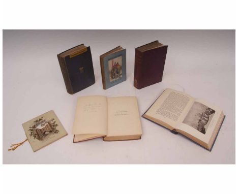
[TOPOGRAPHY]. GREAT BRITAIN Cary's New Itinerary: or, An Accurate Delineation of the Great Roads both Direct and Cross Throughout England and Wales; with Many of the Principal Roads in Scotland, eighth edition, no date, half calf, large sectional folding map (now cloth-backed), five (of six) smaller folding maps, octavo; together with Paterson, Lieut.-Col. A New and Accurate Description of All the Direct and Principal Roads of Scotland, fifteenth edition, London, 1811, full marbled calf (upper board almost detached; lower board detached; spine strip incomplete), folding map frontispiece, seven further folding maps (as called for), octavo, (2).


Lot 122
Philip Dumaresq and Thomas Lempriere, 'A New and Accurate Map of their Majesties Island of Jersey....', hand coloured engraved map with decorative title cartouche, scale with dividers, compass rose and Jersey Arms, c.1694, taken from the volume 'Caesarea - Or an Account of the Island of Jersey' by the Rev. Philip Falle, 11½ x 15in. (29.25 x 38cm.)., * Condition: Some foxing, mainly to the right side. Lower right corner and text below lower margin poorly printed (offset type). 3in. repaired tear to right hand edge just below Castle Bank. Some ghost printing across surface of paper due to being folded for many years. Modern gilt frame with pale apricot mount.


-
109198 item(s)/page