We found 109198 price guide item(s) matching your search
There are 109198 lots that match your search criteria. Subscribe now to get instant access to the full price guide service.
Click here to subscribe- List
- Grid
-
109198 item(s)/page
![[Ottoman Empire] - Speed, John The Turkish Empire London: G. Humble, [1626] Hand-coloured engraved map, English text on verso](https://cdn.globalauctionplatform.com/103db3fe-7615-4ce5-8821-aead00b5a32c/51cf8f16-f243-4bf9-9cc1-aeb400fa8fd9/468x382.jpg)


Lot 193
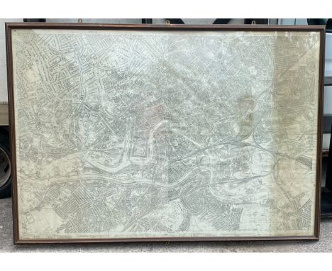
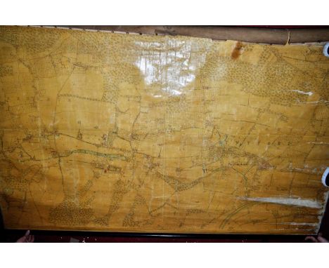
Sale Item: FRAMED WINDERMERE LAKE MAP (AF) Vat Status: No Vat Buyers Premium: This lot is subject to a Buyers Premium of 15% + Vat @ 20% Additional Info : Lots purchased online with the-saleroom.com will attract an additional charge for this service in the sum of 4.95% of the hammer price plus VAT @ 20%

Lot 999
LEY ROBERT: (1890-1945) German Nazi politician, head of the German Labour Front 1933-45. Vintage signed 8.5 x 6 photograph of Ley seated in a half-length pose, in his uniform, at a table alongside two other men, as they inspect a map (?) before them. Signed by Ley in dark fountain pen ink with his name alone to the image. VG
Lot 1189
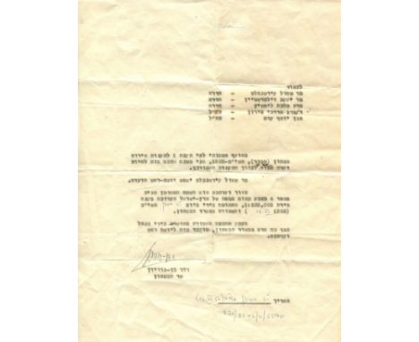
BEN-GURION DAVID: (1886-1973) Zionist leader, the primary national founder of the State of Israel and the first Prime Minister of Israel 1948-54, 1955-63. T.L.S., in Hebrew, one page, 4to, n.p., 12th June 1952, to an unidentified recipient, in Hebrew. Ben-Gurion writes, in part, 'Pursuant to my authority derived from Section A of the security service (exception) regulations - 1952, I hereby appoint you to commission the exceptions no.4 committee in furtherance of the said regulations. Mr. Shaul Kirschenblat will serve as a chairman of the committee. Your committee's zone will be the area marked around no.4 in orange on the state of Israel map ratioed by 4:250,000, signed by me on 6.12.1952 and held at the Ministry of Defence. A copy of the said map, approved by the Defence Ministry Human Resources Manager, is hereby provided to you'. Some light overall creasing, about VG Ben-Gurion served as Minister of Defence 1948-54 and 1955-63.


Lot 474
A quantity of Victorian children's bone letters of the alphabet and other bygones and miscellanea, to include treen pastry jiggers and butter stamp, Oxo Ltd 1953 Coronation commemorative tin, Victorian glass inkwell with brass cap, hand bell, blue glass cream jug, map, etc Mostly in good condition
Lot 564
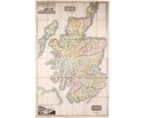
Atlas Company of Scotland - The Travelling map of Scotland Scale 12.5miles:1 inch, engraving, full contemporary colour with title and vignettes of Staffa and Port Patrick, backed on linen, slightly soiled, original maroon cloth covered card slip case with green title label, W & A K Johnston (et al) [c1843]
Lot 565
Blacks New large map of Scotland Scale 4inches:1mile, engraving on twelve sheets, in full contemporary colour, backed on linen, original green cloth covered slip case with publisher's pictorial label and signature of a former owner and date 1880, spine gilt, worn, joints separating, Edinburgh: A & C Black [1862]

Lot 579
Lewis (Samuel) publisher - A Topographical Dictionary of Scotland comprising the several Counties, Island, Cities, Burgh and Market Towns, Parishes and Principal Villages...embellished with a large map of Scotland...supplementary volume: Map of Scotland Scale 10miles:1 inch, engravings on six folded sheets, slightly separating in the cross folds, title and contents leaf, contemporary cloth, 4to, London: S Lewis & Co 1846


Lot 247
THE LAND & WATER MAP OF THE WAR (1915) Portraying the armed forces on the western front in 1915 Drawn under the direction of Hilaire Belloc 81cm x 103cm; with frame 105cm x 127cm Condition: For a condition report or further images please email hello@hotlotz.com at least 48 hours prior to the closing date of the auction. This is an auction of preowned and antique items. Many items are of an age or nature which precludes their being in perfect condition and you should expect general wear and tear commensurate with age and use. We strongly advise you to examine items before you bid. Condition reports are provided as a goodwill gesture and are our general assessment of damage and restoration. Whilst care is taken in their drafting, they are for guidance only. We will not be held responsible for oversights concerning damage or restoration.

Lot 31
A LARGE FORMAT MAP OF SINGAPORE CITY Published in 1958 by the Singapore Chinese Booksellers Ass. and printed in Hong Kong, unframed This large format map is believed to be the first official bi-lingual map produced after the 1957 Treaty of London, after which English was not the only official language in Singapore. 90cm x 136cm Condition: Condition Report Folds as issued, tears to some of these folds, a tear to upper margin at upper right corner, some staining /browning to paper allover, creases and wear to edges. For further images please contact the saleroom. This is an auction of preowned and antique items. Many items are of an age or nature which precludes their being in perfect condition and you should expect general wear and tear commensurate with age and use. We strongly advise you to examine items before you bid. Condition reports are provided as a goodwill gesture and are our general assessment of damage and restoration. Whilst care is taken in their drafting, they are for guidance only. We will not be held responsible for oversights concerning damage or restoration.

Lot 33
A JAPANESE FOLDING HANDBOOK Describing a Japanese business in Pre War Malaya and Singapore with a translation from Japanese to Malay; the map illustrating Malaysia and Singapore 20cm x 13cm Condition: For a condition report or further images please email hello@hotlotz.com at least 48 hours prior to the closing date of the auction. This is an auction of preowned and antique items. Many items are of an age or nature which precludes their being in perfect condition and you should expect general wear and tear commensurate with age and use. We strongly advise you to examine items before you bid. Condition reports are provided as a goodwill gesture and are our general assessment of damage and restoration. Whilst care is taken in their drafting, they are for guidance only. We will not be held responsible for oversights concerning damage or restoration.

Lot 35
A MAP OF SINGAPORE Mid 20th c. Backed on linen 56cm x 83cm Condition: Margins have been trimmed. Browning and staining througout the sheet. Wear at the folds, please see further images. This is an auction of preowned and antique items. Many items are of an age or nature which precludes their being in perfect condition and you should expect general wear and tear commensurate with age and use. We strongly advise you to examine items before you bid. Condition reports are provided as a goodwill gesture and are our general assessment of damage and restoration. Whilst care is taken in their drafting, they are for guidance only. We will not be held responsible for oversights concerning damage or restoration.
Lot 50
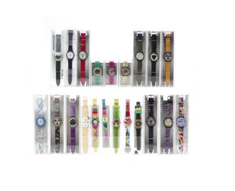
A QUANTITY OF SWATCH WATCHES Including a Citibank London limited edition watch, seven Chrono Swatch watches, a World Map Swatch watch, a 1992 Swatch Steam watch, a Swatch Wild Card watch, a Swatch Chrono Riding Star watch, two Singapore Airlines Swatch watches, a 1993 Scuba 200 Swiss Swatch watch, a Scuba 200 Mint Swatch watch, a 1994 Marechal automatic swatch watch etc. Dials measuring approximately 35mm -40mm Condition: Msot examples with signs of light use, one or two with signs of regular use to the straps. The majority with the rubber straps have some discolouration etc in places. One with black rubber strap, the strap has perished (as per extra image). The Citibank exmaple the strap is worn and sticky. Another luminous example with damage to strap. Of the three Automatic examples in the lot two appear to run, but the last does not appear to start running, these not checked for time keeping. The quartz examples are not currently running and have not been tested. This is an auction of preowned and antique items. Many items are of an age or nature which precludes their being in perfect condition and you should expect general wear and tear commensurate with age and use. We strongly advise you to examine items before you bid. Condition reports are provided as a goodwill gesture and are our general assessment of damage and restoration. Whilst care is taken in their drafting, they are for guidance only. We will not be held responsible for oversights concerning damage or restoration.


Lot 1087
After Alexander Charles-Jones, (b. 1959), Cocks Only, lthograph print, signed and titled in pencil to the margin, 31 x 46cm, together with "The Hen Party" signed limited edition print no. 351/750, 31 x 49cm and after I. Scott, Fishermans Map Of Salmon Pools On Part Of The River Spey, coloured print, 19 x 74cm. (3)


Lot 6524
Piere Alexander Aveline (French 1702-1760): 'Plan of the Town and Mole of Agde' engraving pub.1759; Neele (English 1758-1824) 'Sweden Norway and Denmark' 19th century engraved map with hand colouring; selection of 19th century maps with hand colouring including 'Canaan' 'Isrealites in the Desert' 'Spain and Portugal', together with collection of five illustrations after Helen Knapping max 23cm x 36cm (24) (unframed)


Lot 6526
John Senex (English 1678-1740): 'The Continuation of the Road from London to Holy Head', engraved map pub. D Henry and R Cave c. 1765 and three other 18th century engraved strip maps; Robert Laurie (English 1755-1835): 'Commencement of the Roads to Holyhead' and 'Commencement of the Roads to the Lakes of Lancaster', pair of engraved maps with hand colouring pub. 1815. Together with two other strip maps and collection of 19th century landscape engravings max 33cmx39cm (15) (unframed)

Lot 6528
Richard Blome (British 1635-1705): 'A Mapp of Warwickshire with its Hundreds', engraved map with hand colouring pub.c.1673, 32cm x 26cm; John Gibson (British 1724-1773): 'A New and Accurate Map of the Kingdom of Prussia and Polish Prussia', engraved map with hand colouring pub. c.1767, 20cm x 29cm; Thomas Kitchin (British 1719-1784): 'Essex', 18th century engraved map with hand colouring 22cm x 27cm (3)


-
109198 item(s)/page