We found 109182 price guide item(s) matching your search
There are 109182 lots that match your search criteria. Subscribe now to get instant access to the full price guide service.
Click here to subscribe- List
- Grid
-
109182 item(s)/page


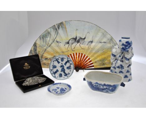
Lot 26
A Chinese blue and white tureen base decorated with a watery landscape, 18.5 x 11.8 cm and two Chinese blue and white saucers, all 18th century to/w a Japanese blue and white figure of a woman holding a pot, Meiji, 22.3 cm, a paper fan decorated with ostriches in a landscape to one side and a map of Africa to the other and a cased silver plated buckle.


Lot 26
YEATS, JACK B../MARRIOTT, ERNEST.Jack B. Yeats: His Pictorial and Dramatic Art, with an original watercolour by Jack B Yeats ‘To Lily (Yeats) from Jack’, November 1911, with an inscription on the fly leaf to Hilda Pollexfen from Lily Yeats with an original bookplate of Hilda Pollexfen by EC Yeats (Cuala Press printed) and an address label (Greystones) with a small sailing ship on the label - in Jack B Yeats hand November 1911, all in a leather box made by Sangorski and Sutcliffe.The original drawing shows Theodore shipwrecked sitting on a floating barrel and looking at a pirate map.

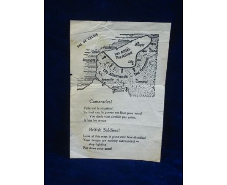
Lot 323
WW2 NAZI DROP LEAFLET DUNKIRK EVACUATION. An original Nazi propaganda leaflet dropped by the Luftwaffe on the defeated allied troops retreating towards Dunkirk in order to encourage them to surrender. Printed in French and English, showing a map of the battle field and the advantageous position held by the Germans. 25-30


Lot 161
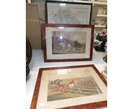
AN OVERVIEW OF THE CAMPAIGN OF THE BATTLE AT BORODINO WITH THREE FOLDOUTS, 1846 General von Hofmann, DIE SCHLACHT VON BORODINO MIT EINER UBERSICHT DES FELDZUGS VON 1812 [The Battle at Borodino with the 1812 Campaign Overview ] Koblenz: K. Badeker, 1846. 8vo (221 x 140 mm). 80 pages plus three large foldouts, including a colored map of the battle at Borodino (approximately 400 x 600 mm). Contemporary half leather binding. Spine with embossed gilt tooling. Text in German. PROVENANCE From a regiment library (stamped on the first flyleaf) Ex-libris of Hanns Georg Schmitz-Otto on front endpaper THIS LOT IS BEING SOLD WITHOUT RESERVE.


Lot 1385
An early 19th century needlework map of Europe by S Ferguson, detailing the countries and borders of Europe, annotated with British military victories, 47 x 46cm, in glazed Victorian rosewood frame Condition Report / Extra Information Loss to upper centre near Sweden app. 2 x 1cm. Two small moth holes at 12 o'clock. The whole with staining and discolouration. Some thread loss to central area, most noticeably to Germany and Poland.

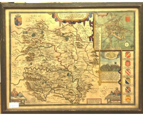
Lot 1476
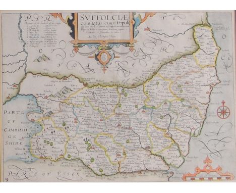
Christopher Saxton - Engraved county map of Suffolk, later hand-coloured, taken from the 1637 edition, 28 x 38cm Condition Report / Extra Information Not stuck down. Several creases lower right and one crease to left of centre fold. No tears. With margin. Colours good with light fading only. Minor spotting upper right.


Lot 1059
BIBLE (Geneva version), London, Robert Barker 1611-1612, 4to, Book of Common Prayer with Psalms bound together with Old Testament and New Testament, old calf, front board detached, content clean and sound, Geneva-Tomson-Junius edition, Herbert 312 (title page as per Herbert 289 and includes Speed's Genealogies and map) (1)


Lot 149
John Cary: Cary's New Pocket Plan of London, Westminster and Southwark, circa 1798. An engraved folding map in 18 sections backed onto linen, 41cm x 61cm, to include 'A List of Penny Post Receiving Houses and over 350 Hackney Coach Fares'. In original slipcase with mounted title label. Condition Report: Generally good with age related wear. Some areas where the linen back is showing through in the folds.


Lot 485
THE GENEALOGIES RECORDED IN THE SACRED SCRIPTURES with the Line of our Saviour Jesus Christ by I.S. CVM PRIVILEGIO Circa 1665 A fabulous antique religious book containing the whole family and tribal history of Adam and Eve and their descendants. The book also contains a detailed map and description of Canaan showing Egypt , Moab , Tema and many other Biblical locations

Lot 1065
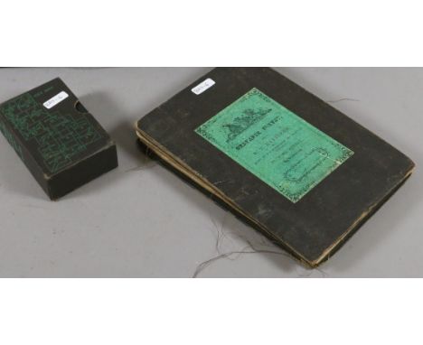
A complete collection of "The Ancient Counties of England" series circular silver medallions, on display tray in original case, with booklet containing a reproduction of a map by Willem and Johan Blaeu, also a Neville Willams "Royal Homes" book published by The Birmingham Mint 1976, each medallion approx 1.4ozt, and a spare display case (2).


Lot 3070
Turnor (Edmond). Collections for the history of the town and soke of Grantham .... hand coloured engraved map frontispiece and seven engraved plates, plate of Johannus De Welby stain glass window with tissue guard from another work loosly inserted, later half moroccoed over patterned boards, spine ends worn, folio, 1806.
-
109182 item(s)/page