We found 109182 price guide item(s) matching your search

Refine your search

Year

Filter by Price Range
  • List
  • Grid
  • 109182 item(s)
    /page

Lot 87

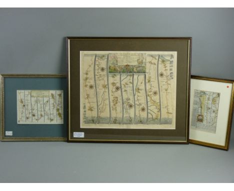
JOHN OGILBY coloured and tinted road map, plate no. 87 - 'The Road from Welshpool to Carnarvon in North Wales', 35.5 x 43 cms with text page details verso, OWEN & BOWEN coloured and tinted road map 1720, plates 57 & 58 - 'Northop to Holyhead', 18 x 12 cms, glazed verso and JOHN SENEX coloured and tinted road map, 1719 - 'The Road from London to Montgomery', 15.5 x 21 cms
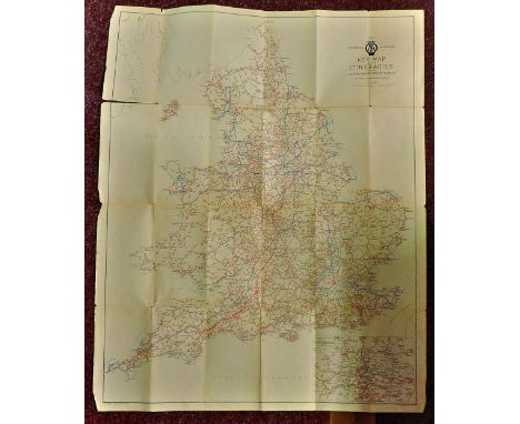
Lot 2893

18th century engraved map of Essex, by Eman Bowen, with slight hand colouring, in glazed frame, 53cm x 71cm

Lot 2457

Second World War R.A.F. silk escape map depicting Greece, Albania, Bulgaria (South), Turkey and Europe, Turkey in Asia (Western Seaboard), Crete (inset right) and on reverse side Slevakia (South), Poland (South), Hungary (South East), Romania, Serbia, Bulgaria (N. Central & E.), Croatia (East), Montenegro (East) and Albania (North)

Lot 1293

Selection of maps including Cambridgeshire and Suffolk by T McLean 1818, Cambridgeshire circa 1850 by Longman 17th century hand coloured engraving map of Norfolk, Suffolk, Cambridge, Northamptonshire and Lincoln by Joannis Jansson and others

Lot 233

A Modern Wrist Watch and Two Map Measuring Wheels

Lot 257

A Mounted Ordnance Survey Map of Shropshire Together with Measuring Grid

Lot 262

A Pair of Framed Religious Prints and a French Map of Scotland Dated 1771 by M Bonne

Lot 1278

Issued 2000-2001 AD. Comprising: three sealed Bank of Romania packs of 1000 notes each; pack serial numbers 028202 028204 and 0282XX (last two digits of last pack obscured by packaging); each pack signed; note serial numbers not visible. Obvs: solar system. Revs: map of Romania. Pick 112. 180 grams total, 150 x 66mm. [200] Uncirculated.

Lot 1279

Issued 1999 AD. Comprising: three sealed Bank of Romania packs of 1000 notes each; pack serial numbers 038430 038431 and 038884; each pack signed; note serial numbers not visible. Obvs: solar system. Revs: map of Romania. Pick 111a. 2.41 kg total, 142 x 62mm. [3000] As issued, mint state.

Lot 1280

Issued 1999 AD. Comprising: three sealed Bank of Romania packs of 1000 notes each; pack serial numbers 038430 038431 and 038884; each pack signed; note serial numbers not visible. Obvs: solar system. Revs: map of Romania. Pick 111a. 2.39 kg total, 142 x 62mm. The image shown for the note has the serial number blacked out as this is a generic image only, to illustrate the design; the image of the three bank packs is of this lot, as offered. [3000] As issued, mint state.

Lot 1281

Issued 1999 AD. Comprising: three sealed Bank of Romania packs of 1000 notes each; pack serial numbers 028202 028204 and 0282XX (last two digits of last pack obscured by packaging); each pack signed; note serial numbers not visible. Obvs: solar system. Revs: map of Romania. Pick 111a. 2.37 kg total, 142 x 62mm. The image shown for the note has the serial number blacked out as this is a generic image only, to illustrate the design; the image of the three bank packs is of this lot, as offered. [3000] As issued, mint state.

Lot 1470

5th-1st century BC.A collection of mainly iron objects forming part of a grave assemblage, comprising: a throwing spear with barbed head and spike finial, ritually bent and broken; a thrusting spearhead with narrow leaf-shaped blade, median square rib, closed socket; a horse's snaffle bit with attachments; fragments of the lateral binding strip for a scabbard, one with a suspension ring; two bronze domed fittings; iron fittings for an organic vessel including a boss and radiating lobed arms, one bent beneath the boss, two substantial rings and a spiked staple; polaroid photograph of the group in conservation (with sword); detailed archaeological drawing of the group at 1:1 scale; detailed drawing of the group's disposition prior to excavation (with sword and vessel), dated 17th October 1986 with sketch map showing the site location close to a road junction near Aguilas, Murcia, Spain. 1.6 kg total, bit: 28cm (11"). Fair condition.Property of a London gentleman; acquired from a major Mayfair gallery; acquired on the London art market before 1999.The throwing spear had been bent and broken before deposition, a common practice in many parts of Europe in the Iron Age whereby items intended for burial had to be ritually 'killed' (put beyond use"). 

Lot 910

A Topographical, Ecclesiastical and Natural History of Hertfordshire by the Reverend Thomas Cox printed 1700 and including the fold out map after the title page

Lot 794

An early 20th century watercolour and bodycolour still life study of a copper vase containing apple blossom and pussy willow, 60 x 48 cm approx in carved oak frame with gilt slip together with a large coloured reproduction print of an 1806 map of London after Edward Mogg, 83 x 124 cm approx in wooden frame.

Lot 954

Carys - New Map Of England, and Wales with part of Scotland - published 1794 with hand coloured maps (complete)

Lot 15

A 17th century 1627 hand tinted French map of Avignon, framed H 53 x W 63cm

Lot 468

A campaign style brass bound table with map insert, 41 x 90 x 60cm

Lot 325

THREE CARP FISHING RODS TO INCLUDE 2 PROLOGIC 2 DR. MII CARP RODS AND A DAM NEW DIMENSION CAPE ROD, MAP DAVE HARREL MATCH ROD, 2 CAPE LANDING NETS WITH HANDLES AND A ROD BAG

Lot 187

A coloured map; together with a quantity of various pictures, prints and oleographs

Lot 389

J. Carey, Map of Sussex 1805, 36 x 52cm

Lot 27

A reproduction Saxton map of Lancashire and a signed Judy Boyes print Winter at Buttermere, 53/500

Lot 254

Vintage AA Map of England & Wales 1950's-60's With some routes marked in blue crayon.

Lot 268

Map - Bacons Norfolk County Map and Guide for Cyclists and Tourists, in waterproof cover. Well used.

Lot 331

Antique Map (c1760) A new and correct chart of Europe by Thomas Jeffery's. Geographer to his Royal Highness the Prince of Wales c1760.

Lot 358

Special rehearsal addition script- Harry Potter. With signed copy of a Posy Simmonds book, Enid Blyton book and map

Lot 199

MAP, of old London, 92cm x 133cm, framed and glazed.

Lot 2227

An old Map, Watercolour of a hillside and a signed Drawing of a Naval Officer by Poli.

Lot 115

A reproduction coloured map of Amsterdam in an ebonised glazed frame, 77 x 29cm

Lot 327

An antique map of Berkshire by C & J Greenwood

Lot 993

Revolver: A Franklin Mint (?) copy of the Colt .45 S.A. Revolver carried by Gen George S. Pattern JR. Displayed on a frame with a map of Europe with Patton's battles marked. A decent replica model (non firing no certificate required) Action in w/o. Eagle plastic grips. A good display item.

Lot 6415

A quantity of WWII era manuals including Field Service 1944 and Artillery Training Volume III 1943, a map etc

Lot 6161

A painted aluminium chart glass/map magnifier

Lot 1218

Hachette Partworks Collection Diecast Tractor Group, 40 examples all boxed in bubble boxes, examples to include MAP DR3 1948, Bolinder Minktell BM10, Oliver Standard 70 1947 and others

Lot 623

THOMAS BOWEN - 'An accurate map of South America', engraving, unframed, 33cm x 46cm also five other unframed maps engraved for Bankes's New System of Geography and various other unframed engravings (12)

Lot 1478

A Saxton's Map of Somerset.

Lot 1443

A Print of ''The Hundreds of Herefordshire'' Map, 10 1/2'' x 7 1/2'.

Lot 1370

'An Indian Motorist's 'Road Map of the Madras Presidency' at a Scale of 1" to 20 Miles Folded & Reinforced by Linen Published in 1936 by the Central Survey Office of Madras.

Lot 1403

A quantity of miscellanea including a menu from a 1973 Oxford College dinner party 'Toast to The Queen', set Royal Scots Guards, Cricket cigarette cards, envelope from the House of Commons, Ministry of Food ration book, strategic war map of Ireland 1940 - 42.

Lot 1477

A Saxton's Map of Gloucestershire

Lot 1324

A framed and mounted Print of Gordon's Map of the South Wales Coalfield Shewing along with a framed Map of Wales by Joan Bleau (1645-62)

Lot 1304

A Map of Rivers in Cardigan, Montgomery and Radnorshire by Drayton, 1613.

Lot 1177

A small quantity of Maps including A.H Swiss no. 5 hunting map, Llandrindod Wells Ward, Locke & Co. fisherman's map of the River Wye by Maude Parker R.W.A., etc.

Lot 1318

An early 17th c. framed Map of Switzerland labelled verso 'Das Wiflispurgerov Mercator-Hondius', 36.5 x 48.5 cms

Lot 1139

Two pairs of old Binoculars, a canvas Map of Europe and a Paperweight.

Lot 1303

A Map of Radnorshire 1607.

Lot 330

Richard Blome, Late 17th century engraving with later hand colouring, A map of Shropshire, 21cm x 26cm, Framed and glazed, with a watercolour by Noel Shepherdson, a colour print of a maiden on a wall with a basket of apples after Eugen von Blaas, a small print Speed Map of England 25.5cm x 34cm and two other items (6)

Lot 343

THROSBY (J), THE HISTORY AND ANTIQUITIES OF THE ANCIENT TOWN OF LEICESTER, with engraved frontis, engraved plates - some folding - and map, 3/4 leather with marbled boards, Leicester, 1791; SELECT VIEWS IN LEICESTERSHIRE FROM ORIGINAL DRAWINGS, 2 vols, numerous plates, c1790; POTTER (T), CHARNWOOD FOREST WITH ILLUSTRATIONS, engraved frontis and title vignette, two tone plates, green cloth, 1842; BURTON (W), A DESCRIPTION OF LEICESTERSHIRE, (later binding, portrait and title are hand written / drawn), London, 1622, and one other book (6) (AT FAULT)

Lot 326

Robert Morden, 18th century engraving with later hand colouring, A New and Correct Map of North Wales, 38.5cm x 51cm, Unframed

Lot 552

A map of Bedfordshire circa 1806 original hand colour Neale - 38cm x 26cm

Lot 1715

Royal Geographic Society framed silver world map circa 1976, marked 925/1000, 51cm x 70cm (frame)

Lot 1731

Two framed map prints 57cm x 88cm approx.

Lot 1057

TALISKER AGED 10 YEARS - MAP LABEL Active. Carbost, Isle of Skye. 70cl, 45.8% volume, in carton. CONDITION REPORT: Bottle slightly grubby, otherwise good condition.

Lot 1156

FIFTEEN VARIOUS MINIATURESTo include: Ledaig 1974, Clynelish 12yo Ainslie & Heilbron, Lochside 1966 Signatory, Johnnie Walker Blue Label, Aberfeldy 15yo Flora & Fauna, Talisker 10yo (map label), Dallas Dhu 10yo, Glenturret 1972, Yamazaki 12yo, Linkwood 15yo, Talisker 8yo, Tomintoul-Glenlivet, Balvenie Founder's Reserve (cognac style bottle), Scapa 1983 and Glen Gordon 8yo. All 5cl. 15 bottles. CONDITION REPORT: Most good condition, viewing recommended.

Lot 105

A small quantity of ephemera to include 'Royal Tournament' military programme 1919, Festival of Britain programme and transport map, 1953 Coronation transport map etc

Lot 683

AFTER WILLIAM HOLE Scotia Regnum, engraved map, later hand-coloured, 26.5 x 32cms; Another, After I. Harris, The Last Part and The West Part of the River Thames, 22 x 38cms. (2)

Lot 670

AFTER JOHN CARY A New Map of Derbyshire, Divided into Hundreds..., hand coloured engraved map, dissecting into fifteen sections and mounted on linen, pub. J. Cary, No. 86 St James's St., London, 1831, associated cloth covered case.

Lot 663

Cary [John] : Cary's New Itinerary or an Accurate Delineation of the Great Roads..., third edition with improvements (lacking map to rear), London, 1806, calf; A Further Copy, seventh edition, with folding linen-backed map, London 1817 (rebacked calf). (2)

Lot 524

A Vintage Stanfords general Map of the USA (1959) from the Map Room at The London School of Economics W 104cm together with other vintage maps (a/f)

Lot 613

A large printed map of central London framed and glazed 133 x 92cm

Lot 1K

A hand coloured map of Staffordshire, 10 1/2" x 8". THE TOTAL HAMMER PRICE FOR THIS LOT WILL BE DONATED TO EAST ANGLIAN AIR AMBULANCE, WITH NO COMMISSION TO BUYER

Loading...Loading...
  • 109182 item(s)
    /page

Recently Viewed Lots