A Quantity of Vintage Original Action Man Uniforms Accessories From 1960’s Artic Explorer, including: Polar Explorer, Anorak, over-trousers, gloves, boots, rucksack, goggles, skis, ski sticks, sextant, snow shoes, helmet, ice axe, goggles, pitons, karabiners, map, radio transmitter, storm lamp lens only, compass, hat, Mountaineer: anorak, knee breaches, boots, rucksack, ice axe, crampons, suckers, Base camp: flag, tent & wire fittings, billycan and wire ladder, all in good to excellent condition. (A.Lot)
We found 109182 price guide item(s) matching your search
There are 109182 lots that match your search criteria. Subscribe now to get instant access to the full price guide service.
Click here to subscribe- List
- Grid
-
109182 item(s)/page
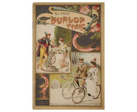
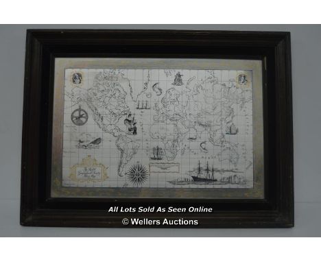
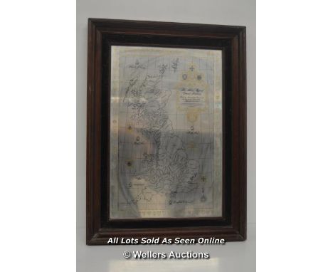
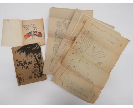
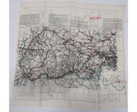
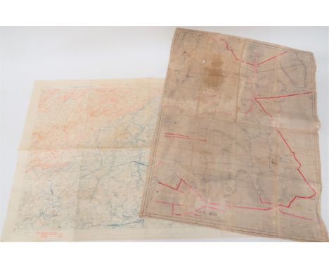
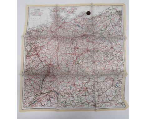
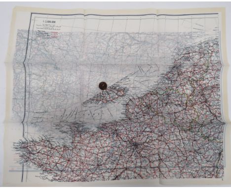
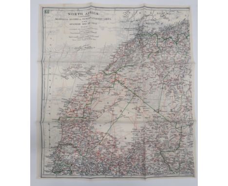
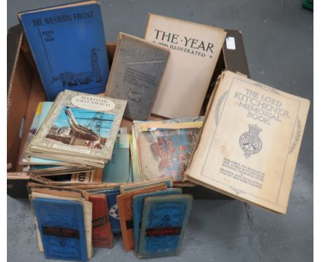
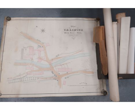
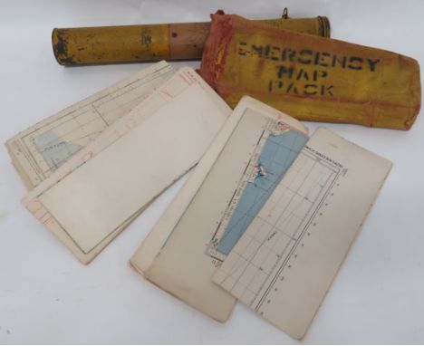
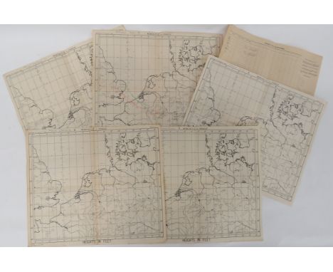
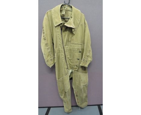
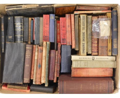
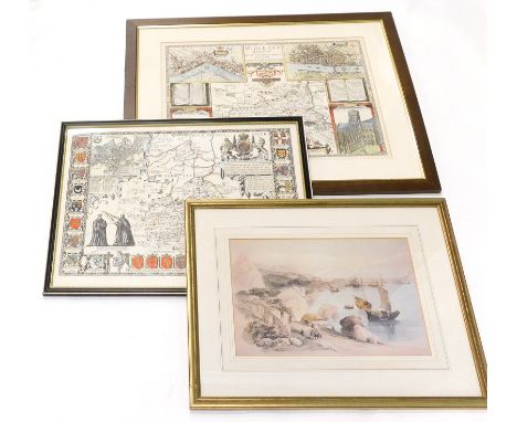
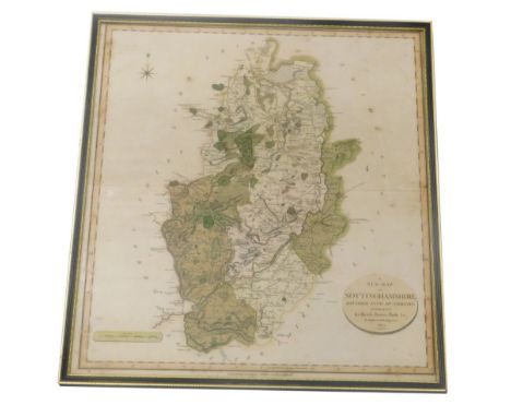
A collection of rare late 19th and early 20th century Continental and British cycling trade catalogues, advertisements, patents, maps and cycle touring guides,to include a c.1896 guide no. 7 in 'The Way About Series of Gazetteer Guides', 'The Way About Hertfordshire', an 1898 booklet for Dunlop Tyres along with a number of 20th century flyers, an 1898 advert for the 'Constra' saddle, an 1899 catalogue for S. de Long & Co., Anvers, the Minerva & Romania bicycles, an 1898 fold-out cycling map of Belgium produced by Touring Club de Belgique, 3rd edition, a late 19th/early 20th century fold-out cyclists map of Bexhill-on-Sea, Eastbourne, Hastings, Rye & District, a 1928 Cyclist's Touring Club Handbook & Guide, a c.1900 Pattisons Whisky Cyclists' Road Map, a 1910 Cycling Pocket Road book, a 1934 John Bull Tourist's Guide in hard cover wallet, a 1901 Chase cycles catalogue, a 1907 Monople Cycles catalogue, trade list and letter, a 1909 catalogue for Cycles ClŽment, Paris, along with another printed flyer, a 1910 catalogue for Nil Supra Cycles, Paris, a scarce c.1912 catalogue for Raleigh Bicycles entitled 'The Book of the Raleigh' with embossed front cover along with other Raleigh related promotional material, a 1917, 1920 and 1938 B.S.A Bicycles catalogue and an early 20th century pamphlet entitled 'A Potted History of the Bicycle', an early 20th century pamphlet 'Cycling Penny Handbooks No. 3: The A.B.C of Cycle Touring' by Reginald Wellbye, a large early 20th century b/w printed image of Paskell's cycling shop, Finsbury, backed with cardboard, a 1988 booklet promoting the history of Reynolds steel tubing, five loose patents from the 1890s relating to bicycle components, (qty)Condition: The collection is in a condition relative to its age, most of the catalogues are held in individual sleeves, some are dog-eared, faded, held together by rusting staples, many have stains and . From the collection of cycling journalist David Taylor (1937-2020).
Scarce Far East Escape Packconsisting silk printed, language chart with Union Jack and phrases in various languages including Sumatran, Thai, Burmese and Tamil ... Paper, printed on linen, language chart with central, royal coat of arms and English and Burmese writing ... Double sided, printed silk map 44/C and 44/D .. Heliograph mirror in linen case. All contained in a silver coloured, fabric bag. Belonged to Sergeant J H P Lawrence 62 Sqn.
WW2 RAF Emergency Map Pack. .An interesting and unusual example, possibly for Coastal Command aircraft. A yellow painted canvas pack, stencilled “Emergency Map Pack. Containing approximately 20 air maps of the UK and parts of Europe. ... Accompanied by a RAF radio Box Kite. contained in original tin tube. (2 items) . . . .Kite has not been removed from the tin and sold as a historical collectors item as viewed.
WW2 Bomber Command Operationally Used Captain of Aircraft Maps. .A selection of 5 maps Newcastle to Prague and corrected to 1944. Each map gives details of the route to and from the target with heights and details of the date, target and aircraft code letter. Some with calculations and notes to the reverse. Comprising: 23/12/44 Trier K. ... 28/1/45 Coligne Y. ... 1/2/45 Munchen Gladbach K. ... 14/2/45 Chemnitz K. .... 1/3/45 Kamen K. .... Also a Petrol Log for a Lancaster with some pencil notes. Overall GC used condition (6 items) . . . .Targets and dates are confirmed. The vendor believes the maps relate to 90 Squadron RAF.
1941 Pattern Electrically Heated Sidcot Suitgreen tan canvas, one piece suit. Offset front, full length body zip. Zips to the ankles and cuffs. Large, open top, leg bag pockets. Left chest angled, open end map pocket. Electrical terminals to the ankles and cuffs. Internal issue label "22C/775" "Size 3". Some service wear and old repairs.
RAF Air Ministry Navigator's Wooden Map Board .A good example with wooden board. The front with hinged perspex cover and adjustable, brass arm with lower directional protractor. Rear of board with AM 1940 stamp, also a canvas pencil holder. .... Together with navigator rule, with brass arm. (2 items) . . . .
Bygone books, etc., an interesting selection to include Warne's Picture Natural History, various other natural history fiction, non fiction, The Electrician's Pocket Book 1949, The Motor Manual Motor, a small quantity of map books, pocket diaries, year books 1913, Great Discoveries, religion, prayer, Biggles and the Black Peril, cookery, Life and Words of Christ, etc., (a quantity).
A Second War ‘Gothic Line’ Immediate M.M. awarded to Corporal C. A. W. Lowen, B.E.M., Princess Patricia’s Canadian Light Infantry, for gallantly clearing a path through a heavily sown minefield which enabled the rescue of several stranded comrades, some of whom were wounded, during the course of which he himself was wounded in the hand and arm by an exploding mine Military Medal, G.VI.R. (H.16558 Cpl. C. A. W. Lowen. C. Inf. C.) good very fine £1,200-£1,500 --- B.E.M. (Military) London Gazette 1 January 1943. M.M. London Gazette 8 March 1945. The original recommendation states: ‘H16558 Corporal Charles Albert Willoby Lowen, P.P.C.L.I. Reference Map ITALY, TOMBA di PESARO On the morning of 31 August 1944, Princess Patricia’s Canadian Light Infantry attacked a section of the GOTHIC Line. The objective of C Company was road junction MR 016755. Number 13 Platoon was leading and H.16558 Corporal Charles Albert Willoby LOWEN was in command of a section of this platoon. A heavily sown minefield about six hundred yards in depth lay between the company and its objective. The ground was flat and completely bare except for a large patch of scrub two hundred yards from the right flank. At least three snipers were in this scrub and were sniping the company. The line of advance was covered by enemy artillery fire. Number 13 Platoon reached their objective, but three casualties from mines remained about one hundred yards in the rear. Corporal LOWEN asked for and received permission to go back to the casualties and to clear a lane for stretcher bearers, and the remainder of the company who had provided covering fire for 13 Platoon. Throughout the time he was finding a route back, Corporal LOWEN was sniped at and was under other enemy fire. He was wounded in the left hand and arm by an exploding mine. Notwithstanding these difficulties, Corporal LOWEN continued to clear a lane and finally reached the wounded men and the balance of the company. The coolness and skill of Corporal LOWEN, coupled with his complete disregard of his personal safety, enabled the remainder of the company to reach the objective without casualties and enabled the wounded men to be recovered. His conduct and devotion to duty were an inspiration to all who took part in the operation.’ Sold with heavily redacted copies of his record of service and discharge certificate which confirms award of B.E.M., M.M., 1939-45 Star, Italy Star, France and Germany Star, Defence Medal, and Canadian War Service Medal and Clasp.
A WWI military silk map, 'To Constantinople from the Dardanelles', stamped 'With best wishes from Manchester Guardian readers', 48 x 60cm, also a period poster 'Allied Air Offensive against Germany up to January 1st 1941Additional InformationThe handkerchief is brown in colour, some spots, staining, poster is mottled, some tears and losses, etc.
An 18th century engraving, an accurate map of the Matchless Lake of Derwent (situate in the most delightful vale which perhaps ever human I beheld) near Keswick, Cumberland, with hand coloured detailing, 21 x 41cm, framed and glazedAdditional InformationThe paper is foxed and brown throughout and is slightly undulated within the mount. Mount with some specs of dirt and foxing here and there throughout. The frame with light wear.
WENCESLAUS HOLLAR AFTER HOLBEIN; etching, Princess Mary daughter of Henry VIII, 14 x 11cm, framed and glazed, and a late 16th century hand coloured engraved road map being page 123 of an Atlas showing roads to Halifax and Richmond, with a 19th century hand coloured map of Westmoreland and another of Cumberland and a hand coloured engraved book plate (5).Additional InformationAll maps with some foxing and general age browning. The map of Halifax and Richmond is generally much cleaner. Frames with general wear.
JOHN SPEED; an early 17th century and later coloured engraved map, 'The Isle of Man', 1610, image approx 38 x 50cm.Additional InformationGood wide margin, centre fold. Some brown spots of staining - noticeably to the text beneath 'Isle of Man' title. Further small brown stains and foxing and detritus beneath the glass throughout. The map is bordered to the back.
AFTER J RAPKIN "Falkland Islands and Patagonia" a map, visible image 35.5 cm x 25.5 cm, together with AFTER J RAPKIN "East Canada and New Brunswick", coloured engraved map, image size approx 26 cm x 34.5 cm, a copy of "Tombelson's Panoramic Map of The Thames and Medway", two Polar charts and Central chart and another modern copy of a map, "Proportions of The Russian Empire in Eastern and Western Asia - The Aral Sea according to Khanikoff Drawn by Augustus Petermann Engraved by GH Swanston", coloured engraving, 30.5 cm x 45 cm, together with an engraving "An Exact Chart of All the Countries through which Captain Behring travelled from Tobolski Capital of Siberia to the Country of Kamtschatka", image size 18.5 cm x 33.5 cm, "Carte du Spitsberg..... 1758", coloured engraving, image size 22.5 cm x 31 cm and AFTER P. F TARDIEU "Carte Generale de L'Empire de Russie 1878", image size 58 cm x 123 cm
Jenkinson (Henry Irwin), Jenkinson's Practical Guide to Carlisle, Gilsland, Roman Wall and Neighbourhood, small 8vo, gilt cloth, illus with map and frontispiece, 1875; Brown (Paul), The Great Wall of Hadrian, 1st and 2nd editions, 8vo, cloth illus, 1932 and 1936; and three other books and one pamphlet concerning the Roman Wall. (7)
Whellan (T.), Directory and Topography of the County of Durham, with Newcastle-upon-Tyne and other Towns etc., 8vo, half-calf, 1865, (facsimile title page); Parson (William) and White (William), History, Directory, and Gazetteer of the Counties of Durham and Northumberland, 2 vols, 8vo, calf, illus with tables (maps not present); Parson (William) and White (William), History, Directory, and Gazetteer of the Counties of Durham and Northumberland, 2 vols, small 8vo, calf, illus with tables (maps not present); Cooke (George Alexander), Topographical Description of the Country of Durham, forming a county itinerary, 16mo, calf, illus with fold-out map and tables, nd. (6)
Grose (Francis), The Antiquities of England and Wales, vol 1, Northumberland, large 4to, full calf, illus with engravings, printed for S. Hooper 1773; and Grose (Francis), Antiquities of England and Wales: Northumberland (only), 4to, full calf, illus with engravings and hand coloured map, 1787. (2)
Fryer (John & Sons) Map of the County of Northumberland from an actual survey, published in the year 1820, engraved by M. Lambert, Newcastle upon Tyne, with hand-colouring, linen-backed in three parts, folded and enclosed in book-pattern box case; together with An Alphabetical Index to Fryer's Map, Newcastle upon Tyne 1822, and A List of the Wards, Divisions, Parishes and Constabularies in Northumberland, Alnwick 1817, 2 vols. in 1, half-calf binding, formerly the property of T.W. Beaumont Esq.
Bates (Cadwallader J.), Popular County Histories: Northumberland, 8vo, half calf, 1895, with the bookplate of Fred Raimes, Hartburn Lodge, Durham; Whellam (William), History of Northumberland etc., 8vo, half calf, 1855; and Hodgson (The Rev.), A Topographical and Historical Description of Northumberland, 8vo, quarter-calf and marble boards, illus with engravings and fold-out map. (3)
Hutton (William), The History of the Roman Wall, 8vo, original boards, illus with fold-out map and plates, 2nd edition 1813; a History of the Picts or Romano-British Wall...taken during a pilgrimage taken on that part of the island, 1849, 8vo, half calf, illus, George Bell 1849; and Simpson (F. Gerald), Water Mills and Military Works on Hadrian's Wall, 4to, cloth, illus with fold-out charts, limited edition 400 copies, Kendal 1976, with dw. (3)
Armstrong (Lt. Andrew & Son) A Map of Northumberland 1769, engraved by Thomas Kitchin, with hand-colouring, linen backed in three sections, folded and contained in book-patterned case, scale 1in. to the mile; together with A Companion to Armstrong's Map of Northumberland, 8vo, marbled boards, 1769: the map bearing the bookplate of Sir Horace St. Paul.
Baillie (J.), An Impartial History of Newcastle upon Tyne and its Vicinity, 8vo, full calf, illus with fold-out map and engravings, Newcastle 1801; A Popular History of Newcastle upon Tyne and Gateshead, complied by the best authorities, 8vo, half calf and marbled boards, Newcastle 1862; The Newcastle Remembrancer and Freeman's pocket companion, 8vo, marbled boards, new edition Newcastle 1817; and Burgess (A.), The Newcastle Freeman's pocket companion, small 8vo, half calf with marbled boards, Gateshead 1808, with the bookplates of Matthew Mckey. (4)
-
109182 item(s)/page