We found 108737 price guide item(s) matching your search

Refine your search

Year

Filter by Price Range
  • List
  • Grid
  • 108737 item(s)
    /page

Lot 5

Cluver (Philip). Introductionis in Universam Geographiam tam veterem quam novam Libri VI, Tabulis aeneis illustrati Accessit P. Bertii Breviarium Orbis Terrarum, Amsterdam: Ex Officina Elzeviriana, 1672, [12], 388 [76]p., engraved decorative title (leaf *1), part title to the Breviarium, 38 uncoloured engraved folding maps (complete as list), lacking the two plates of compass roses (not called for in index list), map of Germany torn along old fold and frayed at margins, map of Persia waterstained, occasional worming to fore margins not affecting text, lacking front free endpapers, contemporary calf, hinges and joints weak and cracked, spine label partially lacking, worn and rubbed, 12moQTY: (1)NOTE:Willems 1467.

Lot 52

Meinertzhagen (Richard). Birds of Arabia, London: Henry Sotheran Limited, 1980, additional half-title, nineteen mounted colour plates, mounted photographic illustrations, folding map, further black & white illustrations to text, armorial bookplate of The Lord Rootes to front blank, original green half morocco by Morrell, top edge gilt, raised bands finished in gilt, gilt bird and palm vignettes to compartments, boards marked, 4to (175 of 295 copies)QTY: (1)

Lot 377

A Tibetan coral and turquoise mounted gilt metal flask modelled as a temple lion, with detachable head, height 14cm, length 14cm, a large soapstone map weight carved with mythical creature on a rectangular base, height 12.5cm, length 6cm and a Japanese porcelain seated Buddha (3).

Lot 413

A colour lithographic map of California depicting the Eldorado-49, after A. M. Robertson, originally 1927, 86.5 x 65cm, framed and glazed.

Lot 292

Collection of folding maps, to include London - drawn and engraved expressly for the Post Office Directory 1899, two Daily Telegraph World Maps, seven Daily Telegraph War Maps including 'The Western Front', 'The Far East', 'The Russian Front', 'Finland, Scandinavia and the Baltic States', 'The Mediterranean and Northern Africa', Daily Express War Map of the Pacific, News Chronicle Map of Europe, War Map of the Western Front Supplement to "The Great War" Number 1. 27th October 1939 (qty)

Lot 320

Three pictures to include a signed limited edition Bob Farndon print "No Ball" together with a portrait of a woman and a coloured map of Essex (3) 

Lot 372

John Ogilby - The road from Huntingdon to Ipswich, engraved and hand-coloured strip map, dated 1675, housed within a gilt, ebonised and glazed frame, 51cm by 39cm 

Lot 224

CARTON WITH MISC OLD F/G MAPS OF DEVONSHIRE, HERTFORDSHIRE, CORNWALL & EXETER TO TRURO ROAD MAP

Lot 973

TWO SIGNED COLOURED PRINTS OF WORLD WAR II AIRCRAFT, SIGNED PRINT OF BATTLE OF BRITAIN A.C.E. WING COMMANDER GEOFFRY PAGE D.S.O. D.F.C., PRINTS OF AIRCRAFT AND A FOLDING MAP

Lot 136

Christopher Saxton and Robert Vaughan, original later coloured map of Brecknoc. 27x31cm approx. Modern frame. (B.P. 21% + VAT)

Lot 139

A Mitchell (20th century British), river scene with mountains, probably Snowdonia, signed, watercolours. 40x57cm approx. Together with a framed map of the southern tip of Pembrokeshire with Ramsey Island. 40x45cm approx. Framed. (2) (B.P. 21% + VAT)

Lot 421

Large fold out map of collieries in Carmarthenshire.(B.P. 21% + VAT)

Lot 410

A collection of maps, some framed including Bartholomew's One Inch Map of the Lake District, War Office map of the Isle of Man 1940, Youth Hostels map of England and Wales, map of Israel, world map etc.

Lot 454

A box of travel ephemera, Lybia - The lost cities of the Roman Empire, pamphlets of Persia, a road map of India from 1942, airline playing cards, sewing kits, etc.

Lot 873

Jan Jannson, hand coloured map of Great Britain and Ireland, 1647, framed and glazed, 58.5cm x 48.5cm overall.

Lot 1184

A FRAMED FOIL STYLE MAP WITH CHERUBIC SIDE PICTURES

Lot 11

Two leather bound volumes of Excursion in the County of Essex, published 1818 and 1819. A historical and topographical delineation of every town and village, illustrated with 100 engravings and a map of the county. Binding in very poor condition.

Lot 16

A clothbound edition of The History of the Birds of Essex by William E. Glegg, F.Z.S., M.B.O.U. with twenty plates and a map. Published by H.F. & G. Witherby, 326 High Holborn, W.C (London) 1929. Together with an Essex Field Club Special Memoirs, Vol. III 'The Mammals, Reptiles and Fishes of Essex: A Contribution to the natural History of the County (Illustrated)' by Henry Laver, M.R.C.S., F.S.A., F.L.S.

Lot 25

Ten various interesting volumes of the history of Essex etc, including a reproduction paperbound Chapman & Andre Map of Essex 1777.

Lot 755

Timpo Toys loose United States G.I. figures including 3 pce Mortar Team, figures eating, map reading, ill, fighting etc, includes BAME soldiers (3), stretcher incomplete and repaired, 3 bayonets missing, otherwise G-VG, (31 figures + 4 accessories),

Lot 90

A Poole Pottery Hardy's Wessex charger decorated with a map, local views and a profile portrait, printed marks and numbered 117/250, 41cm diameter.

Lot 184

Various soapstone trinket pots and others, leather wallets and purses, assorted table linen, a linen-backed Ordnance Survey map, Famous Families, The Percys of Northumberland, a Mongolian sheepskin white hat, etc (2 boxes) 

Lot 285A

Map after Iohan Speede "The West Ridinge of Yorkshire with the most Famous and Fayre Citie, Yorke described" 1610, map of York top right hand corner, coats of arms of nobility, with text verso, double framed 

Lot 286

Reproduction map of Pratt's High Test Plan of the Bath Road, framed 

Lot 94

WILKINS, Henry. “Suite de Vues Pittoresques des Ruines de Pompeii, et un Precis Historique de la Ville”, Rome 1819, thirty full-page aquatint plates, table of the plates, a map of the Bay of Naples; quarter-cloth with gilt-lettered & tooled spine.

Lot 5017

(Edward Bawden), collection of fourteen titles illustrated by Edward Bawden, including Jennings: 'Dunlopera. The Works and Workings of the Dunlop Rubber Company', London, Privately Published, 1961, 24 colour linocut illustrations by Bawden in text as called for, pictorial endpapers/pastedowns by Bawden, 156,[4]pp, orginal cloth gilt; 'The Histories of Herodotus of Halicarnassus', New York, The Heritage Press, 1958, 2 volumes, colour ills. throughout by Bawden, map endpapers/pastedowns, original pictorial cloth gilt by Bawden; Denis Saurat: Death and the Dreamer', Westhouse, 1946, 1st edition, b/w frontis + full page b/w plates by Bawden as called for, orig. pictorial cloth, dust wrapper (by Bawden); Ambrose Heath: 'Good Potato Dishes', L, 1948, 4th impression, illustrated title page by Bawden, orig. paper covered boards, dust wrapper (by Bawden); Rex Warner: 'Greeks and Trojans', 1951, 1st edition, original cloth, dust wrapper (black & white ills. and dust wrapper by Bawden); Gray: 'How Animals Move', 1953, 1st edition, orig. cloth, dust wrapper (ills. and d/w by Bawden); 'BBC Year Book 1947', orig. cloth gilt, dust wrapper (by Bawden); Jean Comay: 'The World's Greatest Story', L, W & N, 1978, 1st edition, 45 b/w ills. by Edward Bawden as called for, original cloth gilt, d/w; plus 6 others ills./dust wrapper art by Bawden (15)

Lot 5092

Patrick Leigh Fermor: 'Between the Woods and the Water', London, John Murray, 1986, 1st edition, 1st impression, double page map, original cloth gilt, pictorial dust wrapper by John Craxton (a VGC+ internal and external copy, d/w with £13.95 price intact), together with 'A Time of Gifts', L, John Murray, 1987, 7th printing, and a 1986 3rd impression of 'Between the Woods and the Water', both orig. cloth gilt, both in pictorial dust wrappers by John Craxton. The first two books in Fermor's celebrated travel trilogy that recounts his walk from the Hook of Holland to Constantinople, both works are well known for their "blend of youthful joie de vivre, [and] erudition that enlightened the reader about the historical background of middle Europe" (ODNB). (3)

Lot 5217

[John S. Roberts]: 'The Life and Explorations of David Livingstone, LL.D., Carefully Compiled from Reliable Sources', London; Newcastle-on-Tyne, Adam & Co, [1878], 2 volumes in 1, continuous pagination, vii,[3],508,v,[2],510-973pp, printed title pages for volumes 1 & 2, tinted lithograph frontis, additional tinted litho title page, folding map of South & Central Africa + 86 tinted lithograph plates as called for (list calls for 86 plates in total including map, so appears to have some additional plates not listed), thick 8vo, contemporary half calf gilt, oxblood morocco gilt label to spine

Lot 5218

Mungo Park: 'Travels in the Interior Districts of Africa: Performed under the Direction and Patronage of the African Association in the Years 1795, 1796 and 1797', London, G. & W. Nicol, 1810, 6th edition, engraved portrait frontis, large engraved folding map of Mungo Park's route through West Africa exploring the Upper Niger river + 5 engraved plates as called for (of which 2 botanical, 3 folding views), contemporary calf gilt (slightly worn), spine gilt in compartments

Lot 5219

(Africa, Travel & Exploration), Samuel White Baker, 2 titles: 'The Albert N'yanza, Great Basin of the Nile, and Explorations of the Nile Sources', London, Macmilan, 1866, 1st edition, 2 volumes, engraved portrait frontis to volume I, tinted litho frontis view of Lake Albert to volume II, 2 engraved coloured maps (of which 1 large folding) + 32 wood engraved ills. (some full page) as called for, uniform half green morocco gilt, spines gilt in compartments, 'The Nile Tributaries of Abyssinia, and the Sword Hunters of the Hamran Arabs', L, Macmillan, 1868, 3rd edition, engraved portrait frontis, 2 engraved maps (1 folding) + 23 (of 24) engraved plates, original pictorial cloth gilt; Thomas Heazle Parke: 'My Personal Experience in Equatorial Africa as Medical Officer of the Emin Pasha Relief Expedition', L, Sampson Low, c.1891, 3rd edition, 18 b/w plates + folding colour map in rear pocket as called for, orig. pictorial cloth gilt; Rudolf C. Slatin Pasha: 'Fire and Sword in the Soudan. A Parsonal Narrative of Fighting and Serving the Dervishes 1879-1895', L, Edward Arnold, 1896, 4th edition, port. frontis + 21 b/w plates + folding plan & folding map at end as called for, orig. pictorial cloth gilt; plus G.B. Hill 'Gordon in Central Africa 1874-1879', 1899, orig. cloth gilt (6)

Lot 5220

(Middle East, Arabia, Travel), St John Philby: 'The Empty Quarter. Being a description of the Great South Desert of Arabia known as Rub' al Khali.', London, Constable & Co, 1933, 1st edition, frontis + 31 plates from photographs + 3 folding coloured maps/plans as called for, original cloth. Account of his remarkable 1932 crossing of the 'empty quarter' by the pre-eminent British Arabist Harry St John Bridger Philby (1885-1960); Freya Stark: 'The Coast of Incense Autobiography 1933-1939', L, John Murray, 1953, 1st edition, sketch map of South Arabia/Hadhramaut + 51 b/w illustrations from photos by Stark & wood engravings by Reynolds Stone as called for, orig. cloth gilt, dust wrapper; T.E. Lawrence, 2 titles: 'Revolt in the Desert', L, Jonathan Cape, March 1927, 1st edition, 3rd impression, folding map + b/w plates as called for, original cloth gilt, 'The Seven Pillars of Wisdom', L, Cape, August 1935, 1st trade edition, 3rd impression, portrait frontis + 4 folding maps + numerous b/w plates as called for, 4to, orig. cloth gilt, 'Lawrence of Arabia' printed memorial booklet and postcard size colour illustration loosely inserted; plus 3 others Richard Burton, Yemen & Oman (7)

Lot 5221

(Asia, Travel), a collection of twenty three assorted titles relating to Asia, Central Asia, China, India, The Silk Road etc, including Sven Hedin 'The Silk Road', 1938, 1st English edition, and 'Big Horse's Flight. The Trail of War in Central Asia', 1936, 1st English edition, both with folding map and numerous plates from photographs as called for, both original cloth; Nick Danziger: 'Danziger's Travels', 1987, 1st edition, signed, orig. cloth, dust wrapper; plus others Gobi desert, Himalayas, Istanbul, Afghanistan, Tibet, North-West Frontier etc etc (23)

Lot 5222

(Travel & Exploration), William Spotswood Green: 'The High Alps of New Zealand, or a Trip to the Glaciers of the Antipodes, with an Ascent of Mount Cook', L, Macmillan, 1883, 1st edition, b/w frontis + maps (1 folding) as called for, xiv,350pp + 32pp catalogue of ads at end, original cloth gilt, professionally rebacked retaining original backstrip. The first New Zealand climbing book; Msjor-General Donald Macintyre: 'Hindu-Koh: Wanderings and Wild Sport on and Beyond the Himalayas', Edinburgh, William Blackwood, 1891, new edition, frontis + 31 b/w ills. as called for, original pictorial cloth gilt; Constance Frederica Gordon-Cumming (1837-1924): 'Two Happy Years in Ceylon', L, Chatto & Windus, 1901, new edition, frontis, folding map + 23 plates & 4 ills. in text as called for, orig. pictorial cloth; Sven Hedin: 'Big Horse's Flight. The Trail of War in Central Asia', L, Macmillan, 1933, 1st edition, folding map, profusely illustrated with b/w plates (mainly from photographs) as called for, original cloth gilt; Rex Hardinge: 'Gambia and Beyond', L, Blackie, 1934, 1st edition, frontis + 15 plates as called for, orig. cloth; Peter Freuchen: 'Arctic Adventure. My Life in the Frozen North', L, Heinemann, 1936, 1st edition, 66 plates/maps as called for, orig. cloth; plus 2 others similar (8)

Lot 5227

(Travel, Africa, South America), Henry Savage-Landor, 3 titles: 'Across Widest Africa. An Account of the Country and People of Eastern, Central and Western Africa as seen during a Twelve Months' Journey from Djibuti to Cape Verde.', London, Hurst & Blackett, 1907, 1st edition, 2 volumes, folding coloured map + numerous black & white illustrations, mainly from photographs, as called for, uniform original cloth gilt. Landor was an English painter, writer and explorer who travelled the world. With an assignment to paint Menelik II, Emperor of Ethiopia, Landor took the opportunity to make a trip across Africa. The journey took about a year and he covered eight thousand miles; 'Across Unknown South America', London & New York, Hodder & Stoughton, 1913, 1st edition, 2 volumes, 2 folding maps + 8 coloured plates and 260 black & white ills. as called for, 4to, uniform original cloth gilt; 'Everywhere, the Memoirs of an Explorer', London, T. Fisher Unwin, 1924, 1st edition, port. frontis + 22 ills. + 8 maps & diagrams as called for, original cloth gilt; Frederick Courtney Selous: 'Travel and adventure in South-East Africa; being the narrative of the last eleven years spent by the author on the Zambesi and its tributaries; with an account of the colonisation of Mashunaland and the progress of the gold industry in that country', London, Rowland Ward, 1893, 3rd edition (published same year as the first) folding map + numerous Illustrations from photographs and line drawings as called for, Czech, p. 146: "Selous describes numerous adventures with lions and leopards, particularly near the Zambesi, Zweswi, and Manyami rivers, with additional sport after rhinoceros, eland, and hartebeest. After returning to the Transvaal, he linked with Montague Kerr and traveled into Matabeleland. Selous hunted more lions and rhinoceros, and vividly depicts an elephant hunt near the Zweswi River . he concludes with a chapter on rifles, and another reflecting earlier sporting adventures after elephant, rhinoceros, buffalo, and others." Gee "Sportsman's Library", xviii, 503 pp, original tan pictorial cloth gilt; Kingston: 'Great African Travellers from Bruce and Mungo Park to Livingstone, Stanley, Gordon Cumming, Selous and Sir Harry Johnston', L, Routledge, 1914, new edition, profusely illustrated with full page plates and b/w ills. in text throughout, original pictorial cloth; M.F. Hill: 'Permanent Way. The Story of the Kenya and Uganda Railway', Nairobi, East African Railways and Harbours, [1949], plates and maps, 4to, orig. cloth gilt, d/w; plus others including Hillaby 'Journey to the Jade Sea', 1964, A Maitland 'Speke', 1961, Stenning 'Savannah Nomads', 1959, Debenham 'The Way to Ilala', 1955, plus others the Mahdiya, Sokoto Caliphate, Lake Rudolf, Sudan etc (17)

Lot 5236

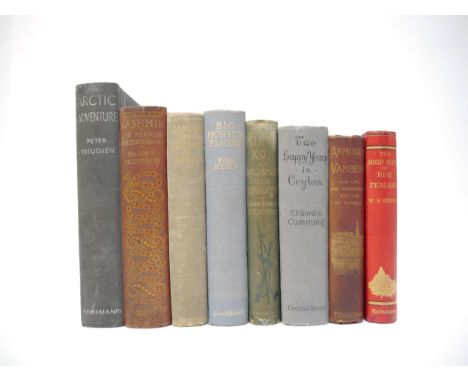
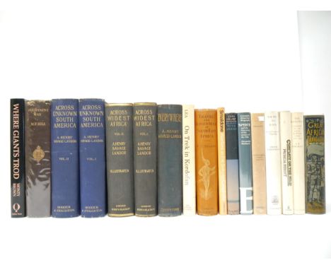
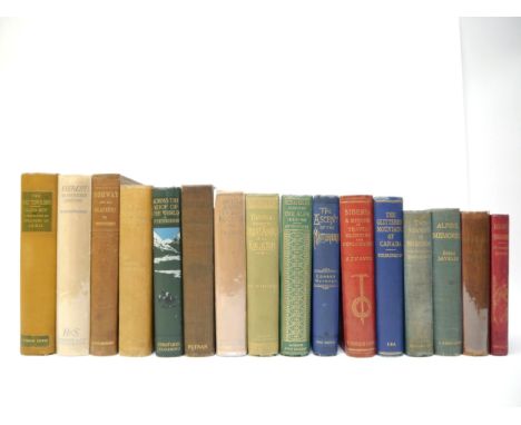
(Mountaineering, Exploration, Travel, Hunting), a collection of sixteen late 19th/early 20th Century mountaineering and exploration books relating to the Himalayas, Alps, Rockies, Andes, Dolomites etc, including Edward WHYMPER, 3 titles: 'Scrambles Amongst the Alps in the Years 1860-69', London, John Murray, 1871, 4th thousand, 5 folding maps, 23 full page engraved plates + 92 illustrations in text as called for, 432pp, original green cloth, spine decorated and lettered in gilt (VGC). Edward Whymper (1840–1911) was an English mountaineer, explorer, illustrator, and author best known for the first ascent of the Matterhorn in 1865. Four members of his climbing party were killed during the descent. Whymper also made important first ascents on the Mont Blanc massif and in the Pennine Alps, Chimborazo in South America, and the Canadian Rockies. His exploration of Greenland contributed an important advance to Arctic exploration, 'The Ascent of the Matterhorn', London, John Murray, 1880, 1st edition, 2 folding maps + 14 full page engraved plates + 91 illustrations in the text as called for, xxii, 325pp, original blue decorative cloth gilt, bevelled edges, gilt blocked illustration of the Matterhorn to front cover (VGC), 'Travels Amongst the Great Andes of the Equator', L, John Murray, 1892, 2nd edition, folding lithographic map in rear pocket + 3 further maps (of which 2 folding) + 20 full page engraved plates + 118 ills. in text as called for, original decorative cloth gilt, bevelled edges; Lieutenant P.T. Etherton: 'Across the Roof of the World: a Record of Sport and Travel Through Kashmir, Gilgit, Hunza, the Pamirs, Chinese Turkistan, Mongolia and Siberia', London, Constable & Co, 1911, 1st edition, folding map, portrait frontis + numerous full page plates and ils. in text as called for, original pictorial cloth gilt, top edge gilt. The author hunted sheep, gazelle, ibex, wapiti, and roe deer. Czech, p. 73: "This book represents a wonderful blend of travel, explorations, and big game hunting."; Guido Rey: 'The Matterhorn', L, T. Fisher Unwin, 1907, 1st edition, 14 tipped in tinted plates + 11 full page plates from photographs + 23 in text ills. by Edouardo Rubino as called for, 336pp, original cloth, leather gilt labels to spine, top edge gilt, others uncut; Hugh Tuttledge: 'Everest: The Unfinished Adventure', L, Hodder & Stoughton, November 1937, 1st edition, portrait ills. of the 13 expedition members on 7 full page plates at front (including Hugh Ruttledge as the portrait frontispiece) + 2 folding maps & portfolio of sixty-three photographic plates at rear, as called for, original cloth gilt, dust wrapper. After his attempt to summit the mountain in 1933, Ruttledge was invited to lead the sixth British attempt on Everest in 1936. Because of recent failed expeditions, the pressure on Ruttledge's large and talented team to succeed was great, but heavy snow and an early monsoon forced them to abort their summit attempt; James D. Forbes: 'Norway and Its Glaciers, Visited in 1851; Followed by Journals of Excursions in the High Alps of Dauphine, Berne, and Savoy', Edinburgh, A & C black, 1853, 1st edition, 2 coloured lithograph maps (of which 1 folding at rear) + 10 coloured lithographic plates (including frontis) + 22 wood engravings in text as called for, xxiv,349pp, original blindstamped cloth gilt (VGC). Bookplate of Peter Bicknell (1907-1995), British architect, author, exhibition curator and mountaineer, attached to FFEP; Sir William Martin Conway: 'THE FIRST CROSSING OF SPITSBERGEN. Being an Account of an Inland Journey of Exploration and Survey, with Descriptions of Several Mountain Ascents, of Boat Expeditions in Ice Fjord, of a Voyage to North-East-Land, the Seven Islands, down Hinloopen Strait, nearly to Wiches Land, and into most of the Fjords of Spitsbergen, and of an almost complete circumnavigation of the main Island', L, Dent, 1897, 1st edition, 8 colour lithographic plates (after sketches by H.E. Conway) + 2 large folding colour maps + numerous photographic black & white plates & ills. as called for, xii,371pp, original quarter beige over green bevelled edge cloth gilt, top edge gilt, others uncut. The author spent the summers of 1896 and 1897 exploring the interior of West Spitsbergen. They made 13 mountain ascents, produced a survey sketch of about 600 sq miles of central West Spitsbergen, almost completed a circumnavigation of the main island; Samuel Turner: 'Siberia. A Record of Travel, Climbing and Exploration', L, T. Fisher Unwin, 1905, 1st edition, portrait frontis + 2 folding maps + numerous full page & in text black & white ills. from photgraphs as called for, original red pictorial cloth gilt, top edge gilt. A journey across Siberia and the pioneering winter exploration of the Altai Mountains, the highest mountains of Siberia; Lewis R. Freeman: 'On The Roof Of The Rockies. The Great Columbia Icefield Of The Canadian Rockies', NY, Dodd Mead, 1925, 1st US edition, frontis + 60 full page ills. from photographs as called for, xiii,[3],270pp, original pictorial cloth gilt, dust wrapper (scarce in d/w); J. Monroe Thorington: 'The Glittering Mountains of Canada - a Record of Exploration and Pioneer Ascents in the Canadian Rockies, 1914-1924', Philadelphia PA, John W. Lea, 1925, 1st edition, limited edition (1059/1500), numbered, 65 plates from photos (including frontispiece), 4 panoramic plates and 6 maps as called for, original cloth gilt; Walter Dwight Wilcox: 'The Rockies of Canada. A Revised and Enlarged Edition of "Camping in the Canadian Rockies", NY & London, G.P. Putnam's Sons, 1909, 3rd edition, large folding colour map in pocket at rear + numerous photogravure and other ills. by the author as called for, orig. cloth gilt, top edge gilt, others uncut; plus Sanger Davies 'Dolomite Strongholds', 1894, John Tyndall 'The Glaciers of the Alps', 1860, Marsh 'Two Seasons in Switzerland', 1895 & Javelle 'Alpine Memories', 1899 (16)

Lot 5237

Sir George Scott Robertson, 2 titles: 'The Kafirs of the Hindu-Kush', London, Lawrence & Bullen, 1896, 1st edition, large folding map at end + 79 b/w illustrations by A.D. McCormick, of which several full page plates, as called for, xx,658pp, rebound full navy blue morocco, ruled and lettered in gilt, top edge gilt, others uncut. A scarce and important work which contains some of the only accounts of this region (then Kafiristan, now north-east Afghanistan) from the time period. Robertson (1852-1916) was a soldier (in command of the British Empire forces during the Siege of Chitral), author and administrator who undertook some arduous journeys through Kafiristan in the latter part of the 19th Century; 'Chitral, the Story of a Minor Siege', L, Methuen, 1898, 1st edition, maps/plans/plates (some folding) as called for, original pictorial cloth gilt (2)

Lot 5238

(Lhasa, Tibet, Nepal, Buddhism, Himalayas), a collection of twenty four titles relating to travel and the history, religion and people of Tibet and Nepal, including William Woodville Rockhill: 'Diary of a Journey through Mongolia and Tibet in 1891 and 1892', Washington D.C., The Smithsonian Institution, 1894, 1st edition, large folding map + 27 plates + 13 ills. in text as called for, original cloth gilt. William Woodville Rockhill (1854-1914) was a United States diplomat, the first American to learn to speak Tibetan, and one of the West's leading experts on the modern political history of China. A narrative of the author's second journey through Mongolia and Tibet, which was described in diary form. He started from Peking on Nov. 30, 1891 and travelled northwards to Hwang-ho via Kalgan, thence to Lan-cho, Sining-fu, Kumbum Monastery, Tsaidam, Changtang, Tangla Range, Chamdo and Batang. Scarce; Schuyler Jones: 'Tibetan Nomads. Environment, Pastoral Economy, and Material Culture', Thames & Hudson, 1996, 1st edition, numerous photographic illustrations in colour and black & white, maps, diagrams etc, 4to, original cloth, dust wrapper; Suydam Cutting: 'The Fire Ox and other Years. An Account of his Travels in Tibet, Nepal, Assam, and other Far Eastern Lands', L, Collins, 1947, 1st edition, profusely illustrated throughout, original cloth gilt, dust wrapper; Francesco Maraini: 'Secret Tibet', L, Hutchinson, 1952, 1st edition, numerous illustrations from photographs by the author as called for, orig. cloth gilt, dust wrapper; F. Spencer Chapman: 'Lhasa: The Holy City', L, Chatto & Windus, 1938, 1st edition, 8 colour plates + 64 pages of photographic plates as called for, original yellow pictorial cloth gilt; A. Henry Savage-Landor: 'Tibet and Nepal', L, A & C Black, 1905, 1st edition, ex South Morningside circulating library, 75 colour plates as called for, orig. decorative cloth gilt; Heinrich Harrer: 'Seven Years in Tibet', L, Rupert Hart-Davis, 1953, 1st edition, colour frontis, map + black & white photographic plates as called for, original cloth gilt, d/w, and 'Return to Tibet', 1984, 1st edition, orig. cloth, d/w; plus others including Sis and Vanis 'On the Road through Tibet', [1957], profusely illustrated from photos, Oakley 'Holy Himalaya', 1905, Fleming 'Bayonets to Lhasa', 1961, Tucci 'The Religions of Tibet', 1980, 'Karmapa the Black Hat Lama of Tibet', 1976, Bailey 'No Passport to Tibet', 1957, Schary 'In Search of the Mahatmas of Tibet', Ford 'Captured in Tibet', 1957, Mathiessen 'The Snow Leopard', 1978, etc etc (24)

Lot 5241

(Asia, Travel, History), a collection of thirty eight titles relating to Arabia, the Middle East, Central Asia, the Silk Road, China, including Bertram Thomas: 'Arabia Felix: Across the Empty Quarter of Arabia', foreword by T.E. Lawrence, London, Jonathan Cape, February 1932, 2nd impression, large folding coloured map of Southern Arabian Desert, + 2 maps and numerous plates, many from photographs, as called for, original cloth gilt, dust wrapper (15s price intact). English diplomat and explorer Bertram Thomas undertook a number of expeditions into the Arabian desert and became the first European to cross the Rub' al Khali from 1930 and 1931, a journey he recounted in Arabia Felix with detailed descriptions of the animals, inhabitants, and culture; Eric Newby: 'A Short Walk in the Hindu Kush', L, Secker & Warburg, 1958, 1st edition, 1st impression, frontis + 40 illustrations from photographs as called for, original cloth lettered in silver (VGC), dust wrapper (slightly worn/small part loss at top edge, else 25s price intact, generally VGC). A generally very good first edition example of Newby's most celebrated and sought after famous travel book; Freya Stark: 'The Southern Gates of Arabia: A Journey in the Hadhramaut', London, John Murray, 1936, 1st edition, 1st impression, 2 folding maps plus numerous illustrations from photographs by the author as called for, original cloth gilt. The author's first book to recount her remarkable journey into the Hadhramaut, into which no previous European had ever ventured so far. She would receive the Royal Geographical Society's Founder's Gold Medal in 1942 for her travels in, and accounts of, southern Arabia; Esther Fihl: 'Exploring Central Asia: From the Steppes to the High Pamirs 1896-1899', Seattle WA, University of Washington Press, 2010, 2 volumes, profusely illustrated with photographic and other illustrations throughout, large 4to, original pictorial boards; John Hedley: 'Tramps in Dark Mongolia', L, T. Fisher Unwin, 1910, 1st edition, large folding map at end + 50 illustrations from photographs as called for, original pictorial cloth gilt; Sven Hedin: 'Jehol City of Emperors', L, Kegan Paul, 1932, 1st edition, frontis + 62 illustrations from photos + 4 line ills./maps as called for, orig. cloth gilt; Frederic Villiers: 'Port Arthur: Three Months with the Besiegers', L, Longmans, 1905, 1st edition, maps and ills. as called for, original cloth gilt; Gorm Pedersen: 'Afghan Nomads in Transition, a Century of change among the Zala Khan Khel', Copenhagen, 1994, profusely illustrated from photographs in colour and black & white, 4to, original cloth, dust wrapper; plus Sykes 'Persia and Its People', 1910, Morden 'Across Asia's Snow and Deserts', 1928, Galwan 'Servant of Sahibs', 1924, Forbes 'The Afghan Wars 1839-42 and 1878-80', 1892, Wendell Phillips 'Unknown Oman' and 'Oman a History', 1st editions in wrappers, 'The Country of the Turcomans', 1977, plus others Opium Wars, Great Game, Silk Road, Syrian Desert, Ondaatje 'Sindh Revisited a Journey in the Footsteps of Captain Sir Richard Burton', etc etc (38)

Lot 5249

Fourteen A & C Black colour books, including 'Cambridge', 1907, 77 colour plates by W. Mathison + folding map at end as called for, original pictorial cloth gilt, top edge gilt; A.R. Hope Moncrieff: 'London', 1910, 32 colour plates as called for, original red pictorial cloth gilt, top edge gilt; 'Hampshire', 1909, 75 colour plates by Wilfrid Ball + folding map at end as called for, orig. pictorial cloth gilt; 'Sussex', 1913 reprint, 75 colour plates by Wilfrid Ball + folding map at end as called for, orig. pictorial cloth gilt, top edge gilt; 'The Wye', 1910, 24 colour plates by Sutton Palmer + folding map at end as called for, orig. pictorial cloth gilt, top edge gilt; plus others Edinburgh, Chester, Middlesex, Worcestershire, Cornwall, 6 shillings series The Cotswolds, North Devon, Peak Country & Liverpool (14)

Lot 5250

Thirteen A & C Black colour books, including 'Wessex', 1906, described by Clive Holland, 75 colour plates by Walter Tyndale + folding map at end as called for, original pictorial cloth gilt, top edge gilt; 'Essex', 1909, described by A.R. Hope Moncrieff, 75 colour plates by L. Burleigh Bruhl + folding map at end as called for, orig. pictorial cloth gilt, top edge gilt; 'Warwickshire', 1906, described by Clive Holland, 75 colour plates by Fred Whitehead + folding map at end as called for, orig. pictorial cloth gilt, top edge gilt; 'Kent', 1907, 73 colour plates by W. Biscombe Gardner as called for, orig. pictorial cloth gilt, top edge gilt; 'The English Lakes', 1905, 75 colour plates by A. Heaton Cooper as called for, orig. pictorial cloth gilt, top edge gilt; 'Bonnie Scotland', 1912 reprint, 75 colour plates by Sutton Palmer as called for, orig. pictorial cloth gilt; plus others 'Lancashire', 'London to the Nore', 'Yorkshire', 'Buckinghamshire and Berkshire', 'the Tower of London', 'Isle of Wight' & 'Isle of Man' (13)

Lot 5251

Sixteen A & C Black colour books, including 'Naples', 1904, 80 colour plates by Augustine Fitzgerald as called for, original pictorial cloth gilt, top edge gilt; 'Florence & Some Tuscan Cities', [1905], 75 colour plates by Colonel R.C. Goff as called for, orig. pictorial cloth gilt, top edge gilt; 'Sicily', 1911, 48 tipped in colour plates by Alberto Pisa + sketch map at end as called for, original pictorial cloth gilt, top edge gilt; 'Venice', 1912 reprint, 75 colour plates by Mortimer Menpes as called for, orig. pictorial cloth gilt, top edge gilt; 'Holland', 1904, 75 colour plates by Nico Jungman as called for, orig. pictorial cloth gilt, top edge gilt; 'Belgium', 1908, 77 colour plates + sketch map as called for, orig. pictorial cloth gilt; 'Bruges & West Flanders', 1906, 37 colour plates as called for, orig. pictorial cloth gilt, top edge gilt; plus others 'Tyrol', 'Upper Engadine', 'Montreux', 'Rome', 'Moscow', 'Our Life in the Swiss Highlands', 'Ireland', St. Petersburg' & 'Germany' (16)

Lot 5252

Sixteen A & C Black colour books, including 'Kashmir', 1909, 70 colour plates by Major E. Molyneux + sketch map at end as called for, original pictorial cloth gilt, top edge gilt, orig. prospectus for 'Burma' by R. Talbot Kelly loosely inserted; 'India', 1905, 75 colour plates by Mortimer Menpes as called for, original pictorial cloth gilt, top edge gilt; 'Australia', 1910, 75 colour plates by Percy F.S. Spence + sketch map at end as called for, "presentation copy" blind stamp to title page, original pictorial cloth gilt, top edge gilt; 'California the Land of the Sun', 1914, 32 tipped in colour plates by Sutton Palmer + sketch map at end as called for, orig. pictorial cloth gilt, top edge gilt; 'Northern Spain', 1906, 75 colour plates by Edgar Wigram + map at end as called for, orig. pictorial cloth gilt, top edge gilt; 'The Riviera', 1907, 75 colour plates by William Scott + folding map at end as called for, orig. pictorial cloth gilt, top edge gilt; 'Morocco', 1904, 74 colour plates by A.S. Forrest as called for, orig. pictorial cloth gilt, top edge gilt; 'Constantinople', 1906, 63 colour plates by Warwick Goble + folding map at end as called for, orig. pictorial cloth gilt; plus others 'Japan', 'World Pictures', 'South America', 'The Savage South Seas', 'Venice', 'Naples', 'France' & 'From Sketch Book & Diary' by Elizabeth Butler (16)

Lot 5259

(Maps), 'Encyclopaedia Britannica...The Tenth of the New Volumes, Being Volume XXXIV of the Complete Work. Maps', A & Black, 1903, 10th edition, map volume, 124 double page colour maps as called for, [1],497,[1]pp index, imperial 8vo, original three quarter navy leather gilt, top edge gilt

Lot 5260

(Atlases, 19th Century Juvenile Education), George Roberts: 'The Elements of Modern Geography and General History; on a plan entirely new: Containing an Accurate and Interesting Description of all the Countries, States, &c, in the Known World; with the Manners and Customs of the Inhabitants; to which are added Historical Notices of each Country to the present time, and questions for examination. The whole illustrated by numerous correct maps and engravings.', London, Pinnock & Maunder, 1820, 1st edition, engraved folding double hemisphere world map frontis + 8 folding maps + 11 (of 12) engraved views of world cities and costume plates (lacks plate facing p.250) + 4 engraved plates at end on the construction of maps, xii,435,[1]pp, engraved views and costume plates with contemporary m/s captions in pen & ink to margins, contemporary calf (worn), later printed label to spine. An extremely scarce first printing, likely owing to heavy use due to its success as a school text book; together with Samuel Butler: 'An Atlas of Ancient Geography', London, Longman et al, 1822, copper engraved title page, index + 20 double page engraved maps (all with contemporary hand colouring except plate XX, plans of Rome, Rome & environs, Athens & Syracuse), maps/plates with contemporary manuscript titles/notes to reverse of each, original half roan over marbled paper covered boards (worn), printed paper label to front cover (2)

Lot 5262

James Wyld: 'Wyld's New Plan of London 1860', engraved folding map of London, linen-backed, in 40 sections, with Post Office districts over-printed, 57 X 94 cms, folding into original cloth over boards (worn, lacking spine); together with Stanford's Map of Central London. Published 1st of May, 1914, folding map, colour-printed, linen-backed, in 40 sections, 67 x 99 cms, folding into original printed boards (upper board detached, spine worn) (2)

Lot 5263

(Mappa Mundi), P.D.A. Harvey & Scott D. Westrem: 'The Hereford World Map', London, The Folio Society, 2010, 2 volumes, comprising Introduction, colour frontis & colour ills. throughout of the Hereford Mappa Mundi, 108pp; Commentary, 2 black & white plates + 12 colour plates showing sections of the Mappa Mundi, lvii,476pp, each 4to, original pictorial blue buckram gilt, Merida end papers, ribbon page markers, slipcases. The two companion volumes (only), produced to accompany the Folio Society limited edition facsimile of the Hereford World Map issued in 2010 (2)

Lot 5264

'King Henry's Map of the British Isles', The Folio Society, 2009, limited edition (2,750), facsimile map, reproduced from Cotton MS Augustus I.i 9 in the British Library and printed on Neobond (a high quality simulation vellum), approx size 63 x 46cm, silk ribbon tie, housed in original velvet lined decorative blue cloth gilt map box, printed paper label inside lid, metal clasp, together with the companion commentary volume by Peter Barber, Folio Society, 2009, 48 colour illustrations (of which 3 double page) as called for, original pictorial cloth gilt, slipcase. A Superb Facsimile of the King's personal map, produced by the Folio Society to commemorate the quincentenary of Henry VIII's accession. This historic map of Britain, Angliae Figura, hung on the walls of Hampton Court Palace, where its owner, King Henry VIII, would have consulted it frequently. Now a treasure of the British Library, it is the most important manuscript map of Britain created during Henry's reign. (2)

Lot 5267

William Gilpin: 'Observations, Relative Chiefly to Picturesque Beauty, Made in the Year 1776, on Several Parts of Great Britain; Particularly the High-Lands of Scotland', London, R. Blamire, 1792, 2nd edition, 3 volumes, 40 plates comprising 1 diagram, 5 hand coloured plans + 34 soft ground aquatints, bound together with 'Observations on the River Wye, and Several Parts of South Wales, &c., relative chiefly to Picturesque Beauty; Made In the Summer of the Year 1770', L, R. Blamire, 1792, 3rd edition, 17 soft ground aquatints, rebound full panelled calf gilt; together with John Cary: 'Cary's New Itinerary: Or an Accurate Delineation of the Great Roads...throughout England and Wales', 1817, 7th edition, large folding frontis map of England and Wales + 6 folding maps at end only, rebound quarter blue morocco gilt (2)

Lot 5308

(Ornithology, Birds, Butterflies), Arthur G. Butler; H. Gronvold & F.W. Frohawk (illustrated): 'Birds of Great Britain and Ireland, Order Passeres, Complete in Two Volumes', London & Hull, Brumby & Clarke, [1908], 1st edition, 2 volumes, 107 chromolitho plates of birds & 8 of eggs as called for, large 4to, original quarter buckram gilt over blue cloth, top edges gilt, others uncut; Henry Seebohm: 'The Birds of Siberia. A Record of a Naturalist's visits to the Valleys of the Petchora and Yenesei', London, John Murray, 1901, 1st edition, folding map + numerous b/w ills. in text throughout, original pictorial cloth gilt, top edge gilt; William Macgillivray: 'A History of British Water Birds, Indigenous and Migratory', London, William S. Orr, 1852, 2 volumes, 7 engraved full page plates + numerous b/w ills. in text as called for, recased retaining original publisher's cloth gilt, replenished end papers; A.W. Kappel & W. Edmont Kirby: 'British and European Butterflies and Moths (Macrolepidoptera)', London, Nister, [1895], 30 coloured plates as called for, 4to, original pictorial cloth gilt, all edges gilt; plus Saunders 'Manual of British Birds', 1927, Rev J.G. Wood 'Homes Without Hands', 1898, new impression, Montagu & Rennie 'Ornithological Dictionary of British Birds', 1831, Wood 'British Birds in their Haunts', 1867, plus 5 mainly late 19th & early 20th Century ornithological booklets/pamphlets including Whitaker 'Collection of Birds from Morocco', 1897, pp593-610, others Dresser, Tegetmeier etc

Lot 516

A circular contemporary port hole mirror together with a framed map of Northumberland and a further framed print of a stag.

Lot 712

Poster for The Long Way Round with Ewan McGregor and Charlie Borrman together with a scratch map of the world

Lot 115

Collection of three antique framed maps: 'Buckinghamshire' published by Fullarton & Co, 'Somersetshire' and Saxton's Map of 'Radnorshire, Brecknockshire, Cardiganshire and Carmarthenshire 1578'. the larger approx 50cm x 40cm (3)

Lot 252

Militaria: DUNKIRK TO BERLIN, map of the journeys undertaken by the Rt. Hon. Winston S. Churchill M.P., June 1940 - July 1945, printed and published by George Philip & Son London, 110cm x 91cm, unframed.in original slip case

Lot 7169

CBG Mignot - WW1 Series [post war issue] - Automitrailleuse Blinde [Armoured Car], comprising: Camouflaged Armoured Car with Added Armour Plates and HMG, Driver, Officer with Map & 2 x Gunners Depicted in Horizon Blue and Adrian Helmets. Mint overall, contained in a near Mint CBG "Soldats de Plomb" labelled Western Front Diorama Type Drop Front Display box

Lot 7179

CBG Mignot - Le Grande Guerre [WW1] Range - [Post War Issue], comprising: Avion De Reconnaissance, 1914 [Recon Plane] - Monoplane with Pilot, Officer with Map & Ground Crewman Spinning the Propeller. Mint overall, contained in a generally near Mint set box.

Lot 151

A German NEAG Berlin infantry compass together with a map measurer

Lot 285

A coloured map of Hammersmith and a coloured printed map of The British Isles

Lot 326

A coloured map of Ireland

Lot 444

A box of miscellaneous books, road map etc

Loading...Loading...
  • 108737 item(s)
    /page

Recently Viewed Lots