We found 109182 price guide item(s) matching your search

Refine your search

Year

Filter by Price Range
  • List
  • Grid
  • 109182 item(s)
    /page

Lot 370

Book, United States Pictures, hardback edition by Richard Lovett, 1891, with fold out map and many b/w illustrations, illustrated boards. (fair/gd)

Lot 373

Ephemera, a mixed selection to inc. Homes and Gardens (1947 & 48), Royal Aircraft Establishment 1950s music and theatre programmes, 1951 Green Line map, 1930s and 40s telegrams, original pencil drawing of 2 children, 1930s Oberammergau booklet, plan and postcards, assorted 1920s, 30s and 40s advertising and sporting items (gen gd) (approx. 60)

Lot 644

Cigarette cards, Churchman's, selection of scarce cards, Can You Beat Bogey at St Andrews? (set of 55 cards, mixed backs), Phil May Sketches (Gold Flake) (46/50), Boy Scouts (various series, 33) & Sectional Cycling Map (19) (very mixed condition, fair/gd)

Lot 116

A French Dinky Toys 884 Brockway Bridge Layer, with eight plastic bridge pieces, two inflatable pontoons and map/leaflet, in original box with inner packing, VG, some mildew/mould to inflatables, no bungs, box G, lid split at two corners

Lot 548

Uncommon Meccano Prize Models Competition 1914-1915 Booklet together with other Railway Books and ephemera 24 page Booklet, F, wear to cover and spine, complete, Hundred of Manhood and Selsey Tramway later known as The West Sussex Railway book by Griffith (1948), The Tal-Y-Llyn Railway by Cozens (1948), Map of Norway (1951), Bergen in a Nutshell by Forlag, Bergen Steamship Co Travel and Accommodation Tickets, M/S Venus Cabin Card, Hotel Receipts and handwritten notes on trip to Norway in 1951, F-G (small quantity)

Lot 102

SURVEY AND ADMEASUREMENT OF ENFIELD CHASE, PART OF ENGRAVED PLAN OF UNIVERSITY COLLEGE LONDON, ENGRAVED MAP OF ST GILES IN THE FIELDS AFTER HEWITT PUBLISHED BY R P MOORE, AND FRAMED ENGRAVED MAP OF WARWICKSHIRE

Lot 167

TINTED AND ENGRAVED MAP OF THE WORLD 'ORBIS TERRARUM TABULA RECENS EMENDATA ET IN LUCEM EDITA', FRAMED AND GLAZED

Lot 279

FRAMED MAP OF EXETER AFTER DAVID TRELAWNY PUBLISHED BY HERIZ STUDIOS, AND FRAMED BESLEY'S BIRD'S EYE VIEW OF EXETER

Lot 136

A Framed 17th Century Map by John Ogilvy, the Road From Prestaine to Carmarthen (1675) 45x35cm

Lot 284

A Framed Ordnance Survey Map of Eccleshall, 1:10560 Scale, 50x38cm

Lot 369

Victorian map of the Isle of Wight, together with two reproduction maps of Essex

Lot 526

A collection of various militaria: including canvas map cases, water bottles etc. (a lot)

Lot 556

A collection of WWII and later canvas rucksacks, map and ammunition cases: together with two gas masks, two pairs of black leather boots, a rain cape and other related items (a lot)

Lot 97

EARLY FRAMED JOHN SPEED MAP OF OXFORDSHIRE - 60 CMS X 46 CMS

Lot 304

AN EMBOIDEREDSILK MAP OF ENGLAND AND WALESIN A FRAME (SLIGHT DAMAGE)A/F

Lot 262

REPRODUCTION COLOURED MAP OF NORFOLK AFTER THAXTON, 1574, FRAMED AND GLAZED, 63CM WIDE

Lot 233

A coloured map of Suffolk after Cary

Lot 297

A part artists set; solitaire board; a cuckoo clock; and a pull down map AF

Lot 449

An antique map of Norfolk

Lot 658

A vintage framed map

Lot 205

A framed World spice trade map. (83cm x 63.5cm)

Lot 214

A framed regimental map together with a Christopher Saxton printed map. To include a 1st Battalion Royal Lincolnshire Malaya Map 1955-1958 and a print of a 1579 map of England & Wales. H:69cm, W:53.

Lot 217

After John Speede, framed map of West Riding of Yorkeshyre, described 1610.

Lot 1226

A MAHOGANY AND BRASS BANDED COFFEE TABLE, depicting a world map in two globes, with a glass top and brass caps, width 89cm x depth 61cm x height 41cm

Lot 1379

° Stow, John - A Survey of the Cities of London and Westminster ... Written at first in the year MDXCVIII... Now lastly, corrected, improved, and very much enlarged ... by John Strype .. to which is prefixed,the Life of the Author ..., 2 vols, with the large folded map, portrait and numerous other engraved views, parish and ward plans etc. (some double-page), text illus., subscribers list; later 19th century blind and gilt decorated diced calf, gilt extra decorated and panelled spines, marbled edges ad e/ps, roy, 4to, 1720

Lot 1529

19th century embroidered map sampler, Britain and Wales

Lot 1377

° Wright, Thomas - The History and Topography of the County of Essex, 2 vols, pictorial and printed titles, 99 engraved plates and folded map, subscibers list; later 19th century gilt red half morocco and cloth with panelled spines, g.e., 4to (1831)

Lot 1406

° Willis, N.P. & Coyne, J. Stirling - The Scenery and Antiquities of Ireland, 2 vols, engraved pictorial and printed titles, map and 118 plates (by W.H. Bartlett); later 19th century gilt half morocco and patterned boards with panelled spines, 4to, (1841?)

Lot 103

WINSTON CHURCHILL - 'LONDON TO LADYSMITH VIA PRETORIA' Longmans, Green and Co., 1900 With internal map 13cm x 19.5cm Condition: Minor to moderate signs of wear commensurate with age and use,

Lot 17

A MAP OF CENTRAL HONG KONG Early-mid 20th Century Printed in conjunction with the Travel Association Handbook of Hong Kong Copy of receipt available 25cm x 39cm; with frame 35cm x 49cm Condition: No obvious condition issues

Lot 18

A CITY MAP OF SINGAPORE Mid 20th Century Showing the downtown core up to the Botanic Gardens in the north east The reverse with a smaller Road Gazetteer map of Kallang Airport and surrounding area 79.5cm x 66.5cm; 102cm x 89cm with frame Condition: Minor signs of wear commensurate with age and use

Lot 19

A MAP OF CHINA (1770) By Thomas Kitchen Titled lower left "A New Accurate Map of China, drawn by surveys taken by Jesuit missionaries by order of the Emperor" 36cm x 43cm; with frame 65cm x 71cm Condition: No obvious condition issues

Lot 20

A MAP OF JAPAN AND COREA (1851) Published by John Tallis & Co Note that 'Korea' is spelt in its earlier construction, with a 'C' 26cm x 35cm; with frame 48cm x 56cm Condition: No obvious condition issues

Lot 21

A MAP OF BRITISH INDIA (1851) Published by John Tallis & Co 33cm x 25cm; with frame 48cm x 40cm Condition: No obvious condition issues

Lot 22

A MAP OF CABOOL THE PUNJAB AND BELOOCHISTAN (1851) Published by John Tallis & Co 27cm x 35cm; with frame 40cm x 47cm Condition: No obvious condition issues

Lot 23

A MAP OF NORTHERN INDIA (1850) By John Rapkin, published by John Tallis & Co Purchased from ALTFIELD gallery in Hong Kong in 1997. Copy of receipt available. 25cm x 33cm; with frame 53cm x 60cm Condition: No obvious condition issues

Lot 24

A MAP OF SOUTHERN INDIA (1851) By John Rapkin, published by Tallis & Co Purchased from ALTFIELD gallery in Hong Kong in 1997. Copy of receipt available. 33cm x 25cm; with frame 60cm x 50cm Condition: No obvious condition issues

Lot 25

ROAD MAP OF INDIA, (1942) Large scale 1942 edition of the 1939 survey, Scale 1 inch : 50 miles 109cm x 76cm; with frame 122cm x 89cm Condition: No obvious condition issues

Lot 28

THE LAND & WATER MAP OF THE WAR (1915) Portraying the armed forces on the western front in 1915 Drawn under the direction of Hilaire Belloc Linen backed, original holder present 81cm x 103cm; with frame 105cm x 127cm Condition: Minor signs of wear commensurate with age and use

Lot 282

A nest of tables with map tops

Lot 134

A reproduction map of Great Britain (32cm x 41cm) and a further map of the New Town, 1767 (2)

Lot 94

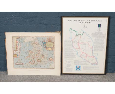
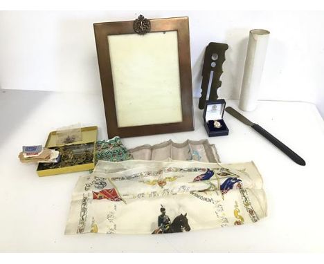
A mixed lot of WWII items including a presentation picture frame with the Territorial Service pressed to top and inscribed Presented by the People of Monimail in grateful recognition of your services away in His Majesty's Forces during the War 1939-1945 (27cm x 21cm) and a rolled commemorative map of the 79th Armoured Division, 1944-45, button stick, a collection of brass buttons and badges, handkerchiefs etc. (a lot)

Lot 298

Environs of Bayonne, from Cassini's Survey, London 2nd December 1813 map, plus sheet 77 Devizes map of Wiltshire

Lot 365

Three antique cast map weights,together with a nutcracker and corkscrew.

Lot 1092

European school (19th/20th century) Windmill on the coast, canvas laid to panel, 18cm by 26cm, together with an antique map of Yorkshire (Gerardus Valk and Petrus Schenk, Ducatus Eboracensis pars occidentalis, The West riding of Yorke Shire, c.1700)

Lot 1105

John Speed engraved and hand tinted map of the West Riding of Yorkshire with York(e) town plan 1616 together with two other maps, Joan Blaeu Ivra Insvla and a reprint of a map of the British Isles originally 1621 (3)

Lot 1130

Maps. A collection of engraved antique maps of the British Isles, including: 1) Speed (John). The Isle of Man, London: Thomas Bassett and Richard Chiswell, [1676], 410 x 550 mm, hand-coloured, verso strengthened along central fold and with remnants of mounting-tabs along top edge, loose in map 2) Morden (Robert). The North Riding of Yorkshire, London: Abel Swale, Awnsham and John Churchill, c.1695, hand-coloured, 380 x 430 mm, mounted, 3) Ogilby (John). The Road from York to Whitby and Scarborough in Yorkshire, c.1700, 360 x 470 mm, laid down on tissue, mounted, 4) Pitts (J.). A New Map of Twenty Miles Round London, c.1750, 450 x 405 mm, 5) Bowen (Emanuel). An Accurate Map of the North Riding of York Shire, London: for John Bowles, Carington Bowles, Robt Sayer, c.1750, 560 x 730, toned, rolled in a tube, and 6 others similar in a folder with a small number of other prints (qty: 4 maps in mounts, 1 in tube, and a folder)

Lot 652

The Sherwood Foresters in The Great War 1914-1918, one volume, by Lieut-Col W C Oates D.S.O., with one map present inside

Lot 262

A Victorian steel engraving Country map of York by C & J Greenwood of London, 62 x 75 cm overall, framed and glazed

Lot 228

A TOUR THROUGH THE PRINCIPAL PROVINCES OF SPAIN & PORTUGAL PERFORMED IN THE YEAR 1803 WITH CURSORY OBSERVATIONS ON THE MANNER & INHABITANTS', London printed for Richard Phillips, 6, Bridge Street Blackfriars, 1806, with engraved fold out map at the beginning, half calf with marbles boards

Lot 97

A pair of gilt framed oil on canvas, depicting countryside scenes together with a framed map West Riding Of Yorkshire and three other framed pictures. (6)

Lot 519

Four framed prints of ancient maps. A map of Britain according to Notitia Imperll. A map of Great Britain according to the itinerary of Antoninus. A map of Great Britain according to Ptolemy's geography rectified. A map of Britain in the most ptate of the Roman Pound and Government.

Lot 741

A mixed lot including a vintage Slazenger tennis racket, soda syphon, framed map of Suffolk, a vintage washboard and a cast iron kettle

Lot 300

PAIR OF CANVAS PRINTS IN GILT FRAMES, 85cm x 65cm each, along with another framed print and a framed map (4).

Lot 290

A map of Radnorshire, Johannes Janssonius-Dutch 1588-1664. Radnoriensis Comitatus Vulgo The Counties of Radnor. Double glazed 15' x 19'

Lot 451

A county map of Wiltshire by John Speede, from The Theatre of The Empire of Great Britain c.1676, with a depiction of Stonhenge and fourteen armorials of the Earls of Wiltshire and Salisbury. 15½' x 20'

Lot 585

A 1926 map of Ludlow Together with a map of Shropshire

Lot 519

SUSAN PURSER HOPE (BRITISH, CONTEMPORARY) GREEN SHOES, fused and stacked glass elements, with a feature map of Norfolk mount49 x 49 cm overallQty: 1

Lot 3066

Hand-tinted 17th Century map of Nottinghamshire in frame, 59 x 46cm

Lot 450

A collection of six pictures to include a of map of Cornwall, a pen and watercolour of the Arc de Triomphe, two rural landscapes and two others W:50cm x H:38cm Map dimensions

Loading...Loading...
  • 109182 item(s)
    /page

Recently Viewed Lots