We found 109182 price guide item(s) matching your search
There are 109182 lots that match your search criteria. Subscribe now to get instant access to the full price guide service.
Click here to subscribe- List
- Grid
-
109182 item(s)/page


Lot 5264
A Stuart Crystal cartographic goblet, commemorating Matthew Flinders (1771-1814) and his mapping of Australia, finely engraved by Bernard York, signed, with a portrait bust and map, air twist stem, circular foot, 19.5cm high; another, commemorating the United Kingdom's entry into the EEC, 1973, 19.5cm high, [2]

Lot 5824
An interesting folio of 18th century and later maps and cartographic engravings, The Camp of the Israelites according to Lamy; The Theracian Bosporus with Constantinople Divided in Wards; Plan of Y Famed Temple of Montmorillon Both Above and Under Ground; Antient Spain; A Map of Propria and Numidia; The Principal Battle Fields in Greek & Roman History; etc
![John Cary (c. 1754-1835), by and after, A New Map of England and Wales [...], London: May 1806, monochrome engraving, 48.5cm](https://cdn.globalauctionplatform.com/0502a1f8-5efd-4ab7-8a81-ac4d00ef7203/844c19d9-59c4-4331-a22f-ac5d00d52416/468x382.jpg)
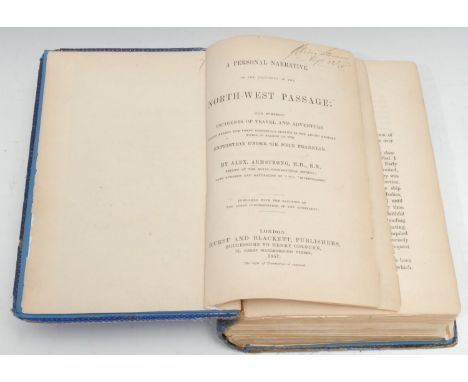
Lot 5828
John Cary (c. 1754-1835), by and after, A New Map of England and Wales [...], London: May 1806, monochrome engraving, 48.5cm x 38cm, (1); Brookes' Travelling Companion through England and Wales, London: William Darton, Jun:r, January 27th, 1812, hand-coloured engraving over fifteen-folds, laid on linen, 59cm x 51cm, fragmentary marbled sleeve on suite, (1); William Gardner (18th century), by and after, New and Improved Map of England and Wales, including the Principal of Scotland [...], London: William Darton, 16th April, 1823, hand-coloured engraving over twenty-folds, laid on linen, 76cm x 64.5cm, contemporary marbled endpapers and sleeve en suite, contemporary ink MS ownership inscription: George Peel, (1), [3]


Lot 5830
Local Interest - J. Dower, after Phillips (J.) and W.F. Hutchings, A Map of the County of Stafford, Divided into Hundreds & Parishes, From an accurate Survey, Made in the Years 1831 and 1832, London: Published by Henry Teesdale & Co., August 1st, 1832, named-view architectural vignette of Lichfield Cathedral to the lower-right, hand-coloured engraving over forty-folds, laid on linen, the margins green silk-mounted, 137cm x 100.5cm, contemporary calf book-shaped library case (chipped and worn), marbled edges, push-cover, 27.5cm high, [1]

Lot 5831
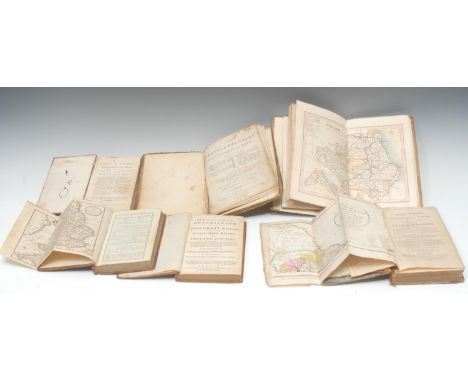
Local Interest - The Ordnance Map of Ashbourn (sic, Ashbourne) and the Neighbourhood, No. LXXII, Printed from one in Electrotype, Tower of London: Ordnance Map Office, July 5th, 1833, eight-folds laid on linen, monochrome engraving, 35cm x 40cm, contemporary tartan printed wrappers, (1); another, similar, Ordnance Survey: Buxton and Matlock, No. LXXXII S.W., Printed from an Electrotype, Tower of London: Ordnance Map Office, 1862, twenty-four-folds, monochrome engraving, 94cm x 76cm, contemporary black boards (upper-cover detached), supplied by Edwin Slater (Late Simms), Manchester, his ticket, (1); Buxton and Leek, including Bakewell, Haddon Hall, Edensor and Wildboarclough, [mid-19th century?], eight-folds laid on linen, engraving, 31cm x 46.5cm, contemporary black wrappers, (1); further early 20th century and later Ordnance Survey, including 1902 Buxton and Chesterfield (2), 1903 Rochdale (1), 1914 Macclesfield and District & Derby, Nottingham and Leciester (2), Chapel en le Frith [n.d.] (1); etc., (2), [10]
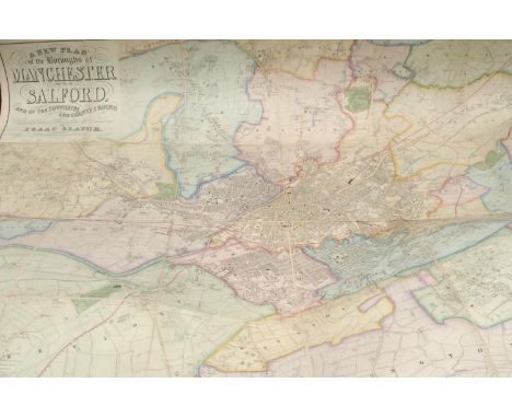
Lot 5832
Manchester and Lancashire - No. 43, London: Published by G. & J. Cary, January 1st, 1832, hand-coloured engraving over twelve folds, linen-backed, 56cm x 67.5cm, marbled covers, (1); Isaac Slater (1803-1883), A New Plan of the Boroughs of Manchester and Salford, and of the Townships and Country Round, Extending there Miles from the Exchange, [Manchester: n.d., c. 1860?], hand-coloured steel engravings over twenty-four folds laid on linen, 112cm x 124cm, one contemporary cloth board and marbled endpaper only, (1); I. Slater's Plan of Manchester and Salford, Manchester: 1876, lithograph over eighteen-folds, laid on canvas, 59cm x 73cm, (1); A New Plan of Manchester & Salford, frontispiece from Aston's Picture of Manchester, third edition, Manchester: [n.d., c. 1830], title-page attached, 37.5cm x 45cm, (1); A Table of the Reciprocal Distances of the Principal Towns of England, Including all the Market Towns of Lancashire [...], Liverpool: Wales and Co., [n.d., 1824/5], 41cm x 52.5cm, tartan-type cloth to verso, (1); Lancashire, from Cox's Magna Britannia et Hibernia, 1272-1337pp and illustrated with fold-out map and distance table, paper wrappers, (1), [6]
Lot 5833
Miscellaneous UK - James Wyld (1812-1887), by and after, Wyld's New Plan of London and its Vicinity, London: Published by James Wyld, Geographer to the Queen [...], 1867, hand-coloured lithograph, 84cm x 108cm, (faults), (1); Yorkshire, Ordnance Survey, Sheet 93, Knaresborough [...], London: 1858, 67cm x 100cm, marbled endpapers, buckram boards, (1); John Bartholomew Junior (1831-1893), Map of Derbyshire, Manchester: Abel Heywood & Son, [n.d.], 28cm x 39.5cm, cloth over board covers, (1); a later map of Derbyshire, (1); Philips' Handy Volume Atlas of London, A Series of Fifty-Five Sectional Maps [...], sixth edition, London: George Philip & Son, Ltd., [n.d., 1910], contemporary red cloth (taped), 8vo, (1), [5]

Lot 5835
Rhine Panorama, Friedrich Wilhelm Delkeskamp (1794-1872), by and after, Panorama Des Rheims von Mainz bis Cöln, [n.d., c. 1830], monochrome aquatint over eighteen folds, 220cm long, contemporary boards and titled sleeve en suite, (1); another similar, Hirschenhein's, later, loosely-inserted ephemera, (1); Panoramic Map of the Rhine, from Cologne to Mayence, Engraved to Accompany Tombelson's Views, [London]: W. Tombleson & Comp:y, [n.d., 1832], ten-folds, monochrome, 123cm long, marbled endpapers and sleeve en suite, (1), [3]
![A George III cartographic and topographical parlour game, Walker's Tour Through England and Wales, a New Pastime, [London]: P](https://cdn.globalauctionplatform.com/0502a1f8-5efd-4ab7-8a81-ac4d00ef7203/bbb4b7f7-e436-4726-a88a-ac5d00d529c8/468x382.jpg)
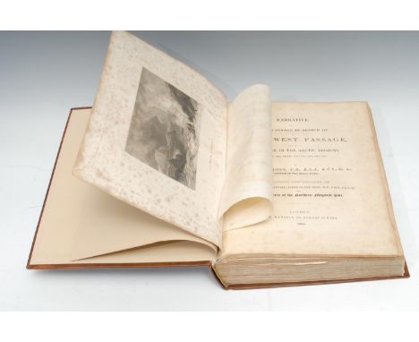
Lot 5840
A George III cartographic and topographical parlour game, Walker's Tour Through England and Wales, a New Pastime, [London]: Published for the Author, January 2nd, 1809, by W. & T. Darton, the didactic map field hand-coloured, each margin flanked by rows of directions from No. 1 Maidstone back to No. 118. London "The Game", 55.5cm x 65cm, contemporary marbled sleeve en suite, [1]

Lot 5852
World War Two, RAF - Local Interest, the wartime correspondence from F/Sgt. Joseph Glossop to his wife Mrs G. Glossop (née Reaney), firstly of 193, Notts Road, Belper, Derbyshire, and then as his wife Belper Road, Heage, addressed from various stations and covering a wide variety of every day topics, some in active service envelopes, dated from 1941-1946, a few postcards and a map of Germany, [archive collection]
![Bible, King James Version - The Holy Bible, Containing the Old Testament and the New [...], bound with the Book of Common Pra](https://cdn.globalauctionplatform.com/0502a1f8-5efd-4ab7-8a81-ac4d00ef7203/0e0cc536-2bda-43e7-869d-ac5d00d53887/468x382.jpg)
Lot 5868
Bible, King James Version - The Holy Bible, Containing the Old Testament and the New [...], bound with the Book of Common Prayer and Sternhold & Hopkins Psalms (incomplete) at the beginning and end respectively, London: Robert Barker and John Bill, 1630, Black Letter Printing, parallel columns, BCP red-tinted title-page cropped and laid on a paper leaf, its calendar and orders partially printed in red, complete Genealogies with two-page map of Canaan, general and NT titles within heart-shaped borders, final NT leaf defective, Psalms with title-page but closes on A5, later 18th century reverse calf, blind-tooled borders (upper-cover detached), ink MS ownership inscription: Charles Meakin/His Book November * 1785, some earlier family genealogical notices to verso of general title, 4to (22cm x 18cm), Herbert 429, [1]
![Cartography - [Cary (John)] and Paterson (Daniel): three titles contemporaneously bound as one in a travelling sammelband, co](https://cdn.globalauctionplatform.com/0502a1f8-5efd-4ab7-8a81-ac4d00ef7203/16e411e4-f4bf-4ace-80b0-ac5d00d53d4d/468x382.jpg)
Lot 5875
Cartography - [Cary (John)] and Paterson (Daniel): three titles contemporaneously bound as one in a travelling sammelband, comprising Cary's Traveller's Companion, or, A Delineation of the Turnpike Roads of England and Wales [...], A New Set of County Maps [...], third edition, London: 1791, [bound with], Cary's New Itinerary [...], second edition, London: 1802, [&], A Travelling Dictionary [...], seventh edition, London: T.N. Longman, 1797, the Cary titles copperplate printed, pp: [4] (blanks), [6], 40 county maps with some hand-colouring, fold-out Yorkshire map, 2 maps North & South Wales, [8]; [1] (blank), 2, [1] (blank), fold-out map over two leaves, [6], [54], [12], 1-796 printed in double-columns, 797-868, [2] (adverts, including illustrations of terrestrial globes by Cary); iv, 215, [3] (blanks), contemporary speckled calf, gilt Neoclassical spine, verso flyleaf with contemporary red wax impression of a contemporary owner's monogram, 8vo, [1]
![Cartography - [Hutchinson (Thomas)], Geographia Magnæ Britanniæ., Or, Correct Maps of all the Counties in England, Scotland,](https://cdn.globalauctionplatform.com/0502a1f8-5efd-4ab7-8a81-ac4d00ef7203/25d5dbc4-1d52-4dec-8054-ac5d00d53ea7/468x382.jpg)
Lot 5877
Cartography - [Hutchinson (Thomas)], Geographia Magnæ Britanniæ., Or, Correct Maps of all the Counties in England, Scotland, and Wales [...], [London]: Printed for T. Osborne [...], October 12th 1748, copperplate printed, pp: double title-page by Samuel Wale RA (1721?-1786), [2], 1 fold-out map of England & Wales only (lacks the Kingdom of Scotland), 60 maps (3 bound out of sequence), 39, [1] (blank), [26] (index), [1] (blank), 20th century red morocco gilt over marbled boards by Graham Bloodworth, Leciester, his ticket, marbled endpapers en suite, 8vo, [1]
Lot 5878
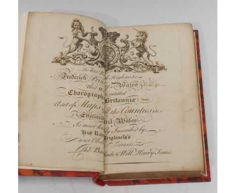
Cartography - [Toms (William Henry) & Badeslade (Thomas), Chorographia Brittaniæ., Or, A Set of All the Maps of the Counties in England and Wales [...]], first edition, [London: W.H. Toms, 1742], copperplate printed, lacking title-page, pp: engraved dedication double-page, 46 b/w double-page maps and 5 double-page tables, 20th century crimson morocco gilt over marbled boards by Graham Bloodworth, Leicester, his ticket, marbled endpapers en suite, spine incorrectly dated 1741, 8vo, [1]Provenance: James Wyld, Junior (1812-1887), the British geographer and map-seller, best known for Wyld's Great Globe. His Plain Armorial bookplate to recto pastedown.
Lot 5879
Cartography - A New and Accurate Description of the Present Great Roads and the Principal Cross Roads of England and Wales [...], London: Printed for R. and J. Dodsley, 1756, pp: [viii], 168, lxiv, [2] (blank), contemporary calf, slightly later Spade Shield Armorial bookplate: James Martin, 8vo, (1); Owen's Book of Roads [...], London: Printed for W. Owen, 1777, incomplete and lacking map, contemporary quarter-calf over marbled boards, 8vo, (1); Owen's New Book of Roads [...], London: 1805, fold-out map, contemporary mottled calf, slightly later ink MS ownership inscription on title-page, 8vo, (1); Ogilvy (David, Jun), A General Itinerary of England and Wales, with Part of Scotland [...], London: Printed for G. & J. Robinson [...], [n.d., 1804], fold-out map with some hand-colouring, contemporary calf over boards (faults, worn, loose and some losses), ink MS ownership inscription, 8vo, (1); Kitchin (Thomas, Hydrographer to His Majesty), The Traveller's Guide Through England and Wales [...], London: Printed for Charles Dilly, 1783, contemporary boards, perished calf spine, later ink MS title-label to upper-cover, 4to, (1); a 19th century atlas album of hand-coloured engraved county maps by and after Joshua Archer (fl. 1841 - 1861), London: [c. mid-19th century], later papered boards, 4to, (1), [6]
![Cartography - Bowles's Post-Chaise Companionl or, Travellers (sic) Directory through England Wales [...], The Second Edition,](https://cdn.globalauctionplatform.com/0502a1f8-5efd-4ab7-8a81-ac4d00ef7203/2b2df414-382c-4c08-b336-ac5d00d541f0/468x382.jpg)
Lot 5882
Cartography - Bowles's Post-Chaise Companionl or, Travellers (sic) Directory through England Wales [...], The Second Edition, Corrected, and greatly Improved; with Additions, two-volume set, London: Printed for the Proprietor Carington Bowles [...], 1782, copperplate printed, pp: [2] (blank), two-page map, xv, [1], road maps 1-100 on 50 sheets, [5], [3] (blanks); [4] (blanks), [2], road maps 101-200 on 50 sheets, 191-243, [2] (advert), [3] (blank), contemporary green-stained calf, flat spines with gilt-lettered morocco square and oval pieces, gilt horizontal bands, 8vo, [2] Provenance: 1) contemporary ink MS shelf numbering, Q-1, to each pastedown; 2) Emily Spike, June 13th 1840, The Gift of her Father, ink MS dedication inscription to each flyleaf.

Lot 5884
Cartography - Cary (John, Surveyor of the Roads to the General Post Office), Cary's New Itinerary; or, An Accurate Delineation of the Great Roads, Both Direct and Cross, Throughout England and Wales; With many of the principal Roads in Scotland [...], London: Printed for John Cary, 1798, fold-out map, contemporary mottled calf, gilt-lettered, 8vo, (1); Binding, another copy, ninth edition, London: 1821, later 20th century red morocco by Graham Bloodworth, Leicester, his ticket, marbled endpapers, slipcase en suite, 8vo, (1); 4 other copies and editions, including third edition, 1806, fifth edition, 1812, eighth edition, 1819, eleventh edition, 1828 (bound as two), contemporary boards, leather and later cloth bindings, 8vo, (4); the abridged edition, London: 1803, contemporary calf (worn), 8vo, (1), [8]
![Cartography - Leigh's New Pocket Road-Book of England Wales [...], sixth edition, London: Printed for Leigh and Son, 1837, pp](https://cdn.globalauctionplatform.com/0502a1f8-5efd-4ab7-8a81-ac4d00ef7203/6cd9b1ea-726d-48f2-8b3e-ac5d00d5448a/468x382.jpg)
Lot 5886
Cartography - Leigh's New Pocket Road-Book of England Wales [...], sixth edition, London: Printed for Leigh and Son, 1837, pp: [2] (blank), Table of the Price of Posting frontispiece, vi, stipple engraved allegorical half-title, 55 full-page county maps, 511, [1] (errata), fold-out map with contemporary hand-colouring, 4 (adverts), [1] (blank), contemporary green roan boards, the upper-cover gilt-lettered, rebacked in green morocco gilt by Graham Bloodworth, Leciester, his ticket, later marbled endpapers, indistinct contemporary ink MS ownership inscription, 12mo, (1); Provincial Imprint, Osborne's Guide to the Grand Junction, or, Birmingham, Liverpool, and Manchester Railway, with the Topography of the Country [...], Illustrated with Numerous Wood Engravings and Maps, first edition, Birmingham: E.C. & W. Osborne [...], 1838, fold-out maps and plates, full-page plates, various advertisements, the text incomplete, 20th century black morocco gilt over marbled boards by Graham Bloodworth, Leicester, his ticket, indistinct contemporary ink MS ownership inscription, 12mo, (1), [2]

Lot 5887
Cartography - Lewis's New Traveller's Guide, or a Pocket Edition of the English Counties, Containing all the Direct & Cross Roads in England & Wales, With the Distance of each Principal Place from London, London: Published by W. Lewis, [1819], pp: hand-coloured map of England and Wales frontispiece, [x], 42 hand-coloured maps with accompanying letterpress leaves, contemporary claret roan gilt over contemporary boards, slightly later presentation inscription: A Present to Matthew Whittaker, No 3 *** St., Bradford, square 8vo, (1); another copy, lacking preface, contemporary binding, contemporary ownership inscription: Edward Pemble Guildford, ink stencilled ownership crest, another later inscription: Basil L. Gimson, Sept. 1944, square 8vo, (1), [2]
Lot 5888
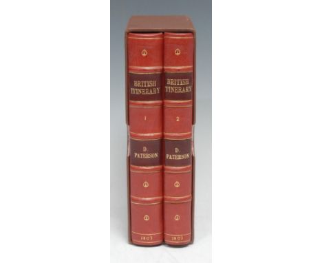
Cartography - Paterson (Daniel, Esq., Assistant Quarter Master General of His Majesty's Forces), Paterson's British Itinerary, Being A New and accurate Delineation and Descriptions of the Direct, and Principal Cross Roads of Great Britain, revised second edition, two-volume set, London: Printed for the Proprietors, Bowles & Carver [...], 1803, pp: [2] (blank), two-fold map, [2], xxxv, [1] (blank), 340 parallel road maps, 341-403, [5] (blanks); [6] (blanks), [2], [1] (blank), 46 parallel road maps, 450-663, [2] (blank), volume II flyleaf with an interesting 19th century ink MS note on travel between Lichfield and Worcester, 20th century red morocco binding by Graham Bloodworth, Leicester, his ticket, the covers with a blind-ruled fillet, six-compartment spine of raised bands, gilt-lettered pieces in the second and fourth compartments, contemporary yellow-stained edges, marbled endpapers, custom built slipcase en suite, 8vo, [2]Provenance: Colonel Henry Bromley (d. 1836), of Abberley Lodge (later Hall), Worcestershire, former MP for Worcester at the 1806 election until his resignation the following year rather than defend an allegation of bribery from his defeated candidate. His Plain Armorial bookplates are preserved on each pastedown.

Lot 5889
Cartography - Paterson (Daniel, Esq., Assistant Quarter-Master General of His Majesty's Forces): Paterson's British Itinerary/Being A new and accurate Delineation and Descriptions of the Direct, and Principal Cross Roads of Great Britain, second edition, two-volume set, London: Printed for the Proprietors, Bowles & Carver, 1796, pp: two-page map, [3], xxxv, [1], maps 1-340, 341-403, [3] (blanks); [4] (blanks), [2], maps 404-449, 450-634, [3] blanks, contemporary mottled calf, gilt-lettered red and green morocco pieces, 8vo, (2); A New and Accurate Description of all the Direct and Principal Cross Roads in Great Britain [...], three copies: third edition, 1776, eighth edition, 1789, and tenth edition, 1794, various contemporary bindings, each with contemporaneous and/or later ownership inscriptions, 8vo, (3), [5]

Lot 5890
Cartography - Taylor and Skinner's Maps of the Roads of Ireland, Surveyed in 1777 and Corrected down to 1783, second edition, London: T. Longman, 1783, copperplate printed on a blue-grey stock of paper, pp: repaired and conserved 6-fold map, xxvii, [1] (blank), 289, [1] (blank), [10] (index), 20th century three-quarter green morocco gilt over marbled boards by Graham Bloodworth, Leicester, his ticket, marbled endpapers en suite, the title-page with indistinct contemporary ink MS ownership: John Po**n, 8vo, [1]
![Cartography - The Post-Chaise Companion: or, Traveller's Directory throuh Ireland [...], To which is added, a Dictionary, or](https://cdn.globalauctionplatform.com/0502a1f8-5efd-4ab7-8a81-ac4d00ef7203/d39e5389-f714-4c42-bd79-ac61014ea67d/468x382.jpg)
Lot 5891
Cartography - The Post-Chaise Companion: or, Traveller's Directory throuh Ireland [...], To which is added, a Dictionary, or Alphabetical Tables [...], Dublin: Printed for the Author, 1786, PP: title-page engraved by John Duff (d. 1787), xiv, xv-xlii printed in paginated double-columns within black-ruled borders, 1-496 also printed in paginated double-columns within black-ruled borders, [497]-534, [2] (errata and publisher's notice), illustrated with frontispiece, fold-out national map, further double-page map, and 2 double-page plates, 20th century red morocco gilt over marbled boards by Graham Bloodworth, Leicester, his ticket, marbled endpapers en suite, 8vo, [1]

Lot 5893
Cartography - Wallis's New Pocket Edition of the English Counties, or Traveller's Companion, in which are carefully laid Down all the Direct & Cross Roads, Cities, Townes (sic), Villages, Parks, Seats, and Rivers, with a General Map of England & Wales, London: Published by J. Wallis, [n.d., c. 1810], hand-coloured and copperplate printed throughout, pp: [2] (blank), [iv], 44 maps, contemporary boards with red roan corners and applied with a gilt-lettered title-piece, rebacked to style, square 8vo, [1]

Lot 5894
Cartography and Cartobibliography - Provincial Imprints, Fordham (Sir George Herbert), two volumes: Hertfordshire Maps: A Descriptive Catalogue of the Maps of County, 1579-1900 [&] Supplement, Hertford: Stephen Austin & Sons, Ltd., 1907-1914, illustrated, contemporary pictorial wrappers (various states), folios, (2); Skelton (R.A.), County Atlases of the British Isles 1579-1703, London: Carta Press, 1970, h/b, d/j, 4to, (1); Philips' Select Atlas of Modern Geography [...], London: [n.d., pre-1914], double-page maps, green cloth gilt, 8vo, (1); Mais (S.P.B.), Britannia 1651~1951, Stapes Press: 1951, pictorial d/j, h/b, folio, (1); Christopher Saxton and Tudor Map-Making; John Speed; etc., [14]
Lot 5920
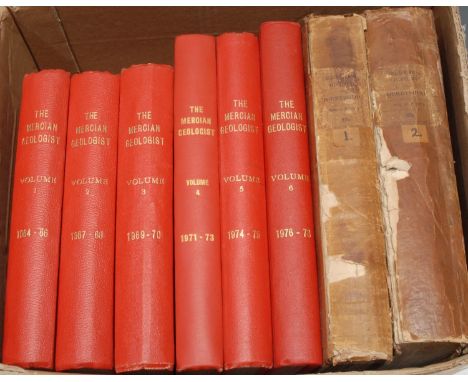
Geology, Local Interest - The Mercian Geologist: Journal of the East Midlands Geological Society, 1964-1978, bound as six volumes, red buckram, 4to and folio, (6); Provincial Imprint, Glover (Stephen), The History and Gazetteer of the County of Derby [...], first edition, two-volumes (all published): volumes I & II: Part 1, Derby: Printed for the Publisher by Henry Mozley and Son, 1831-1833, the second volume with fold-out hand-coloured county map, contemporary cloth boards, second volume with contemporary crested bookplate: Thomas Langhorne, 4to, (2), [8]
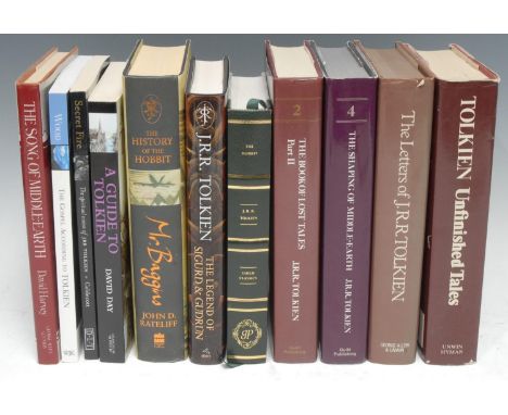
Lot 5924
J.R.R. Tolkien and Lord of the Rings - Rateliff (John D.), The History of the Hobbit, Part One: Mr Baggins only, first and only edition, London: Harper Collins, 2007, h/b, d/j, 8vo, (1); Carpenter (Humphrey, editor), The Letters of J.R.R. Tolkien, London: 1981, h/b, d/j, 8vo, (1); Tolkien (J.R.R.), Unfinished Tales of Númenor and Middle-earth, London: 1987, h/b, pictorial d/j, 8vo, (1); Caldecott (Stratford), Secret Fire: The spiritual vision of JRR Tolkien, London: 2003, p/b, 8vo, (1); Harvey (David), The Song of Middle-Earth: J.R.R. Tolkien's Themes, Symbols and Myths, London: 1985, h/b, d/j, 8vo, (1); Tolkien (J.R.R.) and Tolkien (Christopher, editor), The History of Middle-Earth: Part II, The Book of Lost Tales, third impression, 1987, [&], Part IV, The Shaping of Middle-Earth, The Quenta, The Ambarkanta and the Annals, together with the earliest 'Silmarillion' and the first Map, first edition, 1986, London: Guild Publishing, h/b, d/j, 8vo, (2); etc., [11]
![Local Interest - Buxton: Hydrotherapy, Thresh (John C.), Buxton, as a Health Resort [...], Buxton: C.F. Wardley, 1883, contem](https://cdn.globalauctionplatform.com/0502a1f8-5efd-4ab7-8a81-ac4d00ef7203/319cafa7-0786-4011-9aca-ac5d00d55c78/468x382.jpg)
Lot 5927
Local Interest - Buxton: Hydrotherapy, Thresh (John C.), Buxton, as a Health Resort [...], Buxton: C.F. Wardley, 1883, contemporary cloth, 8vo, (1); two copies, Robertson (William H., M.D.), A Hand-Book to the Peak of Derbyshire, and to the Use of the Buxton Mineral Waters [...], Buxton: John Cumming Bates, [n.d., c. 1861], illustrated, each bound in contemporary textured cloth gilt, alternating size 8vo, (2); Views of Buxton, London: Published by W.D. Sutton, [n.d., c. 1870], full-page b/w engravings, contemporary blue cloth gilt (worn), oblong 8vo, (1); Ancient Remains, Near Buxton [...], Numerous Illustrations, Buxton: C.F. Wardley, [n.d., c. 1900], b/w illustrated, green cloth, 8vo, (1); Kelly's Directory of Buxton [...], 1939, various adverts, printed cloth as issued, 8vo, (1); Ward and Lock's Illustrated Guide to, and Popular History of Buxton, Matlock, Dovedale, Alton Towers, and the Peak District, With Illustrations and New Map, London: Ward, Lock, and Co., [n.d., c. 1880], pictorial boards, 12mo, (1); a later edition, (1), [8]
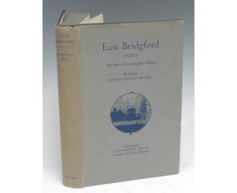
Lot 5930
Local Interest - Hill (The Rev. Arthur du Boulay, M.A., Rector), East Bridgford, Notts.: The Story of an English Village, first and only edition, Oxford: University Press, 1932, illustrated with b/w plates, a handful of in-text illustrations and a loosely inserted fold-out facsimile of a 1612 manorial map, contemporary green cloth gilt, dustjacket with pictorial vignette, 8vo, [1]
![Local Interest - Rhodes (E[benezer]), Peak Scenery, or Excursions in Derbyshire [...], Illustrated with Engravings [...], fir](https://cdn.globalauctionplatform.com/0502a1f8-5efd-4ab7-8a81-ac4d00ef7203/20e5a1e5-4c89-4590-ab44-ac5d00d56019/468x382.jpg)
Lot 5933
Local Interest - Rhodes (E[benezer]), Peak Scenery, or Excursions in Derbyshire [...], Illustrated with Engravings [...], first edition, Parts I, II, & IV only, bound as one, London: Printed for the Author, 1818-1823, full-page b/w plates, contemporary roan gilt rebacked and relaid, red-speckled edges, refreshed endpapers, 4to, (1); Rhodes (E.), Peak Scenery; or, The Derbyshire Tourist, first edition thus, London: Printed for Longman [...], 1824, three-fold county map as frontispiece, slightly later 19th century half-calf gilt over cloth boards, red-stained edges, marbled endpapers, 8vo, (1); Adam (W. ), The Gem of the Peak; or Matlock Bath and Its Vicinity [...], third edition, London: Longman & Co., 1843, fold-out county map as frontispiece, illustrated with full-page chromolithographs or wood engraved plates, further in-text illustrations, contemporary calf, all-edges gilt, slightly later 19th century ink MS ownership inscription: H.W. Langley, 1877, 8vo, (1); Robinson (Joseph Barlow, Sculptor, Derby), Derbyshire Gatherings [...], London: J.R. Smith, 1866, full-page plates, contemporary Gothic Revival red cloth gilt as issued (worn), all-edges gilt, 4to, (1); Leyland (John), The Peak of Derbyshire, Its Scenery & Antiquities, with Illustrations by Alfred Dawson and Herbert Railton, London: Seeley and Co., 1891, named-view monochrome etchings, contemporary green cloth pictorial gilt, floral endpapers, 8vo, (1); English Dialect Society, No. 78, Pegge (Samuel), Two Collections of Derbicisms [...], London: 1896, original wrappers (repaired), 8vo, (1), [6]
![Topography - [Hermannides (Rutgerus)], Rutgeri Hermannidæ Britannia Magna, Sive Angliæ, Scotiæ, Hiberniæ & adjacentium In](https://cdn.globalauctionplatform.com/0502a1f8-5efd-4ab7-8a81-ac4d00ef7203/d13bc4e6-0ea4-4c19-9f3e-ac5d00d57886/468x382.jpg)
Lot 5980
Topography - [Hermannides (Rutgerus)], Rutgeri Hermannidæ Britannia Magna, Sive Angliæ, Scotiæ, Hiberniæ & adjacentium Insularum, Geographico-Historica Descriptio, first edition, Amstelodami: Sumptibus Ægidii Jansonii Valckenier, 1661, title-page with printer's device, pp: [2] (blank), additional engraved title-page by Jan Veenhuysen (c. 1631-1685), [32], fold-out map, 645, [38], [5] (blank), the text illustrated with 32 fold-out birds-eye urban maps, foliate initials and some decorative headers, 17th century Dutch pastiche binding of yapped vellum by Graham Bloodworth, Leicester, his ticket, plain endpapers, 12mo, [1]
![Topography - Cooke (George Alexander), seven counties' Topographical and Statistical Descriptions [...], comprising: Binding,](https://cdn.globalauctionplatform.com/0502a1f8-5efd-4ab7-8a81-ac4d00ef7203/91db17cc-ed90-45ac-a8af-ac5d00d5792d/468x382.jpg)
Lot 5981
Topography - Cooke (George Alexander), seven counties' Topographical and Statistical Descriptions [...], comprising: Binding, three works bound as one, including Somerset, 1820, Wiltshire, [n.d., c. 1830], Hampshire, 1819, all London: Sherwood, Neely and Jones, each prefixed with a two-fold county map, only Wilts. with two leaves of four named-view plates, 20th century half-red morocco gilt over marbled boards by Graham Bloodworth, Leicester, his ticket, conforming marbled endpapers, contemporary red-speckled edges, 12mo, (1); others, Gloucester, n.d., Herefordshire, 1830, and Cornwall, n.d., all London: Sherwood & Co., Herefordshire and Cornwall with engraved frontispieces, half-titles, and their two-fold county hand-coloured, Gloucestershire's county map b/w, each illustrated with b/w named-view plates, each bound en suite in 19th century faux 'morocco' blue pebble cloth, gilt-lettered spines, 12mo, (3); Suffolk, [n.d., c. 1820], contemporary calf, marbled endpapers, 12mo, (1), [5]
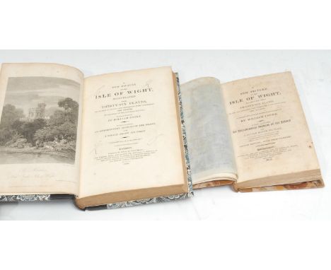
Lot 5982
Topography - Cooke (William): A New Picture of the Isle of Wight, Illustrated with Thirty-Six Plates, of the Most Beautiful and Interesting Views throughout the Island [...], To which is prefixed, An Introductory Account of the Island, and a Voyage Round Its Coast, first edition, London: Printed by W. Wilson, 1808, pp: [2] (blank), xiv, 171, [1] (blank), [4] (index), [2] (blank), illustrated with 36 b/w full-page plates inclusive of frontispiece and a three-fold engraved map with contemporary hand-colouring, as called for, 20th century black morocco gilt over marbled boards by Graham Bloodworth, Leicester, his ticket, two-tone green morocco lettering pieces, marbled endpapers en suite, 8vo, (1); Provincial Imprint, the second edition, with Twenty-Six Plates, Southampton: Printed by and for T. Baker [...], 1812, pp: xiv, 158, [4] (index), illustrated with 26 b/w full-page plates inclusive of frontispiece and a two-fold engraved map with contemporary hand-colouring, as called for, 20th century tan morocco gilt over marbled boards by Graham Bloodworth, Leicester, his ticket, marbled endpapers en suite, 12mo, (1), [2] Provenance: 1) probably Charles Kemeys Kemeys-Tynte (1822-1891), Plain Armorial bookplate to recto pastedown and the title-page with the owner's initials at each angle in ink MS.
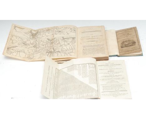
Lot 5983
Topography - Kent - Provincial Imprint, The Kentish Traveller's Companion, in a Descriptive View of the Towns, Villages, remarkable Buildings and Antiquities, Situated On or Near The Road from London to Margate, Dover and Canterbury, Illustrated With a correct Map of the Road on a Scale of One Inch to a Mile, Second Edition, considerably enlarged, Canterbury and Rochester: Printed and Sold by Simmons and Kirby [...]; and T. Fisher, 1779, pp: iv, 248, [8] (index), 3 three-fold road maps, contemporary calf over marbled boards (perished and rubbed, upper-cover detached), slightly later ink MS dated ownership inscription: Skarespeare Book 1803, 8vo, (1); [...] The Fourth Edition, with Considerable Additions, Canterbury: Printed and Sold by Simmons, Kirkby, and Jones [...], 1794, pp: [2] (blank), fold-out distance table frontispiece, iv, 337, [7] (index), [2] (blank), 3 three-fold road maps, 20th century black morocco gilt over marbled boards by Graham Bloodworth, Leicester, his ticket, marbled endpapers en suite, 8vo, (1); Kidd's Picturesque Pocket Companion to Dover; or, The Stranger's Vade-Mecum, The Illustrations designed and engraved by G.W. Bonner, London: James Gilbert, [n.d., c. 1830], pp: [2] (blank), vi, 38, [2] (blank), wood engraved frontispiece and in-text illustrations, later 19th century boards over contemporary pictorial wrappers as issued, the upper-cover with Bibliotheca Cantiana collection label inscribed in ink MS with the title, further Bibliotheca Cantiana: Wm. John Mercer book label to recto pastedown, 18mo, (1), [3]
![Topography - Kirby (Mr John, of Wickham-Market), The Suffolk Traveller [...], The Second Edition, With many Alterations and l](https://cdn.globalauctionplatform.com/0502a1f8-5efd-4ab7-8a81-ac4d00ef7203/8d6187ec-6f6e-44ec-a167-ac5d00d57add/468x382.jpg)
Lot 5984
Topography - Kirby (Mr John, of Wickham-Market), The Suffolk Traveller [...], The Second Edition, With many Alterations and large Additions, By Several Hands, London: Printed for J. Shave, 1764, pp: eight-fold county map delineated with contemporary hand-colouring, xvi, 340, [1] (blank), illustrated with four fold-out road maps, loosely inserted 19th ink MS list of the county's sheriffs, 20th century black morocco over marbled boards by Graham Bloodworth, Leicester, his ticket, marbled endpapers en suite, 8vo, (1); Provincial Imprint, the third edition, [...] To Which Is Added An Appendix [...], Woodbridge: Printed and Sold by Smith and Jarrold, [n.d., c. 1810], pp: three-fold county map, iv, 399, [1] (blank), 72, contemporary quarter-calf gilt over marbled boards, 8vo, (1), [2]
![Topography - Leigh's Guide to Wales & Monmouthsire [...], Illustrated with a Map of Wales, and Views of the Menai and Con](https://cdn.globalauctionplatform.com/0502a1f8-5efd-4ab7-8a81-ac4d00ef7203/70392b9f-08b8-4d2d-a5d3-ac5d00d57c22/468x382.jpg)
Lot 5986
Topography - Leigh's Guide to Wales & Monmouthsire [...], Illustrated with a Map of Wales, and Views of the Menai and Conway (sic) Bridges, London: Printed for Samuel Leigh, 1831, 15-fold engraved and hand-coloured map folding out from pastedown, pp: Menai Suspension Bridge frontispiece only, [2] (blank), vi, 356, [2] (advert), contemporary cloth, the upper-cover with the view of Conway (sic, Conwy) Castle and Bridge, gilt-lettered spine, contemporary green endpapers, those recto with clipped and canted printed title label, Montpellier Library, Cheltenham, their contemporary ticket, contemporary ink MS ownership inscription: Eliz:th Mrs Ashwell, 8vo, (1); Itinerary of Scotland, half-title only, [n.d., c. 1810], pp: [2] (blank), [1]-192, fold-out map of Perth's environs only, contemporary black straight-grained morocco gilt, contemporary ink MS ownership inscription: Henry Broadhurst, another later: Tinsley Warehouse, 8vo, (1); The Traveller's Guide through Scotland and Its Islands, Illustrated by Maps, Views of Remarkable Buildings, & C., sixth edition, volume I only, contemporary calf over marbled boards, 8vo, (1), [3]
![Topography - The Picture of England. Or, A Topographical Account [...] To which is added, A Description of the Principal Post](https://cdn.globalauctionplatform.com/0502a1f8-5efd-4ab7-8a81-ac4d00ef7203/92b7b899-631c-48bc-95e4-ac5d00d57d5f/468x382.jpg)
Lot 5989
Topography - The Picture of England. Or, A Topographical Account [...] To which is added, A Description of the Principal Post Roads in England [...], first and only edition, two-volume set, London: Printed and Sold by R. Butters, 1809, pp: national map as frontispiece, vii, [1], 184, 29 full-page county maps; [iv], 94, [ii], 76, 16, 10 full-page county maps, 20th century blue morocco gilt over marbled boards by Graham Bloodworth, Leicester, his ticket, marbled endpapers en suite, 8vo, (2); A Description of England and Wales [...], volume II only, London: Printed for Newbery and Carnan, 1769, b/w engraved named-view plates, 20th century dark blue morocco over marbled boards by Graham Bloodworth, Leicester, his ticket, marbled endpapers en suite, 8vo, (1), [3]

Lot 5990
Topography and Travel - GB and Europe, including Tattersall (George), The Lakes of England, London: Sherwood & Co., 1836, contemporary diced green calf gilt, 8vo, (1); Tymms (Samuel), The Family Topographer [...], two volumes only: Volumes II Norfolk & III Western Circuit, London: J.B. Nichols and Son, 1832-1833, contemporary printed boards, Plain Armorial bookplates: William Garnett, Esq., Bleasdale and Quernmore Park, Co. Lancashire, 8vo, (1); Devonshire, from Cox's Magna Britannia et Hibernia, 465-604pp, fold-out county map, paper covers, 4to, (1); Bullar (John), A Companion in a Tour Round Southampton [...], third edition, Southampton: 1809, contemporary boards, 8vo, (1); Kohl (J.G.), Ireland, Scotland, and England, London: Chapman and Hall, 1844, contemporary half-calf (disbound), 8vo, (1); Evans (John), The Juvenile Tourist [...], London: 1818, marbled boards (disbound), 8vo, (1); Mavor (William), The British Tourists [...], volume V, London: 1798, contemporary calf (disbound), 12mo, (1); Bibliography, Sanderson's Book of British Topography, Amsterdam: 1961, red cloth, 8vo, (1); Parker (Maude, R.W.A.), The Royal River: An Illustrated Map of the Thames, Edinburgh: John Bartholomew & Son Ltd., 1937, purple cloth covers; Fox (Cyril), The Personality of Britain: Its Influence on Inhabitant and Invader in Prehistoric and Early Historic Times, second edition, Cardiff: 1933, coloured fold-out maps, contemporary printed boards, 4to; Lake Distract; Paris; Touraine; others, [approx. 25]
Lot 5994
Travel - Arctic Exploration, Armstrong (Alex., M.D., R.N.), A Personal Narrative of the Discovery of the North-West Passge [...], first edition, London: Hurst and Blackett, Publishers, 1857, lacking frontispiece and map, pp: xxii, [2], 616 (quire K erroneously paginated), [24] (publisher's list, [2] (blanks), rebacked contemporary blue cloth (chipped), later endpapers stiffening text block, a good ex-library copy, 8vo, [1]
Lot 5995
Travel - Arctic Exploration, Ross (Sir John, C.B., K.S.A., K.C.S., &c. &c., Captain in the Royal Navy), Narrative of a Second Voyage in Search of A North-West Passage, and of a Residence in the Arctic Regions During the Years 1829, 1830, 1831, 1832, 1833., Including the Reports of Commander, Now Captain, James Clark Ross, R.N., F.R.S., F.L.S., &c. And The Discovery of the Northern Magnetic Pole, first edition, London: A.W. Webster, 1835, pp: [viii], xxxiii, [1] (binder's directions), 740, illustrated as called for with the fold-out map of 'Discoveries made in The Arctic Regions' and 30 plates (of which 3 are coloured, 1 one is fold-out map/chart), 20th century panelled calf, gilt-lettered spine piece, beige endpapers, the verso enclosing a sleeve for the larger map, 4to, [1]
Lot 5998
Travel - Polar Exploration - Lewin (Henry W.), Did Peary Reach the Pole? by "An Englishman in the Street", first and only edition, London: Simpkin, Marshall [...], 1911, lacking map, blue cloth, gilt lettered, refreshed endpapers stiffening text block, 8vo, (1); Wilkins (Sir [George] Hubert), Under the North Pole, first edition, [New York]: Brewer, Warren & Putman, 1931, ex-library copy in institutional buckram, 8vo, (1); Ellsberg (Commander Edward), Hell on Ice: The Saga of the "Jeannette", William Heinemann Ltd., 1938, h/b, pictorial d/j, 8vo, (1); others, later 20th century, all h/b, [19]
![Travel and Cartography - Morgan (William), Ogilby's and Morgan's Pocket-Book of the Roads [...], To which is added, A List of](https://cdn.globalauctionplatform.com/0502a1f8-5efd-4ab7-8a81-ac4d00ef7203/e1e8a202-3a5e-4337-ad9f-ac5d00d58137/468x382.jpg)
Lot 5999
Travel and Cartography - Morgan (William), Ogilby's and Morgan's Pocket-Book of the Roads [...], To which is added, A List of the Principal Trading Towns [...], tenth edition, London: Printed for J. Brotherton [...], 1745, contemporary calf (disbound), square 16mo, (1); the fourth edition, London: Printed for J. Brotherton [...], [n.d., c. 1760], with fold-out national map as the frontispiece, contemporary calf, quite plain, red-speckled edges, square 16mo, (1); the nineteenth edition, edited by Salmon, London: Printed for J. Buckland [...], [n.d., 1778?], contemporary hessian covers, contemporary ink MS ownership inscription: John Brookbanks?, square 16mo, (1); an 18th century album of 40 English and Irish maps or street plans, contents leaf only: no bibliographic information hand-coloured and copperplate printed throughout, the urban aerial views including Kensington and other provincial cities or large towns, contemporary speckled calf, gilt-tooled and lettered spine, endpapers with contemporary French MS, oblong 8vo, (1); Cooke (G.A.), The Modern British Traveller: or, Tourist's Pocket Directory [...], Illustrated with Maps of the Counties, forming a Complete British Atlas, pp: two fold-out hand-coloured maps, [xix], [20]-167, [1] (contents), contemporary paper wrappers, 12mo, (1), [5]
![Travel and Cartography - Salmon [Thomas], The Modern Gazetteer: or, A Short View of the Several Nations of the World [...], T](https://cdn.globalauctionplatform.com/0502a1f8-5efd-4ab7-8a81-ac4d00ef7203/6f78cff5-be40-4286-b686-ac5d0183be0e/468x382.jpg)
Lot 6000
Travel and Cartography - Salmon [Thomas], The Modern Gazetteer: or, A Short View of the Several Nations of the World [...], The Sixth Edition, with great Additions, and A New Set of Maps [...], London: Printed for S. and E. Ballard [...], 1759, 7 fold-out maps, contemporary calf (worn), slightly later ink MS ownership inscription: John Owen's Book Anno Domini 1778, 12mo, (1); Galignani's Traveller's Guide through Switzerland [...], sixth edition, Paris: Published by A. and W. Galignani, 1822, contemporary calf, 12mo, (1); Charnock (Dr), Bradshaw's Illustrated Hand-Book to Spain and Portugal: A Complete Guide for Travellers in the Peninsula, With Maps, Town Plans, and Steel Illustrations, London: W.J. Adams, 1866, contemporary red cloth gilt (worn), contemporary Parisian bookseller's ticket, 12mo, (1); American Imprint, Richards (T. Addison), Appleton's Illustrated Hand-Book of American Travel, A Full and Reliable Guide by Railway, Steamboat, and Stage, [...] in the United States and the British Provinces, New York: D. Appleton & Co., 1857, fold-out map (repaired), contemporary covers (worn), 8vo, (1); New Pocket-Panorama of the Rhine, from Mayence to Cologne with Description, 16-fold lithograph, contemporary printed boards, (1); etc., [7]

Lot 6004
Anon, The History of the Incarnation, Life, Doctrine, and Miracles; The Death, Resurrection, and Ascension, Of Our Blessed Lord and Saviour Jesus Christ, [...] To which are added, The Lives, Actions, and Sufferings of the Twelve Apostles [...], with a Chronological Table [...], By a Divine of the Church of England, London: Printed for T. Cooper, 1737, title-page printed in red and black, frontispiece and full-page plates engraved by James Mynde (1702-1771), fold-out map of the Holy Land, contemporary calf (disbound), indistinct mid-19th century ink MS ownership inscription, crown folio (41cm x 27cm), [1]


-
109182 item(s)/page