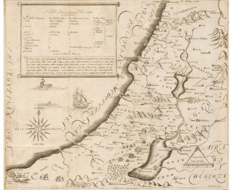
Mead (Richard). A Mechanical Account of Poisons in Several Essays, 1st edition, London: Printed by J.R. for Ralph South, 1702, early signature E. Adey to title, some toning and occasional light spotting, 19th-century bookplate of Samuel Holdsworth to upper pastedown, contemporary calf, joints split and upper board loosening, extremities worn, 8vo, together with:Teresa (of Avila, Saint), Vida da seraphica madre Santa Teresa de Jesus..., Lisbon: Antonio Vicente da Silva, 1761, engraved illustration laid-down on front free endpaper, contemporary limp vellum, with leather ties, 4to,Chambaud (Lewis), A Grammar of the French Tonge, with a prefatory discourse..., 6th edition, revised and corrected, London: C. Bathurst, W. Strahan [& others], 1775, contemporary calf, spine without title label, rubbed, 8vo,Vyse (Charles), The New London Spelling-Book; or, the Young Gentlemen and Ladies' Guide to the English Tongue..., new edition, with alterations, improvements, and additions, London: Published by all the booksellers, and R. & W. Dean, Manchester, 1807, wood engraved portrait frontispiece, front free endpaper inscribed 'Miss Lough's Book April 9th 1809 Bainton', contemporary sheep, lacking spine, upper board loose, worn, 8vo,Bertrand de Moleville (Antoine-Francois), Annals of the French Revolution; or, a chronological account of its principal events, with a variety of anecdotes and characters ... translated by R.C. Dallas, 4 volumes, London: Printed by S. Low, 1800, contemporary diced calf, joints split, lacking spine labels, worn, 8vo,Clarke (Samuel), Homeri Ilias Graece et Latine, new edition, 2 volumes, London: J. Nunn, Baldwin, Cradock & Joy [& others], 1825, folding engraved map frontispiece to each with some offsetting to titles, armorial bookplate of Thomas Fletcher Twemlow to upper pastedowns, contemporary half calf, gilt decorated spines with contrasting labels, 8vo, plus other 17th-19th century antiquarian volumes, including grammars etc., some odd volumes, and two 18th century vellum documentsQTY: (34)


![Bible [English]. The Holy Bible containing the Old Testament and the New, newly translated out of the original tongues and wi](https://cdn.globalauctionplatform.com/130e7446-aa4a-49cf-9a62-aef900af8abb/c504e591-e529-40cc-9a36-aefb00b282f7/468x382.jpg)


![De Bry (Theodore). Brevis Narratio eorum quae in florida Americae provi[n]cia Gallis acciderunt...quae est seconda pars Ameri](https://cdn.globalauctionplatform.com/130e7446-aa4a-49cf-9a62-aef900af8abb/0623df0d-798e-4a7f-9ee9-aefb00b1d710/468x382.jpg)


![British Isles. Hollar (Wenceslaus), Untitled map of the British Isles, [1643 or later], uncoloured etched map surrounded by s](https://cdn.globalauctionplatform.com/130e7446-aa4a-49cf-9a62-aef900af8abb/b649ea28-5c8b-4e3b-941c-aefb00b21ad1/468x382.jpg)
![British Isles. Mercator (Gerard & Hondius Henricus), Anglia, Scotia et Hibernia, [1595 or later], uncoloured engraved map](https://cdn.globalauctionplatform.com/130e7446-aa4a-49cf-9a62-aef900af8abb/c0d0c7b3-d96f-4e9b-9cd5-aefb00b21b90/468x382.jpg)
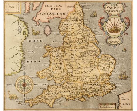
![British Isles. Ortelius (Abraham), Angliae, Scotiae et Hiberniae sive Britannicar: Insularum Descriptio [1592], hand-coloured](https://cdn.globalauctionplatform.com/130e7446-aa4a-49cf-9a62-aef900af8abb/a3a51d0f-6825-49f2-8eb0-aefb00b21c48/468x382.jpg)
![British Isles. Waldseemuller (Martin), Tabula Moderna Hiber, Strasbourg, [1525], uncoloured woodblock map, title in a decorat](https://cdn.globalauctionplatform.com/130e7446-aa4a-49cf-9a62-aef900af8abb/74994250-9ec6-49ca-b3f9-aefb00b21d0c/468x382.jpg)


![Guyana. Schomburgk (Robert H.), Map's [sic] of the limits of British Guiana surveyed under Her Majesty's Commission by Robert](https://cdn.globalauctionplatform.com/130e7446-aa4a-49cf-9a62-aef900af8abb/734f5b83-d327-4498-b59f-aefb00b225e4/468x382.jpg)


