We found 109182 price guide item(s) matching your search
There are 109182 lots that match your search criteria. Subscribe now to get instant access to the full price guide service.
Click here to subscribe- List
- Grid
-
109182 item(s)/page


Lot 352
Mint collection of definitives from QV in one volume, also Falkland Islands Dependencies from 1944, South Georgia from 1963, BAT from 1963, all to around 2010, generally previously hinged to 1984 and u/m thereafter, better items include 1891 to 6d, KEVII ½d to 2½d, 1929-37 to 1s, 1938-50 to £1, 1960-62 Birds to £1, 1968 Flowers to £1, 1971 to 25p on 5s, 1989 Ships to £5, 1994 Birds to £5, 2003 Birds to £5, 2006 Aircraft to £5, FID 1948-49 thin map to 1s, South Georgia 1971 to 50p on 10s, 1993 Whales & Dolphins to £5, 1999 Birds to £5, 2004 Juvenile Fauna to £5, 2009 Shackleton to £5, BAT 1963-69 to both £1, 1971 to 50p on 10s, 1993 Ships to £5, 1998 Birds to £5, 2003 Research Bases to £5, 2008 Explorers to £5, condition of earlier issues mixed (Scores)
Lot 489
Mainly mint selection in album 1857-1900 including c1857 coloured map (100x100mm), 1858-62 (6d) (2), (9d), 1859-61 6d (2), 1860-63 2d, 4d and 6d no gum), 1862 1s used, 1863-72 1d to 4d with additional shades, 1876 ½d on 9d and ½d on 10d, 1877 ½d on 10d watermark inverted and 1d on 4d, 1883 16c on 17c (3 types), 1886 2c on 38c and 1887 2c on 13c (2 singles and a pair), 1893 1c on 2c, 1893 1c on 2c and 1c on 16c both in used blocks of 30 (5x6), 1895-99 set of 6, 1898 36c Diamond Jubilee and overprinted "SPECIMEN", 1899 6c on 18c with different surcharges plus "ULTRAMAR" ovpt, 15c on 36c and "ULTRAMAR" ovpt, 1899 15c overprinted "SPECIMEN" plus seven 'used' forgeries of early issues, mostly good to fine, part to large part o.g. (154), cat £4,800+


Lot 1452
An early 19th century map of the County Palatine of Lancaster by G Hennett, published by Henry Teesdale & Co, London, May 1st 1830, 163 x 115cm, in leather box modelled as a book with simulated wood covers and marbled paper sides. CONDITION REPORT: There are some areas of discolouration particularly to the left side, the housing is quite worn, there are two small areas where the map is coming away from the backing, there is some fraying the borders of the reverse.


Lot 1454
A group of predominantly late 19th/early 20th century maps to include Lancashire, Cheshire, Denbighshire, also an earlier hand coloured map of Cheshire inscribed 'Published by The Proprietors T Brideslade & W.H. Toms, Septr 29th 1741', 15 x 15cm and a map of North Wales inscribed 'Published by Alexr Hogg at The Kings Arms number 16 Pater Noster Row', majority framed and glazed.

Lot 1456
A 19th century 'G Bradshaw's map of canals, navigable rivers, railroads in the Midland counties of England (...) from a level of 6' 10" under the old dock sill at Liverpool, from levels taken by Twyford & Wilson, Surveyors and Engineers, Manchester' published February 12th 1830, 135 x 126cm, and a 'G Bradshaw's map of canals situated in the counties of Lancaster, York, Derby and Chester (...) from levels taken by William Johnson & Son, Manchester', 92.5 x 130cm, in leather box modelled as a book with marbled paper sides (2). CONDITION REPORT: 'Lancaster, York etc...': Discolouration and staining, some small nibbles to the edges and imprint of the Greek key border across the map; 'Midland Counties...': Some discolouration and small nibbles to the edges; both with staining and fraying to the backs; the housing is worn.


Lot 116
D-Day signed Navy cover. RNSC (6) 11. Operation Neptune, D-Day, 6th June 1944 Pre-Assault Royal Navy Bombardment. Cover design shows a map of the Navy approach and assault on the beaches. 50th Anniversary postmark Battle for Caen 5 June 1994. Signed by Sgt. J. C. Joe Stringer MM (48 Commando, came ashore Juno Beach). Good condition. All signed items come with our certificate of authenticity. We combine postage on multiple winning lots and can ship worldwide. UK postage from £3.95, EU from £4.95, Overseas from £6.95

Lot 117
D-Day signed Navy cover. RNSC (6) 11. Operation Neptune, D-Day, 6th June 1944 Pre-Assault Royal Navy Bombardment. Cover design shows a map of the Navy approach and assault on the beaches. 50th Anniversary postmark Battle for Caen 5 June 1994. Signed by Major Dan. J. Flunder OBE, VRD, RMR (Capt. and Adjutant 48 Commando, came ashore Juno Beach). Good condition. All signed items come with our certificate of authenticity. We combine postage on multiple winning lots and can ship worldwide. UK postage from £3.95, EU from £4.95, Overseas from £6.95
![[CORY, (Robert, Jnr)] A Narrative of the Grand Festival at Yarmouth..., with an Appendix. Yarmouth: J. Keymer 1814, 8vo, firs](https://cdn.globalauctionplatform.com/4b91fb87-3797-42db-8dd7-a87e00bd8f1d/51fae093-23c5-440a-9840-86219c69c615/468x382.jpg)
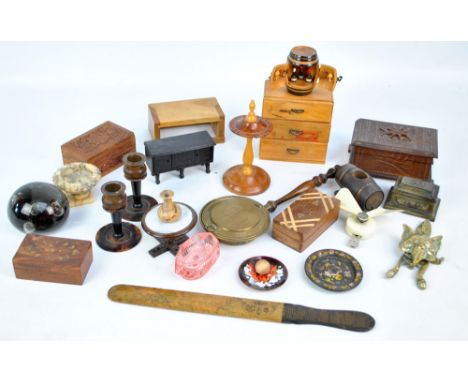
Lot 150
[CORY, (Robert, Jnr)] A Narrative of the Grand Festival at Yarmouth..., with an Appendix. Yarmouth: J. Keymer 1814, 8vo, first edition, engraved title and 2 folding plates, uncut in original boards, stitching broken with contents working loose; GILBERT's New Map of England and Wales, folding linen backed map published 1849 by H. G. Collins and G. Philip, hand coloured, 84.5 x 69cm, lacking upper cover (2)
![[CANNING (Richard)] The Principal Charters which have been granted to.. Ipswich.., 1754, 8vo, rebacked tree calf; TAYLOR (J E](https://cdn.globalauctionplatform.com/4b91fb87-3797-42db-8dd7-a87e00bd8f1d/c026c7a8-612a-4038-8ee8-4468fcab8c9b/468x382.jpg)
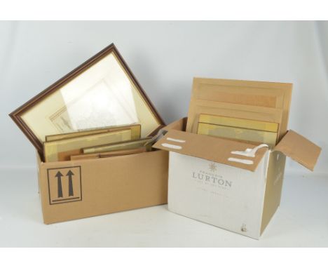
Lot 174
[CANNING (Richard)] The Principal Charters which have been granted to.. Ipswich.., 1754, 8vo, rebacked tree calf; TAYLOR (J E) In and About Ipswich, 1888, 8vo, plates after Percy Stimpson, light foxing, half bound (chipped spine); SHOBERL (F) Suffolk or Original Delineations Topographical, Historical and Descriptive. 1818, 8vo, folding map, modern cloth; L'ESTRANGE (J) The Eastern Counties Collectanea. Norwich 1872-73, 8vo, plain cloth (4)
Lot 176
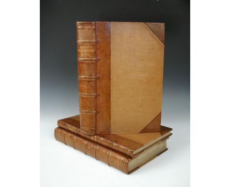
NASH (Treadway) Collections for the History of Worcestershire. First edition, 2 vols 1781-82, folio, vignette titles, folding map, numerous engraved plates and pedigrees or tables, (vol. I lacks pedigree of Talbot on p.158, duplicate pedigree of Berkeley supplied), together with index volume by John Amphlett, 1895, all in later half calf (3)


Lot 344
Literature and travel. LAVELEYE (Emile de) The Balkan Peninsula, 1887, 8vo, folding map, cloth; GORDON (J & C) Two Vagabonds in the Balkans, 1925, plates; ALEXANDER (N) Wanderings in Yugoslavia, 1936, folding map, cloth; STANFORD's 'Col Rhodes' Map of Africa, 67 x 56cm; COLLINS' Enlarged Map of Russia and Turkey, 53 x 88cm; various others including bindings, Hogarth's Works, Johnson's Dictionary in miniature, Glasgow 1820, etc. (23)


Lot 63
BUTLER (S), An Atlas of Modern Geography, London: Longman & Co (c. 1835), 8vo, engraved title, folding world map and 22 double page maps, light dust soiling, original boards; also a folder of small 19th century maps and prints (chipped) ; TEMPESTA (Antonio), Avorum societas Romanorum et Bat., 1611, oblong 8vo, lacking title and plates 21-25, an album of 31 (of 36) engravings, each tipped-in, with Latin and Dutch text below image and Latin text to verso, 16.5 x 21 cm (plate), later plain cloth binding (3)


Lot 87
SIMEONI (Gabriele) Dialogo Pio et Speculativo, con diverse sentenze Latine e volgari. Lyon: Guillaume Rouille 1560, small 4to, folding map of the Auvergne, one plate, woodcut illustrations in the text, some browning, library stamp to foot of title, engraved bookplate of Allan Bright, full later fine red morocco gilt by J. Haines (Liverpool), a.e.g.

Lot 90
Literature, various leather bound incomplete sets, mainly 19th century. DEFOE (D) The Farther Adventures of Robinson Crusoe, 7th edition, 8vo, (date imprint faint), folding world map, 5 engraved plates, rebacked; others - odd volumes of Bell's British Theatre, Voltaire's Essai sur les Moeurs, vols. I to 3 only, 12mo, Paris 1813; etc (c.60 vol.)

![Cary (John). [New and Correct English Atlas: being a New Set of County Maps from actual surveys..., 1787], advertisement leaf](https://cdn.globalauctionplatform.com/0ad8af21-096e-4cf8-91d7-a8810068a4aa/5dbe9a10-23ee-4bd0-9c8a-a88200c460d8/468x382.jpg)
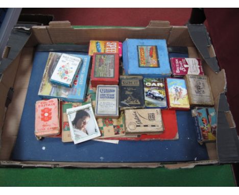
Lot 307
Cary (John). [New and Correct English Atlas: being a New Set of County Maps from actual surveys..., 1787], advertisement leaf, contents leaf, 46 engraved county maps, each dated September 1st 1787 (including map of South Britain, North Wales and South Wales), all hand-coloured in outline, folding table of directions for the junction of the roads, of England and Wales through all the counties, others for the Market borough towns, List of the Principal ports and sub port towns etc, all maps with central vertical fold, and hinged, bound in the form of a saddle atlas CONDITION REPORT: leather cover is in poor condition, interior pages are foxed and stained, some tears to the maps, in overall used condition


Lot 514
A group of items relating to Sir Kenneth Lewis DL MP, Member of Parliament for Rutland and Stamford 1959-83 at Stamford and Spalding 1983-87, including a vase etched with the House of Parliament and Rutland 1952-82, Rutland West, House of commons ash tray, and Cary's map of Rutlandshire 1787.


-
109182 item(s)/page