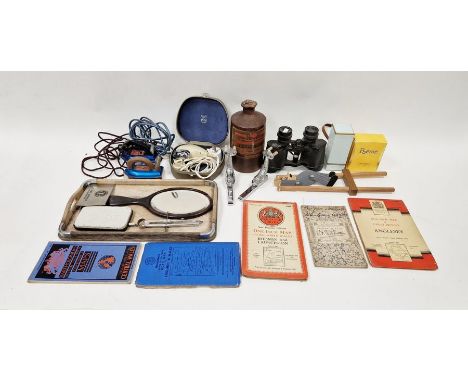
Edward Stanford: 'India and Adjacent Counties - Baroda', folding colour lithographic map, 1917, published under the direction of colonel S.G. Burrard, Surveyor General of India, sheets 41 and 46, covering roughly the area of the present day state of Gujarat, approx 57 x 91cm, folding into original covers, printed paper label to front cover
We found 108737 price guide item(s) matching your search
There are 108737 lots that match your search criteria. Subscribe now to get instant access to the full price guide service.
Click here to subscribe- List
- Grid
-
108737 item(s)/page
James Kingston Tuckey: 'Narrative Of An Expedition To Explore The Zaire River, Usually Called The Congo. In South Africa. In 1816; To Witch Is Added, The Journal Of Professor Smith; Some General Observations On The Country And Its Inhabitants; An Appendix: Containing The Natural History Of That Part Of The Kingdom Of Congo Through Which The Zaire Flows', London, John Murray, 1818, 1st edition, engraved folding map frontis (with a couple of neat tape repairs verso) + 13 engraved plates (of which 1 hand coloured depicting squid etc) as called for, 4to, lxxxii,498pp, "withdrawn" inkstamp verso title page, no other markings, contemporary marbled paper covered boards, recased modern half morocco, oxblood morocco gilt title label to spine. Tuckey sailed with the Royal Navy and explored various parts of Africa during his career, and searched for a connection between the Congo and Niger Rivers of western and central Africa aboard the schooner Congo in 1816. The crew was unsuccessful, struggling to navigate rapids and eventually dying of fever. Although the expedition failed it inspired interest by the British to continue African exploration. The accounts of the expedition gleaned from officer's reports, incomplete journals, etc., provided useful information on the natural history and inhabitants of the region.
(London), collection of 7 titles on London, including Rendle & Norman: 'The Inns of Old Southwark and Their Associations', London, Longmans, 1888, folding map (from Rocque's 1746 map) + 11 other full page plates and numerous ills. in text as called for, rebound half calf gilt; Philip Norman: 'London Vanished & Vanishing', L, A & C Black, 1905, limited edition de luxe, signed by Norman and numbered (128/225), 75 colour plates as called for, 4to, original cream cloth, lettered in gilt, top edge gilt; George Hennessy: 'Novum Repertorium Ecclesiasticum Parochiale Londinense, or London Diocesan Clergy Succession From the Earliest Time to the Year 1898', L, Swan Sonnenschein, 1898, 1st edition, fewer than 120 copies subscribed for, 4to, original black cloth gilt; Walter George Bell: 'Fleet Street in Seven Centuries', L, Pitman, 1912, 1st edition, 46 ills., rebound half calf gilt; John Diprose: 'Some Account of the Parish of Saint Clement Danes (Westminster) Past and Present', L, Diprose & Bateman, 1868, map frontis, orig. cloth gilt, rebacked retaining orig. backstrip; Walford: 'Greater London', Cassell, [nd], c. late 19th Century, 2 vols, uniform half calf gilt (worn); plus 1 other similar (8)
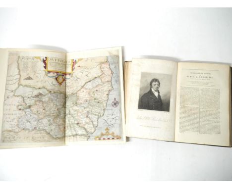
'Froggett's Survey of the Country Thirty Miles round London. 1831', engraved folding map, hand coloured in outline, dissected and backed onto linen, published London, I.W. Froggett, June 14th 1831, printed area approx size 109 x 135, folding into original cloth slipcase, printed paper label to cover
A Saxton/Kip engraved map of Suffolk, 1637, 'Suffolciae Comitatus', hand coloured, repaired top left, close trimmed to margins, bound together with the Suffolk text from 'Camden's Britannia', 1610 edition, pages 459-470, wooden boards, pen & ink title to front cover, bookplate of Richard Thurlow, Ipswich, to front pastedown; together with 'The History of Suffolk', [nd], circa 1814/15?, no title page, half title,[i]-108pp, bound together with 'The East Anglian Spectator', 1814, No.'s 1-3, 200pp, commencing with 'Biographical Memoir of Sir P.B.V. Broke, Bart. Captain in the Royal Navy -of Nacton Hall, Suffolk]', with engraved portrait frontis of Broke, old black cloth, later rebacked, contemporary printed paper label to spine (2)
Frederic Shoberl: 'The Beauties of England and Wales. Vol. XIV [Suffolk]', London, 1813, 413pp + [10]pp index, extra illustrated edition with 48 engraved plates, mainly full page, plus double page map of Suffolk, handsomely bound in half tan morocco gilt, spine gilt decorated in compartments, all edges gilt, marbled pastedowns/EP's, by Sotheran & co, Piccadilly
Eight Fenland and East Anglia interest titles, including Frederic John Gardiner: 'History of Wisbech and Neighbourhood...1848-1898', Wisbech, Gardiner & Co; London, Marlborough & Co, 1898, 24 leaves of plates/illustrations, including large folding map at end, as called for, original cloth gilt, top edge gilt; Miller & Skertchly: 'The Fenland Past and Present', Wisbech & London, 1878, a/f, inner joints split, leaves loose, lacking a few leaves, large folding map and majority of plates present, original cloth gilt; 'Kelly's Directory of Cambridgeshire 1937', large folding coloured map, original cloth gilt; T.J. Walker: 'The Depot for Prisoners of War at Norman Cross Huntingdonshire. 179to 1816', L, Constable, 1913, plates, original cloth gilt; plus 4 others (8)
A small collection of Norwich interest titles, including Edward Preston Willins: 'Quaint Old Norwich', 1884, limited edition (421/500), numbered, frontis + 50 plates as called for, folio, original full vellum (worn); plus Augustus Jessopp & M.R. James: 'The Life and Miracles of St. William of Norwich', Cambridge University Press, 1896, 1st edition, 5 plates + map as called for, original cloth gilt; plus Helen Caroline Colman: 'Jeremiah James Colman, A Memoir', 1905, privately printed at the Chiswick Press, frontis + 28 illustrations as called for, original cloth gilt; Robert Fitch: 'Views of the Gates of Norwich, Made in the Years 1792-3, by the late John Ninham, with an Historical Introduction...', Norwich, printed by Cundall Miller & Leavins, 1861, 22 plates as called for, 4to, original cloth gilt; 'Illustrated Record of the Great Flood, of August, 1912', Norwich, Roberts & Co, [1912], 16 illustrations from photos, 16pp, original printed wraps (VGC); plus 2 others similar (7)
(Cambridgeshire), Emanuel Bowen: An Accurate map of Cambridgeshire divided into its hundreds', engraved map, hand coloured in outline, published London, Robert Wilkinson, c.1750, engraved inset prospect of Ely, engraved vignette illustration of eel catching/hunting, approx 72 x 52cm, framed and glazed 91 x 70cm
Gareth Fuller (British b. 1980)Bristol, 2014Archival inkjet print on 310gsm fine art paperSigned and numbered 101/250 in pencilFramed and glazed92 x 92 cm (36 x 36 in)Fuller (born 1980) is a British artist known for his intricate drawings and map art of cities and places that he explores. He drafts impressionistic "mind maps" of places where he has lived. Fuller is the pen name of Gareth Fuller of London, England, who was previously known as Gareth Wood. Fuller, who says he has always enjoyed exploring and getting lost, observes contemporary culture and investigates urban existence through his art, while telling stories, provoking conversation and "celebrating the identity of places in all their glory". Fuller became an Irish Citizen in 2018.
Unusual Highly Collectable Lord of the Rings Presentation Map Showing Middle Earth. Gold Effect. Measures 31. 5 x 23. 5 inches overall. Good condition. All autographs come with a Certificate of Authenticity. We combine postage on multiple winning lots and can ship worldwide. UK postage from £5.99, EU from £7.99, Rest of World from £9.99
A collection of Channel Islands (Guernsey) postcards and ephemera etc, to include a RPPC "Vale Coronation Celebration, July. 1911; photographs of a Mill and Police headquarters; In Loving Memory cards, various Guernsey families, the earliest 1889; two-part 1938 Lancresse Bay map; bowling pin badges, together with various other souvenir photo cards etc, some Channel Islands, etc. (quantity)
Lawrence (T. E.), Seven Pillars Of Wisdom, a triumph, first trade edition, 1935, original gilt decorated tan cloth, monochrome illustrations and folding maps, 4to, spine faded, shaken, cracked hinge at title, light spotting; together with Lawrence (T.E.), Revolt in the Desert, 4th imp. March 1927, monochrome illustrations and folding map, 8vo, original buff cloth, cloth soiled, ep's toned, occasional spotting. (2) - Seven Pillars Of Wisdom: spine faded, shaken, cracked hinge at title, light spotting - Revolt in the Desert: cloth soiled, ep's toned, occasional spotting.
“Map of Kent with her Cities and Earles Described and Observed”,, John Speed, Kent county map with inset maps of Rochester and Canterbury, decorative strapwork cartouche, with seven armorials and Royal coat of arms with supporters to top edge, engraving with hand-colouring. On wove paper, a 19th century copy of the earlier map, framed behind glass, 16½ x 21¼in. (41.9 x 53.1cm.).. Time stained
AFTER JOHANNES BLAEU & TIMOTHY PONT "Glottiana - the upper ward of Cyds-dayi" black and white engraved map, later coloured. 40 cm x 54 cm together with AFTER W & J BLAEW "Herefordshire" black and white engraved map, later coloured with French text verso, 41.5 cm x 50 cm together with AFTER E HASTED "A map of the Hundreds of Stowing Street and Heane ... " black and white engraved map, later coloured, 46 cm x 38.5 cm and AFTER JOHN OGILBY "The road from Bristoll to Worcester" black and white engraved strip map, later coloured, 32 cm x 45 cm CONDITION REPORTS These are originals. Glottiana is framed and glazed. The others not - see images for further detail
Berresheim, Tim1975 HeinsbergTitel: "Haruspex - Early Bird". Datierung: 2022. Eigentümer: Tim Berresheim. Token ID: 1. Token Type: NFT, ERC-721. Blockchain: Ethereum. Tokenisiert durch: Time To Token. Smart Contract: 0x61150522381Da7f63EE9D6Df94d718907f989757. Royalties: 10 %. Media Storage: Arweave. Dateiformat: ZIP (auf USB-Stick). Dateigröße: 552,2 MB.+Physisches Kunstwerk:Titel: "Haruspex - Early Bird".Datierung: 2022.Technik: Baryt.Maße: 70 x 120cm.Bezeichnung: Verso auf Aufkleber signiert, datiert, betitelt und bezeichnet: STUDIOS NEW AMERIKA Haruspex. Early Bird. Baryt 2022 70 cm x 120 cm TB22/PH-880 W{|CC|RRR|+} Tim Berresheim - AACHEN.Rahmen/Sockel: Rahmen.Hybrides NFT (NFT + Print)"Haruspex - Early Bird" ist das Debut-NFT von Tim Berresheim.Erstmals erstellte er einen NFT mit der Berechtigung, dass die digitale Arbeit in der Zukunft als physischer Print gedruckt werden darf, sofern es die Technik zulässt. Zusätzlich zu dem NFT erhält der Sammler oder die Sammlerin bereits heute einen physischen Print zur digitalen Arbeit.Tim Berresheim untersucht in seinem künstlerischen Werk die Beziehung zwischen Kunst und Technologie und den Einfluss des drei- und mehrdimensionalen, illusionistischen Raums auf seine Kompositionen. Mit "Haruspex - Early Bird" präsentiert der Künstler ein komplexes Werk, das die Grenzen der Überführung des digitalen Renderings in die reale Welt aufbricht, indem es über zukünftige technologische Entwicklungen spekuliert. Sein "Haruspex" (Haruspex ist ein römischer Priester, der über Zeichen die Zukunft vorhersagt) liefert digitale Zusatzinformationen aus der digitalen Arbeit, die in Zukunft auch in die reale Welt überführt werden können. Als "Early Bird" macht Tim Berresheim somit seine digitale Arbeit schon jetzt für Sammler oder Sammlerinnen physisch zugänglich.Auch im digitalen Zeitalter stößt die Technik an die Grenzen des real Darstellbaren. Manches digitale Farbenspektrum ist heute schlichtweg noch nicht druckbar und macht es Künstlern und Künstlerinnen unmöglich, ihre digitale Kunst als gleichwertigen Print anzubieten. Mittels NFT hat Tim Berresheim einen Weg gefunden, seine digitale Arbeit bereits heute Sammlern oder Sammlerinnen als zukünftigen physischen Druck zu versprechen. Im NFT verbrieft der Künstler neben Informationen zu Belichtung und Farbe 13 weitere zu den Outputs von Depth Map, Albedo, Denoise Albedo Noisy, Diffuse Direct, Diffuse, ID, Indirect, N, P, Raycount, Specular Albedo, Specular Direct und Specular Indirect aus seiner digitalen Arbeit, die auf einem USB-Stick mitgeliefert werden. Sobald es die Technik erlaubt, kann sich der Sammler oder die Sammlerin die digitale Arbeit als gleichwertige physische Arbeit produzieren lassen. Um die technische Grenze, mit der sich Tim Berresheim in dieser Arbeit konfrontiert sah, auch für die Zukunft festzuhalten, bietet der Künstler schon heute einen Print an, der später neben den neuen, ausgereiften Druck seines digitalen Kunstwerks gestellt werden kann.Repräsentiert durch die SNA - Studios New Amerika GmbH.Bezahlung auch mit der Kryptowährung Ether (ETH) möglich.Neben unseren AGB gelten zudem die Sonderbedingungen für Versteigerungen von NFTs. Dieses Objekt wird regelbesteuert verkauft. (AGB §V5.1) Tim Berresheim Deutschland Digitale Kunst Zeitgenössische Kunst NFT Wahrsagung NFT Digitale Kunst ZukunftErläuterungen zum KatalogErläuterungen zum Katalog
[WORLD WAR II]: A printed softcover 8vo booklet containing over 100 maps of British towns and cities, published by the Army General Staff, Department of War Maps and Surveying, Berlin, 1940, the front cover marked as to be used only by members of the service and indicating that the maps were up-to-date as of 30th June 1940. Issued ahead of Germany's intended invasion of England in the autumn of 1940, the booklet features alphabetically ordered maps (some of them folding out) of various towns and cities including Aldershot, Bath, Birmingham, Blackpool, Bristol, Cardiff, Coventry, Derby, Ipswich, Leeds, Liverpool, Manchester, Nottingham, Portsmouth, Sheffield, Torquay, Truro, Wigan, Wolverhampton and York etc. Each map names various roads and streets as well as identifying rivers and other places of interest (sports grounds, railway stations etc.). London is not included. Some light overall age wear and minor staining to the grey and black printed cloth wrappers. About VG
LA CONDAMINE CHARLES MARIE DE: (1701-1774) French Explorer, Geographer and Mathematician. He measured the length of a degree latitude at the equator, spending ten years in Ecuador, and prepared the first map of the Amazon. Rare A.L.S., `La Condamine´, one page, 8vo, n.p., 11th December 1752, in French. La Condamine states `Je reçois dans le moment, Monsieur, par un courier du cabinet arrivant de berlin un paquet de M. de Maupertuis avec deux exemplaires de ses lettres dont un pour vous que j´ai l´honneur de vous envoyer´ (Translation: "I have received right now, Sir, by a courier of the cabinet, arriving from Berlin, a parcel from M. de Maupertuis containing two copies of his letters, one of them for you which I am honoured sending to you") La Condamine referring to Maupertuis, further states `Sa santé est un peu meilleure. Le roi est venu passer quelques heures à Berlin et lui a fait dire que son intention avait été d'aller le voir, mais que les affaires l'en avaient empêché… Vous aurez vu la lettre apologétique du roi qu'on imprime actuellement, ainsi que le tombeau de la Sorbonne…´ ("His health is a little better. The King came to spend a few hours in Berlin and told him that his intention had been to go and see him, but that work had prevented him from doing so... You will have seen the King's apologetic letter which is currently being printed, as well as that the tomb of the Sorbonne…") Tear to the bottom right edge, not affecting the text or the signature. Overall minor age wear, clipped right bottom corner and few small stains, otherwise G Pierre Louis Maupertuis(1698-1759) French Mathematician and Philosopher. Maupertuis was the first President of the Prussian Academy of Sciences at the invitation of Frederick the Great. He is credited with the invention of the "Principle of Least Action", and the Maupertuis´s principle, an integral equation that determines the path followed by a physical system, is named after him.
Eman. BowenAn Accurate Map of the County of Gloucester divided into Hundreds, drawn from the best authorities and illustrated with historical extracts...with a view of the Cathedral Church...'printed for R. Sayer and I. Ryall in Fleet St. T Kitchin on Holborn Hill etc., hand coloured, with creases in the centre of the map (probably where it has slipped in the mount), 50 x 42cm approx, framed and glazed
The Benny Hill Show - Thames Television - an original rehearsal script from 'Show 1' of The Benny Hill Show, recorded on 4th December 1987. Pink cover, with white pages. 58pp. Includes a map page and information on rehearsal and recording dates. This script belonged to supporting actor Bob Todd. Complete script.
NINETY SEVEN TITLES RELATING TO ANTIQUE INDIAN ARMS AND ARMOUR, ART AND HISTORY, comprising 'Indian Arms and Armour Vol. 1', G N Pant, 1978 with DW; 'The Adventures of Hamza', large V & A Exhibition book of 16th century illustrations, with DW (new condition, sealed); 'An Illustrated Handbook of Indian Arms', Hon. W Egerton, W H Allen 1880 (rebound); 'Catalogue of Urdu Books in the India Office Library 1800-1920', S Al-Din Quraishi, British Library 1991; 'Catalogue of the Collection of Indian Arms . . . now in the India Room at Marlborough House 1898', C Purdon Clarke 1898 (photocopy); 'Economic Products of India Exhibited at the Calcutta International Exhibition 1883-84', G Watt (reprint, soft covers); 'Sword of the Raj - the British Army in India', R Beaumont 1977 with DW; 'Palaces of the Raj', M Bence-Jones 1973 with DW; 'A Man of the Enlightenment in Eighteenth Century India - the Letters of Claude Martin 1766-1800', R Llewelyn-Jones (Ex. Public library); 'Indian Miniatures', M Bussagli 1969 with DW (Ex. Public library); 'Arts and Crafts in India', Cooper and Gillow 1996, soft covers; a large road map of India d.1940; and approx. eighty five assorted Islamic and Indian sale catalogues from Sotheby's, Christies and Bonhams 1976-2013. Average good condition (97).
Cunningham (C.D.) and Abney (Captain W. de W.) The Pioneers of the Alps, 4to, cloth, illus., 1887; Gos (Francois) (F.F. Roget trans.) Zermatt and Its Valley, 8vo, cloth, illus. with fold-out map and plates, nd; Zincke (F.B.) Swiss Allmends, 8vo, gilt cloth, 1874; and two other books on alpine climbing.
Otley (Jonathan) A Concise Description of the English Lanes and Adjacent Mountains, sml. 8vo, cloth, illus. with fold-out map, Keswick 1830; and Rowbotham (Thomas L.), Needham (J.), Keene (W.C.) and other Artists, Our Native Land: Its Scenery and Associations, 4to, quarter calf, illus. with 36 chromolithographs, 1879.
Kennedy-Fraser (Marjory) Songs of the Hebrides, 2 Vols, lge. 4to, boards, Boosey & Co., 1909; Kennedy-Fraser (Marjory) and MacLeod (Kenneth) From the Hebrides, lge. 4to, cloth, Glasgow, nd; Humble (B.H.) The Songs of Skye, sml. 8vo, boards, illus. with fold-out plates, Stirling, 1934; Lauder (Sir Thomas Dick) Scottish Rivers, 8vo, cloth, illus., Glasgow 1890; Brown (P. Hume) Scotland Before 1700 From Contemporary Documents, 8vo, cloth, illus. with fold-out map, Edinburgh 1893; and other books on Scottish subjects. (13)
-
108737 item(s)/page