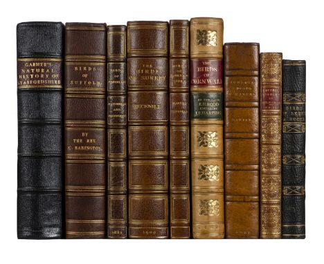
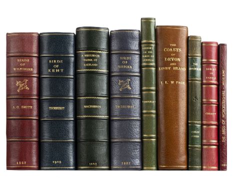
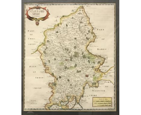
Kennedy (Alexander W. M. Clark). The Birds of Berkshire and Buckinghamshire, 1st edition, Eton: Ingalton and Drake, 1868, 4 hand-coloured albumen prints mounted on card, tissue-guards, half-title discarded, bookplate of George Oakley Fisher (1859-1933), collector, contemporary half morocco, 8vo (17.6 x 11.8 cm), together with: Garner (Robert), The Natural History of the County of Stafford [-Supplement to the Natural History of the County of Stafford], 2 parts in 1 volume, 1st edition, London: John Van Voorst, 1844-60, engraved frontispiece, etched plate, 7 lithographic plates, hand-coloured folding map, extra-illustrated with engraved plates mainly from The Beauties of England and Wales, half-title discarded, frontispiece spotted and offset, light spotting to other plates, short split to one fold of map, contemporary marbled boards, rebacked retaining original roan cornerpieces, 8vo (21.5 x 13.2 cm), Macpherson (Hugh Alexander, & William Duckworth), The Birds of Cumberland critically studied, including some Notes on the Birds of Westmorland, 1st edition, Carlisle: Chas. Thurnam & Sons, 1886, hand-coloured lithographic frontispiece by J. G. Keulemans, folding colour map, top edge gilt, contemporary dark green crushed half morocco gilt by Morrell, 8vo (21.5 x 13.4 cm), Bucknill (John A.), The Birds of Surrey, 1st edition, London: R. H. Porter, 1900, half-title, 6 photogravure plates, folding map, contemporary dark green crushed half morocco gilt by Morrell, 8vo (21.9 x 13.3 cm), Babington (Churchill), The Birds of Suffolk [caption-title], [?Bury St Edmunds, 1883-4], extracted from the Proceedings of the Suffolk Institute of Archaeology and Natural History, pp. 277-557, 7 halftone plates, lithographic map hand-coloured in outline, with descriptive text-leaf (unpaginated), interleaved throughout, ownership inscription, bookplate and annotations of Thomas Tindal Methold (1838-1902) of Hepworth Hall, Suffolk, contemporary half morocco, 8vo (21.6 x 13.6 cm), and 4 similar works, 19th-century county faunas or avifaunas, leather-bound, 8vo (Qty: 9)NOTESTHE DAVID WILSON LIBRARY OF NATURAL HISTORY PART I Gernsheim 436 (Kennedy); Mullens & Swann pp. 326 (Kennedy), 226 (Garner), 374 (Machperson), 105 (Bucknill), 33 (Babington). Kennedy's work was the first ornithology book to be illustrated with photographs.


![[Caledonian]. The Caledonian Musical Repository: a choice selection of esteemed Scottish songs, adapted for the voice, violin](https://cdn.globalauctionplatform.com/0450faa8-8d79-4719-b091-abb300cb473d/c08c06f1-b3ea-4a11-b60c-abb400fb4298/468x382.jpg)
![Crosthwaite (Peter). [Series of 7 maps of the Lake District, reprinted, London, 1800], comprising 6 engraved folding maps of](https://cdn.globalauctionplatform.com/0450faa8-8d79-4719-b091-abb300cb473d/091fd01e-e14d-4c76-b801-abb400fb4347/468x382.jpg)


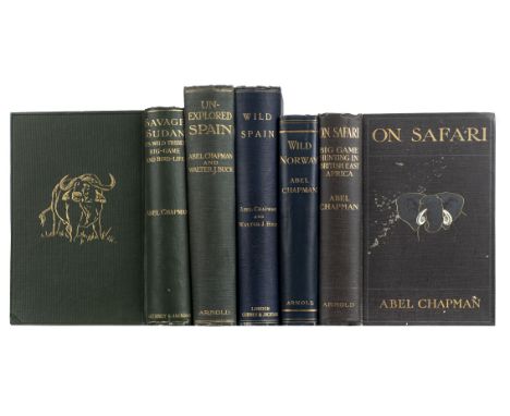
![Bates (Henry Walter). The Naturalist on the River Amazons [sic], a Record of Adventures, Habits of Animals, Sketches of Brazi](https://cdn.globalauctionplatform.com/0450faa8-8d79-4719-b091-abb300cb473d/6cc33b34-caa4-4158-ac55-abb400fb5e8a/468x382.jpg)
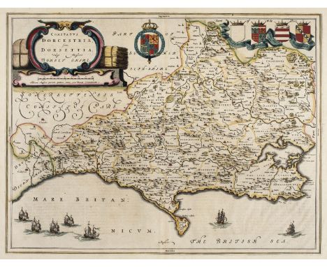
![Devon. Blaeu (Johannes), Devonia vulgo Devon-Shire, [1645 or later], engraved map with contemporary outline colouring, 395 x](https://cdn.globalauctionplatform.com/0450faa8-8d79-4719-b091-abb300cb473d/2d94178c-7c94-4aea-927e-abb400fa41ad/468x382.jpg)