We found 109198 price guide item(s) matching your search

Refine your search

Year

Filter by Price Range
  • List
  • Grid
  • 109198 item(s)
    /page

Lot 1029

( BOWYER, R) An Illustrated Record of Important Events in the Annals of Europe, during the last four years, comprising a series of views of the principal places ... (etc) 13 superb hand coloured aquatint inc. double page uncoloured map, full-page plate of facsimile signatures, original paper covered boards, with printed title-label on upper cover, lacks spine, large folio, printed by T. Bensley, 1816.

Lot 1033

COLLINS, Capt. Greenville - The Islands of Scilly - hand coloured sea chart, size of the actual map 560 x 440 mm, with - Toovey's " A True Description of the Setting of the Tides." The text framed below the map, 1693 (or later).

Lot 1036

CORNWALL- Curnbura Cive Cornwallie: hand coloured map by Jan Blaeu, 485 x 360 mm, f & g.

Lot 1037

CORNWALL... (Cornubia Cive Cornwallia), Jan Blaeu, hand coloured map, 51 x 40.5 cm, in an 'old' Hogarth frame, Latin text on verso, circa 1645, with Buck, S and N, South West view of Tremanton Castle, 37 x 18 cm in an 'old' Hogarth frame, 1734. (2).

Lot 1038

CORNWALL: hand coloured map by John Speed, size 490 x 360 mm, published by John Sudbury and G Humble, circa 1610, attractive f & g.

Lot 1041

DURHAM, Episcopatus Dunblmensis Vulgo Bishoprioke of Durham- hand coloured map by Jan Blaeu, attractively f&g, size 465 x 360 mm, circa 1645.

Lot 1044

GREENWOOD, C.J. Map of the County of Cornwall from an actual survey, made in the years 1826 and 1827, map with full wash colouring with inset of the Scilly Isles and St Michaels Mount, 685 x 600 mm.

Lot 1047

HELVETIA (Switzerland): uncoloured map after Mercator, 445 x 335 mm, Circa 17th Century.

Lot 1054

OGILBY, JOHN - The Continuation of the road from London to Barnstaple, hand coloured strip road map, 440 x 320 mm, c1675.

Lot 1059

SOMERSETSHIRE: hand coloured map by Robert Morden, 420 x 360, in Hogarth frame.

Lot 1060

TAYLOR, Alexander, New Map of Ireland, Showing the Great Features of the Country, described in a Manner highly expressive, and the Distances Between the Towns, Stages, Marked in Miles and Furlongs for the use of Travellers, large folding map, original hand colouring, folding into twenty-five sections, mounted on linen, date 1793, 73 x 32cm (no slip case)

Lot 671

MINIATURE - Pictures of English History in Miniature, Designed by Alfred Mills, 2 vols., engraved plates, lacking title page to volume two, Darton, Harvey & Darton. size 65 x 55 mm, 1815, With - Collins, Thomas, The Perfect Ready Reckoner, in Miniature, cont. sheep, Baldwin & Cradock, 1830, With - The Waistcoat Pocket Map of London New Omnibus Guide, hand coloured map, folding into cloth covers, with printed paper title label on the upper cover, size (when folded) 65 x 55 mm, 1871 (4).

Lot 836

SWIFT, Jonathan - Travels into Several Remote Nations of the World. 2 vols. Calf worn. Benj. Motte, London. 1727 *one map and one plate

Lot 855

HALL, Leut- Col, L.G.A, The Inland Water Transport of Mesopotania Wilfred Nunn, Tigerous Gun boats, original cloth frayed at the head of the spine, illust, 8vo, 1932, with Bacon's wall map of Mesopotania (3).

Lot 868

PLOWEDEN, Water Chichele Travels in Abysinnia and the Galla Country with an Account of a Mission to Ras Ali in 1848, folding maps, 8vo, rebound in half morocco, with Portal, Gerald H. My Mission to Abysinnia, frontispiece, folding map, light staining to first few pages, half morocco, with Lucas, Thos J, Camp Life and Sport in South Africa, Experiences of Cape Warfare with the Cape mounted rifles, four tinted lithograph plates, 8vo, half calf, publisher Chapman and Hall, 1878 (3).

Lot 878

WOOD, William T, Described by A.J. Mann, The Salonika, original cloth, forty plates, fold in map, 4to, A & C Black, 1920; together with eleven others in decorative cloth bindings.(12)

Lot 880

ASPINELL, Algernon E, The British West Indies Their History, Resources and Progress, one large coloured map, 8vo, original red cloth, 1812; together with six other travel books (7).

Lot 882

BEATTIE, William - Scotland Illustrated ... by T. Allom, W. H. Bartlett etc: 2 Vols. Map, 119 steel engraved plates. Cont. half calf a little scuffed in places but a good sound set. 4to. Virtue, 1838. (2)

Lot 885

BRANNON'S Graphic Delineations of the most prominent objects in The Isle of Wight. 30 steel engraved plates, oblong large 8vo, original blue cloth with map of the island in gilt on the upper cover, contents becoming loose, published by A. Brannon, Wootton, n.d.

Lot 894

COXE, William, An Historical Tour in Monmouthshire, illustrative of views by Sir R.C. Hoare, Bart, 2 vols, folding engraved county map by Nathaniel Folkland, full diced calf, worn on hinges, large 4to, printed through Cadell and Davies 1801. *with 93 additional plates bound in. (2).

Lot 897

GILPING, William, Observations on the River Wye, in several parts of South Wales, &c relative chiefly to the picturesque beauty made in the Summer of the year 1770, 14 tinted aquatint plates, 8vo, contemporary calf, 1782; with The Cambrian Traveller's Guide in every direction, containing remarks made in many excursions in the principality of Wales and bordering districts augmented by extracts from the best writers, 8vo, full gilt calf, printed for the editor Stourport, second edition, 1813; with Skrine, Henry, Two Successive Tours throughout the whole of Wales, with several of the adjacent English counties, fold in hand coloured map, paper covered boards, 8vo, 1812; with two others on Wales. (5).

Lot 902

IRELAND, W. H., England's Topographer, or a New and Complete History of the County of Kent, 4 volume set, folding map and plates, from original drawings by George Shepherd, H. Gastinaux & Etc, contemporary half calf, rubbed, n.d., Circa 1800, WITH another set lacking plates, sold with all faults, not subject to return (7).

Lot 903

JENKINS, Alexander - The History and Description of the City of Exeter, and its Environs, Ancient and Modern, eng. frontis, folding plan of Exeter, map, 2 plates, half calf, P. Hedgeland, Exeter, 1806.

Lot 904

KELLY'S Directory of Devonshire, folding map, original cloth, 4to, 1889; with Baring-Gould, Devonshire Characters, illustrated, original cloth in dust wrappers, 8vo, cheap edition, 1926.

Lot 905

LANDSCAPE ANNUALS : Roscoe, Thomas. The Tourist in France, illus. from drawings by J. D. Harding, original full green morocco, 8vo. 25 steel engraved plates, 1834 - with three copies of A Tourist in Italy, each with 25 plates and in fresh green morocco, 1833 [two copies], 1832. With - Bartlett, W. H. Footsteps of Our Lord and His Apostles in Syria, Greece and Italy, org. cloth, slight cracking to hinge, still a good bright copy, Map, 21 plates. 4to. 1851.* Apart from a couple of loose plates good fresh copies.(5)

Lot 908

POLWHELE, Richard, The History of Devonshire in Three Volumes, original cloth in dust wrapper, folio, publisher Kohler & Coombes, 1977. * originally published between 1793 and 1806, this facsimile edition contain the folding map and 23 full page plates, with two other books on Devon (5).

Lot 910

RENDELL, James, Memoirs of the Map of Hindoostan or the Mogul Empire with an introduction illustrated of the Geography and a map of the countries situated between the head of the Indus and the Caspian Sea, folding map and folding plan, full page plate, large 4to, original paper covered boards, lacking spine, printed by M. Brown 1788.

Lot 911

SALMON, N, The History of Hertfordshire; Describing the County and its Ancient Monuments particularly the Roman... etc, double page county map, folio, full calf, 1728.

Lot 923

STOCKDALE, F.W.L. Excursions in the County of Cornwall... illustrated with fifty engravings, including a map of the county, rebound in half morocco, tall octavo, large paper copy, 1824.

Lot 926

TVA SOMRAR I NORRA ISHAFVET, A.G. NATHORST, * fine copy, 2 vols, original gilt cloth, illustrated, large 8vo, Stockholm 1900; with Younghusband, Sir Francis, Kashmir described, 70 coloured plates by Major E Molyneux, large fold in map, Adam & Charles Black, 1909. (3)

Lot 930

(WEST, Thomas) - A Guide to the Lakes, in Cumberland, Westmorland, and Lancashire, eng. frontispiece a little ink stained, folding map, 8vo, Cont. speckled calf, 8vo, fourth edition, 1789. With - Combe, William - The Tour of Doctor Syntax, In Search of the Picturesque, 30 hand coloured aquatint plates. 8vo, full diced calf, third edition, Ackermann, 1813. With - Papworth, John - Poetical Sketches of Scarborough, Illustrated by Twenty-one Engravings of Humorous Subjects, hand coloured aquatint plates, tear to title without loss, 8vo, full diced calf lacking label, Ackermann, second, 1813, With - a used copy of the second edition of Doctor Syntax.(4)

Lot 935

WRIGHT G. N. & ALLEN, Thomas, - Lancashire, vol. 1 only, steel engraved plates, folding county map, decorative red cloth, worn on spine, 4to, n.d. circa 1830's, with Johnston, W. and A. K., The World - an Altas, containing 34 coloured maps, original decorative cloth, folio, n.d., circa 1900, with four odd volumes of Morris's Seats (6).

Lot 936

WRIGHT, G.N & BUCKINGHAM, L.F.A - Belgium The Rhine, Italy, Greece, and the Shores and Islands of the Mediterranean : IN 48 ORIGINAL PARTS, Engraved vignette title-page, full-page map, 192 steel engraved plates, org. printed wrappers, rear wrapper of part 35 creased and torn, 4to, c1840. * A scarce work, in the original 48 parts (A Lot).

Lot 941

BLACKWOOD, William, Palaentological map, folding hand-coloured map, linen-backed dissected into twelve sections, 600 x 510 mm, n.d., circa 1850.

Lot 999

TOZER, Edward J. F - The South Devon Hunt , folding map in pocket of the inside cover, org. cloth, Illust., stout lg. 8vo, ALS enclosed, published by the Author, Teignmouth, 1916, a fine copy of quite a scarce book - With three others.(4)

Lot 359

Two ecclesiastical books1- ECHARD, Laurence: A general Ecclesiastical History.. W. Bowyer, 1702, with a frontis Plus a folding map. Cont. full leather, rubbed and covers detached; 2- Birch, G H: London Churches of the xviith and xviiith Centuries. Batsford, 1896, folio, half leather, rubbed. (2)

Lot 360

A collection of ten bookscomprising ART, Etc: Knight, Charles (edit): The Arts and Industry of all Nations or Pictorial Gallery of Arts, in 2 volumes, with 50 steel engravings & 4000 wood engravings. JG Button, no date, c1860, supplied to subscribers only. 4to. Cont. half leather and marbled boards. VG; Royal Blue Book: Fashionable Directory, and Parliamentary Guide. Gardiner, 1848. PP: xx, 761, (iii), 120. Original gilt pictorial boards; TOMLINSON, C (Edit): Cyclopaedia of useful arts, 2 volumes. Virtue, nd, C1860. With 44 engraved plates (one folding). Cont. half leather, rubbed; tear to pages xii/xiii of the preface, with the loss of a few letters; PYNE, W. H (Edit): Etchings of Rustic Figures for the embellishment of Landscape. Ackermann, 1815. PP: 8 + 60 plates. 4to. Rebound in cloth backed boards with the original leather label to upper cover & new endpapers. Scattered spotting and a couple of small stains; Sampson, Henry: A history of advertising from the earliest times. 1875, with 14 plates. Recased with new endpapers; The Co-Operative Wholesale Societies Limited England and Scotland - Annual for 1889. With a Map & 166 plates; The Art Journal, Virtue, 1862. 4to. Cont. half leather, aeg; & The Studio, Volume 26, 1902, fully illustrated. Half leather. (10)From the Paul Bentley collection of maps and atlases.

Lot 363

A map of LondonLONDON Map: STOKE, John: A Map of the Country Sixty-Five Miles Round London; from Actual Surveys, by John Andrews & Andrew Dury, in four sheets: NE, NW, SE, & SW, 1777. Each measuring 136 x 119 cm. Hand coloured, linen backed and folding, with a contemporary marbled slipcase (rubbed). Rare MapFrom the Paul Bentley collection of maps and atlases.

Lot 376

A group of prints and mapsincluding: Engraved plate of St. Pauls, North elevation, George Gladwin, 1826 (70 x 49 cm), rolled; The South East prospect of St. Michael’s Mount, Cornwall. May 24, 1739 (81 X 18 cm), rolled; Ordnance Survey Map of Hampstead, 1873. Three sheets joined together (106 X 67 cm); City & county of the city of Canterbury, surveyed in 1873 by W Wynne. Coloured, linen backed, folded in the middle and rolled (106 X 71 cm); Hollars' views of London for 1647, sheets 2-6. Lithograph Soc. 1907. Rolled; & Rhinebeck’ Panorama of London, London Topographical Soc. Pub. No. 125, 1981, rolled. KAY NIELSEN: Ten tipped-in colour plates, each with the description paper guard; Plus one colour plate by Jessie M King; Eight colour plates, including two by Rowlandson; Plus a colour lithograph: The British Bee Hive- a penny political picture for the people, 1867; Plus: Sixteen other engraved plates. (qty.)From the Paul Bentley collection of maps and atlases.

Lot 395

A group of four maps of Essexcomprising Emanuel Bowen: An Accurate map of the County of Essex, Divided into its Hundreds. Dedicated to Benjamin Mildmay Earl Fitzwalter. C1767; Plus Three other Essex Maps, 2 hand coloured. All mounted, framed & glazedthe largest 40.5 x 50cmthe smallest 12 x 8.5cm. (4)

Lot 152

Sundry lot including map, various board games, travel games, playing cards etc All in used condition, unchecked

Lot 1189

and some other items. All Dutch language, mostly 1930s but also incl. earlier publications. (1) In de duinpan. Tweede druk. Koog aan de Zaan, Noord-Hollandse Propaganda-Commissie van de Algemene Nederlandse Geheel-Onthouders Bond, n.d. (ca. 1935), 12 p., 4 ills., orig. stapled (sl. foxed/ browned) pictorial wr. Extremely rare sm. publication, w. amazing front wr. design. (2) Nederlanders in Spanje. Geronseld? Amst., Agentschap Amstel, n.d. (ca. 1937), 16 p., orig. wr. (w. folds). (3) Fascisme of socialisme. Wat eischt het gemeenschapsbelang? Feiten ter overdenking. N.pl., Ned. Vereeniging van Spoor- en Tramwegpersoneel, n.d. (ca. 1938), 16 p., orig. stapled woodcut wr., obl. 8vo. Final page: "Uw antwoord? N.V.V. (and) S.D.A.P. Geen fascisme maar Socialisme!" (4-5) Een heilige ontevredenheid. By T.T. de W. Van breken en bouwen. By S.H. v. G. Amst., Bond van den Soc. Dem. Vrouwenclubs, n.d. (ca. 1931-33), 2 vols., 16 and 8 p. (incl. wr.), orig. stapled wr. w. lithogr. ills. by A. Funke Küpper. Very rare. (6) Van een belangwekkend bedrijf. Hoe het werkt en groeit. Amst., De Arbeiderspers, 1932, (16) p., printed in black, blue and yellow, w. map and ills., orig. thread-bound wr. Very nicely designed publication on de Arbeiderspers. (7) Viruly, A. Ons land en het geweld. Amst., Contact, 1938, 30 p., orig. wr. printed in blue and orange des. by Brögel. (8) Kamerverkiezing 1933. Stemt op de S.D.A.P. Het wonder-biljet zorgt dat het zoo wordt: stemt rood! Movable board propaganda card, 9 x 8.3 cm, w. turnable circular disk behind a square, printed in red and black, in envelope w. the printed text "Op 't drukwerk in dit zakje staat voor U een hééle goede raad". Extremely rare. -and approx. 59 others. (total approx. 65)

Lot 1199

16 augustus te Amersfoort Landdag voor de vrede en voor de erkenning van de Sowjet-Unie. Amst., V.V.S.U. (Veren. van Vrienden van de Sowjet-Unie), n.d. (1936), (16) p., photogr. and other ills., map, plan and score, orig. photomonotage wr. by K. Vanek (=H. Leupold), 4to. Stained copy, wr. sl. wrinkled and lacking staples. Very rare publication w. impressive wrappers. (2) Struik, A. Het vijfjarenplan als socialistisch offensief. Amst., "Agentschap Amstel", 1931, 32 p., photogr. ills., orig. stapled photomontage wr. signed "montage ar.fot 1" (N. de Haas). Wr. splitting at foot of spine. (3) Idem (introd.). Triomf van het socialisme. De weg tot de klassenlooze maatschappij. Het tweede vijfjarenplan van de Sowjet-Unie. Ibid., idem, (1932), 32 p., w. ills., orig. stapled photomontage wr. w. "(ar)fot 2" (C. Oorthuys) in lower right corner. -and 2 similar others, one w. wr. signed "Brögel". (total 5)

Lot 1201

van den Nederlandschen Bond van Jongelingsvereenigingen op Gereformeerden Grondslag, op woensdag 29 mei (...) en op Hemelvaartsdag 30 mei 1935. Rott., T. de Vries Dz. for gereformeerde Jongelingsbond, 1935, 40 p., w. double-p. map, photogr. ills., orig. stapled photomontage wr. by W. Brandenburg (signed in the technique), large 8vo. Front wr. w. central crease and foxed in top margin, spine rubbed. (2) Nathans, N. Spanje. Amst., N.V. de Arbeiderspers, 1936, 16 p., orig. stapled photomontage wr., large 8vo. S. Imperfections. Very rare. (3) Zwartbroek, G.J. S.O.S. VARA! Verdedigingsrede uitgesproken op de vergadering van den verenigingsraad van de VARA op 28 April '34 tegen zijn royement als VARA-lid. N.pl., n.publ., 1934, 30,(1) p., orig. stapled photomontage wr., large 8vo. -and 3 others w. nice photomontage wr. (1x monogrammed "GP" and 1x monogrammed "W"), publ. by the Arbeiders Jeugd Centrale. (total 6)

Lot 1337

(1) De haven van Amsterdam. Fold. flyer printed in blue, red and black, unfolded measuring 23.5 x 75 cm, ca. 1930, one side showing a map, the other side w. maps, photogr. and text, des. by Cohen, monogrammed multiple times. Sm. tear on fold. Striking design by Cohen. (2) The same fold. flyer but w. the text in French and the monogram of Cohen only appearing once. (3) Amsterdam. All-round port for general and bulk cargo. Centre of international air-traffic. Fold. flyer printed in blue, black and red, unfolded measuring 21.5 x 90 cm, printed by Stadsdrukkerij Amsterdam, ca. 1930, one side w. general explanatory text in Dutch, French, German and English and photogr. ills., the other side w. maps, statistics and ill., des. by Cohen, signed "Fré Cohen Fec." Some tears on folds and sm. dam. spots. (4) Le port maritime et le port aérien d'Amsterdam. Amst., imprimerie Municipale for the Municipalité, (1930), 28 p., photogr. ills., col. ills. and orig. stapled photomontage wr. printed in blue, red and black des. by Cohen (monogrammed on front wr.). -and 1 smaller flyer des. by the same. (total 5)

Lot 1348

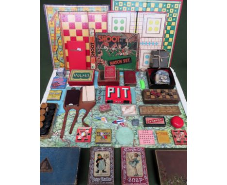
Comprises 17 picture postcards, 15 cut out advertisements, var. numbers of the periodicals Wereldpost (3x, 1923), Succes and Auto-Kampioen (11x), menu cards, programmes, travel brochures, etc. Incl. a.o.: (1-11) Auto-Kampioen. Weekblad voor auto- motor- en luchtoerisme. Uitgave van den Kon. Ned. Toeristenbond A.N.W.B. Year 29, nr. 46, year 30, nr. 8, 12, 24, 32, 33, 50 and 52, year 31, nr. 21 and 47, and year 32, nr. 4 (numbers 1509, 1523, 1527, 1539, 1547, 1548, 1565, 1567, 1588, 1614 and 1623). The Hague, 16 Nov. 1935 - 22 Jan. 1938, w. continuous pagination, num. ills. and advertisements, orig. wr. by Lavies (a.o.?), some signed by Lavies in the technique. Sm. defects. Good run. (12) N.V. Nederlandsche Huistelefoon Mij. 's-Gravenhage. Trade catalogue, ca. 1935, (8) p. (incl. wr.), w. 5 ills., orig. stapled wr. des. by Lavies. Perforated, vague vertical fold throughout. (13) Individueele Risico Onderlinge Ongevallen (I.R.O.), The Hague. 13 het ongeluks-getal! Fold. flyer, unfolded measuring 16.7 x 36.4 cm, ca. 1935, des. by Lavies. (14) Zestien 12 daagsche rondreizen. Noorwegen. Det Bergenske Dampskibsselskab- Bergen. Travel brochure, ca. 1935, (6) p. (incl. inside wr.), orig. stapled wr. des. by Lavies. (15) Kompas van Nederland. The Hague, Kompas, n.d. (ca. 1935), atlas w. fold. map of the Netherlands, followed by 11 fold. maps of the provinces, orig. boards des. by Lavies, narrow large 8vo. -and approx. 55 others. A few duplicates. (total approx. 70)

Lot 1353

Text by H.R. Schmid. Dutch adaptation by F.K.A. Rombach. N.pl., n.publ., n.d. (ca. 1935), 64 p., fold. map, num. photogr. ills., orig. stapled photomontage wr. printed in blue, red and black des. by Matter (back wr. signed in the technique). Sm. imperfections. (2) Idem. The same guide, but a variant ed., w. the image of the signed back wr. printed in black only and different image on front wr. (3) Idem. Zwitserland in wintertooi. Zurich, Zwitsersche Verkeerscentrale, n.d. (ca. 1939), (12) p., double-p. map, 4 isotype double-p. tables and photogr. ills., orig. stapled photomontage wr. printed in red and black des. by Matter, front wr. signed in the technique. (4) Aeschbach H. (1911-99). Angelsport in der Schweiz. Printed in Luzern by Buchdruckerei Keller for Scweizerische Verkehrszentrale, n.d. (ca. 1939), 32 p., fold. double-p. map, 13 double-p. isotype tables, orig. stapled photomontage wr. by Aeschbach (back wr. signed in the technique). Sm. imperfections. -and 7 others from the same series, w. unsigned wr. but probably (partly) by Matter or Aeschbach: Heilbäder der Schweiz (Aeschbach mentioned among the photographers), Sport in der Schweiz, Schweizer Bergfibel, Im Auto durch die Schweiz, Ferienland Schweiz, Lente in Zwittserland and Zwitserland - Vacantieland (stamp on front wr.). (total 11)

Lot 1521

for var. countries incl. France, India, USSR, Greece, Egypt, Netherlands, Israel/ Palestine and Switzerland. Early to mid. 20th cent. Incl. a.o.: (1) Three sm. envelopes, "Souvenir of the Holy Land", each w. 10 or 12 sm. photogr. of Jersusalem, Tiberias and Samaria-Galilee. (2) A series of 6 brochures from the Chemins de Fer Paris-Lyon-Méditerranée, steps 1-6. Each folds out into a map and highlights a different city/ area on the trip. (3) Two on French Indochina. (4) Four on var. locations in the USSR, incl. Moscow. (5) Five sm. booklets w. photogr. of Egypt. (6) One about the Sahara Desert des. by H. Villain. (total approx. 50)

Lot 1545

Mostly Dutch, but also incl. a few (pro) German items, ca. 1938-45. A varied collection, also including a number of items produced just after the war. A number of items have a caricatural nature, the collection also includes some modern reference works on this kind of art produced during the war. Incl. a.o.: (1) "Zeer geachte heer Schreuder. Indien mogelijk zouden wij het zeer op prijs stellen indien de kinderen nog even aan de schoolvoeding konden deelnemen, daar wij in het geheel geen aardappelen hebben [signed]." Short letter in pen, dated 16-5-1945. (2) "Geachte heer, gaarne zou ik zien, dat één of meer van mijne kinderen in de komende tijd aan de warme schoolvoeding zouden kunnen deelnemen [signed]. Short letter in pen, dated Amsterdam, 14 mei 1945. (3) "Oorlogswinter 1944-1945." Large fold. plate after L. Visser, the sheet measuring 49.5 x 65.5 cm, publ. by Vondel in Amst., (1945). Caricature showing the difference between fat Germans and starving Dutch people. (4) English language folded silk soldier's map of France, no date. (5-6) Two variants of the game "zoek het 5de zwijn/ where is the 5th pig"; when folded correctly, creates a portrait of Hitler. (7) Passierschein. Der deutsche Soldat, der diesen Passierschein vorzeigt, benutzt ihn als Zeichen seines ehrlichen Willens, sich zu ergeben. Safe conduct. The German soldier who carries this safe conduct is using it as a sign of his genuine wish to give himself up. Sm. folded leaf printed on both sides, w. the printed signature of Dwight D. Eisenhower. Sm. defects. (8) Tentoonstelling van fotografische opnamen van Duitse concentratiekampen en verwoest Arnhem. N.pl., n.publ., n.d. (1945), 32 p., orig. stapled wr. A shocking documentary series of photographs. (9) Hoef, A. v.d. Mijn kamp. Gedichten uit het Concentratiekamp, Amersfoort. Groningen, Werkman, (1945), 32 p., orig. stapled wr. (10) 22 sm. photographs, 8 showing the destruction after the bombing of Rotterdam, 14 Mai 1940. Some duplicates. (total approx. 220 in 1 box)

Lot 1608

Mostly consisting of richly ill. periodicals in var. languages, but also incl. tourist guides, propaganda booklets, etc. Comprises a.o.: (1) U.S.S.R. im Bau/ In Construction, 11 numbers 1931-49 (incl. numbers 2-4, 5, and 7-10 of year 1949). (2) Sowjetunion. Nr. 3, 6 (52), 95, 99-102, 104, 105 and 11 (404), 10 numbers 1950-83. -and 3 numbers of the French edition. (3) 1961. De USSR. Propaganda booklet, n.pl., n.publ., n.d., 48 p., finely designed w. num. ills. incl. photomontages and isotypes. (4) Leningrad town views. State Fine Arts Publishing House, Moscow, 1963, no pagination, text in English and Russian, richly ill., orig. cloth-backed boards w. (sl. torn) dust wr., obl. large 8vo. (5) UdSSR. Abteinung der UdSSR auf der Weltausstellung in Brussel, 1958. Fold. flyer, unfolded measuring 57.5 x 44.5 cm, w. map and ills. Sl. imperfections. (total approx. 40)

Lot 1630

1933-1983 (for the 50th anniversary of the company). Paris, Raffy, 1983. 60 x 95 cm. (2) Massé, J. Air France world map. Paris, Perceval, ca. 1970. 146 x 84 cm. -and 3 others, incl. a reprint of Mitschké's 34 avions d'Air France poster. Edges sl. worn, world map w. sm. pinholes in corners, not affecting image. (total 5)

Lot 1848

19th-20th cent. Comprises a.o.: (1) Natives. Their homes and customs (South Africa). N.pl., n.publ., n.d. (ca. 1900), 16 photogr. plates, orig. wr., obl. 8vo. Front wr. loose. Very rare photo album on the Zulus. (2) Van Nelle's Koffie. Van Nelle kwaliteit. Sm. poster, 26 x 19 cm, des. by Reclamebureu Publi, (1957). (3) Sudan. Sudan Railways. Itineraries of inclusive return tours. Summary of main services from 1st November, 1937. Fold. leporello printed on both sides, 14 p., w. photogr. ills. and a map, 8vo. (4) Odd Hølaas: Ook ik ben Amerika. Prospectus, Utrecht, Erven J. Bijleveld, (1938), bifolium w. photomontage front cover. (5) Een lustrum-pakket! 2 Romans voor 1 maal f 1.40! 2 Romans in 1 pakket! Advertorial booklet for the Nobel-Reeks (Nijkerk, Callenbach), 1939, 8 p., w. ills. and photomontage front cover, orig. stapled wr. Duplicates. (total approx. 100 in 2 binders)

Lot 238

Ca. 1944. Hand dec. cardboard portfolio w. 3 loosely inserted pamphlets (for different regions of the Netherlands) of color-coded manuscript train schedules, each pamphlet w. (fold.) map(s) and schedules. Portfolio 28.5 x 15 cm. Covers sl. stained, some browning. Incredibly detailed and beautifully crafted manuscript train schedule.

Lot 281

Even als de zelve in het H. Schrift bevonden worden met nutte en wyd-loopige Aenmerkingen verrykt ende opgeluystert door twee-honderd uytmuntende Print-verbeldingen zeer konstiglyk in 't Koper gesneden door Joannes; Philippus, en Theodorus Gallée. Antwerp, C.M. Spanoghe, 1783. 1 (of 2) vols. (8),XXIV,284,(12) p. Richly ill. w. engr. frontisp. (sm. tear), 170 full-p. engr. plates and 6 p. w. 4 sm. engr., numb. 1-24, mainly after M. de Vos and M. Heemskerck. Contemp. (worn) marbled calf (front cover almost detached), gilt title and dec. on ribbed spine. 4to. Lacking large fold. engr. map of the Holy Land, 6 plates (normally, the work lacks more plates). Rare, almost complete, Antwerp Print bible.

Lot 3

behelzende in het kort voor de jeugd alle de voornaamst merkwaardigheden onzes Vaderlands (...) met platen. Dordrecht, Blussé en van Braam, 1830. xxxvi,311 p. Incl. fold. handcol. map. Paper binding on spine worn. Added: Muller, J.F.L. Alphabetisch Letterkransje. Amst., D. Noothoven van Goor, ca. 1850. Fine copy on thick paper. -and 4 more 19th cent. Dutch alphabet books. (total 6)

Lot 321

der Zeven Vereenigde Provincien. In 't Nederduits overgeset d. H. v. R(ijn). Leiden, D. Haak, S. Luchtmans & J.A. Langerak, 1726. 6 vols. 1 large fold. engr. map of Zeeland (repaired tear), 6 fold. bird's eye plans of cities in Zeeland, 1 bird's eye view of Utrecht, 28 (fold.) views/ plates (2 extra), 24 (mostly fold.) portraits (1 w. 2 sm. tears, sl. affecting image), num. in-text ills., portraits and coats of arms. Unif. contemp. vellum w. blindst. centerpiece, manuscript title on ribbed spine. Folio. 1 vol. w. library ticket on spine. Some stains/ defects on covers, a few parts very browned/ foxed. (total 6)

Lot 330

Leiden, F. Hackes & P. Leffen, 1658. (16),317,(11) p. (addendum of 4 p. added after p. 14) engr. title-p. vignette (coat of arms of the city), later imitation leather, 4to. (2) Leiden. Leiden, Gebrs. Snel, n.d. (ca. 1910). Leporello, w. 12 photogr. in sepia, orig. dec. cloth, 8vo. Most leaves loose. (3) Vries, J.H. de. Uitbreiding van Leiden's grondgebied. Leiden, A.H. Adriani, 1889. 18 p. orig. paper wr. (4) Leiden en Omstreken, Gids voor vreemdelingen bij een bezoek aan de stad en hare omgeving. Leiden, L. van Nifterik, n.d. (ca. 1910). Orig. printed paper wr. w. map on back, w. fold. city plan and fold. table. Stamp on wr. and sl. soiled. All in good condition (total 4)

Lot 338

(1) Historische, geographische, Konst- en- reis Almanach voor den Jaare 1770 (...). Amst., Steven van Esveldt. Engr. title-p., fold. map of the Middle East handcol. in outline, 12 engr. plates for the months. Later speckled paper wr. Provenance written on upper flyleaf. Good copy. (2) Almanak, van vernuft en smaak voor het jaar MDCCXCVIII/ MDCCCI. Ibid., Wed. J. Doll. Contemp. (worn) gilt calf. Provenance written on upper flylvs. Upper covers detached. (3) Three Enkhuizer Almanaks, 1827/ 1835/ 1845. All w. title-p. woodcuts, sm. woodcuts for the months. (Worn) wrs. (4) Two Nederlandsche Muzen-Almanaks, 1832/ 1837. Both w. engr. frontisp. portraits and engr. title-p. 1 w. upper cover detached. -and 2 others. All w. signs of wear. (total 10)

Lot 417

Plan in poster format (92 x 79 cm map image). Poly-coloured lithogr. on paper (99 x 84 cm). Amst., J. Vlieger, ca. 1920. Folded, but well-preserved.

Lot 435

Col. copper engr., 24 x 30 cm, by T. Doesburgh, an apprentice of R. de Hooghe. This view was originally used as one of the panels on the sides of the wall map: "Nieuwe kaert van den lande van Utrecht" by N. Visscher, 1696. Third state, 1799. Rare.

Loading...Loading...
  • 109198 item(s)
    /page

Recently Viewed Lots