We found 109182 price guide item(s) matching your search

Refine your search

Year

Filter by Price Range
  • List
  • Grid
  • 109182 item(s)
    /page

Lot 457

Robert K Browning Collection of County Golf Course Handbooks et al (5) to incl Golf in Devon (Series no. 6) covers worn; Golf in Hants and Dorset (Series no.10); 2x Golf in Surrey (Series no. 20) incl Revised 5th ed, and Chipstead Golf Club Golf 'Golf in Surrey' folding map of all the courses (5) Note: From The Estate of The Late David Easby

Lot 865

1984 Ltd Ed 'The Book Of St Andrews Links' with slipcase #193/200 signed by Stewart Larson, produced in 1984, this book includes the topic titles of 'Plan of Golf Courses,' 'Descriptions of the Greens,' 'Rules of the Game,' 'Bye-Laws of the Links,' 'Regulations for Starting,' and 'Golfing Rhymes' - protected by a slipcase, this book is limited edition numbered 63 of 200. It is the 'Facsimile Edition' and in very good condition. The all leather and gilt boards book is complete with a foldout course map and advice on how to play each hole. It is signed in fine point blue sharpie by J Stewart Lawson, who was the club captain in 1979-1980

Lot 34

A QUANTITY OF ASSORTED TOYS AND GAMES, to include boxed Playcraft Toys 'Honky Tonk' 12 note upright piano, No.N16, boxed Saxon Tower plastic 'The Diver' toy, set of 36 No. Victorian/Edwardian six sided wooden pictures blocks all contained a vintage Marmite shipping box, boxed Progress Gyroscope Top with Blackpool Tower stand, assorted boxed vintage puzzles and games, boxed Kay Peep-Scope featuring Buck Ryan of the Daily Mirror, complete with viewer and four films, empty box for Meccano set No.2 containing assorted plan books, wooden book/flower press, small quantity of boxed modern Corgi diecast vehicles, includes one empty box, South Staffordshire Regt. press photograph, 1937 Coronation Souvenir medal, WWII Identity Card, The Tornado Stamp Album (WWII era) and contents, 1960's road map etc., Piano and diecast in fairly good condition with only minor wear, all other items in playworn condition with loss and wear, contents of sets not checked, boxes damaged

Lot 124

TWO FRAMED PRINTS TO INCLUDE THE HOWARD VINCENT MAP OF THE BRITISH EMPIRE, 1924, TWENTY-FIRST EDITION

Lot 2022

AN ETCHED MANCHESTER UNITED MIRROR, A MAP OF CHESHIRE AND A TOY BOX

Lot 2205

A FRAMED ETTCHED MAP OF CORNWALL AND A CLOCK

Lot 42

A VINTAGE JOHN OGILVY MAP - LONDON TO HOLYHEAD, FRAMED

Lot 476

OVER THIRTY BOOKS OF STAMPS TO IONCLUDE 2/-, 1d, 4d, 3d ETC AND A POSTAL HISTORY MAP OF BRITIAN

Lot 88

A VINTAGE ROBERT MORDEN MAP - THE COUNTY PALATINE OF LANCASTER, FRAMED

Lot 537

ANTIQUE HAND COLOURED BOUNDARY MAP OF TIVERTON BOROUGH. WITH KEY INCLUDING PARISHES AND TOWNSHIPS WITH PROPOSED BOUNDARIES. DRAWN BY LT ROBERT K. DAWSON RE [1798-1861] AND BEARING HIS SIGNATURE, 17” X 13”

Lot 558

HAND COLOURED ANTIQUE ROAD MAP, C1700, THE ROAD FROM HUNTINGDON TO IPSWICH 10” X 8”

Lot 149

A Kelly's Directory of Lincolnshire, with map, 1926, together with a directory of Lincoln and Neighbourhood 1967. (2)

Lot 44

Eleigh on Sea - Sponsor: Countrywide South East Ltd Artist: Esme Taylor Eleigh on sea was inspired by The Blue Tit swimmers in Leigh-on-Sea, who swim in the cold sea every season. Eleigh wears a vintage flowery swim hat and polka dot swimsuit. Her body is covered with a map of the sea and landmarks along the seafront from Leigh-on-Sea to Shoeburyness.

Lot 30

Elle the Explorer - Sponsor: IPECO Artist: Phillippa & Rachael Corcutt Set sail on a wonderful adventure with this fun, nautical design. This adventurous elephant wears a pirate hat, map and compass, eyepatch and has a trusty seagull and crab friend. This design is inspired by Southend’s connections to the sea, maritime history and the wonders of travel and discovery and is sure to encourage budding adventurers to discover the coastline.

Lot 163

Meyer (Johann Heinrich) Der Rigiberg in Zeichnungen nach der Natur, engraved title with oval sepia-printed aquatint vignette, sepia-printed aquatint head-piece, parallel text in German and French, engraved map in outline hand-colouring, 4 hand-coloured aquatint plates making up a larger panorama, 4 engraved key plates to the panorama on 2 sheets, 9 smaller hand-coloured aquatint plates on 8 sheets, some foxing (hand-coloured plates largely unaffected), contemporary green half morocco over marbled boards, a little rubbed, [Bobins 1698], folio, Zurich, Fuessli, 1807.⁂ A rare and impressive work on the Rigi mountain and surrounding area. The plates were engraved after drawings by Johann Heinrich Fuessli and Heinrich Keller.

Lot 100

Ferrario (Giulio) Descrizione della Palestina o Storia del Vangelo, 30 fine hand-coloured aquatint plates, folding engraved map with outline hand-colouring, hand-coloured engraved plan and one uncoloured engraved plate, tissue guards, contemporary morocco, elaborately stamped in gilt and blind, uncut, head of spine damaged but repairable, [Bobins 1708; Rohricht 1757; Tobler p.217], 8vo, Milan, 1831.

Lot 48

Breton (Lt. William Henry) Scandinavian Sketches, or a Tour in Norway, first edition, half-title, lithographed frontispiece, vignette title and 16 plates, 5 hand-coloured of costumes, the rest on india paper and mounted, one double-page, folding lithographed map at end, some very light offsetting but overall a lovely clean copy, engraved bookplate of the art collector and benefactor John Sheepshanks, modern bookplate of Robert J.Hayhurst, later speckled calf, gilt, by Rivière, neatly rebacked preserving old gilt spine, [Abbey, Travel 255; Bobins 1679], 8vo, [1835].

Lot 146

Keller (Henry) Panoramic View of Switzerland from Mont Righi, fine hand-coloured aquatint panorama by John Clark after Henry Keller, on 3 conjoined sheets and folding concertina-style, c.270 x 1940 mm., some very light offsetting and one or two small stains, tear to one fold, publisher's advertisement mounted on front pastedown, folding into original cloth folder with large decorative paper label to upper cover, a little rubbed and soiled, lacking ties, Leigh and Son, [c.1830] with A Companion to Keller's Panorama of Switzerland..., double-page hand-coloured aquatint circular panorama (small tear to fold at head), hand-coloured engraved map, original yellow wrappers with engraved label with hand-coloured aquatint vignette to upper cover, 8vo, Samuel Leigh, together 2 vol., companion booklet loosely inserted in panorama folder, [Abbey, Life 522; Bobins 1307], 4to

Lot 136

Huber (Caspar) Album von St. Moritz in Oberengadin Ct. Graubunden, 2 hand-coloured vignette aquatint titles (one bound before text leaves at end and within hand-coloured decorative border), 12 fine hand-coloured aquatint plates, each mounted and with gold printed border and captions, further plate with 3 hand-coloured engraved vignettes, lithograph map, titles and vignette plate foxed, first plate with mount quite extensively browned, other plates generally very clean, new endpapers, original red cloth, gilt, rebacked and corners repaired, [Bobins 1692], oblong folio, Zurich, Henri Fuessli, [c.1860].⁂ Superb views including St. Moritz (3), Samaden (2), Pontresina, Bernina (2) and Sils.

Lot 118

Hacquet (Balthasar) Neueste physikalisch-politische Reisen...durch Dacischen und Sarmatischen oder Nordlichen Karpathen, parts 1 and 2 only (of 4), first edition, engraved frontispiece, engraved map vignettes to titles, engraved vignette illustrations, 13 hand-coloured engraved plates, one folding, foxing, later half vellum over white glazed boards, spines gilt with quadruple orange labels, [Bobins 1433], 8vo, Nurnberg, im Verlag der Raspischen Buchhandlung, 1790-91.⁂ Rare work on the Carpathian mountains, covering geology, mineralogy, palaeontology, botany and peoples of the area. Most of the plates in these 2 parts show local costumes. Hacquet (c. 1739-1815) was a surgeon in the mining town of Idrija and professor of anatomy and surgery in Ljubljana. Under the protection of Maria Theresa and Joseph II, he travelled around the Austrian Empire and was the first explorer of the Julian Alps.

Lot 186

Postans (Marianne) Cutch; or, Random Sketches...in one of the Northern Provinces of Western India, first edition, half-title, lithographed additional pictorial title, 7 hand-coloured lithographed plates (one folding) and hand-coloured map, wood-engraved illustrations, one full-page, occasional light marginal foxing or soiling, modern half crimson morocco, spine gilt in compartments, uncut, [Bobins 1462; Colas 2414; Not in Abbey or Tooley], 8vo, 1839.

Lot 236

Torrens (Lt.-Col. Henry d'Oyley) Travels in Ladâk, Tartary, and Kashmir, first edition, folding lithographed map and 12 chromolithographed plates including 2 folding panoramas, wood-engraved illustrations, errata slip tipped in, 8pp. publishers' catalogue at end, light foxing to some plates, particularly second panorama, generally a good clean copy, old book-label of Major C.F.Campbell, bookplate removed, original purple pebble-grain cloth, gilt, bevelled edges, a little rubbed and marked, spine faded, [Bobins 1655], 8vo, 1862.

Lot 100

A large German WWII "Invasion" map of England, 54" x 36", "ENGLAND MILITAR GEOGRAPHISCHE OPERATIONS KARTE", dated 15.8.1940, GC (slight tear) £50-60

Lot 26

A WWI trench map of Wytschaete, 1-10000 dated 1.4.17; another of Belgium, 1-20000, dated 18.7.17; 3 aerial trench photos, a manual "Trench Standing Orders 37th Division"; also several other items. GC £40-50

Lot 24

A WWI trench map Richebourg, 1-10000, dated 8.8.16; 6 WWI dated maps of the front line: Belgium, France, Hazebrouck, Amiens and 2 other of France. GC £50-60

Lot 27

A WWI trench map "France 1-20000", 7 other WWI front line maps. GC £50-60

Lot 25

A 1-10000 Trench Map of Lens, dated 1916, 3 other WWI front line maps; also some other maps and manuals. GC £40-50

Lot 783

A COLLECTION OF VARIOUS JEWELLERY To include a single Swedish gold coloured horse shoe ear pendant, with screw back fitting, stamped 18K; a polished anchor shaped charm stamped 750; a diamond accented stick pin, stamped 18K; a puzzle style ring; a map style stick pin stamped 585; a sapphire and cultured pearl bar brooch, stamped 585; together with further items Gross weight: 38 grams

Lot 93

"Golf at Gleneagles" 144 page Book written by RJ Maclennan in 1921. A history of golf at the famous Scottish course, including a description of each hole and how it should best be tackled. Illustrated thoughout with green-tinted photographs and plans attractively set within grey borders, each featuring a golfing vignette. Colour fold out map of the course. Original pictorial boards depicting the armorial design of Gleneagles. Generally good

Lot 1201

A Firestone Tyres enamel forecourt map, 123 x 73 cmslightly bowed, some rust/damage/loss, see images

Lot 1209

A Michelin forecourt map sign, Reproduced from Michelin map 930, 1968 edition, 86 x 63 cmGenerally good, some surface damage, dent to Brighton

Lot 64

A collection of fifteen various pendant bracelet chrms; three 9ct gold (bird in cage, veteran car, “21” key); ne marked “k18” (mandolin); one marked 585” (shoe); two marked “10k/10ct” (steel drum, map of Trinidad); one with indistinct mark (Eiffel tower); six apparently un-marked; & a Sterling Empire State Building. Weight: 30.7g in total.

Lot 288

CAELAVIT, Petrus Kaerius. A small engraved map of Somerset Shire with hand-colouring, 8.5cm x 12.5cm, framed & glazed (16.5cm x 20.5cm overall).

Lot 289

PENNINGTON, Joseph (fl. late 18th century) “A Map of The Town of Ipswich, In which the Streets, Buildings, Yards etc Are drawn from an actual survey finished 1778 by Joseph Pennington, Land Surveyor”, 63.5cm x 72.5cm, framed & glazed (82cm x 91cm overall).

Lot 286

MORDEN, Robert (c.1650-1703) A hand-coloured engraved map of Wiltshire, 41cm x 34.5cm, framed & glazed (41cm x 45cm overall).

Lot 113

Queen Box Set / Signatures, The Complete Works - Numbered Fourteen LP Box Set released 1985 on EMI (QB 1) with Inner sleeves, Book, Itinerary and Tour Map (numbered 002755) - The Book has been signed by all four band members on their photographs and includes a letter from the Fan Club with an apology from Brian May for a mistake at the start of his signature - The Vendor's late husband was a member of the Fan Club and it is very unusual to find this set with signatures in the Book rather than on the rear on Sleeve 14 - All in Excellent to EX+ condition

Lot 88

A tray of various lighters, Zippo & others, pen knives, map wheels, sea bean heart etc

Lot 9136

Two WWI trench maps consisting of Ploegsteert Edition 5D 18.07.18 and 1916 dated; France Sheet 36B N.E. Edition 7, pencil signed at head "XI Chester[?] A. Taylor", together with an earlier OS England and Wales map sheet 148, signed in pen & ink at head "A. Taylor "C" Coy". Arthur Taylor (1898-1914), Lieutenant 4th Bn. attd. 11th Bn. Cheshire Regiment, died on Wednesday 10th April 1918, and is commemorated at the Ploegsteert Memorial, Comines-Warneton, Hainaut, Belgium. (3)Arthur Taylor was born in Macclesfield and won a County Scholarship to the Modern School (Macclesfield Grammar School) in 1909. He was academically gifted, being School Captain in what should have been his last year, 1915-16, and had secured a Scholarship at Trinity Hall, Cambridge, but did not take his place at Cambridge, as he, and the other prefects, were conscripted in 1916. Commissioned into the 4th Cheshires, he was attached into the 13th Battalion following its heavy losses at Passchendaele. In February 1918 this battalion merged with the 11th and Arthur was transferred as Acting Lieutenant, just before the German spring offensive of March and April 1918. During this offensive the 11th were swept back by the Germans and suffered heavy losses. On the 8th of April they took up station in the line south of Ploegsteert wood, before a heavy German bombardment followed by an assault from the Germans on the 10th. Forced to shelter when virtually surrounded in the remains of the wood, after some resistance they were forced to withdraw on the 12th, when they did 662 men and 18 officers were casualties, 17 of them reported killed. Arthur's exact fate is not clear, he was reported as a P.O.W. in Germany, however, he was not seen again, it is possible he died or was killed after being taken prisoner on the battlefield by German stormtroopers  

Lot 9089

A WWII British Army helmet with large map case (2)

Lot 159

FOLDING MAP. A Langley's New Travelling & Commercial Map of England & Wales, containing a list of all the Cities, Borough & Market Towns etc., & measured miles from London, c.1817. Sectioned & laid on linen. 48 x 68cm.  Please note that all items in this auction are previously owned & are offered on behalf of private vendors. If detail on condition is required on any lot(s) PLEASE ASK FOR A CONDITION REPORT BEFORE BIDDING. The absence of a condition report does not imply the lot is perfect. WE CANNOT SHIP THIS LOT or other large, glazed or fragile pictures. Our recommended carrier is MBE Plymouth on +44 (0) 1752 257224 or info@mbeplymouth.co.uk

Lot 56

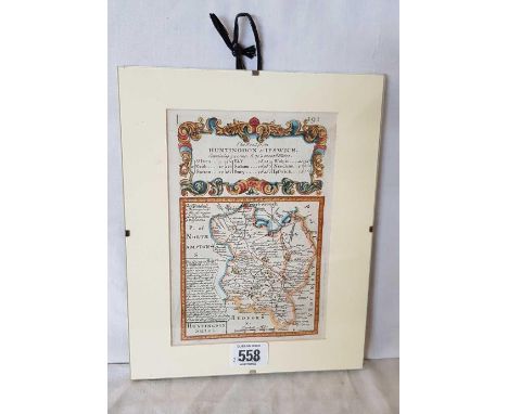
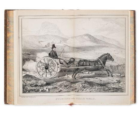
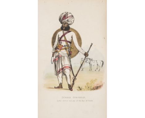
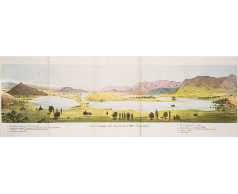
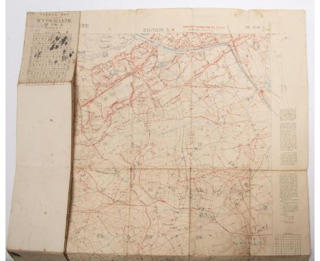
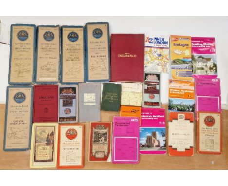
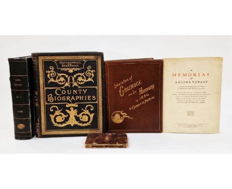
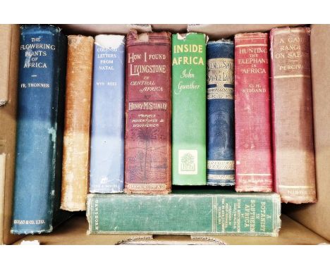
Antiquarian Gage, John  "The History and Antiquities of Suffolk. Thingo, E 100", London, Samuel Bentley, published by John Deck and Samuel Bentley in 1738, map frontis, plates and plans, water damage, rebound at some point De Barri, Giraldus and Hoare, Sir Richard Colt  "The Itinery of Archbiship Baldwin Through Wales AD1588", London, printed for William Miller, 1806, one only, engraved plates, bindings loose, contemporary boards, backstrip missing Gautier, Leon  "Charlemagne ...", 3 vols, Alfred Mame et Fils, 1888, full leather, gilt titles and dentels, the Coat of Arms/Insignia crest for Winchester College to each front board, all boards loose, backstrips missing, etc (2 boxes)   with Strickland, Agnes  "Lives of the Queens of England", Longmans Green Reader & Dyer, 1875, engraved frontis, vignette on tp, engraved plates, full green calf, *** vols Clarendon, Edward Earl of  "The History of the Rebellion Civil Wars in England...", Oxford, printed at the Theater, 1732, 8 vols, rebound red morocco, engraved plates with tissue guards, offsetting, backstrips have loss and have faded, gilt titles Hume, David  "The History of England in Two Volumes and a Further Continuation to the Reign of George IV in 1 Volume", Hewson Clark Esq, vols 1 and 2 printed for Thomas Kelly, 1823, engraved plates, engraved vignette on tp, water damage and foxing to vol 1, vol 3 published Thomas Kelly, May 29, 1824, all 3 vols marbled boards, half leather but in poor condition (2 boxes)

Lot 66

Astronomy Lowell, Percival "Mars", Longmans Green & Co 1896, 2nd edition, ink name top of tp, frontis with tissue guard, plate 24 is a double page map of Mars from the Lowell Observatory Flagstaff 1895, red cloth which has got stains and damp, gilt pictorial front board, gilt titles "Mars and its Canals", the Macmillan Company 1907, photographic frontis of Mars hill, double page plan of Mars, numerous plates and illustrations, hinges cracked, inked name inside front board, green cloth, gilt titles, some staining Pickering, William H. "Mars", the Harvard Astronomical Station, Jamaica, published Richard G Badger, Gorham Press, Boston, 1921, photographic frontis, photographic plates and other plates, some light foxing throughout, names and inscriptions inside front board and ffep, blue cloth blindstamped  Flammarion, Camille "La Planete Mars ...", 2 vols, Paris, Gauthier-Villars 1892, vol 2 dated 1909, numerous illustrations throughout, small folio, blue cloth, inked name inside front board of both volumes, blue cloth with black titles, vol 2 backstrip beginning to split from the top  Antoniadi, E M "La Planete Mars ...", L'Observatoire du Meudon, Paris, 1930, some water stains to the edges of initial pages, illustrations throughout, blue cloth, ink name inside front board, front board water damaged, backstrip faded De Vaucouleurs, Gerard de "The Planet Mars", translated from the French by Patrick A Moore, Faber & Faber Ltd, 1950, bearing a compliment slip for Messrs Faber and Faber with compliments of the author, not signed, orange cloth, dj has seen water damage (7) 

Lot 88

Large quantity of Ordnance Survey maps to include "Bacon's Large Print Motor Map - showing Golf Links", Bartholomew Ordnance Survey map backed onto linen, Ripon and Northallerton, GW Bacon & Co, two large printed maps of England and Wales, linen backed within a red cloth small folio, the maps marked North Sheet and South Sheet and gilt titles to the cloth binding, map of England and Wales, W H Smith & Sons Railway Map of Great Britain showing construction, canals, steamer tracks, etc, linen backed map of Carte de France eta des Frontieres, this is number 35 'Vesole' and sundry others (1 box) 

Lot 5

Dale, John (ed)  "Oxfordshire and Berkshire, Historical, Descriptive and Biographical in the Reign of King Edward VII", JG Hammond & Company (n.d.), photographic ills and portraits, ills to include Burford Vicarage, The Friends School, Sibford, Banbury, Interior of St Johns Roman Catholic Church, Banbury, Bodicote Church, Aynhoe Park, Aynhoe Church, folio, full leather with elaborate gilt decorations and titles, a.e.g.  Lysons, Rev Daniel and Lysons, Samuel  "Magna Britannia being a concise topographical account of the several counties of Britain - volume third containing Cornwall ", (only) printed for T Caddell 1814, folding map, frontis, engraved plates, some foxing and offsetting, binding tight, half title, blindstamp on half title Public Library and Museum, library stamps on verso to plates, bookbinders stamp 'J Bland & Co, Bolton' ffep, blue cloth, backstrip beginning to detach, not collated."Lord Anson's Voyage Round the World ..., a series of the most entertaining and surprising adventures ...", 2nd edition, R. Whitworth 1760, not complete, one very torn folding plate, front ep and half titles missing, contemporary ink names inside front board, contemporary leather separating "A Memorial of Anson's Voyage ...", printed for the company of Roche Products Ltd., limp cover, facsimile map  Methven, Cathcart W  "Sketches of Greenock and its Harbours", Greenock James McElvie & Sons 1886, plates, full brown leather with gilt titles and decorations, gilt dentelles, raised bands, a.e.g. (5)

Lot 95

Large quantity of ephemera to include old handcolour map of Monmouthshire after J Badeslade by W H Toms, unframed, old photographs, 1951 Cotswold Craftmanship Exhibition catalogue and other leaflets, pamphlets, etc (2 boxes) 

Lot 32

Stanley, Henry M  "How I Found Livingstone in Central Africa ...", Sampson Low, Maston, Low & Searle, 1872, 2nd edition, frontis photographic portrait of Henry Stanley, folding map, pictorial boards, loss to the backstrip and rather worn Stigand, C H  "Hunting the Elephant in Africa", Macmillan & Co, 1913, photographic ills, red cloth rather worn Percival, A Blayney  "A Game Ranger on Safari", Nisbet & Co, 1928, photographic frontis, plates and photographic plates, red cloth, backstrip faded Hutchinson, John "A Botanist in Southern Africa", Gawthorn, 1946, photographic and other ills, green cloth, all rather chipped and worn and other related volumes (1 box) 

Lot 65

Johnson Samuel " A Dictionary of the English Language; in which the words are deduced from their origins...." printed W & A Strahan 1784, 5th edition, advertisement for 4th edition after the preface , there are two volumes , the first elephant folio, rebacked, contemporary leather laid down, vol II 5th edition 1773 , 8vo, full contemporary calf with Clarke, Francis L  "The Life of the Most Notable Arthur Marquis and Earl of Wellington ..., copious details and delineations, historical political and military ...", printed by and for J & J Cundee (1812, 1813), folding map to vol 1 and 2, engraved frontis and half-title to vols 1 and 3, frontis missing from vol 2, plates, headers, vol 1 has had repairs with sellotape to frontis and half-title, sellotape has since been removed, all three copies rebound and rebacked, contemporary boards and half leather, pastedown with gilt titles to the three backstrips, all speckled edges (3) 

Lot 193

A Selection of Islay and Islands Whisky miniatures to include: Lagavulin 16 Year Old White Horse bottling, 2 x Laphroaig 10 Year Old, Highland Park 12, Bunnahabhain 12, Talisker 10 Map Label, Isle of Jura 10 

Lot 297

DEBRET, Jean-Baptiste.- Voyage pittoresque et historique au Brésil ou séjour d'un artiste français au Brésil depuis 1816 jusqu'en 1831 inclusivement.- Edição comemorativa do IV Centenário da Cidade de São Sebastião do Rio de Janeiro.- Rio de Janeiro: Comemorações do IV Centenário, 1965.- 3 vols.: il.; 55 cm.- B., Jean-Baptiste Debret (1768-1848), French painter and draftsman, lived in Brazil between 1816 and 1831, where he was a painting teacher, eventually becoming director of the Imperial Academy of Fine Arts. Back in Europe, between 1834 and 1839, he published in Paris his monumental «Voyage pittoresque...», illustrated with 153 hand-coloured engravings. This is the facsimile edition, printed in Tokyo, limited to 1003 copies (this one with number 978), based on the original edition, of what many consider the most beautiful book on Brazil. The first volume includes, in addition to a portrait of the author and a map of South America, 36 prints reproducing the lithographs, which mainly represent indigenous customs. The second volume features 49 reproductions (some doubles), a map and a plan of Rio de Janeiro. The third includes 54 prints and a facsimile of a letter from the Emperor. The prints of the last two volumes represent, predominantly, urban scenes. Very clean brochure copy, keeping its original cases intact, with bone clasps.

Lot 308

BARRÉ, Pe. Joseph.- Histoire générale d’Allemagne.- A Paris: Chez Charles J.B. Delespine & Jean Thomas Herissant, 1748.- 10 tomos em 11 vols.: il.; 25 cm.- E., Main work of Fr. Joseph Barré (1692-1764), French historian, Chancellor of the University of Paris between 1744 and the year of his death. Illustrated edition with an engraved title, a portrait of the dedicatee, Frederick Augustus II of Saxony, King of Poland, a fold-out map of Germany (volume I) and two fold-out maps (volumes II and IV). Slight moisture stains (from the tide) on the endpapers and title of volume I; some wormholes on the outer margin of about 25 leaves towards the end, in volume V. Otherwise, a very clean copy with large margins (carminated edges). Unidentified heraldic ex-libris (probably marquis de Corbeau de Vaulserre), with motto “Nil Nisi Virtute”. Good period bindings, entirely in flecked sheepskin, retaining the original marbled paper endpapers. Brunet, I, col. 666. Cohen-de Ricci, col. 113/114.

Lot 322

GORDON, Rev. William.- The history of the rise, progress, and establishment, of the independence of the United States of America: including an account of the late war; and the thirteen colonies, from their origin to that period.- London: Printed for the Author, 1788.- 4 vols.: IX mapas desdobr.; 21 cm.- E., Original edition published one year before the American edition, of the first history of the American Revolution, written by an American. William Gordon (1728-1807), was born in the United Kingdom, in Hitchin (Hertfordshire); he soon developed sympathies for the independence ideas of the North American colonies, reason why in 1770 he decided to settle definitively in America. He made valuable contributions to its History, namely George Washington, John Adams and Thomas Jefferson. In the words of Joseph Sabin, Gordon is rightly recognized as one of the most impartial and authoritative of the numerous historians of the American Revolution (vol. VII, p. 346/347). The collation of the four volumes is as follows: Vol. I: [24], 504 p.: 1 unfolded map; vol. II: [8], 584 p.: 4 unfolded maps; vol. III: [8], 499, [1 br.] p.: 2 unfolded maps; vol. IV: [8], 445, [1 br.] p.: 2 unfolded maps. Very clean copy with good margins, preserving all nine maps well folded and fresh, namely: I - The United States of America.; II - Boston, with its environs.; III - New York Island, & parts adjacent; IV - The Jerseys, &c. &w.; V - New Hampshire, Vermont, &c.; VI - The Carolina’s, with part of Georgia.; VII - Charlestown & Fort Moultrie.; VIII - The part of Virginia which was the seat of action. IX - York Town. The first volume does not include the “List of subscribers” (7 p.), which some copies have after the preface (after the preliminary A4 sheet). Good contemporary bindings, full calf bindings painted with mottled patine and smooth neo-classical spines, good decorated, with labels in different colours, conserving the original marbled paper endpapers. Sabin, 28011. Sowerby, 487.

Lot 225

Framed map of Europe - Theatrum Historicum Pars Occidentalis. Approx. 48 x 61cms reasonable used condition discoloured throughout

Lot 229

Framed hand coloured map depicting regions of Europe Including Italy. 32.5 x 46cms reasonable used with signs of minor foxing

Lot 261

Framed hand coloured map of Croatia, Bosnia & Serbia, by Antonio Zatta. Also another framed map of Austria & Hungary both reasonable used condition. Croatia map has minor foxing

Lot 749

Map of Suffolk, coloured engraving, 26cm wide, glazed and framed

Lot 325

EDWARD WELLER (1819-1884) 'LONDON AND SOUTHWEST RAILWAY' map, coloured. Mounted in a frame and glazed.68cm x 48cm

Lot 246

A RAILWAY MAP ADVERTISING TOURISM TO OXFORD

Lot 483

HENRY WILLIAM TAUNT (1842-1922) TWO BOOKS 'TAUNTS ILLUSTRATED MAP OF THE THAMES' AND 'GORING STREATLEY AND THE NEIGHBOURHOOD'

Loading...Loading...
  • 109182 item(s)
    /page

Recently Viewed Lots