We found 109198 price guide item(s) matching your search
There are 109198 lots that match your search criteria. Subscribe now to get instant access to the full price guide service.
Click here to subscribe- List
- Grid
-
109198 item(s)/page
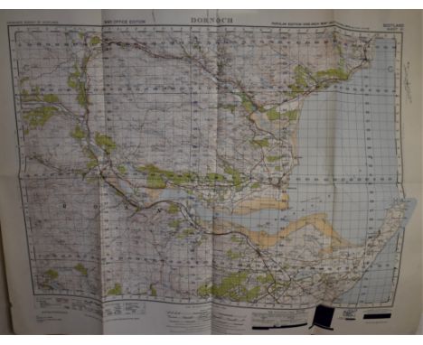


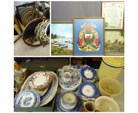
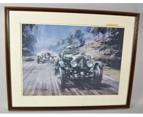
Lot 316
BLUE & WHITE TABLEWARE, various patterns, ceramic bread bin and two chamber pots ETC, COLOURFUL VINYL CRESTED HERALDIC EMBLEM OF WALES, 70 x 56cms, oil on board, numerous boats on beach, 59 x 90cms and Berkshire Map and other rural bridge scene, and GILT, OAK, MAHOGANY and other framed wall mirrors, two W S & S Austrian type scene wall chargers ETC

Lot 237
3rd-2nd millennium BC. A large clay tablet with cuneiform script to both sides, one side with tight lines of script, the other side with an empty central column and three further empty columns to the sides, cuneiform script in between, possibly representing a map. 627 grams, 16cm (6 1/4"). Ex central London gallery; acquired on the UK art market in 1999; formerly with Maggs Bros, London, WC1; previously in a UK collection formed before 1992; this lot has been checked against the Interpol Database of stolen works of art and is accompanied by AIAD certificate number no. 10321-166474.[No Reserve] Fair condition, repaired.


![John Tallis JuniorLondon & New York: John Tallis & Co, (1850) [c1851]Steelplate engraving, outline colour, centerfold as issu](https://cdn.globalauctionplatform.com/2d84ed6c-8111-4c7c-ae3d-acbf00899800/5aba039e-1507-42b3-9e71-acc30112cc6c/468x382.jpg)
Lot 100
John Tallis JuniorLondon & New York: John Tallis & Co, (1850) [c1851]Steelplate engraving, outline colour, centerfold as issued, light tanning along centerfold, bottom left: The Illustrations by H. Warren & engraved by H. Bond; bottom right: The Map Drawn & Engraved by J. Rapkin; verso: pencil notefrom Illustrated Atlas and Modern History of the World24 by 32cmLITERATUREScott, V., Tooley's Dictionary of Mapmakers (Q-Z), Riverside: Early World Press, 2003, p.244

Lot 104
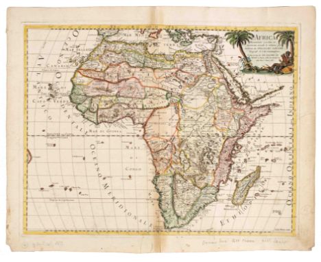
Samuel BoultonLondon: Robert Sayer, (1787) 1787Copperplate engraving, outline colour, paper watermarked Southern Africa: three vertical folds, offsetting, short tears at edge along folds, some frittering along bottom edge, 4cm narrow strip of loss in upper left corner margin; verso: foxing on one sheet, light tanning along edges, paint show through, '27' in ink Northern Africa: three vertical folds, offsetting, short tears at edge along folds; verso: pencil note, paint show through, '26' in inkboth approximately 53 by 122cmBoulton based these large wall maps on an earlier map by D'Anville, who attempted to include all the accurate scientific knowledge (contemporary and ancient) at the time, hence the large empty areas in the interior of the continent. Boulton enlarged and expanded the map, but followed DAnville precepts. He stated 'The inland parts of Africa being but very little known and the names of the regions and countries which fill that vast tract of land being for the greatest part placed by conjecture it may be judged how absurd are the divisions traced in some maps and why they are not followed in this.'The map also includes a great deal of text with two sections about Southern Africa. Particularly fascinating is the list of salaries of the Company (VOC) employees at the Cape.LITERATURENorwich #105(2)

Lot 110
Giles & Didier Robert de VaugondyParis: Giles & Didier Robert de Vaugondy, (1756) 1756Copperplate engraving, outline colour, centerfold, paper watermarked, 5cm open tear with paper loss in upper margin along centerfold, bottom 2cm of centerfold opening, four small holes in bottom corners, light tanning along plate mark, bottom right corner: Guill. Delahaye Sculp sit; upper right corner: '102' in ink; verso: ink name and number '109', pencil number46 by 59cmfrom Atlas UniverselGiles Robert de Vaugondy and his son Didier were joint publishers of Atlas Universel and it took fifteen years to produce. According to Norwich, 601 copies were printed. The interior of Africa is mostly empty. This map is a revision of Robert de Vaugondy's L'Afrique Divisée map; the shape of the Cape is more rounded and Cape Francois, Cape Falso and Mosselbay are added.LITERATURENorwich #94Tooley p. 94

Lot 111
Thomas JefferysLondon: The Gentleman's Magazine, February 1748Map in situ, copperplate engraving, uncoloured, three vertical and one horizontal folds, light tanning; magazine: disbound, 2 contents pages + page 51 - 9523,8 by 25cmJefferys was a prolific cartographer, engraver and map publisher in London. The main focus of the map is delineating the tribal regions in Africa. He supplied maps for Edward Cave's Gentleman's Magazine from 1747 to 1757.LITERATUREScott, V., Tooley's Dictionary of Mapmakers (E-J), Riverside: Early World Press, 2003, p.435
![Jacques Nicolas BellinParis: Chez Didot, (1739 & 1740) [c1748]Copperplate engraving, uncoloured, pencil numbers in margin, bo](https://cdn.globalauctionplatform.com/2d84ed6c-8111-4c7c-ae3d-acbf00899800/1b9556e9-6003-4dcf-a1ae-acc30112b6b8/468x382.jpg)
Lot 113
Jacques Nicolas BellinParis: Chez Didot, (1739 & 1740) [c1748]Copperplate engraving, uncoloured, pencil numbers in margin, bottom right corner: T.II.No.4.; verso: blank, pencil notefrom L'Histoire Generale des Voyages by Antoine Francois Prévost19,3 by 14,2cmThe plate includes a plan of the VOC fort, a map of Table Bay and a view of Table Mountain and the settlement at the Cape of Good Hope. There are also keys to the geographic features and details of the settlement such as the Company Garden.LITERATURECartwright, Maps of the South Western Cape of Good Hope, #334
![George Mathaus SeutterAugsburg: M Seutter, (1728) [c1740]Copperplate engraving, full colour, centerfold, two repaired closed](https://cdn.globalauctionplatform.com/2d84ed6c-8111-4c7c-ae3d-acbf00899800/b0855566-9dd5-4c05-886f-acc30112b491/468x382.jpg)
Lot 114
George Mathaus SeutterAugsburg: M Seutter, (1728) [c1740]Copperplate engraving, full colour, centerfold, two repaired closed tears of 5 and 4cm, some soiling in margins, a few foxing spots; verso: paint show through, some soiling along edges, pencil notes51 by 57,5cmfrom Atlas NovusNorwich states that this map is 'crowded with erroneous detail' and Tooley concurs that it is an 'extraordinarily inaccurate map'. It shows the large lake in central Africa, the Abyssinian province of Amhara is located in the kingdom of Monomotapa, and the information in southern Africa is mostly fantasy. It also includes the real and fictitious St Helena islands.LITERATURENorwich #80Tooley p.110
![Francois ValentynAmsterdam: J van Braam & G onder de Linden, [1724-26]Copperplate engraving, uncoloured, 3 vertical and 1 hor](https://cdn.globalauctionplatform.com/2d84ed6c-8111-4c7c-ae3d-acbf00899800/fe4eb3c4-f5d0-4855-b4ee-acc30112b050/468x382.jpg)
Lot 116
Francois ValentynAmsterdam: J van Braam & G onder de Linden, [1724-26]Copperplate engraving, uncoloured, 3 vertical and 1 horizontal folds as issued, evenly tanned, white foxing patch next to Saldanha, 'No 43' in upper right corner, very narrow 20cm strip of paper loss in margin along right edge; verso: damp marks along edge and white foxingfrom Oud en Nieuw Oost Indien, vol.544 by 55,5cmValentyn travelled to Batavia in 1658 as an employee of the Dutch East India Company. This map of the Cape of Good Hope is fairly accurate and an important feature is the inset of the Cape Peninsula with the names of farms and their owners. This provides valuable historical information about the expansion of the Cape before the retirement of governor Simon van der Stel.LITERATURECartwright, Maps of the South Western Cape of Good Hope, #3Norwich #214
![Johann Baptist HomannNuremburg: J B Homann, (1715) [1715]Copperplate, centerfold, full colour, paper watermarked, soiling esp](https://cdn.globalauctionplatform.com/2d84ed6c-8111-4c7c-ae3d-acbf00899800/6e1680ec-ceb3-47f0-931d-acc30112ab7b/468x382.jpg)
Lot 118
Johann Baptist HomannNuremburg: J B Homann, (1715) [1715]Copperplate, centerfold, full colour, paper watermarked, soiling especially along margins, small tears along edges in margins, pencil notes in margin, small damp marks along right edge; verso: blank, paint show through, pencil notes48,2 by 57,6cmAccording to Norwich this is the first map to include a lengthy note verifying the accuracy of the source of the Nile (which is incorrect). Another interesting inaccuracy is the depiction of the real and fictitious St Helena. Note also the fat-tailed sheep with its tail on a cart in the elaborate cartouche.LITERATURENorwich #72Tooley Plate 51
Lot 121
Giovanni de RossiRome: Giovanni Giacomo de Rossi, (1677) 1677Copperplate engraving, centerfold, full colour, soiling in margins especially bottom right corner, paperloss at lower left corner, pencil notes, tanning along centerfold, 6cm repaired closed tear and a few short tears, one small repaired hole, two small holes; verso: soiling with a heavier patch of approximately 14cm diameter and along centerfold, pencil note, '3' in inkfrom Mercurio Geografico Overo Guida Geografica39,7 by 54,6cmThis map faithfully reproduces Sanson's map of Africa from 1668 (acknowledged in the cartouche), with the only change the translation of the text to Italian.LITERATUREBetz #120
![Nicholas Lenglet DufresnoyParis: Charles Estienne Hochereau, (1656) [c1716]Copperplate engraving, full colour, two vertical f](https://cdn.globalauctionplatform.com/2d84ed6c-8111-4c7c-ae3d-acbf00899800/9006b964-1851-4e82-9f93-acc30112a317/468x382.jpg)
Lot 123
Nicholas Lenglet DufresnoyParis: Charles Estienne Hochereau, (1656) [c1716]Copperplate engraving, full colour, two vertical fold lines, top right corner: Tom I Pag: 454; pencil number on recto and versofrom Methode Pour Etudier La Geographie14,5 by 16,5cmThe original version of this map first appeared in an atlas of Africa published by Nicolas Sanson in 1656. Dufresnoy used newly engraved plates to publish this version of the map. It differs from the Sanson map in two ways: it is smaller and there is no imprint for engraver.LITERATUREBetz #86
![Petrus BertiusAmsterdam: Jodocus Hondius Jr, (1616 or 1618) [1616 or 1618]Copperplate engraving, outline colour, tanning alon](https://cdn.globalauctionplatform.com/2d84ed6c-8111-4c7c-ae3d-acbf00899800/441eaaf0-086a-4ae5-bc10-acc30112a1c6/468x382.jpg)
Lot 124
Petrus BertiusAmsterdam: Jodocus Hondius Jr, (1616 or 1618) [1616 or 1618]Copperplate engraving, outline colour, tanning along edges, upper left corner: 616; verso: Latin title page, pencil note, two upper corners taped to mount board; framed from Tabularum Geographicarum Contractarum 9,5 by 13,2cm Jodocus Hodius became the second publisher of Bertius' 'Tabularum Geographicarum Contractarum' after Claesz-Langenes and for an unknown reason decided to engrave new copperplates. Interestingly the southern point of Africa is narrower compared to the previous version. Betz speculates that because of similar geographic features, the Claesz-Langenes map may have been based on Al-Idrisi's map of the world. This was in The Book of Roger, written in Arabic and published in 1598 in Rome.LITERATUREBetz #56 (Claesz-Langenes map #37)Tooley p.26
![Sebastian Münster Basel: S H Petrie, (1588) [1614]Woodblock engraving, centerfold, outline colour, tanned evenly with lighter](https://cdn.globalauctionplatform.com/2d84ed6c-8111-4c7c-ae3d-acbf00899800/261c072d-6e77-4ca8-8993-acc30112a05d/468x382.jpg)
Lot 125
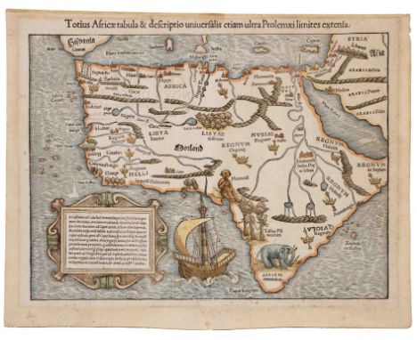
Sebastian Münster Basel: S H Petrie, (1588) [1614]Woodblock engraving, centerfold, outline colour, tanned evenly with lighter strip along centerfold, pencil note, 5mm of bottom edge of margin folded with some paperloss, tanning along outer edge, repairs to wormholes of which largest 15mm which affect the frame of the title box and 'C. de Volia' in southern Africa, top center: Africa / Lybia / Morenlandt / mit allen Koenigreichen / so jetziger zeit darumb gefunden warden; verso: title page in German, heavy tanning; framedfrom Cosmographia36 by 31cm'Africa Tabula Nova' is often referred to as Münster's second map of Africa even though there is little resemblance. The map was printed using a woodcut engraving, but an attempt was made to reproduce the appearance of a copperplate engraving. This was in response to the popular Ortelius atlas and, in fact, it closely follows his Africa map of 1570.LITERATUREBetz #21Norwich #14Tooley p.85
![Sebastian MünsterBasel: S H Petri, (1572) [1572]Woodblock engraving, full colour, foxing spots, pencil notes, bottom left cor](https://cdn.globalauctionplatform.com/2d84ed6c-8111-4c7c-ae3d-acbf00899800/20d51986-3ef3-4eaf-8175-acc301129b7e/468x382.jpg)
Lot 127
Sebastian MünsterBasel: S H Petri, (1572) [1572]Woodblock engraving, full colour, foxing spots, pencil notes, bottom left corner with some loss, top center: De Africae Regionibus, upper left corner: 1328; verso: Latin text, two upper corners taped to mount board, tanning, some foxing, top center: Liber VI; upper right corner: 1327; framed12,4 by 15,5cm (leaf: 30,5 by 19cm)from Latin edition of CosmographiaThe 1572 Latin edition of Cosmographia is the only one in which this map appears. See lot 128 for more information about Münster's Cosmographia.LITERATURETooley p.85
Lot 128
Sebastian Münster Basel: S Münster, (1540) 1552Woodblock engraving, centerfold, outline and decorative colour, tanning in margins, foxing; verso: Latin title on right hand sheet, tanning, foxing, paint show through, pencil notesfrom Cosmographia25,5 by 34,5cmMünster was the first map maker to publish separate maps of the continents in his encyclopedia Cosmographia. For his map of Africa he used ancient sources, but also the discoveries of Portuguese explorers. This increased the accuracy of the coast line, but for the interior Münster relied on Roman sources, which explains the inclusion of the one eyed man or Monoculi.As Jonathan Swift satirized in 1733: So geographers, in Afric maps With savage pictures fill their gaps And o'er uninhabitable downs Place elephants for want of townsThis is a rare unusual variant of Münster's Monoculi map. During printing the loose metal type set was inserted upside down. On the map there are three instances: QVIOLA, Regnü and part of Garamantes. Not only does this help in dating the map, but it also gives insight into the woodblock printing process used in the mid16th century.LITERATUREBetz #3 (Variant 8)Norwich #3Sebastian Münster, Accessed 26 January 2021,

Lot 130
AN EXTRACT: THE VOYAGE OF WILLIAM TEN RHYNE TO THE CAPE OF GOOD HOPE & A DRAUGHT OF THE STRAIGHTS OF GIBRALTAR BY CAPTAIN RICHARD BOLLANDAwnsham ChurchillTall 4to, full red leather, pages 763 - 784, 1 double page map + 1 double page plate, corners lightly bumped with light wear to boards, foxing and tanning in margins, 2cm tear in one page marginfrom A Collection of Voyages and Travels, London, c1710
![Augustus Petermann & Hermann HabernichtGotha: Justus Perthes, (1866) [c1880]Copperplate engraving, centerfold, outline and re](https://cdn.globalauctionplatform.com/2d84ed6c-8111-4c7c-ae3d-acbf00899800/55a5ec5d-ee47-4c40-9971-acc30112ce88/468x382.jpg)
Lot 99
Augustus Petermann & Hermann HabernichtGotha: Justus Perthes, (1866) [c1880]Copperplate engraving, centerfold, outline and relief colour; sides, top and small section of bottom taped to window mount; soiling line along inner edge of window mount, some foxing, lower left corner: Gezeichet v, H, Habernicht; rev. 1878, lower right corner: Gest. V. C. Stier, Terrain v. C. Jungmann; verso: blankfrom Stieler's Hand-Atlas No. 7133 by 40,6cmPetermann was a German cartographer who was appointed as director of the geographical institute of Justus Perthes in Gotha in 1854, after spending most of his early career in England. At Gotha he introduced innovative and progressive ideas based on both his German and English experience.He also started the first European geographical journal. The map contains a great deal of information and shows the route of explorers such as Livingston, Krapf, Ladislaus Magyur, Silva Porto, Speke, etc. There are also detailed insets of Table and False Bay on the map.LITERATURECartwright, Maps of the South Western Cape of Good Hope, #224Scott, V., Tooley's Dictionary of Mapmakers (K-P), Riverside: Early World Press, 2003


Lot 593
EPHEMERA, a collection of legal documents (indenture, will, settlements, death certificate, etc), seven Peat's Farmer's Diary Account books, twenty two mid 20th century publications (The Footprint, Rose Hill Footprints, Norvic Way) Old and Young 'The Variety Journal' 1893, a ration book 1953 - 1954, five mid 20th century photographs of Leek, an album of 100 photographs of Scotland and a RAC Quick-Way Motoring Map of London published by George Philips and Sons E.C.4 (cloth edition)


Lot 92
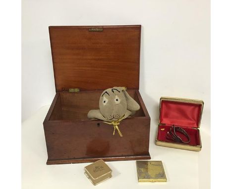
A mixed lot including a mahogany box with rectangular hinged top with moulded edge with unfitted interior, on plinth base (h.16cm x 32cm x 24cm), an early 20thc stuffed child's toy rabbit, a white metal fork converted to bangle, stamped Devonshire Hotel, a compact bearing a map of Texas to lid, two jewellery boxes and a collection of keys (a lot)


Lot 1034
AMSTELODAMI Sumptibus Ioannis IanBonii - engraved map 'A General Plot & Description of the Fennes and surrounded grounds in the six counties of Norfolk, Suffolk, Cambridge within the Isle of Ely, Huntingdon, Northampton and Lincolne etc, 45 x 56cm, unframed; together with a chart of The Beautiful Fishery of Whittlesea Mere, engraving on silk (a/f) (2)

Lot 1036
After Christopher Saxton - engraved county map of Suffolk with hand-coloured hundreds, 29 x 38cm; together with after Robert Morden - engraved county map of Suffolk; after John Speed - engraved county map of Suffolk with inset plan for Ipswich and coats of arms; and one other reproduction county map of Suffolk (4)


Lot 1057
An early 20th century Great Western Railway map depicting various Great Western Railway stations and locations from London through to Ireland, South Wales, and also depicting the London suburbs, framedCondition report: A few tears at ends of creases but these do not extend to map itself. Very small holes where map has been folded both ways, but almost no detail lost. In a glass fronted frame. Overall appears delicate.


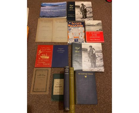
Lot 143
A Collection of various collectable Scottish books and surrounding areas, Includes The Highlands and Islands of Scotland by Angus & Patricia Macdonald, Two 'The Civic Survey of Edinburgh' Booklets by Professor P.Geddes dated 1911, Two copies of Shoal and Sheaf by David M.N. Tinch, The Scots Magazine, A Hundred Years in the Highlands by Osgood Mackenzie, The Whisky Roads of Scotland, Clachan and Countryside by T.T. Kilbucho, Map of the Environs of Glasgow, The Orkney Norn by Marwick, Lowland Scotch by Wilson, The Scottish Tongue by W.A. Craigie, John Buchan, Peter Giles and J.M. Bulloch, The Boy Comes home by A.A.Milne and Summer Tours in Scotland by David MacBrayne's Royal Mail Steamers Columba, Iona & Co.

Lot 186
Two Collectors books, Boxed book set and two boxed maps titled 'Music for King Henry' BL Royal MS II E XI Commentary by Nicolas Bell, Performing edition by David Skinner, London The Folio Society 2009, 'King Henry's Map of the British Isles' BL Cotton MS I i 9, Commentary by Peter Barber- London -The Folio Society 2009. Together with two maps Printed on Neobond by Beacon Press, for the Folio Society, London. Both limited to 2750 copies. 'King Henry's Prayer Book' BL Royal MS 2A XVI Commentary by James P.Carley- London -The Folio Society 2009
Lot 237
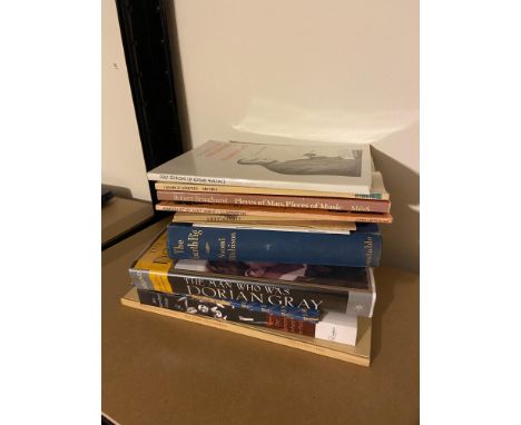
A Collection of signed books, 'A Guide to the First Editions of Edgar Wallace' No#668, 'Metro' by George Szirtes signed, 'Pieces of Map, Pieces of Music' by Robert Bringhurst- signed and dated 1898, 'Memoirs of my Aunt Minnie' by John Herdman- Signed, Selected Poems by Sydney Goodsir Smith- signed, 'The Loves of Asklepiades'-signed, 'Pier & Ocean' by Erlend Brown- signed, 'The Fourth Pig' by Naomi Mitchison- signed, 'The Man who was Dorian Gray' by Jerusha Hull McCormack- signed and comes with a letter, 'The Unacknowledged Legislator' by Bonamy Dobree- Signed by general editor Herman Ould, 'The Dancers Inherit the party' by Ian Hamilton Finlay- signed & 'The First Childermas' by William Kean Seymour- signed.
-
109198 item(s)/page