We found 109182 price guide item(s) matching your search
There are 109182 lots that match your search criteria. Subscribe now to get instant access to the full price guide service.
Click here to subscribe- List
- Grid
-
109182 item(s)/page


Lot 95
ITALIAN FASCIST MEMORABILIA. A green velvet cushion with Facist badges etc, sewn on. Including cloth badges of the Motorised Infantry, Sappers, Signals, etc. 19.1/2" x 16.1/2" in size with (9) badges. Four small glasses with etched (Spanish) royal crest and Eritrea below, also 230 photographs C1930 of natives and ladies of Eritrea. A 1928 dated map of Anglo-Egyptian Sudan. Several Desert Victory official photographs, captured vehicles etc. Two Facist Door Plates in brass.
Lot 272
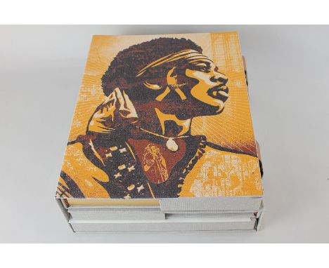
Woodstock Experience volume 1 and 2, with Michael Lang, featuring photographs by Henry Diltz, limited edition 805/1000, signed by Michael Lang and Arlo Guthrie, in a boxed set with a Woodstock ticket from 1969, an essay folder, a print by Peter Max, a 7'' vinyl pressing of Santana's 'Savor' and Jefferson Airplane's 'White Rabbit' and a facsimile site map in presentation box


Lot 262
A pair of late Victorian printed adverts, for Williams' Perran Foundry Co, Revolving Stamps, Stamps for Crushing Ores and Crushing Mill, illustrated with line engravings, Perranarworthal, Cornwall and London, 25cm x 19cm; a two-fold map of Cornwall, includibng the Scilly Isles, 18cm x 24cm; late 18th/early 19th century Laurie two-fold map, Cumbria, Yorkshire, Westmoreland and Northumberland, hand-coloured engraving, 31cm x 26cm; etc, [5]


Lot 46
Newton (C.T.). Travels & Discoveries in the Levant, 2 volumes, 1st edition, 1865, folding map frontispiece to each, 39 lithographed plates and plans, occasional light water stains and spotting, original green blindstamped cloth gilt, spines neatly repaired, small split at head of lower joints, 8voBlackmer 1193. (2)
Lot 475
Folkes (Martin). Tables of English Silver and Gold Coins..., now Re-printed, with PLates and Explanations, London: Society of Antiquaries, 1763, 67 engraved plates, armorial ink stamp and bookplate of Jonathan Peckover to pastedowns, hinges strengthened, contemporary calf gilt, spine lacking title label, joints cracked and some wear, 4to, together with [Leake, Stephen Martin], Nummi Britannici Historia: Or an Account of English Money, from the Conquest to the Uniting of the two Kingdoms by James I. and of Great Britain to the Present Time, 1st edition, 1626 [but 1726], nine engraved plates (including one additional), title torn at head and repaired, some dampstaining, front endpaper replaced, contemporary mottled calf, rebacked, later title label to spine, 8vo, with Ede (James), A View of the Gold and Silver Coins of all Nations Exhibited, [1808], engraved title, two part titles and 34 plates, edges untrimmed, publisher's boards (dampstained), later torn spine strip, 12mo, with Ruding (Rogers), Annals of the Coinage of Britain and its Dependencies..., 6 volumes (including plate volume), 2nd edition, 1819, folding map and numerous engraved plates, contemporary diced calf (text volumes) and contemporary half calf (plates volume), gilt decorated spines, joints cracked, rubbed and some wear, 8vo & 4to, plus Leake (Stephen Martin), An Historical Account of English Money, from the Conquest to the Present Time..., 3rd edition, 1793, 13 engraved plates, front endpaper adhered together at gutter, contemporary calf, joints cracked an spine torn with loss, 8vo (10)
Lot 48
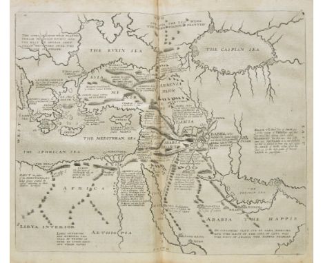
Norman (Charles Boswell). Armenia, and the Campaign of 1877, 1st edition, [1878], eight folding tinted maps and plans including large frontispiece, publisher's adverts at rear, some spotting and dust soiling to frontispiece and title, author's pencil presentation inscription for E.G. Clarke to title, upper hinges cracked, original cloth gilt, rubbed and slightly soiled, frayed at head and foot of spine, together with Cunynghame (Henry Hardinge), Travels in the Eastern Caucasus, on the Caspian and Black Seas, especially in Daghestan, and on the frontiers of Persia and Turkey, during the summer of 1871, 1st edition, 1872, folding map and eight engraved plates including some folding, engraved illustrations to text, some mostly marginal spotting, stitching broken and contents partly loose in original cloth gilt, rubbed and a little frayed at spine ends, plus Curzon (Robert), Armenia: A Year at Erzeroom, and on the frontiers of Russia, Turkey, and Persia, 1st edition, 1854, eight engraved plates including general map, publisher's adverts at rear, some heavy spotting throughout, original cloth gilt, rubbed and soiled, spine faded and frayed at head and foot, plus three related by James Bryce, Friedrich Parrot and Charles Williams, all 8vo (6)
Lot 49
Northall (John). Travels through Italy. Containing new and curious observations on that Country..., 1766, upper margin of title with contemporary signature of Sir Edward Pellew (Admiral Edward Pellew, 1st Viscount Exmouth, 1757-1833), bound without map & plates, title with long repaired vertical tear to centre, book label of Lord Exmouth to upper pastedown, contemporary calf, gilt decorated spine, morocco title label, joints cracked, rubbed, 8vo, together with Atlas des Enfans, ou Nouvelle Methode pour apprendre la Geographie, avec un nouveau traite de la sphere..., new edition, Lyon: Jean-Marie Bruyset, 1790, engraved frontispiece, 24 folding hand-coloured maps and diagrams, occasional spotting, contemporary sheep, spine worn with loss, rubbed and scuffed, 12mo, with Barthélemy (Jean-Jacques), The Travels of Anacharsis the Younger in Greece, during the Middle of the Fourth Century before the Christian Aera, Abridged from the Original Work of the Abbe Barthelemi, 1797, folding engraved map frontispiece, hand-coloured in outline, three engraved plates, some spotting, contemporary half calf, upper board detached and lower joint cracked, wear to board edges, 8vo (3)

Lot 50
Pernety (Antoine-Joseph). The History of a Voyage to the Malouine (or Falkland) Islands, made in 1763 and 1764, under the Command of M. de Bougainville, in order to form a Settlement there; and of two Voyages to the Streights of Magellan, with an account of the Patagonians: Translated from Dom Pernety's Historical Journal written in French, 1st edition in English, 1771, 16 engraved maps, plates and charts, several folding (one or two small repairs to verso), wormtrack just extending into image of frontispiece map (and to title margin), some light spotting and offsetting, previous owner inscription of Henry White, 1802 to front pastedown, contemporary sheep, rubbed and scuffed, 4to Hill 1328; Sabin 6870. First English edition of Louis de Bougainville's voyage by Pernety (Bougainville's secretary) and a primary source on the Falkland Islands. (1)
Lot 502
Rackham (Arthur, illustrator). Peter Pan in Kensington Gardens, 1st edition, 1906, 50 tipped-in colour plates, some light spotting to first few leaves, and contents leaves with some edge-fraying, original cloth gilt, rubbed and marked, recased with original spine laid down, with some consequent discolouration, 4to, together with Awdry (Reverend W.), The Railway Series, numbers 14-20, 22, 24 & 25, all 1st edition, 1959-70, colour plates, all original cloth, 7 in frayed dust wrappers, together with Railway Map of the Island of Sodor, circa 1960, original printed wrappers, frayed and some wear to edges, and 12 reprint editions from the same series, all oblong small 8vo (24)
Lot 51
Raleigh (Sir Walter). The History of the World, in Five Books ... whereunto is added, in this Edition, the Life of Tryal of the Author, printed for Tho. Basset [and others], 1687, 6 double-page maps, 2 double-page battle plans, 3 woodcut genealogies to the letterpress, engraved portrait bound as frontispiece, lacking the engraved title and 'The Mind of the Front' leaf, water-staining in top margins of plates and a few text gatherings, frontispiece, title page and first text-leaf frayed with marginal browning, closed tear touching frame of Syria map (facing page 236), Sicily map (facing page 548) with repaired closed tear in gutter, signature 2I2 torn, small hole in 2R2, a few spots and marks, contemporary ownership inscription to title page, modern calf, folio PMM 117 for the first edition; Wing R168. (1)
Lot 513
De La Beche (Henry T.). Report on the Geology of Cornwall, Devon, and West Somerset, published by order of the Lords Commissioners of Her Majesty's Treasury, 1839, folding hand-coloured lithograph map frontispiece, eleven engraved plates (including eight folding), some fraying and spotting, 20th century cloth gilt, rubbed and some marks, 8vo, together with other miscellaneous books, including topography, natural history, etc. (2 cartons)

Lot 516
The Japanese Government Railways. An Official Guide to Japan, Tokyo, 1933, numerous colour folding maps including frontispiece, colour illustrated endpapers, some minor toning, original red cloth, 8vo, together with South American Publications Limited, The South American Handbooks, 1925, colour folding map, slightly torn with tape repairs, black and white advertisements to the front and rear, some light spotting, original red cloth, lightly rubbed to head and foot, 8vo, and Baedeker (Karl), Egypt and The Sudân, 6th edition, 1908, 24 colour folding maps, plus 76 plans and 57 vignettes, some light spotting, original red cloth, lightly rubbed to head and foot, 8vo, plus approximately 80 further early to mid 20th century travel guides, including Baedeker, Murray's, Blue Guides, all original cloth, G/VG, 8vo (2 cartons)
Lot 53
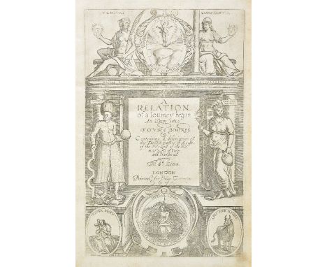
Sandys (George). Sandys Travels, containing an History of the Original and Present State of the Turkish Empire ... the Mahometan Religion and Ceremonies ... a Description of Constantinople, the Grand Signior's Seraglio ... also, of Greece ... Aegypt ... Armenia, Grand Cairo, Rhodes, the Pyramides, Colossus ... Alexandria ... the Holy Land ... lastly, Italy described, and the Islands adjoining ... the seventh edition, 1673, engraved additional title, folding map, folding view of Constantinople, numerous engraved vignettes in the letterpress, woodcut headpieces and initials, mild spotting and soiling, occasional light browning, a few leaves faintly creased at lower outer corners, some bleeding of ink in the 2 folding plates, small tear to bottom edge of N4, contemporary ownership inscriptions of one John Arden to initial blank and title page, contemporary sprinkled calf, rebacked, blind panels to sides, slightly rubbed, some restoration, folio Atabey 1087, Cox I p. 206 (giving the date 1672), Wing S680; Blackmer 1484 for the second edition. 'Sandys' work first appeared in 1615; it was one of the most frequently reprinted of English travel books, probably because it was so lavishly illustrated. This is the last edition of this work' (Atabey). Provenance: Christopher Hogwood CBE (1941-2014; book-label to front pastedown). (1)

Lot 534
Turnbull (Patrick). Sahara Unveiled, A Great Story of French Colonial Conquest, 1st edition, 1940, 31 black and white illustrations, map endpapers, some light spotting, original cloth in price clipped dust jacket, covers slightly rubbed to head and foot, 8vo, together with Roome (William J.W.), Tramping Through Africa, a dozen crossings of the continent, 1st edition, A. & C. Black, 1930, 31 black and white illustrations and folding map to the rear, some minor spotting, original brown cloth in dust jacket, loss to head of spine, covers slightly toned, 8vo, and Gunther (John), Inside Africa, 1st edition, 1955, map endpapers, some light spotting, original black cloth in price clipped dust jacket, spine lightly rubbed to head and foot, 8vo, plus other modern Africa history and miscellaneous reference, mostly original cloth in dust jackets, some paperbacks, G/VG, 8vo (6 shelves)

Lot 541
Frazer (James George). The Native Races of Africa and Madagascar, 1938, 10 black and white illustrations, some light spotting to the fore-edge, original cloth in dust jacket, covers worn with some loss, large 4to, together with Tuckey (J.K.), Narrative of an Expedition to Explore the River Zaire, usually called The Congo, in South Africa in 1816, new impression, 1967, facsimile folding map to front, original red cloth, lightly rubbed to head and foot, 4to, and Clammer (David), The Last Zulu Warrior, Cape Town, 1977, limited edition 567/1000, numerous colour and black and white illustrations, original gilt decorated faux leather in dust jacket and slipcase, covers slightly rubbed to head and foot, large 4to, plus other mid 20th century and modern Africa reference and related, many original cloth in dust jackets, some paperbacks, G/VG, 8vo/4to (6 shelves)

Lot 542
Lugard (F.D.). The Rise of Our East African Empire, early efforts in Nyasaland and Uganda, 2 volumes, 1893, folding maps to front and rear pockets of volume 1, numerous black and white illustrations and maps, period inscriptions to head of half titles, some minor toning, uniform original illustrated red cloth, boards and spines slightly rubbed to head and foot, spines lightly faded, 8vo, together with Shaw (Flora L.), A Tropical Dependency..., 1st edition, 1905, colour folding map to the front, some minor spotting, original red cloth, boards and spine lightly faded and rubbed to head and foot, 8vo, and Morel (Edmund D.), Affairs of West Africa, 1st edition, 1902, 36 black and white illustrations plus 3 maps, some minor toning, original gilt decorated red and yellow cloth, boards and spine slightly rubbed to head and foot, 8vo, plus other late 19th century and modern Africa reference, mostly original cloth, many in dust jackets, G/VG, 8vo/4to (6 shelves)

Lot 547
Curzon (George). British Government in India..., 2 volumes, 3rd impression, 1925, numerous black and white illustrations, some light spotting, uniform original gilt decorated blue cloth in dust jackets, covers, rubbed and marked with minor tears, large 4to, together with Corner (Julia), India, Pictorial, Descriptive, and Historical, 1873, colour folding map to front, numerous black and white illustrations, bookplate to front pastedown, some light toning and spotting, contemporary gilt decorated full calf, boards and spine rubbed, 8vo, and Malleson (G.B.), The Decisive Battles of India from 1746 to 1849 inclusive, 2nd edition, 1885, black and white portrait frontispiece, one map and 4 plans, bookplate to front pastedown, some spotting, contemporary gilt decorated full calf bound by Angus & Robertson, boards lightly marked, plus other mostly 20th century India history, reference and related, mostly original cloth, many in dust jackets, G/VG, 8vo/4to (6 shelves)
Lot 57
Sturt (Captain Charles). Two Expeditions into the Interior of Southern Australia, During the Years 1828, 1829, 1830, and 1831: With Observations on the Soil, Climate and General Resources of the Colony of New South Wales, 2 volumes, 1st edition, 1833, half titles, 13 engraved plates, of which four hand-coloured, folding engraved map, single-page map, a few scattered spots, armorial bookplates of Wrest Park, contemporary sprinkled calf, rebacked, spines with red and green labels and gilt decoration, 8vo Ferguson 1704. Sturt's expeditions to explore the river systems of New South Wales, the first of which was drought-affected and resulted in the discovery and naming of the Darling River. The second expedition was to trace the Murrumbidgee River, which flowed into another river, named the Murray by Sturt (unaware that it was in fact the Hume River, discovered earlier by Hume and Hovell). Sturt and his party had to row for nearly 1000 miles, against the current, to Sydney after a relief vessel failed to materialise on the south coast. (2)
![Thicknesse (Philip). A Year's Journey through the Paix Bâs and Austrian Netherlands, Volume I [all published], 1st edition, 1](https://cdn.globalauctionplatform.com/1580937d-4450-45cf-b668-a8d500d52e36/6e402d87-ca35-4c1a-cf86-172f0359403a/468x382.jpg)
Lot 58
Thicknesse (Philip). A Year's Journey through the Paix Bâs and Austrian Netherlands, Volume I [all published], 1st edition, 1784, engraved folding frontispiece, half-title, list of subscribers, frontispiece slightly browned and frayed, half-title slightly soiled, signatures 2G2-3 misbound after 2F1, small perforation to 2L2, quire 2T spotted, contemporary quarter sheep, red morocco spine label, vellum tips, a few small worm-holes to foot of spine, 8vo, together with [La Combe de Vrigny], Travels through Denmark and some Parts of Germany: by Way of Journal in the Retinue of the English Envoy, in 1702 ... 1st edition in English, 1707, engraved folding map, contemporary calf, old paper spine label, slightly rubbed, 8vo Cox I pp. 154 & 181. Thicknesse's account of a 'rather quarrel-ridden tour' (ODNB) is notably scarce in first edition: the list of subscribers records 115 printed, with six copies located by ESTC. (2)
Lot 67
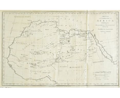
Association for Promoting the Discovery of the Interior Parts of Africa Proceedings ... 1st edition, printed by C. Macrae, printer to the Association, 1790, half title, engraved folding map as frontispiece, list of members, light soiling to pages 106-7, last few leaves spotted, contemporary tan half sheep, pink paper sides, rubbed, spine faded, extremities worn, paper lifting, 4to (28.5 x 22.5 cm) Cox I p. 388. This first iteration of the proceedings of the African Association concerns the ill-fated dual expedition of William Lucas and John Ledyard. The foundation of the African Association in 1788, under the auspices of Sir Joseph Banks, marked 'the beginning of African exploration in a systematic way' (Cox). (1)
Lot 68
Baker (Samuel White). The Albert N'Yanza, Great Basin of the Nile, and Explorations of the Nile Sources, 2 volumes, 1st edition, 1866, portrait frontispice to volume I, colour lithograph frontispiece to volume II (detaching), folding colour map bound upside down in volume I (torn without loss), single page map, wood-engraved illustrations, a few faded ink stamps, some light spotting and soiling, stitching weak, hinges tender, library bookplates, original green cloth gilt, small tears at spine ends, volume II covers with some damp stains and split at head of lower joint, 8vo, together with The Nile Tributaries of Abyssinia, and the Sword Hunters of the Hamran Arabs, 1st edition, 1867, portrait frontispiece, two maps (one folding with small marginal chips and closed tears), illustrations, a few light spots, hinges breaking, original blue cloth gilt, spine a little faded with tears at ends, 8vo, plus Ismailia. A Narrative of the Expedition to Central Africa for the Supression of the Slave Trade, 2 volumes, 1st edition, 1874, portrait frontispieces, two maps (one folding and reinforced to verso), wood-engraved illustrations, scattered spotting, bookplates, contemporary green half calf gilt, spines and edges a little rubbed, 8vo, plus Wild Beasts and their Ways. Reminiscences of Europe, Asia, Africa, and America, 2 volumes, 1st edition, 1890 (7)
Lot 7
Cluver (Philipp). Introductionis in Universam Geographiam, tam veterem quam novam Libri VI, Amsterdam: Johannes Janssonius, 1661, 43 double-page engraved maps after Ortelius and others (of 45; lacking one world map and Pannonia and Illyricum), 1 folding chart, lacking index leaf, a few maps very slightly frayed and soiled in lower margins, interleaved throughout, slightly later (?18th century) inked annotations to interleaves between pages 2-3 and 128-9, typescript list of contents tipped to first interleaf, minor worming to quire O et seq., affecting text in O and frames of a few maps, contemporary ownership inscription to title page, contemporary calf, rebacked, sides pitted, restoration to extremities, 4to Sabin 13805. (1)

Lot 70
Bentley (W. Holman). Pioneering on the Congo, 2 volumes, 1st edition, Religious Tract Society, 1900, photographic frontispieces, folding colour map, numerous illustrations to the text, contemporary ownership inscriptions to front free endpapers, top edges gilt, original blue pictorial cloth gilt, extremities lightly rubbed, 2 short nicks to head of volume 1 spine, a bright copy, 8vo, together with Barns (T. Alexander), The Wonderland of the Eastern Congo, the Region of the Snow-Crowned Volcanoes, the Pygmies, the Giant Gorilla and the Okapi, 1st edition, G. P. Putnam's Sons, 1922, photographic frontispiece, numerous similar plates, folding map, top edge gilt, others untrimmed, original tan cloth, gilt roundel of a gorilla to front board, spine spotted, large 8vo, plus Lloyd (Albert Bushnell), In Dwarf Land and Cannibal Country, a Record of Travel and Discovery in Central Africa, 1st edition, T. Fisher Unwin, 1899, photographic frontispiece, photographs to the text, 3 maps (2 folding), front inner hinge cracked but holding, top edge gilt, others untrimmed, original red pictorial cloth gilt, spine and portion of front board faded, large 8vo, and: Ward (Herbert), A Voice from the Congo, 1st edition, William Heinemann, 1910, photogravure frontispiece, numerous plates, one (facing page 65) frayed along bottom edge, occasional light spotting, top edge gilt, others untrimmed, original patterned cloth, slightly rubbed and bumped, 8vo; Morel (Edmund D.), The British Case in the French Congo, 1st edition, William Heinemann, 1903, folding map, spotting to edges and prelims, bookplate of African explorer Herbert Ward (1863-1919), original pictorial cloth gilt, 8vo; and 30 similar works (36)
Lot 75
Campbell (Dugald). On the Trail of the Veiled Tuareg, 1st edition, Seeley, Service & Co. Limited, 1928, photographic frontispiece, 15 plates, folding map, inscribed by Campbell 'Kind & grateful thoughts from the author, 29. 3. 28' on the front free endpaper, top edge blue, original blue cloth gilt, a few pale marks, 8vo, together with Storrs (Ronald), Orientations, 1st edition, 3rd impression, Ivor Nicholson and Watson Limited, 1937, photographic frontispiece, 14 plates, folding map, signed by the Storrs on the initial blank, original blue cloth gilt, faded, spine nicked and rolled, 8vo, plus Graham (R. B. Cunninghame), Mogreb-el-Acksa, A Journey in Morocco, 1st edition, William Heinemann, 1898, photogravure portrait frontispiece, map, front inner hinge partially cracked, prelims spotted, faded contemporary inscription to half-title, fore and bottom edges untrimmed, original green moiré cloth, 8vo, and Kumm (Karl), From Hausaland to Egypt, through the Sudan, 1st edition, Constable and Co., Ltd., 1910, photogravure frontispiece, 6 colour plates of butterflies and moths, text illustrations, folding map, light spotting, bookplate of lepidopterist Vera Molesworth Muspratt, original pictorial cloth, slightly marked, 8vo, and 33 others, late-19th and early-20th-century general African travel, original cloth (39)
Lot 76
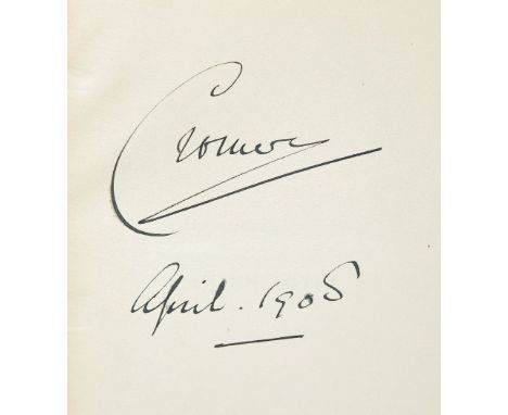
Cromer (Evelyn Baring, Earl of). Modern Egypt, 2 volumes, 1st edition, Macmillan and Co., Limited, 1908, photogravure frontispiece, folding map, endpapers browned, signed by the author, 'Cromer, April 1908', on volume 1 initial blank in black ink, original green cloth, volume 1 corners bumped, mild indentation to volume 2 spine, 8vo, together with Broadley (Alexander Meyrick), How we Defended Arábi and his Friends, a Story of Egypt and the Egyptians, 2nd edition, 1884, frontispiece, 13 plates, light spotting, title page frayed, inscribed by the author on the half-title, original green cloth, slightly marked, 8vo, plus Millais (John B.), Far Away up the Nile, 1st edition, 50 plates, sketch-map, spotting to text-block, original red cloth, large 8vo, and 34 others, all relating to Egypt or Sudan, late-19th and early-20th century, original cloth (38)
Lot 77
Du Chaillu (Paul B.). Explorations & Adventures in Equatorial Africa, 1st edition, 1861, folding map (torn without loss), illustrations, publisher's list at end, light spotting, 'Penarth Library' inscription to front pastedown, original cloth gilt, rebacked with original spine relaid, light edge wear, 8vo, together with A Journey to Ashango-Land: And Further Penetration into Equatorial Africa, 1st edition, 1867, wood-engraved frontispiece, folding map, illustrations, some light soiling, original cloth gilt, spine faded with tears at ends, inscribed at front "With the kind compliments of Author and Publisher", 8vo (2)

Lot 79
Galton (Francis). Memories of My Life, 1st edition, Methuen & Co., 1908, portrait frontispiece with tissue-guard, 1 plate, text illustrations, frontispiece offset to title, and with a few marginal spots, pages 1/2 of publisher's catalogue excised, tear to pages 3/4 with loss, contemporary ownership inscription to half-title verso, later inscription to front free endpaper, bottom edge untrimmed, original blue cloth, spine and front board lettered and ruled in gilt, extremities very slightly rubbed, spine rolled, 8vo, together with Landor (A. Henry Savage), Across Widest Africa, an Account of the Country and People of Eastern, Central and Western Africa as seen during a Twelve Months' Journey from Djibuti to Cape Verde, 2 volumes, 1st edition, Hurst and Blackett Ltd., 1907, half-tone photographic frontispieces, numerous plates, large folding map, bookplates of Hans Sauer and I & F W Hosken, top edges gilt, others untrimmed, original blue cloth gilt, mild fraying to extremities, covers mottled, large 8vo, plus Melland (Frank H., & Edward H. Cholmeley), Through the Heart of Africa, being an Account of a Journey on Bicycles and on Foot from Northern Rhodesia, past the Great Lakes, to Egypt, undertaken when proceeding home on leave in 1910, 1st edition, Constable & Company Ltd., 1912, half-tone photographic frontispiece, 45 plates, folding route map, occasional spotting to text-block, bookplate of Sir Kenneth Irwin Crossley, 2nd Baronet (1877-1957), top edge gilt, others untrimmed, original pictorial orange cloth gilt, spine slightly faded and rolled, square 8vo, plus Burton (Richard F.), The Lake Regions of Central Africa, A Picture of Exploration, 1st US edition, New York: Harper & Brothers, Publishers, 1860, wood-engraved frontispiece, text illustrations, occasional spotting and soiling, photographic portrait of Burton mounted to initial blank, original purple cloth, recased and relined, rubbed, 8vo, and 6 others In 1845 Galton toured Egypt, the Sudan and Syria, and in 1850 travelled to south-west Africa under the auspices of the Royal Geographical Society. (14)
Lot 8
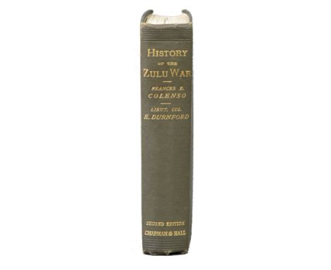
Colenso (Frances E., & Edward Durnford). History of the Zulu War and its Origin, second edition, with additions, and map, Chapman and Hall, Limited, 1881, folding plate, 'Outline Sketch of Isandhlwana', engraved folding colour map to rear, pale spotting to title page, very short closed tear to folding map stub, the image unaffected, and mild spotting along central fold, edges untrimmed, original green cloth, sides very slightly rubbed and marked, corners bumped, 8vo, a bright copy Mendelssohn I pp. 355-6 ('The work severely criticises the general policy of Sir Bartle Frere ... [and] contains a full account of the war, including the battles of Isandlwana, Rorke's Drift, and Ulundi'). (1)

Lot 81
Hamilton (James). Sinai, the Hedjaz, and Soudan: Wanderings around the Birth-Place of the Prophet, and across the Aethiopian Desert, from Sawakin to Chartum, 1st edition, Richard Bentley, 1857, half title, 2 folding maps ('Map of Part of Nubia' and 'From Djidda to Tayf, shewing Mr Hamilton's Route, 1854'), bookseller's ink-stamp to half title verso, contemporary inked marginalia to pages x-xi relating to Speke and Burton's Nile expedition, very faint occasional spotting, original purple cloth, spine rolled and faded, with a closed tear to the cloth, fraying to joints and spine-ends (head of spine repaired), a few marks to sides, extremities bumped, 8vo Macro 1117. 'In the early 1850s, James Hamilton traveled to Cairo, via Sinai to Suez, down the Red Sea to Yanbu and Jidda, around the Hijaz, across the Red Sea to Suakin, then to Khartoum, and back up the Nile to Cairo' (Slight, The British Empire and the Hajj: 1865-1956, ch. 2). (1)
Lot 82
Horneman (Frederick). The Journal of Frederick Horneman's Travels from Cairo to Mourzouk, the Capital of the Kingdom of Fezzan, in Africa in the Years 1797-8, 1st English edition, 1802, two folding engraved maps, small sketch map, American Museum pf Natural History library ink stamp at foot of page 85, some spotting and toning, endpapers renewed, contemporary half calf, rebacked, light edge wear, 4to (1)
Lot 83
Huxley (Elspeth). The Sorcerer's Apprentice. A Journey through East Africa, 1st edition, 1948, folding map, illustrations, original cloth (some fading to extremities), dust jacket, spine chipped at head, repairs to verso, 8vo, together with The Red Rock Wilderness, 1st edition, 1957, some spotting, previous owner signature, original cloth, dust jacket, spine toned with chips and tears, repairs to verso, 8vo, plus The Flame trees of Thika, 1st edition, 1959, frontispiece, original cloth, price-clipped dust jacket, small tears and light stains, 8vo, with others by Huxley including White Man's Country. Lord Deamere and the Making of Kenya, 2 volumes, 1935 (ex libris) and The Merry Hippo, 1963 (with bookplate to half title) (22)

Lot 87
Laing (Alexander Gordon). Travels in the Timannee, Kooranko, and Soolima Countries, in Western Africa, 1st edition, John Murray, 1825, folding map frontispiece, 7 aquatint plates, spotted and offset, institutional ink-stamps, plate facing page 371 shaved along fore edge, modern half calf, 8vo, together with Park (Mungo), Travels in the Interior of Africa, in the Years 1795, 1796, & 1797, abridged from the Original Work, printed by J. W. Myers, 1799, engraved portrait frontispiece (laid down, possibly supplied), dedication leaf, lacking half title and advertisements, title repaired, contemporary gift inscription to head, contemporary inscription 'Mr Mungo Park' to final page, soiling, inner hinges strengthened, contemporary marbled calf, rebacked, at an early date, extremities worn, 8vo, plus Butler (Sir William Francis), The Campaign of the Cataracts, being a Personal Narrative of the Great Nile Expedition of 1884-5, 1st edition, Sampson Low, Marston, Searle, & Rivington, 1887, frontispiece, 6 plates, folding maps, perforation stamp, light spotting and closed tear to title page, splits to map folds, edges untrimmed, modern red quarter morocco, spine rolled, 8vo, and Denham (Dixon), Narrative of Travels and Discoveries in Northern and Central Africa, in the Years 1822, 1823, and 1823 by Major Denham, Captain Clapperton and the Late Doctor Oudney, 2 volumes, 3rd edition, John Murray, 1828, 12 engraved plates including frontispieces, 3 folding maps, occasional spotting, frontispieces offset, short closed tear to folding map to rear of volume 1, early-20th-century tan calf by Riviere for Henry Sotheran, very slightly rubbed, 8vo, and 5 others (11)

Lot 89
Leyden (John). Historical Account of Discoveries and Travels in Africa, enlarged, and completed to the Present Time ... by Hugh Murray, 2 volumes, 1st edition, Edinburgh: George Ramsay and Company for Archibald Constable and Company, 1817, half titles, folding map frontispiece to each volume, 4 further maps (3 folding), 5 pages of publisher's advertisements to volume 1, spotting and browning to preliminaries and maps, occasionally to text, volume 1 frontispiece with clean splits to folds, edges untrimmed, original blue paper boards, rebacked at an early date in purple cloth retaining original paper spine-labels (chipped), spines sunned, boards slightly marked, extremities worn, 8vo Provenance: contemporary ownership inscriptions of the Duke of Buccleuch to endpapers and front boards. (2)
Lot 9
Cooley (William Desborough). Inner Africa Laid Open, in an Attempt to Trace the Chief Lines of Communication across that Continent South of the Equator: With the Routes to the Muropue and the Cazembe, Moenemoezi and Lake Nyassa; the Journeys of the Rev. Dr. Krapf and the Rev. J. Rebmann on the Eastern Coast, and the Discoveries of messrs. Oswell and Livingstone in the Heart of the Continent, 1st edition, 1852, half title, folding map, advertisements at rear, stitching weak, some leaves detaching, offsetting from map to title, light marginal toning, previous owner ink stamp at head of title and at front, original cloth, rebacked, some edge wear and stains, 8vo, together with The New Africa. A Journey up the Chobe and down the Okovanga Rivers. A Record of Exploration and Sport, by Aurel Schulz, M.D. and August Hammer, C.E., 1st edition, 1897, portrait frontispiece, folding map (repaired), illustrations, advertisement leaf at end, light spotting, presentation inscription, original cloth, a little rubbed with some fading, 8vo, plus The Ila-Speaking Peoples of Northern Rhodesia, by Rev. Edwin W. Smith & Captain Andrew Murray Dale, 2 volumes, 1st edition, 1920, folding map, illustrations, some light spotting, previous owner inscriptions, original cloth, spines darkened and rubbed at ends, 8vo, with other Africa related including Sir Charles Eliot's The East Africa Protectorate, 1905 and Cullen Gouldsbury & Hubert Sheane's The Great Plateau of Northern Rhodesia, 1911 (22)
Lot 90
Livingstone (David & Charles). Narrative of an Expedition to the Zambesi and its Tributaries; and of the Discovery of the Lakes Shirwa and Nyasa. 1858-1864, 1st edition, 1865, folding wood-engraved frontispiece, folding engraved map (with closed tear), publisher's 32 page catalogue at end, illustrations, title detaching, armorial bookplate, original burgundy cloth gilt, spine faded with small tears at ends, a few flecked stains, 8vo, together with The Last Journals of David Livingstone, in Central Africa, from 1865 to his death. Continued by a narrative of his last moments and sufferings, obtained from his faithful servants Chuma and Susi, by Horace Waller, 2 volumes, 1st edition, 1874, portrait frontispiece to volume I, two folding maps (one contained in volume I rear pocket), wood-engraved illustrations, publisher's catalogue at end of volume II, some light spotting, original cloth gilt, spines faded with small tears at ends, 8vo, with three others including Narrative of an Expedition to the Zambesi and its Tributaries, 1st US edition, New York, 1866, and Missionary Travels and Researches in South Africa, 1857 (lacking one map) (6)
Lot 91
Park (Mungo). The Journal of a Mission to the Interior of Africa, in the Year 1805. Together with Other Documents, Official and Private, Relating to the same Mission. To which is Prefixed an Account of the Life of Mr. Park, 1st edition, 1815, half title, folding engraved map (offset to part title opposite), a few minor spots, contemporary half calf, rebacked, original spine relaid, spine label renewed, 4to (1)

Lot 92
Salt (Henry). A Voyage to Abyssinia, and Travels into the Interior of that Country, executed under the Orders of the British Government, in the Years 1809 and 1810, 1st edition, F. C. and J. Rivington, 1814, 7 maps and charts (4 folding, 1 coloured and folding), 27 engraved plates, bound without the half-title, creasing to endpapers, title page and final text-leaf, occasional light browning, tears to inner folds of folding colour map, repairs verso, contemporary streaked calf, rebacked with the original spine gilt spine laid down, rear board slightly scuffed and skilfully restored, 4to (30 x 22.5 cm) Blackmer 1479; Czech Africa p. 141. (1)
Lot 93
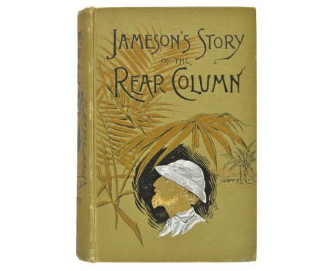
Schweitzer (Georg). Emin Pasha, his Life and Work, frontispiece, folding map, endpapers browned, Baron Llangattock bookplates, edges untrimmed, original blue cloth, spines very slightly faded, a few small marks, a bright copy, 8vo, together with Mounteney-Jephson (A. J.), Emin Pasha and the Rebellion at the Equator, 1st edition, Sampson Low, Marston, Searle & Rivington, 1890, photogravure portrait frontispiece, folding colour map, folding facsimile of the Mahdi's letter (in Arabic), 21 plates, illustrations to the text, very mild occasional spotting, original pictorial red cloth, extremities very slightly rubbed and bumped, faint discolouration to rear board, 8vo, plus Jameson (James S.) The Story of the Rear Column of the Emin Pasha Relief Expedition, authorized edition, New York: United States Book Company, [1890], frontispiece, numerous text illustrations, 2 folding maps (1 repaired), original pictorial green cloth, extremities slightly rubbed, 8vo, and Wauters (A. J.), Stanley's Emin Pasha Expedition, 1st edition, John C. Nimmo, 1890, frontispiece, 33 plates, folding map, occasional spotting, short closed tear to map, original green cloth gilt, extremities slightly rubbed, spine rolled, 8vo, and 6 others including first-hand Rear Column accounts, all original cloth, 8vo (12)

Lot 94
Selous (Frederick Courteney). Sunshine and Storm in Rhodesia, 1st edition, Rowland Ward & Co., Limited, 1896, photographic frontispiece, 8 plates, text illustrations, folding map, zebra-print endpapers, original tan cloth, rubbed and variably darkened, spine rolled, 8vo, together with Maxse (Frederick Ivor), Seymour Vandeleur, the Story of a British Officer, 1st edition, The National Review Office, 1905, frontispiece, 13 plates (many coloured), 9 folding maps and plans, light spotting, marginal tide-mark to plates and maps, top edge gilt, others untrimmed, original vellum, 4to, number 77 of 150 copies initially by the author, plus Schreiner (Olive), Dreams, 3rd edition, T. Fisher Unwin, 1891, frontispiece, signed by the author 'Olive Schreiner, June 17th 1897' on the title page, contemporary dark green full morocco for Bumpus, joints slightly rubbed, 8vo, and 62 others, all concerning southern Africa, late-19th or early-20th century, travel, military, politics, mainly original cloth (70)

Lot 97
Stanley (Henry M.). In Darkest Africa, 2 volumes, 1st edition, deluxe issue, 1890, 2 heliogravure portrait frontispieces and 36 wood-engraved plates, all on india paper, mounted, 6 etched plates by Montbard, signed by the artist in pencil, all with tissue-guards, 3 folding colour maps (2 linen-backed), 1 leaf of manuscript facsimile, 1 geological profile, numerous wood-engravings to the text, 1 additional wood-engraved plate not listed in contents (group portrait facing p. xiii volume 2), spotting to etched plates, additional plate and versos of linen-backed maps, mild spotting to volume 1 frontispiece and folding map, heavier spotting to etched plates and folding map versos, top edges gilt, others untrimmed, original black half morocco over bevelled boards, titles and decoration to japon sides gilt, japon mottled, extremities rubbed, demy 4to Number 27 of 250 deluxe copies signed by Stanley on the limitation page. (2)
Lot 98
Stanley (Henry M.). The Congo and the Founding of its Free State: A Story of Work and Exploration, 2 volumes, 1st edition, 1885, portrait frontispieces, folding map contained in rear pocket of each, illustrations, publisher's catalogue at end of volume II, a few light spots to titles, small Sotheran ink stamps at head of front endpapers, original pictorial cloth gilt, tiny tears at head of volume II spine, one corner bumped, 8vo (2)
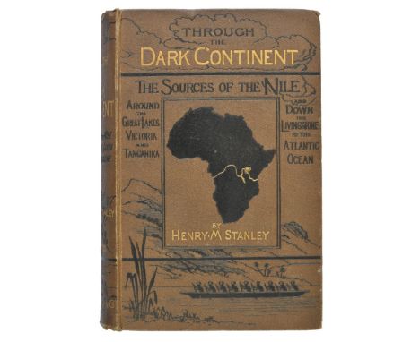
Lot 99
Stanley (Henry M.). Through the Dark Continent or the Sources of the Nile around the Great Lakes of Equatorial Africa and down the Livingstone River to the Atlantic Ocean, 2 volumes, 1st edition, 1878, portrait frontispieces, folding map contained in rear pockets, maps and illustrations, publisher's list at end of volume II, Blackie & Son Private Library labels and shelf numbers at front, original pictorial cloth gilt, small split to lower joint of volume I, spines ends a trifle rubbed, 8vo (2)
Lot 1
Baedeker (Karl). Russia with Teheran, Port Arthur, and Peking, 1st edition in English, 1914, folding maps and plans, map of Southern Siberia and Turkestan (opposite Page 497) torn in half but complete, bookseller's ticket to title, original cloth, spine rubbed and a little frayed on upper joint, together with The United States with an Excursion into Mexico, 1st edition in English, maps and plans as listed including large general map at rear, original cloth, rubbed and slightly soiled, spine faded and frayed at extremities, plus Imperial Japanese Government Railways. An Official Guide to Eastern Asia, Vol. IV: China, [1915], folding maps and plans including one map in pocket at rear, illustrations to text, lacks title (?), a little occasional spotting and soiling, inner hinges cracked, original cloth, rubbed, plus six further Baedeker publications, all small 8vo (10)
Lot 101
Stanley (Henry M.). Coomassie and Magdala: The Story of Two British Campaigns in Africa, 2nd edition, 1874, portrait frontispiece, two folding maps, illustrations, a few light spots, partly unopened, endpapers renewed, original green cloth gilt, spine a little darkened and rubbed at ends, 8vo, together with Through the Dark Continent or the Sources of the Nile around the Great Lakes of Equatorial Africa and down the Livingstone River to the Atlantic Ocean, 2 volumes, 1st US edition, New York, 1878, portrait frontispieces, folding map contained in rear pockets, maps and illustrations, slight marginal toning, small water stain at foot of a few leaves in volume II, original green pictorial cloth gilt, edges a little rubbed, slight bowing to covers, 8vo, plus My Dark Companions and their Strange Stories, 1st edition, 1893, illustrations, presentation inscription, endpapers lightly toned, front hinge tender, original cloth gilt, light edge wear, 8vo, with three others: Coomassie and Magdala, 1874, How I Found Livingstone: Travels, Adventures and Discoveries in Central Africa, 1872, and The Congo and the Founding of its Free State, 2 volumes, 1885, all 1st US editions (8)
Lot 103
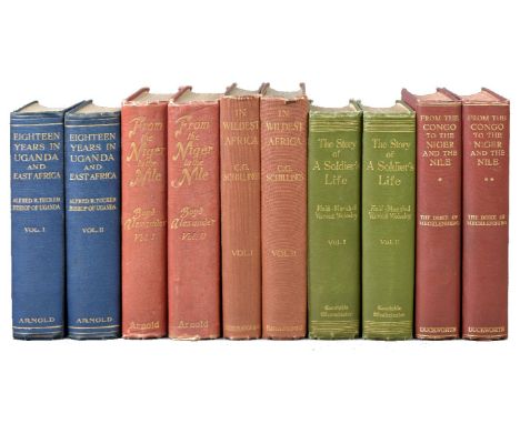
Tucker (Alfred R.). Eighteen Years in Uganda & East Africa, 2 volumes, 1st edition, Edward Arnold, 1908, photogravure frontispiece to volume 1, 60 plates from watercolours (4 in colour), folding colour map, 16-page publisher's catalogue, mild spotting to prelims, photogravure, map and page-edges, original blue cloth gilt, extremities very lightly bumped and rubbed, a few trivial marks, volume 2 spine rolled, 8vo, together with Wolseley (Garnet, 1st Viscount), The Story of a Soldier's Life, 2 volumes, 1st edition, Archibald Constable & Co Ltd, 1903, photogravure frontispieces, 3 plans (2 folding), title pages in red and black, top edges gilt, others untrimmed, original green cloth gilt, extremities very lightly rubbed and bumped, 8vo, plus Alexander (Boyd), From the Niger to the Nile, 2 volumes, 1st edition, Edward Arnold, 1907, half-tone frontispieces, 42 similar plates, numerous text illustrations, 2 folding maps, light spotting, contemporary newspaper cutting mounted to volume 1 front free endpaper and offset to half-title, a few marginal nicks to volume 1 frontispiece, plate facing p. 2 volume 2 chipped to no loss of image, original red cloth gilt, spines faded, extremities lightly rubbed and bumped, spine-ends nicked, 4to, and Mecklenburg (Adolf Friedrich, Duke of, & others), From the Congo to the Niger and the Nile, an Account of the German Central African Expedition of 1910-1911, 2 volumes, 1st edition in English, Duckworth & Co., 1913, numerous photographic and other plates, folding map, text-block spotted, bookplates of Ernest E. Testi, endpapers browned, top edges dyed red, original red cloth, a few pale marks, 8vo, and 1 other Wolseley's Story is inscribed on the half-title of the first volume 'Dudley Alexander, with best wishes for the new year, from A J Mounteney Jephson, New Year 1904', with the engraved bookplate of the recipient, Major Dudley Alexander CMG (1863-1931) to front pastedown. Mounteney-Jephson (1859-1908) was a member of the Emin Pasha Relief Expedition. (10)
Lot 105
Weale (J.P. Mansel). The Truth about the Portuguese in Africa, 1st edition, 1891, small map to verso of half title, a few manuscript annotations and corrections by the author, some toning to endpapers (rear endpaper with small repair), original green cloth, spine ends a little rubbed, 8vo Author's presentation copy, lengthy inscription to Empress Frederick of Germany (1840-1904) on half title. (1)

Lot 106
Wingate (Sir Reginald). Mahdiism and the Egyptian Sudan, being an Account of 9 folding colour maps, 4 folding plans, 1 folding map in end-pocket, 15 other maps and plans, inscribed by the author 'J. M. Cook, with F. R. Wingate's kindest remembrances, London, Oct. 1891' on the half title, endpapers renewed, original red cloth, spine faded, front board marked, extremities bumped, 8vo, together with Petherick (John), Egypt, the Soudan and Central Africa, with Explorations from Khartoum on the White Nile to the Regions of the Equator, being Sketches from Sixteen years' Travel, 1st edition, Edinburgh: William Blackwood and Sons, 1861, lithographic folding map, spotting to endpapers and prelims, occasionally to text, prelims creased, front inner hinge cracked but firm, ink-stamps of big-game hunter Henry Thomas Glynn (1856-1928), original brown cloth, a few marks to spine, head and foot frayed, board-corners worn, 8vo, plus Gessi (Romolo), Seven Years in the Soudan, being a Record of Explorations, Adventures, and Campaigns against the Arab Slave Hunters, 1st edition, Sampson Low, Marston & Company, 1892, frontispiece, 11 plates, light spotting, ink-stamps of Glen Ewin, front inner hinge superficially cracked, original pictorial blue cloth, slightly rubbed, 8vo, and 11 similar works Presentation copy of Mahdiism and the Egyptian Sudan; the recipient was probably John Mason Cook (1834-1899), son of the travel agent, Thomas. He took full control of the company in 1878, and under his auspices Thomas Cook & Son were responsible for the transfer of wounded soldiers to Cairo the Battle of Tell el-Kebir in 1882, and provided river transportation for the abortive Gordon Relief Expedition of 1884-5. (16)
Lot 107
Aikin (J.). A Description of the Country from thirty to forty Miles round Manchester..., 1st edition, published John Stockdale, 1795, engraved allegorical frontispiece, additional engraved title (additional title detached), list of subscribers, forty-five uncoloured engraved plates and sixteen engraved maps, with two additional plates not called for, two large folding maps (one with contemporary outline colouring), one folding map with folds partially repaired on verso, occasional spotting and staining, later endpapers, modern cloth gilt, 4to (1)

Lot 113
Blome (Richard). Britannia: or a Geographical Description of the Kingdoms of England, Scotland and Ireland with the Isles and Territories thereto belonging..., Illustrated with a map of each county of England besides several general ones. The like never before published, printed Tho. Roycroft for the Undertaker, Richard Blome, 1673, title page printed in red & black, dedication to Charles II, preface and five pages of tables and twenty-four pages displaying 808 heraldic shields, folding engraved map of the British Isles, forty-four double page engraved county maps, a plan of London and five folding maps of North Wales, South Wales, Scotland, Ireland and British Islands (complete as list), title page and dedication detached, upper hinge cracked, near contemporary calf gilt with later morocco gilt label to spine, worn and rubbed, folio William Nicholson, the Bishop of Carlise condemned Blome's Britannia 'as a most entire theft out of Camden and Speed'. Most cartographers borrowed from the works of earlier atlases this makes Nicholson's condemnation somewhat harsh and certainly overlooks the fact that Blome's maps have a charming naivety which has never been replicated. The six folding maps in this atlas are often trimmed and damaged. The examples contained in this example are in surprisinly good condition. Chubb XCIX, Skelton 90. (1)
-
109182 item(s)/page