We found 109198 price guide item(s) matching your search
There are 109198 lots that match your search criteria. Subscribe now to get instant access to the full price guide service.
Click here to subscribe- List
- Grid
-
109198 item(s)/page


Lot 316
Berry, William 'The History of the Island of Guernsey', pub. Longman, 1815, 348pp, 29 engraved plates, folding map, professionally rebound, half calf with marbled boards, gilt lettering and decoration to spine, together with Berry's Illustrations - facsimile of engraved plates. (2) *Condition: Calf expertly rebacked, first five leaves expertly repaired at upper margin, plates somewhat foxed and with light water stain to lower margin, slight foxing to a few leaves at start.

Lot 12
British Isles. De L'Isle (Guillaume), Les Isles Britanniques... , 1772, hand coloured engraved map, large decorative cartouche, 480 x 615 mm, together with Jaillot (Hubert). L es Isles Britanniques qui contiennent les Royaumes d'Angleterre, Ecosse et Irlande..., circa 1709, hand coloured engraved map, inset map of the Orkney, Faroe and Shetland Islands, large decorative cartouche and mileage scale, 465 x 655 mm (Qty: 2)

Lot 136
Gentleman's Magazine: or, Monthly Intelligencer, 45 volumes, a broken run, 1734-1826, numerous engraved maps, plans, engraved views, antiquities, etc., occasional slight defects (but contents generally intact), contemporary mixed calf bindings (earlier volumes bound in contemporary vellum-backed marbled boards), some wear, with occasional loss to spines, one or two covers detached and some joints cracked, 8vo (Qty: 45)NOTESThis series of Gentleman's Magazine consists of: Volumes IV (1734), VIII (1738), IX (1739), X (1740), XII (1742), XIV (1744), XVIII (1748), XXI (1751), XXV (1755), XXVI (1756), XXVII (1757), XXIX (1759), XXXI (1761), XXXVIII (1768), XL (1770), XLIV (1774), XLV (1775), XLVI (1776), XLVII (1777), L (1780), LIII (1783), LV (1785 in 2 parts), LVIII (1788, part 1 only), LIX (1789, part 1 only), LXI (1791, part 2 only), LXII (1792, parts 1 & 2), LXIV (1794, parts 1 & 2), LXV (1795, parts 1 & 2), LXVI (1796, parts 1 & 2), LXVII (1797, parts 1 & 2), LXVIII (1798, parts 1 & 2), LXIX (1799, parts 1 & 2), LXXII (1802, parts 1 & 2) LXXVIII (1808, part 1 only), LXXIX (1809, part 1 only), LXXXI (1811, part 1 only), LXXXVI (1816, part 2 only), LXXXVIII (1818, part 2 only), LXXXIX (1819, part 2 only), XCI (1821, part 2 only), XCII (1822, part 1 only), XCV (1825, part 2 only), and XCVI (1826, part 1 only). All the maps and plans of America called for in these volumes by David C. Jolly, Maps of America in Periodicals Before 1800 (1989) are present. These include numbers 3, Accurate Map of the West Indies, 7, Plan of the City and Harbour of la Vera Cruz, 8, Draught of the Castle of San Lorenzo, 9, View of the Town and Castle of St. Augustine, 54, Map of the British and French Settlements in North America, 56, Map of the World on Mercator's Projection, 65, Map of the Caribbee Islands (with closed tears and some creases), 69, Map of that Part of America which was the Principal Seat of War in 1756, 118, Map of Martinico, 119, Map of the Country between Crown Point and Fort Edward, 120, New and Accurate Map of the Isles of Guadaloupe, 121, Map of the Island of Orleans with the Environs of Quebec, 122, Authentic Plan of the River St. Laurence, 257, Plan of the Town and Chart of the Harbour of Boston, 258, Map of 100 Miles Round Boston, 260, New and Correct Plan of the Town of Boston, 288, Map of the Country Round Philadelphia including Part of New Jersey, New York, Staten Island & Long Island, 289, Sketch of the Country Illustrating the Late Engagement in Long Island, 290, Map of Connecticut and Rhode Island, with Long Island Sound, 291, Map of the Progress of His Majesty's Armies in New York. The volume for 1776 also contains the first printed appearance of the American Declaration of Independence (pages 361-362).
Lot 139
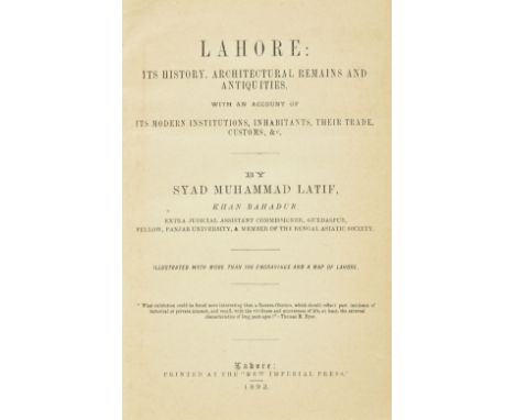
Latif (Syad Muhammad). Lahore: Its History, Architectural Remains and Antiquities, with an Account of its Modern Institutions, Inhabitants, their Trade, Customs &c, one volume bound as two, 1st edition, Lahore: New Imperial Press, 1892, folding map frontispiece, numerous lithographic plates as listed, some light toning throughout, interleaved with blanks, inner upper hinge of first volume cracked, later cloth gilt, slightly rubbed, 8vo (Qty: 2)NOTESUncommon first edition containing some material in Persian.

Lot 14
British Isles. Mercator (Gerard & Hondius Henricus ), Four regional maps, circa 1610, including Westmorlandia, Lancastria, Cestria...., circa 1613, engraved map of North West England & Wales with contemporary outline colouring, large strapwork cartouche, slight toning, 365 x 420 mm, Latin text on verso, together with another copy similar, with Warwicum, Northamtonia, Huntingdonia, Cantabrigia, Suffolcia, Oxonium..., circa 1613, uncoloured engraved map of South East England, large strapwork cartouche, 370 x 470 mm, French text on verso, plus Anglesey, Garesay, Wight vectis olim [and] Jarsay, circa 1633, four uncoloured engraved maps on one sheet (as published), one marginal closed tear but not affecting printed image, 325 x 435 mm, French text on verso, and Sanson (Nicolas). Britannicae Insulae in quibus Albium sive Britannia Maior Ivernia sive Britannia Minor tum et Orcades, Ebudes, Cassiterides, 1641, engraved map with contemporary outline colouring, slight staining, 400 x 525 mm (Qty: 5)
Lot 141
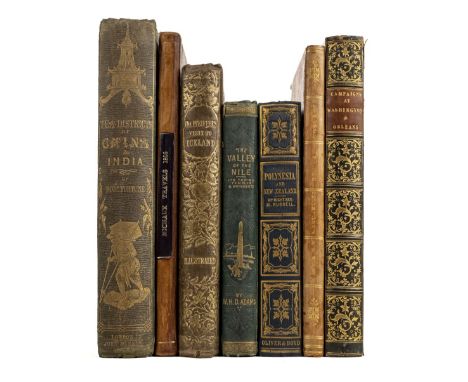
Michaux (Francois A.). Travels to the Westward of the Allegany Mountains, in the States of the Ohio, Kentucky, and Tennessee, in the Year 1802..., Translated from the French, London: Richard Phillips, 1805, folding engraved map frontispiece, 16 page publisher's catalogue at rear, some spotting, endpapers renewed, contemporary half calf, rebacked, slim 8vo (Sabin 48706), together with Fortune (Robert) , A Journey to the Tea Countries of China; including Sung-Lo and the Bohea Hills; with a short notice of the East India Company's Tea Plantations in the Himalaya Mountains, 1st edition, London: John Murray, 1852, tinted lithograph frontispiece, additional decorative title in red & black, lithograph map with original hand-colouring, one colour lithograph plate and wood engraved plate, numerous wood engraved illustrations, 32 page publisher's catalogue at rear, original green cloth, gilt blocked spine and upper board, spine slightly rubbed, 8vo, plus Russell (Michael) , Polynesia: or, an historical account of the principal islands in the South Sea, including New Zealand, 3rd edition, Edinburgh: Oliver & Boyd, and London: Simpkin, Marshall & Co., [1845], folding lithograph map frontispiece, additional wood engraved title, ownership inscription to front free endpaper, all edges gilt, original cloth with gilt blocked decoration, in bright condition, 8vo, and [Louis XVIII, King of France] , Relation d'un voyage à Bruxelles et à Coblentz. (1791.), Paris: Baudouin Freres, 1823, scattered spotting, contemporary half calf gilt, slim 8vo, plus [Gleig, George Robert] , A narrative of the campaigns of the British Army at Washington and New Orleans, under Generals Ross, Pakenham, and Lambert, in the Years 1814 and 1815; with some account of the countries visited, 2nd edition, London: John Murray, 1826, light scattered spotting, contemporary half calf, gilt decorated spine, 8vo, plus Visit to Iceland and the Scandinavian North, translated from the German of Madame Ida Pfeiffer, 1852, and The Valley of the Nile, by W.H. Davenport Adams, 1867 (Qty: 7)
![Rossi ( Giacomo Giovanni de). [Mercurio Geografico overo guida geografica in tutte le parti del mondo ...], 2 volumes bound i](https://cdn.globalauctionplatform.com/f5399dcd-9895-4006-9620-ab1400ddab44/73d7111f-a137-4f95-9e91-ab14011cc4c0/468x382.jpg)
Lot 143
Rossi ( Giacomo Giovanni de). [Mercurio Geografico overo guida geografica in tutte le parti del mondo ...], 2 volumes bound in one, Rome, circa 1692, lacking half-title and title page to volume one but retaining title page to volume two and index, 126 uncoloured engraved maps (complete as list), including 28 double-page, one folding and 97 single-page, a few maps toned, some marginal dust and finger soiling, one map with a repaired marginal closed tear, but not affecting image, faint but mostly obliterated library? stamps to margins of maps on recto, small gilt paper labels to verso of each map, one map (hemispheral world) with repaired hole (excised library stamp) in lower margin, not affecting printed image, later endpapers, modern quarter blind-stamped morocco gilt, large folio (Qty: 1)NOTESThere is considerable variation in the contents of this atlas, which includes maps by or after Cantelli da Vignola, the Sansons and others.
Lot 152
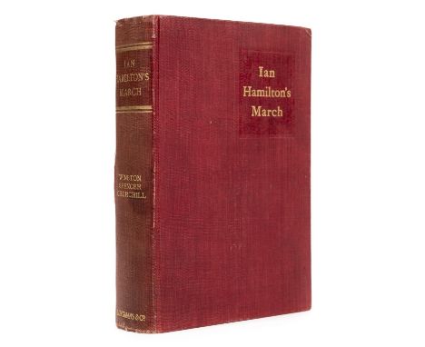
Churchill (Winston Spencer). Ian Hamilton's March, 1st edition, Longmans, Green, & Co., 1900, portrait frontispiece, folding map, 2 leaves of publisher's advertisements and 32pp publisher's catalogue (dated 7/00) at rear, minor spotting, original dark red cloth gilt, a little rubbed and slightly faded on spine, lower joint partly split, 8vo (Qty: 1)NOTESWoods A5.
![Channel Islands. A collection of seven maps, 17th - 19th century, including Mercator (Gerard). Anglesey [on sheet with] Garne](https://cdn.globalauctionplatform.com/f5399dcd-9895-4006-9620-ab1400ddab44/e841e7b1-7f80-4408-b71e-ab14011c7b79/468x382.jpg)
Lot 16
Channel Islands. A collection of seven maps, 17th - 19th century, including Mercator (Gerard). Anglesey [on sheet with] Garnesay, Wight olim Vectis & Jarsay, circa 1610, engraved map with contemporary outline colouring, slight staining, 325 x 435 mm, French text on verso, together with Mercator (Gerard & Hondius Henricus), Anglesey [on sheet woth} Wight ol Vectis, Garnesay & Jarsay, circa 1630, four uncoloured engraved maps on one sheet, 145 x 200 mm, Latin text on verso, with Fullarton (Archibald, publisher). Channel Island, Scilly Islands and Isle of Man, circa 1840, five engraved maps on one sheet with contemporary outline colouring, 430 x 290 mm, with another four maps and charts including examples by Herder, Bonne and Depot de la Marine, various sizes and condition (Qty: 7)

Lot 161
Cary (John). Cary's Traveller's Companion, or a Delineation of the Turnpike Roads of England and Wales..., 3rd edition, 1791, calligraphic title with near contemporary ownership signature (dated 1814), with an additional presentation inscription to verso, advertisement and forty-three (complete) engraved maps with contemporary outline colouring, map of Yorkshire is sectionalised, folding and laid on linen and contained in a pocket at the front of the atlas, six page list of the market and borough towns and a two page advertisement bound at rear, seventeen pages of blank paper bound at rear, marbled endpapers, contemporary red morocco in an 'envelope style' binding, some staining and wear to extremities, 8vo (Qty: 1)NOTESChubb CCXXV
Lot 162
Cary (John). Cary's Travellers's Companion; or, a Delineation of the Turnpike Roads of England and Wales; shewing the immediate Route to every Market and Borough Town throughout the Kingdom, 1819, engraved title, 43 engraved maps, hand-coloured in outline, including folding map of Yorkshire contained in map pocket, 4pp. publisher's advertisements to rear, one preliminary blank detached, stitching showing at front, marbled endpapers, all edges gilt, contemporary straight-grain red morocco wallet binding, darkened and rubbed with some splitting to map pocket, with notebook loosely inserted, 11 pages with contemporary ink or pencil manuscript travelling notes, all edges gilt, matching marbled wrappers, 8vo (Qty: 1)
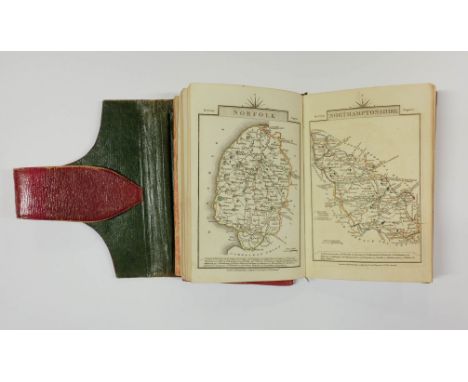
Lot 166
Eaton - Cheshire. The Eaton Tourist: or a "colloquial description" of the Hall, Grounds, Gardens, &c. at Eaton, the Seat of the Right Hon. Earl Grosvenor, Chester: J. Seacome, 1825, etched frontispiece, folding map and 4 plates, manuscript note to fore-margin of title, some offsetting from plates, bound with Bath , The Original Bath Guide: containing an Essay on the Bath Waters; with a Description of the City; and a variety of miscellaneous information, Bath: M. Meyler , [1824?], folding engraved frontispiece, decorative vignette title, 2 folding maps, 2 plates and 1 wood engraved illustration, bound with Kenilworth , A Guide to Kenilworth, containing a brief historical account of the Castle, Priory, and Church..., Coventry: Merridew & Son, circa 1824, engraved frontispiece, 5 plates and single-page plan, manuscript note to fore-margin of title, bound with Coventry , The Coventry Guide, containing a concise account of the ancient history of the City, and particular descriptions of the Churches, St. Mary Hall and other public buildings, Coventry: Merridew & Son, 1824, engraved frontispiece, 6 plates, some offsetting, manuscript note to fore-margin of title, 20th century half calf, small 8vo, together with Butcher (Edmund) , An Excursion from Sidmouth to Chester, in the Summer of 1803. In a series of letters to a Lady. Including sketches of the principal towns and villages, 2 parts in one, London: C. Whittingham for H.D. Symonds, 1805, engraved frontispiece, contemporary half calf, red morocco title label, 12mo in 6s, plus [Gibbs, Samuel] , Gibb's Illustrated Bath Visitant; or, New Guide to Bath, Bath: Samuel Gibbs, [1855?], engraved frontispiece, title in red & black, 2 folding engraved maps and 3 plates, wood engraved illustrations, adverts at rear, all edges gilt, late 19th century dark brown half morocco gilt by Riviere, extremities slightly rubbed, 12mo in 6s, and Oldfield (Henry George & Dyson, R.R.) , The History and Antiquities of the Parish of Tottenham High-Cross, in the County of Middlesex..., London: Printed for the authors, 1790, engraved frontispiece, 8 engraved plates, folding pedigree, light scattered spotting, contemporary mottled calf, gilt decorated spine, black morocco title label, upper joint cracked, large 12mo, plus [Bristol Hot-Wells] , Important Considerations, respectfully addressed to a distinguished Female Invalid; and Published with a view to the benefit of other Patients at the Bristol Hot-Wells, Bristol: Printed by J. Mills & Co., circa 1808, upper blank margin of title excised, contemporary speckled calf, gilt decorated spine, rubbed, small slim 8vo (Qty: 5)

Lot 168
Laurie (Robert & Whittle James, publishers). Laurie & Whittle's New Traveller's Companion Exhibiting a Complete and Correct Survey of all the Direct and Principal Cross Roads in England Wales and Scotland; as far North as Edinburgh and Glasgow...., 6th. edition, 1812, title page, advertisement, index and table of explanation all present, general map of England & Wales and twenty- five (complete) engraved road maps, all with original hand colouring, occasional staining, a few maps trimmed, later endpapers, modern cloth gilt, large 8vo (Qty: 1)NOTESThere is some variation in the dates at the base of the maps. The map of England & Wales is dated 1808. The map of Scotland 1809 and the remainder 1806.

Lot 169
Lewis (W., publisher). Lewis's New Traveller's Guide, or a Pocket Edition of the English Counties Containing all the Direct & Cross Roads in England & Wales..., circa 1819, frontispiece of an engraved map of England & Wales with contemporary hand colouring (near detached), calligraphic title page with a black & white engraved vignette of a coach and postillions, preface, contents list, list of mail coaches and cost of postage, forty-two (complete as list) engraved maps with contemporary outline colouring, including one folding (Yorkshire), each map with a page of descriptive text, an additional circular map of 'A Map of the Country ten Miles round London' by E. Lacey with bright contemporary hand colouring, tipped on to verso of map of England and Wales, some dust and finger soiling throughout, contemporary half morocco, heavily worn and frayed, 12mo (Qty: 1)NOTESChubb CCCLXIV. The title page is undated but the preface has the date Oct. 16 1819. The additional map of London is not listed in Howgego.
![[Metroland] . 'The Regional Survey of Gerrards Cross based on the Six Inch O. S. Map No. 48 S. E.', Easter 1940, manuscript t](https://cdn.globalauctionplatform.com/f5399dcd-9895-4006-9620-ab1400ddab44/e9b81076-899a-4a93-94fd-ab14011cd102/468x382.jpg)
Lot 170
[Metroland] . 'The Regional Survey of Gerrards Cross based on the Six Inch O. S. Map No. 48 S. E.', Easter 1940, manuscript title-page, 1 printed and 10 manuscript maps all hand-coloured (30 x 46 cm), 20 matt gelatin silver print photographs (mainly 8.5 x 13 cm), all mounted rectos only on 15 cloth-hinged thick card leaves with manuscript captions on mounted slips, 1 additional leaf with inset sheet of translucent paper captioned by hand providing key to photographs on subsequent leaf, printed label 'F. Whillock' to front pastedown, post-bound in contemporary cloth album (bottom post loose), title gilt to front cover, oblong folio (60.5 x 37.5 cm) (Qty: 1)NOTESA detailed cartographic survey of the Buckinghamshire town compiled in the midst of the Phoney War. The maps are headed: Land Utilisation; Relief and Drainage; Towns and Communications; Relief; Sections; Geology; Public Conveyances; Communications; Populatio; Public Buildings, Spaces etc.; and Civil Administration.
![Roscoe (Thomas). Wanderings and excursions in South Wales [& North Wales], 2 volumes, London: Tilt & Bogue, Simpkin &](https://cdn.globalauctionplatform.com/f5399dcd-9895-4006-9620-ab1400ddab44/a91c5fdd-f443-4355-a8af-ab1b012029f9/468x382.jpg)
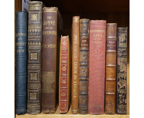
Lot 172
Roscoe (Thomas). Wanderings and excursions in South Wales [& North Wales], 2 volumes, London: Tilt & Bogue, Simpkin & Co., and Orr & Co., [circa 1860?], additional engraved vignette titles, 2 folding engraved maps (South Wales map with closed tear to fold & short closed tear to North Wales map), single-page plan and numerous plates, near contemporary half calf, gilt decorated spines with morocco title labels, extremities rubbed, 8vo, together with Wanderings and Excursions in North Wales, London: Charles Tilt and Simpkin & Co., [1837], engraved frontispiece, additional vignette title and numerous plates, some offsetting from plates, modern calf, large 8vo, plus Marsh (John Fitchett) , Annals of Chepstow Castle or Six Centuries of the Lords of Striguil from the Conquest to the Revolution, Exeter: Privately Printed by William Pollatrd, 1883, Large Paper copy, half-title, title in red & black, subscriber's list present at rear, top edge coloured red, remainder untrimmed, original cloth, frayed at head & foot of spine, lower joint worn and a little torn, large 4to (limited Large Paper edition 15/25 with the subscriber's name of W.T. Pears, Esq., Old Hall, Aigburth, Liverpool, in letterpress to half-title), and other British topography related including The Romantic and Picturesque Scenery of England and Wales..., by P.J. De Loutherbourg, 1805, facsimile edition, Ironbridge Gorge Museum Trust, Shropshire, 1979, colour plates (including two plates from the original edition loosely inserted), original dark green quarter morocco, folio, contained in original slipcase, and The Vale of Nantgwilt, by R. Eustace Tickell, 1894, etched plates, contents loosely contained in original quarter vellum cloth covers, worn, oblong folio, etc. (including few odd volumes) (Qty: 13)

Lot 176
Smith (Charles). Smith's New Pocket Companion to the Roads of England and Wales and Part of Scotland, 1826, frontispiece of a double page map of England & Wales, printed title, advertisement, fifteen pages of a general index, 126 uncoloured engraved strip road maps on forty-two leaves, map of the Isle of Wight and six pages of tables of cross-roads, slight spotting throughout, bookplate of Sir David Salomons Bart,contemporary half calf gilt, upper joint weak, slight wear to extremities, 8vo (Qty: 1)NOTESChubb. CCCCII. Uncommon.
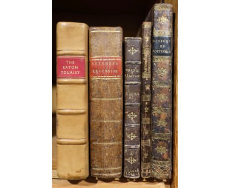
Lot 179
Wilde (William R.). The Beauties of the Boyne , and its Tributary, the Blackwater, Dublin: James McGlahan , 1849, wood engraved illustration to title with publisher's complimentary inscription to upper blank margin, folding map and numerous wood engraved vignette illustrations, publisher's adverts at front and rear, original cloth gilt, slightly frayed at head & foot of spine, 8vo, together with Mauchline Ware binding , Two Hundred and Twenty-Two Popular Scottish Songs, with Music. The Choicest Melodies of Scotland, as sung by Wilson, Templeton, Mackay, and other popular vocalists, Glasgow: John S. Marr, 1868, all edges gilt, original Mauchline Ware binding with wooden boards made from wood from the mound where Lord Dundee fell at Urrard House at the Battle of Killiecrankie in 1689 during the Jacobite uprising, red morocco spine with gilt decoration (slightly rubbed), small 8vo, plus Jones (Stephen) , Masonic Miscellanies, in Poetry and Prose..., Dublin: Joseph Hill, 1800, upper outer blank corner of title torn and repaired, repairs to leaves B4 & B5, some soiling, 20th century half calf, 12mo, and Knox (A.E.) , Autumns on the Spey, 1872, 4 tinted lithograph plates (including frontispiece), few wood engraved vignette illustrations, original cloth with gilt blocked image to upper board, 8vo, and others including A Guide-Book to Dundee by Lawson Brothers, Dundee, 1870; Melodies, by Thomas Moore, Phildelphia: T. Jekyll, 1821; Days at the Coast by Hugh Macdonald, Glasgow: John Cameron, 1860; An Account of the Antiquities, Modern Buildings, and Natural Curiosities, in the Province of Moray..., [by Isaac Forsyth], Edinburgh: Michael Anderson, 1813 (without map), and Authenticated Report of the Discussion which took place between the Rev. Richard T.P. Pope, and the Rev. Thomas Maguire, in the Lecture Room of the Dublin Institution..., Dublin: R. Coyne, 1827 (Qty: 9)

Lot 18
Cheshire. Speed (John), The Countye Palatine of Chester with the most ancient Citie described, published John Sudbury and George Humble, 1616, hand coloured engraved map, inset town plan of Chester, central fold partially split and repaired on verso, occasional marginal closed tears, slight browning to margins but not affecting printed image, slight creasing, 390 x 515 mm, Latin text on verso (Qty: 1)

Lot 180
Wiltshire. Songs in Wiltshire, by Alfred Williams, 1st edition, London: Erskine Macdonald, 1909, title signed by the author, front free endpaper with ownership signature S.G. Croome, edges untrimmed, original green cloth gilt, 8vo, together with Jones (Joseph Barnard) , Williams of Swindon, 1st edition, Swindon: The Swindon Press, June 1950, original cloth, slight spotting and discolouration, 8vo, with loosely inserted autograph letter signed from the author J.B. Jones to a Mr Howarth dated 30 November 1950, plus Williams (Alfred) , The Selected Poems of Alfred Williams, 1st edition, London: Erskine Macdonald, 1926, front pastedown with ownership signature of Benjamin S. Lightfoot, original green cloth gilt, lower outer corner of front board neatly repaired with matching cloth, 8vo, and Tanner (Robin & Heather) , Wiltshire Village, 1st edition, London: Collins, 1939, monochrome frontispiece and illustrations, ownership inscriptions to front blank, printed map endpapers, original green cloth gilt, 4to, and Brewer (J. Norris) , Introduction to the Original Delineations, Topographical, Historical, and Descriptive, intituled the Beauties of England and Wales, 1818, 2 folding engraved maps, scattered spotting, contemporary half calf, large 8vo, and [Storer, James Sargant] , Antiquarian and Topographical Remains of the most interesting Objects of Curiosity in Great Britain, 2 volumes, 1816, numerous engraved plates, contemporary calf, gilt decorated spines with contrasting morocco labels, boards detached, 8vo, plus a good selection of other Wiltshire topography and history related, mostly 20th century publications (including few pamphlets), together with Alfred Williams, Heather & Robin Tanner reference etc. (Qty: approx. 50)
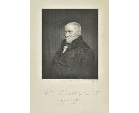
Lot 188
Phillips (John). Memoirs of William Smith, LL.D., Author of the "Map of the Strata of England and Wales", by his Nephew and Pupil John Phillips, 1st edition, London: John Murray, 1844, engraved portrait frontispiece, four profile portrait plates (including one in silhouette), illustrations and diagrams to text, publisher's list at rear, a few minor spots, light toning to fore-edge margins, front endpaper with 20th century ownership signatures, hinges cracked, original brown blindstamped cloth, spine torn and head and foot with loss (2 cm at foot & 6 cm at head), 8vo, together with Sheppard (Thomas) , William Smith: His Maps and Memoirs, Hull: A. Brown & Sons, 1920, black & white plates and folding plans, illustrations and tables, original cloth, frayed at head & foot of spine, joints split, 8vo (Qty: 2)NOTESPhillips: Only 500 copies printed.

Lot 193
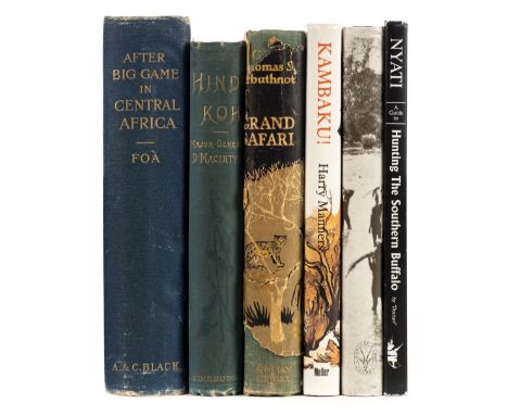
Foà (Edouard). After Big Game in Central Africa..., translated from the French, with an Introduction by Frederic Lees, 1st edition, Adam & Charles Black, 1899, additional half title, portrait frontispiece, numerous black and white illustrations throughout, single page map of Africa and half-tone illustrations and advertisement at rear, one plate detached and crudely taped in, slight spotting to title, manuscript presentation inscription to verso of front endpaper, top edge gilt, publisher's blue cloth with gilt elephant motif to upper siding, spine a little faded, worn and rubbed at extremities, 8vo, together with Macintyre (Major-General Donald, V.C.), Hindu-Koh: Wanderings and Wild Sport on and beyond the Himalayas, new edition 1891, additional half title, frontispiece of a collection of big game trophies with key plate, numerous illustrations throughout, two manuscript ownership inscriptions to first front blank, publisher's blue cloth gilt, a little worn at extremities, 8vo, with Arbuthnot (Thomas S.). Grand Safari, William Kimber, 1854, additional half title, numerous illustrations throughout, publisher's cloth gilt, dust jacket worn and frayed, torn with some loss and stained with old sellotape marks, 8vo, plus Manners (Harry). Kambaku!, 1st English edition, Frederick Muller, 1981, additional half title, numerous illustrations throughout, map of Mozambique endpapers, publisher's cloth gilt, dust jacket price clipped, 8vo, and Sanches-Ariño (Tony). On the Trail of the African Elephant, 1st edition, Rowland Ward, 1988, additional half title, colour portrait frontispiece, title signed by author numerous colour and black & white illustrations, 'zebra-pattern' endpapers, publisher's cloth gilt, dust jacket, 8vo with ' Doctari'. Nyati a guide to Hunting Zimbabwe's most dangerous big game, The Southern Buffalo, Mag-set publications 1996, additional half title, numerous colour illustrations throughout, publisher's leatherette gilt, dust jacket, slim 8vo (Qty: 6)


Lot 21
Devon. Donn (Benjamin), A Map of the County of Devon, with the City and County of Exeter, 1st. edition, 1765, printed title, key plate, twelve engraved double page maps engraved by Thomas Jefferys, all with contemporary outline colouring, ornate cartouche and uncoloured plans of Exeter and Plymouth, some off setting, slight dust soiling and a little creasing, all plates re-guarded, later endpapers, old dealers catalogue entry sellotaped to front endpaper, modern half morocco with morocco gilt title label to upper siding, slight wear to extremities, folio (Qty: 1)NOTESProvenance:- Beeleigh Abbey Books 1992 and then from the private collection of Rodney Shirley. Batten & Bennett. The Printed Maps of Devon, no. 44

Lot 22
Dorset. Greenwood (C. & G.), Map of the County of Dorset, from an actual survey, made in the years 1825 & 1826..., published Sept. 11th 1826, engraved map with contemporary hand colouring, calligraphic title, compass rose, table of explanation and a large uncoloured vignette view of Weymouth, slight offsetting and staining, 1170 x 1580 mm, contained in a contemporary calf bookbox, slight wear to extremities (Qty: 1)

Lot 23
* Drayton (Michael). North Wales & Warwickshire, circa 1622, together two untitled allegorical engraved maps, one with later hand colouring, the map of Flint and Denbigh (coloured), 250 x 330, the map of Warwickshire with parts of Worcestershire, Staffordshire, Leicestershire and Oxfordshire (uncoloured), trimmed along vertical margins with loss to printed border, 250 x 325 mm, both mounted, framed and glazed (Qty: 2)
![Durham. Bill (John), The Bishoprick of Durham, [1626], hand coloured engraved miniature map, slight text show-through, 95 x 1](https://cdn.globalauctionplatform.com/f5399dcd-9895-4006-9620-ab1400ddab44/43b542c6-e4bc-4d54-85b6-ab14011c80a2/468x382.jpg)
Lot 24
Durham. Bill (John), The Bishoprick of Durham, [1626], hand coloured engraved miniature map, slight text show-through, 95 x 125 mm, English text on verso, together with another fourteen coloured county maps of Durham, with examples by Moll, Ellis, Van Langeren, Bickham (1796 edition), Lewis, Condor/Hogg, Teesdale, Osborne, Badeslade & Toms, Morden (miniature), Kitchin/Jeffreys, Cole & Roper, Van den Keere and Langley, various sizes and condition, mounted (Qty: 15)
![Durham. Bowen (Emanuel), An Accurate Map of the County Palatine of Durham, Divided into its Wards, [1762], engraved map with](https://cdn.globalauctionplatform.com/f5399dcd-9895-4006-9620-ab1400ddab44/52b5bdb0-3bf3-452f-8fa5-ab14011c8121/468x382.jpg)
Lot 25
Durham. Bowen (Emanuel), An Accurate Map of the County Palatine of Durham, Divided into its Wards, [1762], engraved map with contemporary outline colouring and some later enhancement, 420 x 505 mm, together with Jansson (Jan). Episcopatus Dunelmensis vulgo The Bishoprike of Durham, Amsterdam, circa 1646, engraved map with contemporary outline colouring, partially split along central fold, some marginal closed tears but not affecting image, 410 x 510 mm, French text on verso, with Saxton (Christopher & Kip W.). Dunelmensis Episcopatus qui comitatus est Palatinus ..., [1637], hand coloured engraved map, trimmed with very slight loss to upper right corner, 280 x 340 mm, plus another eighteen engraved county maps, including examples by Van den Keere, Greenwood, Hall, Kitchin, Moll, Seller/Grose, Cary, Phillips, Archer, Morden (large), J & C Walker, Murray, Pigot/Slater, Lewis and Fullarton, with two additional maps of Northumberland by Van den Keere and Osborne, various sizes and condition (Qty: 23)
![[Duchy of Urbino]. 'Documenti ò siano copie d'istromenti autentici con le loro dichiaritoni della regioni patrimoniali et avi](https://cdn.globalauctionplatform.com/f5399dcd-9895-4006-9620-ab1400ddab44/c15ac325-ef39-4d11-838e-ab14011cfe86/468x382.jpg)
Lot 257
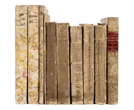
[Duchy of Urbino]. 'Documenti ò siano copie d'istromenti autentici con le loro dichiaritoni della regioni patrimoniali et avite della casa Feltria, e della Rovere, e de successori', 3 volumes, c.1710 [and earlier?], Italian manuscript in black ink on laid paper, pp. [6] 522 [13], [approx. 800], [approx. 250], volume 1 with a few printed fragments bound in and counted in pagination, volume 2 comprising documents in various hands (possibly of various dates), 2 folding pen-and-ink genealogical tables to volumes 1 (dated 1641) and 3 (with latest date 1705; repaired verso), volume 2 with folding genealogical table in watercolour (dated 1709 in accompanying text) and double-page grisaille watercolour map of the viciariate of Mondavio (dated 1696), genealogical tables in text, bookplates of Frederic North (see note), volumes 1-3 in contemporary vellum, red spine-labels, volume 3 retaining blue silk ties, volume 2 spine defective, 4to (26 x 19 cm), together with: ' Compendio della vita dell'ultimo Duca d'Urbino Francesco Maria 2o della Rovere', [c.1700?], Italian manuscript in black ink on laid paper, pp. [55], contemporary vellum, manuscript spine-title, 4to (29.5 x 21.5 cm) (Qty: 4)NOTESProvenance: 1) Frederick North, 5th Earl of Guilford (1766-1827), with engraved bookplates (first work) and manuscript pressmark (second work). 2) Sir Thomas Phillipps (1792-1872), English bibliophile ( Phillipps Manuscripts 5796-8 and 7657). 3) Professor Cecil H. Clough (1930-2017), Reader in Medieval History, University of Liverpool. The della Rovere and Montefeltro dynasties were united by the marriage of condietteri Giovanni della Rovere (1457-1501) to Giovanna, daughter of Federico III da Montefeltro (1422-1482), duke of Urbino. Their descendants held the duchy of Urbino until its annexation by the Papal States in 1631.
![Durham. Speed (John), The Bishoprick and Citie of Durham, published Thomas Bassett & Richard Chiswell [1676], hand colour](https://cdn.globalauctionplatform.com/f5399dcd-9895-4006-9620-ab1400ddab44/04ccb882-70b4-4617-881d-ab14011c81d7/468x382.jpg)
Lot 27
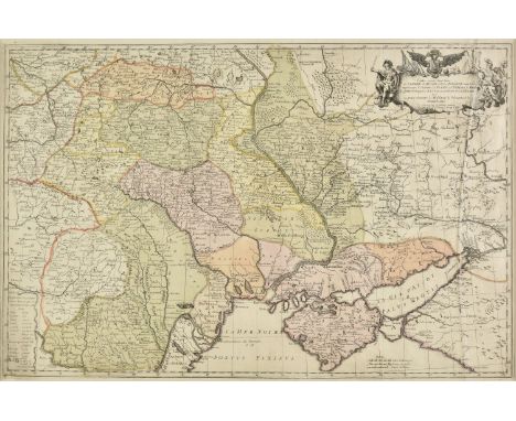
* Eastern Europe. Facius J. G. & G. S.), Carte exacte d'une Partie de L'Empire de Russie et de la Pologne meridionale renfermant l'Ukraine..., Bonn, 1769, engraved map with contemporary hand colouring, 475 x 725 mm, mounted, framed and glazed (Qty: 1)NOTESA scarce map of Eastern Europe including Poland, Lithuania, Russia and Ukraine. This is the first edition of the map, which was re-issued the following year as a 4-sheet map of the Theatre of War in the region, which was published by Jager.
Lot 270
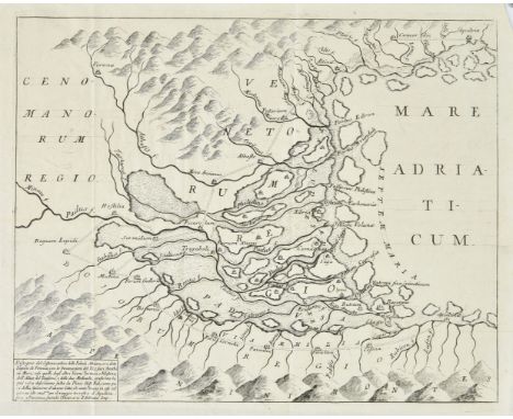
Silvestri (Carlo). Istorica e geografica descrizione delle antiche paludi adriane, ora chiamata, lagune di Venezia, 1st edition, Venice: Domenico Occhi, 1736, half-title, 2 engraved folding maps, woodcuts in text, uncut in contemporary carta rustica, 4to (24 x 17.5 cm), together with: Moscardo (Lodovico), Historia di Verona, nella quale si contengono i sucessi occorsi, dall'origine sua, fino all'anno MDCLXVIII, 1st edition, Verona: Andrea Rossi, 1668, a few stains, contemporary ownership inscription to foot of title-page, later half sheep, rubbed, head of spine chipped, 4to (22.2 x 16.2 cm), Salomoni (Jacopo), Agri Patavini Inscriptiones sacrae et prophanae, 1st edition, Padua: ex Typographia seminarii, 1696, engraved folding map, marginal worming from quire 2V, contemporary tan panelled calf, rubbed and worn, 4to (21.8 x 16 cm), [Tuscany], Istorie pistolesi, ovvero delle cose avvenute in Toscana dall'anno MCCC. al MCCCXLVIII. e diario del Monaldi, 2nd edition, Florence: Giovanni Gaetano Tartini e Santi Franchi, 1733, title-page in red and black with engraved vignette, variable browning, light spotting, D8 re-guarded (possibly a cancel), uncut in contemporary carta rustica, wear to spine, 4to (23.8 x 17.5 cm), Sansovino (Francesco). Venetia, citta nobilissima et singolare, descritte in XIII libri, Venice: Steffano Curti, 1663, engraved frontispiece view of Venice, engraved portrait, spotting and browning, occasional modern marginalia and underlining, free endpapers excised, contemporary vellum, spine worn, 4to (22.5 x 16.2 cm), and 1 other (Qty: 6)NOTESProvenance: Professor Cecil H. Clough (1930-2017), Reader in Medieval History, University of Liverpool. Two copies traced in UK libraries for the first work, a description of the Venetian lagoon (British Library and Glasgow). The anonymous Istoria pistolesi was first printed in 1578, by the Giunti.
Lot 272
Trissino (Giovan Giorgio). Tutte le opere, non piu' raccolte, 2 volumes, 1st edition, Verona: Jacopo Vallarsi, 1729, half-titles, title-pages in red and black with engraved vignette, engraved portrait frontispiece to volume 1 by Gutwein after Perini, engraved headpiece and initial, 2 folding plans (depicting Rome and a Roman military camp ), volume 1 signature 3D3 slit for cancellation, uncut in contemporary carta rustica, marbled paper backstrips, 4to (29.5 x 21.5 cm), together with: Trombelli (Giovanni Crisostomo), De cultu sanctorum dissertationes decem, 2 volumes in 5, 1st edition, Bologna: Lorenzo Martelli, 1740-3, engraved frontispiece, spotting, marginal worming to quires 2M-N in volume 1, light marginal damp-staining in volumes 3 and 5, contemporary carta rustica, 4to (24.5 x 18.2 cm), Speroni de Alvarotti (Arnaldo). Adriensium episcoporum series historico-chronologica monumentis illustrata, 1st edition, Padua: Giovanni Antonio Conzatti, 1788, engraved portrait , 3 engraved plates of episcopal tombs (of 4?), large folding engraved map, errata leaf, later stiff marbled wrappers, 4to (26 x 19 cm), [Padua], Orazione detta in nome della magnifica citta di Padova all'eccellenza del signor Z. Paulo Baglioni proveditor in occasione della parenza dal suo gloriosissimo reggimento, 1st edition, Padua: Penada, [1800?], 31 pp., engraved title-vignette, headpiece and initial, damp-staining, contemporary patterned wrappers, 4to (28.2 x 20.2 cm), and 1 other (Qty: 10)NOTESProvenance: Professor Cecil H. Clough (1930-2017), Reader in Medieval History, University of Liverpool. Trissino (1478-1550) was an important Renaissance humanist from Vicenza.
Lot 28
* Embroidered map. Europe, by M.S. Smeaton, 1823, oval map of Europe and North Africa, hand-embroidered in silk threads on linen, the place names and title worked in black cross-stitch, and the map outlines, oval foliate title frame, and floral border worked in colours using various stitches, browned and spotted, some holes and loss to blank margins, image size 47.5 x 43 cm (18.75 x 17 ins), tacked onto original wooden stretcher, together with the original gilt frame and verre eglomise mount (broken), latter dated at head and with maker's name at foot 'M.S. Smeaton' (Qty: 1)

Lot 3
Balkans. Homann (Johann Baptist, heirs of), Regnum Bosniae, una cum Finitimis Croatiae, Dalmatiae, Slavoniae, Hung. et Serviae Partibus ... / Regni Serviae Pars, una cum Finitimis Valachiae & Bulgariae Partibus..., Nuremberg, circa 1740, large engraved map on two conjoined sheets with contemporary hand colouring, fifteen uncoloured town plans and views at base and to the sides of the map, old folds, slight staining, 510 x 1095 mm (Qty: 1)

Lot 30
England & Wales. Cary (John), Cary's New Map of England and Wales with Part of Scotland, on which are carefully laid down all the Direct and Principal Cross Roads, the Course of the Rivers and the Navigable Canals, Cities, Market and Borough Towns, Parishes and most considerable Hamlets, Parks, Forests &c &c, 1st edition, 1794, engraved map with contemporary outline colouring, sectionalised and laid on three linen sheets, each sheet with the label of William Faden ' Geographer to His Majesty' to verso, calligraphic title and dedication, inset maps of England and Wales and the Scilly Isles, very slight offsetting and occasional spotting, overall size approx. 1800 x 2220 mm, contained in a contemporary marbled card slipcase, very slight wear to extremities (Qty: 1)NOTESThis highly detailed map is usually seen in atlas form and very occasionally as a wall map.

Lot 31
England & Wales. Chatelain (Henry Abraham), Nouvelle carte du Gouvernement civil D'Angleterre et de celuy de la Ville de Londres, Nouvelle carte pour Introduire a la Geographie et a la Genealogie des Rois D'Angleterre et D'Ecosse..., [and] Carte pour L'Intelligence de L'Histoire D'Angleterre où on remarque les Conquestes de cette Monarchie ..., circa 1720, together three engraved maps and genealogical tables, one map with old folds, 355 x 460 mm, 380 x 920 mm and 350 x 460 mm respectively, (Qty: 3)NOTESOriginally published in 'Atlas Historique et Methodique'.
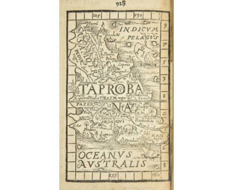
Lot 326
Rheticus (Georg Joachim, 1514-1574; former owner). Procli, De sphaera liber I. Cleomedis, De mundo ... Arati Solensis Phaeonomena ... Dionysii Afri, Descriptio orbis habitabilis. Omnia Graece et Latine ita coniuncta ... una cum Ioan. Honteri Coronensis De Cosmographiae rudimentis, Basel: Sebastian Henricpetri, 1561, 5 parts in 1 volume, Proclus's work with woodcut illustrations in text including an armillary sphere, astronomical diagrams and a vignette of Proclus teaching, Honter's work with 12 double-page woodcut maps each with additional single-page woodcut map to conjugate leaf verso, complete with the final leaf (blank except for publisher's woodcut device verso), browning, damp-staining to lower margins, concomitant holes to first 4 leaves including title-page, title-page with central 4 cm diagonal closed tear, contemporary inscription 'Ioachimo Rhaetico' in ink to head with initial 'I' just trimmed (see note), and later inscriptions including 'Seminarii Studiosoru[m] Religios[orum] Vienna, Anno 1620 12 April', later half morocco, rebacked retaining most of original spine, crudely recoloured, 8vo (15 x 9 cm) (Qty: 1)NOTESProvenance: Georg Joachim Rheticus (1514-1574), inscribed 'Ioachimo Rhaetico' ('From Joachim Rheticus') at the head of the title-page, in Rheticus's hand. An extraordinary and newly discovered association copy throwing light on the career of one the principal actors in the scientific revolution of the 16th century. Rheticus was the sole pupil of Nicolaus Copernicus, and the meeting between the two at Frombork in 1539 is considered without question to mark 'the beginning of modern astronomy' (DSB XI p. 359). He is perhaps remembered chiefly for encouraging Copernicus finally to consent to the publication of De Revolutionibus (1543), and for seeing the work through the press at Nuremberg while Copernicus lay dying; but it was in fact Rheticus's own account of his teacher's system, the Narratio prima (1540), which was the first published exposition of Copernican heliocentrism. Basel printers Heinrich Petri (1508-1579) and son Sebastian (1546-1626) were distant relatives of Johann Petreius, printer of the first edition of De Revolutionibus . In 1566, five years after their printing of the present compilation, they issued the second edition of De Revolutionibus , which was the first also to contain the Narratio Prima . Rheticus was a prolific correspondent at the centre of European intellectual life in the mid-16th century, and a handful of books with his inscription are known to exist in libraries or are attested in surviving letters and other sources. The National Library of Sweden holds a copy of Sacrobosco's Sphera mundi and other texts (Venice: Giunta, 1518) which contains the similar inscription 'Ioachimo Rhaetico', also in Rheticus's hand (shelfmark Stockholm K. Bibl., 106A, Fol, RAR; see further Goddu, 'Copernicus's Annotations: Revisions of Czartoryski's "Copernicana"', Scriptorium , 58 (2), 2004. p. 207). The only other example of a book inscribed by Rheticus we trace in commercial records is the legendary Horblit-O'More-Beltrame copy of De Revolutionibus , presented to Andreas Aurifarber, which achieved a record price for a printed book relating to the history of science when it realised $473,000 at auction in 1989 (see Gingerich, An Annotated Census of Copernicus' De revolutionibus , I.117). Adams P2134 (under Proclus); Houzeau & Lancaster 767; Sabin 65940; Shirley, World 108 & British Isles 69; VD16 P 4970. First edition of this compendium of cosmographical treatises to include Johannes Honter's De Cosmographiae rudimentis , which here contains Honter's double-page cordiform world map and maps of Malta, Mallorca, Cyprus, southern Africa, Madeira, Egypt and the Arabian Peninsula (as well as the Persian Gulf), India, Java, Sri Lanka ('Taprobana') and elsewhere; the first edition of Honter's work, printed at Krakow in 1530, is exceptionally rare and was printed with a double-page world map only. Heinrich Petri had previously issued a compendium containing Proclus's work together with those of Cleomedes and Aratus in 1547; the present iteration, containing Honter's text, was reprinted in 1585.AMENDMENT 9/12/2019:One party has noted that the inscription can also be read as ‘To Joachim Rhaeticus’, in the dative case, and that the inscription is not necessarily in Rheticus’s autograph.Additional information including images of other known inscriptions which in our opinion supports our attribution can be provided to bidders on request.

Lot 330
Strada ( Famianus ). De Bello Belgico decas secunda ab initio praefecturae Alexandri Farnesii parmae placentiae que ducis III... , Rome: Apud Haeredes Francisci Corbelletti, 1658, additional engraved title incorporating map of Belgium & Low Countries depicted as a lion (slightly close-trimmed to fore-edge & lower borders), ink stamp to both additional title and letterpress title, 10 engraved portrait plates (all folding), some dust-soiling and toning, contemporary calf, rubbed and light wear to extremities, 12mo, together with Estrades (Godefroi comte d') , Lettres et Negociations de Messieurs le marechal d'Estrades, Colbert, marquis de Croissy, et comte d'Avaux, ambassadeurs plenipotentiares du roi de France, à la Paix de Nimegue, et les reponses & instructions du roi, & de Monsieur de Pomponne..., 3 volumes, The Hague: Adrian Moetjens, 1710, titles in red & black, bookplate with initials W.A. to upper pastedowns, contemporary speckled calf, each volume neatly rebacked with gilt decorated spines, 12mo, plus Jonston (John) , [Heroes] ex Omni Historia Scotica lectisimi, Leiden: excudebat Christophorus Guyotius, sumtibus Andreae Hartii Bibliopolae Edinburgensis, 1603, title-page excised at head with loss of first word of title, final leaf provided in neat manuscript facsimile, dust-soiled and browned, bookplate of Henry Drummond of Albury Park, Surrey to upper pastedown, without free endpapers, 19th century calf-backed marbled boards, worn, slim 4to, and Claudius (Gottfried Christoph) , Historia Fratrum sportulantium ex antiquitate eruta atque exercitatione..., auctore M.G.C.C., Frankfurt, 1724, title in red & black, some leaves close-trimmed at fore-edge, browning, contemporary half calf, gilt decorated spine, slim 8vo, plus 5 other 17th & 18th century continental antiquarian (Qty: 11)
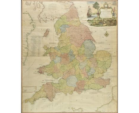
Lot 34
* England & Wales. Kitchin (Thomas), A New Map of England & Wales. Drawn from Several Surveys &c. on a New Projection, Corrected from Astronomical Observations & the Places marked where the Observat'ns were made....., The Canals inserted to 1792 by J. Phillips Surveyor, published Laurie & Whittle, 12th May 1794, large hand coloured engraved map, inset map of the Scilly Isles, occasional repaired marginal closed tears, old folds, 1280 x 1085 mm, framed and glazed (Qty: 1)

Lot 349
Stuart (James & Revett, Nicholas). Les Antiquities d'Athenes, Mesurees et Dessinees par J. Stuart et N. Revett, Peintres et Architectes..., 4 volumes, Paris, 1808-1822, half-titles, 191 engraved plates & plans (8 double-page), scattered spotting, occasional toning & finger-soiling, fore-margins to last few leaves in volume 3 dampstained, together with the supplement volume Hittorff (Jacques Ignace, ed.) , Les Antiquites Inedites de l'Attique, contenant les restes d'architecture d'eleusis, de rhamnus, de sunium et de thoricus, par la Societe des Dilettanti..., Paris, 1832, half-title, 60 engraved plates (including single-page map), scattered spotting, uniform 19th century maroon half morocco gilt, extremities rubbed and scuffed, folio (Qty: 5)NOTESProvenance: From the Estate of Michael Jaffé CBE (1923-1997), English art historian and director of the Fitzwilliam Museum, Cambridge. Blackmer 1617 reference to French edition.

Lot 35
England & Wales. Lewis (Samuel), A Map of England & Wales Divided into Counties, Parliamentary Divisions and Dioceses, Shewing the Principal Roads, Railways, Rivers & Canals and the Seats of the Nobility and Gentry, with the distance of each town from the General Post Office London..., published S.Lewis & Co., 1840, 1840, engraved map with contemporary outline colouring, sectionalised and laid on linen, in four parts (as published), inset map of the Scilly Isles, calligraphic cartouche, compass rose, table of explanation and large uncoloured engraved vignette of the Post Office in London, slight spotting and offsetting, each sheet approx. 1050 x 850 mm, each section bound in contemporary morocco gilt, some rubbing to extremities, size when folded 225 x 145 mm (Qty: 4)
Lot 36
England and Wales. Wyld (James), Railway Map of England, Wales and Scotland, Drawn from the Triangulation of the Ordnance Survey, the Survey of the Railway Companies, and Other Information..., circa 1855, very large engraved map with contemporary outline colouring on four sheets and laid on linen, heavily dust soiled and stained at base with numerous closed tears, mostly at base, presented on a contemporary wooden batten with gilt manuscript title 'England' on a separate panel affixed to batten, with large spring loaded roller at top of map, 1970 x 1310 mm, contained in a contemporary painted pine box, together with Wyld (James, publisher). An untitled Ordnance Survey map of most of Staffordshire and Warwickshire, circa 1845, large engraved map with contemporary outline colouring on twenty-eight conjoined sheets and laid on linen, heavily dust soiled and stained at base with several closed tears, mostly at base, presented on a contemporary wooden batten with a gilt manuscript title 'Staffordshire' on a separate panel affixed to batten with a large spring loaded roller at top of map, 1820 x 1460 mm (Qty: 2)

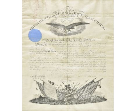
Lot 380
* Lincoln (Abraham, 1809-1865). Document signed 'Abraham Lincoln', Washington, 1 August 1864, a military commission, appointing John T. Bolton Second Lieutenant in the Veteran Reserve Corps, printed on vellum with engraved eagle at head and military apparatus at foot, wafer seal to left margin, manuscript insertions, signed by President Lincoln and the Secretary of War, Edwin M. Stanton, a little soiling and slightly heavier on folds, approximately 48 x 40 cm, together with two similar military commissions on vellum, appointing John T. Bolton to First Lieutenant 'For gallant and meritorious services during the [American Civil] war', 10 May 1866, and Captain, 13 March 1867, both with stamped signatures of President Andrew Johnson and Secretary of War Edwin M. Stanton, the first with circular brown stain at head, plus an earlier commission appointing First Sargeant in Company K of the 28th Regiment of New Jersey Volunteers, 15 September 1862, signed by the commanding officer W.V. Wisewell, printed on paper with manuscript insertions, some overall browning and creasing, approximately 25 x 38 cm, plus (Oldroyd Osborn H) , The Assassination of Abraham Lincoln, Flight, Pursuit, Capture, and Punishment of the Conspirators, with an Introduction by T.M Harris, Washington: O.H. Oldroyd, 1901 , illustrations from photographs, advert leaf and folding map at rear some soiling to first few leaves, frontispiece and title-page slightly creased, original cloth gilt, slightly rubbed, 8vo, plus a typed letter signed from Oldroyd to Captain John T. Bolton, Washington, 28 March 1914, beginning 'Mr H.H. Rumble of your city visited my Collection in this House in which Abraham Lincoln died and informed me that you were on duty at Ford's Theatre on the night of the Assassination', and hoping Bolton might write his recollections of that event to place in the collection, some light browning and creasing, one page, 8vo, the five documents matted in heavy card mounts with an additional printed contents list and contained with the inset book in a bespoke brown half morocco clam shell book box, the spine gilt-titled 'The Assassination of Abraham Lincoln Documents', overall 68 x 54 cm (Qty: 1)NOTESJohn T. Bolton was a respected soldier who was present when Abraham Lincoln was assassinated. It is understood from the family that he had applied for a position in the President's personal security team and that this was being considered at the time of the assassination. Lincoln was shot by John Wilkes Booth, an actor and Confederate sympathiser on 14 April 1865 and died the following day.


Lot 40
Germany. Ortelius (Abraham), Germaniae Veteris Typus, 1601, hand coloured engraved map, slight spotting to margins, 370 x 470 mm, Latin text on verso, together with Munster (Sebastian). Tabula Germaniae, circa 1542, uncoloured woodblock map on a trapezoidal projection, some marginal closed tears affecting title, 280 x 340 mm, Latin text on verso, with Mercator (Gerard). Tab. IV. Europae, Germaniam et Galliam Belgicam Exhibens, circa 1600, hand coloured engraved map, 345 x 400 mm, plus Hondius (Henricus). Episcopatus Paderbornensis descriptio nova..., [1636], hand coloured engraved map, 380 x 490 mm, English text on verso, with another five maps of Germany and German regions including examples by Blaeu, Mercator/Hondius, Cary and Fullarton, various sizes and condition (Qty: 9)

Lot 426
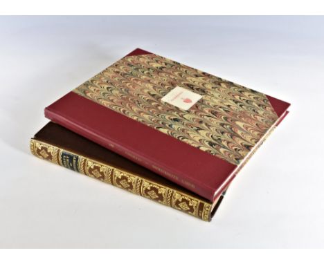
Folio Society . The Oregon Trail, by Francis Parkman, 2010, The Source Of The Nile..., by Richard Burton, 1994, includes facsimile folding map, The Fatal Shore..., by Robert Hughes, 1999, William Russell, Special Correspondent of The Times, edited by Roger Hudson, 1995, Memoirs of a Fighting Captain, by Admiral Lord Cochrane, 2005, together with 101 further volumes of Folio Society publications, all original cloth in slipcases, G/VG, 8vo (Qty: 106)

Lot 43
Hertfordshire. Speed (John), Hartford Shire Described, The sittuations of Hartford and the most ancient town S. Albons with such memorable actions as have happened, published John Sudbury and George Humble, 1st edition, [1611], hand coloured engraved map, inset town plans of Hertford and Verolanium (St. Albans), central fold partially split, some marginal fraying, right hand margin extended, several repaired marginal closed tears, 385 x 515 mm, English text on verso, mounted (Qty: 1)

Lot 44
Hungary. Blaeu (Johannes), Hungaria Regnum , circa 1644, engraved map with contemporary outline colouring, some dust soiling and very light overall toning, 420 x 515 mm, German text on verso, together with Cary (John). A new Map of Hungary with its Divisions into Gespanchafts or Counties; The Principality of Transylvania, Croatia &c. 1811, engraved map with contemporary hand colouring, slight creasing, 465 x 525 mm, with Homann (Johann Baptist). Marchionatus Moraviae Circulis Olomu-cencis quem Mandato Caesareo, circa 1720, engraved map with contemporary hand colouring, 490 x 590 mm (Qty: 3)

Lot 45
Hungary. Ortelius (Abraham), Ungariae Loca Praecipua Recens Emendata atque Edita, per Ioannem Sambucum Pannonium, Imp. Ms. Historicum. 1579, [1584], engraved map of Hungary and Transylvania, contemporary hand colouring, base of central fold strengthened and repaired on verso, one small worm hole in printed margin, 350 x 510 mm, Latin text on verso (Qty: 1)NOTESMarcel van den Broecke. Ortelius Atlas Maps, no. 151

Lot 46
Hungary. Seutter (George Matthaus), Novissima et Accuratissima Hungariae cum Circumjacentibus Regnis et Principatibus..., Augsburg, circa 1745, engraved map with contemporary outline colouring, large uncoloured allegorical cartouche and mileage scale, central fold partially strengthened on verso, 510 x 590 mm, together with Homann (Johann Baptist). Regni Hungariae tabula generalis..., Nuremberg, circa 1720, engraved map with contemporary hand colouring, some browning to margins, margins strengthened on verso, printer's fold, 475 x 570 mm (Qty: 2)


Lot 473
Risley (H.H.) . The Tribes and Castles of Bengal, 2 volumes, limited edition of 250 copies, 1891, Calcutta, some light spotting, uniform original decorated boards, spines & boards marked & slightly rubbed with minor loss, 8vo, together with Tod (James) , Annals and Antiquities of Rajast'han..., 2 volumes, popular edition, 1914, black & white folding map to volume 1, bookplates to front pastedowns, some light spotting & toning, uniform original brown cloth, 8vo, and Wilkins (W.J.) , Modern Hinduism..., 1887, Calcutta, period inscription to the half-title, some light toning, original gilt decorated blue cloth, boards & spine slightly rubbed, 8vo, plus other late 19th century & modern India reference & related, including Archaeological Survey of India, 23 volumes plus Index, by A. Cunningham, some leather bindings, mostly original cloth, many in dust jackets, G/VG, 8vo/4to (Qty: 6 shelves)

Lot 478
Taylor (Richard Cowling) . Statistics Of Coal..., 1848, Philadelphia, linen lined colour folding map to the front plus 4 further folding maps, torn folding map to pp 144/145, bookplate to front pastedown, water mark from front endpapers to pp 1, contemporary blue half cloth to marbled boards, lightly rubbed, 8vo, together with Owen (Richard & Bell, Thomas) , Monograph on the Fossil Reptilia of the London clay,..., 1849-58, Palæontographical Society, 58 black & white plates, some light spotting & toning, modern endpapers, modern gilt decorated red half calf, lightly marked, large 4to, and Dodd (George) , Dodd's Curiosities of Industry contents: gold in the mine, the mint,..., 1852, some spotting & toning, original embossed brown cloth, spine slight faded & rubbed to head & foot, 8vo, plus other 19th century & modern mining, archaeology & palaeontology reference, including North of England Institute of Mining Engineers, Transactions, 4 volumes, 1853-56, Newcastle-upon-Tyne, some leather bindings, mostly original cloth, many in dust jackets, G/VG, 8vo/4to (Qty: 6 shelves)

Lot 48
* Indian Ocean. Valentijn (Francois.), Tabula Indiae Orientalis et Regnorum Adjacentium, J van Braam et G. onder de Linden, Amsterdam, circa 1726, hand coloured engraved map, old folds, slight overall toning, one area of bleaching (possibly from old tape on verso), 500 x 670 mm, mounted, framed and glazed (Qty: 1)NOTESA highly detailed map of Australia, Southeast Asia and the Indian Ocean, from Valentyn's Oud en Nieuw Oost-Indien, one of the earliest contemporary maps to report information drawn from the Dutch V.O.C. during the period. The map is an overview from Valentyn's monumental work on the East India Company, showing most of the charter covered by the VOC monopoly, from the Cape of Good Hope to Japan. Tooley, R.V. 'The Mapping of Australia' no.1268.
![Japan. Le Rouge (George Louis), Carte du Japon et de la Corée, Paris, [1748 - 1759], engraved map with contemporary outline c](https://cdn.globalauctionplatform.com/f5399dcd-9895-4006-9620-ab1400ddab44/93205b42-28c5-4888-99e5-ab14011c8e9b/468x382.jpg)
-
109198 item(s)/page