We found 108737 price guide item(s) matching your search

Refine your search

Year

Filter by Price Range
  • List
  • Grid
  • 108737 item(s)
    /page

Lot 555

Dieppe, France (Dieppe, Ville de Normandie au Pais de Caux Port de Mer …), Fer, Les Forces de l` Europe…, Paris, ca. 1696. 11 x 7”. (HC) Handsome, detailed plan of the extensive fortifications at Dieppe on the Normandy coast. A fleet of ships is shown and the map is decorated with a compass rose and simple title cartouche that mentions the British bombardment of the town in 1694. Engraved by Herman van Loon and published by Nicolas de Fer, Geographer at Louis XIV`s court. He was one of the most prolific publishers of plans of European cities in the late seventeenth century. Wide margins with light toning and a small spot near center. (+B)

Lot 556

Strasbourg, France (Strasbourg, Ville Ancienne Celebre et Tres Fortisiee… / Strasburg, eine Uhralte Sehr Beruhmte u. nun auch Ungemein Fortisierte Statt…), Seutter, ca. 1735. 22.5 x 19.3”. (HC) Superb bird`s-eye plan of the fortifications for Strasbourg and the surrounding countryside. Below the map is a panoramic view of the great city with numerous buildings marked. The view is set in an elaborate border flanked by opposing allegorical vignettes of Bellona (Peace) on the left and Mercury and Ares, god of War, on the right. Old color with a slightly uneven impression. There are a few spots, a printer`s crease in bottom right corner, light soiling, and an extraneous horizontal crease. (+B)

Lot 557

Spain & Portugal (Hispania), Mercator/Hondius, Atlas Minor, Amsterdam, [1607]. 7.3 x 5.5”. (HC) Charming miniature map of the Iberian Peninsula and the Balearic Islands with considerable detail throughout. A sailing ship is shown entering the Straits of Gibraltar and a large strapwork title cartouche further decorates the map. This is from the first edition, with Latin text on verso. Marginal soiling with manuscript page number and cardinal directions in blank margins. (A)

Lot 560

Spain (L`Espagne Dressee sur la Description qui en a ete faite par Rodrigo Mendez Sylva…), Delisle, Paris, 1701. 24.5 x 17.5”. (HC) Handsome, large map of the Iberian Peninsula, including the Balearic Islands and part of the north coast of Africa. The map is based on the cartography of Rodrigo Mendez Sylva. The sheet is filled with detail and decorated with a beautiful title cartouche featuring Zephyrus, the Greek god of the west wind and Chloris. the goddess of spring and flowers. The map was engraved by Charles Berey and the cartouche was engraved by Charles Simonneau. Original outline color on heavy hand-laid paper with light toning and a few spots. A long centerfold separation has been closed on verso with old paper and archival tape. There is a short tear in right blank margin. (B)

Lot 561

Spain ([Lot of 2] Les Royaumes d`Espagne et de Portugal, Divises par Grandes Provinces... [and] Prospects of the Land Upon the Coast of Spain), ca. 1760-71. x ”. A) Les Royaumes d`Espagne et de Portugal, Divises par Grandes Provinces…, by Jean Janvier, circa 1760, hand color (17.5 x 12"). This detailed map of Spain and Portugal includes the Straits of Gibraltar, the Balearic Islands of Ibiza, Majorca and Minorca, and the northern coastline of Algeria. A decorative title cartouche features the coats of arms of Spain at top and Portugal at bottom. Condition: Original outline color on watermarked paper with wide margins and just a hint of toning. B) Prospects of the Land Upon the Coast of Spain, from The English Pilot, published by Mount & Page, circa 1771, black & white (9 x 15"). This unique sheet depicts numerous views of the coastline of Spain and the Barbary Coast on both the recto and verso. Each view is accompanied by descriptive text of the land. The verso includes navigational notes for sailing the coasts of Spain and Barbary. Condition: Light toning and soiling in blank margins. See description. (A)

Lot 564

Southeastern Spain (Granata, et Murcia Regna), Blaeu, Amsterdam, ca. 1638. 19.5 x 15”. (HC) Fine, decorative map of the southeastern part of Spain from the Strait of Gibraltar to Alicante, including Marbella, Malaga, Sevilla, Granada and Almeria. The map is richly adorned with a title cartouche, scale of miles cartouche featuring a cartographer, two coats of arms, two compass roses and a sea battle. A legend at bottom identifies archbishoprics, bishoprics, and universities. French text on verso. Lovely old color with wide margins, a few small spots, and short centerfold separations in top and bottom blank margins. There are a few abrasions, a small damp stain, tiny tears and chips all confined to blank margins, far from map image. (+B)

Lot 566

Eastern Spain (Regni Valentiae Typus), Mercator/Hondius, Atlas Minor, Amsterdam, [1607]. 7.3 x 5.8”. (HC) Beautiful small map of Valencia covering the coastline from Cartagena to Benicarlo with north oriented to the right. It is decorated with a sailing ship, sea monster, and strapwork title and distance scale cartouches. This is from the first edition, with Latin text on verso. Marginal soiling with a light damp stain in blank margin at top left. Manuscript page number and cardinal directions in blank margins. (A)

Lot 568

Andalusia, Spain (Andaluzia Continens Sevillam et Cordubam), Jansson, Amsterdam, ca. 1640. 19.5 x 14.8”. (HC) Handsome map of the region surrounding Seville including, Cadiz, Gibraltar and Spain`s popular Costa del Sol. Generously adorned with cartouches, putti, a compass rose, two coats of arms, sailing ships and galleys. The coats of arms pictured are of Seville on the left and Cordoba on the right. French text on verso. Original color with wide margins, some light uneven toning, and a 1.5" crack adjacent to the centerfold near the Strait of Gibraltar. (B)

Lot 569

Portugal (Portugalliae que olim Lusitania, Novissima & Exactissima Descriptio Auctore Vernando Alvaro Secco), Ortelius, Theatrum Orbis Terrarum, Antwerp, ca. 1573. 20 x 13.3”. (HC) This is one of the earliest and most beautiful maps of Portugal. It is oriented with north to the right and richly adorned with two large cartouches, sailing ships and a very devilish-looking sea monster. The map is based on Fernando Alvarez Secco`s map of 1560. The cartouche at bottom contains a dedication to Cardinal Camerlengo, Guido Ascanius Sfortia, from Secco that enumerates the great achievements of Portugal. Dutch text on verso. Ref: Van den Broecke no.26. Lovely old color on watermarked paper with light damp stains in blank margins, barely entering map at corners. French manuscript writing on verso opposing the Dutch text. (+B)

Lot 571

Portugal (Portugallia et Algarbia quae olim Lusitania. Auctore Vernando Alvaro Secco), Blaeu, Amsterdam, ca. 1635. 19.4 x 15”. (HC) Two superb compass roses orient this beautiful map of Portugal with north to the right. The cartography is based on Fernando Alvarez Secco, a Portuguese chart maker whose (1560) map was used by various publishers until the end of the 17th century. The map is adorned with numerous artistic embellishments including ships, coats-of-arms, Neptune astride a sea monster, and a title cartouche flanked by Moors using scientific instruments. The imprint of Willem and Joannes Blaeu is at lower right. French text on verso. Ref: Goss (Blaeu) no.57. Wide margins with a few small stains primarily above the title and distance scale cartouches, a damp stain in the lower right blank margin, and a few small edge tears confined to the blank margins. An ownership label is adhered to the lower right corner, well away from the image. (B)

Lot 573

Portugal (Le Royaume de Portugal et des Algarves…), Sanson/Jaillot, Atlas Nouveau, Paris, ca. 1696. 21.8 x 29.5”. (HC) This large, decorative map of Portugal depicts numerous towns of various sizes and the topography of the land. The map is adorned with two large, allegorical cartouches. The title cartouche features Mercury, a river god, and numerous cherubs. The distance scale cartouche is surrounded by mermen, putti wrestling a sea monster, and the coat of arms of Portugal. Title in Latin above neatline: Nova Regni Portugalliae et Algarbiae Descriptio. Ref: Pastoureau, Jaillot I-E [305]. Tears that enter 3" into map image at right and 12" into map image at top have been partially closed on verso with old paper. There are a few additional short tears that enter map border and a few small chips, one of which has been repaired with old paper with a small amount of border in facsimile at bottom right. There is some soiling and a few damp stains at right. (+C)

Lot 578

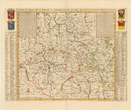
Central Europe ([Lot of 2] Palatinat du Rhein, Alsace, et Partie de Souabe de Franconie &c [and] Eigentliche Vorbildung der Feldschlacht so im ober Elsas den 2. Marty 1634... / Conflictus in Alsatia Superiori), Paris, ca. 1648-70. 20.2 x 14.5”. (HC) A. Palatinat du Rhein, Alsace, et Partie de Souabe de Franconie &c, by Nicolas Sanson, from Cartes Generales de Toutes les Parties du Monde…, dated 1648, hand color (20.2 x 14.5"). This detailed map of eastern France, southwestern Germany and northern Switzerland depicts key towns, boundary lines and topographical features. Centered on the southern part of the Rhein River and the beginning of the Danube River, the map stretches from Frankfurt (Francfort) in the north to Basel in the south. Other key cities shown are Strasbourg, Baden-Baden, Stuttgart (Stugart), Ulm, Augsburg. The map also features a decorative cartouche and a distance scale. Engraved by R. Cordier Abbavil. Ref: Pastoureau, Sanson V [48]. Condition: Original outline color with minor toning and foxing in margins. (A) B. Eigentliche Vorbildung der Feldschlacht so im ober Elsas den 2. Marty 1634... / Conflictus in Alsatia Superiori, by Matthaus Merian, from Theatrum Europaeum, circa 1670, black & white (13.8" x 11"). This finely engraved view depicts a battle from the Thirty Years` War that took place in Upper Alsace in 1634. The towns of Sennen (Cernay), Dann (Thann), Auffholtz (Uffholtz) and Wattweil (Wattwiller) are depicted with bird`s-eye views. The title explains that Swedish General Otto Louis of Salm-Kyrburg-Morchingen was defeated during the battle. At bottom is a legend identifying numerous locations. Condition: A faint spot towards center, and a couple of short tears confined to blank margins that have been closed on verso with archival tape. (B+) See description. ()

Lot 579

Central Europe (Alemagne), Duval, Le Monde ou la Geographie Universelle, Paris, [1672]. 5 x 4”. (HC) This miniature map of central Europe depicts major towns and key topographical features. Pierre Duval was Nicolas Sanson`s nephew and pupil. He published a wide range of atlases and individual maps including a fine miniature world geography with many of the maps based on Sanson. Ref: King (2nd ed) pp. 132-135; Pastoureau, Duval XI C [79]. There is a minute hole at left due to a paper flaw. (A)

Lot 582

Central Europe (Carte du Duche de Silesie Divisee en Haute et Basse et Subdivisee en ses Principalles Principaute… / Nouveau Theatre de la Guerre d`Allemagne…), Crepy, Nuremberg, 1761. 53.5 x 24.5”. (HC) This impressive, large-scale map depicts parts of central Europe during the Third Silesian War (part of the Seven Years` War). Two rococo-style title cartouches attribute the cartography to Homann. The map extends from Luxembourg and the Netherlands in the west to western Poland in the east and depicts towns, roads, boundary lines, and the topography of the land. A large inset of northeastern Poland is at top right, with its own title cartouche, Carte Particuliere de la Prusse Royale…. Printed on 3 sheets, joined as issued. Original outline color on watermarked paper with light soiling, tiny worm holes, and a couple of short cracks. There are numerous separations along the horizontal fold, the majority of which have been closed on verso with archival materials. There is a tear that enters 3" into map at left and another 3" tear to the left of the main title cartouche that have both been archivally repaired. (+C)

Lot 583

Central Europe, Germany (Germaniae Veteris, Typus), Ortelius, Theatrum Orbis Terrarum, Antwerp, 1587. 18.3 x 14.3”. (HC) This is Ortelius` second map of ancient Germany. The region covered takes in all of central Europe from Belgium and France through Poland, to include northern Italy and Hungary. The map is based on the writing of classical authors such as Ptolemy, Caesar and Strabo. It is richly engraved and features four large strapwork cartouches. Latin text on verso, published in 1595. Ref: Van den Broecke no.200. Lovely old color with toning along centerfold and foxing primarily confined to blank margins. (+B)

Lot 584

France and Germany (Alsatia Inferior), Mercator, ca. 1630. 17.1 x 14.4”. (HC) Handsome map of the region around Strasbourg and the Rhine River, with west oriented at the top. The decorative strapwork cartouche incorporates the distance scale. Fully engraved to illustrate the rivers, forests and mountains and locate hundreds of tiny villages. French text verso. Lightly toned with wide margins. There are light damp stains, a few tiny worm tracks, and a small hole at far right that are all confined to blank margins. (+B)

Lot 586

Germany (Saxoniae, Misniae, Thuringiae, Nova Exactissimaq Descriptio), Ortelius, Theatrum Orbis Terrarum, Antwerp, ca. 1573. 19.8 x 13.5”. (HC) This handsome map covers Saxony and the surrounding region with great detail. It is embellished with a decorative title cartouche, a legend in scroll-style cartouche, distance scales and a decorative border. The map is filled with place names, each symbolized by a tiny castle. Dutch text on verso. Ref: Van den Broecke no.93. Attractive old color on watermarked paper with light damp stains in blank margins. French manuscript writing on verso opposing the Dutch text. (A)

Lot 588

Germany (Archiepiscopatus Trevirensis), Jansson, Amsterdam, ca. 1660. 19 x 16”. (HC) This copper-engraved map covers the Reinland Pfalz area, a wine growing region through Germany, Luxembourg and France. The map is filled with details of towns, villages, forests and rivers. Coats of arms also decorate the map, indicating the various duchys and bishoprics. The strapwork title cartouche is topped with a bishop`s hat and is accompanied by an ecclesiastical figure in robes. German text on verso. Original color with wide margins. There is a tiny hole and crack at top due to the oxidation of green pigment and a few white spots near the cartouches at bottom. (B)

Lot 589

Germany (A Newe Mape of Germany Newly Augmented by Iohn Speed. Ano Dom. 1626), Speed, London, ca. 1676. 20.8 x 15.8”. (HC) This decorative map displays the German Empire, covering the area from Belgium and the Netherlands east to Poland and Hungary. The map is filled with place names and pictorial representations of topography. Along the top of the map are birds-eye views of Heidelberg, Frankfurt, Vienna, Prague, Cologne, Nuremberg, Strassborg and Augsburg. Along the left and right are various costumed figures including a Nobleman, Merchant, Bohemian and Helvetian to name a few. Imprint of Basset and Chiswell with English text on verso, published circa 1676. There is a bottom centerfold separation that extends 1" into the image and a tiny abrasion near the left neatline. Narrow, but adequate, bottom margin with a few minor chips in the blank margins. (B)

Lot 590

Germany (Tabula Generalis Holsatiae Complectens Holsatiae, Dithmarsiae, Stormariae, et Vagriae Ducatus), Homann, Nuremberg, ca. 1720. 22.3 x 19”. (HC) This is a beautiful map of Schleswig-Holstein from the city of Hamburg on the Elbe River and north to Denmark. The map is filled with detail of roads, fortified cities, small towns and even names the islands in the Elbe. A block of armorials lies in the Baltic Sea and an allegorical title cartouche, representing the pastoral bounty of the region, fills the corner below the Elbe. (A)

Lot 591

Germany and Russia (Thietmarsiae, Holsaticae Regionis Partis Typus [on sheet with] Prussiae Descriptio…), Ortelius, Theatrum Orbis Terrarum, Antwerp, ca. 1573. 17 x 12”. (HC) Two maps on a folio sheet, each with decorative cartouches and a ship or sea monster. The first covers the region known as Dietmarschen in Schleswig Holstein at the mouths of the Elbe and Eider rivers including Brunsbuttel and Meldorf. The cartouche attributes the map to Petrus Boeckel. The second map covers part of the Prussian Empire, which is the present-day Russian enclave of Kaliningrad (here Kunigsberg). Ortelius based this map on the work of Heinrich Zell. Dutch text on verso. Ref: Van den Broecke no.88. Attractive old color on watermarked paper with light damp stains confined to the wide blank margins. French manuscript writing on verso opposing the Dutch text. (A)

Lot 592

Northern Germany (Circulus Westphalicus, sive Germaniae Inferioris), Blaeu, Amsterdam, ca. 1645. 20.9 x 16.1”. (HC) This beautifully engraved regional map of Germany is roughly centered on Munster, and extends to include part of the Netherlands. It covers the region from the Baltic, as far east as Hanover and west and south to Maastricht. Prominent are the courses of the rivers Weser, Ems, and the Rhine-Meuse-Scheldt delta, one of the largest deltas in western Europe. The map does not have a compass rose, but north is to the right. A fabulous figural title cartouche with coat-of-arms incorporates a small map of Hamburg. Spanish text on verso. Lovely color with wide margins, a few faint spots, and some minor printer`s creases along the centerfold and title cartouche. A short centerfold separation in bottom blank margin has been closed on verso with archival tape. (+B)

Lot 595

Northern Germany (Electoratus Hanoverani…), Seutter, Augsburg, ca. 1730. 19.5 x 22.8”. (HC) This map of northern Germany is centered on Hanover and includes the cities of Gottgen, Hamburg and Osnabruck. There is fine detail of forests, mountains and the Elbe River. The large cartouche is surrounded with many figures and in the opposite corner is a small landscape. Engraved by Tobias Conrad Lotter in his characteristic bold engraving style. There is a small spot near the center of the map and some light soiling primarily in the blank margins. (+B)

Lot 597

Southwestern Germany (Franconia Neue verbesserte Carten des Gantzen Franckischen Krayses), Sandrart, Nuremberg, ca. 1680. 14.7 x 11.5”. (HC) This detailed map of Franconia in southwestern Germany is comprised of the northern parts of the modern state of Bavaria, a small part of southern Thuringia, and a region in northeastern Baden-Wurttemberg. The Rhine, Danube and Main Rivers wind through the region with their extensive river systems. The cities of Frankfurt, Mannheim, Nurenberg, Stuttgart, and Ingolstadt are depicted, along with numerous other towns. The map is adorned with a decorative title cartouche. Trimmed close to neatlines and mounted on backing paper, with light toning and a small hole along centerfold towards bottom. The backing paper has several damp stains, and a hole and a few tears just below map. (B)

Lot 600

Western Germany (Westphalia Ducatus Auctore Ioh. Gigante Medico et Mathematico), Blaeu, Amsterdam, [1662]. 19.3 x 14.8”. (HC) This elegantly engraved map of Westphalia, including Hamm and Lippstadt, was produced by Joannes Gigas (Gigante). The mountainous topography is graphically depicted and several small coats of arms adorn the map. Beautifully decorated with strapwork title and scale of miles cartouches. Spanish text on verso. Fine impression and original color with wide original margins and watermarked paper. Near fine save for some very light toning on the centerfold. (A)

Lot 601

Western Germany (Mosellae Fluminis Tabula Specialis in qua Archiepiscopatus et Electoratus Trevirensis…), Homann, Grosser Atlas, Nuremberg, [1716]. 22.8 x 19.4”. (HC) This detailed map of the western part of Rheinland Pfalz shows the area along the Mosel River, with the archbishopric of Trier, and the Rhine River from Bonn to Mainz in the south. Many place names, mountains, forests and rivers are shown on the map. A large decorative allegoric title cartouche fills the lower right corner, featuring River Gods to represent the rivers in the region. Original color with two minute holes and a couple of small spots. (+B)

Lot 602

Central Germany (Hassia Landgraviatus), Mercator/Hondius, Atlas Minor, Amsterdam, [1607]. 7.3 x 5.5”. (HC) Handsome small map of the state of Hesse detailing the course of the Fulda and Lon Rivers, filled with information of cities, villages, forests and mountains. Decorated with a strapwork title cartouche incorporating a distance scale. This is from the first edition, with Latin text on verso. Marginal soiling with manuscript page number and cardinal directions in blank margins. (A)

Lot 604

Eastern Germany (Provinz Brandenburg), Radefeld, Meyer`s Hand Atlas, Hildburghausen, 1846. 14 x 11.8”. (HC) This railway map of the state of Brandenburg is centered on Berlin. A legend below the title identifies railways and train stations. The map gives good detail of towns, roads, and topography, and is divided by rural districts Original color with minor soiling in wide, blank margins. (A)

Lot 605

Czech Republic (Bohemiae Nova Descriptio Tabula XVII), Munster, Geographia, Basel, ca. 1552. 14.8 x 11.8”. (BW) This is a Ptolemaic-style woodcut map of Bohemia oriented with north to the bottom. Prague is shown near the center of the map. The exaggerated mountains and forests are typical of the early woodblock maps. This is an early map to show the encroachment of the Ottoman Empire into Europe. A table describing map symbols, including Christian and Moslem villages, is at the lower right. Latin text on verso marked page 46. The right and left hand coordinate scales are partially trimmed with a small repair at the upper centerfold. Minor creasing along the centerfold. (B)

Lot 608

Czech Republic (Carte du Royaume de Boheme. La Chronologie de ses Rois. Les Etats de Silesie, Moravie, et Lusace), Chatelain, Atlas Historique…, Amsterdam, ca. 1708. 24.5 x 18.3”. (HC) This is a very attractive and informative map of the region of present-day Czech Republic, Slovakia and southeastern Poland. At the sides are lists of towns and dukedoms, along with a chronological history of the dukes and kings of Bohemia. In the upper corners are four finely rendered coats of arms for Bohemia, Monrovia, Silesia, and Lusace. The map is adorned with miniature bird`s-eye views of major towns and a compass rose at lower left. Issued folding with minute holes at fold intersections. (A)

Lot 610

Switzerland (Valesiae Altera et VII Nova Tabula), Munster, Geographia, Basel, ca. 1545. 13.5 x 10”. (BW) This is a Ptolemaic-style woodcut map of southern Switzerland with mountains prominently shown in profile. St. Moritz is at the lower right with Sitten (Sion), at lower center. Latin text on verso marked page 35. There is a damp stain in the left and right third of map with some minor wrinkling at the lower right corner. The right margin has been augmented and there is light text show-through. (B)

Lot 611

Switzerland (Lacus Lemanni Locorumque Circumiacentium Accuratissima Descriptio), Blaeu, Novus Atlas, Amsterdam, ca. 1645. 20.5 x 16.3”. (HC) This beautifully engraved chart of the vicinity of Lake Geneva in Switzerland is based the work of Swiss theologian Jacques Goulart. It is filled with minute detail including estates, vineyards, parks, fortified cities, tiny villages, and several notations concerning the Duke of Savoy`s numerous attempts to gain control over Geneva. The map is richly embellished with a compass rose, sail boats and fishermen in the lake, and three decorative cartouches. The title cartouche is topped with the coat of arms of Geneva supported by cherubs in military garb. French text on verso. Old color with slightly uneven toning and a centerfold separation that just enters map at bottom that has been repaired with old paper on recto, covering up the neatline. There are a few spots and some errant marks of color. (B)

Lot 612

Switzerland (Argow cum Parte Merid. Zurichgow), Blaeu, Amsterdam, ca. 1650. 19.6 x 15.1”. (HC) Nice copper engraved map of Canton Aargau and parts of the Cantons Schwyz, Zurich and Glarus. Includes the cities of Bern and Lucern. Beautifully engraved to depict the numerous lakes and mountainous countryside and embellished with a small title cartouche. Latin text on verso. Old color and wide margins with a hint of toning. (A)

Lot 613

Switzerland (A New Map of Switzerland, Divided into the Thirteen Cantons with Their Allies & Their Subjects), Laurie & Whittle, London, 1794. 26 x 19.3”. (HC) This fully engraved map of Switzerland is divided into thirteen cantons. There is excellent detail of the lakes, mountains, and rivers in the region. A legend below the title cartouche identifies towns of various sizes, parishes, abbeys, baths, fields of battle, and "great vineyards." A note at right gives additional information on the cantons. Printed on heavy bluish paper with light toning along centerfold and a centerfold separation that enters 2" into map at bottom that has been closed on verso with archival materials. (+B)

Lot 614

Switzerland, Geology (Livret-Guide Geologique Dans Le Jura et les Alpes de la Suisse…), 1894. 5.8 x 8.3”. (PC) This rare geological excursion guide was issued in conjunction with the International Geological Congress of 1894, which met in Zurich, Switzerland. The volume contains 2 maps and 10 profiles and cross sections of the Jura mountains and the Alps. In addition to the maps and profiles are numerous other illustrations and tables included in the text, describing particular excursions and geologic features. 307 pp., hardbound in brown cloth covered boards with gilt title and stamp on front cover. Maps are clean and bright and are generally very good to fine. The geologic map has a few short splits at fold intersections. Plates were originally housed in pockets attached to the front and back covers, but the pockets are now perished. Text is generally good with some light toning and brittle endpapers. The hinge is starting and the covers are somewhat bumped and worn. (+B)

Lot 617

Austria (Salisburgensis Iurisdictio…), Ortelius, Theatrum Orbis Terrarum, Antwerp, ca. 1573. 17.2 x 13.2”. (HC) This unusual regional map is drawn as though on a parchment with its edges curling up to reveal a view of the city beneath it. The cartography is based on Marcus Secznagel. This is the first of Ortelius` maps of the region surrounding Salzburg with the large bird`s-eye view of the city in the lower right quadrant. This plate was used for the editions between 1570 and 1595 and was replaced with a much less decorative map in the later editions. It is a superb example of decorative cartography. Dutch text on verso. Ref: Van den Broecke no.107. Lovely old color on watermarked paper with light damp stains confined to the blank margins. (A)

Lot 618

Austria (Austria Archiducatus auctore Wolfgango Lazio), Hondius/Blaeu, Amsterdam, ca. 1635. 21.3 x 14.2”. (HC) This striking, large map of the Danube River valley is based on the cartography of Wolfgang Lazio. Vienna is prominently featured with the Danube river flowing across the center of the map. Numerous tiny villages, cities, mountains, forests and lakes are depicted. Three decorative cartouches grace the map including a coat of arms. This was among the plates that were sold to Blaeu after Jodocus` death in 1629. Hondius` imprint has been removed and replaced with Blaeu`s own imprint. French text on verso. There are two edge tears in the left and right blank margins that just enter the map border and a hint of toning along the edge of the sheet. An ownership label is adhered to the lower right corner, well away from the image. (+B)

Lot 619

Austria (Stiria Steyrmarck), Blaeu, Novus Atlas, Amsterdam, ca. 1635. 19.7 x 14.8”. (HC) Nice map of the region roughly corresponding to the modern Austrian state of Styria with a bit of present-day Slovenia and Hungary included. It is roughly centered on the city of Graz and highlights the cities along the Drava River, now one of the most popular cycle paths in Europe. The title cartouche includes a warrior maiden, a putto, and a coat of arms, which appears to be the reverse image of the coat of arms of Styria. Watermarked paper with light toning along centerfold and a few faint spots. There are a few worm holes and damp stains in blank margins, far from map image. (B)

Lot 620

Austria (Austriae Archiducatus Inferioris et Superioris…), Danckerts, Amsterdam, ca. 1680. 22.8 x 19.5”. (HC) This boldly engraved map details Lower Austria, along the course of the Danube River, and features numerous place names, towns, cities, villages, churches and topography. Wienn (Vienna), Baden and many other fortified cities are located in this very striking example. The map extends west to Enns and Rottenmann. At bottom right is a small inset of Upper Austria, roughly centered on Lintz (Linz). The inset is surrounded by a river god and two putti holding the coat of arms for Lower Austria. The title is flanked by a legend and two distance scales. Old color with light toning along centerfold, a printer`s crease at lower right, and some spots. There is a centerfold separation that enters 1.5" into image that has been closed on verso with old paper, and some minor damp stains in blank margins that just enter map border. (B)

Lot 622

Western Austria (Saltzburg Carinthia), Mercator/Hondius, Atlas Minor, Amsterdam, [1607]. 7.3 x 5.5”. (HC) Attractive small map of the historic Salzburg and Corinthian regions. Fully engraved to illustrate the mountainous terrain filled with rivers, lakes, forests and villages. Decorated with a strapwork title cartouche incorporating a distance scale. This is from the first edition, with Latin text on verso. Lightly toned with marginal soiling and a damp stain in blank margin at top left. Manuscript page number and cardinal directions in blank margins. (+B)

Lot 623

Eastern Europe (Landtafel des Ungerlands, Polands, Russen, Littaw, Walachei und Bulgarei), Munster, Cosmographia, Basel, ca. 1578. 13.5 x 10”. (BW) Woodblock map of the region containing present-day Romania, Bulgaria, Moldova and Ukraine, with parts of Poland, Belarus and Russia. It has graphic depictions of the rivers, mountains, forests, and towns, with many ancient place names. German text on verso. Some small stains, light toning along centerfold, and a few minute wormholes at right only visible when held to light. There is marginal soiling and some worm tracks in bottom blank margin, one of which just touches neatline. (B)

Lot 624

Eastern Europe (Tabula Geographica Continens Despotatus Wallachiae Atque Moldaviae, Provinciam Bessarabiae… Polonicam Podoliae, …), Homann Heirs, Nuremberg, 1769. 20 x 18.3”. (HC) This map of parts of present-day Romania, Moldova and Ukraine is filled with details of forts, towns, and the topography of the land. Bucharest (Bukurest), Bilhorod-Dnistrovskyi (Akermann), and many other cities are depicted with miniature bird`s-eye views. Adorned with a rococo-style cartouche. Original color on watermarked paper with light toning along centerfold and a few faint stains. (+B)

Lot 626

Eastern Europe - Poland (Poloniae Finitimarumque Locorum Descriptio Auctore Wenceslao Godreccio), Ortelius, Theatrum Orbis Terrarum, Antwerp, ca. 1573. 19.5 x 14.5”. (HC) This is Ortelius` first map of the region, covering all of Poland and extending into Lithuania and Russia in the north and to the Black Sea in the south. The map is based on the cartography of Grodecki (1558 & 1562), which was in turn based on the work of Wapovsky (1526). The map is filled with cities and the forests are boldly depicted. Dutch text on verso. Ref: Van den Broeck no.154. Lovely old color on watermarked paper with light damp stains in blank margins, barely entering map at top corners. (+B)

Lot 627

Northeastern and Eastern Europe (Pomeraniae, Wandalicae Regionis, Typ. [on sheet with] Livoniae Nova Descriptio [and] Ducatus Oswieczensis, et Zatoriensis Descriptio), Ortelius, Theatrum Orbis Terrarum, Antwerp, ca. 1573. 19.5 x 15”. (HC) Three fine maps of the Baltic and Polish regions printed on a single folio sheet. The top map features Pomerania and is based on the Peter Artopaus map published in 1550 by Sebastian Munster. The map of Livonia was drawn by Johannes Portantius and is believed to have been based on the lost maps of the region by Marcus Ambrosius and Caspar Henneberger. The map of Oswieczensis was drawn by the Polish cartographer Stanislav Porebski in 1563. Dutch text on verso. Ref: Van den Broecke no.158. Attractive old color on watermarked paper with light damp stains in the blank margins, barely entering map image at the corners. (+B)

Lot 628

Russia (Tabula Russiae ... M.DC.XIIII), Blaeu, Amsterdam, ca. 1644. 21.6 x 16.8”. (HC) This is Blaeu`s version of Hessel Gerritsz` rare and significant map of Russia, which he compiled from manuscripts brought back by Isaac Massa. The map covers the European part of the Russian Empire extending from Poland to the steppes of Tartary, and from the Mourmanskoy More (Barents Sea) to the Black and Caspian Seas. The large inset plan of Moscow is attributed to the Crown Prince Fydor Gudonov. The map is richly decorated with a large title cartouche, sailing ships, a compass rose, three Russian gentlemen, and an inset view of Archangel Sckagoroda. French text on verso. A good impression and attractive color with light toning along centerfold and a centerfold separation that enters 2" into map at bottom that has been closed on verso with old paper. There are minor damp stains and two archivally repaired tears in blank margins, not affecting map. (+B)

Lot 629

Russia ([Lot of 2] Russiae, vulgo Moscovia dictae, Partes Septentrionalis et Orientalis [and] Russiae, vulgo Moscovia, Pars Australis), Blaeu, Amsterdam, ca. 1680. 21.3 x 16.5”. (BW) This lot includes a matched pair of maps of Russia, each of which includes a strapwork title cartouche that credits the map to Isaac Massa, who visited Moscow in the early 1600s. The maps have no text on verso indicating they were issued after the demise of the great Blaeu publishing empire, as these were among the plates auctioned in 1677 following the fire that destroyed the printing house. Size varies slightly. A. Russiae, vulgo Moscovia dictae, Partes Septentrionalis et Orientalis. This map details the area from Finland to Siberia and beyond the Jenisej River and south to the Volga River, with Kazan and Novogorod shown. A partial coastline of Novaya Zemla is shown at the top of the map. The map is fully engraved with mountains and forests with deer, bear and other animals throughout. The title cartouche is flanked with pelts, and hunters and a wide variety of animals surround the scale of miles. The crest of the Russian Empire is shown at top. The map is nearly identical to Jansson`s map of the same title. Condition: Scattered foxing with paper added in bottom blank margin to repair several chips that enter map border in a couple of spots, with minor loss of neatline. B. Russiae, vulgo Moscovia, Pars Australis. This map covers the southern part of the empire bordering the Caucasus. The map is elaborately embellished with richly dressed people and wild animals flanking three cartouches. The imprint of Johann and Cornelius Blaeu is at bottom, just left of centerfold. Condition: Light foxing with paper added in bottom corners to repair several chips, one of which just touches neatline at left. Both are backed with Japanese tissue. See description for additional details. (B)

Lot 630

Russia (Novissima et Accuratissima Totius Russiae vulgo Muscoviae Tabula), Danckerts, Amsterdam, ca. 1690. 22.5 x 19.5”. (HC) This detailed map of western and central Russia extends from Scandinavia and Novaya Zemlya in the north to the Black and Caspian seas in the south. The forests and rivers in the region are prominently featured, including the Volga and Ob Rivers. Numerous place names are also depicted, from large, fortified cities to small towns. The map is adorned with a decorative title cartouche featuring Russian soldiers. Original color with numerous cracks caused by the oxidation of the green pigment, some of which have been closed on verso with archival tape. There are four very small (1/8 to 1/4") areas of loss, a few tiny abrasions, and marginal soiling. This map would greatly benefit from conservation. (C)

Lot 633

Russia, Eastern Europe and Central Asia (Russiae, Moscoviae et Tartariae Descriptio…), Ortelius, Theatrum Orbis Terrarum, Antwerp, [1598]. 17.5 x 14”. (HC) Fascinating map of Russia and the former Soviet republics from the surveys of the English merchant and adventurer, Anthony Jenkinson, in 1562. Jenkinson was leader of the Muscovy Company`s first expedition to Russia and the first European to travel widely throughout the region. Ortelius` map replicates much of the detail and decoration found on the original Jenkinson map complete with extensive notations, illustrations of Cossacks, camels, encampments, armies, and a curious burial scene where the dead are hung from trees. A vignette of Ivan the Terrible appears at top left. Dutch text on verso. Ref: Van den Broecke no.162. There is a tiny paper repair and small spot along centerfold at top, and a few short tears and chips confined to blank margins that have been professionally repaired. (+B)

Lot 634

Western Russia (Moscovia), Mercator/Hondius, Atlas Minor, Amsterdam, [1607]. 6.8 x 5.3”. (HC) Handsome map of western Russia with Moscow (Moscowia) depicted at lower right and Novgorod (Nouogardia) at top left. Fully engraved to show forests, rivers, lakes and cities and adorned with decorative title and scale cartouches. This is from the first edition, with a blank verso. Marginal soiling. Manuscript page number, cardinal directions, and a notation in blank margins. (A)

Lot 636

Moscow, Russia (Moscva), Merian, Neuwe Archontologia cosmica, Frankfurt, ca. 1650. 13.9 x 10.8”. (HC) Great bird`s-eye plan displaying Moscow situated at the junction of the Moskva and Neglinnaya Rivers, which form a moat protecting all but the northeast flank of the Kremlin. The map shows the Kremlin and old city, Kitay-gorod, at center. These are surrounded by successive rings of fortifications in an elegant and superbly well-protected metropolis. The plan is ornamented with a coat of arms, simple compass rose and a key to the numbered features, quarters and buildings contained in a monument-style cartouche. Watermarked paper with minor foxing and a few tiny chips and tears all confined to the blank margins. (A)

Lot 640

Romania (La Transilvania Divisa su l`Esemplare delle Carte Migliori…), Cantelli da Vignola, Mercurio Geografico…, Rome, 1686. 22.1 x 16.5”. (HC) This boldly engraved map of the Transylvanian region is quite uncommon. Rivers and mountains dominate the map with the locations of cities and villages carefully noted. The title and a notation are enclosed in a cartouche festooned with military flags and cannon. Cantelli pioneered this bold engraving style that was followed and further developed by Coronelli. The map was published in conjunction with Giacomo Giovanni de Rossi. Light soiling with a couple of tiny centerfold separations that have been archivally repaired. There are some printer’s creases at left that have been reinforced on verso with Japanese tissue, and a tiny worm hole at top right. (+B)

Lot 642

Black Sea (Sevastopol. Shewing the Russian Defense Works and the Approaches of the Allied Armies…), U.S. Government, Senate Doc. No. 1, 34th Cong, Special Session, Washington D.C., 1856. 45.5 x 29.8”. (HC) This scarce map shows the positions of the Russian troops (in green) and English and French troops (in red and blue) around the city of Sevastopol, in present-day Ukraine, during the Crimean War. Sevastopol was a pivotal battleground, as it was a critical port in the Black Sea. The map detail includes the street layout of Sevastopol, numerous forts, artillery placements, and very detailed topography. Drawn by Lieutenant George R. Wilkinson and Captain T. Spratt for the British Hydrographic Office: this is the U.S. edition. Original color. Folding as issued. There is a binding tear that just touches the neatline at left and a few edge tears repaired on verso with archival materials, all of which are confined to the blank margins. There are a few faint spots. (+B)

Lot 645

Southeastern Europe (Novissima et Accuratissima Hungariae…), Seutter, Augsburg, ca. 1745. 22.5 x 19.5”. (HC) A superb map of Hungary, Romania and the Balkans dense with place names and topographical features. At bottom are two very graphic and historically interesting cartouches. Surrounding the title are scenes including a portrait of the king of Hungary, a soldier, the personification of Justice, river gods, and numerous putti each holding a herald representing the neighboring regions. Surrounding the distance scale is a group of men engaged in wine tasting, hunting and fishing. Nice impression and original color. There are a couple minor printer`s creases and a few light spots in the map. There is a minor damp stain in top and left blank margins that just enters map borders. (+B)

Lot 646

Balkans (Illyricum), Ortelius, Theatrum Orbis Terrarum, Antwerp, ca. 1573. 18.8 x 14.3”. (HC) Handsome map of the coastal region of Slovenia and Croatia based on the cartography of Johann Sambucus (1572) and Hirschvogel (1565). It is filled with mountains, forests and hundreds of tiny villages and decorated with a strapwork title cartouche. Dutch text on verso. Ref: Van den Broecke no.144. Lovely old color on watermarked paper with light damp stains in the blank margins, just entering map border at right. (A)

Lot 648

Croatia (Estat de la Republique de Raguse), Duval, Le Monde ou la Geographie Universelle, Paris, [1672]. 4.8 x 4”. (HC) This is a miniature map of the Dalmatian coast of present-day Croatia. It depicts the Republic of Ragusa, a vassal of the Ottoman Empire, and rival with the Republic of Venice for control of trade in the Adriatic. The city of Raguse (Dubrovnik) is prominently shown. Pierre Duval was Nicolas Sanson`s nephew and pupil. He published a wide range of atlases and individual maps including a fine miniature world geography with many of the maps based on Sanson. Ref: King (2nd ed) pp. 132-135; Pastoureau, Duval XI C. Watermarked paper with faint toning along centerfold and minor soiling in blank margins. (A)

Lot 649

Balkans ([Lot of 2] Sclavonia, Croatia, Bosnia cum Dalmatiae Parte [and] Karstia, Carniola, Histria et Windorum Marchia), Blaeu, Amsterdam, ca. 1680. 19.4 x 15”. (BW) Two detailed maps of the Balkans, each of which includes a strapwork title cartouche that credits the map to Gerard Mercator. There is no text on back of either map, indicating they were issued after the demise of the great Blaeu publishing empire, as these were among the plates auctioned in 1677 following the fire that destroyed the printing house. A. Sclavonia, Croatia, Bosnia cum Dalmatiae Parte. The course of the Danube and its tributaries across the northwestern Balkans is the focus of this handsome map. It shows the political divisions of Slovenia, Croatia, Bosnia, Serbia and Dalmatia and locates even the tiniest hamlets. The coats of arms of the Venetian Republic, Habsburg Monarchy, and Ottoman Empire reflect the power struggle that dominated this region. B. Karstia, Carniola, Histria et Windorum Marchia. A fine map of the northern tip of the Adriatic Sea and the Gulf of Venice, present-day northeastern Italy, Slovenia and Croatia. Decorated with a title cartouche, compass rose, distance scale cartouche and a sailing ship. Both have a few faint spots with light foxing and paper has been added in blank margins to repair several chips. Backed with Japanese tissue. (+B)

Lot 650

Balkans, Serbia, Romania (Neu-Geographisch Vorgestelltes Ungarisches Kriegs-Theatrum in Servien und dem Bannat Temeswar ... 1716 und 1717), Homann, Nuremberg, ca. 1720. 22.5 x 19.3”. (HC) This fascinating map depicts the Siege of Belgrade from 1716 to 1717, which occurred during the Austro-Venetian-Ottoman war. The battle ended on August 17, 1717 with Belgrade, an important stronghold for the Ottoman Empire, falling into Austrian control under the command of Prince Eugene of Savoy. The main map depicts the region with Belgrade at left, Temeswar at top, and the Danube River flowing through the center. The map features 9 insets, including the battle plans of the Siege of Belgrade and the Battle of Peterwardein (Petrovaradin), and bird`s-eye views of the fortifications of Temeswar, Belgrade, Semendria, and several other towns. Original color and watermarked paper with a few faint spots and a hint of toning along centerfold. There are two centerfold separations that enter 3" and 4" into map that have been closed on verso with archival materials. (+B)

Lot 653

Greece (Graecia), Blaeu, Amsterdam, ca. 1680. 20.3 x 16.3”. (BW) Handsome map of Greece and the Aegean Sea, extending north to Albania, Macedonia and the Dardanelles. The map is adorned with a large strapwork title cartouche that features a Greek Sultan, and a secondary cartouche with a coat of arms. There is no text on back indicating it was issued after the demise of the great Blaeu publishing empire, as this was among the plates auctioned in 1677 following the fire that destroyed the printing house. Ref: Zacharakis, C. no.245. Light soiling with a centerfold separation at bottom and two tears at top that enter 1-1.5" into map image have been repaired with archival materials. Paper has been added in blank margins to repair several chips. Backed in Japanese tissue. (B)

Lot 654

Greece, Balkans (Macedonia, Epir. et Achaia), Mercator/Hondius, Atlas Minor, Amsterdam, [1607]. 7.3 x 5.5”. (HC) A fine small map covering northern Greece and Albania with part of Macedonia. The title and distance scale are enclosed in a strapwork cartouche. This is from the first edition, with Latin text on verso. Light show-through of text on verso with a couple of tiny spots in the image. Manuscript page number and cardinal directions in blank margins. (+B)

Lot 659

Italy (Europae Tabula VI), Ruscelli, Venice, ca. 1561. 10.3 x 7.5”. (HC) This Ptolemaic map shows Italy and includes Corsica, and parts of Sardinia and Sicily. The map is drawn on a trapezoidal projection and shows ancient political divisions during the Roman period. Finely engraved with a stippled sea. Nice impression on watermarked paper. There is light toning along centerfold, a professionally repaired centerfold separation near Semnones, and printer`s ink residue. (+B)

Loading...Loading...
  • 108737 item(s)
    /page

Recently Viewed Lots