
Irish Gaelic printing The Catechism, or Christian Doctrine by way of Question and Answer [Irish title: An teagasg Críosduidhe]. Paris: James Guerin, 1742. First edition, 8vo, contemporary tree sheep (lacking front board), liv 513 pp., parallel text and title-pages in Irish and English, small ink-stain to foot of title-pages, damp-staining to quires R, S and X [ESTC T97298];Mignan, Robert. Travels in Chaldaea, including a Journey from Bussorah to Bagdad, Hillah, and Babylon, performed on Foot in 1827. London: Henry Colburn and Richard Bentley, 1829. First edition, 8vo, xvi 333 [3] pp., advertisement leaf, contemporary purple diced calf gilt, 2 folding maps, 7 aquatint plates [Atabey 908];Hartshorne, Anna C. Japan and her People. Philadelphia: Henry T. Coates & Co., 1902. First edition, 2 volumes, 8vo, original blue pictorial cloth gilt, 50 photographic plates, folding map, bookplates;and 5 othersNote: Note: This Irish catechism, written by the Roman Catholic priest Andrew Donlevy (1680-1746), is 'the most complete formal text in Irish for [its] period and draws on the author's spoken Irish' (ODNB).
We found 109198 price guide item(s) matching your search
There are 109198 lots that match your search criteria. Subscribe now to get instant access to the full price guide service.
Click here to subscribe- List
- Grid
-
109198 item(s)/page
Travel Group of 19 Goldberry, Silv. Meinard Xavier. Travels in Africa. London: James Ridgway, 1802. 3 volumes, 12mo, maps and plates, contemporary calf gilt with red morocco gilt labels, folding map cut and bound in two parts;Blagdon, Francis. Modern Discoveries; or, a Collection of Facts and Observations... London: James Ridgway, 1802. Volume 2 only, 12mo, folding map, calf uniform with Goldberry;Roscoe, Thomas. The Tourist in Switzerland and Italy. London: Robert Jennings, 1830. 8vo, 25 plates, contemporary diced calf with later spine;[Lysons, Daniel and Samuel. Magna Britannia - Buckinghamshire. London, 1806.] 4to, Buckinghamshire section only, maps and plates including some hand-coloured, modern half calf;Stanley, Henry M. In Darkest Africa. London: Sampson, Low, Marston, Searle and Rivington, 1890. 6 volumes, 8vo, original red cloth gilt;[Holmes, W.H.] Twenty-Seventh Annual Report of the Bureau of American Ethnology. Washington: Government Printing Office, 1911. 4to, original green cloth gilt;Musgrave, Sir Richard. Memoirs of the Different Rebellions in Ireland. Dublin: John Milliken, 1801. Second edition, 4to, contemporary calf, joints split, many tears and repairs with some loss;and 5 others
![Indian lithographic printing Collection of works, 19th and early 20th century [Indian convict autobiography] Muhammad Jaffer](https://cdn.globalauctionplatform.com/bc80e8b7-d26a-42a0-aa0c-b06900ce413d/5b39ff6c-fdc5-428a-abc7-b07300ca6c70/468x382.jpg)
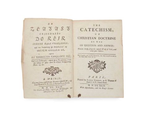
Indian lithographic printing Collection of works, 19th and early 20th century [Indian convict autobiography] Muhammad Jaffer Thanesari (1838-1905). Tawarikh-i 'Ajib ['Wonderful Stories']. [Place illegible:] Temple Press, 1307 AH [1889/90 CE]. 8vo (24.5 x 15cm), recent half leather, in Urdu (except testimonials in English to verso of title-page), lithographed throughout, [2] 100 pp., map of Port Blair in text (p. 66), browning, tissue-repairs to title-page, worming to head and foot of last few leaves similarly repaired, light marginal worming;Mawlawi Sayyid Muhammad Husayn Aghlab Muhani. Nayrang-i Afghan ['The Charm of the Afghans']. Lucknow: Matba' Sham Oudh, 1904. First edition, 8vo (24 x 14cm), recent half leather, in Urdu, lithographed throughout, [2] 4 8 64 344 5 pp., 2 albumen-print photographic portraits of Abd al-Rahman Khan and Habibullah Khan mounted to leaf after title-page, variable browning, corner of pp. 23/4 detached, closed tear in pp. 225/6;Mawlawi Abu Muhammad 'Abd al-Haqq. History of Palestine. [Urdu title:] Tarikh Bayt al-Muqaddas. Delhi: Mujtabai Press, 1891. 8vo (23.2 x 14cm), recent half leather, in Urdu, lithographed throughout, [2] 40 pp., 3 plates, marginal repair to title-page, small closed tear in final plate;and 6 others, including Mirza Muhammad Jalal al-Din Tabataba'i, Tawqi'at Kisra, Lucknow: Nawal Kishore, c.1858 (Persian literature) and similarNote: Note: Muhammad Jaffer Thanesari was a Wahhabi Muslim activist arrested in 1863 for conspiring to smuggle funds to anti-British mujahideen in Afghanistan. From 1866 to 1883 he was a prisoner at the Port Blair penal colony in the Andaman and Nicobar Islands. Tawarikh-i 'Ajib, an account of his time in prison, is also known under the title Kala Pani. Printed on the verso of the title-page is a testimonial in English from Richard Carnac Temple as cantonment magistrate, Ambala: 'I have known Muhammad Jafir to 10 years, first as a munshi at Port Blair and then as an employe [sic] here under me, whatever may have been his shortcoming in days gone by he seems to have profited by this severe punishment that overtook him and has been as long as I have known him a quiet, inoffensive man [...]'. A date in the colophon suggests that the work may have first been printed in 1887. The second work, Nayrang-i Afghan, appears to be a history of Afghanistan; the author's other works according to a note on the title-page include works on Russia (Kitab-i Rus) and the Islamic schools of law (Haqa'iq-i Madhahib).

Cary, John Cary's New and Accurate Map of London and Westminster, the Borough of Southwark and parts adjacent; viz. Kensington, Chelsea, Islington, Hackney, Walworth, Newington, &c... London: John Cary, [n.d.] Large folding map, 153 x 82cm, hand-coloured, some browning, a few holes to linen at folds, some slight damage to a few panels with a little loss, without case

Thomson, John The Atlas of Scotland, containing Maps of Each County Edinburgh: J. Thomson, 1832. Large folio, hand-coloured double page panorama of Principal Mountains and uncoloured panorama of Principal Rivers, 58 double-page hand-coloured engraved maps, hand-coloured index map, later cloth gilt, title-page repaired, title, prelims and index leaves mounted, a few small repairs to upper margins of maps, a little dampstaining
View books, Baedekers, Scottish interest and miscellaneous Collection of works 11 view books (c.1900, oblong 4to, with plates from photographs, various media, and including: J. J. Riley, Photographic View Album of Southport; T. S. Gowland, Album of Views of Eastbourne, leporello format; H. Owen, Photographic View Album of Barmouth and District; E. J. Oldbury, Picturesque Views of Knighton and Neighbourhood; and similar, including Colwyn Bay, Shrewsbury, Blackpool, etc.); 7 Baedekers (Southern France; Italy ; Spain and Portugal, 2 copies; Central Italy; Rhine; Egypt); John Wilson, Wilson's Guide to Rothesay and the Island of Bute, Rothesay: John Wilson, 1848. 8vo, original red cloth gilt, engraved map frontispiece, vignette title-page, plate; The Stranger's Guide to Edinburgh ... Seventh Edition, Edinburgh: John Moir, 1820, 12mo, later sprinkled half calf, folding map (backed on linen); The Story of the Stewarts, Edinburgh, 1901, 4to, original cloth, inscribed by the author; Henry Herbert & Co (publisher), London (Illustrated), a Complete Guide to the Places of Amusement ... 1879, 4to, original cloth, text printed in purple within decorative chromolithographic border, wood-engraved illustrations, mounted albumen print portrait photographs; Joseph Gostwick, English Poets, Twelve Essays, London: Frederick Bruckmann, 1876 (8vo, original cloth, mounted albumen print portrait photographs from paintings; and approx. 20 others, the lot sold as seen, not subject to return
Scotland Large collection of works on topography and local history Wilson, Daniel. Memorials of Edinburgh in the Olden Time. Edinburgh: Thomas C. Jack, c.1840. 2 volumes, 4to, original green cloth gilt, folding map frontispiece, numerous engraved plates;St John, Charles. A Tour in Sutherlandshire, with Extracts from the Field-Books of a Sportsman and Naturalist. London: John Murray, 1849. First edition, 2 volumes, 8vo, original green pictorial cloth gilt, 10 engraved plates, wear to spine-ends, tissue-guard for frontispiece of volume 1 removed;Mackenzie, Colin. Storm and Sunshine of a Soldier's Life. Edinburgh: David Douglas, 1884. First edition, 2 volumes, 8vo, original blue cloth gilt, engraved portrait frontispiece (pencil-marking to tissue-guard), rubbing to extremities, half-title inscribed in pencil 'Emma A. P. Dawson, from Mrs Colin Mackenzie, 1884', albumen print mounted to verso;Craig, R. S., & Adam Laing. The Hawick Tradition of 1514. Hawick: W. & J. Kennedy, 1898. First edition, 4to, original red cloth, frontispiece, folding map to rear, damp-stain to front board and concomitant bleeding of dye into margins of prelims;Batten, Edmund Chisholm. The Charters of the Priory of Beauly. [Edinburgh]: for the Grampian Club, 1877. First edition, 8vo, original cloth;Penney, John. A Topographical and Historical Account of Linlithgowshire. Edinburgh: Stevenson, 1832. First edition, 8vo, original cloth, engraved additional title-page (dated 1831);Edwards-Moss, John E. A Season in Sutherland. London: Macmillan and Co., 1888. First edition, 8vo, original blue cloth, bookplate of Charles Thomas-Stanford (1858-1932);Sharpe, J. Selkirk: its Church, its School, and its Presbytery. Selkirk: James Lewis, c.1914. First edition, 8vo, original cloth, 4 halftone photographic plates;Mackay, Donald. Memories of our Parish (Parish of Reay, Caithness). Dingwall: Ross-shire Printing & Publishing Co., Ltd., 1925. First edition, 8vo, original cloth, 2 plates, presentation inscription from the author;Horne, John. Summer Days in Cattiland. Wick: office of the "John O'Groat Journal", c.1910. First edition, 8vo, original cloth-backed boards;MacCormick, John. An t-Eilean Muileach. The Island of Mull. Its History, Scenes and Legends. Glasgow: Alex. Maclaren & Sons, 1923. First edition, 8vo, original cloth;Evans, A. H. A Fauna of the Tweed Area. Edinburgh: David Douglas, 1911. First edition, 8vo, plates, bookplates;Tait, E. S. Reid (editor). The Statistical Account of Shetland 1791-1799 ... by Sir John Sinclair. Lerwick: T. & J. Manson, 1925. 4to, original cloth;Metcalfe, William M. A History of the County of Renfrew from the Earliest Times. Paisley: Alexander Gardner, 1905. 4to, original quarter vellum, top edge gilt, others untrimmed, folding map (detached, spotted);Anderson, Joseph (editor). The Orkneying Saga. Edinburgh: Edmonston and Douglas, 1873. 8vo, original cloth, lithographic frontispiece, plates;and approx. 40 others including Edinburgh and provincial Scottish imprints
![Speed, John and Peter Keer [Volume of miniature maps of Scotland and Ireland] [London, c.1650]. Oblong 12mo (10.3 x 15.3cm),](https://cdn.globalauctionplatform.com/bc80e8b7-d26a-42a0-aa0c-b06900ce413d/4216ed2e-c303-431f-a471-b07300caaf8d/468x382.jpg)
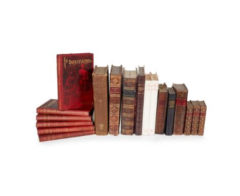
Speed, John and Peter Keer [Volume of miniature maps of Scotland and Ireland] [London, c.1650]. Oblong 12mo (10.3 x 15.3cm), modern half calf, 12 engraved maps with text on versos, comprising: 1) The Kingdome of Scotland; 2) The South p[ar]t of Scotland wherin are contayned Edinbrough, St Andrew and Glasco; 3) The Southern parte of Scotland, wherin is ye strange Lake Lomund; 4) The Eastern Part of Scotland wherin ther are divers Shires and the University of Aberdyn; 5) Part of Scotland it is called of the inhabitance Stranaverne with his borderers; 6) The Isles of Hebrides wth ther borderers; 7) Cathanes and Orknay Ins[ulae]; 8) The Kingdome of Irland; 9) Mounster; 10) Linster; 11) Connack; 12) Ulster. Light bronwing, very shallow chip to top edges, 'The South p[ar]t of Scotland with minor loss to lower fore corner, a few marks.Together with: John Cary, [Cary's New map of England and Wales with part of Scotland ... Delineated from Actual Surveys and materially assisted from Authentic Documents liberally supplied by the ... Post Masters General, London: J. Cary, 1794], 4to (30.2 x 24.5cm), contemporary marbled boards, rebacked and recornered, engraved dedication leaf, 14 + 88 pp. letterpress, engraved hand-coloured general map, 'Explanations' leaf (numbered 72), 45 maps hand-coloured in outline, lacking title-page and at least sheet numbers 16, 23-26, 33-6, 40, 43, 51-2, 58, 62-9, sheet 57 loose [ESTC N48119, 9 copies in libraries world-wide].Sold as a collection of maps not subject to return

Orkney and Shetland Collection of engraved maps and charts, 17th to early 19th century Collins, Greenvile. 10 sea charts, c.1693 or later, approx. dimensions 51 x 62cm, all with numerous rhumb lines, several backed on additional sheet of paper apparently at or near date of issue, variable toning, charts comprising: The South Part of the Isles of Shetland (hand-coloured); Part of the Maine Island of Shetland, 2 copies (both hand-coloured, decorative title cartouches); The Islands of Orkney (2 copies, one hand-coloured, decorative title-cartouches, coloured copy with damp-staining along top edge, uncoloured copy browned); The East Coast of Scotland with the Isles of Orkney and Shetland (hand-coloured, reinforced verso along central fold); The Cheife Harbours in the Islands of Orkney (4 copies, each with 2 inset maps and a panel of coastal profiles inset, decorative title cartouches, one hand-coloured);Mackenzie, Murdoch. Carte des îles Orcades et de la côte nord d'Ecosse ... réduite des plans de Mackenzie et publiée par ordre du Contre-Amiral Decrès Ministre de la Marine et des Colonie. Paris: Dépôt général de la Marine, An XII [1803/4]. 63 x 92 cm, rhumb lines, inset map of Shetland and coastal profiles, hand-coloured, central fold;[Bellin, Nicolas]. Carte réduite des isles Britanniques. Quatrième feuille. Partie septentrionale de l'Ecosse, [Paris], 1757. 64 x 92cm, rhumb lines, decorative title cartouche, inset panel of Orkney coastal profiles, central fold;Sanson, Nicolas. Les isles Orcadney ou Orkney; Schetland, ou Hetland; et de Fero, ou Farre, tirées de divers memoires. Paris: Pierre Mariette, 1669. 55 x 72cm, decorative title cartouche, central fold; and 4 others similar
![Fife Collection of works Fraser, Sir William. Memorials of the Family of Wemyss of Wemyss. Edinburgh: [no publisher], 1888. F](https://cdn.globalauctionplatform.com/bc80e8b7-d26a-42a0-aa0c-b06900ce413d/7b5af266-fca6-4acd-9c38-b07300caa995/468x382.jpg)
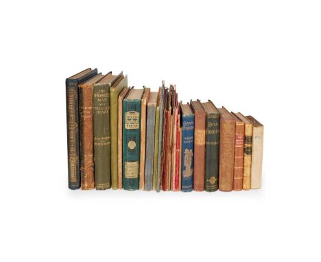
Fife Collection of works Fraser, Sir William. Memorials of the Family of Wemyss of Wemyss. Edinburgh: [no publisher], 1888. First edition, one of 100 copies (according to other records), 3 volumes, 4to, original red quarter morocco gilt by C. S. Smith of Edinburgh, top edges gilt, others untrimmed, decorative title-pages, 33 colour lithographic plates reproducing original charters, letters and other documents, wood-engraved illustrations of seals and signatures in text, volume 1 with presentation plate to front pastedown, largely effaced but name of recipient William Blackwood Esq. (presumably the famous publisher) visible, volumes 2-3 with bookplates of William Montagu Hay, 10th Marquess of Tweeddale, spines rubbed, peripheral mottling to covers, volume 2 with split to foot of spine;Idem. Illustrations of the Memorials of the Family of Wemyss of Wemyss. Edinburgh: [no publisher], 1888. 2 copies, 4to, both in original red cloth gilt, containing duplicates of the title-pages, colour plates and other illustrations from the Memorials, one copy with bookplate of Innes of Learney to front pastedown and later colour print mounted to front free endpaper, the other with bookplate of Francis James Grant, Rothesay Herald and Lyon Clerk, second copy with wear to spine-ends mottling to covers;Idem. The Melvilles, Earls of Melville, and the Leslies, Earls of Leven. Edinburgh: [colophon:] by T. and A. Constable, at the Edinburgh University Press, 1890. First edition, one of 150 copies, 3 volumes, 4to, original red cloth gilt, rebacked in red morocco, top edges gilt, others untrimmed, 41 plates including photogravures or lithographs from portrait paintings (many on india paper, mounted) and colour lithographic facsimiles of historical documents, printed presentation plate addressed in manuscript to Archibald Stirling of Keir to front pastedown of volume 1;Idem. Introductions and Illustrations in the Melvilles, Earls of Melville and the Leslies, Earls of Leven. Edinburgh: [no publisher], 1890. 2 copies, 4to, both in original red cloth gilt, plates, one copy inscribed by William Fraser to David Chalmers of Redhall (1820-1899), Scottish industrialist, with a letter from Fraser to Chalmers in original envelope mounted to endpaper, and Chalmers's bookplate;Patrick, John (1831-1923). Photographic Views of the Fife Coast, c.1870. 8vo, original green cloth, 13 albumen-print photographs (10.7 x 18cm), on card mounts backed onto continuous sheet of linen folded in leporello format, printed border and captions to mounts, contemporary gift inscription to front pastedown, modern bookplate to rear, light soiling to mounts, ties detached or gone;Fife Tales by Photo. Part I. Contents. I. The Mother's Fault. II. The Gowks. III. The Minstrel. With a Calotype [sic] of Macduff's Castle. Leven: John Patrick, 1861. 12mo, 74 pp., original glazed yellow printed wrappers, albumen-print photographic frontispiece, wrappers chipped and soiled, attempted adhesive-repair to spine, closed tear in index leaf, occasional soiling to contents;Limekilns. Its Antiquities and Church Landowners, Harbours, Ships, Shipmasters and Shipments, and Passagium Reginae. Compiled under the Instructions of the Right Honourable the Lord Wavertree of Delamere. Edinburgh: for private circulations, 1929. First edition, one of 215 copies, large folio, original cloth, 20 plates, front free endpaper excised, pen-marks to endpapers, mark to foot of p. 88;Watson, Charles Brodie Boog. Alexander Cowan of Moray House and Valleyfield (Founder of A. Cowan & Sons), his Kinsfolk and Connections. Perth: D. Leslie (Watson & Annandale), privately printed, 1915. Folio, original cloth, halftone photographic frontispiece from a painting, 2 double-page plates, without genealogical tables listed in contents, inscribed by the author, together with a separate issue of the final part ('Some Notes on Moray House'), folio, original cloth, with plates as in the preceding work, inscribed by the author;Mackay, Aeneas J. G. A History of Fife and Kinross. Edinburgh: William Blackwood and Sons, 1896. First edition, large-paper issue, one of 100 copies, 4to, original black cloth gilt, top edge gilt, others untrimmed, folding map, bookplates (R. Y. Pickering, dated 1895, and the Barons Glenconner);and 4 others including William Gifford of Joppa, An Ancient Seaport on the Shores of the Forth, Dunfermline: Journal Printing Works, 1914Note: Note: John Patrick was originally a baker in his native Buckhaven before becoming a commercial photographer, working first in Kirkcaldy and subsequently Edinburgh; his famous images include a portrait of Thomas Carlyle taken during Carlyle's visit to Kirkcaldy in 1874. No other copy of Fife Tales by Photo traced.
![Dixon, Robert Map of the Colony of New South Wales [and other folding maps] London: J. Cross, 1837. Folding map, 76 x 126cm,](https://cdn.globalauctionplatform.com/bc80e8b7-d26a-42a0-aa0c-b06900ce413d/130f90db-54db-420d-afe5-b07300caa843/468x382.jpg)
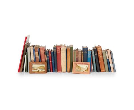
Dixon, Robert Map of the Colony of New South Wales [and other folding maps] London: J. Cross, 1837. Folding map, 76 x 126cm, hand-coloured, in original green cloth case with paper label to upper cover, a little browning and a few small stains in places, some rubbing and staining to case and label;Wyld, James (publisher). A new map of the Country twenty-five miles round London. London: James Wyld, [n.d.] Folding map on four sheets, each 56.5 x 67cm, hand-coloured, in original purple cloth case with paper label to upper cover;Bartholemew, John. Thacker's Reduced Survey Map of India. Calcutta: Thacker, Spink & Co., 1914. Folding map in original blue cloth; with separate index volume;Baker, Benjamin. [Kent]. London, [n.d,] a partial (sheet vi only?) folding map of the county of Kent, 97 x 65cm
![Parry, Edward and others [Voyages, abridged] Journal of a Voyage of Discovery to the Arctic Regions. London: Richard Phillips](https://cdn.globalauctionplatform.com/bc80e8b7-d26a-42a0-aa0c-b06900ce413d/b9bf1f8e-d452-4733-a468-b08100d1d63e/468x382.jpg)
Parry, Edward and others [Voyages, abridged] Journal of a Voyage of Discovery to the Arctic Regions. London: Richard Phillips, [n.d.] 8vo, folding map, 3 plates; [bound with] Prior, James. Narrative of a Voyage in the Indian Seas... London: Richard Phillips, [n.d.] 8vo, folding map, map, 2 plates; [bound with] Dupin, Charles. Narratives of Two Excursions to the Ports of England, Scotland, and Ireland, in 1816, 1817, and 1818. London: Richard Phillips, [n.d.] 8vo, hand-coloured plate, folding map; [bound with] Chateauvieux, Frederick Lillin de. Travels in Italy... London: Richard Phillips, [n.d.] 8vo, 2 plates including one folding aquatint; [bound with] Forbin, Count. Travels in Greece, Turkey and the Holy Land, in 1817-18. London: Richard Phillips, [n.d.] 8vo, 6 plates; [bound with] Analyses of New Works of Voyages and Travels, published during the last Six Months in Great Britain. London: Richard Phillips, [n.d.] 8vo;[volume 2:] de Forbin, Count. Travels in Egypt. London: Richard Phillips, [n.d.] 8vo, folding aquatint plate and 6 others; [bound with] McKeevor, Thomas. A Voyage to Hudson's Bay, during the Summer of 1812. London: Richard Phillips, 1819. 8vo; [bound with] Freminville, Chevalier de la Poix de. Voyage to the North Pole. London: Richard Phillips, 1819. 8vo, 8 plates; [bound with] Queene, J.S. Narrative of thirty-four years Slavery and Travels in Africa. London: Richard Phillips, 1819. 8vo, frontispiece; [bound with] May, R. de. Narrative of the Sufferings and Adventures of Hendrick Portenger... London: Richard Phillips, 1819. 8vo; [bound with] Travels of M. Burckhardt in Egypt and Nubia. London: Richard Phillips, 1819. 8vo; [bound with] Prior, James. Voyage along the Eastern Coast of Africa to Mozambique, Johanna, and Quiloa; to St Helena... London: Richard Phillips, 1819. 8vo, plate, 2 folding maps; [bound with] Cordova, Admiral Don A. A Voyage of Discovery to the Strait of Magellan. London: Richard Phillips, 1819. 8vo, portrait, folding map; [bound with] Waller, John Augustine. A Voyage in the West Indies... London: Richard Phillips, 1820. 8vo, 6 plates, map; 2 volumes, 8vo, contemporary half calf, bindings worn, bookplates of Klingelheofer
![Blaeu, Johannes Le Theatre du Monde, ou Nouvel Atlas, cinquieme partie [Scotland and Ireland] Amsterdam: Johannes Blaeu, 1654](https://cdn.globalauctionplatform.com/bc80e8b7-d26a-42a0-aa0c-b06900ce413d/67f5f306-ccd7-4050-a1f5-b07300ca95d6/468x382.jpg)
Blaeu, Johannes Le Theatre du Monde, ou Nouvel Atlas, cinquieme partie [Scotland and Ireland] Amsterdam: Johannes Blaeu, 1654. Folio (50 x 33cm), [12] 181, 59 pp (rectos of map-sheets not counted in pagination), contemporary mottled calf, gilt spine, engraved architectonic title-page incorporating arms of Scotland and with letterpress title in French on mounted slip, 55 engraved maps (all but one double-page), containing titles within decorative cartouches, several maps additionally with dedication and mileage charts in similar cartouches (a few dedications also incorporating arms of the dedicatee), maps and title-page with contemporary hand-colour throughout, title-page additionally heightened in gilt, woodcut initials and tailpieces, binding pitted, variable browning and offsetting, occasional spotting, small worm-track to lower margin from front to p. 40 (text and maps never affected), repaired closed tears to text-leaf *1 and map of Lennox ('Levinia'), 'Scotia Regnum' map with old circular stain to upper margin, Lower Clydesdale ('Gottiana Praefectura Inferior') map with Dutch text verso and small hole in image [Skelton 59a; cf. Chubb, 'The Atlases of Scotland' II-III, Dutch and Latin editions]Note: Note: 'The first printed atlas of Scotland' (Skelton), being the fifth volume of Blaeu's 1654 world atlas, this copy from the French-text edition: editions with text in French, Latin, Dutch and German were all published in the same year, with a Spanish edition appearing in 1659; the maps themselves are titled in Latin and English. The work contains 'three general maps and forty-six maps of Scottish counties and regions, engraved at Amsterdam from drawings by Robert Gordon of Straloch (1580-1661) and his son James (c.1615-1686), minister of Rothiemay in Banffshire, together with a general map of Ireland and five maps of Irish provinces, after Mercator and Jansson. The maps by the Gordons incorporate the results of the earliest topographical survey of Scotland, that made by Timothy Pont at undetermined dates, apparently within the last two decades of the 16th and the first decade of the 17th century' (ibid.).
![Scotland Collection of engraved maps, 17th and 18th century [Blaeu, William Janszoon]. Scotia Regnum. Amsterdam, c.1650. 50 x](https://cdn.globalauctionplatform.com/bc80e8b7-d26a-42a0-aa0c-b06900ce413d/bab38b11-83d0-4050-a005-b0830160be50/468x382.jpg)
Scotland Collection of engraved maps, 17th and 18th century [Blaeu, William Janszoon]. Scotia Regnum. Amsterdam, c.1650. 50 x 59.5cm, German text on verso, a few closed tears, old repairs;Wit, Frederik de. Scotia Regnum. [Amsterdam], c.1690. 2 copies: one 61 x 93cm, hand-coloured in outline, with letterpress tables conjoined to sides, browning, light soiling, small repair to foot; the other 61 x 52cm, without the conjoined letterpress tables, hand-coloured, somewhat browned, old paper reinforcement along left edge;Kitchin, Thomas. North Britain or Scotland divided into its Counties. London: William Faden, 1778. 77 x 62.5cm, hand-coloured, decorative title cartouche, old linen reinforcement to head and foot of central fold verso;Idem. A New and Complete Map of Scotland and Islands thereto belonging. London, c.1775. 2 sheets, each approx. 62 x 105 cm, hand-coloured in outline, large decorative cartouche and inset map of Shetland, south sheet with old repairs verso;Allard, Carel. Novissima Regni Scotiae Septentrionalis et Meridionalis Tabula. Amsterdam, c.1700. 53.5 x 62cm, hand-coloured, decorative title and dedication cartouches, toning;Homann, Johann Baptist. Magnae Britanniae Pars Septentrionalis. Nuremberg, c.1720. 63 x 53cm, hand-coloured, decorative title and mileage cartouches, toning;Visscher, Nicolaus. Exactissima Regni Scotiae Tabula. [Amsterdam:] P. Schenk Junior, c.1720. 63 x 53cm, hand-coloured, decorative title and mileage cartouches, toning, repairs;Bowles, Carrington. Bowles's New Pocket Map of Scotland. London, 1788. 68 x 54cm, hand-coloured, spotting along edges;Johnston, Alexander. A New Map of the North [South] Part of Scotland, c.1720. 2 sheets, each 39 x 47cm;and 9 others, including duplicates of the south sheets of Kitchin's New and Complete Map, the north sheet of Johnston's map (hand-coloured), 2 maps by Pazzini Carli, 1795, and similar
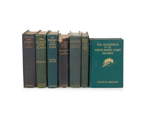
Travel Collection of works Shackleton, Ernest H. South. New York: The Macmillan Company, 1920. First US edition, 8vo, original green cloth, all plates and maps as called for, wear to head and foot of spine, front inner hinge tender;Patterson, J. H. The Man-Eaters of Tsavo and Other East African Adventures. With a Foreword by Frederick Courteney Selous. London: Macmillan and Co., Limited, 1908. First edition, 8vo, original pictorial cloth gilt, photographic frontispiece, map to rear, photographic illustrations throughout the text, contemporary ownership inscription to title-page;Selous, Frederick Courteney. Sport and Travel, East and West. London: Longmans, Green, and Co., 1900. First edition, 8vo, original green cloth, 18 plates;Roosevelt, Theodore. Through the Brazilian Wilderness. New York: Charles Scribner's Sons, 1914. First edition, 8vo, original cloth, all plates and maps as called for, spine sunned and with fraying to head;and 12 others, including Theodore Roosevelt, African Game Trails, reprint, c.1910 (original pictorial cloth), Charles Sheldon, The Wilderness of the Upper Yukon, 1911 (original cloth), W. S. Rainsford, The Land of the Lion, 1909, Lord Roberts, Forty-One Years in India, 1898 (2 volumes, original cloth), William T. Hornaday, Camp-Fires on Desert and Lava, 1908 (original cloth), and similar


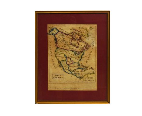
Mary Ann Evans(19th Century British School)"North America", a pre-Civil War manuscript map; depicting areas such as 'British America', 'United States', 'Russian America', and 'New California',signed and dated 'Mary Ann Evans, June 17th, 1851',pen and ink with watercolour,29.5 x 22cms, in frame.


![Original antique map of Ireland.[Frame 55x67cm]](https://cdn.globalauctionplatform.com/cb6b8728-79f7-427e-aa5f-b07e00b41c3e/4bfd0836-4ef7-4b4d-bb92-b07e00fbba54/468x382.jpg)
![Antique Map of Fife and Part Of Lothian with description on reverse side.[Frame 51x63cm]](https://cdn.globalauctionplatform.com/cb6b8728-79f7-427e-aa5f-b07e00b41c3e/30eea44d-727f-4c0a-9617-b07e00df5b2b/468x382.jpg)
![Original hand painted map by H.Moll from his atlas 1729 along with one other.[58x70cm]](https://cdn.globalauctionplatform.com/cb6b8728-79f7-427e-aa5f-b07e00b41c3e/0ced27a2-5d1b-4adc-ab33-b07e00e0655d/468x382.jpg)


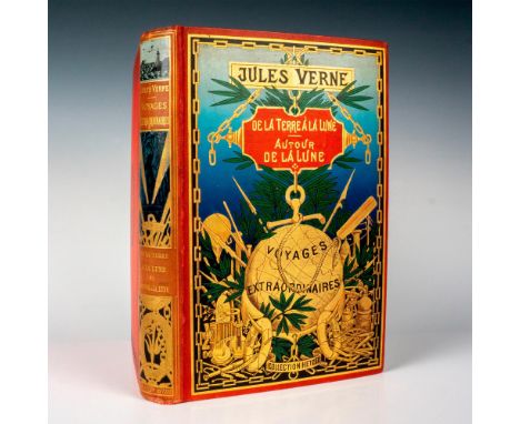
Beautiful type 4 double volume from Hetzel's Au Globe Dore French edition of the Voyages Extraordinaires by Jules Verne. It includes the novels De la Terre a la Lune and Autour de la Lune with 41 illustrations and one map by De Montaut and 44 drawings by Emile Bayard and de Neuville. Type Engel i. Vibrant red cover with rich gild designs and fresh interior. Collection Hetzel, Bibliotheque d'Education et de Recreation, published by Pierre Jules Hetzel et Cie, Paris. Artist: Jules Verne (French 1814-1886)Issued: c. 1903Dimensions: 7.25"W x 11"H x 1.50"DManufacturer: HetzelCountry of Origin: FranceProvenance: Collection of Marie-Claude Lalique Condition: Very good. Minor loosening of spine on the inside of the back cover.
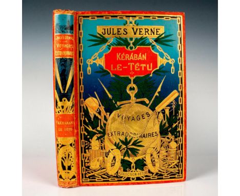
Handsome type 3 single volume from Hetzel's Au Globe Dore French edition of the Voyages Extraordinaires by writer Jules Verne. It includes the novel Keraban Le-Tetu with 101 illustrations by Leon Bennet and one map. Vibrant red cover with rich gild designs, green and blue colors, and fresh interior. Type Engel h. Collection Hetzel, Bibliotheque d'Education et de Recreation, published by Pierre Jules Hetzel et Cie, Paris. Artist: Jules Verne (French 1814-1886)Issued: c. 1898-1902Dimensions: 7.25"W x 11"H x 1.50"DManufacturer: HetzelCountry of Origin: FranceProvenance: Collection of Marie-Claude Lalique Condition: Very good.
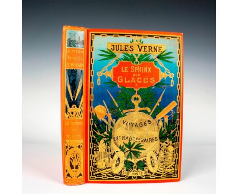
Beautiful volume from Hetzel Au Globe Dore French edition of the Voyages Extraordinaires by writer Jules Verne published between 1896 and 1904. It includes the novel Le Sphinx des Glaces with 68 illustrations by George Roux with 20 chromolithographs and one map. Type 3, type Engel h. Vibrant red cover with rich gild designs. Crisp interior. Includes the Hetzel Catalogue for the year 1897. Collection Hetzel, Bibliotheque d'Education et de Recreation, published by Pierre Jules Hetzel et Cie, Paris. Artist: Jules Verne (French 1814-1886)Issued: 1897Dimensions: 7.25"W x 11"H x 1.50"DManufacturer: HetzelCountry of Origin: FranceProvenance: Collection of Marie-Claude Lalique Condition: Good. Some Foxing. Minor color loss in parts of the front cover.
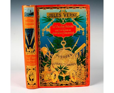
Exceptional type 3 volume from Hetzel's Au Globe Dore French edition of the Voyages Extraordinaires by Jules Verne, published between 1896 and 1904. It Includes the novels Le Village Aerien and Les Histoires de Jean-Marie Cabidoulin with 38 illustrations by George Roux, 6 chromolithographs and one map. Beautiful red cover with gild designs and rich green and blue colors. Collection Hetzel, Bibliotheque d'Education et de Recreation, published by Pierre Jules Hetzel et Cie, Paris. Artist: Jules Verne (French 1814-1886)Issued: 1901-1902Dimensions: 7.25"W x 11"H x 1.50"DManufacturer: HetzelCountry of Origin: FranceProvenance: Collection of Marie-Claude Lalique Condition: Good. Some friction on corners and back of cover, minimal foxing.
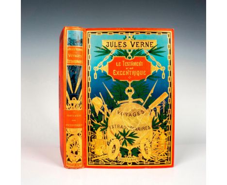
Splendid volume from Hetzel Au Globe Dore French edition of the Voyages Extraordinaires by writer Jules Verne published between 1896 and 1904. It includes the novel Le Testament d’un Excentrique with 61 black & white and color illustrations by George Roux, 35 views and one map of the United States. Outstanding vibrant red cover with rich gild designs, and deep green and blue. At the end of this volume, a catalog Collection Hetzel for 1899. Collection Hetzel, Bibliotheque d'Education et de Recreation, published by Pierre Jules Hetzel et Cie, Paris. Artist: Jules Verne (French 1814-1886)Issued: 1899Dimensions: 7.25"W x 11"H x 1.50"DManufacturer: HetzelCountry of Origin: FranceProvenance: Collection of Marie-Claude Lalique Condition: Very good.
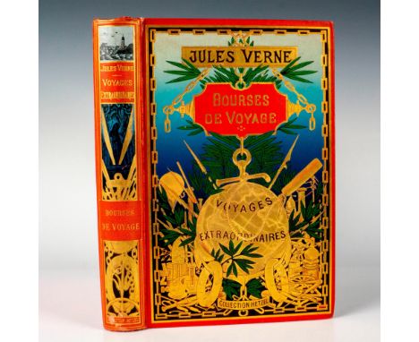
Beautiful single volume from Hetzel Au Globe Dore French edition of the Voyages Extraordinaires by Jules Verne. It includes the novel Bourses de Voyage with 47 illustrations by Leon Bennet, 12 chromolithographs, multiple photographs, and one map. Type4, Engel i. Vibrant red cover with rich gild designs, fresh green and blue colors. Collection Hetzel, Bibliotheque d'Education et de Recreation, published by Pierre Jules Hetzel et Cie, Paris. Artist: Jules Verne (French 1814-1886)Issued: 1904Dimensions: 7.25"W x 11"H x 1.50"DManufacturer: HetzelCountry of Origin: FranceProvenance: Collection of Marie-Claude Lalique Condition: Very good.

Exceptional volume from Hetzel Au Globe Dore French edition of the Voyages Extraordinaires by Jules Verne published between 1896 and 1904. It includes the novel Famille sans Nom with 82 illustrations by G. Tiret-Bognet and a folding map in color. Beautiful red cover with vibrant gild designs,and rich green and blue colors. Type 3. Includes the catalog for Collection Hetzel 1899. Written in pencil on second page: Carte en couleur depliante de Morieu. Cours du St-Laurent. Collection Hetzel, Bibliotheque d'Education et de Recreation. Artist: Jules Verne (French 1814-1886)Issued: 1899Dimensions: 7.25"W x 11"H x 1.50"DManufacturer: HetzelCountry of Origin: FranceProvenance: Collection of Marie-Claude Lalique Condition: Very good. Minor color loss on upper part of front cover.

Splendid volume from Hetzel Au Globe Dore French edition of the Voyages Extraordinaires by writer Jules Verne published between 1896 and 1904. It includes the novel Famille sans Nom with 82 illustrations in black & white and color by G. Tiret-Bognet and a color folding map. Beautiful vibrant red cover with rich gild designs, and bright green and blue. Crisp interior. Type 3. Collection Hetzel, Bibliotheque d'Education et de Recreation, published by Pierre Jules Hetzel et Cie, Paris. Artist: Jules Verne (French 1814-1886)Issued: c. 1900Dimensions: 7.25"W x 11"H x 1.50"DManufacturer: HetzelCountry of Origin: FranceProvenance: Collection of Marie-Claude Lalique Condition: Very good. Minor color loss on upper left side of the front cover.

Outstanding type 3 single volume from Hetzel's Au Globe Dore French edition of the Voyages Extraordinaires by writer Jules Verne. It includes the novel L'Ile a l'Helice with 80 illustrations by L. Bennet including 12 chromolithograph engravings, one color map and two in black & white. Beautiful vibrant red cover with rich gild designs, green floral and black geometric patterns. Type Engel h. Collection Hetzel, Bibliotheque d'Education et de Recreation, published by Pierre Jules Hetzel et Cie, Paris. Artist: Jules Verne (French 1814-1886)Issued: c. 1898-1902Dimensions: 7.25"W x 11"H x 1.50"DManufacturer: HetzelCountry of Origin: FranceProvenance: Collection of Marie-Claude Lalique Condition: Good. Some foxing. Minor loss of blue on top center right side of cover.

France: Grund, 2006. Hardcover pictorial history book in French; depicting famed painting, Napoleon Crossing the Alps, on the book sleeve. Napoleon Bonaparte (1769-1821) was a French military commander who rose to be French Empire. 80-pages, 'Napoleon' gives detail accounts of the French leader's life with mock letters and faux antique map. ISBN: 9782700014693. Artist: Richard HolmesIssued: 2006Dimensions: 12.25"W x 11"H x 2"DManufacturer: GrundCountry of Origin: FranceProvenance: Collection of Marie-Claude Lalique Condition: Near fine.

Handsome volume from Hetzel Au Globe Dore French edition of the Voyages Extraordinaires by writer Jules Verne published between 1896 and 1904. It includes the novel Le Sphinx des glaces with 68 illustrations by George Roux with 20 large chromolithographs and one map. Includes the catalog Collection Hetzel for 1897. Vibrant red cover with gild designs, green floral and black geometric patterns. Collection Hetzel, Bibliotheque d'Education et de Recreation, published by Pierre Jules Hetzel et Cie, Paris. Artist: Jules Verne (French 1814-1886)Issued: 1897Dimensions: 7.25"W x 11"H x 1.50"DManufacturer: HetzelCountry of Origin: FranceProvenance: Collection of Marie-Claude Lalique Condition: Good. Some foxing. Some friction on corners and back of cover.


Newcome (Rev. Peter) The History of the Ancient and Royal Foundation called the Abbey of St Albans. Nichols et al, London 1795 with folding map, two plans and frontispiece. 4to full calf plus Buckler (I.C. and C.A.). A History of the Architecture of the Abbey Church of St Alban. Longman et al, London 1847 with illustrations and diagrams. 8vo. full calf. Both in used condition (2)

Cook (Capt. James). ‘A Compendious History of Captain Cook’s First and Second Voyage…’. Kearsley, London 1784. 2 vols. (175 x 105mm) with folding map. Monckton b/p owners signature, full contemporary calf plus T Lucretius Carus ‘The Epicurean Philosopher’. Stephens, Oxford 1683. Full calf plus two further titles (5)


An 18th Century hand-coloured map of 'Glocester & Monmouth', engraved forJ. Harrison, 15" x 18" (38 x 46cm), an outline coloured map of Suffolk, 7.5" x 9.5" (19 x 24cm), along with an 18th Century Continental map of the British Isles, 8" x 9.5" (20 x 24cm), and a reproduction map of Gloucestershire, (4).

Kenner Star Wars Droids The Adventures of R2-D2 and C-3PO A-Wing Fighter Vehicle, complete with two side cannons and removable canopy, Active attack lasers untested, in good original condition, some yellowing to plastic, needs a clean, two original card packing pieces, operating instructions and a special Planetary map, outer box is in fair to good original condition, edge/age wear, some creasing, one end flap sellotaped closed, Toys R Us price label $16-97.
-
109198 item(s)/page