We found 108737 price guide item(s) matching your search
There are 108737 lots that match your search criteria. Subscribe now to get instant access to the full price guide service.
Click here to subscribe- List
- Grid
-
108737 item(s)/page


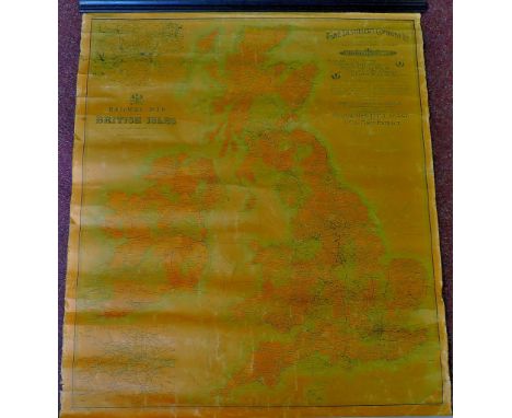
Lot 274
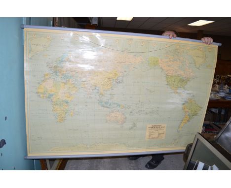
COLLECTION OF SENIOR SERVICE REAL PHOTOGRAPH CIGARETTE CARDS, varying subjects including; dogs, flying, coastwise, etc... on excess of 200 cards, DITTO ALBUM Sights of Britain, JOHN PLAYERS CARDS in cigarette packs TOGETHER WITH FOUR ABC BOOKLETS RELATING TO LNER AND OTHER LOCOMOTIVES, PHILIPS FOLDED PAPER RAILWAY MAP OF THE BRITISH ISLES CIRCA 1942, coloured to groups, CROSSLEY GAS AND OIL ENGINES BOOKLETS EC...
Lot 326
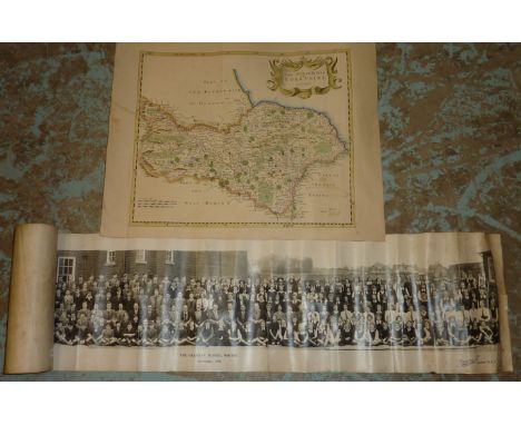
Leech. Sir Bosdin. The History of the Manchester Ship Canal. 2 vols. Pub 1907, seven folded maps to rear slip cases. Gilt brown cloth (in poor condition). ALSO Procter. R. Wright. Memoirs of Bygone Manchester. Pub 1880. With folded facsimile map of Manchester and Salford in rear slip case. Gilt green cloth (in poor condition) (3)

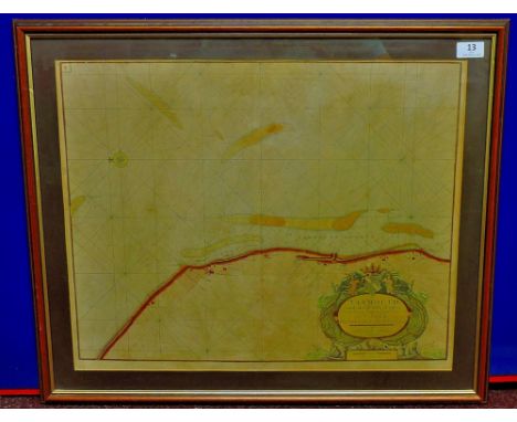
Lot 561
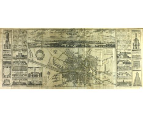
The Earliest Printed Plan of Dublin, 1728 Brooking (Charles) A Map of the City and Suburbs of Dublin, and also the Arch Bishop and Earl of Meath's Liberties with the Bounds of each Parish. Drawing from the Actual Survey made by Charles Brooking published by John Bowles, London, 1728. The map is dedicated to Lord Carteret, Lord Lieutenant at the time, and the top border includes a panoramic view: a Prospect of the City taken from the North, together with 20 interesting smaller views of notable buildings, etc., in the City, some of which have long since disappeared or been rebuilt. The Parish Boundaries are shown in colours. Size: 4 feet, 7 inches wide and 1 foot 11 inches height. Slight occasional time discolouration, a little creased along three folds, the 63cms (24 ½") high, 148cms (58"; 4'10") long upper portion of one fold skilfully repaired and with several minor neat marginal restorations, otherwise, for so large a map, in surprisingly well preserved state. Rare. (1) A plan of outstanding importance - the earliest to portray Dublin on a large and detailed scale. The engraved views are among the first existing of the City. This example is the second variety noted by Cosgrave and has a two columned table of names of buildings and includes 'Bowles Sculpt" below.
Lot 562
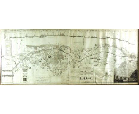
The Grand Canal, 1788 Co. Kildare & Dublin: Brownrigg (J.) Surveyor & Publisher, "A Map & Section of that Part of The Grand Canal now perfected and also a Sketch of the Country on each Side etc etc. Extending from The City of Dublin to the River Barrow at Monasterevan," engraved by J. Ford, Essex Quay, with fine engd. vignette, and inset sections etc., approx. 54cms x 136cms (21 1/2" x 53 1/2"), in hogarth type frame. (1) Fine Extremely Scarce.


Lot 599
Unique Manuscript Map of Sagart, 1823 Co. Dublin: Byrne (Jos. James) Survey of The Parish and Commons of Sagart in the Barony of Newcastle and County of Dublin, surveyed by Joseph James Byrne, 3 Richmond Street, Dublin 1823. Extremely fine manuscript map in full pen, ink and watercolour, with exquisite large sepia landscape cartouche, approx. 163cms x 112cms (64" x 44") linen backed, unframed. Unique. (1)

Lot 604
Indian Interest Portfolio: Early Maps & Prints, includes some original maps, plans and engravings from Cook's 'Voyages,' 1777; Janson Magni Mongolis Imperium, Amsterdam c. 1700, dbl. page map, hd. cold. in outline; Rennell (J.) Map of Cossimbuzer Island, Bengal, L. 1780; Plan of the Environs of the City of Dacca, 1780; a manuscript Plan of the Battle of Buxar, c. 1764; Rennell (J.) Map of Bengal and Bahar, lg. dbl. page map, L. 1779, & others maps & plans, mostly of India, as a coll., w.a.f. Interesting lot. (1)

Lot 631
Knott (Mary John) Two Months at Kilkee, 12mo D. 1836. First Edn. add. engd. title, frontis & 5 engd. plts. & plans (some fold.), orig. cloth; Binns (Jon.) The Miseries and Beauties of Ireland, 2 vols. L. 1837, First, fold. map cold. in outline, 9 engd. plts. cloth, Vol. I spine dam. & loose. (3)


Lot 647
1798 etc: Mac Nevin (Wm. James) A Ramble through Swisserland in the Summer and Autumn of 1802 8vo D. 1803. First End., Map frontis, 280pp, bound with: Dodd (J.S.) The Traveller's Directory through Ireland, 8vo D. 1801. First Edn., lg. map frontis, 2 lg. fold. plts. VII, 224pp, cont. hf. crimson mor. Scarce.


Lot 691
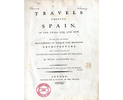
Swinburne (Henry) Travels through Spain in the Years 1775 and 1776, In which several Monuments of Roman and Moorish Architecture are illustrated ... 4to L. 1779. First Edn., lg. fold map (with tears), 13 plts. as called for, (but with extra views not called for, bound in), cont. calf, spine worn. With Borris Library & Furness stamps. (1)
Lot 712
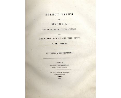
Home (Robert) Select Views in Mysore, The Country of Tippoo Sultan; From Drawings taken on the Spot. Lg. 4to L. (Published by R. Bowyer) 1794. First Edn. L.P., 3 lg. fold. plans, 2 printed on blue, fold. hd. cold. map & 27 engd. plts., 13 leaves printed Arabic, full cont. calf, dble gilt and blind fillet borders, and with armorial? in gilt on both covers, upr. cover loose. (1)
Lot 732
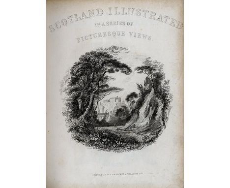
Engraved Views: Bartlett (W.H.) The Scenery and Antiquities of Ireland, 2 vols. in one, lg. 4to L. n.d. First Edn., 2 engd. add. titles, engd. map, & 118 engd. plts., cont. hf. mor.; also Scotland Illustrated in a Series of Picturesque Views L. 1845. Ed. by Prof. Wilson, add. engd. title, 80 engd. plts. cont. full mor. (2)
Lot 733
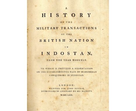
Orme (Robert) A History of the Military Transactions of the British Nation in Indostan, 2 vols. in 3, 4to L. 1763 - 1778. First Edn., 35 engd. fold. & single page maps & plts. (1 lg. map lacking one folded section, & 1 leaf p. 512, dam. with loss), cont. mottled calf, joints cracked & rubbed. (3)


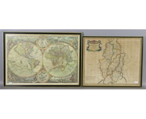
Lot 238
Map: Nollin (J.B.) Le Royaume D'Irlande. Divise en Provinces Subdivises en Contez et en Baronies selon les Memoires du Sr. Petty et d'Autres... Dedie a Marie D'Este Reyne D'Angleterre, D'Ecosse, et D'Irlande ... Paris 1690, approx. 64cms x 49cms (25" x 19 1/2"), with attractive engraved cartouche, and with contemporary hand colouring, hogarth frame. (1) * The Jacobite Map of Ireland.


Lot 269
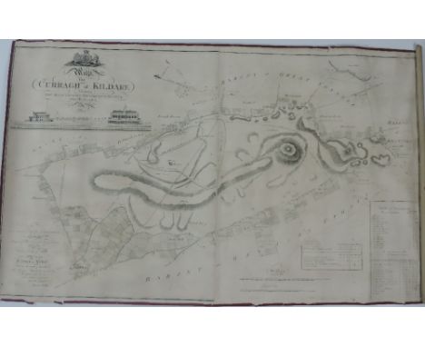
Rare Map of The Curragh Co. Kildare: Walker (Henry) Surveyor. "A Map of the Curragh of Kildare" showing The Race Courses Gentlemen's Seats etc. Accurately described. Dedicated to The Duke of Leinster and engraved by Kersting, approx. 69ms x 114cms (27" x 45"), with engd. views of The Stand etc., gilt frame. V. Rare. (1)
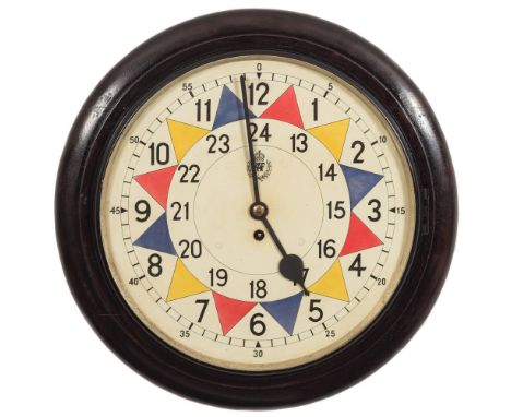
Lot 745A
An RAF operations room sector wall clock: the eight-day duration, single-fusee movement stamped to the backplate 9113, Made by Elliott Ltd, England, 1939, the twenty-four hour, fourteen-inch sector dial having black Roman numerals, RAF 'King's Crown' warrant officer's insignia to the centre, red, blue and yellow sector markings and blued steel spade hands, the round ebonised case having a black painted brass bezel and stamped on the rear of the backbox Elliott Ltd, above the Air Ministry cypher, stencilled to the back with the Admiralty arrow followed by R 4-8-1953, Stores No. 218/WS, Con. No. A159407/53/C22(B), diameter 47cm. * Sector clocks were widely used during the Second World War to track enemy aircraft movements. As an enemy plane was spotted its' position was marked on a UK map using the British Modified Grid system laid out at a sector operations room, using a coloured disc matching the coloured segment on the clock dial as pointed to by the minute hand, each coloured sector representing five minutes. The discs were then repositioned on the map as further sightings came in, using a magnetic 'rake', which enabled the controllers to follow the progress and formation of each flight and work out its' possible target, This simple, but extremely effective, method of gaining the required information with speed allowed quick decisions to be made in the battle of the air.


Lot 283
King & Country “Club Special” soldiers. 1998 issue – Seaforth Drummer (98SD). 2x 1999 issue - Seaforth Piper (PD SFP). 1999 issue 7 – Victorian Sailor with Tankard (VS1). 2x 2000 issue – Seaforth Drum Major (PD SFDM). Plus a 2001 issue- Afrika Korps Officer (01MIL) with Luger and map. All boxed, with packing, minor wear. Contents Mint. See internet


Lot 342
King & Country Montgomery’s 8th Army “Matilda Tank” (EA07). A heavy British tank in sand, olive green and pale blue camouflage livery, with two man crew, driver and commander with mike in hand, plus standing Sergeant holding map. Boxed, some wear to outer and inner packing. Contents Mint. Plate 3

Lot 346
2 King & Country “8th Army” sets. The Mine Sweepers (EA13). Comprising Officer with map and machine gun, soldier minesweeping and soldier crouching down holding mine. Plus 2 German Minefield signs. Plus 8th Army Tank Riders (EA30). 3 soldiers in seated/kneeling positions with rifle and machine gun. Both boxed with packing. Contents Mint.(8) Plate 3
Lot 649
An altimeter, in the form of a large pocket watch, 2¾” diameter, by J Hicks, 8, 9 & 10 Hatton Garden, London, the lacquered brass case bearing broad arrow mark, contained in 1917 dated leather compass case; a 1917 dated military stop watch, by Mayer & Weill (not working); a 1915 dated compass in pocket watch type case, bearing broad arrow, by Short & Mason Ltd, London; a 1916 dated prismatic marching compass, by Gruchon & Emons, London; a Gamage pocket watch type Voltmeter; a small velvet lined pocket watch type container; and a Universal Map Measurer, in original box (worn). Average GC (7)


Lot 1018
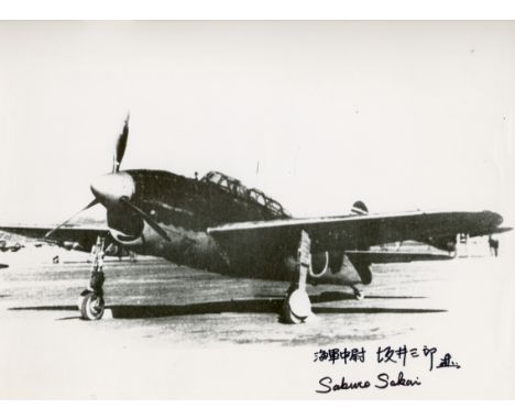
KAMIKAZES: Small selection of signed documents by few of the most famous Japanese kamikazes, comprising Mitsuo Fuchida (1902-1976) Captain of the Japanese Navy, and bomber Aviator during WWII. Best known for leading the first air wave attacks on Pearl Harbour on 7 December 1941. Signed 12 x 8.5 copy of a map showing the Kamikazes route to Pearl Harbour. Signed twice, in bold blue ink, in occidental and Japanese characters, to a clear area of the image; Saburo Sakai (1916-2000) Japanese naval Aviator and flying ace of the Imperial Japanese Navy during World War II . Signed 12 x 11 photograph by Sakai, the image depicting an aircraft fighter. Signed twice, in bold black ink, in occidental and Japanese characters, to a clear area of the image; and Ryuji Nagatsuka (1924- ) Japanese Kamikaze survivor. Professor at Tokyo University and Author of the work `I was a Kamikaze. The Knights of the Divine Wind´ (1973). Signed 8 x 12 image showing a reproduction of the Nakajima Ki-44-I, a Japanese aircraft fighter. Signed in bold red ink, in Japanese characters, to a clear area of the image. EX, 3 £150-200


-
108737 item(s)/page