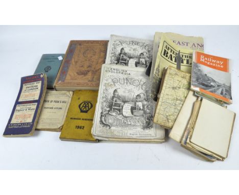
We found 109182 price guide item(s) matching your search
There are 109182 lots that match your search criteria. Subscribe now to get instant access to the full price guide service.
Click here to subscribe- List
- Grid
-
109182 item(s)/page


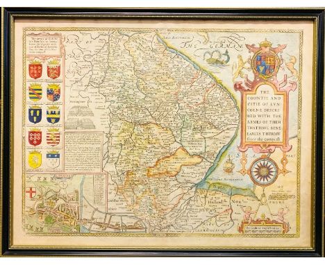
Lot 351
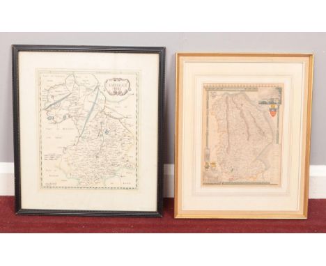
John Speed (1552-1629). Map of Lincolnshire, c.1676, hand-coloured copper engraving on laid/chain-lined paper, featuring armorial shields, sea monsters, ships and inset view of Lincoln, published by Bassett & Chiswell, 41.5cm by 54.5cm. Framed and glazed recto & verso (both sides visible). Well-preserved with light, even toning; a couple of pale marks/discolouration at lower-right; short tear at right-hand margin, just into engraved border

Lot 177
Leslie (C), THE THEOLOGICAL WORKS OF THE REVEREND MR CHARLES LESLIE, 2 vols, full leather, laid paper, engraved head panels, printed by W. Bowyer, London 1721, with Burder (S), THE GENUINE WORKS OF FLAVIUS JOSEPHUS, THE JEWISH HISTORIAN: CONTAINING TWENTY BOOKS OF THE JEWISH ANTIQUITIES, SEVEN BOOKS OF THE JEWISH WAR, AND THE LIFE OF JOSEPHUS, WRITTEN BY HIMSELF, 2 vols bound as one, full leather, engraved frontispiece, fold out plan of the temple at Jerusalem, fold out map of old Jerusalem, printed for J. and J. Cundee by Albion Press, London (3) (at fault)


Lot 192
Clarke (S) (Ed), HOMERI ILIAS GRAECE ET LATINE. ANNOTATIONES IN USUM SERENISSIMI PRINCIPIS GULIELMI AUGUSTI, DUCIS DE CUMBERLAND, ETC REGIO JUSSU, sixth edition, 2 vols, full leather, each with book plate to inside front cover and fold out map frontispiece (extensively inscribed verso in vol I), printed for C. Hitch & L. Hawes et al, London 1760 (2) (at fault)


Lot 205
* After CORONELLI (VINCENZA MARIA), a hand-coloured engraved map titled 'Isola di Malta, olim Melita Descritta e Dedicata Dal P. Coronelli Cosmografo della Serenissima Republica di Venetia, All'illustrissimo, et eccellentissimo Signore Giorgio Corner, in Venicea1689' [Island of Malta, formerly Melita Described and dedicated by P. Coronelli Cosmographer of the Serenissima Republic of Venetia, To the most illustrious, and most excellent Lord Giorgio Corner, in Venice 1689], the map with title cartouche and ornate hand-coloured border depicting the armorial crests of the Knights of Malta, 43cm x 59cm, framed and glazed NOTE: We believe the map to be a 19th century copy of the 1689 original.

Lot 206
* After ROSSI (GIACOMO GIOVANNI), a hand coloured engraved map titled 'Isola Di Malta, Gozzo Comino E Cominotto cauata dalle piu recenti notitie e da ta in luce da Gio. Giacomo de Rossi dalle sue stampe in Roma alla Pace con Priu del S. Pont l'anno 1686' [Islands of Malta, Gozzo Comino And Cominotto informed by the most recent news and highlighted by Gio. Giacomo de Rossi from his prints in Rome to Peace with Priu. del S. Pont in the year 1686], with lower inset 'Valetta And Its Fortifications' with surrounding key to thirty seven locations, 40.5cm x 54cm, framed and glazed NOTE: We believe the map to be a 19th century copy of the 1686 original.


Lot 113
19TH CENTURY MAPS (3) - North Wales, Warwickshire and Middlesex and a miniature unframed map of Leicestershire by Cary, a parcel of pages from 'The Illustrated London News 1888' and two large unframed 18th century engravings, being oval portraits of Henry Bennet Earl of Arlington, 42 x 26cms and of The Duke of Marlborough, 40 x 30cms


Lot 638
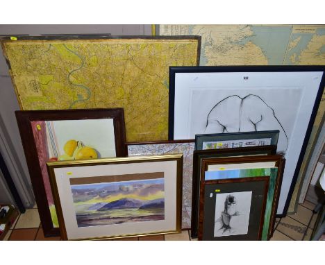
PICTURES, PRINTS AND MAPS ETC, to include a nude charcoal sketch signed Pam Brittain? (19)95, approximate size 77cm x 58cm, Ian Reynolds landscape watercolour (slipped in mount), unsigned still life study of fruit, pencil portrait with indistinct signature, vintage map of London Suburbs approximate size 89cm x 115cm, mounted to a backing board, Geographica sales managers map of Great Britain, Ordnance Survey Rout Planning Map 'South' etc


![An early 19th century map of Sweden & Norway by Herman Moll Geographer. [29x35cm- frame]](https://cdn.globalauctionplatform.com/334d0405-07ea-4882-835a-ae0100f24b6d/414eb332-3e05-41f3-bfbb-ae0100f98468/468x382.jpg)
![Antique hand coloured map 'The Continuation of the Road from London to Berwick', framed and mounted [47x53cm]](https://cdn.globalauctionplatform.com/334d0405-07ea-4882-835a-ae0100f24b6d/e687680d-5db7-4183-b65d-ae0100f99fd4/468x382.jpg)
![An 18th century map of Wilton Common 1764. [40x34cm]](https://cdn.globalauctionplatform.com/334d0405-07ea-4882-835a-ae0100f24b6d/8d7bf492-722a-45a7-873f-ae0100fa6e3b/468x382.jpg)

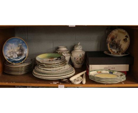
Lot 321
Decorative and household ceramics and glassware, including various sets of collector plates, other serving plates including a pair of Villeroy & Bosch basket pattern plates and four shaped serving dishes, maritime tankards, a set of six large blue glass plates; together with a framed print after John Ward 'The William Lee at the Mouth of Humber Dock, Hull', a framed players cigarette card display of naval ships, and a world map after an engraving by Moses Pitt, and a reproduction mirror, Danbury Mint tankerds

-
109182 item(s)/page