We found 109182 price guide item(s) matching your search

Refine your search

Year

Filter by Price Range
  • List
  • Grid
  • 109182 item(s)
    /page

Lot 805

JAN JANSSON. 'Cornubia sive Cornwallia'. Essentially a copy of the earlier Jan Bleau map of Cornwall, set differently & more decorative, having the Coats of Arms taken from John Speed's map of Cornwall. Published 1646. Framed and in VGC.

Lot 807

THOMAS KITCHIN. 'A New Improved map of Cornwall from the Best Surveys and Intelligences'. Printed for T. Bowles in St Paul's Churchyard, I. Tinney at the Golden Lion, Fleet Street, John Bowles & Son in Cornhill, & Robert Sayer in Fleet Street. Almost certainly based on the earlier map by Joel Gascoyne. Published 1750. Framed & in good condition.

Lot 808

THOMAS MARTYN. 'A New and Accurate Map of the County of Cornwall from an Actual Survey'. Printed for William Faden, Geographer to the King, 20 February 1784. A 1784 re-issue of the 1749 map of Cornwall, with a dedication to Jonathan Rashleigh of Menabilly. 1784. Framed and in VGC.

Lot 809

J. OGILBY. 'Hatherly to Truro' (Plate 3 from the Barnstaple to Truro road map). Also, Plymouth to Senan' (Plate 4 from the London to Land's End road map). 1675. Both VGC.

Lot 86

SILK MAP. A 1044 'Zones of France' (2nd editon) printed silk map.

Lot 269

Ceramic table lamp, another table lamp, a small rug, a map and lampshades, etc (1 box) 

Lot 411

Small map of Glocestria, hand coloured, 9cm x 13cm and Robert Morden Gloucestershire map, 37.5cm x 44cm, a map of Britannia and a map "Angliae" (4)   

Lot 412

19th century handcoloured map of Gloucestershire, "A New Map of the County of Glocester divided into hundreds", printed for C Smith 1808

Lot 195

A mixed lot to include various black and white photographs of scenes of The Potteries, together with a wall mounted map of the world and various late 20th Century railway posters

Lot 108

Small quantity of various die-cast metal model vehicles, together with a quantity of pens, a framed reproduction Ordnance Survey map and two Bakelite telephones etc

Lot 1312

18th Century hand coloured map of London and Surrey, published by John Andrews, 1777, 19ins x 26.5ins, gilt framed

Lot 1313

19th Century hand coloured map, Isle of Wight and Hampshire, together with a small coloured map of Surrey

Lot 1314

17th Century French hand coloured map of Brittany, dated 1693, 23ins x 32ins, framed

Lot 215

1905 Admiralty map, positions of the French and British fleets in the Solent from the 7th to the 9th August, 1905

Lot 306

Oak and gilt framed map of Ireland

Lot 845

20th Century steel cased open face stop watch inscribed Alfred E. Mutter, Manchester, together with a map measurer in original box

Lot 1867

A collection of mainly 19th century topographical engravings including Thornbury Castle, Gloucester, Clifton Suspension Bridge, etc, together with a coloured engraving of a girl in highland costume, a pencil sketch of a recumbent female nude, inscribed verso Louis Ward, a framed map, etc

Lot 331

A mixed collection of silver and white metal to include an Indian white metal card case engraved with a lion and lioness and map of India, further silver card case engraved with geometric foliage, silver salt, silver sugar nips, 9.5oz approx, together with further boot hook, spoon and sovereign case
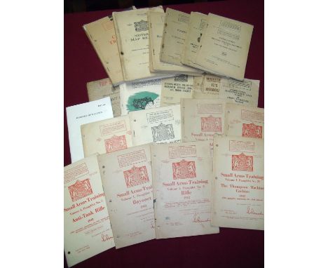
Lot 16

Robert Morden, framed and glazed coloured map of North Wales; together with another map of North Wales

Lot 9

Robert Morden, framed and glazed coloured map of Essex

Lot 52

A large 1934 map of Africa, supplement to South Africa newspaper, with advertising around edge

Lot 383

Kip-Saxton 1610, coloured engraved, Map of Sussex, overall 28 x 39cm

Lot 12

Collection of various military related pamphlets, booklets etc including Cadet Training, Notes on map reading 1929, Royal Army Service Core Training pamphlet 1940 similar 1937, various other wartime pamphlets including Small Arms Training, Military Training, Gas Training etc Musketry in its Humour booklets and standing orders

Lot 54

German 1940/1941 Operation Sea Lion Invasion of Britain maps and booklets including a folder containing a large selection of various detailed maps of Britain and bound volume 1941 England & London map booklet

Lot 6

Oak framed map of Northumberland and Durham produced by British Railways designed and drawn by Lance Cattermole 1949 printed GB (69cm x 110cm including frame)

Lot 507

HUMPHREY LLWYD coloured & tinted map - Wales entitled 'Cambriae Typus', circa 1636-1642, 37 x 50cms

Lot 508

ROBERT ROBERTS OF HOLYHEAD terrestrial map - entitled in Welsh 'Darluniad Y Ddaear', dated 1816, 20 x 36cms

Lot 510

A LATE EIGHTEENTH CENTURY PEN, INK & WATERCOLOUR LINEN-BACKED MAP OF FARMLAND entitled A Plan of Pentre-Bach Farm, the property of Mr Edw. Thomas, Graweth Farm, the property of Rydyvi chapel? & part of Mr William David's farm, all in the Parish of Merthir Tidvile (sic) in the county of Glamorgan, 1791

Lot 303A

Robert Morden Derbyshire map, framed

Lot 380

Speede (John) The Countie of Nottingham described, The Shire Townes Situation and the Earls There of Observed, 1610, [1611 or later], Sudbury & Humble, hand-coloured map, 383mm x 510mm;

Lot 567

SPEEDE (JOHN) NOTTINGHAMSHIRE The Countie of Nottingham defcribed The Shire Townes Situation And The Earls There Of obferved,double page engraved map c.1646, framed, 51cm x 38cm double page engraved map from the 1646 edition of The Theatre..., hand coloured, mounted to within platemark

Lot 170

A large collection of aircraft related prints, to include a map of occupied Jersey

Lot 338

A 19th century sampler, together with a framed and glazed watercolour of floral studies, a reproduction map and other miscellaneous oils and watercolours.

Lot 336

Robert Morden, Engraving with later hand colouring, Map of Shropshire, 36.5cm x 42.5cm, Framed and glazed

Lot 1072

A box of Victorian and later pictures and prints, to include county map, portrait of the Queen, engravings etc

Lot 422

Two boxes of miscellaneous photographs and ephemera, to include Air Raid Precautions handbooks, notes on map reading etc

Lot 23

A framed London Underground Transport map

Lot 635

A Dollond 25x telescope and Blundell Harling nautical map dividers

Lot 736

Mogg's Twenty Four Miles Round London, the folding map published Jan 1st 1812 by Edward Mogg, No 14 Little Newport Street, 57cm wide

Lot 434

Albert Wainwright (1898-1943) - 'Legende - Sage, male nude study for Siegfried', ink drawing, unframed, 21cm x 14cm also painted verso together with a musical verse and a map of Nederland by the same hand (3)

Lot 1777

17th century style map of Ethiopia 39cm x 49cm, 74cm x 82cm (frame)

Lot 1810

Victorian map of London (West) dated 1881, published by Lett, Son & Co, London, 43cm x 68cm, 67cm x 92cm (frame)

Lot 261

9ct gold map of Australia charm probably by William Drummond. Marked W9D to Australia map the frame is marked F.A.F? 9ct. Approx 1.6 grams weight

Lot 263

Antique 9ct gold map of Australia charm Marked 9ct Jeweller association of Victoria stamp, makers partially rubbed Approx 1.5 grams,

Lot 141

Alexander, Colonel Sir James Edward - "Salmon - Fishing in Canada by a Resident" 1st ed 1860, frontis, map, text illustrations, adverts, original blue cloth binding, slight wear top and tail of spine, and general shelf wear to the edges but clean internally

Lot 210

Davies, G. Christopher - The Handbook to the Rivers and Broads of Norfolk & Suffolk, 1890, fifteenth edition, published by Jarrold & Sons, with fold out illustrated map.

Lot 229

Fishing Tackle Catalogues, Anglers Magazines and other Ephemera (22) - Farlow's 93rd ed Tackle Guide c. 1934; Allcocks Anglers Guide; Stanford's (Coloured) Map of the River Thames from Richmond to Lechlade ( incomplete starts at Weybridge) (AF); Faddist Dry Fly Fishing for Coarse Fish; Luron for Angling; 11x 1950's The Angler National Magazine; I Spy Fish and Fishing;3x Ditchfield Little Wonder Books and Hamilton's Anglers Guide The Norfolk and Suffolk Broads with only 7/12 maps.(22)

Lot 309

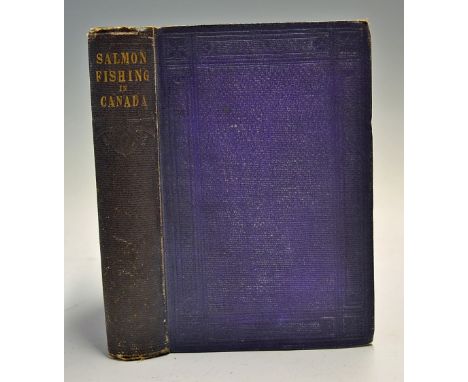
Phair, Charles - "Atlantic Salmon Fishing" ltd ed 900 copies publ'd 1937 by Derrydale Press New York, foreword by Richard C Hunt, illustrated by Pleissner and Nisbet, original green and gilt decorative cloth binding and spine, original fold out map to the rear, many photographic plates et al - some speckle foxing otherwise (F/G).

Lot 348

Young, Archibald - The Angler's & Sketchers Guide to Sutherland, published by William Paterson, Edinburgh, 1881, second edition with fold out map with original brown cloth boards.

Lot 2090

Trench Maps - France 57c and 57c SE, Belgium 28 NW and a folding map Environs de Rouen, c1903, all linen backed, (4) Condition Report Click here for further images, condition, auction times & delivery costs

Lot 2092

Soldiers Pay Book for Saul Yaffin, Cavalry Training Book 1915, Notes on Map Reading 1929, Air Navigation 1941, Meteorology for Aviators 1947, Home Guard Service Certificate for Herbert James Herman June 1942 - Dec. 1944 etc, (7) Condition Report Click here for further images, condition, auction times & delivery costs

Lot 5313

A later hand tinted map of Essex

Lot 1509

An unframed Pratts High Test map of The Great North Road, 15 x 37".

Lot 449

A 1950's Railway Carriage Colour Print depicting Old Harry Rock, Dorset, printed 'The Dorset Coast Go By Train', in original glazed frame, 24 x 43cm, and a further carriage glazed BR Southern Region route map (2)

Lot 464

Two Bacon's Maps, circa 1900, Lewis map of England and Wales 1840, Geographia, District map of London Thurnham, Story's, Cruchley's, other maps, etc.

Lot 466

A Map of Sheffield and District Early XX Century, Queen Victoria's visit to Sheffield 1897, All Their Yesterdays by B. Bunker, Past Chapters in Sheffield History by J.H. Stainton, Hunter Archielogical Society publications, E.L.R catalogue of sale for Grand Hotel, Leopold Street, Abstract of Title 1878.

Lot 503

A Folio of Maps of Sheffield 1904-1935, new map of Gloucester, Worcester, Rutland etc.

Lot 586

An Early XIX Century Cary Map of the North Part of the West Riding; XIX Century Pawson & Brailsford map of Norton, Eckington and Dronfield Parishes and other maps:- One Box

Lot 4155

Five shell advertising posters and four shell Historical map of England and Wales maps

Lot 4190

A framed and glazed AA Coronation Map of London

Loading...Loading...
  • 109182 item(s)
    /page

Recently Viewed Lots