We found 108737 price guide item(s) matching your search
There are 108737 lots that match your search criteria. Subscribe now to get instant access to the full price guide service.
Click here to subscribe- List
- Grid
-
108737 item(s)/page


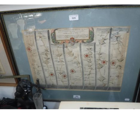
Lot 221
Moore (Thomas), The History of Devonshire, 2 vols, 2 engr tp, 1 fldg map, 1 fldg plan and 92 eng plts, tissue gds, me, cf gt, 8vo, 1829, another edition, 3 vols, Britton (J) & Brayley (EW), Devonshire Illustrated in a Series of Views........., and, Cornwall Illustrated in a Series of Views........,rebd, hf cl gt, 4to, 1831/32 and other volumes, similar.


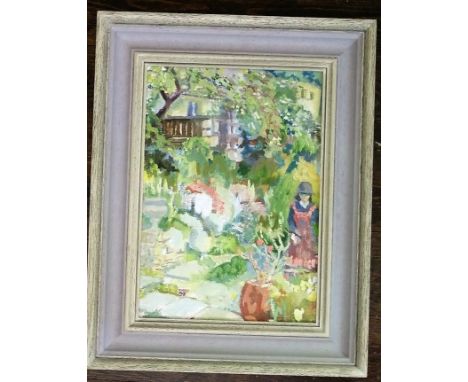
Lot 594
A contemporary oil painting on board of a garden scene with figure and labelled verso Alice J Adams, In a Cotswold garden and with Stroud address details, 34 x 24 cm, together with a coloured map of Gloucestershire after Robert Morden, a pair of watercolours by Alfred N Neate both showing churches at Clapham, a signed coloured limited edition print after Raoul Millais showing mares and foals, a contemporary needlework sampler in the 18th century manner, etc


Lot 1415
James & Alexander Gordon of Letterfurie & the Eighteenth Century Madeira Wine Trade. An Important Archive of approximately 1500 items mainly to do with their business & domestic affairs in London & Scotland including letters regarding enclosures 1755.The lot consists of the following.- Bill for provisions at Canton signed Chinese merchant. Bill Major Duff, Calcutta 1778. Three Gillow bills furniture 1780. Campbell Cabinetmaker 1761. Crichton 4 wheel chaise 1793. Spey Fishing Co, 1789 (28)- Biggs Thames Waterman, bills 1760's (7)- Fine garments & cloth (65)- Boys Schooling & Cloathes 1770 (140)- Tudhoe School, Durham, pre postal (11)- Bounty for Navy, plus other taxes (28)- Printed Bills (47)- The Lands of Durn, building Mill House etc (24)- Banking printed bearer receipts (24)- Bills of Exchange (19)- Ogilvie at Logie, farm rents 1723, plus letters re Scottish enclosures "by likewise planting Colonys of people on ye Moors & Heather ..." 1755. (19)- Letturfurie, every aspect to do with improvements & building 100,000 trees, dyking etc. (461)- Property at Carnbanno. (43)- Housebuilding at Letterfurie & Carnbanno. (165)- The Mrs & Misses Gordon. (171)- Small manu map Walkerdalls, Receipt for making waterproof paste for outsides of buildings G. Castle 1778, Instrument of resignation Ross of Corredorn 1702, other documents. (56)- London Bills. (109)- Pre Postal Letters. (47)- Foundry, New House etc (18)viewing by the many online images via www.the-saleroom.com other viewing only by written application.


Lot 10
An original vintage 1920's RMS Megantic White Star Line ' Plan of Cabin Accommodation ' pamphlet / poster. Printed on paper, the plan opens up to reveal a large and detailed inner map of the accommodation aboard the Megantic, including detailed depictions of the Promenade Deck, A Deck and B Deck etc. Information regards the ship can be found printed on the top pane, including weight, length and breadth. The White Star Line burgee and a printed image of the ship are to each corner. Measures approx 58cm x 82cm when opened. Likely unused. No rips, some crumpling from storage. Obtained from a Scottish travel agents in the 1920's.

Lot 100
An original vintage 1930's RMS Olympic White Star Line ' Tourist ' Third Cabin Plan pamphlet / poster. Printed on paper, the plan opens up to reveal a large and detailed inner map of the Third Class accommodation aboard the Olympic. Information regards the ship can be found printed on the top pane, including weight, length and breadth. The central plans surrounded by black and white photographs depicting some of the activities available onboard, including; Pillow Fighting, Shuffleboard, Deck Tennis, Physical Jerks, Dancing and ' The Afternoon Sing Song'. Dated February 1930. Measures; 57cm x 88cm. Unused condition, no rips or stains. Obtained from a Scottish travel agents who specialised in helping Scots emigrate to Australia, New Zealand and other countries. Rare. RMS Olympic famously being the sister ship to the ill-fated RMS Titanic.


-
108737 item(s)/page