We found 109182 price guide item(s) matching your search
There are 109182 lots that match your search criteria. Subscribe now to get instant access to the full price guide service.
Click here to subscribe- List
- Grid
-
109182 item(s)/page


Lot 40
Ten (1970's REPRINTS) World War II posters - "On to Victory", "On to Japan", Lets Go Forward Together, The Downfall of the Dictators is Assured, Keep Mum She's not so Dumb!, The Result, Better Pot Luck..., Kitchen Waste, Hand it Over! and Coughs and Sneezes. (23 x 16") printed by the Mobile Map Printing Co. (10)

Lot 147
A Copy of Japanese Marks and Seals, London, Henry Sotheran & Co., 1882. Original decorated red cloth gilt, top edge gilt. With coloured frontispiece, double-page map and profusely illustrated. First edition. - Part I: Pottery, Part II: Illuminated Mss. and printed books, Part III: Lacquer, enamels, metal, wood, ivory. Book would benefit from re-binding together with a Copy of Art and Art Industries in Japan by Sir Rutherford Alcock, K.C.B., D.C.L published by Virtue and Co, 1878. (2) Provenance: From a private collection belonging to the Late Dermott Levins, avid Oriental collector, Levins bought from notable London galleries and auction houses in the mid-1940s including Glendining & Co New Bond Street, Yamanaka & Co New Bond Street and later Sothebys.


Lot 747
Macclesfield interest; SAINTER, J.D.; The Jottings of Some Geological, Archaeological, Botanical, Ornithological, and Zoological Rambles Around Macclesfield, with many black and white illustrations, published in Macclesfield by Swinnerton & Brown 1878, with map insert, in original cloth binding, and a information sheet relating to Macclesfield Subscription Library detailing the arrangements for the library and inviting subscriptions, 19th January 1858 (2). CONDITION REPORT: There is damage to the edge of the spine, and the binding is loose on the end papers, a little foxing.


Lot 437
STAMPE, William. A Treatise of Spiritual Infatuation, Being the present visible disease of The English Nation. Hague, 1650. 12mo. 1-142. Errata, 1lf. 33 lff. Ae.g. worn. Embossed leather. worn. Tog.with SHUCKFORD, Samuel, The Sacred and Prophane History of the World connected from the Creation of The World. Tonson, 1733. 3rd edn. in 2 vols. 8vo. 1 folding map. full cf. worn. Plus 4 other Theology. 7


Lot 455
STAYAN, Temple, The Grecian History from the Original Greece, to the Death of Philip of Macedon. Tonson, 1751. 8vo. in 2 vols. engrd. frontis. folding map in vol 1. full cf. scuffed. Tog.with MARTYN, John, The Bucolicks of Virgil, London, 1749, 2nd edn. in 2 vols. 8vo. folding frontis. 2 folding maps, 2 further plates. Plus The Georgicks of Virgil, 3rd edn. 1755. 10 plts. Plus other similar interest and leather bindings. 23


Lot 474
SKELTON, Joseph, Engraved Illustrations of The Principal Antiquites of Oxfordshire, from Original Drawings by F. Mackenzie, Oxford, 1823. 1st edn. Fo. Frontis. & engrd. tp. Map and 49 full page engrs. with tissue guard. foxing, particularly to margins. T.e.g. 1/2 marbled bds. glt. spine scuffed.

Lot 478
GORDON, W.J. Our Country's Butterflies and Moths and How To Know Them. Ill. H. Lynn. Simpkin Marshall, frontis det. 33 plates pict. bds. tog.with PEACOCK, E.H. A Game-Book for Burma and Adjoining Territory, Witherby, 1933. folding map 4to. 25 plts. cl. bds. Plus CARTER, Harry, Orlando Jewitt, OUP. 1962, slim 8vo. glt. cl. 3

Lot 481
BENNET, James, Henry, Winter and Spring on the Shores of The Mediterranean. Churchill, London, 1875. 5th edn. cold. frontis, maps and illus. as listed. 8vo. glt. cl. Tog.with HASSALL, Arthur Hill, San Remo and The Western Riviera, Climatically & Medically Considered. Longmans, 1879. folding fronits. & map. glt. cl. 2

Lot 484
THORNTON, Robert. History of Nottinghamshire. Republished with large Additions by John Throsby. 1790, 2nd edn. 4to in 3 vols. Lacking some plates. some reapplied to new lff. some facsimile. 1/2 marbled bds. scuffed. w.a.f. Tog.with BAILEY, Thomas, Annals of Nottinghamshire History of the County of Nottingham. Simpkin, Marshall, 1853. in 4 vols. frontis. map & 18 full page plts. Illus. in text. 8vo. 1/2 bds. Plus Annals of Nottinghamshire, History of The County of Nottingham including The Borough. 1853, by same. 4 vols. in 2. 4to. frontis. map and plts. a.c.f. 1/2 bds. Plus similar interest. 19

Lot 485
PARSON,W. & BRADSHAW, T. Staffordshire General and Commercial Directory, Manchester, 1818. 8vo. Folding map with 1" tear. new endpp. Rebound small loss to lwr. margin of final 2 pages. tog.with WHITE, Frances, Birmingham. History and General Directory of The Borough of Birmingham, Sheffield, 1849. 8vo. 55 pp. advt. inner joint repaired. Rebacked. Plus others. 10

Lot 488
THORNTON, Robert, The Antiquites of Nottinghamshire, London, White, 1677. Fo. Frontis. port. red and black Tp. dedicated to William Dugdale, with portrait. Preface. Map. 507. 8p. Index of Arms. Index. 23 full page plts. W. Hollar. Many double page. Further engrs. in text. full cf. Conservative Club glt. stmp to upr. bd. Rebacked. tog.with another Nottinghamshire History. 2

Lot 492
LIVINGSTONE, David, Missionary Travels and Researches in South Africa. Murray, 1857. 4to. folding frontis. full page plts. as listed. worn cl. bds. Tog.with STANLEY, Henry, M. How I found Livingstone in Central Africa. Sampson Low, 1872. 2nd. end. 4to. photo. frontis. port. folding map with tear. Illus. advts. to rear. Pict. cl. worn and faded. Plus Through the Dark Continent, by same. Sampson Low, 1880. Frontis. 2 folding maps. full page illus. 4to. gl. cl. Plus similar interest. 7


Lot 416
WHITE'S DIRECTORY OF NOTTINGHAMSHIRE, SECOND EDITION WITH MAP, GREEN CLOTH GILT, 1885 AND CORNELIUS BROWN, HISTORY OF NEWARK, LARGE PAPER EDITION, TWO VOLS, ONE OF ONE HUNDRED NUMBERED COPIES SIGNED BY THE AUTHOR AND INSCRIBED TO MASTER THOMAS EARP WITH THE AUTHOR'S VERY KIND REGARDS AND BEST WISHES, NEWARK SEPT 1ST 1904, HALF CALF (3)


Lot 668
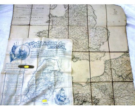
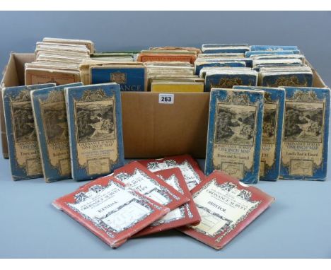
Bartholomew's Maps-Vintage Cloth-backed 'Half inch' maps- Oxford, Merseyside, Cornwall, Argyll, Kent, Herts and Bucks, Peck District, English Lakes, Warwickshire, Sussex, plus, a quarter inch map of Cork and Killarney, these maps are so attractive that they would look well framed in any office or den.
Lot 685
Military-A mixed lot, two copies of the British Army Review for April and October 1961, seven instruction manuals issued by the United States Army Aviation Centre, Fort Rucker, Alabama, including map reading and military symbols, there is also (5) tubes of 'Sunday Times' film strips and explanatory pamphlets on various subjects for schools dated 1966.


Lot 538
Green (Leonard James, 1905-1993). Visit Australia, six gouaches on paper, depicting Australia flora and fauna, together with another gouache on paper of a map of Australia, squared up in pencil, each 31 x 23cm (12 x 9ins) and similar, mounted Possibly comissioned by John I. Thornycroft & Co., for commercial use. See their copyright stamp to verso of artist's photograph copies of the present works in the next lot. Provenance: from a private collection, North Gloucestershire. The current owner knew the artist when she was growing up in Australia. (7)


Lot 1053
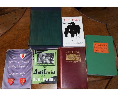
The Irish Tangle for English Readers by Shane Leslie 1946; Tha Tain; Chitrál - The Story of a Minor Siege by Sir George S. Robertson (lacking map) Meuthen 1899; The Anti Christ and Gog and Magog by Maulana Muhammad Ali. Published by Dar-ul-Kutub Islamia Limited, LAHORE, 1948; The Importance of being Earnest' Oscar Wilde Folio Society Edition 1960; STANDING ORDERS AND REGULATIONS FOR THE ARMY IN IRELAND Published by Frederick Muller Ltd.. 1st thus. 1969, Edition originally published in Dublin, 1794. Large format. Black cloth boards, gilt title to spine. 150 pages plus index; The Birth of the Irish Free State 1921-1923 by Joseph Curran (7).


-
109182 item(s)/page